I reserve the right to NA any answer for any reason, to combat duplicates or abuse.
Update 2025-10-30 (PST) (AI summary of creator comment): Answers may be resolved N/A if:
The event occurred in a different month than October 2025
The answer is a duplicate from a previous market
 1,000
1,000🏅 Top traders
| # | Trader | Total profit |
|---|---|---|
| 1 | Ṁ116 | |
| 2 | Ṁ61 | |
| 3 | Ṁ60 | |
| 4 | Ṁ42 | |
| 5 | Ṁ38 |
People are also trading


@strutheo This count?

@Lobstertronic For your consideration, all three of these passed my Microsoft 365 test. And that was just in the past couple days!
https://m.youtube.com/watch?v=eDOKTKbcJC4
25:18
"I mean if you look, one hundred percent of new jobs created in America under my administration have been created by the private sector. Think of that: the government created no new jobs. The private sector created the record number of jobs that we’re talking about. That’s a country. That’s really a success. It’s easy to create government jobs."
26:09
"There’s truly no better time to invest in the USA. The results speak for themselves. Since the election, TSMC has pledged to invest one hundred billion dollars in the United States."
https://m.youtube.com/watch?v=I2hY2qJYtj0
14:50
"Thank you all. It was a great success. It was a great honor. I mean he’s a tremendous leader of a very powerful country and I give great respect to him, and we appreciate the fact that he came to this meeting. Thank you very much."
@Zacd per the resolution criteria you specified (1), Melissa is a post-tropical cyclone (and no longer a hurricane) as of the 11AM EDT advisory (2) and this should therefore resolve NO.
(1)
https://manifold.markets/strutheo/what-will-happen-in-october-2025-ad#jx0hmuiyjs
(2)
https://www.nhc.noaa.gov/text/refresh/MIATCDAT3+shtml/311443.shtml
Hurricane landfall in more than 2 islands:
Jamaica and Cuba is 2 no doubt about these.
Hurricane Melissa did not make an official landfall on any islands in the Bahamas, but its eye passed between Long Island and Rum Cay. However, its powerful winds and rain caused significant damage across the southeastern and central islands.
2 is not more than 2.
Why has this resolved yes? Was there another Island?
@strutheo @Zacd
@ChristopherRandles if you can find reliable information on the exact track of the hurricane missing any islands in the Bahamas however sources a varying at the moment so im not sure.
@Zacd
There is this which seems to show it likely? crossing long Island
https://www.nhc.noaa.gov/archive/2025/MELISSA_graphics.php?product=current_wind
In the advisories we get this fix and direction
At 800 PM EDT (0000 UTC), the center of Hurricane Melissa was
located by an Air Force Reserve Hurricane Hunter aircraft
near latitude 23.5 North, longitude 74.8 West. Melissa is
moving toward the north-northeast near 16 mph (26 km/h).
This point appears to be between the Eastern extremities of Long Island and Rum Cay. This is probably responsible for probably erroneous reports of "passing between Long Island and Rum Cay". The NNE direction of travel may suggest it would have passed over Long Island but I don't find anything specifically saying there was landfall on Long Island, which I think NHC would have reported if it had. The fix is described and "near" 23.5 North, 74.8 West, these co-ordinates seem rounded so it might be further East and/or the path taken may have jogged East of Long Island.
Without evidence specifically claiming an actual landfall should we be assuming there was one?
@parhizj @SaviorofPlant You seem expert on hurricanes, are there more fixes that could help available or anything else that should be looked at?
I believe you meant it passed between Long Island and Long Cay (not Rum Cay)...
TLDR; in summary , I don't know... there could be some scenarios (perhaps lower probability) where it missed both islands, but I have a hard time integrating all the data into a coherent picture with my layman knowledge.
~
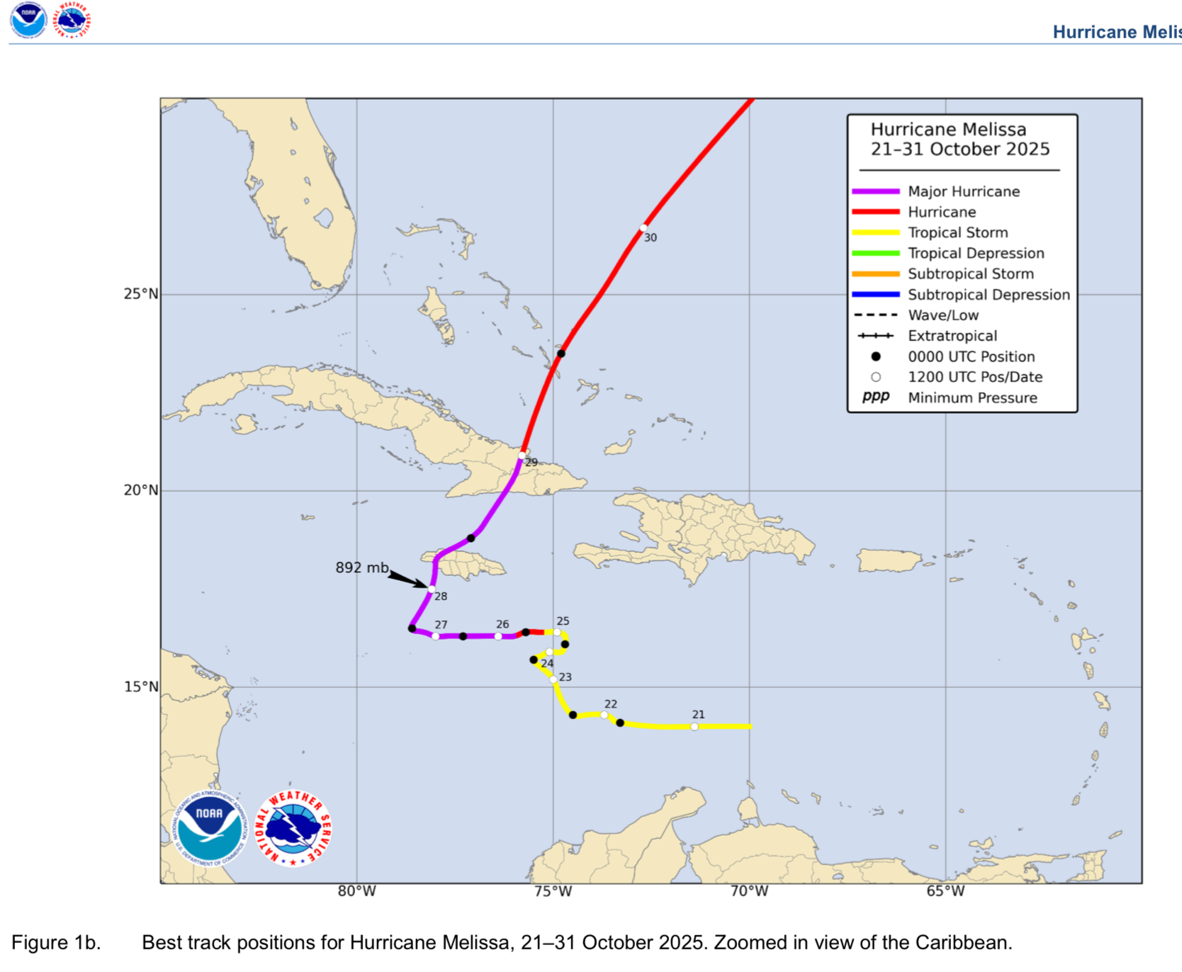
If we take landfall as the definition of MSLP center of the eye crossing land, there are two possible locations in the Bahamas based on examining best track data
1) the SE tip of Long Island, and
2) San Salvador Island.
I reviewed the data I could gather but I can't come to a definitive conclusion that either way whether it did or didn't landfall in the Bahamas in either location. I don't know how to consider the METAR data from the three stations in light of the other data, and these two landfall questions require a high degree of accuracy or just simply more expertise than I have to answer it.
~
For Long Island remote sensing data is sparse for the time it might have made landfall, but based on best track data, recon, and model data one would think it would have to take a perhaps somewhat improbable track or there is some other scenario (like the surface circulation not being coupled well with the lower level circulation -- there was quite a bit of wind shear but I do not know how it affected this)...
Edit:
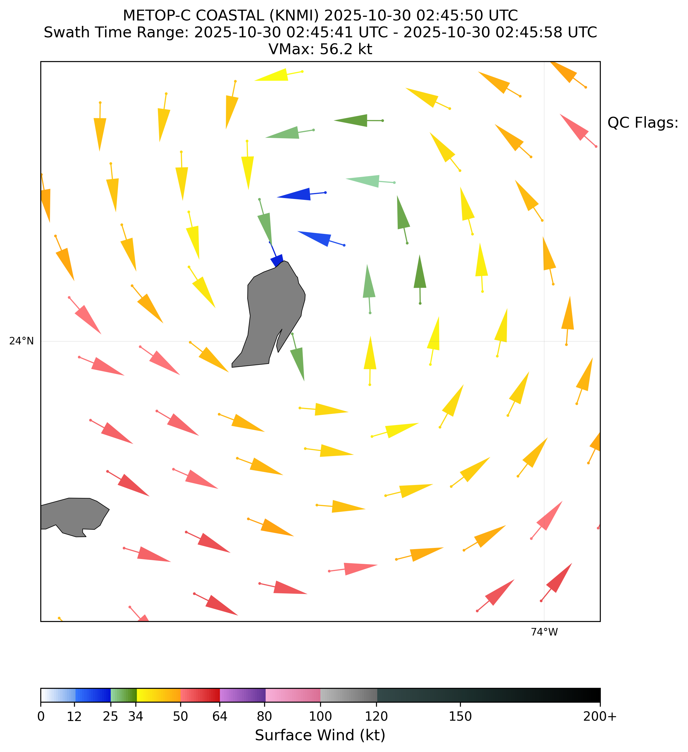
Reviewing my scatterometer pass predictions I realized KNMI interface left some out, so this HY-2B pass might lend some weak support to the Long Island landfall given that it appears in the non-QC'd version (which is actually heavily rainflagged) that the surfaace circulation is over the SE part of Long Island.
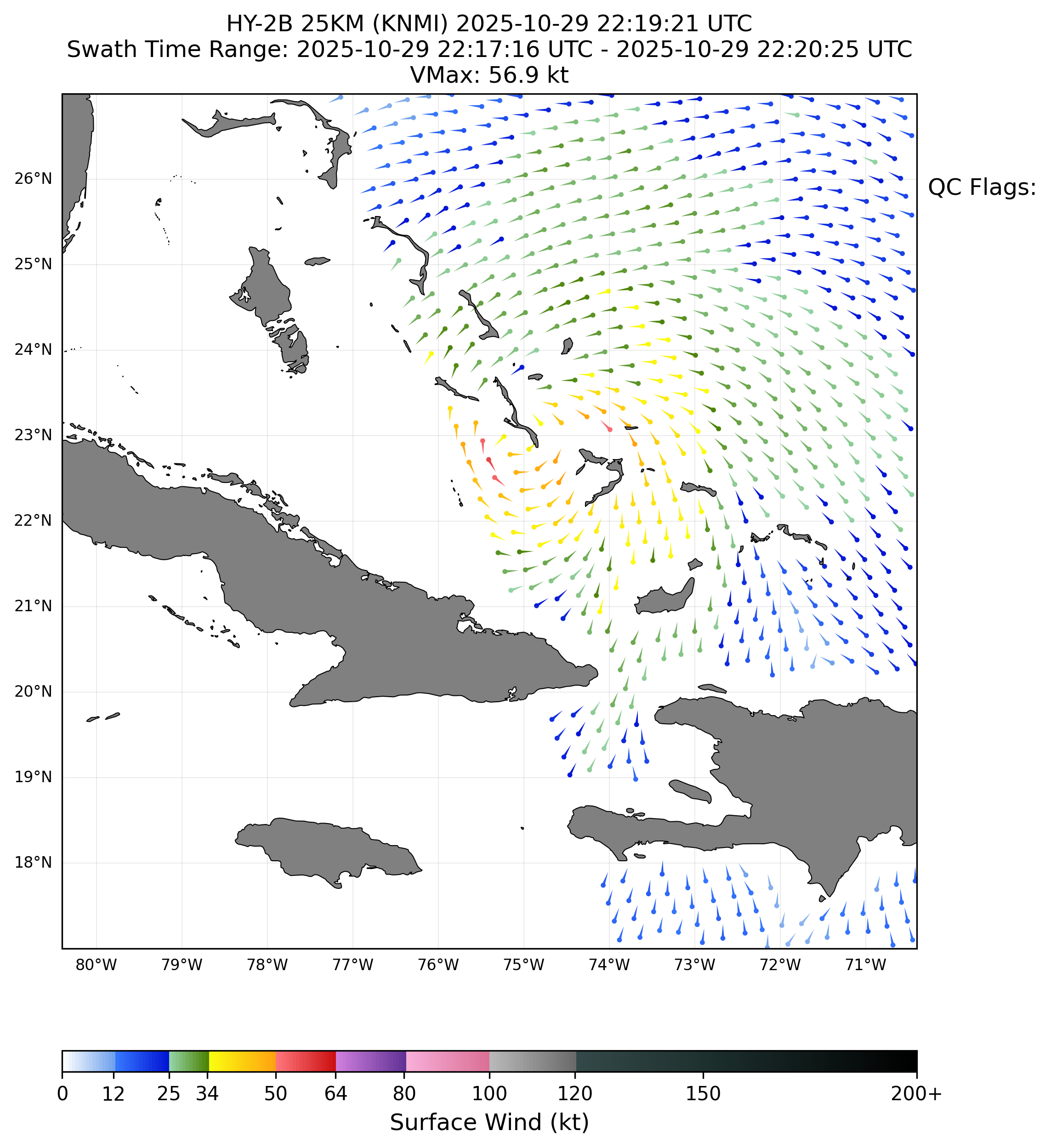
This would require some further examination of the ambiguity data and some more expertise of how much to trust the largely flagged data...
~
My amateur analysis of the data I could find today...
~
The eye was fairly large and rough and with small targets and large uncertainty in the data I'm not skilled enough to come to a clear cut judgement.
~
The NHC best track and recon would indicate a intermediate position between Long Island and San Salvador Island that would seem to imply that a Long Island landfall was likely when you linearly interpolate on best track. However per recon after passing Long Island, the eye was reported as fairly large (see the 30/03Z discussion) and open to the south at the time per recon and there is a chance it wobbled around to the east of Long Island (like the ADT position shows). There may be private data like from tomorrow.io or other sources with microwave data that might end up being more definitive about landfall I dont have access to (checked NRL/RAMMB/etc). Unfortunately the microwave imagery data might not the best proxy if it the low-level circulation that would show up in 37GHz imagery was decoupled from the surface circulation...
~
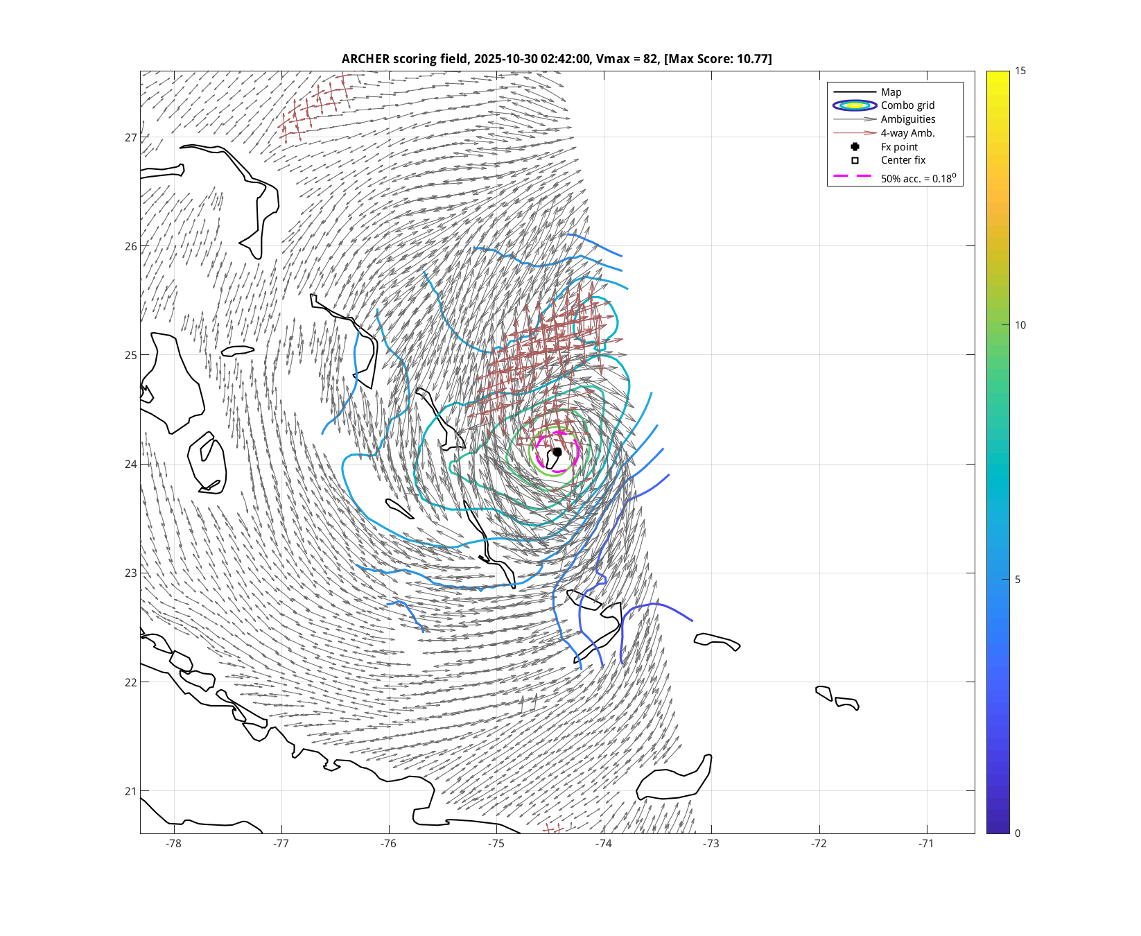
Below are various charts I referenced (some of them my own)
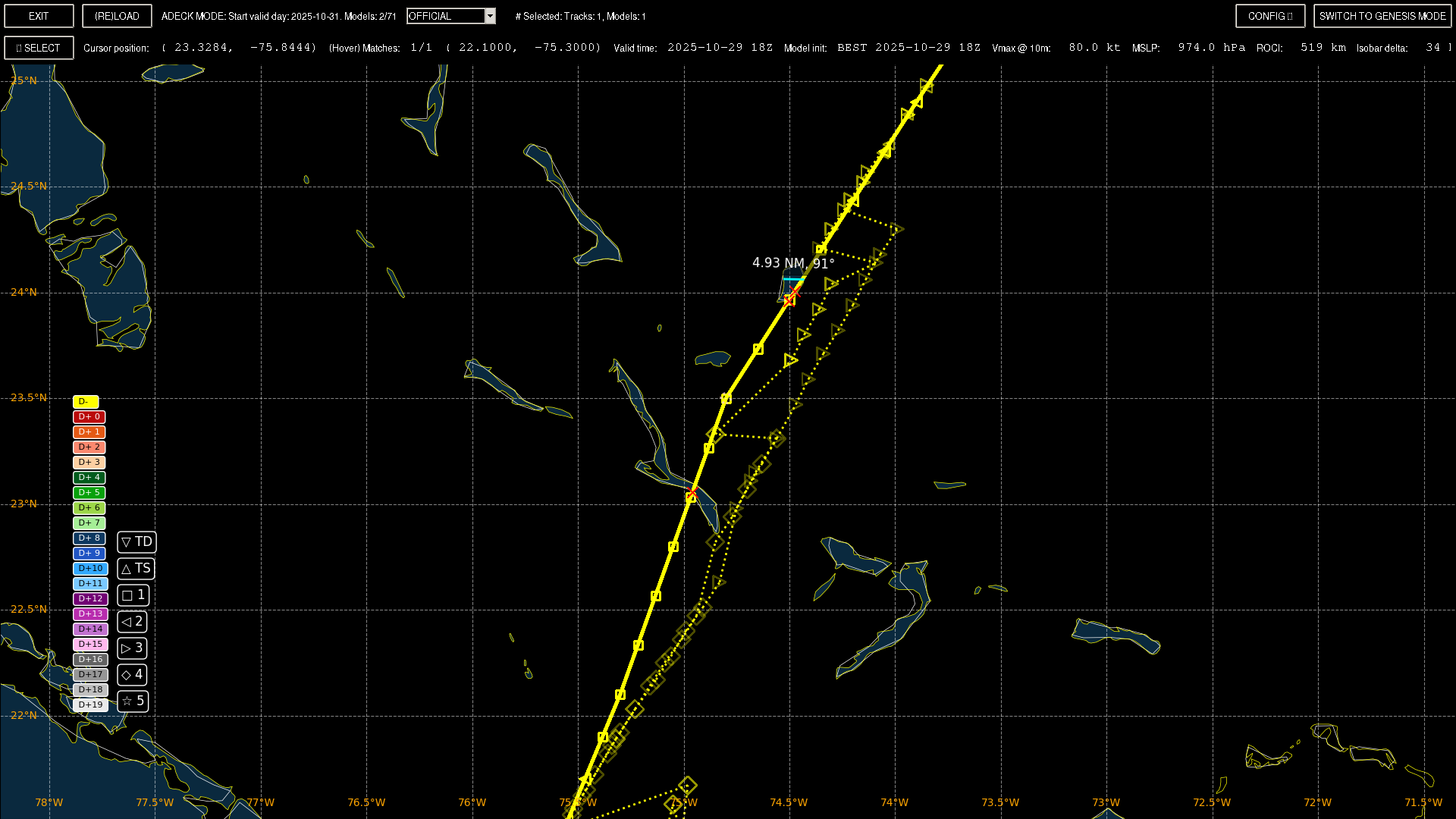
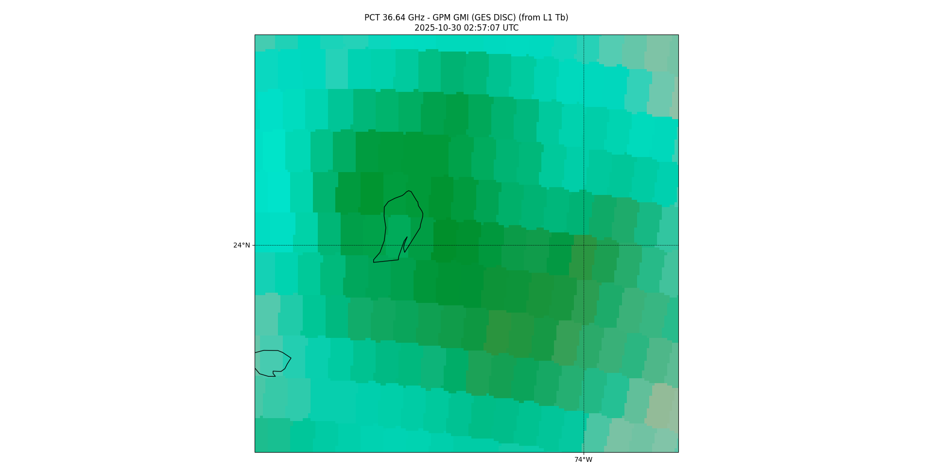
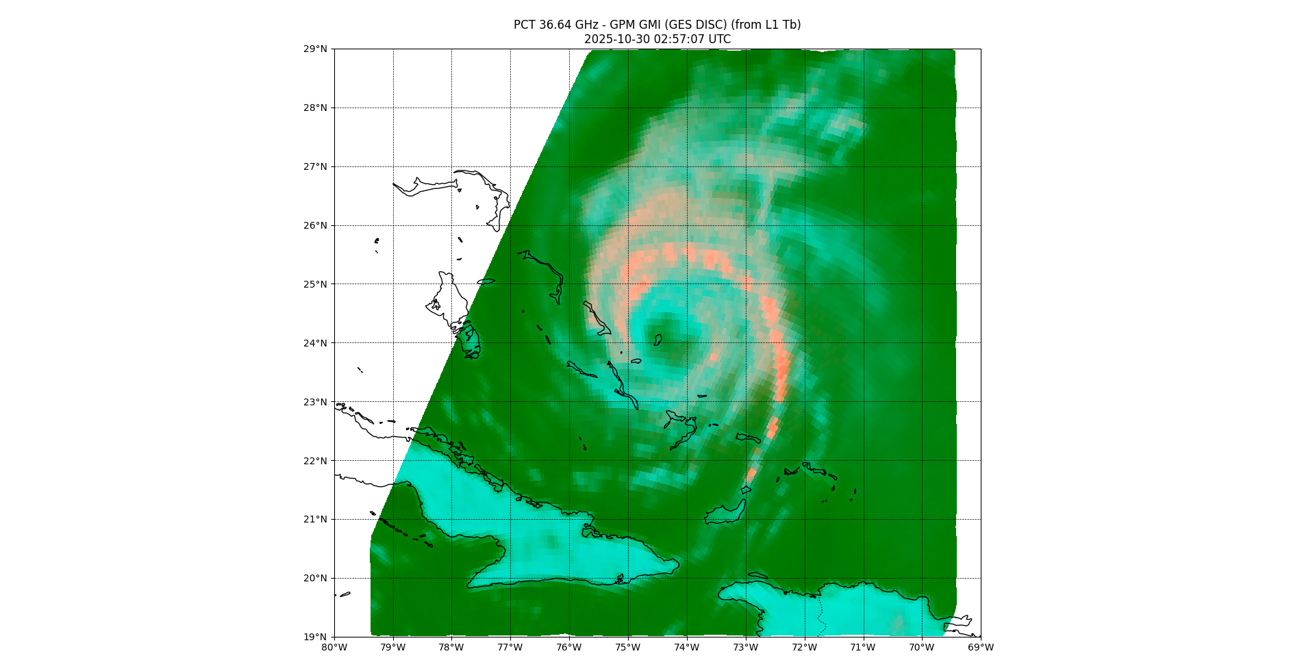
Below the solid yellow is interpolated best track 1hr points apart (with the 30/00Z point just south of Rum Cay Island). the dotted lines are the ADT positions estimated from satellite IR from CIMSS and OSPO (these are very rough estimates and not generally reliable in this situation with no clear eye --- I just provide them as reference).
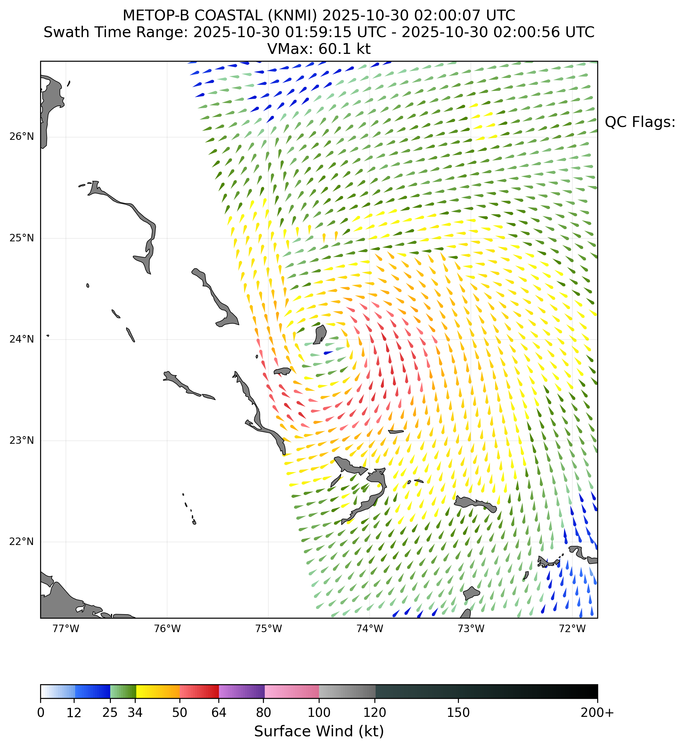
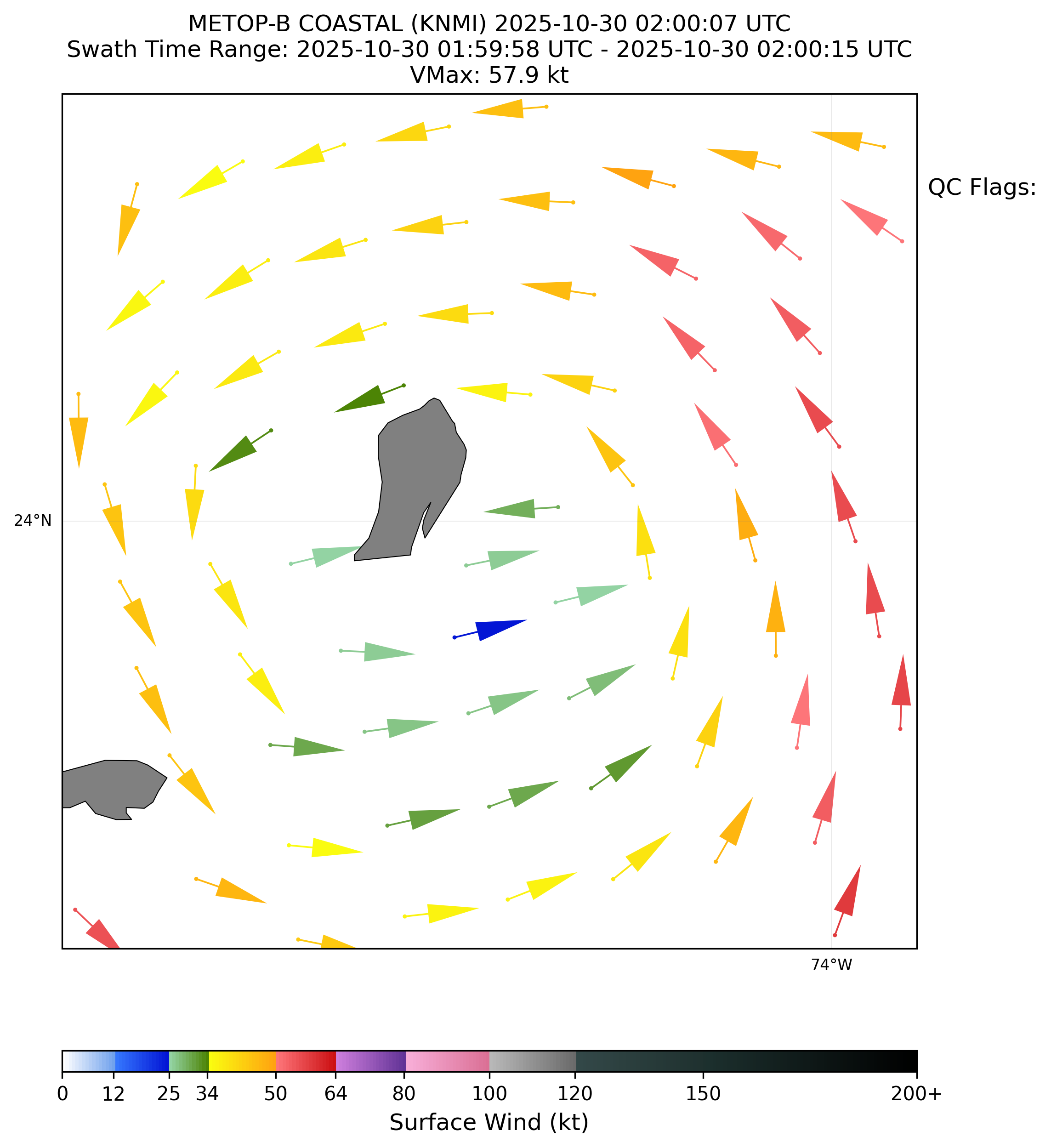
Two different ascat passes from near the San Salvador Island pass (KNMI coastal vectors (12.5km), not QCd)
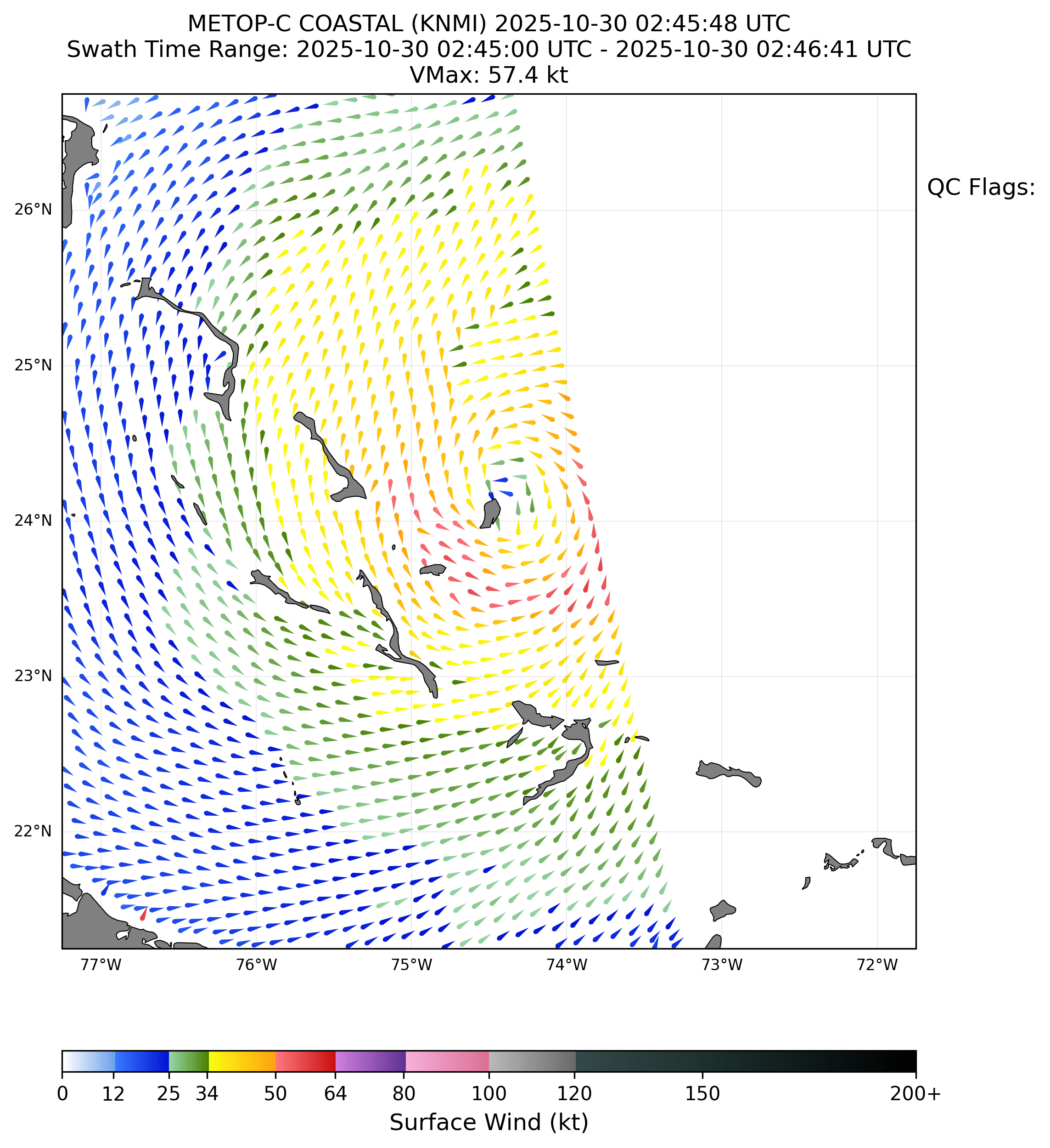
CIMSS ASCAT position fix:
(CIMSS is missing the other ascat pass unfortunately)
CIMSS 37GHz position fix:
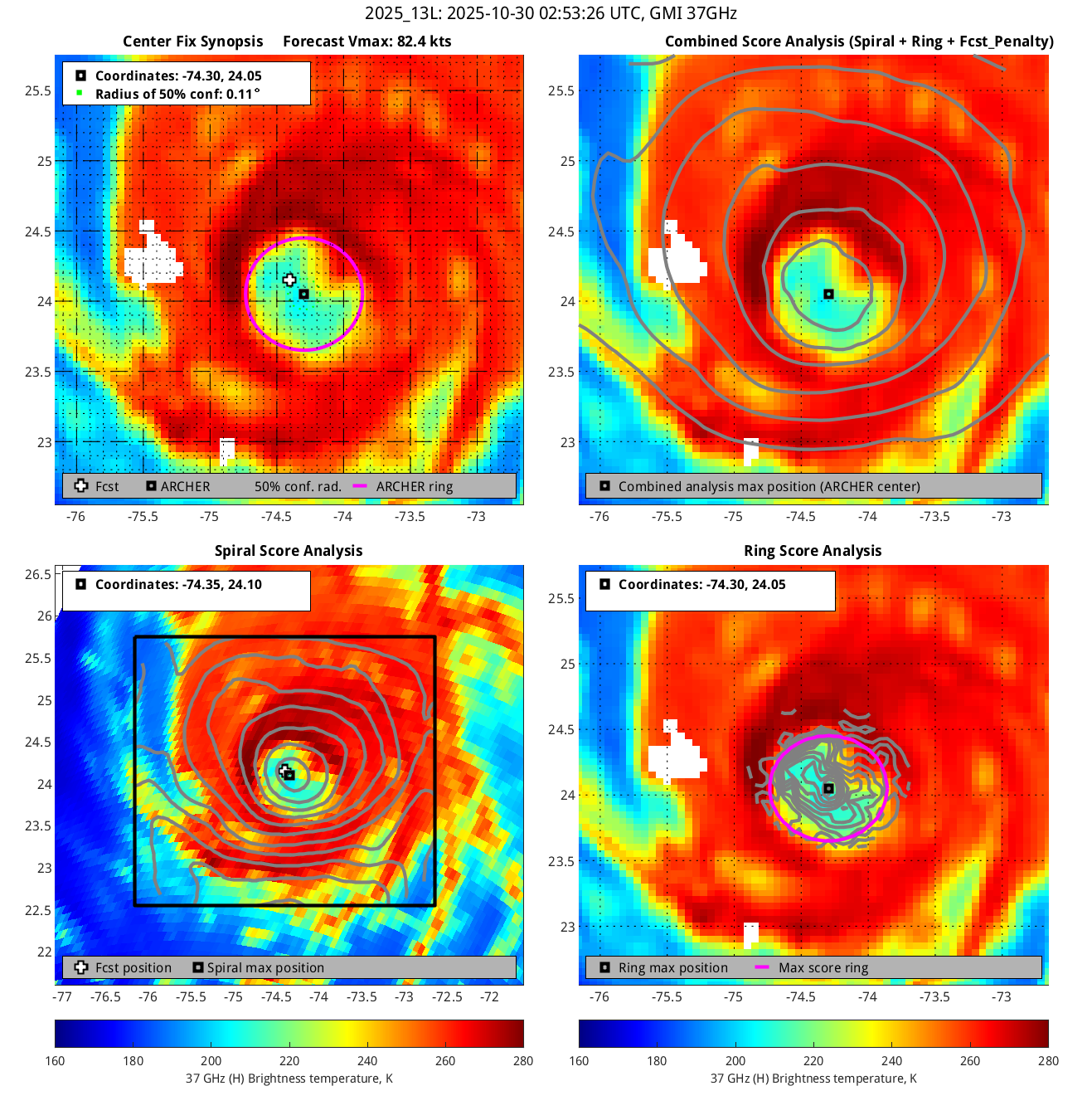
Own charts of same 37GHz Imagery (PCT)
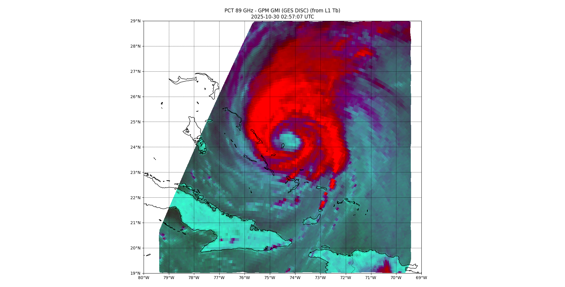
Own chart of 89GHz imagery (shows the storm is tilted NNE)
~
METAR data I've archived from the airport at San Salvador Island (MYSM) (it's on the west part of the island -- about 5NM to the other side) (from metar-taf.com):
https://jumpshare.com/s/qm7fhnbk9qqXEJdpJDig
There are two other METAR data from Hard Bargain Airport and Port Nelson Airport as well I collected (if anyone wants them just ask.)
~
There isn't any Bahamas radar data as far as after I searching I found a message at hurricanecity seeing a message saying it has been out since August...
~
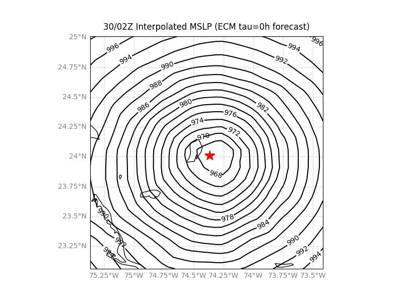
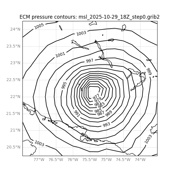
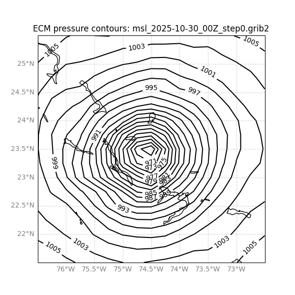
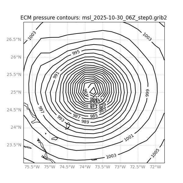
Lastly I interpolated the pressure field for the tau=0 ECM 30/00Z and 30/06Z to 30/02Z to examine the consistency with METAR data (taking the weighted centroid of some of the contours then interpolating between them by time to 30/02Z).
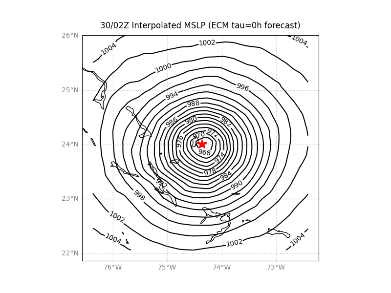
~
orig fields for reference
~
Given the large inconsistency in pressure between METAR data at San Salvador Island (as well as the other two airports also), and the pressure fields from ECM, I find it difficult to build a coherent scenario. With 3 different METAR stations and the model data I don't know what unusual scenario could account for all of the data, this makes it hard for me to judge if such unusual scenarios were the case or I am interpretating the data incorrectly or some of the observations/data have problems, especially given the scatterometer wind data (i.e. the METAR data from the 3 stations seems to paint a more complicated scenario or that the ECM model is wrong in comparison to my more straightforward picture...)
~
In summary, for San Salvador Island at the moment we have multiple sources of remote sensing data (satellite imagery and satellite derived wind products) when it was near or at the San Salvador Island but all have large uncertainty with regards to the actual center (for a large eye) and for such a small target its difficult for me anyway to tell without some expert guidance on how to consider the METAR pressure data....
~
Based on the wind dir data from the San Salvador Island METAR report and the various satellite data I put the closest approach ~ around 30/02Z - 30/03Z. But based on the wind direction changes in the METAR data it would seem the storm circulation did pass east of the western portion of the island.
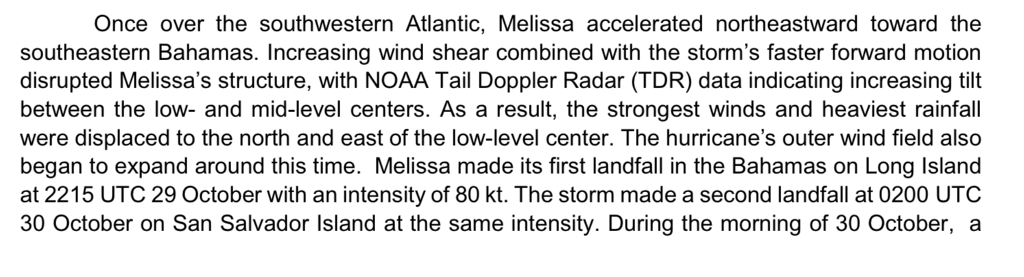
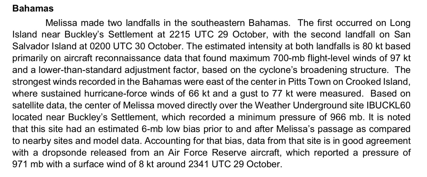
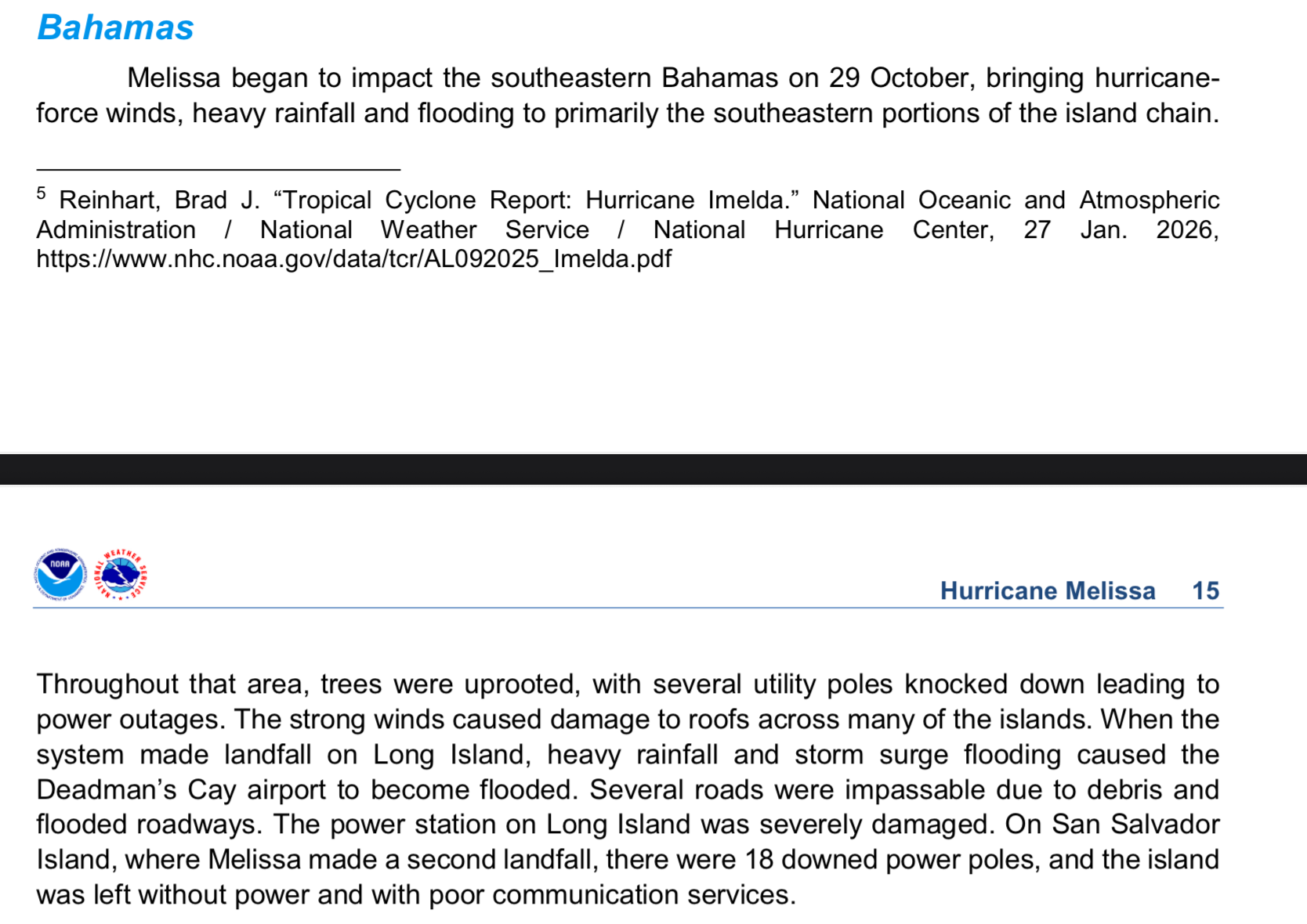
for anyone that cares, the final TCR came out for Melissa today confirming the NE tilt observed in the microwave observations with data from the doppler radar recon, and confirming landfall on both islands mentioned.
@strutheo Resolves YES

@strutheo 3 XKCD comics - https://xkcd.com/3149/ , https://xkcd.com/3156/ , and https://xkcd.com/3157/