Context, as this is just unfolding:
https://twitter.com/bayraktar_1love/status/1660586319679029250?cxt=HHwWhIC89bSdy4suAAAA
Russian separatists seem to cooperate with Ukraine and took the border checkpoint at Kozinka. They seem to be carrying out operations on russian soil in order to create a "security strip".
I am interested in how wide this zone will be.
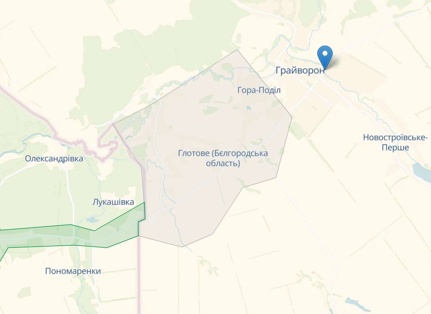
Resolution criteria will be the map of Deepstatelive:
https://deepstatemap.live/en#12/50.4802/35.6510
Market resolves yes if at any time before Monday 29th 15:00 GMT the area marked "contested" reaches the bridge of "Tarana Street" over the creek "Grayvoronka".
Sorry, but I haven't figured out how to place markers on Deepstatelive.
Here is the marker on google maps:
Here are the coordinates:
50.482857, 35.685731
🏅 Top traders
| # | Trader | Total profit |
|---|---|---|
| 1 | Ṁ71 | |
| 2 | Ṁ44 | |
| 3 | Ṁ38 | |
| 4 | Ṁ33 | |
| 5 | Ṁ26 |
People are also trading
The enemy has regained control of the area near Grayvoron.
Deepstatelive.map has updated the map, the territory near Grayvoron is no longer contested.
I think this is very unlikely to resolve YES at this point.
@42irrationalist yeah.
I found this video in a german social media platform:
https://pr0gramm.com/new/5699687
There was no source, but it sounds like the operation is over.
The Kremlin-Russians moved in with their air force.
@Birger Okay this seems to be just an attack helicopter who accompanied the troop transport helicopter. I am still looking for the video of a mig i saw yesterday.
https://twitter.com/front_ukrainian/status/1660627318035955712?cxt=HHwWgIC-verv3YsuAAAA
@Schwabilismus Super interesting, thanks for updating! I'm curious to see whether they make enough progress for deepstate to consider the aforementioned point contested
@Schwabilismus drone footage of the separatists was geolocated:

