Background
Hurricane Otis is a powerful major hurricane moving towards the southern coast of Mexico. Originally expected to only reach Category 1 strength, it rapidly intensified while nearing the coast, reaching Category 4 strength and prompting NHC (National Hurricane Center) to issue a special advisory between the scheduled ones.
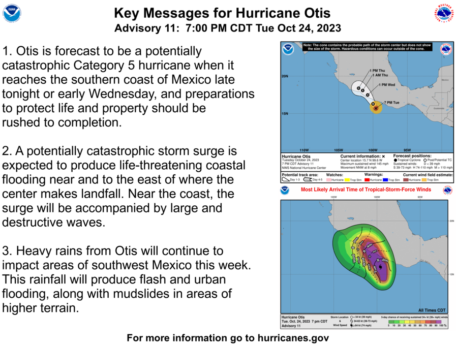
Will Otis become a destructive Category 5 hurricane as forecast by the NHC?
Resolution Criteria
Resolves YES if Otis reaches Category 5 peak strength at any time point of its tropical lifespan.
Resolves NO if the conditions for YES are not satisfied before the dissipation, extratropical transition, or merger with non-tropical fronts.
Will resolve based on advisories from NHC and SMN (Servicio Meteorológico Nacional) of Mexico. If the two agencies give divergent peak strengths for Otis, a blend of their peak sustained wind speeds will be used to convert into an equivalent Saffir-Simpson category.
I will not bet on this market, but I will put Ṁ100 in as subsidy.
 1,000
1,000🏅 Top traders
| # | Trader | Total profit |
|---|---|---|
| 1 | Ṁ89 | |
| 2 | Ṁ70 | |
| 3 | Ṁ51 | |
| 4 | Ṁ17 | |
| 5 | Ṁ8 |
People are also trading
https://twitter.com/burgwx/status/1716972676471021754
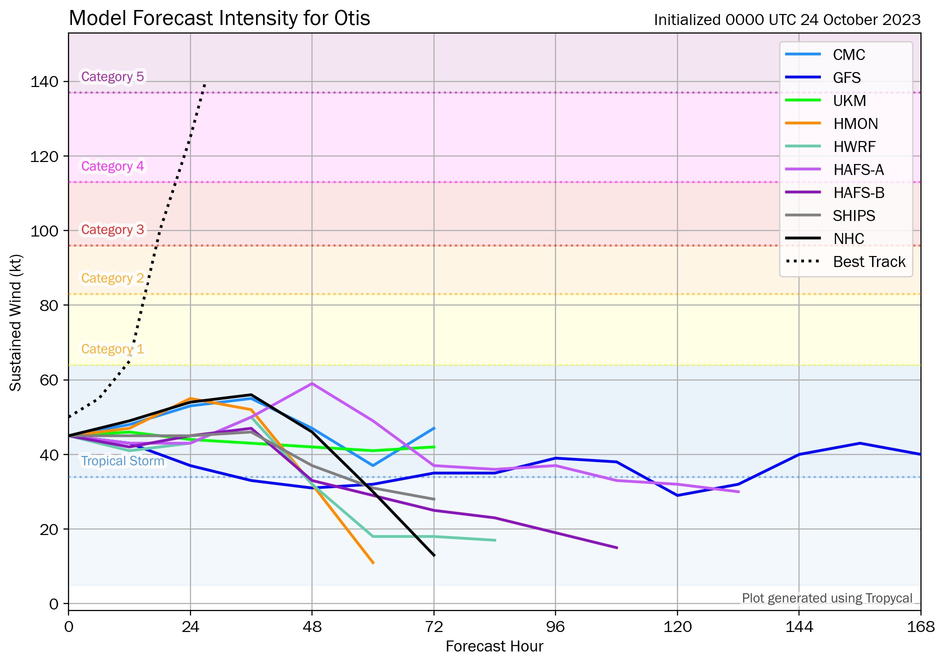
Intensity model forecasts 24 hours ago vs. actual intensity...
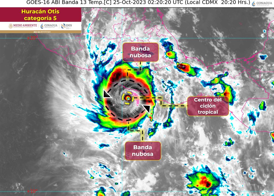
SMN advisory also reporting Category 5 strength:
The condition for YES on this market has been reached. I will leave the market open for another hour for comments or objection, and then I will resolve this market as YES if there are't any.
Hope everyone in the region, especially those living in low-lying areas, reach safe locations ASAP, this is a seriously alarming situation.
000
WTPZ43 KNHC 250250
TCDEP3

Hurricane Otis Discussion Number  12
NWS National Hurricane Center Miami FL       EP182023
1000 PM CDT Tue Oct 24 2023

A nightmare scenario is unfolding for southern Mexico this evening with rapidly intensifying Otis approaching the coastline.  Satellite
images show that Otis has continued to intensify, with Dvorak Data-T estimates between 130-145 kt during the past few hours.  The initial wind speed is set to 140 kt as a blend of these values, making Otis a Category 5 hurricane.  Otis has explosively intensified 95 kt during the past 24 hours, a mark only exceeded in modern times by Patricia in 2015.

Otis should maintain category 5 status before the hurricane makes landfall near the Acapulco area overnight or early on Wednesday.
The only significant change to mention to the track forecast is that it has been shifted to the right due to a recent wobble to the east and the latest model trends, and a general north-northwest motion at about 8 kt is anticipated through landfall.  Rapid weakening is anticipated after landfall, and Otis should dissipate tomorrow night over the higher terrain of Mexico.

This is an extremely serious situation for the Acapulco metropolitan area with the core of the destructive hurricane likely to come near or over that large city early on Wednesday. There are
no hurricanes on record even close to this intensity for this part of Mexico.

...

INIT  25/0300Z 16.1N  99.7W  140 KT 160 MPH
That was truly a stunning development. Now to see if SMN provides a convergent advisory, but a YES resolution seems very likely now.
SHIPs probabilities were very high for 00Z
https://ftp.nhc.noaa.gov/atcf/stext/23102500EP1823_ships.txt
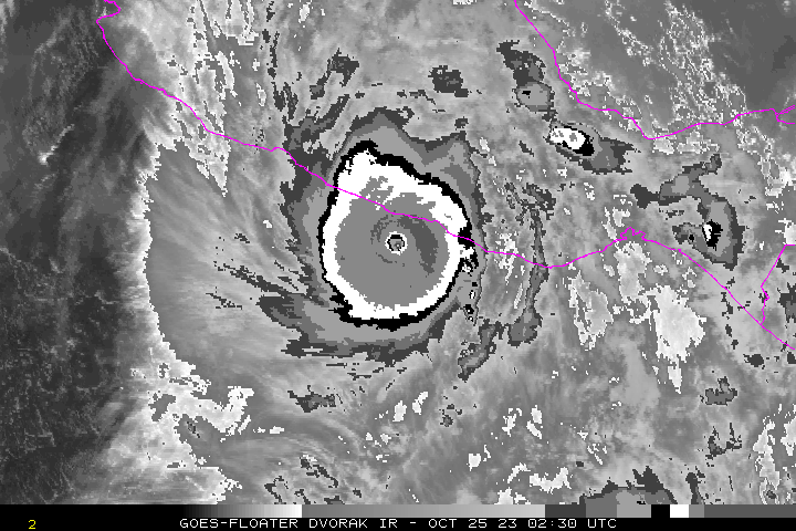
https://www.nhc.noaa.gov/text/refresh/MIATCDEP3+shtml/250250.shtml?
Hurricane Otis Discussion Number  12
NWS National Hurricane Center Miami FL       EP182023
1000 PM CDT Tue Oct 24 2023

A nightmare scenario is unfolding for southern Mexico this evening
with rapidly intensifying Otis approaching the coastline.  Satellite
images show that Otis has continued to intensify, with Dvorak
Data-T estimates between 130-145 kt during the past few hours.  The
initial wind speed is set to 140 kt as a blend of these values,
making Otis a Category 5 hurricane.  Otis has explosively
intensified 95 kt during the past 24 hours, a mark only exceeded in
modern times by Patricia in 2015.

Otis should maintain category 5 status before the hurricane makes
landfall near the Acapulco area overnight or early on Wednesday.
The only significant change to mention to the track forecast is
that it has been shifted to the right due to a recent wobble to the
east and the latest model trends, and a general north-northwest
motion at about 8 kt is anticipated through landfall.  Rapid
weakening is anticipated after landfall, and Otis should dissipate
tomorrow night over the higher terrain of Mexico.

This is an extremely serious situation for the Acapulco
metropolitan area with the core of the destructive hurricane likely
to come near or over that large city early on Wednesday. There are
no hurricanes on record even close to this intensity for this part
of Mexico.
@parhizj None of the intensity models managed to capture the explosive intensification just 24 hours prior, when it was just a TS. It's shaping up to be a catastrophic event for this part of Mexico. The enclosed Acapulco Bay might worsen flooding further... Nightmare scenario indeed.
https://twitter.com/philklotzbach/status/1716971756374708529
#Hurricane #Otis has intensified by 80 mph in the past 12 hours (from 65 mph to 145 mph). That's the fastest 12 hr intensification rate in the eastern North Pacific (to 180°) in the satellite era (since 1966), breaking the old record of 75 mph/12 hr set by Patricia in 2015.