The storm has to have had hurricane strength according to the NHC at the time of landfall. I may wait a couple of days to resolve in case of uncertainty but I will not wait until the next year's NHC report which sometimes includes reassessments.
Landfall: The intersection of the surface center of a tropical cyclone with a coastline. Because the strongest winds in a tropical cyclone are not located precisely at the center, it is possible for a cyclone's strongest winds to be experienced over land even if landfall does not occur. Source: National Hurricane Center
 1,000
1,000🏅 Top traders
| # | Trader | Total profit |
|---|---|---|
| 1 | Ṁ3,592 | |
| 2 | Ṁ1,441 | |
| 3 | Ṁ861 | |
| 4 | Ṁ832 | |
| 5 | Ṁ433 |
Idalia looks to be finally moving northwards according to the latest analysis (from TAFB):
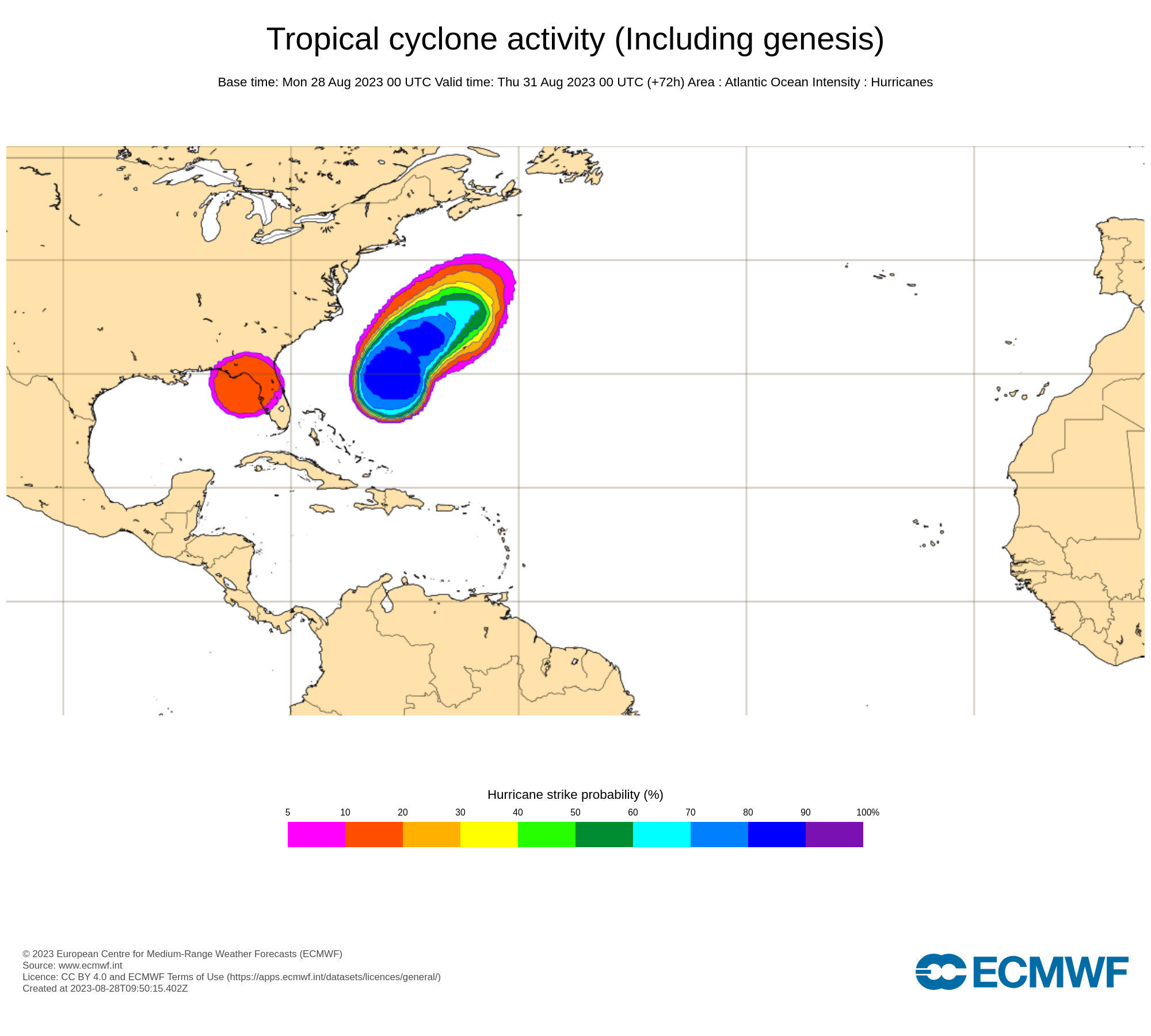
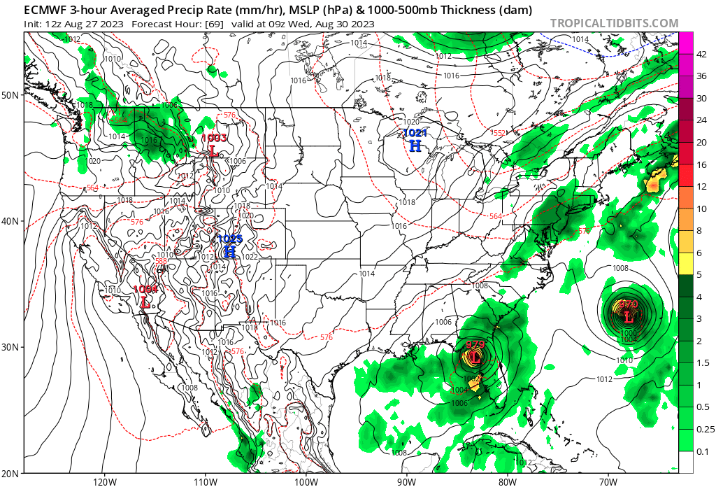
Late guidance from 06h shows the European models (ECMO) now forecasting a hurricane (finally), so now both are in agreement it will be a hurricane before landfall (from AOML):
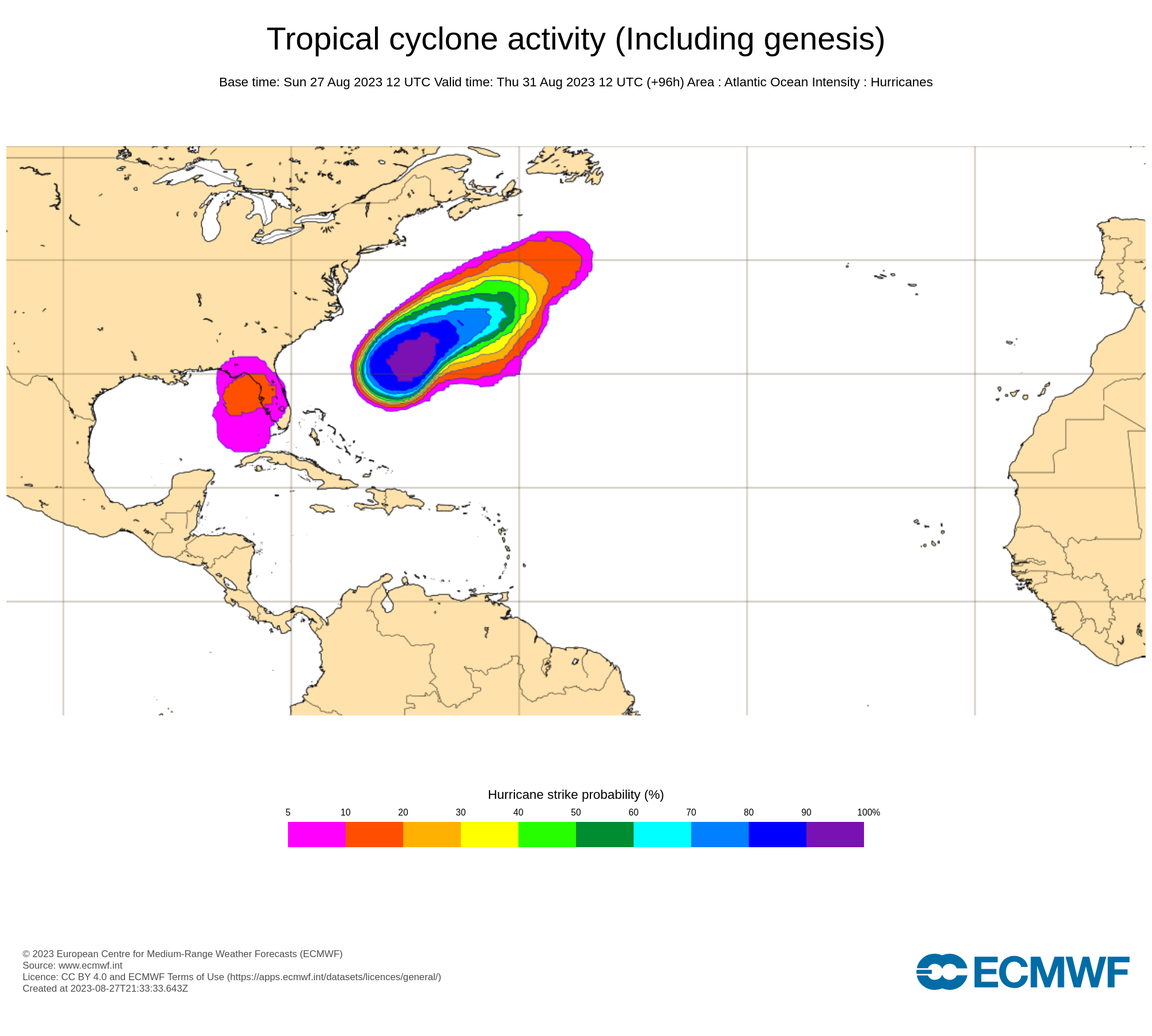
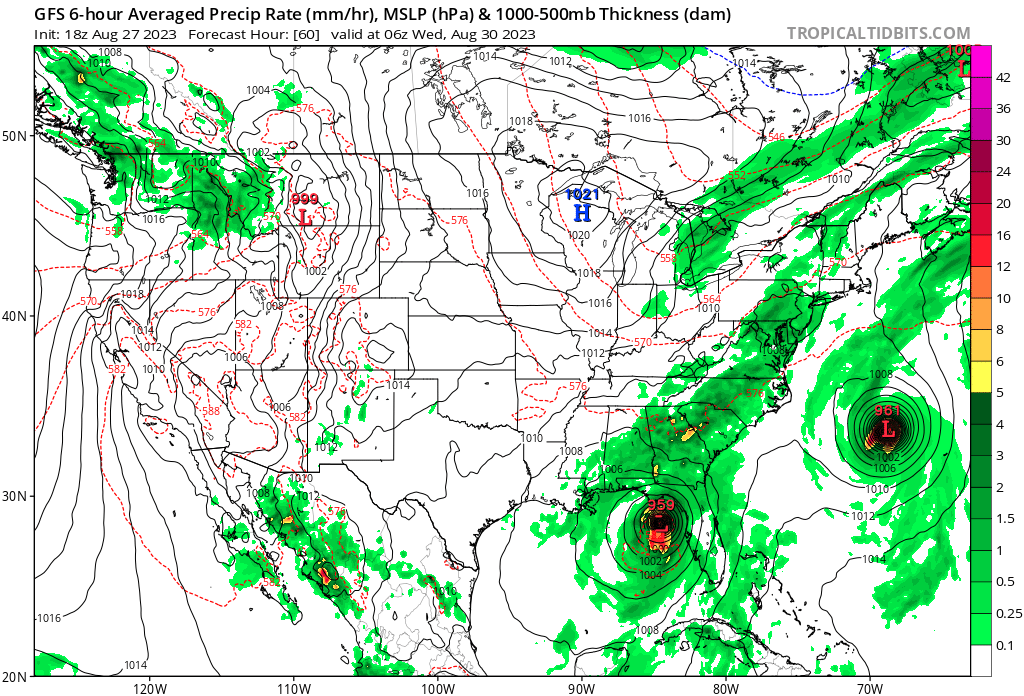
Early guidance from 12h shows the same:
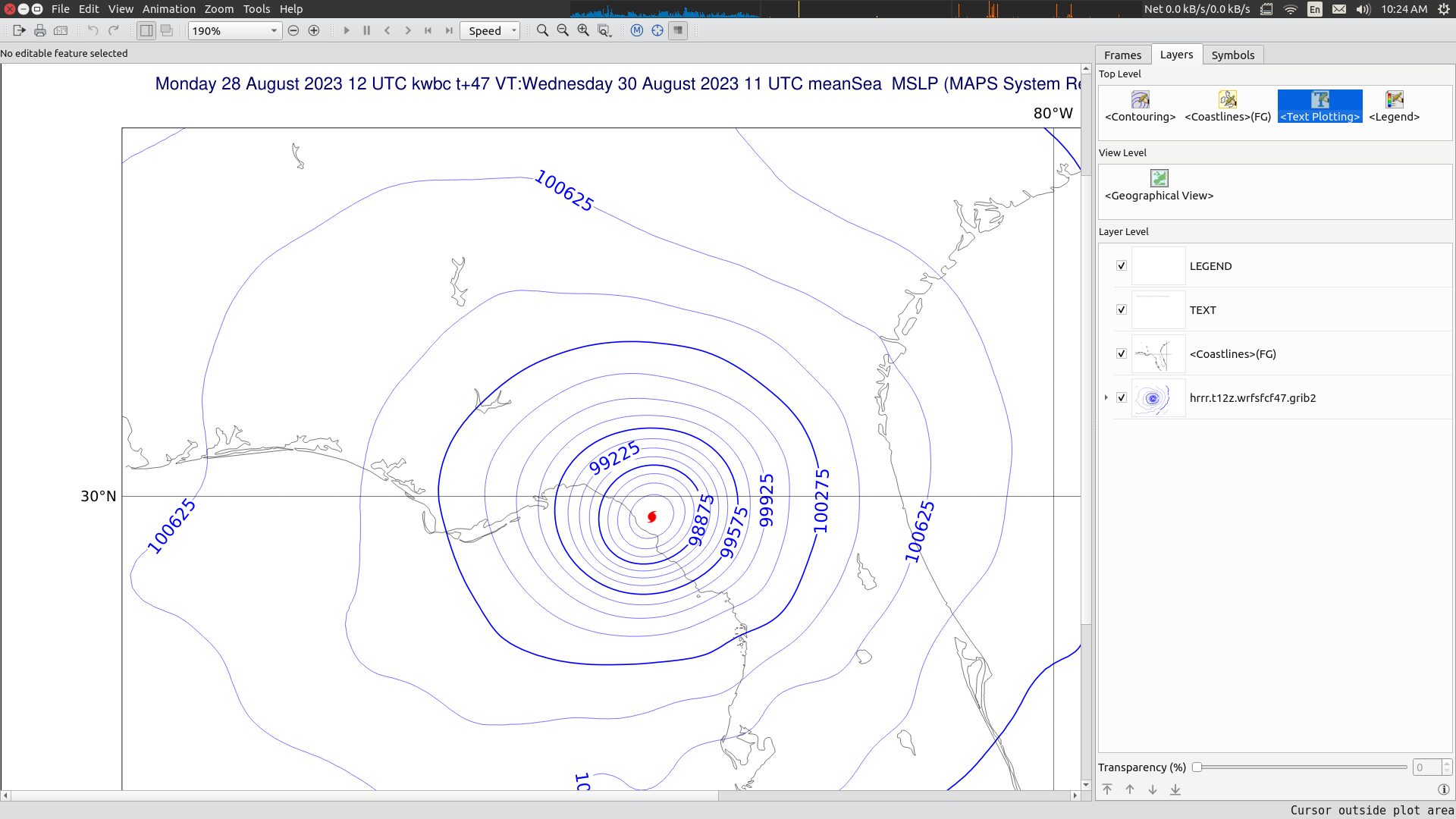
It is hard to tell exactly when it will make landfall, plugging in the HRRR GRIB data from 12h I get 47h from the forecast time (2023 08-30 11 UTC -- around August 30, 7 AM).
This may be later or sooner since both along track and cross track error will matter for when it makes landfall since it is moving parallel to the coast.
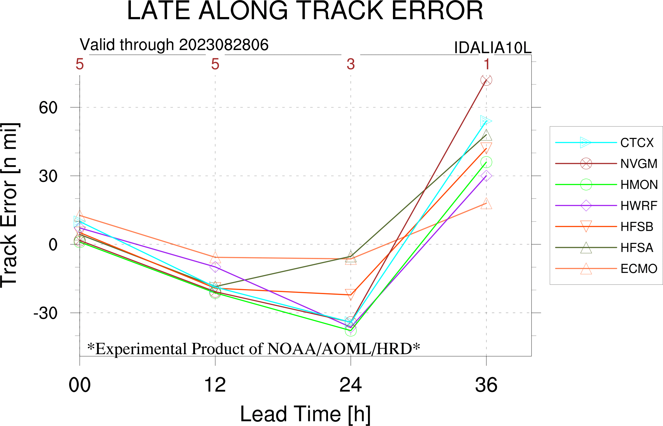
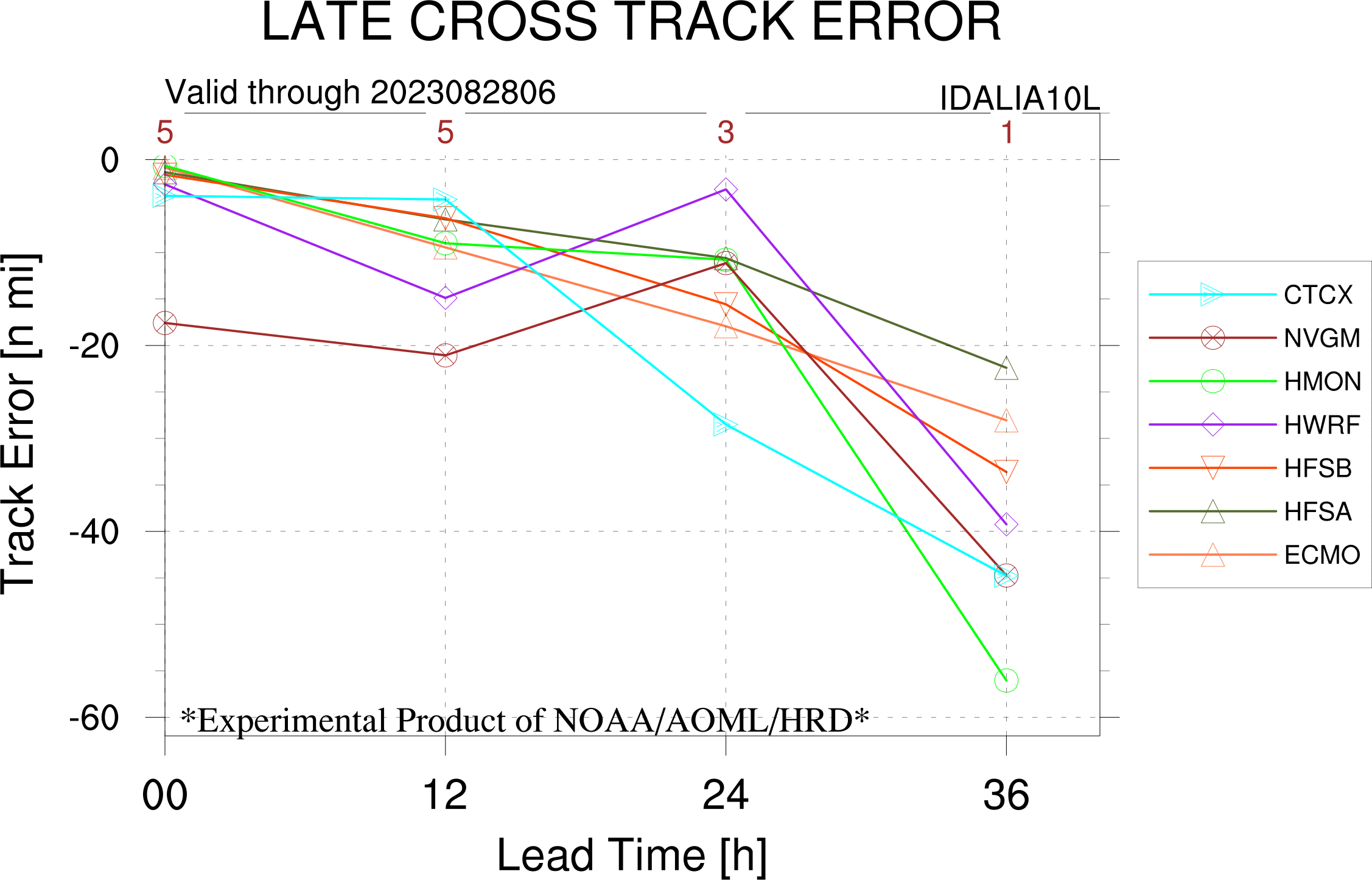
According to these forecasts, this puts landfall at about or less than 48 hours from now. With Idalia now on the move, this is enough confidence now for me to update and sell my NO shares finally and buy YES.
https://www.nhc.noaa.gov/archive/2023/al10/al102023.discus.007.shtml?
The NHC forecast discussion indicates rapid intensification is becoming more likely before landfall.
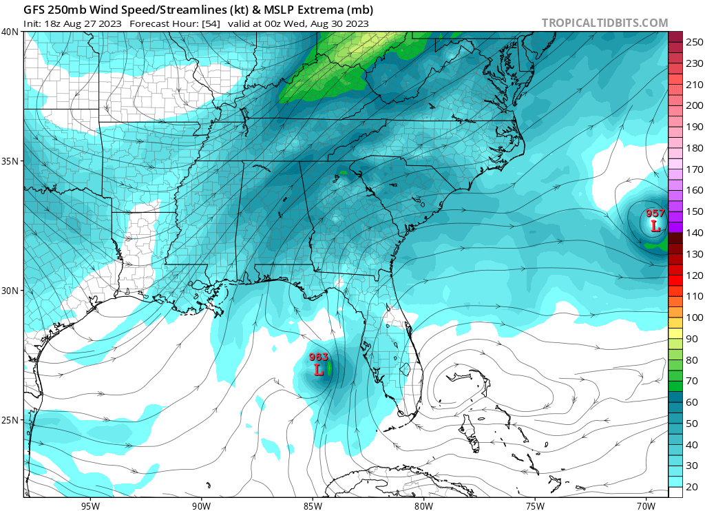
The official forecast (and all regional models) show it becoming either a hurricane or major hurricane, with all the models agreeing on the intensity before landfall in the early guidance (AOML's model viewer):
Only the ECMWF shows it not likely becoming a hurricane or a major hurricane:
The ECMWF cyclone genesis chart shows it between 10-20% of becoming a hurricane.
Here is the intensity bias from AOML's verification (the European model has underestimated the intensity of the storm for the last three forecasts):
Eyeballing this with some simple calculations for weights, I would give weights of 93% to the regional models and 7% to the European model as of now. Even if I assign 95% probability of a hurricane to the regional models and 20% to the European model yields: ~90% ((.93*.95) + (.07 * .20)).
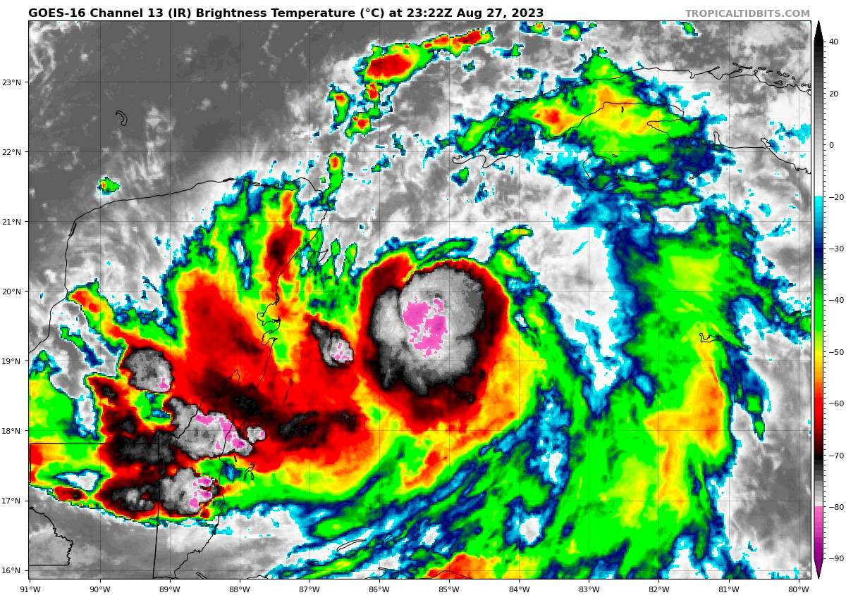
The question is at 91% right now. I am still worried about the gap between the European models and the regional models. Even though the NHC forecast says Idalia seems like its finally on the move, looking at GOES imagery it's hard for me to see that (https://www.star.nesdis.noaa.gov/GOES/sector_band.phpsat=G16§or=gm&band=Sandwich&length=60&dim=0).
I'll wait a few more hours before updating.
I think this and the other market (Florida) is overconfident but I have already spent too much Mana on these two questions to bet it down more.
ECMWF genesis % (from 12h) shows it between 10-20%:
NHC 5pm advisory puts it at 85 kt hours before landfall.
Using a (naive) probability of ~83% for the NHC forecast and taking the high end of the ECMWF (20%) and taking the middle of the two probabilities, gives a percentage of ~52%. Given this discrepancy I think there is still quite a bit of uncertainty 60-72h out.
@parhizj I don't this market is overconfident. There's currently significant convection activity bursts at around -80/-90°C, curving around the Low-Level Circulation within the Radius of Maximum Winds. Pressure is still dropping. The convection may be able to overcome the slight northern shear. This might be a Hurricane even sooner than forecast (very uncertain about that, though). It's trying for sure. Need to keep a close eye on that (sorry, not sorry...). And even if this cycle fails, quick intensification is likely once the storms moves north.
A Cat I at landfall is at this point imo more than 90% likely, if current trends hold. In recent model runs, the GFS indicates even a robust Category II hurricane development (global models need a lot to get this excited). The Euro shows a high-end Cat I. And I don't even wanna talk about the hurricane models.
Once Idalia lifts out of the Yucatan Channel it is expected to quite rapidly intensify as it moves northward from the Gulf, benefiting from favorable conditions, including an upper-level jet digging down over the Mid-Atlantic and being just to the northwest of an upper-level anticyclone. Additionally, the presence of exceptionally (!!!) warm waters in the eastern Gulf is expected to further fuel its intensification to what might be a major hurricane (or very close to one).
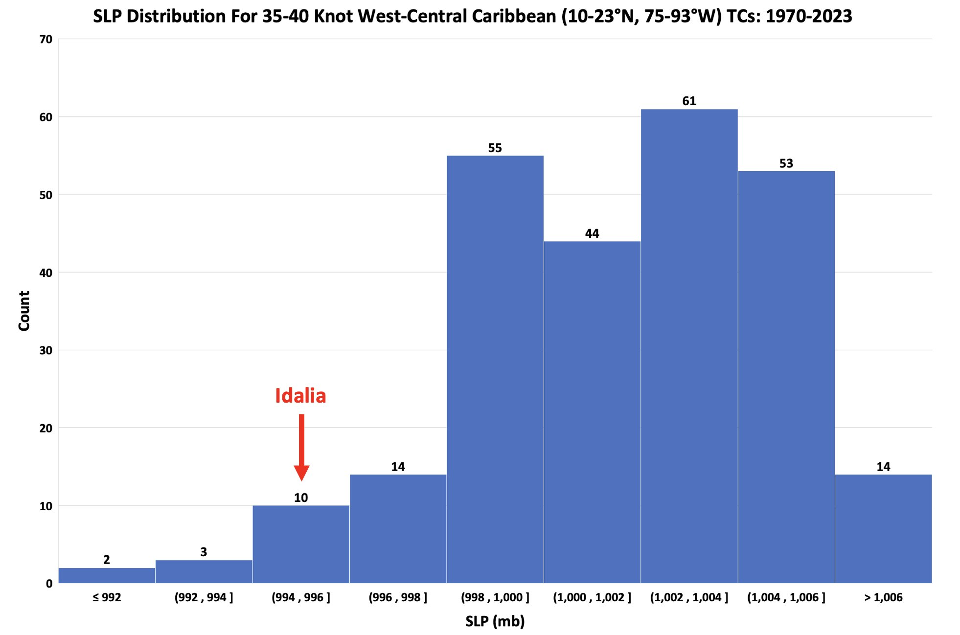
Also apparently Idalia is in the bottom 4% of all 35-40 knot tropical storms in this part of the Atlantic basin since 1970. Meaning its an unusually deep, large storm & there's a good chance Idalia will remain rather large when it likely becomes a hurricane over the eastern Gulf in a few days. (via Eric Webber on X/Twitter)
Tbh I am getting a bit of Typhoon vibes from this one... in the Gulf of Mexico... in August... sketchy...
@Rachell I’m never trusting you ever again. You’ve been corrupted by the hurricane devil. I hope you lose every last fake internet point.
I'm just learning about hurricane forecasting now, so perhaps I'm misunderstanding something here, but wouldn't this chart indicate that this probability should be much lower, more in the 20% range? (image source)
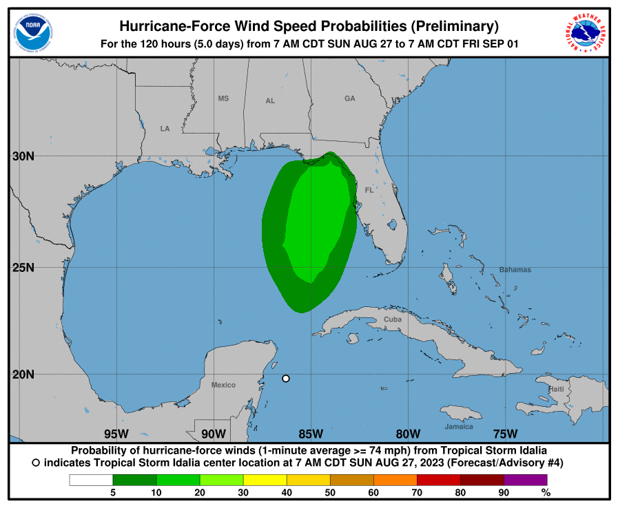
@partlygloudy Yeah that wind speed radii graphic is confusing; I wouldn't rely on that for the category of the storm as it pertains to the question. As for why it shows completely different probabilities I'm not entirely sure (it may use different models/data) but it also may not show the "max" wind speed well if the resolution is too low for such a graphic.
@partlygloudy The NHC is still forecasting hurricane cat at landfall. I don’t really understand that graph.
@partlygloudy This wind field shows the cumulative probabilities that hurricane-force winds will happen at any point on the map within the next 5 days. This means small probabilities are actually quite significant. The probabilities indicate there is - in this case - a 20% chance that hurricane force winds may occur at any location in the light green area.
So a 1/5 chance that you at point x within the 20% range experience hurricane conditions, even though the storm may not track over you and the chances at another point on the track with a direct hurricane impact may be a lot higher. Theres is still a lot of uncertainty in the track/intensity/size forecasts, but I do expect this to clear up as we get more data in and as the trough digs down and steers Idalia north on Monday-Tuesday night/Tuesday morning.
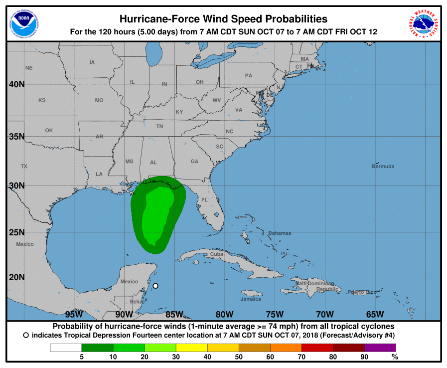
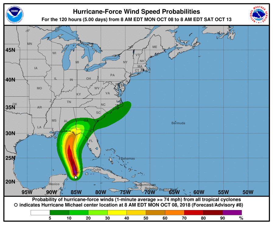
For example this (first image) is the WSP field for hurricane force winds for the already name-dropped Hurricane Michael (2018) on Sunday 7am - and this (2nd image) is the same graph 24 hours later.
@sarius Ahhh okay that makes sense. The probability at each specific point may be low, but the probability at any point is much higher. The probabilities are lower across the whole area, largely because we don't know the exact path of the hurricane yet, so as the path becomes more clear, we would expect to see the probabilities increase along that path
@parhizj I’ll loan you up to Ṁ1000 if you give me a 5% weekly return? In other words, if I lent Ṁ1000 you can give me back Ṁ1050 at the end of the month (or more later if these markets don’t pan out for you)


I suppose the 15% is still because of uncertainty in Franklin's track and/or the disturbance in the Gulf that has the potential of becoming a TS and reaching the Florida panhandle by Aug.31?
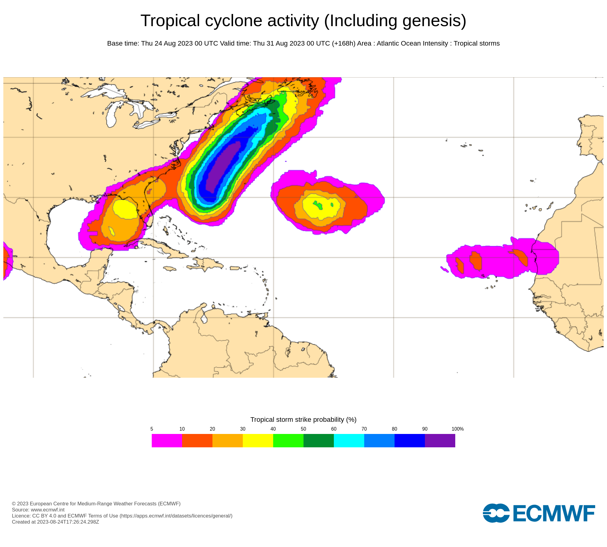
ECMWF Tropical Storm activity probabilities for Aug. 31 (NHC has 50% of the disturbance developing in the next 5 days) (I don't think it is likely it will become a hurricane in time AND make landfall before the end of August but there is still 7-8 days left so it is still too early to say):
The relevant NHC discussion for the Gulf of Mexico:
https://www.nhc.noaa.gov/text/MIATWDAT.shtml
"Looking ahead, an area of low pressure could form late this weekend near the Yucatan Channel. Some gradual development is possible early next week as it moves slowly N or NNE across the eastern Gulf. See the latest NHC Tropical Weather Outlook at www.hurricanes.gov for more details."
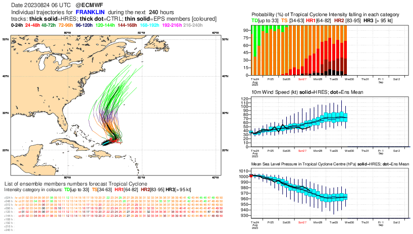
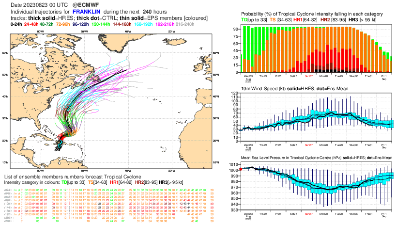
Franklin's track doesn't make it seem likely for US landfall though:
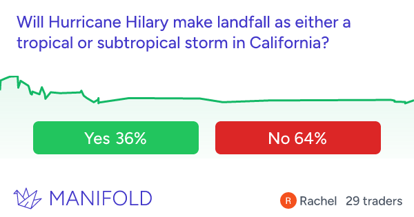
Edit: In case anyone has been following Hillary, if it does make landfall it looks like it will weaken to a tropical storm by then: https://manifold.markets/Rachell/will-hurricane-hilary-make-landfall#W1oOw4yLY7j93MiXT4dB