Between June 1st and November 30th. Resolves according to https://en.wikipedia.org/wiki/2023_Atlantic_hurricane_season#Unnamed_subtropical_storm
 1,000
1,000🏅 Top traders
| # | Trader | Total profit |
|---|---|---|
| 1 | Ṁ1,569 | |
| 2 | Ṁ883 | |
| 3 | Ṁ752 | |
| 4 | Ṁ687 | |
| 5 | Ṁ262 |
People are also trading
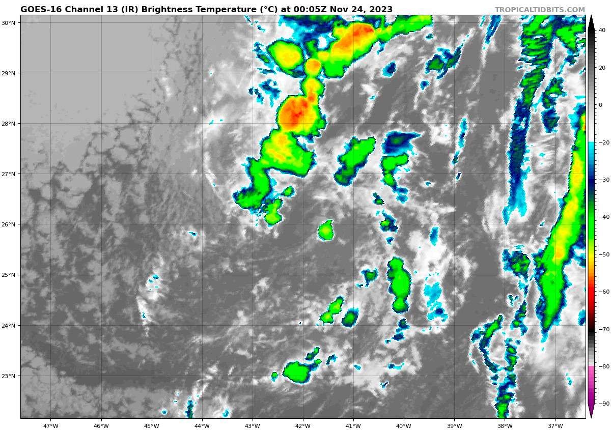
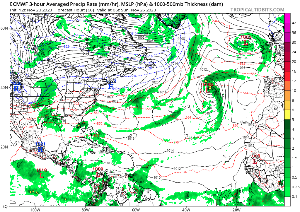
The end is near! One shot left for this season to get to 20 named storms: 90L, aka this little area of not very organized t-storms, could become Vince.
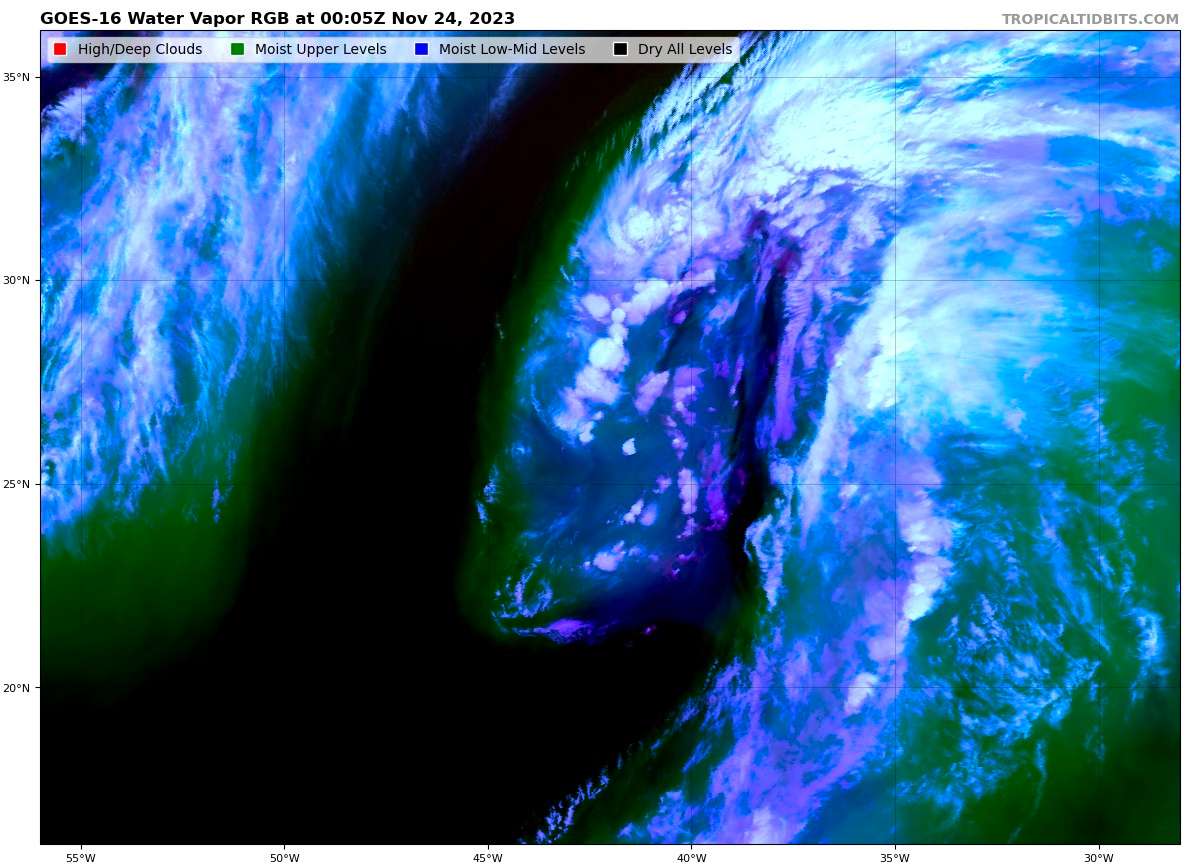
It is set to shed its still very prominent frontal characteristics:
And it could become organized enough to get a name. The NHC puts it at 40% for (S)TC-gen, trending lower. I'd say <25%. If it hasn't done anything by 11-29-12z it's toast. Will keep half an eye on this. Happy Thanksgiving WxPeeps! 🦃
@sarius AFAIK None of the global models (NAVGEM/GFS/ECMWF/CMC) for the past few days show it becoming a TC.
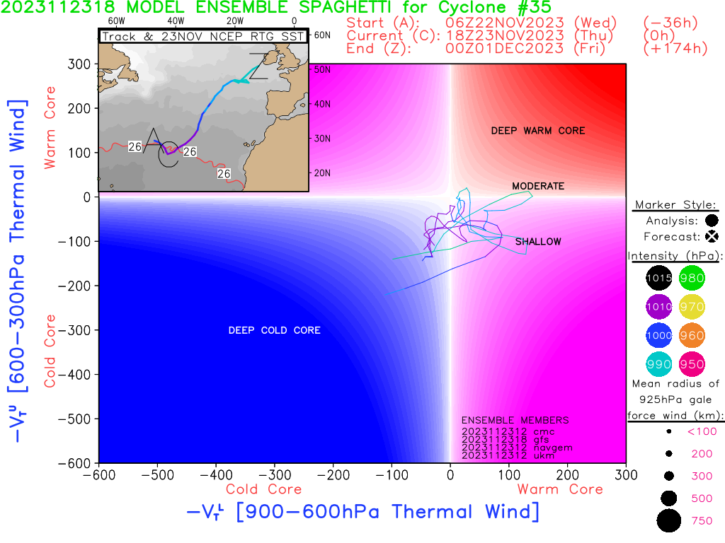
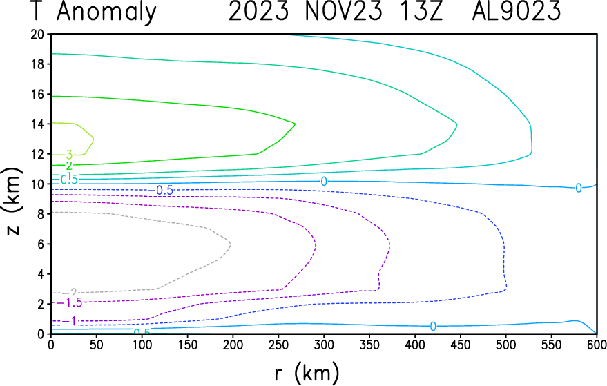
FSU Phase analysis shows it most likely having a shallow core:
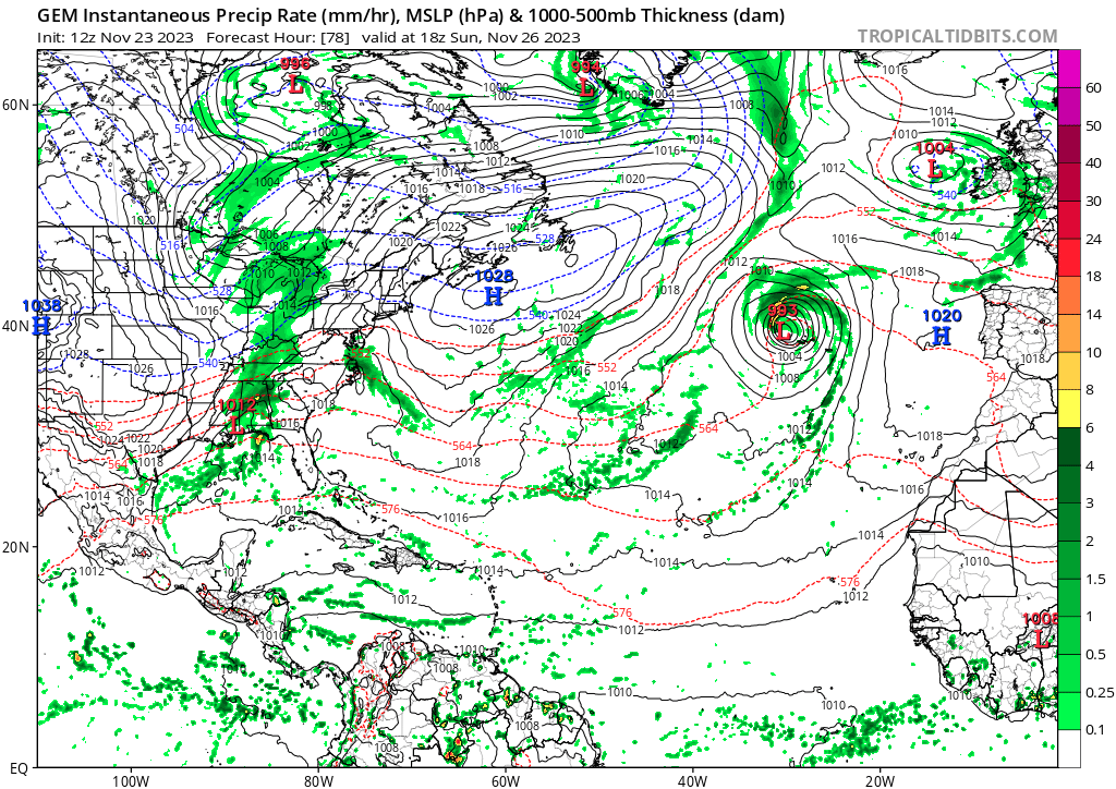
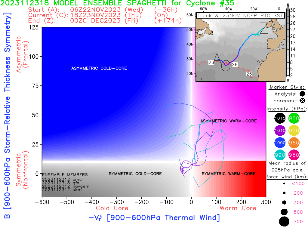
Yeah, I don't think this system has a chance of becoming a TC. A STC is not out of the question, though. And I mean they still get names. GFS, CMC, ICON, NAVGEM all hint at a chance for that happening - to varying degrees. The CMC is the most bullish:
But the Euro keeps it elongated and doesn't show any tropical characteristics:
Don't entirely know what to make of this one. Not very likely but possible, ig. At least this little show should be over come Tuesday night, well before November ends.
@sarius I have a hard time interpreting those model data products for subtropical cyclones... CIRA's product is easier to interpret (~12 hours old), that shows a low with a cold-core (with a warm stratosphere):
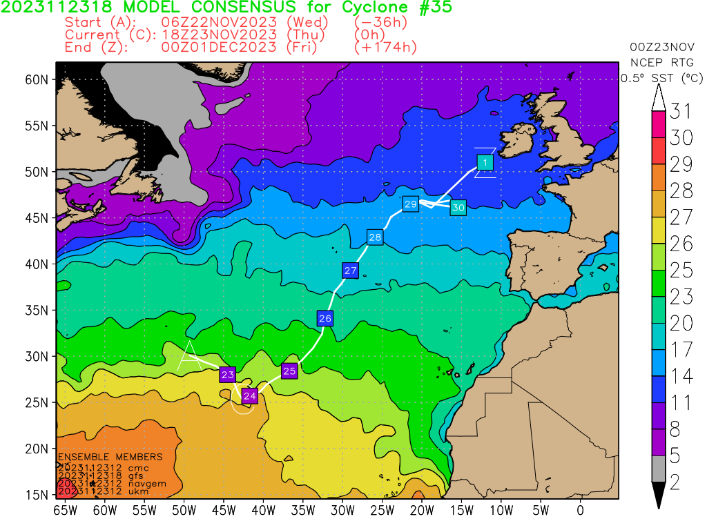
As far as its chances further out, global models seem to show it becoming more frontal after the ~27th next week; assuming it moves according to a NE track, it will encounter much cooler SSTs (as mentioned by the NHC outlook):
That only leaves the next 48 hours or so for development...
Latest outlook downgraded to 30% (both 2 and 7 days), giving it also a deadline of Sunday to develop by.
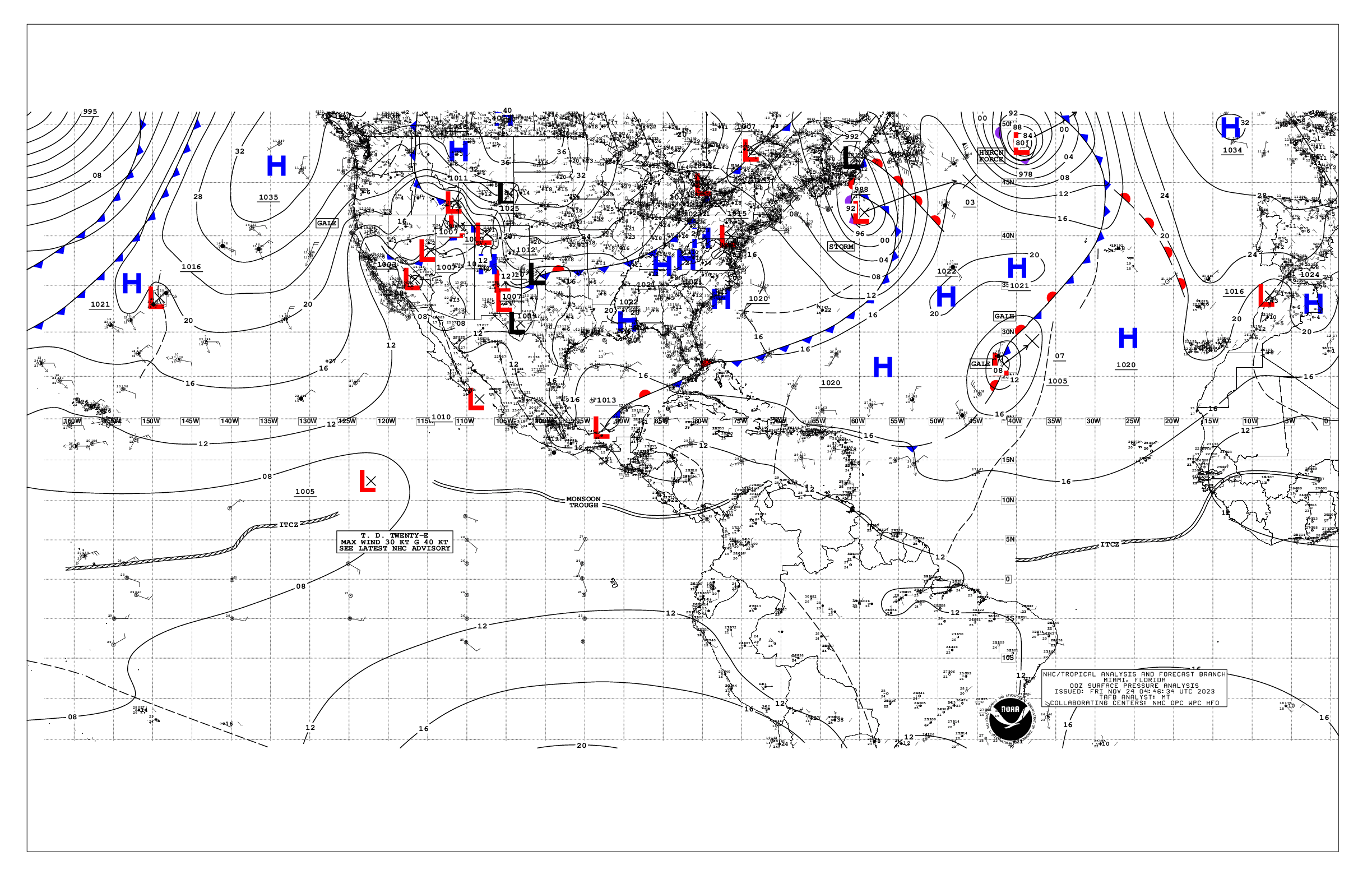
1. Central Subtropical Atlantic (AL90):
A non-tropical area of low pressure located over the central
subtropical Atlantic is producing disorganized shower and
thunderstorm activity, and the associated winds have decreased
below gale force.  This system could acquire some subtropical or
tropical characteristics during the next day or two while it moves
northeastward at 15 to 20 mph.  The chance for subtropical or
tropical development is likely to end by Sunday as the low moves
over much colder waters.
* Formation chance through 48 hours...low...30 percent.
* Formation chance through 7 days...low...30 percent.
As far as my understanding goes, as long as it's attached to that front they won't declare it subtropical (as their definition is non-frontal).
For reference:
Surface analysis from TAFB 00Z:
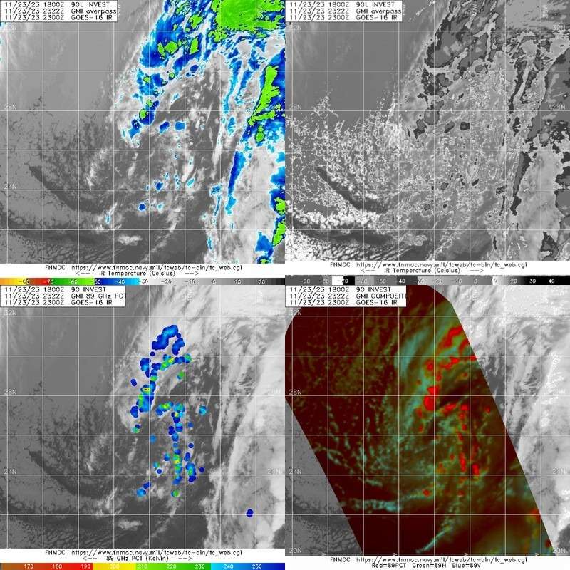
and imagery from FNMOC:

Latest computer-model fed data (18Z) keeps it extra-tropical at 30kt: https://ftp.nhc.noaa.gov/atcf/com/al902023.com
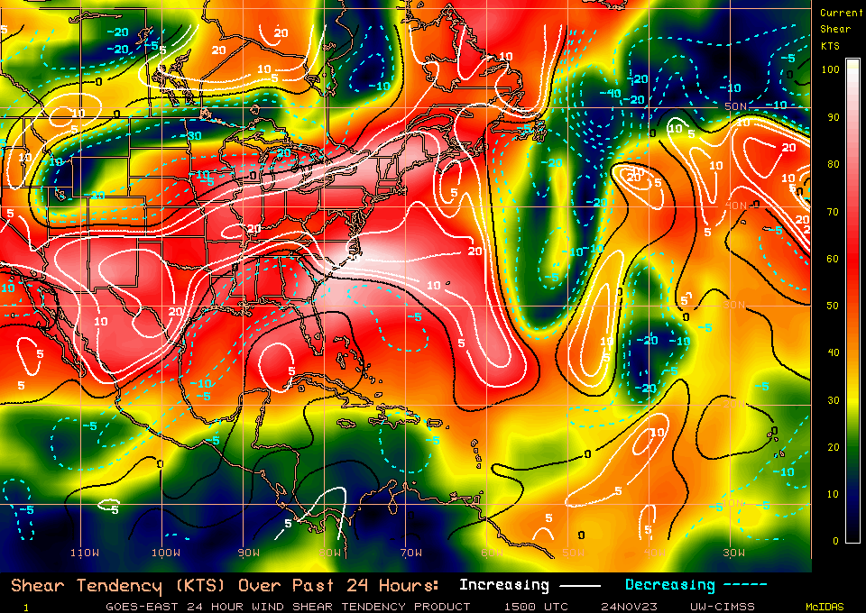
Guesswork for why no genesis today:
Looked like the shear did rapidly drop roughly in the area it was expected to develop today, or it did at least in the path it moved through, but maybe not enough as it was developing ...
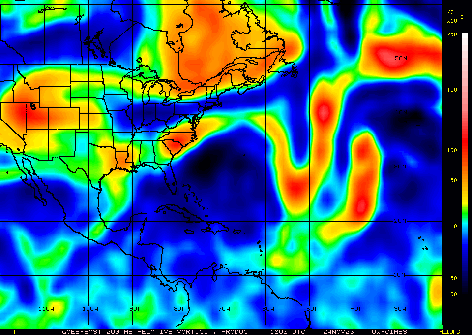
It seems it couldn't get organized, especially higher up:
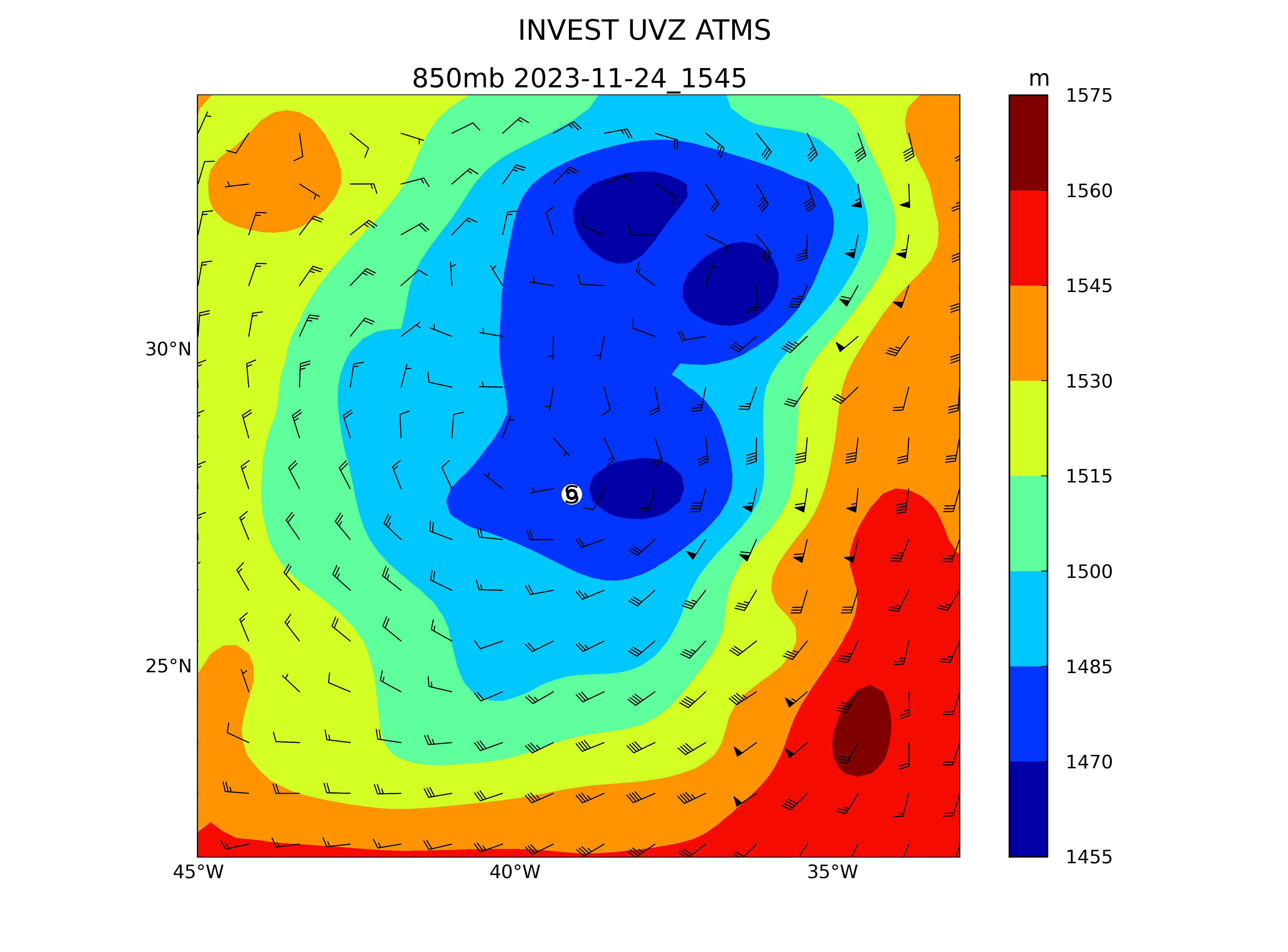
Especially, at 500mb and higher (vorticity hints at that) it couldn't get organized within such short time frames after separating from the front:
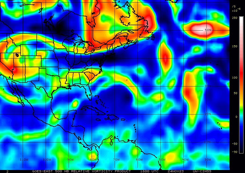
It is usually said that the environment is the dominant factor: the dry air (that it was pulling in from behind) and the shear didn't help today:
GFS diagnostics show it with less than 60% mid-level humidity today and unfavorable shear.
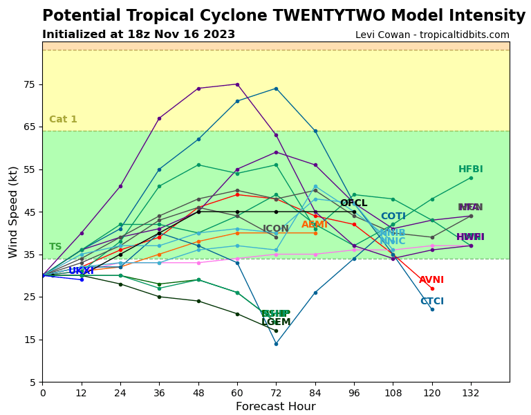
Potential Tropical Cyclone Twenty-Two forecast to reach 45kts per
https://www.nhc.noaa.gov/text/refresh/MIATCDAT2+shtml/162048.shtml
but still possibility from some models staying as depression or weaker


@Domer Interesting definition of fun you have. Some might say hurricanes are deadly serious and so this market is more serious than fun? Not that the predictions here have much consequential effect, but that may well be true of most markets here.
@ChristopherRandles It's a topsy-turvy season with a very quiet August, absurdly busy fall, and unclear if it will wrap up quiet or busy. Extremely abnormal for an ENSO-positive year! Fun to try to predict what is going to happen (I've been more wrong than right this year)
@ChristopherRandles Yeah, I was watching it as well and it was so disorganized most of the time I thought it had a very low chance of becoming named so never updated.
Is distance travelled in 2/3 of the time shown likely to put it over land at time of next full advisory? Coast looks pretty close to equidistant from the two points to me.

So if unlikely at next full advisory, could it get named at intermediate advisory?
@ChristopherRandles I'm surprised it even got classified as a TD. I believe it has to be a confident 35kt to get named for such a storm, or have a Dvorak >= T2.5 for 12 hours (I don't know their exact criteria though so this is a guess), and considering they've put it at 25kt, I think the chances are very low.
@parhizj I think this is their definition
Tropical Cyclone:
A warm-core non-frontal synoptic-scale cyclone, originating over tropical or subtropical waters, with organized deep convection and a closed surface wind circulation about a well-defined center. Once formed, a tropical cyclone is maintained by the extraction of heat energy from the ocean at high temperature and heat export at the low temperatures of the upper troposphere. In this they differ from extratropical cyclones, which derive their energy from horizontal temperature contrasts in the atmosphere (baroclinic effects).
There seems evidence of use of this definition in things they say around time of formation. No minimum windspeed apparently but if it has all those required characteristics then presumably it is not going to be slower than ~20kts,
I was asking more about the policy of whether name can be assigned at intermediate advisory if the necessary windspeed is reached. I agree necessary windspeed is unlikely to happen.
@ChristopherRandles Those are just the criteria though. What I meant is what they do operationally to determine if the criteria is satisfied, and it's more detailed than that. For example, they have seem to have rules concerning time over how long they watch the storm before first declaring it a TD/TS, and then I speculate they might some overruling rules for certain circumstances (if it RI's from a disturbance to a hurricane they're not going to wait 6 more hours). I also think this is complicated by the difference in what type of data they end up having available -- if all they have is DT for their intensity fixes they might have to end up waiting longer before upgrading the intensity.
Whether they have/do name storms in between regular advisory times I don't know. It shouldn't be that difficult to find out (scrape their text archive for all 5 bins: https://www.nhc.noaa.gov/archive/text/TCMAT1/ (for 1 to 5), parse the time field and ATCF ID, get the first time for each storm's ATCF ID, and see if there are any that fall out of the normal advisory times.
From 5 hours ago, max wind I see (non contaminated) is 7.5 m/s (15 kt) (H2-YC)
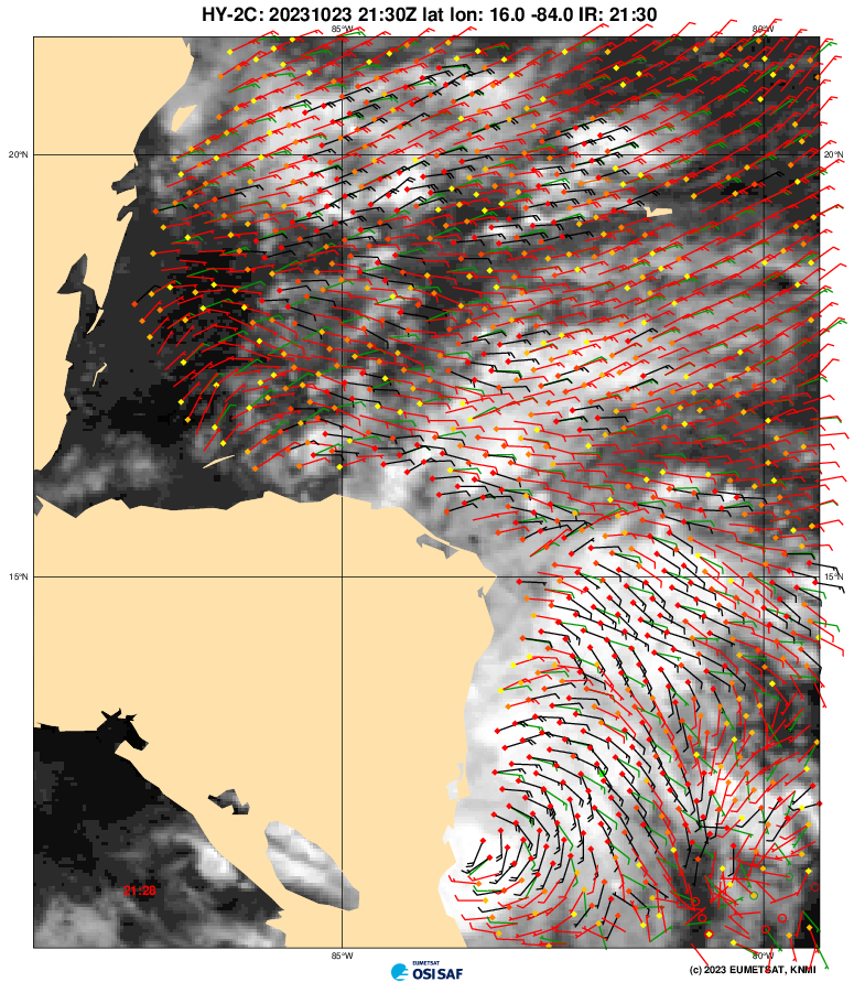
SAB 00Z has it at T1.0/1.5 but note difficulties since it is so close to land (their positioning is very close to land) (https://www.ssd.noaa.gov/PS/TROP/DATA/2023/bulletins/natl/20231024000021L.html)
From current satellite imagery it looks like it might be already inland, especially since convection has stopped recently, so I expect them to say it is inland in the next intermediate advisory.
`Or not: basically they don't know whether the center is on land or not, but they put it 5 miles off the coast from the center they did provide, with an error in their advisory of 60 n. miles.
" Tropical Depression Twenty-One Discussion Number 2 NWS National Hurricane Center Miami FL AL212023 1100 PM EDT Mon Oct 23 2023 It has been a challenge to find the center of the depression this evening. Surface observations from Bluefields Airport in Nicaragua indicated that the center of the depression likely moved northeast of the observing station earlier this evening, but pressures in the area were not particularly low. Since then, a robust mid-level circulation has been visible in shortwave-infrared imagery, but it isn't clear if this extends to the surface. ASCAT data is expected within the next couple of hours, which should provide clarity over whether the center of the depression has reformed under the mid-level circulation, or if has already moved inland. TAFB and SAB Dvorak estimates still support an intensity near 25 kt. Once inland, the depression should quickly weaken and dissipate. However, its worth noting that if the center is still over water and remains there for any period of time overnight, some slight strengthening could occur since the environment is otherwise favorable for intensification. The long-term estimated motion is around 310/4 kt, but this is highly uncertain. The depression, or its remnants, are forecast to continue northwestward tonight, and then generally head westward toward the eastern Pacific after that.
"