"Hone" is the next name to be used for a tropical storm developing in the Central Pacific.
The last storm to develop in the Central Pacific, Ema, occurred in October 2019.
Resolves YES if the Central Pacific Hurricane Center names a tropical (or subtropical) cyclone "Hone" before 00:00 Jan 1, 2025 HST. This will be determined by Central Pacific Hurricane Center (or National Hurricane Center, in the event of a backup) advisories.
Resolves NO otherwise. This includes if a system operationally considered a tropical depression is upgraded in post-analysis/best track to tropical storm strength. Unnamed subtropical storms (such as 96C in 2018) do not count.
 1,000
1,000🏅 Top traders
| # | Trader | Total profit |
|---|---|---|
| 1 | Ṁ103 | |
| 2 | Ṁ23 | |
| 3 | Ṁ13 | |
| 4 | Ṁ3 |
People are also trading
https://www.tropicaltidbits.com/storminfo/#01C
showing TS Hone so probably pretty much decided though have to wait for NHC
https://www.nhc.noaa.gov/text/refresh/HFOTCDCP1+shtml/221500.shtml
First forecast … predicted to become a TS by tonight.
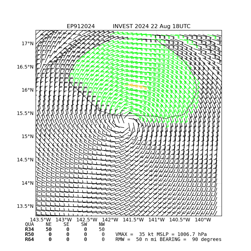
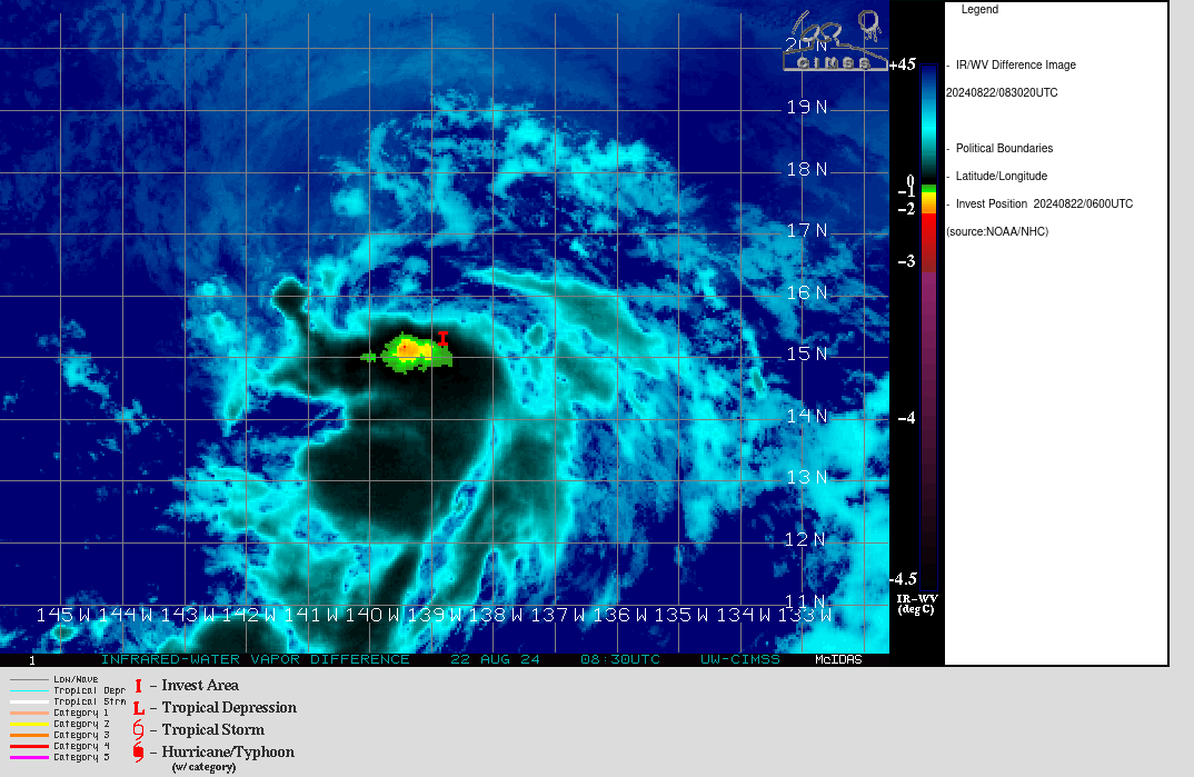
Potential Tropical Cyclone ONE shown at https://www.tropicaltidbits.com/storminfo/#01C
Invest 91E will cross into the CP in the next ~ 24 hours by my estimates. It still has not been classified as a TD yet despite given 90% of development (in 48 hours) for the last day in the GTWO... It's possible the convection will remain sporadic enough not to be classified as a TC until it crosses over, or it could be classified (in the EP basin) in the next few advisories before it does so. s fixes and sat wind speeds have put it near TD strength but the NHC hasn't rushed to classify this one despite phase analysis of most models making it look like a TC.
Edit:
Latest subjective fixes are mixed:
EP, 91, 202408220000,  10, DVTS,         CI,  , 1580N, 13810W,      , 2,  25, 2,     ,  ,     ,    ,     ,     ,     ,     ,     ,  ,  ,  ,  ,  ,    ,    , E,   SAB,  MT,  VIM, 3, 1010 /////,      ,   , GOES18, LLCC, T, DT=1.0 BO SHR  MET=1.0 PT=0.0 FTBO CON
EP, 91, 202408220000, 10, DVTS, CI, , 1570N, 13710W, , 3, 35, 2, 1005, 2, DVRK, , , , , , , , , , , , , , E, TAFB, SK, VI, 5, 2025 /////, , , GOES18, CSC, T, Based on it's current speed and position it looks like 91E will likely cross over into the CP at the next advisory time (< 81 miles from 140W, and bearing W at 15 mph):
Most of the model guidance does indicate it will become a TS.
I will not be betting in this market, but for the record I do think we will see Hone next year (or even later this year). I think it is favored due to El Niño, which is when the vast majority of homegrown central Pacific storms develop. The base rate for years with central Pacific storms seems to be about every 3 years or so (vague recollection of the data, sorry).