Background
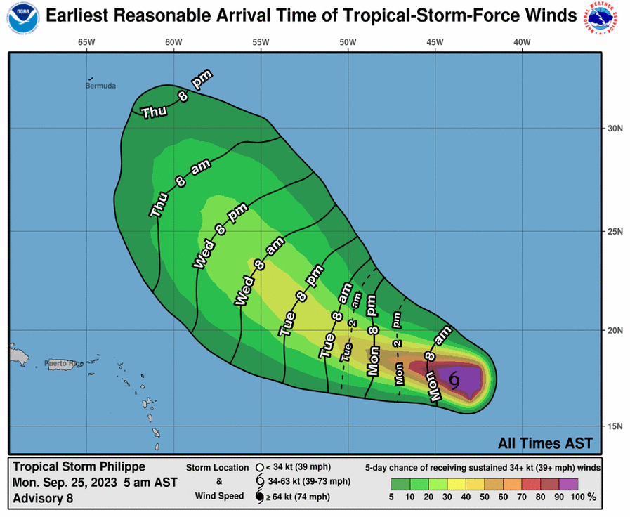
Here is yet another episode of Bermuda tropical cyclone markets (previous ones here and here). According to different model forecasts, the path of Tropical Storm Philippe carries strong uncertainty beyond the next 2-3 days.
Per NHC:
"Philippe should continue west-northwestward over the next day or two, steered along the southern side of a mid-level ridge. In about 2 days, all models depict a weakness developing in the ridge, but the track guidance diverges quite drastically, and it is directly related to the intensity of the system. A deeper, stronger system, like the GFS depicts, will feel the weakness in the ridge and curve the system faster on a more northwestward track. However, a weaker, shallow cyclone, like the ECMWF depicts, will cause the system to continue on a west-northwestward or even westward track. The NHC track forecast continues to be in the middle of the guidance, and lies close to both the simple and corrected consensus aids. This remains a low confidence track and intensity forecast."

Will Philippe pound Bermuda with inclement weather shortly after Lee, or will its impact mostly be confined to the fishies?
Resolution Criteria
Resolves YES if Philippe brings tropical-storm-level winds (>34 knots, >39 mph) to any part of Bermuda while maintaining tropical characteristics.
Resolves NO if Philippe dissipates or becomes extratropical before the fulfilment of the condition for YES.
Will resolve based on Bermuda Weather Service and/or the National Hurricane Center data.
I will not bet on this market, but I will put Ṁ200 in as subsidy.
🏅 Top traders
| # | Name | Total profit |
|---|---|---|
| 1 | Ṁ398 | |
| 2 | Ṁ140 | |
| 3 | Ṁ138 | |
| 4 | Ṁ62 | |
| 5 | Ṁ45 |