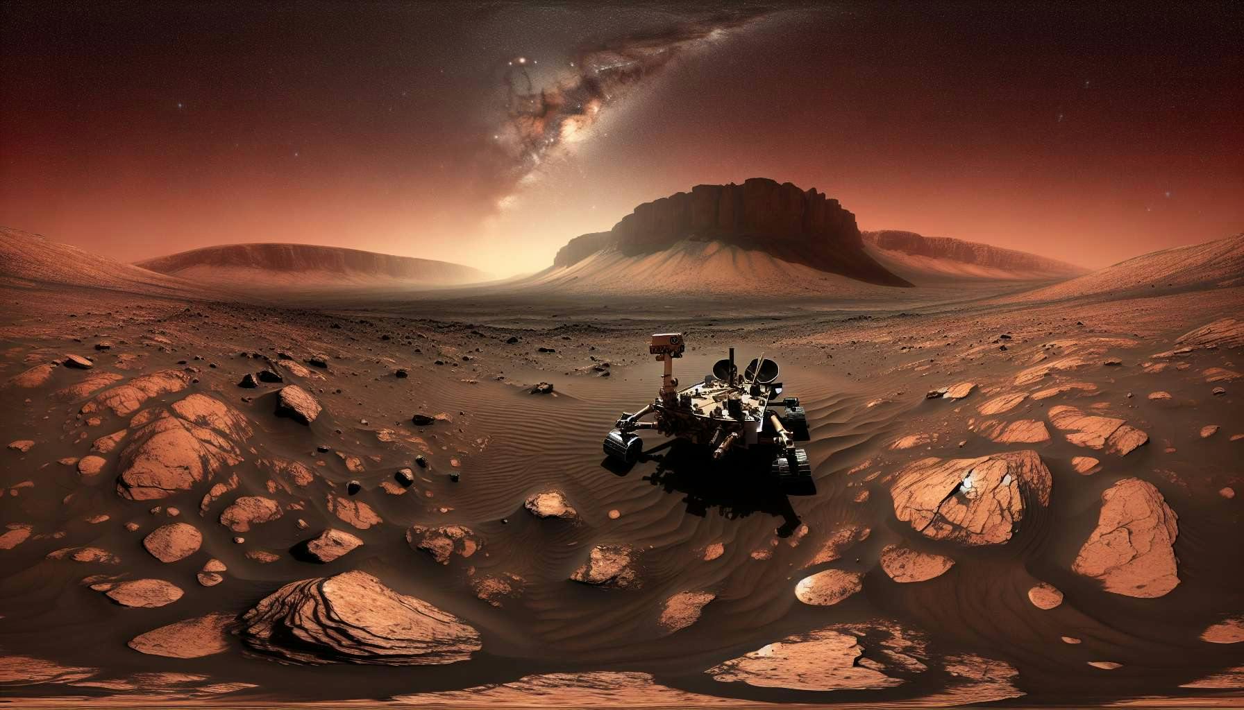
Now that the solar conjunction is past us and the Mars Perseverance rover is back on the move, will the rover exit the Jezero crater through the ancient Neretva Vallis riverbed by Sol 1111 [Apr4-2024]?
Market will be resolved by the rover position on Sol 1111
-- https://mars.nasa.gov/mars2020/mission/where-is-the-rover/
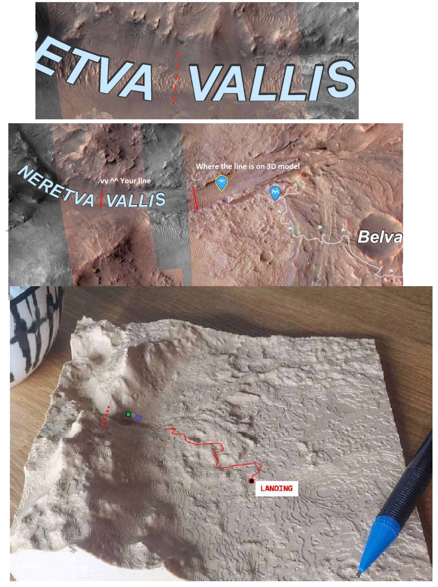
Exiting the crater will be defined as crossing this boundary on the interactive map:
Market will resolve YES if the rover is to the west of the red line on Sol 1111
Market will resolve NO if the rover is to the east of the red line on Sol 1111
Market will resolve YES if the rover is on the red line on Sol 1111
The red line can be extrapolated if the rover doesn't follow the middle of the path.
*Note: If the "Neretva Vallis" text is moved on the interactive map there are two dark and circular geographic features in the interactive map that serve as the landmarks for the "finish line". If needed, image analysis will be used to determine the exact longitude,latitude values of this line to determine if the rover has crossed or not.
This market makes the assumption that the Mars Perseverance rover will finish the "Margin Campaign" and continue with the "Beyond Jezero Campaign"
-- https://mars.nasa.gov/mars2020/mission/status/482/within-the-margin/
3D model (not my model, only used as a visual aid here):
https://www.etsy.com/listing/978024899/mars-3d-topography-model-of-jezero
*Please note: Scale is approximate in this model and may misrepresent the total distance the rover must cover. The main purpose of presenting the 3d model is to show through the river mouth is the least treacherous way out of the Jezero crater.
Other mission updates:
-- https://mars.nasa.gov/mars2020/mission/status/
Latest videos:
https://mars.nasa.gov/mars2020/multimedia/videos/
Geological map of the region:
-- https://en.wikipedia.org/wiki/Jezero_%28crater%29#/media/File:Sim3464_USGS_Jezero_Crater.png
Space.com article:
--https://www.space.com/perseverance-rover-moving-to-jurabi-point-mars
"After its trip to Jurabi Point, Perseverance will head west, climbing uphill in Jezero, observing how the margin rocks change as altitude increases. Then, the Margin Campaign will culminate with a visit to the ancient river channel Neretva Vallis, where the rover will examine the light-hued rocks in the channel wall.
Raw images from the rover:
 1,000
1,000🏅 Top traders
| # | Trader | Total profit |
|---|---|---|
| 1 | Ṁ374 | |
| 2 | Ṁ61 | |
| 3 | Ṁ30 | |
| 4 | Ṁ17 | |
| 5 | Ṁ13 |
People are also trading
The rover has covered some ground, but not enough. Resolves NO
@chrisjbillington yes, when I created the market I thought the rover would be much closer...I wanted traders to make thier decision early rather than "live betting" up to the end date.
@Kable Thanks for bringing this up, I tried my best to estimate on the 3D model but it may have not been close enough.
Disclaimer: the red dashed line drawn on the 2d map is the official red line while the red dotted line drawn on the 3d model is a rough approximation.
@EstMtz
I would suggest maybe getting rid of the reference to the 3D model at all in the description since there seems to be some inconsistencies with the 2D and interactive map and it makes it seem like the rover is a lot closer to where it needs to go for a YES resolution on that 3D model. It might even be better to just change the resolution criteria to whether the rover reaches a longitude lower than 77.2877 (as close as I could get to your red line in the 2D map) aswell instead of doing the red line thing. That way it can be verified easily in the future even if the interactive map changes some (like if they moved the "Nereta Vallis" text or something).
@Kable Thanks for the suggestions! I have modified the 3d model and added a note about the potentially misleading scale.
I agree the longitude,latitude coordinates would be the best way to define the red line, but I wanted to keep it simple initially. I intentionally chose the two dark spots on the Mars geography as the landmarks for the line so it's not based relative to the text annotation. Also, since the line is at an angle choosing one value for the longitude would not be sufficient to define the red line.
See the updated note under the market resolution conditions.
If we get very close, I will provide exact coordinates of this line to resolve the market.
@EstMtz Oh I didn't even notice those dark spots, that should be fine then. Updated model looks good too.