Will the North Atlantic Tracks, Westbound, for Aug 30th, fly over Greenland?
3
Ṁ70Ṁ42resolved Aug 29
Resolved
YES1H
6H
1D
1W
1M
ALL
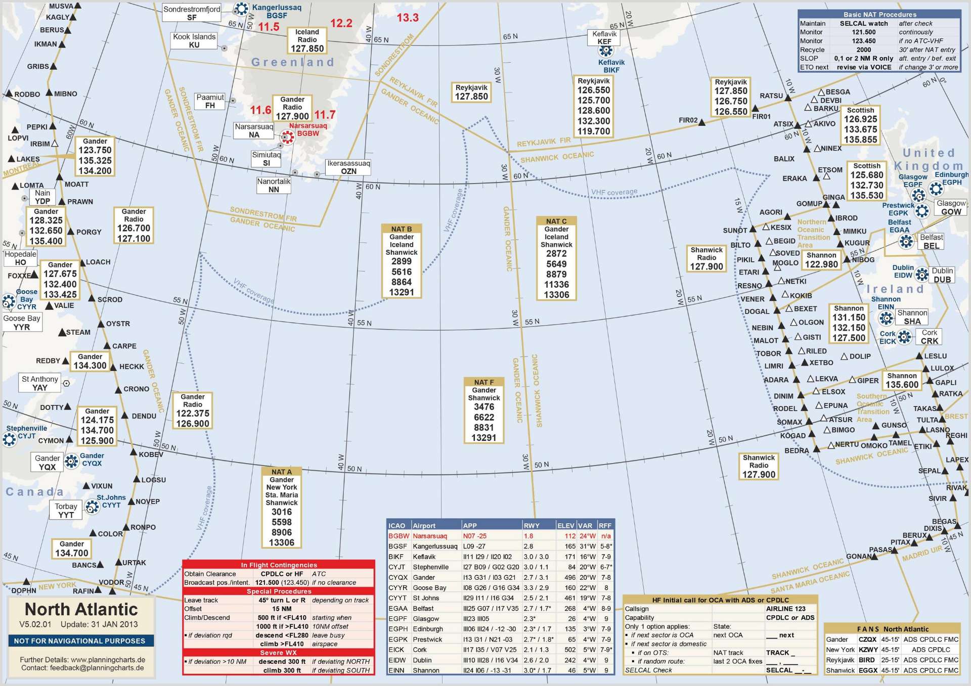
Background: The North Atlantic Tracks System is a system of pre-designated flight paths that are often used during transatlatic crossings, where radar coverage cannot be used for traffic control. Their path changes from one day to the next, based on polling of the participant airline desired routes.
Autoritative source for NATS: FAA
Easier to use source: NATS map , SkyVector (Open Layers, Nav, North atlantic, West)
Westbound track are lettered from A to D-E-G, depending on the number of tracks opened that day. They are published 2200 UTC the day before.
Flying over greenland is defined as at least one track path being, for any distance, higher than latitude 60N, and between 40W and 60W - see the following:
This question is managed and resolved by Manifold.
Market context
Get  1,000 to start trading!
1,000Sort by:

People are also trading
Related questions
Will Trump set foot in Greenland by the end of July 2026?
8% chance
Will Trump attack Greenland in 2026?
4% chance
Will Trump set foot in Greenland by the end of July 2027?
18% chance
Will the USA control Greenland by EOY2026?
7% chance
Will Greenland be controlled by the USA on 31 December 2029?
10% chance
Will Greenland become part of the US by the end of Trump’s term?
5% chance
Will Trump interfere with Greenland?
23% chance
How will the U.S. take Greenland? [Ind MC]
If Greenland is part of the US by end 2027, will an American have died over it?
54% chance
Status of Greenland in 2035?