This is 95L - will resolve YES if it makes landfall (intersection of the center of a tropical cyclone with a coastline.) anywhere while a tropical cyclone at hurricane strength. Resolves per the NHC.
 1,000
1,000🏅 Top traders
| # | Trader | Total profit |
|---|---|---|
| 1 | Ṁ398 | |
| 2 | Ṁ14 | |
| 3 | Ṁ14 | |
| 4 | Ṁ13 | |
| 5 | Ṁ12 |
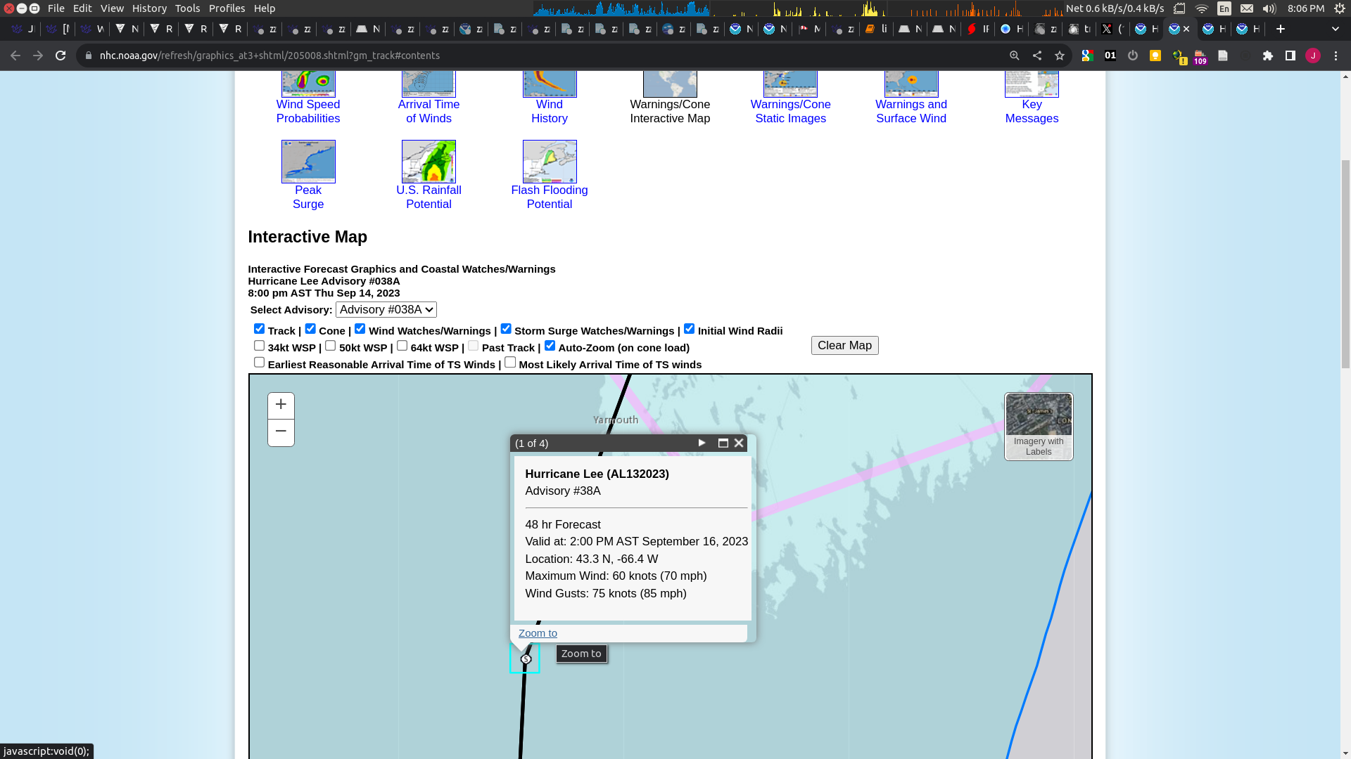
From the latest NHC advisory. This resolves NO. Lee is done for.
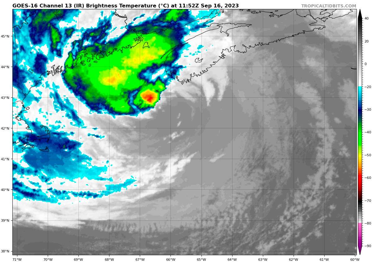
The core of Lee briefly moved across Long Island in Western Nova
Scotia within the past hour or so. Satellite images and surface
observations indicate that the center is now over the Bay of Fundy.
Rain bands continue to spread across portions of Maine, New
Brunswick, and Nova Scotia as seen in radar images. A pair of ASCAT
passes from several ago showed that Lee remains very large, but the
core winds have decreased below hurricane-force.  Considering some
undersampling of that data, the initial intensity was lowered to 60
kt on the 1800 UTC intermediate advisory.

Strong wind shear, dry air, and land interaction should cause
steady weakening during the next day or so.  The global models are
in agreement that Lee should dissipate on Monday, and that is
reflected in the NHC forecast.@sarius Might find this forecast for Lee interesting, i think it is quite rare for a named extratropical storm to landfall both North America and Europe (a quick searched turned up nil)
https://www.nhc.noaa.gov/text/refresh/MIATCDAT3+shtml/160850.shtml?
Intensity models indicate that Lee should
begin gradually weakening very soon, although the maximum winds are
likely to still be at or just below hurricane strength (mainly
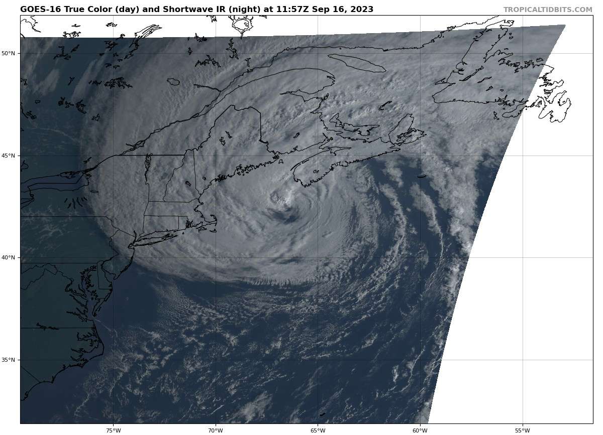
over water) when Lee's center reaches Nova Scotia later today.Lee appears to have completed its transition to a post-tropical
cyclone. The cloud pattern is comma shaped, and there has been no
significant central deep convection for the past 12 hours or so.
The cyclone is now frontal but likely still has a warm core,
indicating that it is a warm seclusion-type of extratropical
cyclone.So it might end landfalling with hurricane force winds but it won't be considered a tropical cyclone any more and therefore no longer a hurricane.
I focused too much on the intensity and not the other requirements such as the tropical part of the tropical cyclone.
@sarius If the last NHC advisory/intermediate advisory has it at 65kt before it moves inland will this resolve yes?
@parhizj I would expect the NHC to issue a post-landfall advisory should Lee be making landfall at/near Hurricane strength. If they don't, I'll use the last advisory and verify with other now-casting meteorological sources and if needed do my own analysis - in that case I would generally lean more towards YES though (if the storm is still a tropical cyclone).
But for now I expect Lee to weaken quite quickly while on approach - my guess is it won't be tropical by the time it makes landfall.
@sarius the NHC themselves say they are relying less on those regional models which show a large drop in intensity and more on the global models (from which you would expect greater uncertainty) which show a smaller drop
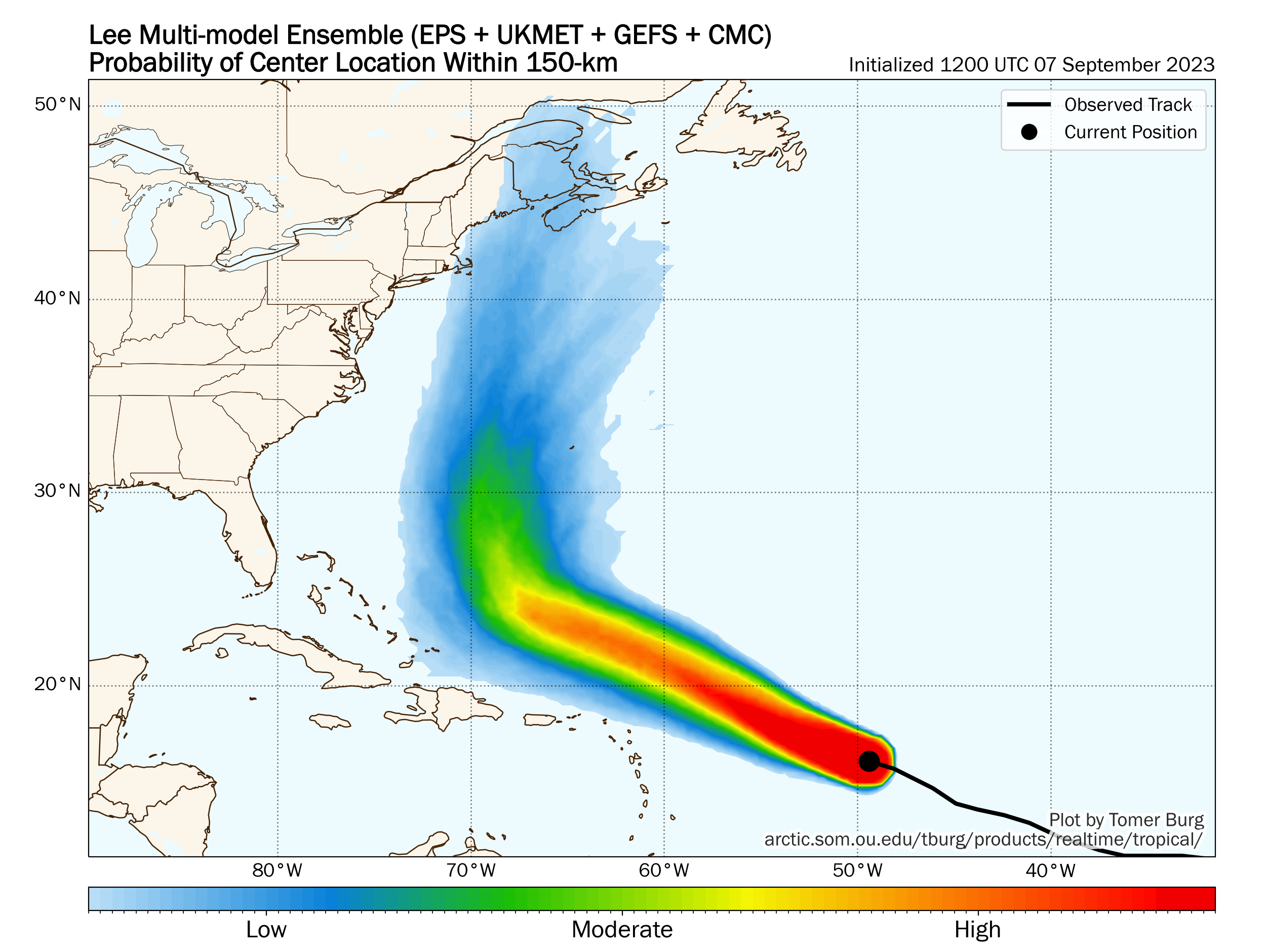
11 am NHC discussion (I'm taking "around" landfall to mean it's going to be somewhat close even though it's likely at landfall):
Southerly vertical wind shear and dry air are eroding deep
convection on the hurricane's south side.  These environmental
conditions are expected to persist while Lee moves over sharply
cooler waters during the next day or so.  Therefore, steady
weakening is forecast and Lee will likely become extratropical
around the time it makes landfall.  The NHC intensity forecast is a
little lower than the previous one, and fairly close to the GFS
model prediction.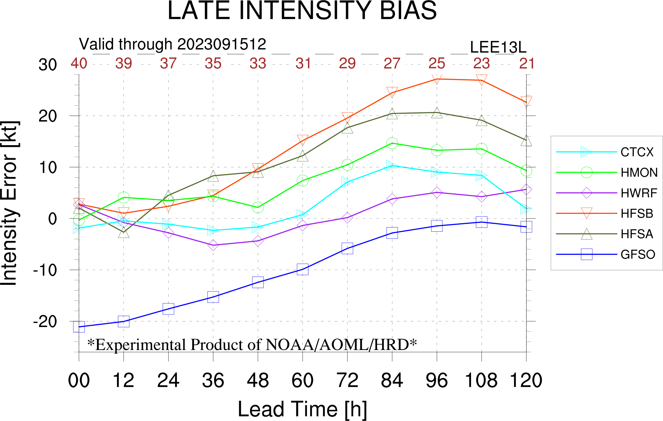
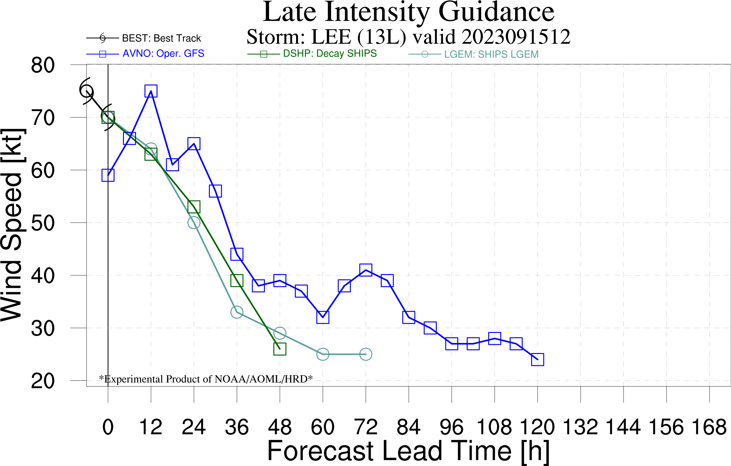
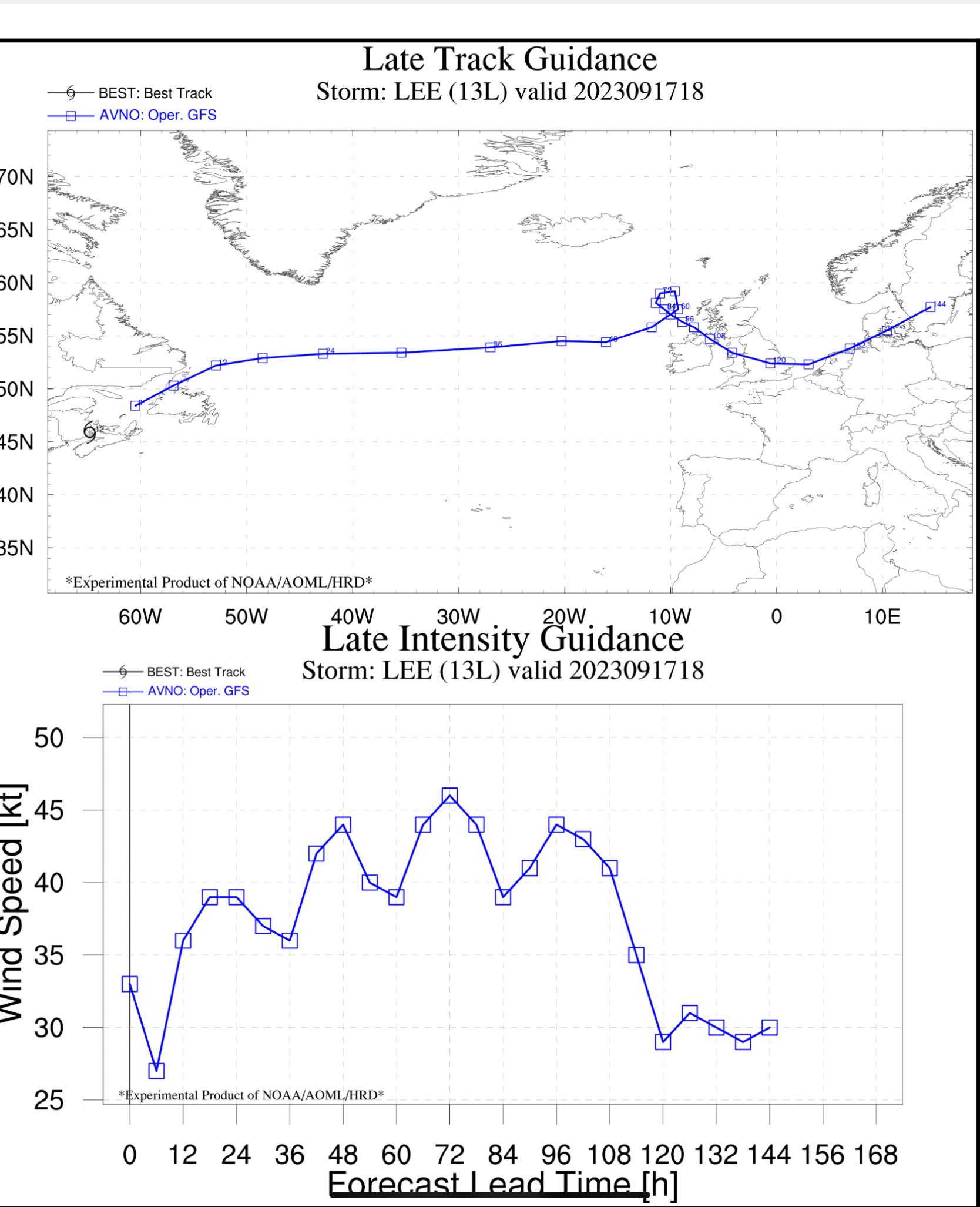
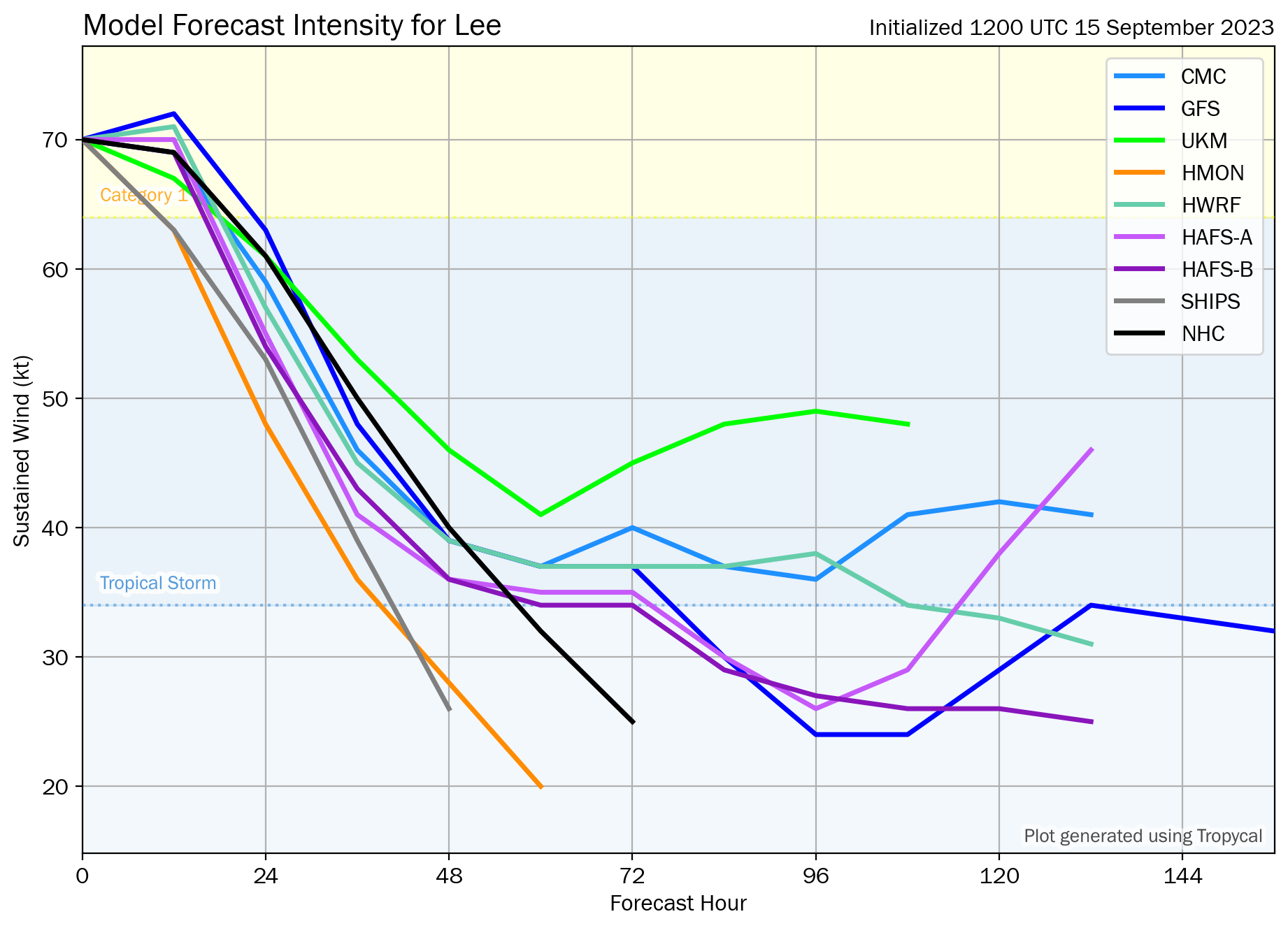
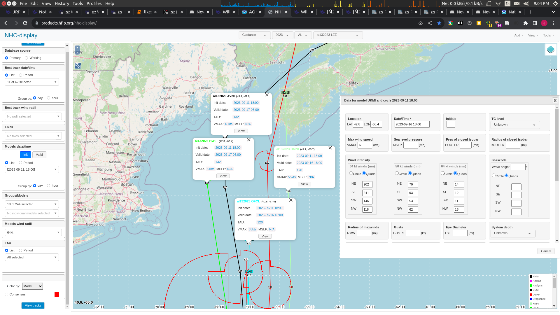
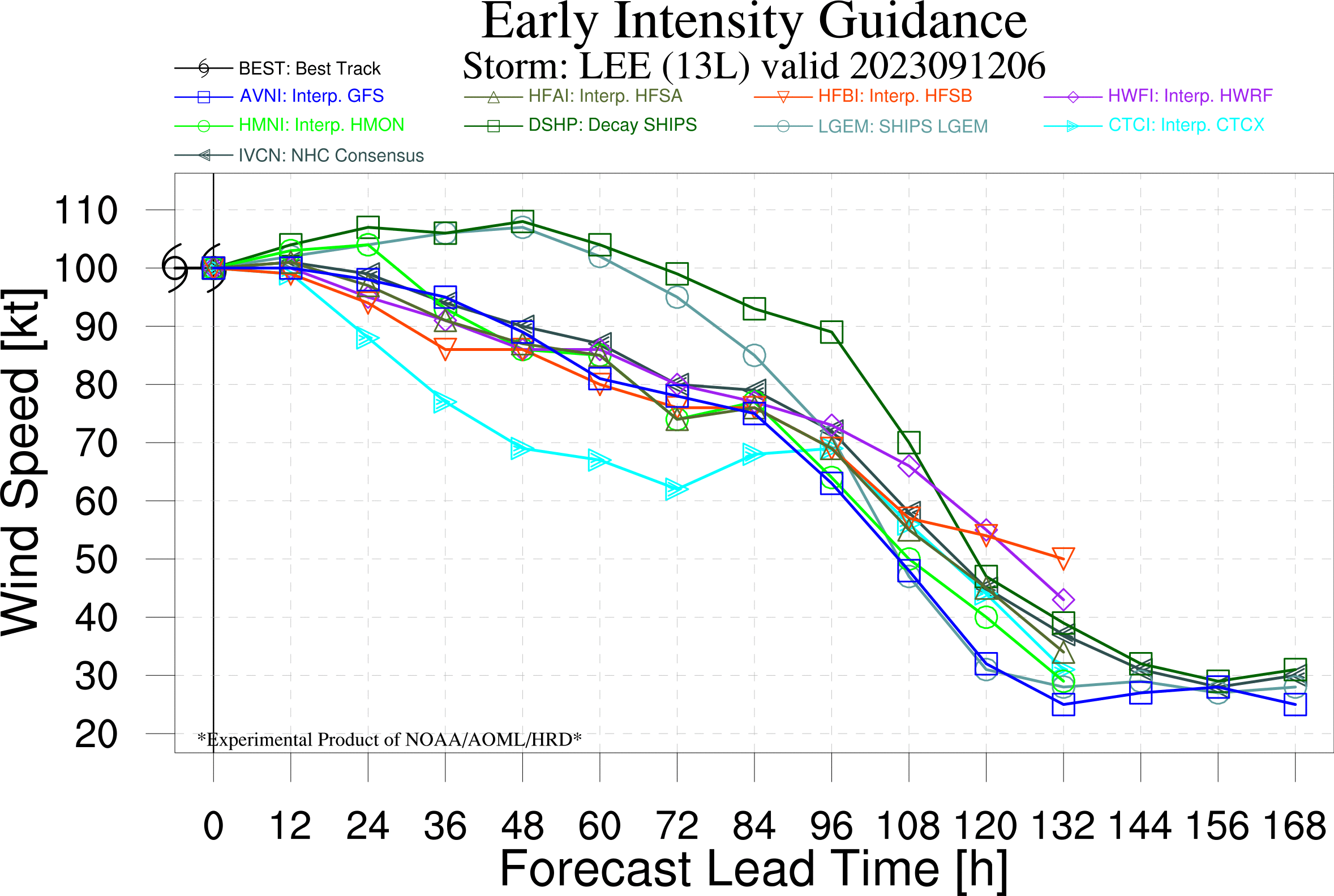
Since NHC is referencing GFS, late guidance from 12h: Lee crosses the tip of NS at ~30h with > 55kt, and with avg intensity error for GFS @ 30h for this storm at ~ -15kt meaning it could be 70kt at that time.
new 8PM OFCL has it at 60 kt again 48h out (just before landfall)
Once again referencing https://www.nhc.noaa.gov/verification/verify4.shtml
Even if you assume the error needed is 10kt (both sides (higher/lower)), that puts the probability of it being a hurricane just prior to landfall at least at 30%...
Latest OFCL advisory puts it 25 KT below Cat 1 strength at +96 hours (before landfall), according to the error statistics this puts it at ~10-15% chance the error is 25 kt before landfall (in reality with a smaller percent chance that it is a hurricane with all other things considered...)
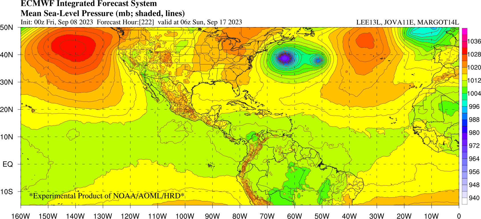
FORECAST VALID 17/1800Z 48.6N  61.4W...POST-TROP/EXTRATROP
MAX WIND  40 KT...GUSTS  50 KT.
34 KT... 90NE  90SE  60SW  60NW.
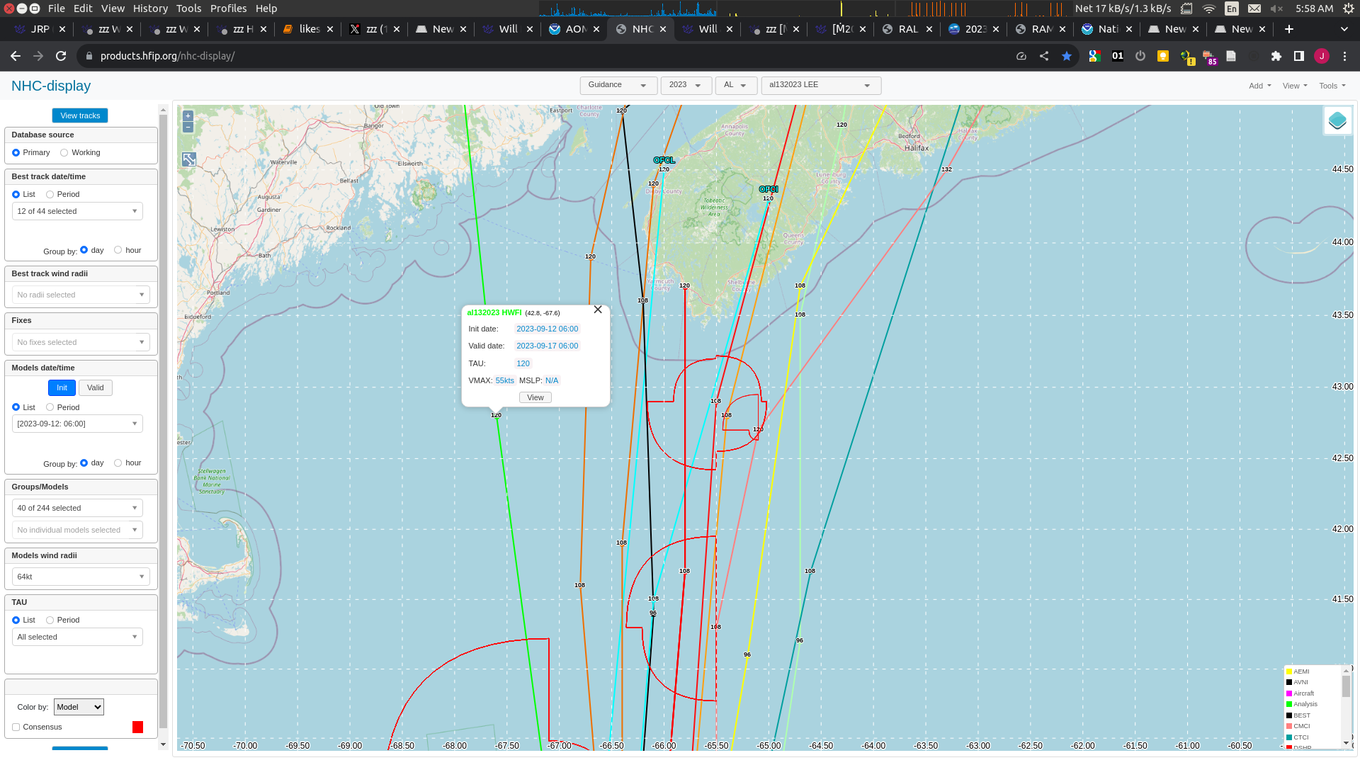
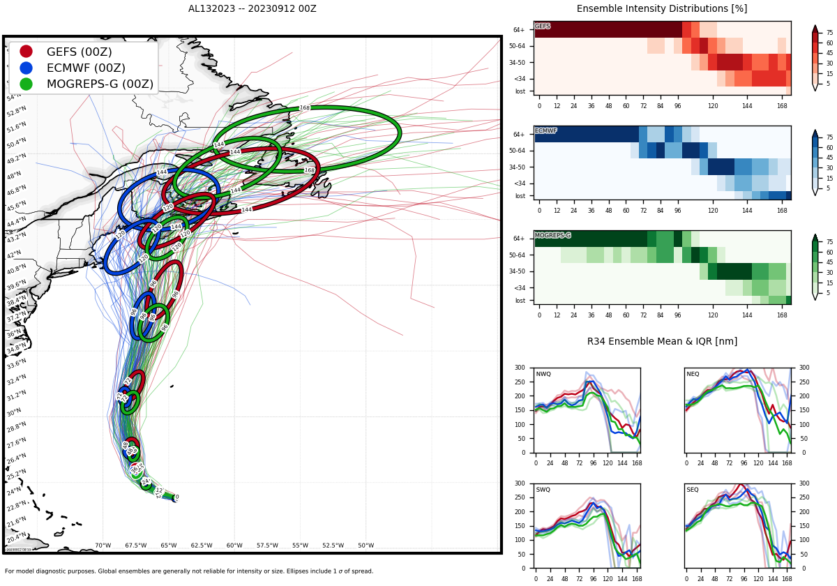
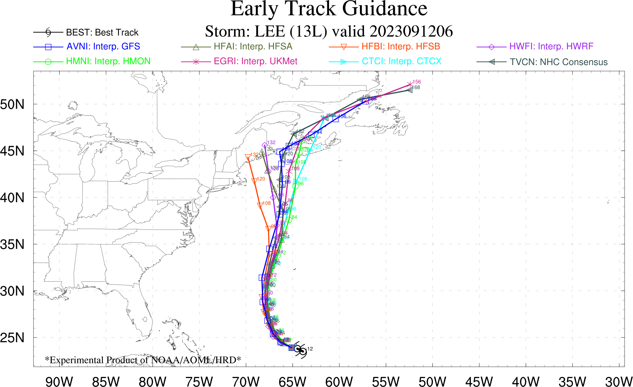
Given that OFCL has it as a borderline Cat. 1 far from the coast of Nova Scotia and the amount of error for 120h in the past at 80% is 25 kt, I think at the moment this market is slightly undervalued now (even though I don't think it's likely to landfall). Only one of the models (UKMI) on 18h guidance shows Lee potentially landfalling as a hurricane, with the others showing it as a tropical storm before landfall:
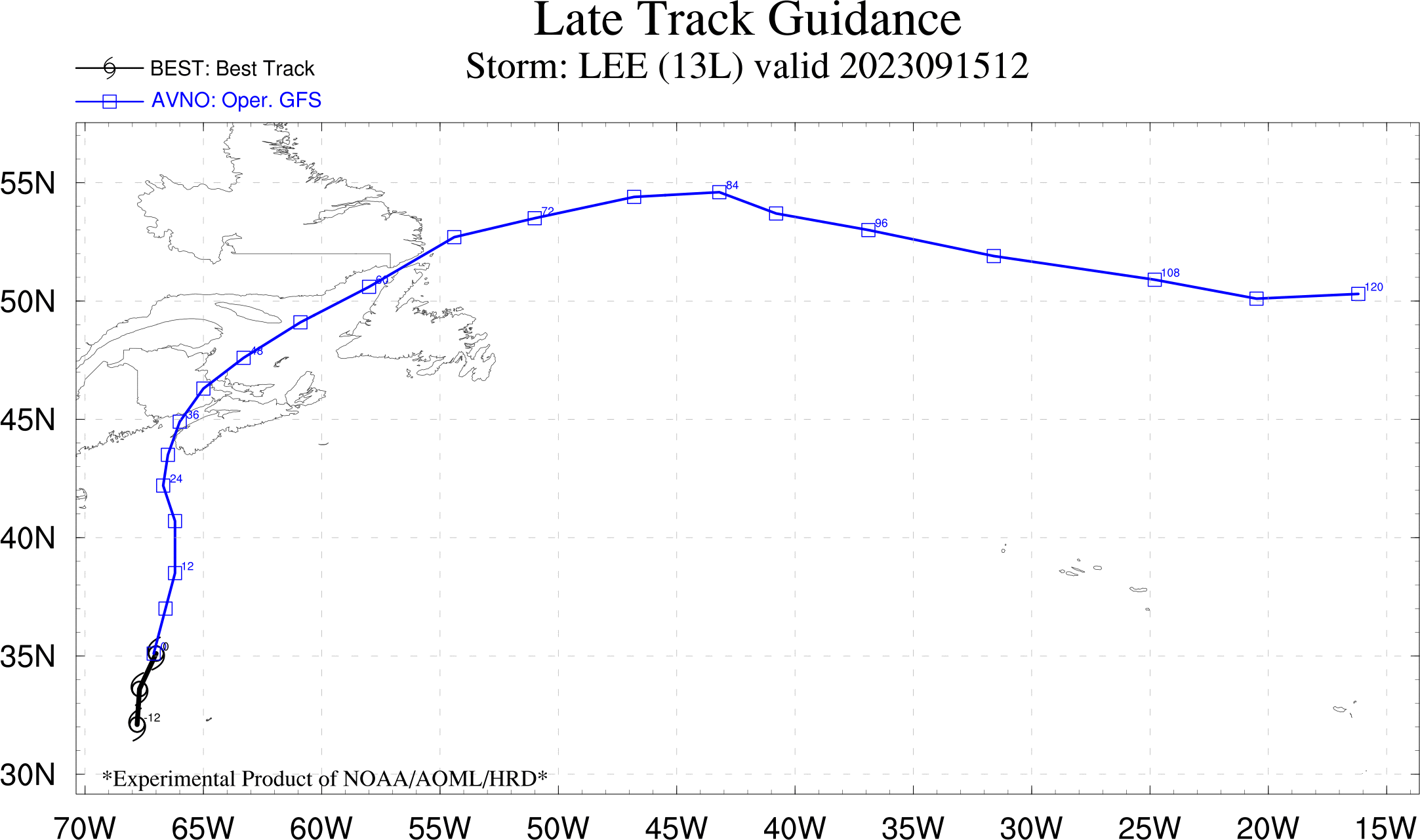
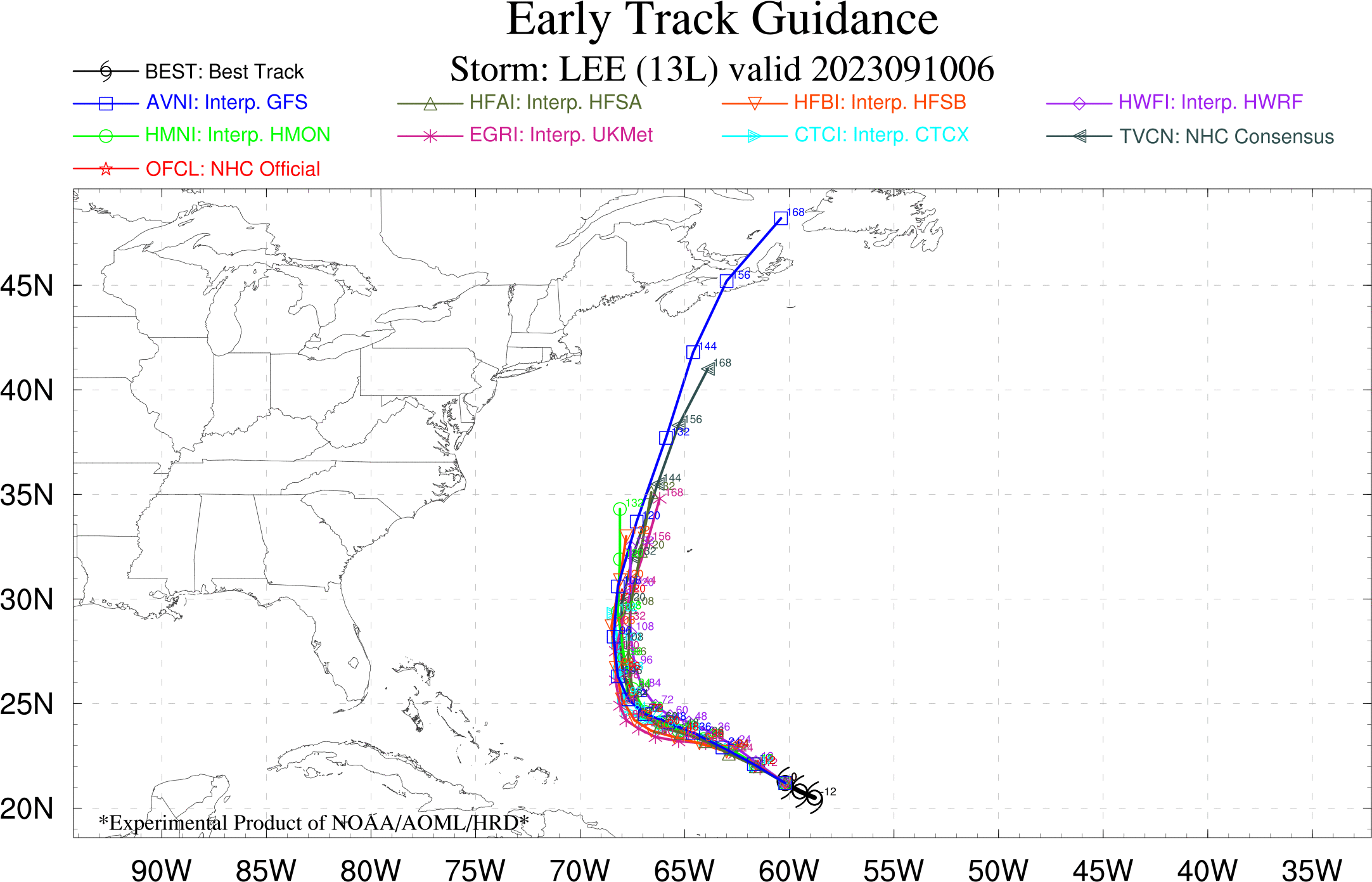
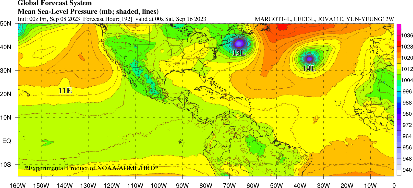
OFCL and most of the models have it landfalling as a tropical storm (UKMI still being the exception). GEFS 00h has it tracking towards Maine, as does 06h interpolative HWRF/HFSA/HFSB showing it moving more slowly than other models and landfalling in Maine (as a tropical storm) as opposed to Nova Scotia.
NHC is also distrustful of GFS in the short term:
A satellite analysis product from UW/CIMSS indicates that there is a gradient of moderate-to-strong southwesterly shear over Lee.  This
product suggests that the GFS, which is analyzing lower values of shear, may not be accurately representing the environment near the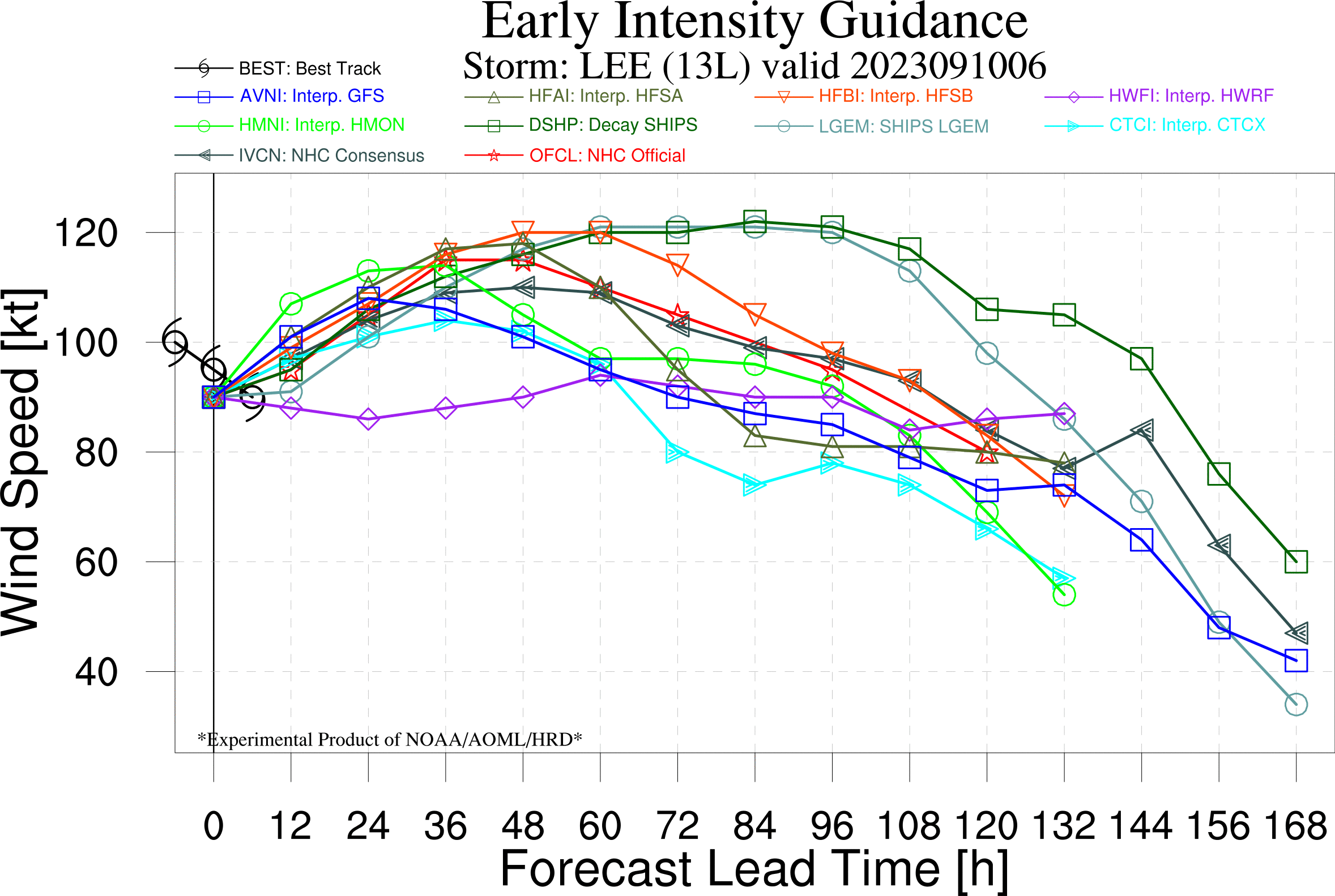
hurricane. Still, most of the model guidance predicts the shear should relax, allowing Lee to strengthen in the next 36-48 h.Latest NHC discussion:
HAFS-A/B forecasts, which both explicitly show the ongoing  ERC. However, Lee's growing wind field, in combination with its slowing forward motion, could make the hurricane susceptible to
feeling the effects of its own cold wake, which the atmospheric-ocean coupled HAFS and HWRF models suggest could begin to occur beyond 36 hours. Thus, the latest NHC intensity forecast
shows gradual weakening beginning by that time, with more pronounced weakening by the end of the forecast period as the hurricane traverses already cooled sea-surface temperatures from Franklin and Idalia last week along its forecast track.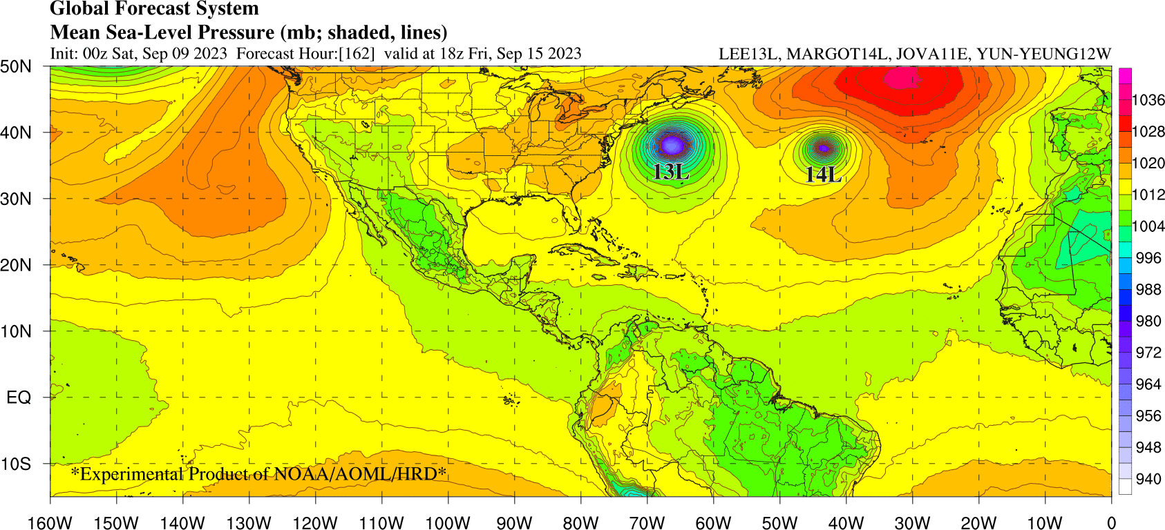


@sarius Margot's heading in the same general direction, so I'm expecting the Fujiwhara effect to pull it back before it gets anywhere close.
@LasseRasinen
00h ECMWF seems to show that, but GFS does not. (On Wednesday 13th ECMWF shows Margot shifting from a northerly track to being pulled northwest)
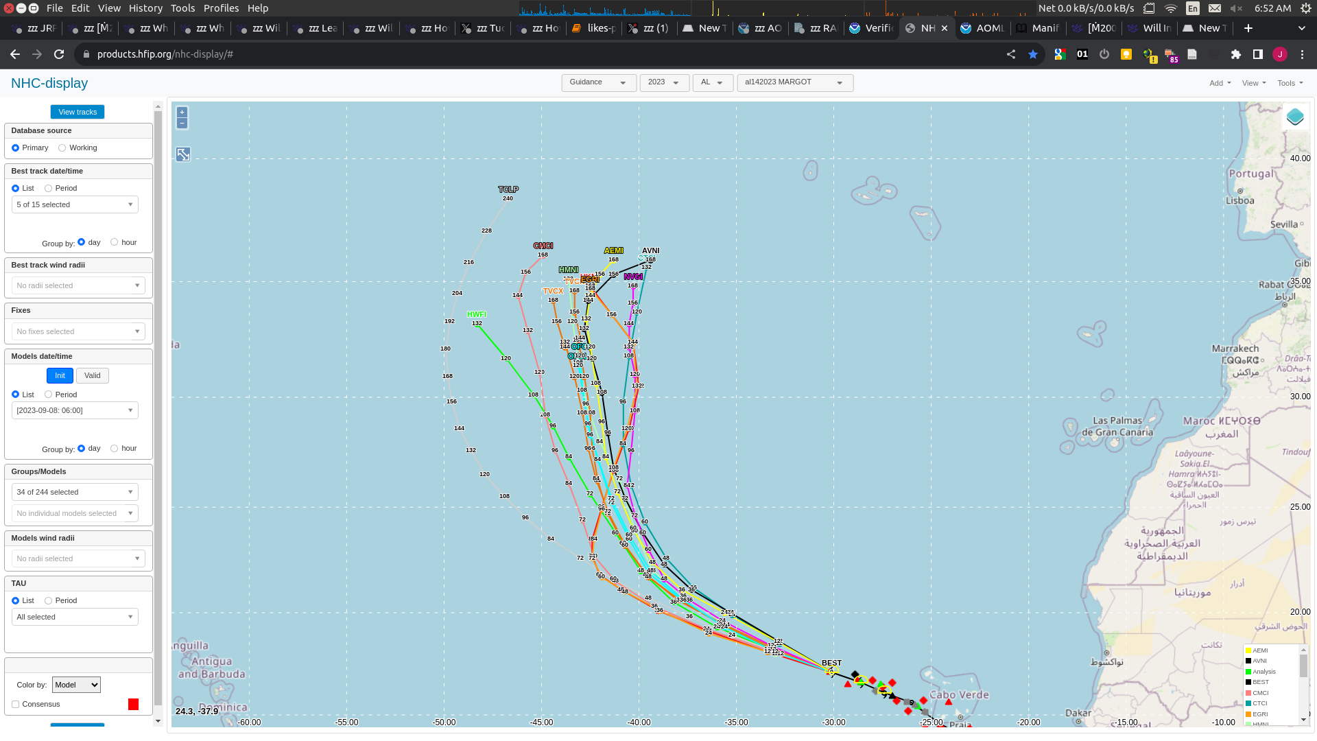
@parhizj True, I'm mostly playing it by ECMWF, and Fujiwhara isn't a guarantee (probably Lee will just steamroll poor Marge).
@LasseRasinen I heard people pronouncing Margot on a (national) forecast as in caught rather than dough. I only know one Margot on the top of my head and it's Margot Robbie of Barbie fame right now...