Resolution source: https://www.nhc.noaa.gov/archive/2025/
Subtropical storm also counts.
Resolves to the UTC time written in the advisory text.
N/A if does not form in 2025.
 1,000
1,000🏅 Top traders
| # | Trader | Total profit |
|---|---|---|
| 1 | Ṁ350 | |
| 2 | Ṁ103 | |
| 3 | Ṁ98 | |
| 4 | Ṁ86 | |
| 5 | Ṁ14 |
TS Jerry has formed with the 15Z advisory.
WTNT45 KNHC 071437
TCDAT5
Tropical Storm Jerry Discussion Number 1
NWS National Hurricane Center Miami FL AL102025
1100 AM AST Tue Oct 07 2025
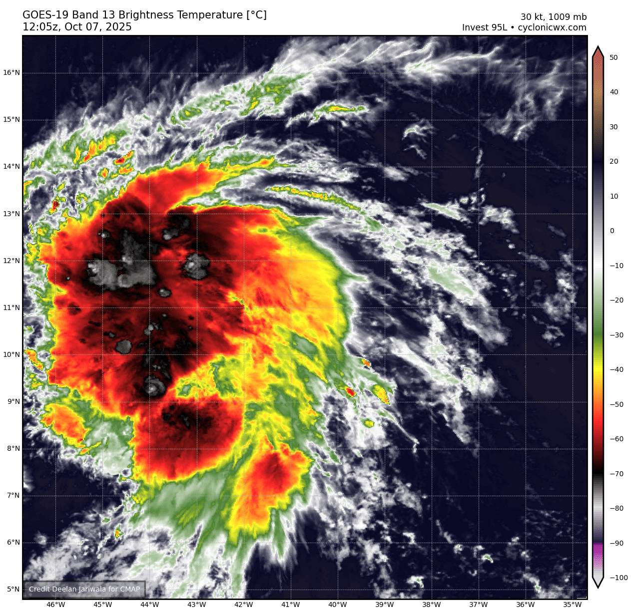
The system we have been monitoring (Invest 95L) over the tropical
central Atlantic has developed sufficiently organized thunderstorm
activity and a low-level center to be considered a tropical cyclone.
This system is far from land, roughly 1000 miles east of the
Windward Islands. An ASCAT pass from around 12Z showed peak winds
between 35 and 40 kt, and based on that data, the initial intensity
is set at 40 kt, making the system Tropical Storm Jerry. Convective
bands are increasing around the center, and the strongest winds are
on the storm's east side.
Jerry is moving quickly westward at about 21 kt on the
south-southwest side of a strong subtropical ridge. A turn to the
west-northwest with a gradual reduction in forward speed is expected
during the next couple of days as Jerry nears the southwestern edge
of the ridge. This should bring the core near or to the north of
the northern Leeward Islands late Thursday and Friday. Around that
time, the models show a deep-layer trough amplifying over the
western Atlantic, which should erode the ridge. In response to the
pattern change, Jerry is forecast to turn northward over the
west-central Atlantic this weekend. The NHC track forecast is a
little faster than the model consensus through 72 hours and in best
agreement with HCCA and the Google Deep Mind ensemble mean, which
have been performing quite well so far this year. Interests in the
northern Leeward Islands should monitor Jerry as there is
uncertainty on how close the core of the system will get to the
islands later this week.
The environmental conditions appear favorable for the system to
strengthen during the next couple of days with the upper-level winds
appearing light, waters quite warm, and abundant surrounding
moisture. The NHC intensity forecast shows the system becoming a
hurricane in a day or two before its closest approach to the
northern Leeward Islands. After the system passes by the islands,
the models diverge significantly with some solutions showing Jerry
moving into stronger shear while others keep it in a favorable
upper-level wind pattern. For now, the official forecast shows no
change in strength from days 3 to 5, but confidence is low for that
portion of the intensity forecast.
Key Messages:
1. Jerry is forecast to pass near or just north of the northern
Leeward Islands Thursday night and Friday. Interests there should
monitor the progress of the storm as there is a risk of wind, surf,
and rainfall impacts. Watches may be required for a portion of that
area later today or tonight.
FORECAST POSITIONS AND MAX WINDS
INIT 07/1500Z 11.5N 44.6W 40 KT 45 MPH
12H 08/0000Z 12.3N 47.2W 45 KT 50 MPH
24H 08/1200Z 13.5N 51.1W 55 KT 65 MPH
36H 09/0000Z 14.9N 54.6W 65 KT 75 MPH
48H 09/1200Z 16.5N 57.6W 75 KT 85 MPH
60H 10/0000Z 18.1N 60.0W 80 KT 90 MPH
72H 10/1200Z 19.8N 61.9W 80 KT 90 MPH
96H 11/1200Z 24.4N 63.4W 80 KT 90 MPH
120H 12/1200Z 29.4N 62.9W 80 KT 90 MPH
$$
Forecaster Cangialosi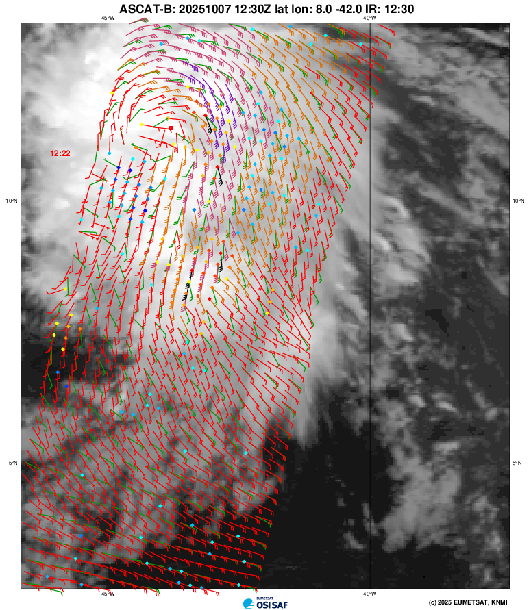
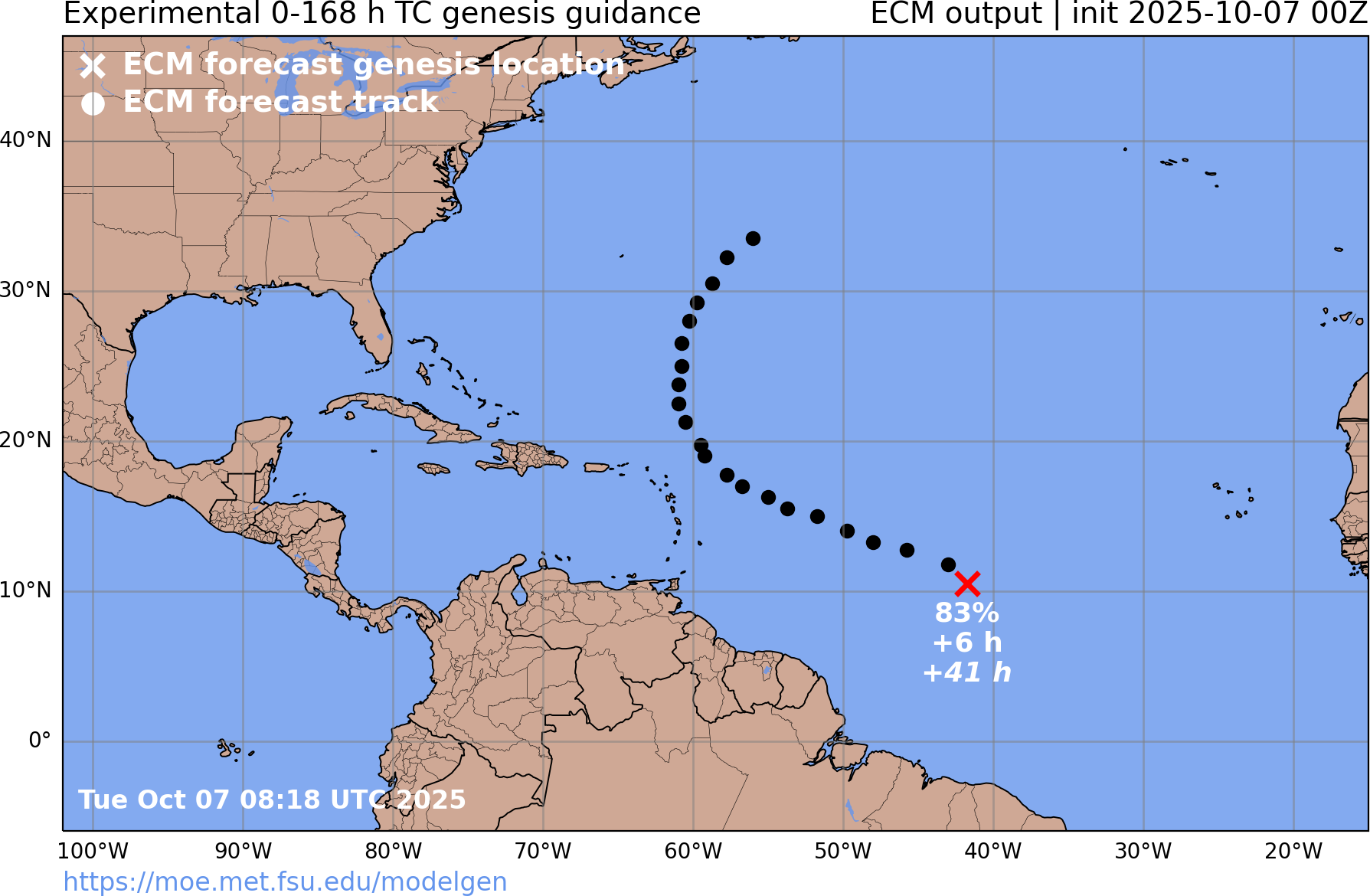
Quite interesting to see still ECM deterministic be so bearish when GFS/CMC model genesis time is so close (9/10 last runs of ECM at the 00Z/12Z intervals have not indicated genesis per FSU).
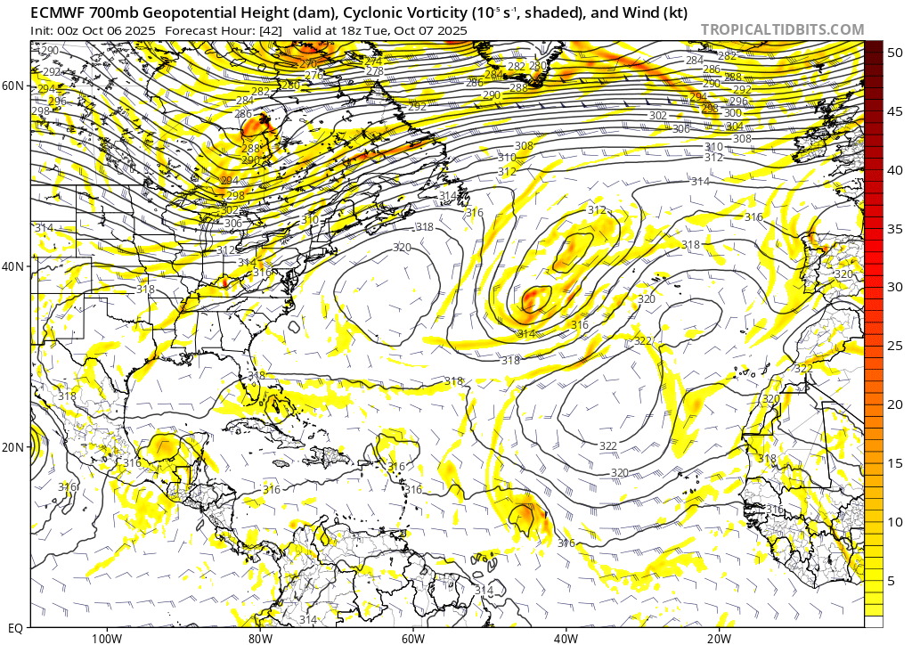
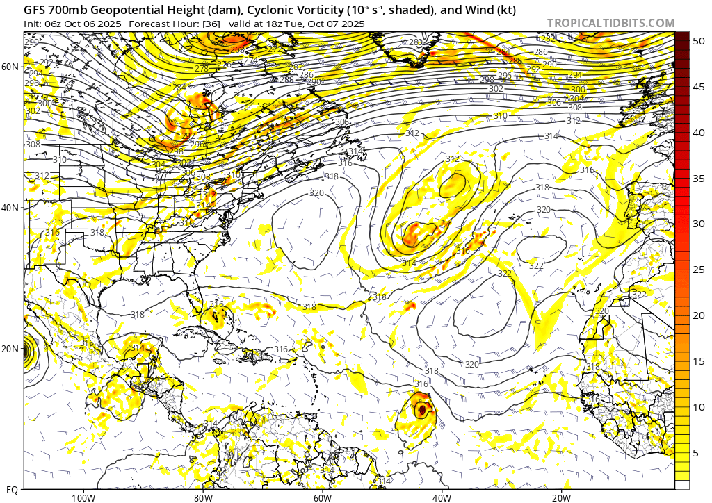
One thing that from the det. models over the last several days is that ECM has consistently predicted a stronger AEJ than GFS, and resultingly a stronger cyclonic flow NE of 95L, shearing it at the 700mb level.
CIRA 700mb vorticity analysis shows the ECM solution looks more likely at the moment...
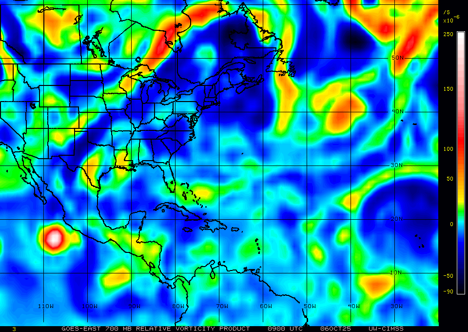
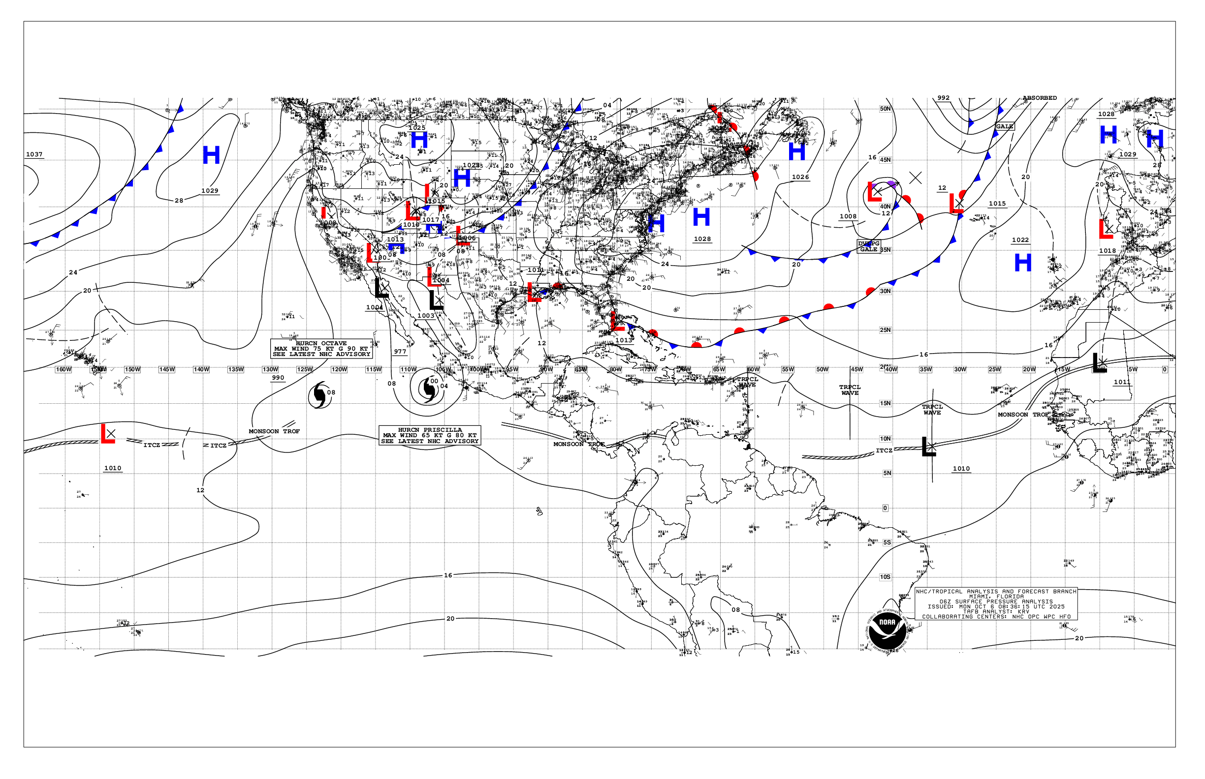
The cyclonic circulation from the high pressure system is also being likely affected by the pair of lows in the central north atlantic, which are forecast to merge and weaken the high pressure system a bit:
TAFB surface analysis 06Z:
So it seems that unless there is significant convection somewhat soon (as per GFS/06Z predicts will happen sometime tomorrow) the system won't slow down enough at least in the short term to organize.
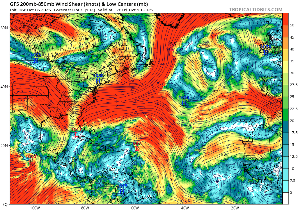
Longer term (Oct. 9-), there wasn't a lot of consistency in the det. models what would happen off the coast of the western Atlantic synoptically once it neared Puerto Rico but that seems to have changed a bit, as a low is supposed to develop off the US east coast now. This doesn't though seem to have changed the situation with the subtropical jetstream that will cause severe deep vertical wind shear when it meets the previously mentioned cyclonic flow...
~
So, based on ECM, GFS overall in the short term, shear (either horizontal in the short term, or vertical in the long-term) still appears to be the main issue by my interpretation (and with the lack of organization/sufficient convection, the dry air in front and being pushed from behind from the AEJ isn't helping).
Edit:
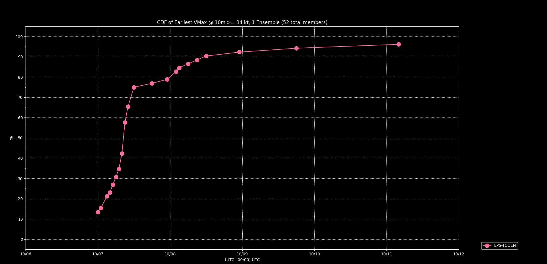
I forgot to mention importantly that the ensembles, do generally indicate development from what I can tell by wind speed alone (didn't look at structure).
However, several members from various ensembles last week showed the earlier development was based on a slightly more southernly track through the Central Atlantic (spun up by winds a bit further from the strong AEJ); it still looks a bit further north than these earlier runs showed from what I recall..
Edit2:
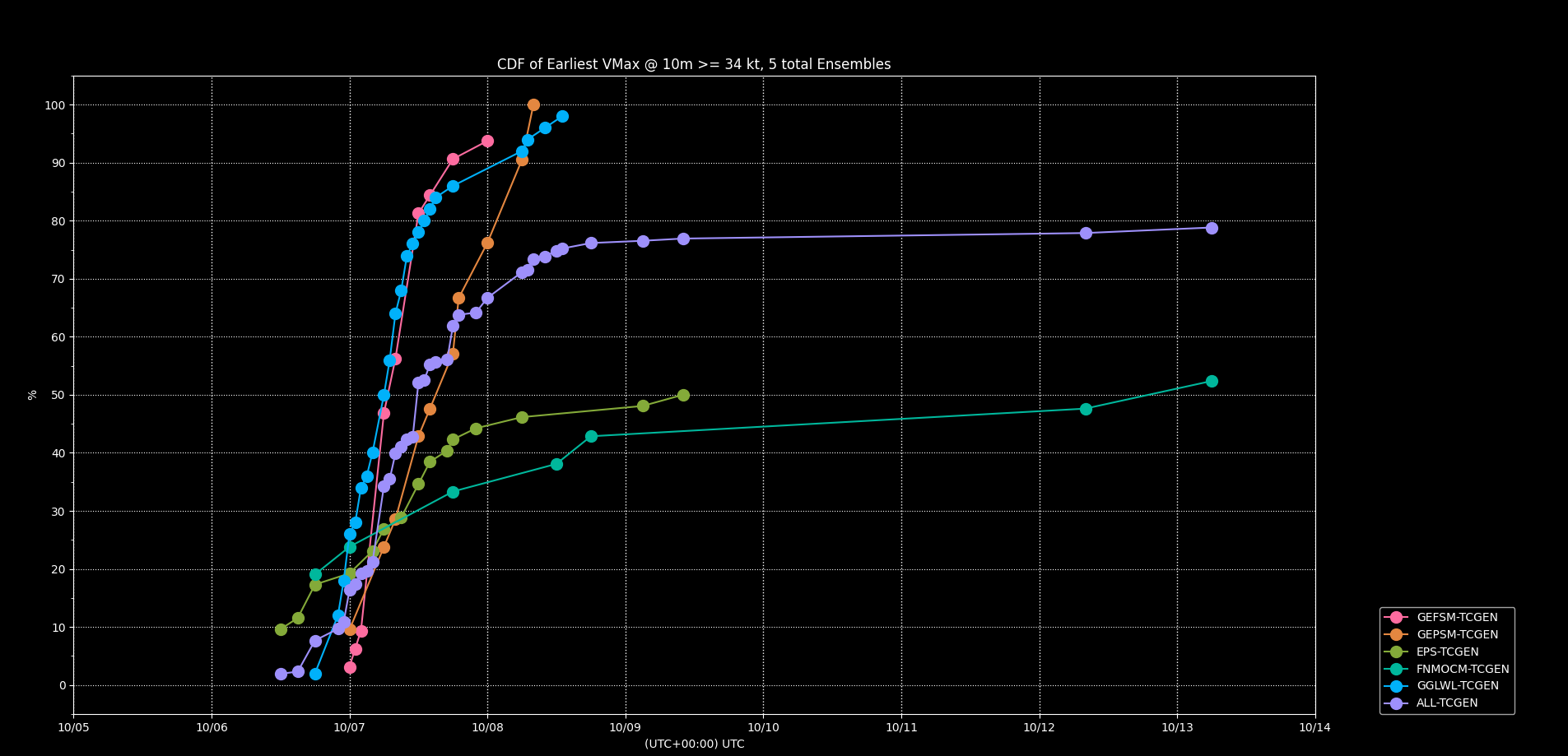
12Z ensembles below:
Should correct myself and say a majority of the ensembles favor it becoming a TS, while EPS and FNMOC are giving it 50/50. (The GEFS/GEPS/FNMOC ensembles didn't decrease in probabilities after applying structural checks like CPS parameters or the 300-500 1k warm contour check).
I did note that the 12Z det. ECMWF again did not show up again in the FSU deterministic genesis product, but by eyeballing the 06Z run from tropicaltidbits I think it did eventually reach a marginal TS/TD.
Edit3:
latest NHC 00Z TWO gives it 80%/90%
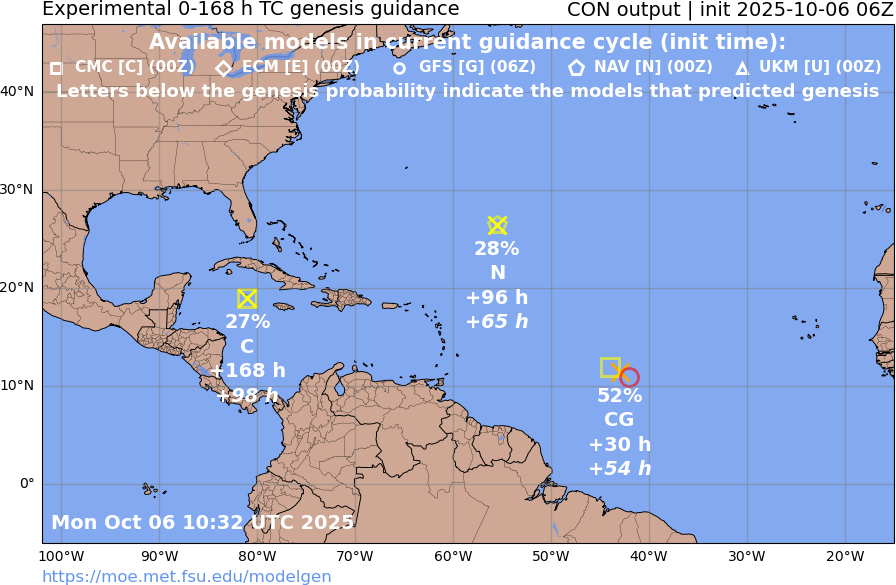
Tropical Weather Outlook
NWS National Hurricane Center Miami FL
800 PM EDT Mon Oct 6 2025
For the North Atlantic...Caribbean Sea and the Gulf of America:
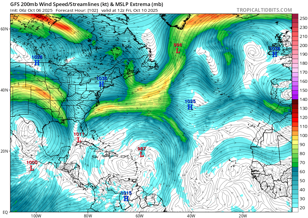
Central Tropical Atlantic (AL95):
Satellite imagery indicates that the area of low pressure located
about 1500 miles east of the Windward Islands continues to become
better organized. Environmental conditions appear favorable for
further development of this system, and a tropical depression or
storm is likely to form in the next day or so while it moves
quickly west-northwestward across the central tropical Atlantic.
This system is expected to be near or north of the northern Leeward
Islands on Thursday and Friday, and interests there should continue
to monitor its progress.
* Formation chance through 48 hours...high...80 percent.
* Formation chance through 7 days...high...90 percent.Edit4:
ECM 07/00Z run is now finally on board, and so is almost all of EPS now.
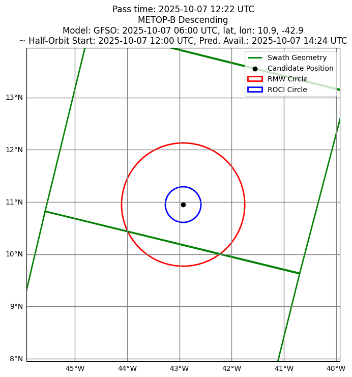
Last scatterometer pass didn't show a clear surface circulation..
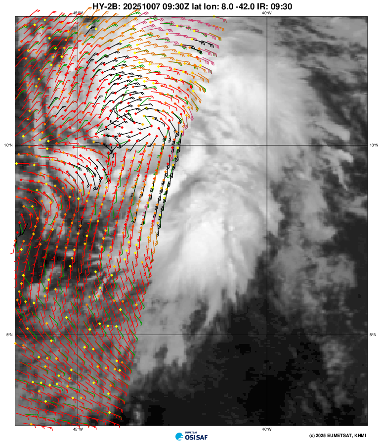
There should be a METOP-B pass at this moment and it should become available in the next couple hours, it will likely be a little west of the GFS prediction below, but the METOP-B pass should cover the center if a clear circulation is present (the scattered convection doesn't give me hope we might find a clear one yet though)...