Resolution source: https://www.nhc.noaa.gov/archive/2025/
Subtropical storm also counts.
Resolves to the UTC time written in the advisory text.
N/A if does not form in 2025.
 1,000
1,000🏅 Top traders
| # | Trader | Total profit |
|---|---|---|
| 1 | Ṁ392 | |
| 2 | Ṁ326 | |
| 3 | Ṁ135 | |
| 4 | Ṁ82 |
https://www.nhc.noaa.gov/text/refresh/MIATCDEP1+shtml/042033.shtml
Tropical Storm Priscilla Discussion Number   1
Based on these data, advisories are
being initiated on Tropical Storm Priscilla, with an estimated
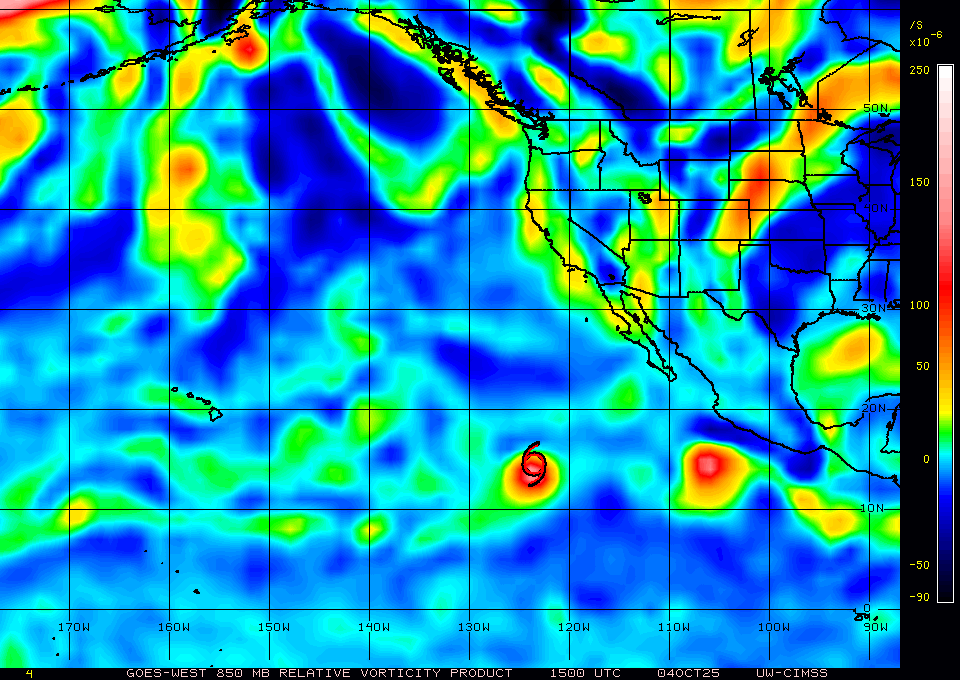
intensity of 40 kt.850mb RVOR already quite a bit above 100 per CIMSS
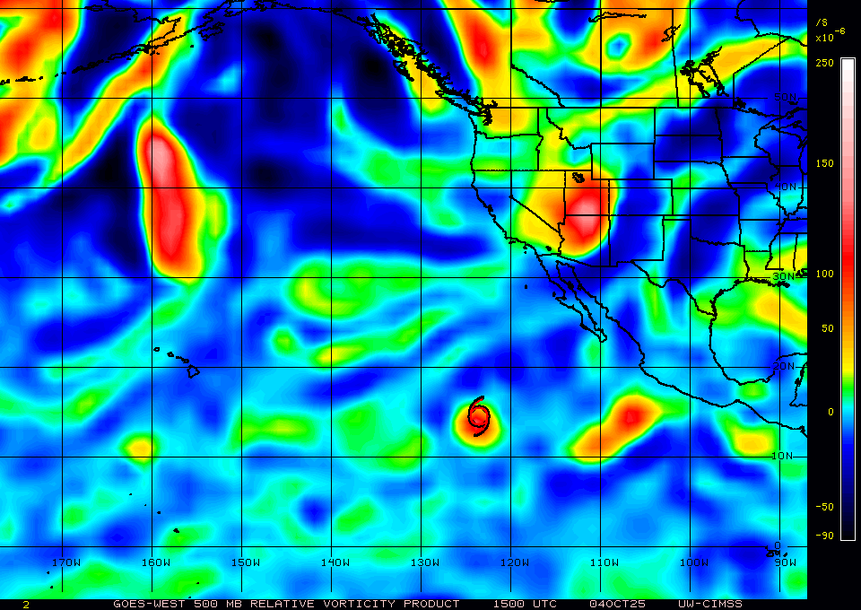
mid level and up shows 500mb is a bit disorganized from shear over the southern part of the system.
Last HY-2B pass shows a robust surface low ...
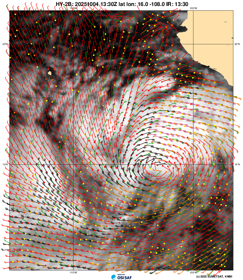
Some disagreement in the DVTS fixes about its strength though (SAB 12Z indicated a weaker center with 1.5/1.5 TAFB 12Z with 2.0/2.0). Based on the HY-2B pass and the ample convection I think we should expect some increase in winds for the METOP-B pass. Latest MTCSWA has been oscillating between 32-34kt for last ~9 hours. D-PRINT at 30 kt.
There should be a fair partial METOP-B pass in about 15 mins that should cover the center ... should be available for the 21Z advisory
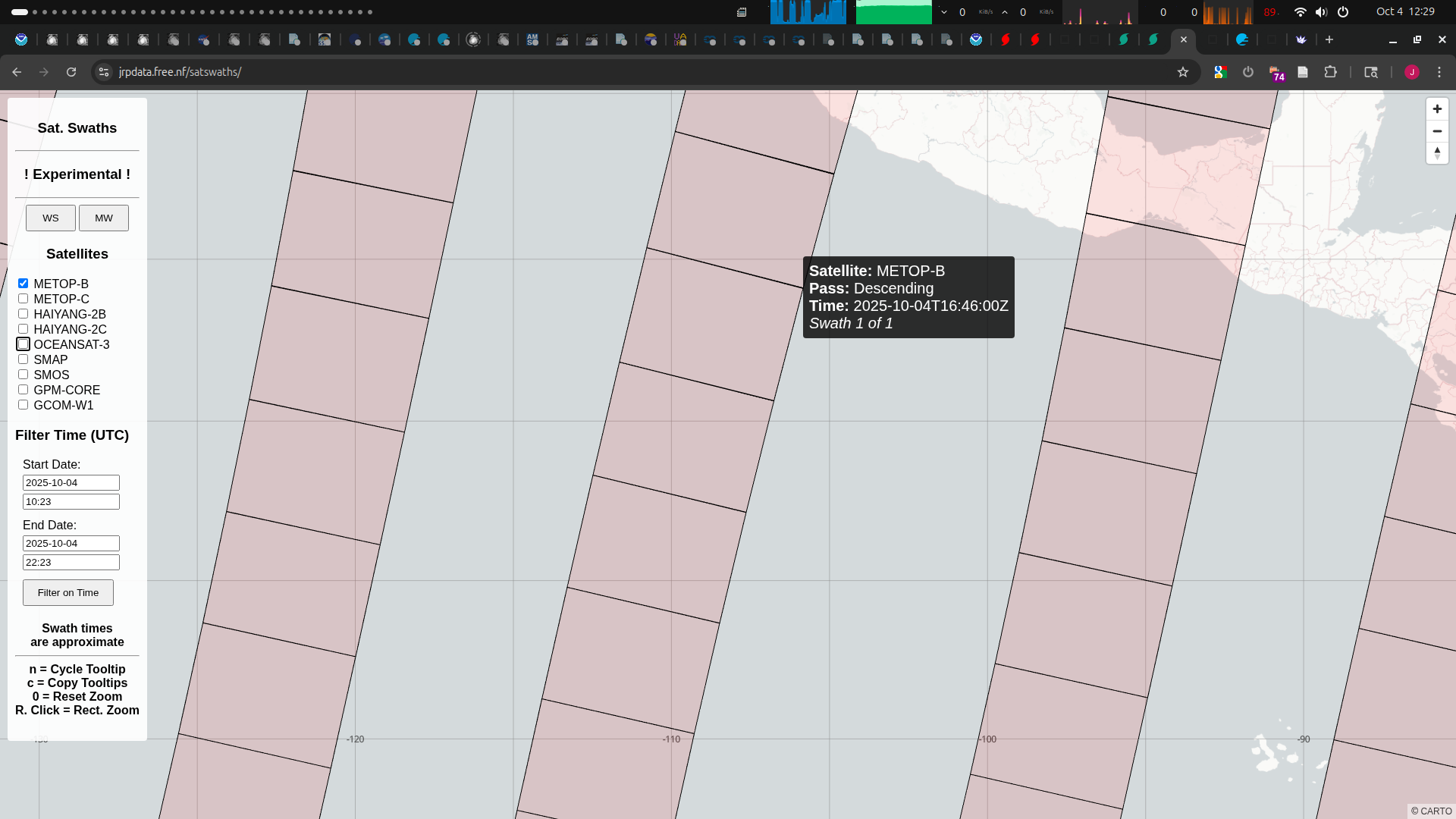
Satellite: METOP-B
Pass: Descending
Time: 2025-10-04T16:46:00Z
Swath 1 of 1
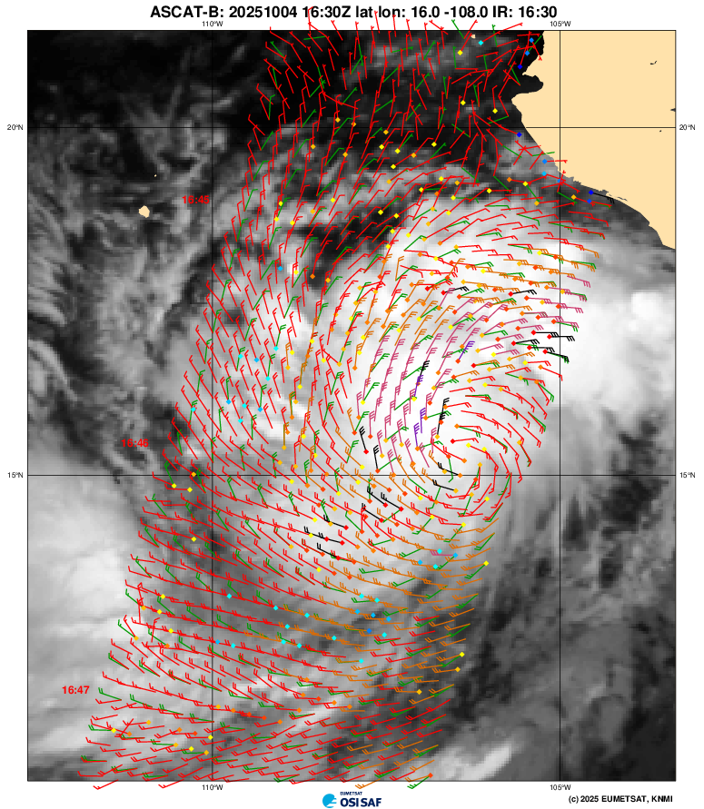
TAFB 18Z DVTS came in at 2.5/2.5
SAB 18Z at 2.0/2.0.
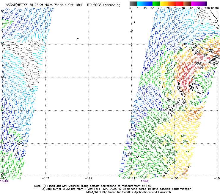
With the METOP-B 25km NOAA wind vectors showing at least 2 34kt+ wind vectors that aren't rain-flagged, it seems likely to me they will classify it for the 21Z advisory as Priscilla.
~
Bettors, I've also created markets for the next TS for both the AL and EP basins:
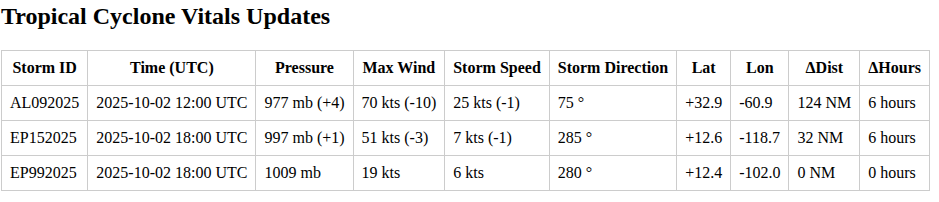
Invest EP99 has been opened.