Resolves according to local time zone wherever the storm is. Subtropical storms count for the purpose of this market
Update 2025-07-31 (PST) (AI summary of creator comment): The resolution will now be determined using UTC time, instead of the storm's local time zone.
 1,000
1,000🏅 Top traders
| # | Name | Total profit |
|---|---|---|
| 1 | Ṁ44 | |
| 2 | Ṁ8 | |
| 3 | Ṁ3 |
People are also trading
@SaviorofPlant Dexter formed this morning.
TROPICAL STORM DEXTER FORECAST/ADVISORY NUMBER   1
NWS NATIONAL HURRICANE CENTER MIAMI FL       AL042025
0300 UTC MON AUG 04 2025

TROPICAL STORM CENTER LOCATED NEAR 34.3N  69.4W AT 04/0300Z
POSITION ACCURATE WITHIN  25 NM

PRESENT MOVEMENT TOWARD THE EAST-NORTHEAST OR 70 DEGREES AT 10 KTNHC has upgraded it to 70%/70% but delays naming based on it still hasn't separated from the front.
Deep convection last 5 hours has improved its symmetry at least by appearance; a blend of satellite wind analysis (MTCSWA) and a pair of recent scatterometer passes 10 mins apart near 14:30,14:40Z (both Vmax of 33 kt), suggest its reached TS intensity (at least briefly near 15Z).
Phase analysis of GEFS 12Z shows the same turn around that GEFS 06Z did, with a bit more than 70% of its members showing it crossing over into becoming subtropical by the 21Z advisory tomorrow. (this was a big shift from the 00Z GEFS forecast)
FNMOC 00Z was even more aggressive, with GEPS 00Z less so (predicting it become tropical ~50% of members). None of these ensembles showing it gaining TS strength, but I think we can disregard that entirely for the moment as it is unlikely to lose too much strength at least over the surface over such high SSTs (the OHC should become more marginal over the next day though). The upshear over the storm is likely detrimental to its development also.
There will be another 17:28Z scat. pass (Oceansat-3) (from about 40 minutes ago) that should be available half an hour before the 21Z advisory (if timely) to see if it has gained or loss strength since then. I don't think it likely it can improve structurally too much to separate from the front though in the next 2.5 hours.
pass predictions (for the scat. sats, and the two microwave sats for 37GHz color) with decent coverage for tonight to tomorrow evening (HCCA 12Z track) (big filled circles are synoptic time, pink is the approx overhead pass time position):
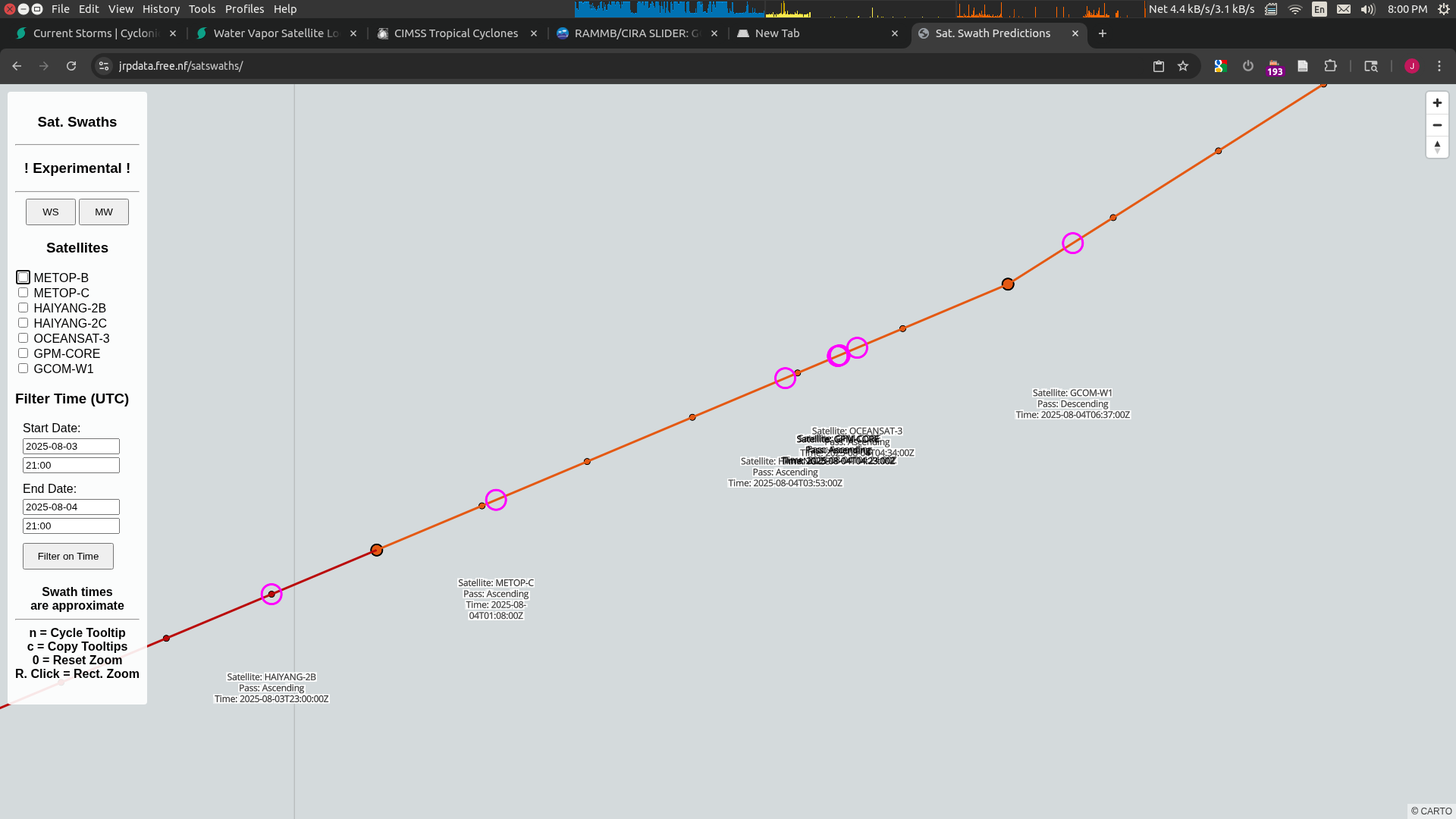
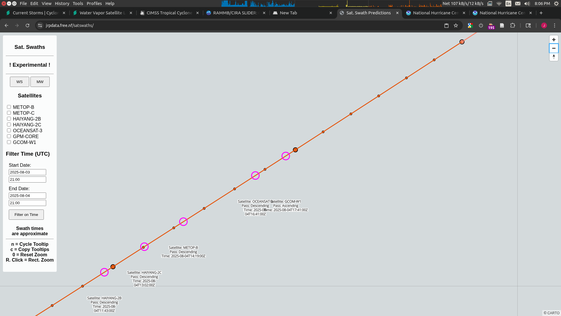
Both HY-2C passes will likely be partial but should overlap the center. The rest should have good coverage.
NHC has upgraded 95L's chances to 80%/80%.
@SaviorofPlant Looks like most of August will likely be quiet, but because of the Gil market, can you clarify the timezone business for this market? How are you going to determine the timezone for the position fix if you stick with local time zone (also whether daylight savings is used)?
94L was opened some hours ago but doesn’t look likely to generate a named storm.
Note that HY-2B,2C wind data have not been received by at EUMETSAT (OSISAF) since the 18th
https://osi-saf.eumetsat.int/community/list-of-service-messages
so KNMI is not producing products for them and not being ingested into ECMWF models as far as I understand: https://obsstatus.ecmwf.int/?step=2025072000 )…
Edit: as of today (07/21) HY-2B, 2C data has started flowing again
12Z ensembles show 93L mostly not going far enough offshore in the gulf to gain enough strength to likely reach TS strength (on the 17th maybe 10% of EPS members (the most aggressive) reaching 34kt, but all ensembles members pressures are > 1005mb), so at best a TD for now. HCCA shows roughly the same track and intensity.