
🏅 Top traders
| # | Trader | Total profit |
|---|---|---|
| 1 | Ṁ1,143 | |
| 2 | Ṁ650 | |
| 3 | Ṁ542 | |
| 4 | Ṁ116 | |
| 5 | Ṁ81 |
People are also trading
https://www.nhc.noaa.gov/text/refresh/MIATCDAT2+shtml/131438.shtml
@SaviorofPlant , 07L now officially TS Gordon
Not sure how long its going to last...
Looks like they're going to raise it to a TS based on update to tcvitals...
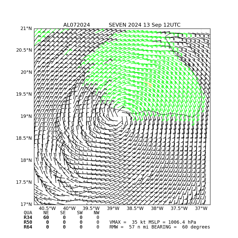
OSPO raised their subjective dvorak to 2.0, and with the last TAFB DVTS of 2.5 and the other objective estimates (ATMS/ADT,DPRINT) that have been at 35kt or above on average (including SATCON combining them all) for a few days puts it at 35 kt. No clean ASCAT pass
Edit: persistent deep convection last 6-7 hours...
Edit: somewhat fading convection
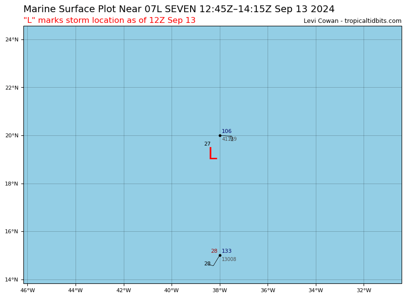
There is a buoy around the RMW in the tcvitals (to the NE) but its at 20 kt
https://www.ndbc.noaa.gov/station_page.php?station=41139
buoy 41139 distance (n.mi) based on interpolated track (RMW was 111 km ~ 96 n. miles (roughly 21-23 kt during this time):
0 94.0 -160.4 2024-09-13 12:00:00
1 97.8 -168.6 2024-09-13 11:00:00
2 103.5 -176.1 2024-09-13 10:00:00
3 110.8 177.3 2024-09-13 09:00:00
4 119.3 171.5 2024-09-13 08:00:00
Buoy was also (~NE of the low center) where you'd expect the max wind to be..
Edit: Now a TS officially
"...DEPRESSION COULD BECOME A TROPICAL STORM TODAY BUT STRUGGLES LIKELY LIE AHEAD..."
https://www.nhc.noaa.gov/text/refresh/MIATCDAT2+shtml/130836.shtml
OFCL forecast still has a short lived TS for today... they've downgraded again the chances as expected for the days afterward... Keeping some mana in today due to the NHC advisory and that the model intensity and phase plots for GFS/ECM deterministic still show it is a TS at least for today....
Latest advisory still a TD.. 35 kt for next 3 days..
Tropical Depression Seven Discussion Number 7
NWS National Hurricane Center Miami FL AL072024
1100 PM AST Thu Sep 12 2024
The depression has been holding steady this evening. After a lull
in the convective activity which exposed the low-level circulation,
thunderstorms have been building steadily to the east of the center.
Unfortunately, the scatterometer pass missed the core of the system
once again. The initial intensity remains at 30 kt, close to the
subjective Dvorak estimates from TAFB and SAB.
A subtropical ridge to the north of the depression is steering the
system west-northwestward at about 14 kt. As the ridge weakens
during the next few days, the cyclone should gradually slow and turn
more westward. There is still a large spread in the track guidance
envelope early next week, which seems partially related to the depth
of the vortex. The ECMWF solution shows a much stronger system that
turns the cyclone to the north sooner compared to the GFS and
GFS-based regional models showing a weaker system that moves faster
and stays in the low-level westerly flow. The latest NHC track
forecast has been nudged a little to the south and lies between the
previous prediction and the consensus aids.
Marginal environmental conditions appear to be preventing the
depression from making any appreciable intensity changes. Visible
satellite imagery from earlier today showed a band of Saharan dust
wrapping around the northern semicircle of the circulation. The
intensity guidance has shifted downward again this cycle, with many
models showing a steady-to-weakening system over the next 3-4 days.
By the end of the forecast period, there is quite a bit of spread in
the intensity guidance as noted earlier. The latest NHC intensity
forecast has been decreased slightly but remains on the high side of
the various aids.
FORECAST POSITIONS AND MAX WINDS
INIT 13/0300Z 18.7N 37.0W 30 KT 35 MPH
12H 13/1200Z 19.1N 38.5W 35 KT 40 MPH
24H 14/0000Z 19.4N 40.7W 35 KT 40 MPH
36H 14/1200Z 19.7N 42.4W 35 KT 40 MPH
48H 15/0000Z 19.7N 44.0W 35 KT 40 MPH
60H 15/1200Z 19.7N 45.6W 35 KT 40 MPH
72H 16/0000Z 19.6N 47.2W 35 KT 40 MPH
96H 17/0000Z 19.8N 49.1W 40 KT 45 MPH
120H 18/0000Z 20.5N 50.0W 45 KT 50 MPH
$$
Forecaster Bucci
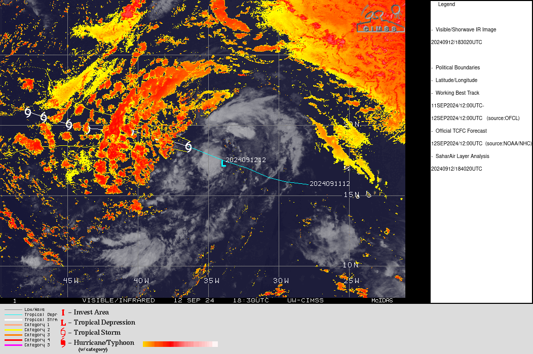
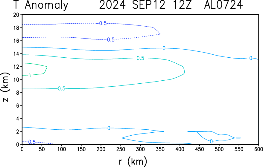
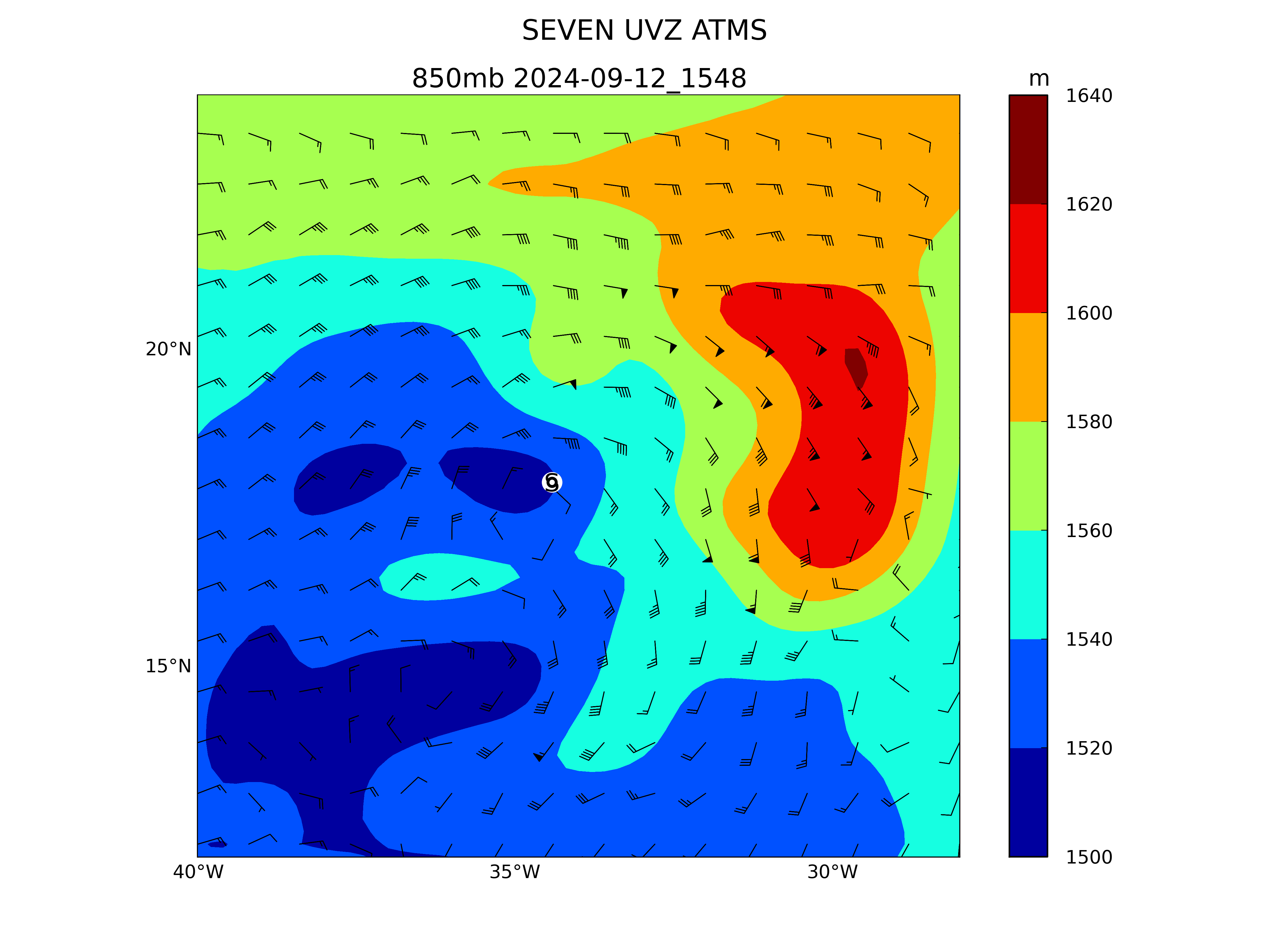
Cool in the lower mids (doesn't look organized enough.)
Objective estimates remain on the border or slightly above TS intensity but there is a lack of any large sustained convection from satellite imagery. It appears to me dry-air intrusion is one of the factors preventing it from strengthening... GEFS/EPS 12Z predicted a marginal TS today/tomorrow and then chances dropping.... Despite NHC advisories predicting a tropical storm I don't have high confidence in such forecasts after reviewing what's available. It seems pretty subjective -- OSPO is still at 2.0, TAFB at 2.5 for dvorak fixes. If OSPO raises to 2.5 and TAFB stays at 2.5 I would expect NHC to raise it to a TS given past discussion.
At the moment it doesn't seem like its going to happen today barring a lucky ASCAT pass with good coverage, which we haven't had so far. Maybe before the 11pm advisory there will be such a fix or better convection.
From soon to could … 😕
“DEPRESSION COULD BECOME A TROPICAL STORM TODAY...”
@parhizj Even if it downtrends in the short term, this system is forecasted to stick around for quite a while, so I still expect it to eventually take the name Gordon. Probabilities on September 12 are probably still too high though...
Still a TD (not a lot of convection)
https://www.nhc.noaa.gov/text/refresh/MIATCDAT2+shtml/121449.shtml
3 forecasters on this advisory ...
While environmental conditions are somewhat favorable for gradual
strengthening, with low-moderate vertical wind shear and
marginally warm SSTs, intensity guidance came in lower for this
cycle. We show the system becoming a tropical storm in the next
day, followed by the intensity only slowly increasing to 45 knots in
the next five days.11pm advisory came and they kept it a TD, but they expect a TS "soon". Convection waned in the last hour so I guess that's one of the reasons... The objective ADT were favorable, the SAB Subjective Dvorak was weak compared to the TAFB keeping it below the margin....
Periodic bursts of convection have been growing and fading in the
tropical depression this evening.  Earlier microwave imagery from
SSMIS showed a fragmented curved band wrapping around the northern
and western portion of the circulation.  Subjective estimates from
TAFB and SAB were T-2.5/35 kt and T-1.5/25 kt respectively and based
on a blend of these, the initial intensity is held at 30 kt.
Edit: Added some Other bet in case dry air causes it to fail to strengthen....
CIRA ATMS: 993 hPa 46 knots Date: 09111933
ADT (OSPO) shows some strengthening in the last couple hours from some deep convection (after a lull in no convection), with raw T at 3.5. (FT at 2.3)... We'll see if it keeps it up for the next 2-3 hours before the 11pm advisory...
2024SEP11 214500  2.2 1007.1  32.0  2.2 2.6 2.7  0.5T/hour OFF  OFF  OFF  OFF -61.78 -36.82  CRVBND   N/A    N/A   16.26   30.49  FCST      MSG3 39.7
2024SEP11 221500 2.3 1006.6 33.0 2.3 2.6 3.5 0.5T/hour OFF OFF OFF OFF -71.62 -46.22 CRVBND N/A N/A 16.30 30.61 FCST MSG3 39.8 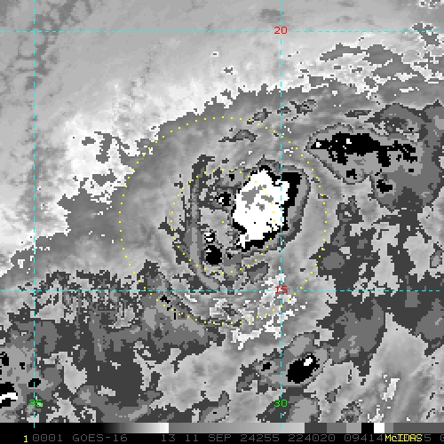
Deep convection for the last five hours, and it's starting to get the look of a TS again...
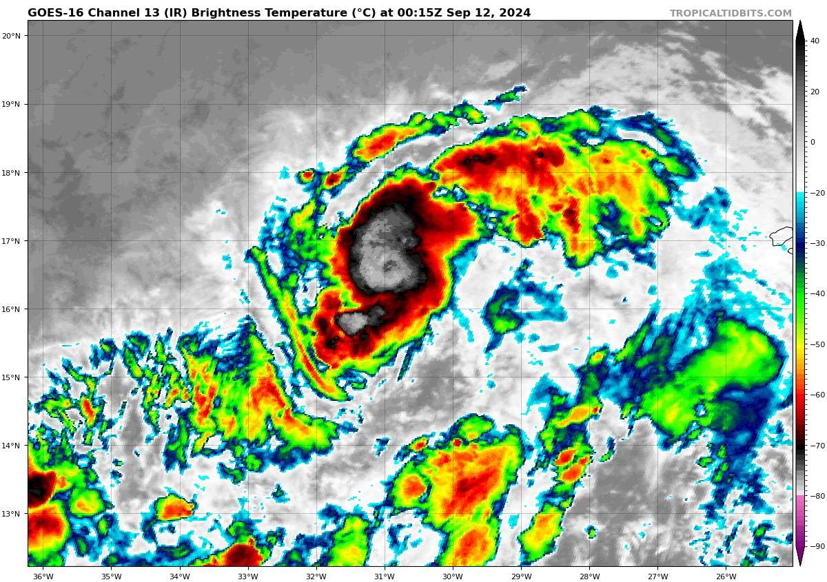
OSPO ADT and CIMSS ADT both put it at ~ TS intensity now.... (34 kt)
2024SEP11 231500  2.4 1005.9  34.0  2.4 2.6 2.6  NO LIMIT  OFF  OFF  OFF  OFF -68.38 -56.51  UNIFRM   N/A    N/A   16.39   30.87  FCST      MSG3 40.1
2024SEP11 234500  2.4 1005.9  34.0  2.4 2.8 2.9  0.7T/6hr  OFF  OFF  OFF  OFF -70.33 -60.64  UNIFRM   N/A    N/A   16.43   31.00  FCST      MSG3 40.3
2024SEP11 234500 2.4 1005.9 34.0 2.4 2.7 2.7 NO LIMIT OFF OFF OFF OFF -70.54 -60.58 UNIFRM N/A -0.8 16.43 31.00 FCST MSG3 40.3 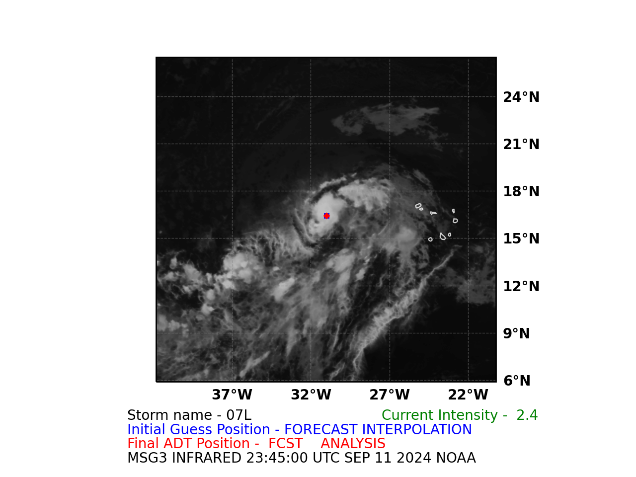
Latest D-PRINT is also at 35kt.
MTCSW from OSPO and CIRA from 21Z are mixed (38 kt, 31 kt) for an average of 34.5kt...
Looks good for a TS at 11pm....
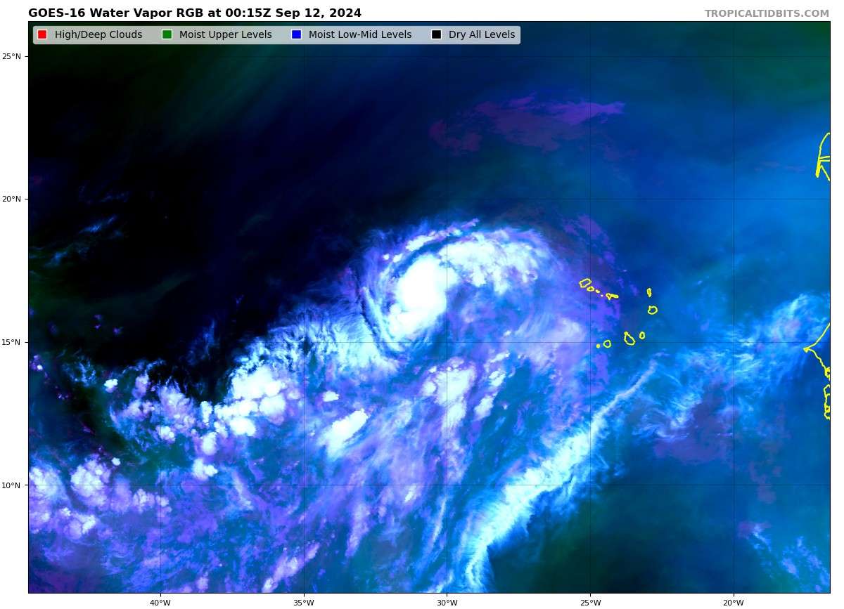
They've fed in 30 kt in the 00Z models, but we have a DVTS of 2.5 now and 07L has disappeared (temporarily) from tcvitals
Now an invest for Eastern Atlantic, 93L.
TWO from 2pm is at 40/80% now for Eastern Atlantic. (Central dropped to 30/30%)
EPS 12Z has increased the probabilities for me to about 50% of a TS from the super ensemble 12Z. Taking into account NHC's genesis probabilities I get about 70% for the super ensemble... Taking the average of the two estimates I get ~ 60% for a TS.
This is a tough one for me to judge at the moment given the high genesis probabilities for a TC by NHC ...
Based on the pressures for all the old 12Z/18Z ensemble members it seems on the margins for a TS (at least for the next ~5 days out). Conditioning on VMax seems to give less realistic probabilities at the moment, so looking at different pressure thresholds I get a different picture:
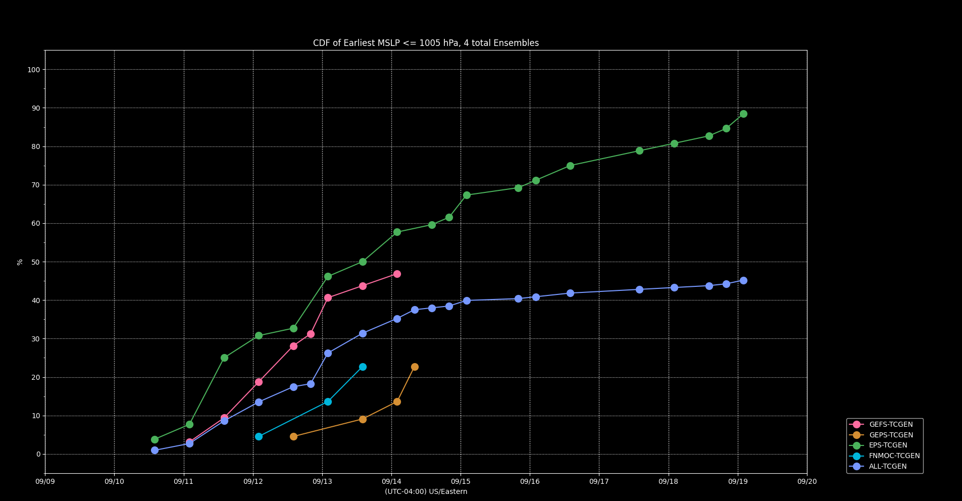
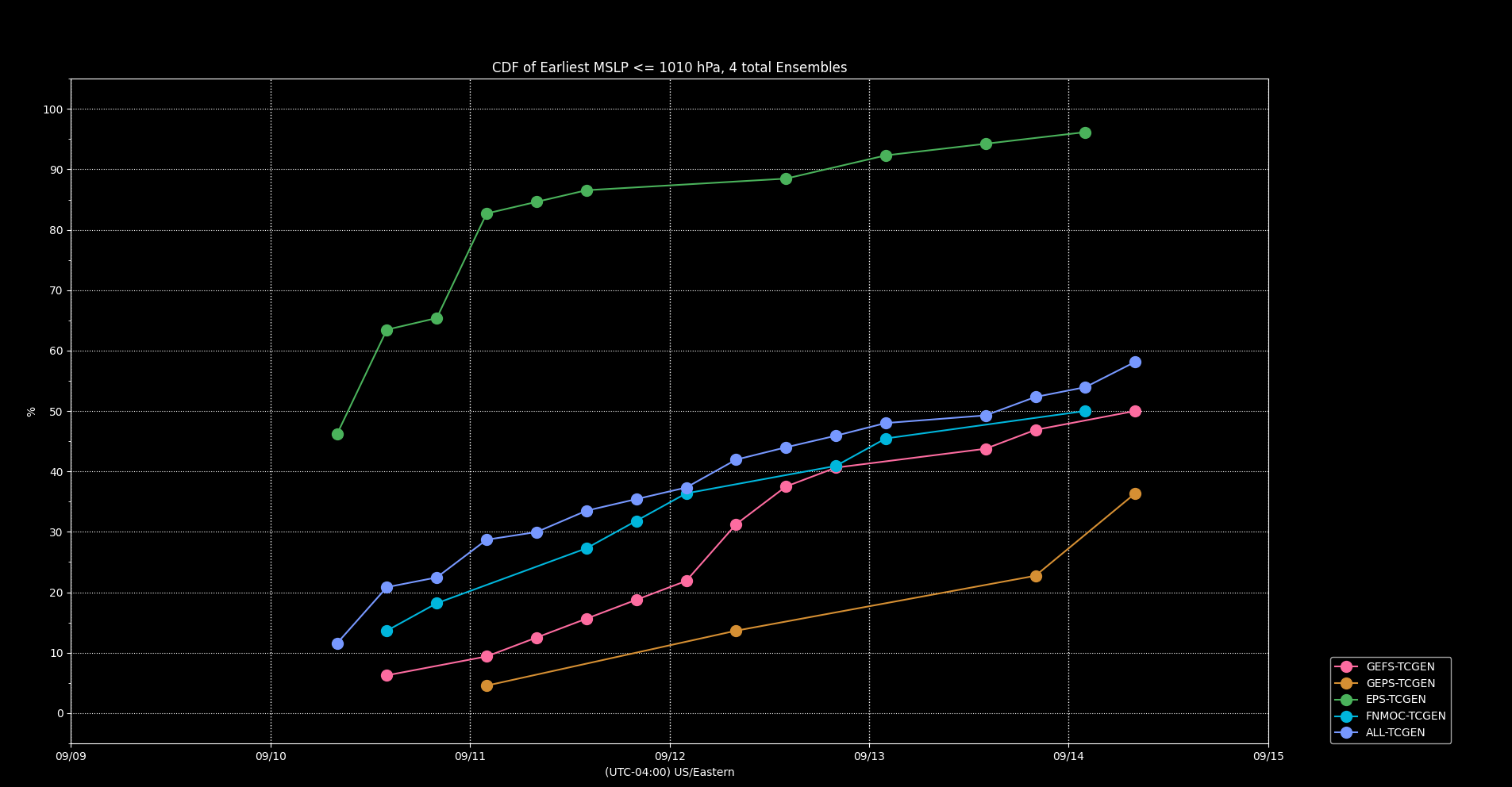
It's possible the 5 day limit doesn't show further development at 7 days for the rest of the members though....
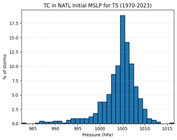
For reference my calculations of a TS (on best track MSLP, which is of course different than than the model MSLP):
GEFS has backed off a bit on genesis, and so has FSU (now that GFS doesn't predict anymore), and the timing slightly pushed back as well. Noticeably absent is CMC (as an ensemble, 12Z is the most bearish of the four)
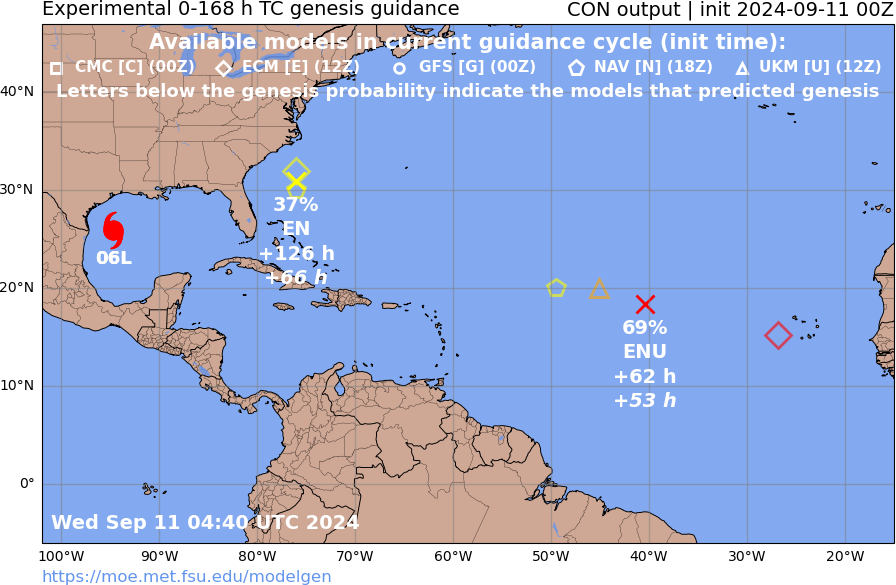
Going to lose some mana if Gordon actually forms this week. Francine not having formed yet still overly complicates it for me ...
NHC/TWO has TC genesis as high as 70% in 7 days in the central Atlantic (with TC Six at 90%)
FSU still has TC genesis at an even higher % (a bit dated with ECM/UK still from yesterday); ECM/00Z on my own tracker still shows a TC but not at TS intensity
My own naive count of the major ensemble members from 00Z (128) has TC genesis at ~ 53%, with the members matching TS intensity (>=34kt) at ~ 42%. Trying to normalize these individual ensemble probabilities on own genesis probabilities with the TWO probabilities, and conditioning using a simulation of Potential TC Six's TS probabilities makes Gordon chances this week plummet to 30%.
All these conditional probabilities come with multiplying uncertainties so I have low confidence in that prediction, otherwise I would bet up Other more, so for now I've matched the YES probabilities for this week timing wise (relative to each other) if Gordon does form.
As a sanity check, as an approximation, NHC's TWO of 70% * (0.42/0.53) {the super ensemble TC/TS probabilities I get for the central Atlantic} yields 55%, implying Other of Gordon not forming this week of 45% -- not far from the current market 40%.
@parhizj NHC is giving 60% for 92L within 48 hours, but models are no longer very enthusiastic - some show development of a TD or low-end TS, but there's very little support for a hurricane out of that system anymore. Seems plausible to me now that the wave behind it will become Gordon instead
Took me a while to do a rough simulation to figure out what probabilities I expect (~10% (5-10 days) for the PDF of the superensemble for 12Z).
As a sanity check, per NHC TWO if you go out only 7 days, 70% * 40% yields 28% for a TC; a TS for both is significantly less (I've put it roughly halfway between my estimate and the simple joint TWO probability estimate) .