Resolves according to operational intensity. Closes early
 1,000
1,000🏅 Top traders
| # | Trader | Total profit |
|---|---|---|
| 1 | Ṁ545 | |
| 2 | Ṁ185 | |
| 3 | Ṁ52 | |
| 4 | Ṁ42 | |
| 5 | Ṁ32 |
People are also trading
@SaviorofPlant this can be resolved. Final advisory was just issued:
https://www.nhc.noaa.gov/text/refresh/MIATCDEP1+shtml/032030.shtml
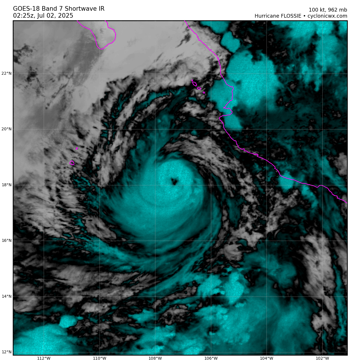
Peaked at cat. 3 (100kt):
https://ftp.nhc.noaa.gov/atcf/btk/bep062025.dat
Props to NHC forecasters -- their forecast of a cat. 3 went above all guidance for at least one of the advisories.
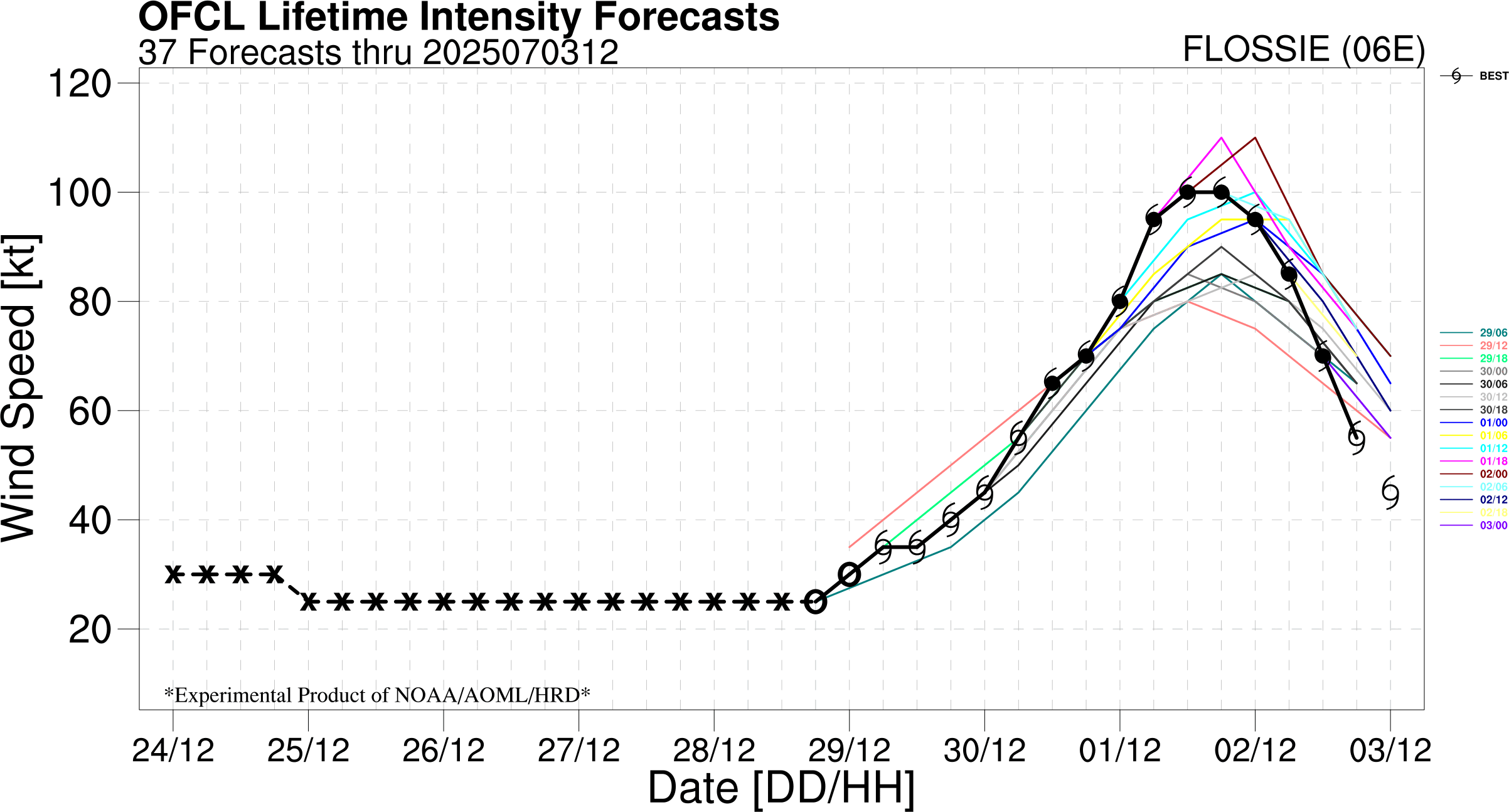
Upgraded in warning to cat 3
Hurricane Flossie Advisory Number 12
NWS National Hurricane Center Miami FL EP062025
800 PM MST Tue Jul 01 2025
...MAJOR HURRICANE FLOSSIE BRINGING GUSTY WINDS AND RAIN TO THE
SOUTHWESTERN COAST OF MEXICO...
SUMMARY OF 800 PM MST...0300 UTC...INFORMATION
----------------------------------------------
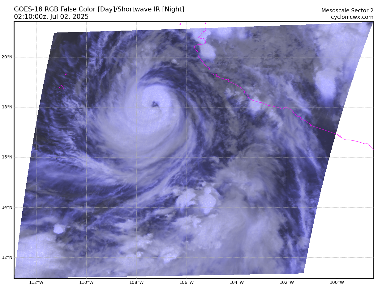
LOCATION...18.2N 107.4W
ABOUT 210 MI...340 KM WSW OF MANZANILLO MEXICO
ABOUT 365 MI...585 KM SSE OF CABO SAN LUCAS MEXICO
MAXIMUM SUSTAINED WINDS...115 MPH...185 KM/H
PRESENT MOVEMENT...WNW OR 300 DEGREES AT 9 MPH...15 KM/H
MINIMUM CENTRAL PRESSURE...962 MB...28.41 INCHES
Edit: ~~~~
Edit:
more meso for another day but it looks cooked (either ERC failed or just broke down?) ....
Last NHC discussion remarks it has peaked....
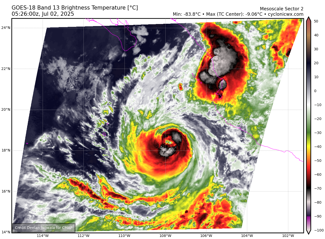
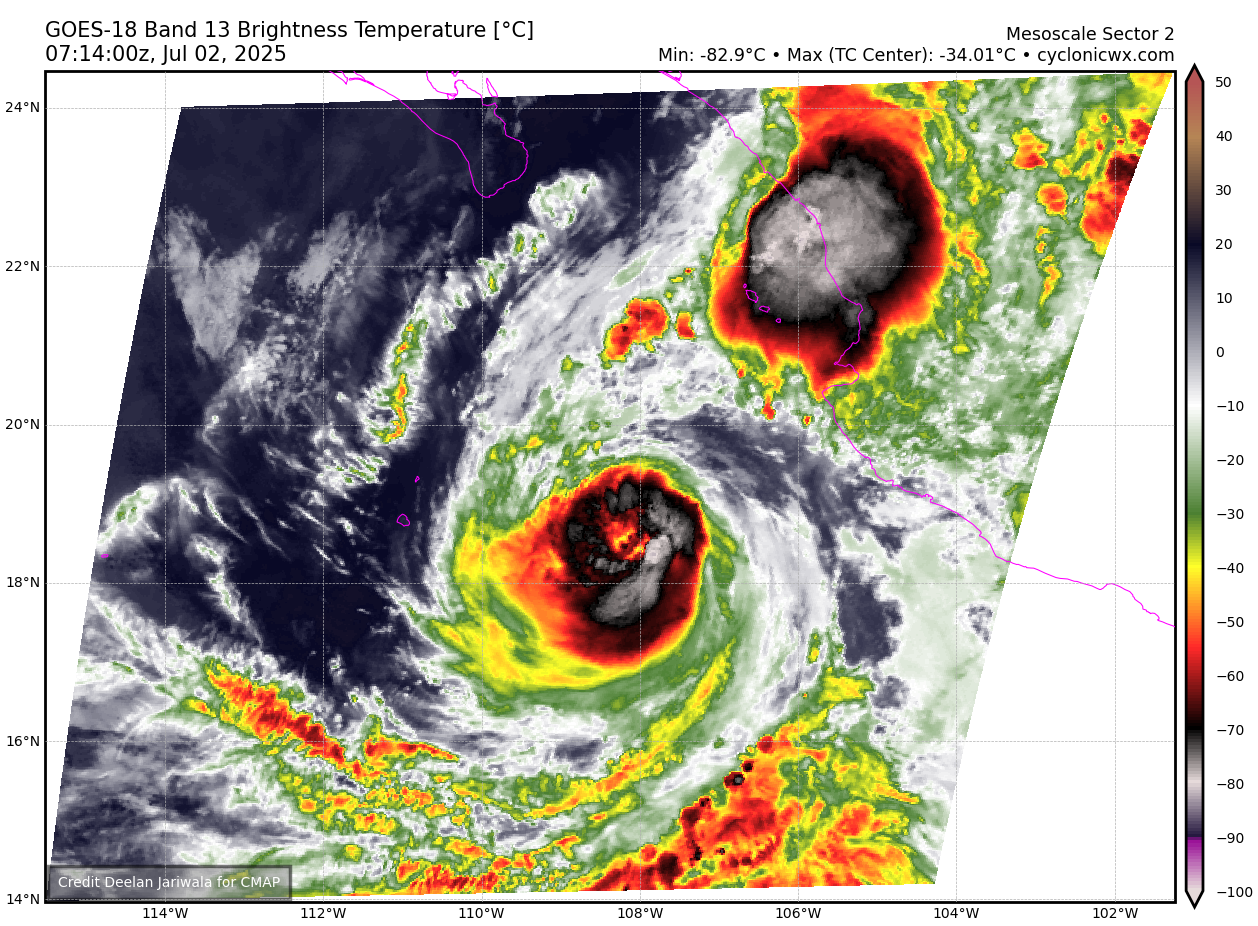
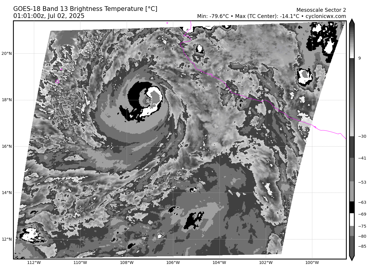
Satellite imagery shows that the inner core of Flossie has started
to degrade this morning, and the eye has become more ragged and
cloud filled. An AMSR2 microwave pass around 0916 UTC shows that
the northern eyewall has started to deteriorate, and is open on the
northern side. This suggest a weakening trend has begun, and Flossie
has likely reached peak intensity. While the system has peaked, deep
cold convection continues to wrap around the southern and eastern
side of the system.
Expected to dissipate within 4 days.
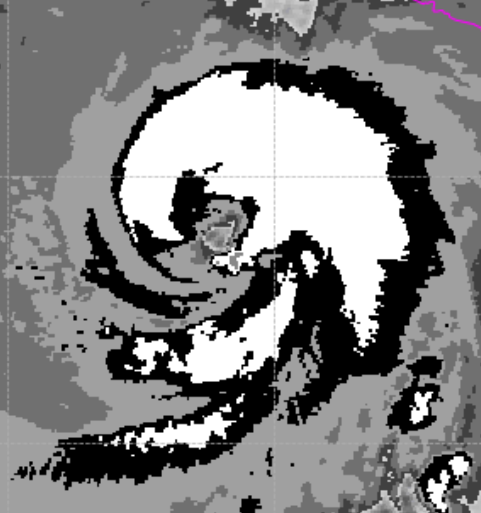
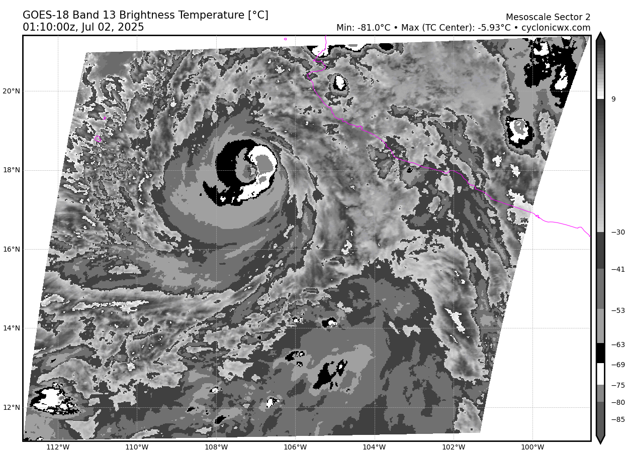
appear to be mesovortices on the triangular eye.
2025JUL01 184020 5.2 963.1 94.8 5.2 5.7 6.0 0.5T/hour OFF OFF OFF OFF -41.11 -70.63 EYE -99 IR 14.3 17.54 106.39 ARCHER GOES19 41.0
2025JUL01 191020 5.3 961.1 97.2 5.3 5.6 6.0 0.5T/hour OFF OFF OFF OFF -27.46 -68.82 EYE -99 IR 14.3 17.71 106.47 ARCHER GOES19 41.2
Edit:
Last few raw dataT in cat 4 range again. Last subjective Dvorak from 18Z were 5.0 (90kt). The best track has 18Z at 95 kt…. It still appears to be strengthening ..
Oh didn't see the best track update...
https://ftp.nhc.noaa.gov/atcf/btk/bep062025.dat
It's now at 100 kt:
EP, 06, 2025070200,   , BEST,   0, 179N, 1071W, 100,  962, HU,  34, NEQ,   80,   60,   50,   70, 1009,  130,  15,   0,   0,   E,   0,    ,   0,   0,    FLOSSIE, D,  0,    ,    0,    0,    0,    0, genesis-num, 007,
EP, 06, 2025070200,   , BEST,   0, 179N, 1071W, 100,  962, HU,  50, NEQ,   40,   40,   30,   30, 1009,  130,  15,   0,   0,   E,   0,    ,   0,   0,    FLOSSIE, D,  0,    ,    0,    0,    0,    0, genesis-num, 007,
EP, 06, 2025070200,   , BEST,   0, 179N, 1071W, 100,  962, HU,  64, NEQ,   20,   15,   15,   15, 1009,  130,  15,   0,   0,   E,   0,    ,   0,   0,    FLOSSIE, D,  0,    ,    0,    0,    0,    0, genesis-num, 007,
Edit:
On IR eye has popped up 3 times briefly in <24 hours..
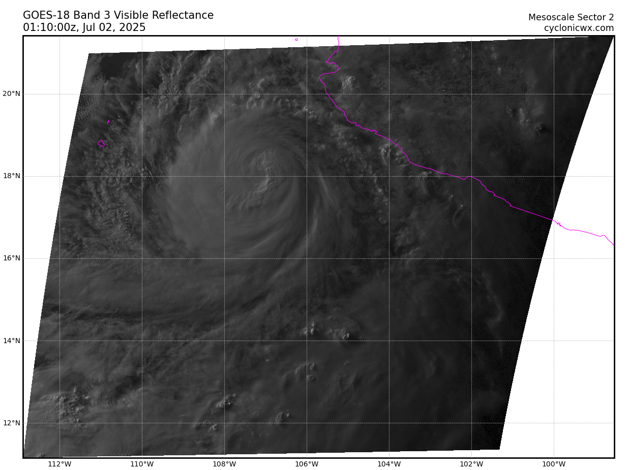
Yin and Yang...
last light..
tcvitals has also been updated:
NHC 06E FLOSSIE 20250702 0000 179N 1071W 300 046 0962 1009 0241 51 028 0148 0111 0093 0130 D 0074 0074 0056 0056 72 229N 1146W 0037 0028 0028 0028 curious to see what they set the warning intensity at… not a lot of support for 100kt still other than raw appearance and cimss adt (with lower raw data t values now…)
Seems to be apparent more Mesoscale vortices in triangular eye wall on shortwave
https://www.nhc.noaa.gov/text/refresh/MIATCDEP1+shtml/010259.shtml
Raised to a hurricane due to that SSMIS F18 microwave pass influencing the ADT data and satellite appearance
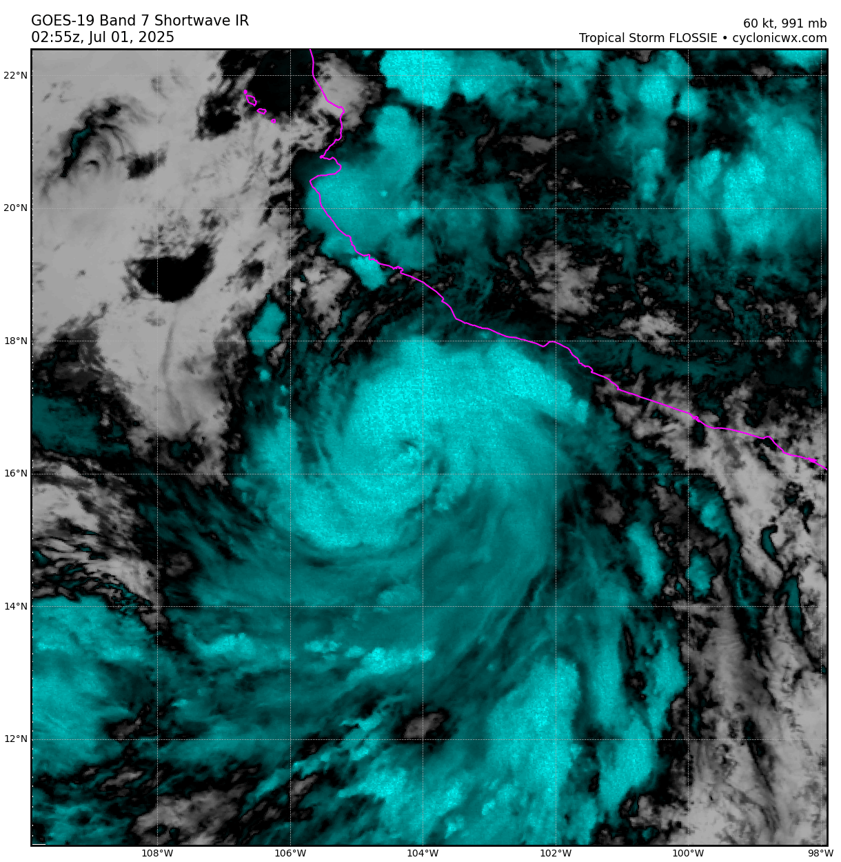
If this is an eye it’s an extremely jagged one. Not clear how organized the core is…
NHC forecast discussion seems to rely on ships RI for their intensity guidance upgrade, but it seems to me there is still some uncertainty about its intensity that was fed into the 01/00Z models (was it too low or about right?). With the new OFCL estimate and ADT estimates the models are sure to be higher for the run after next … but how much higher?
Expecting it will be a hurricane before the day is over and that the strength has been underestimated a bit.
Edit:
Relevant discussion:
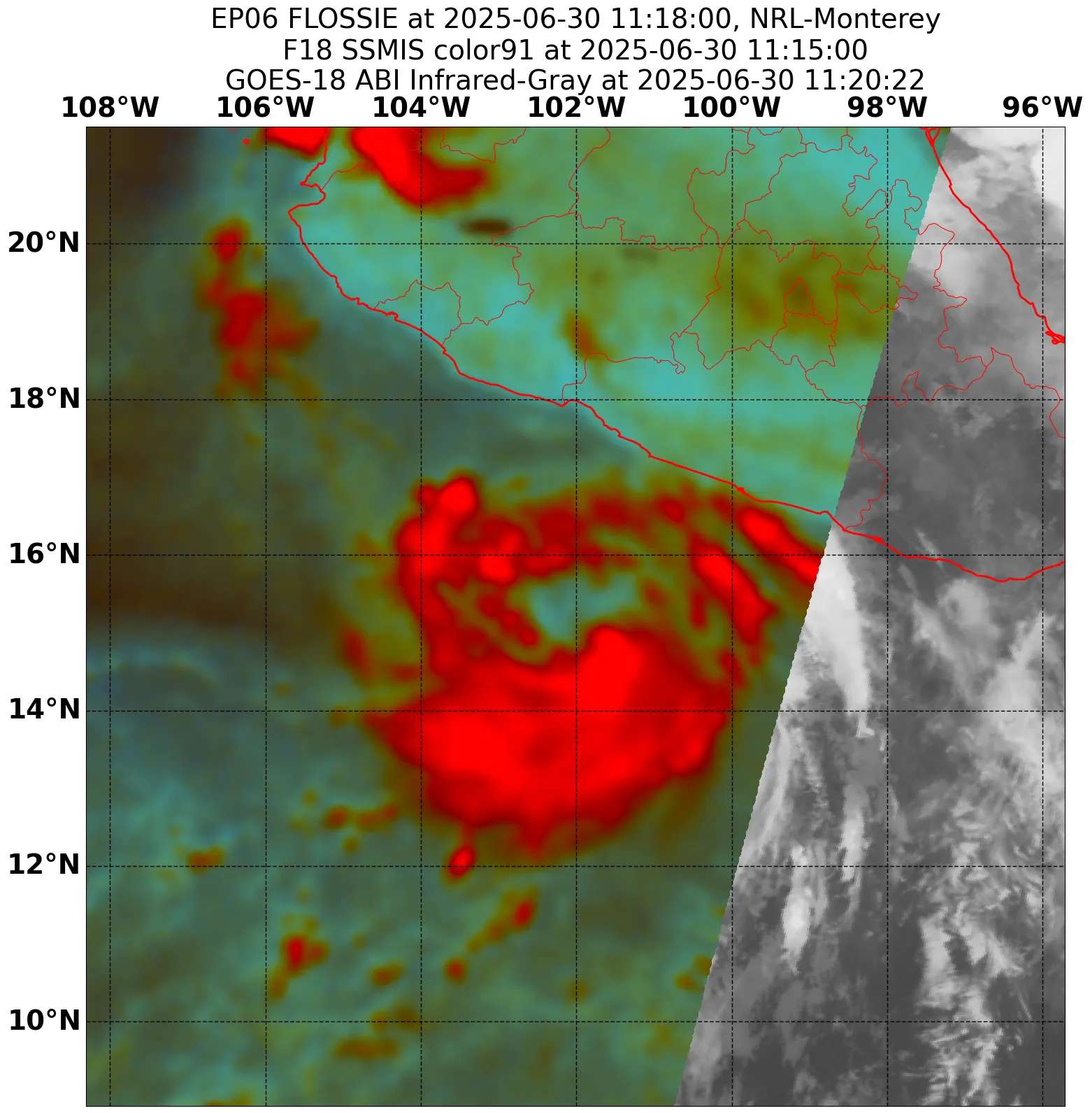
A SSMIS microwave pass from 1117 UTC this morning depicts the system
continues to become better organized, with curved banding and
potentially an inner core trying to develop. Latest Dvorak satellite
intensity estimates from TAFB and SAB have increased this advisory
to T/3.0. UW-CIMMS objective estimates range from 45 to 53 kt. Given
the improving structure and recent satellite trends, the initial
intensity is set to 50 kt for this advisory.

Environmental conditions are favorable for steady to rapid
intensification, with low vertical wind shear, plentiful moisture,
and warm SSTs. The latest NHC forecast explicitly forecasts rapid
intensification over the next 24 hours, and it is noted that some
SHIPS guidance shows a 50-65 percent chance of a 55kt increase in
the next 48 h. The NHC peak intensity forecast remains on the higher
end of the intensity guidance near the HCCA corrected consensus. In
about 48-60 hours, environmental conditions become increasingly less
favorable along the forecast track, with drier air and cooler sea
surface temperatures, which should induce a steady weakening trend.
By day 4, Flossie is forecast to become a post-tropical cyclone as
the system will struggle to produce convection within the harsh
environment.
They've set the intensity to 50kt... I still think this is an under estimate...
DPRINT shows it is near hurricane strength...
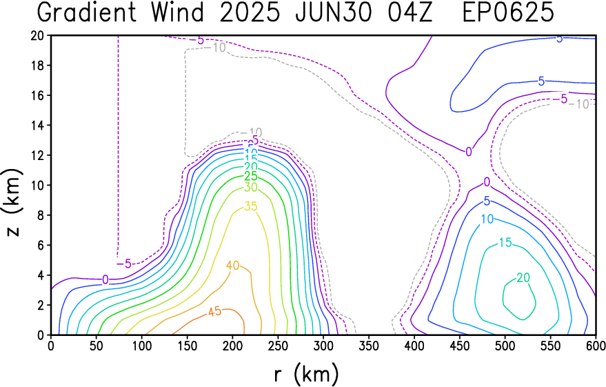
2025JUN30 1340 15.36 -102.37 996 67 61 74
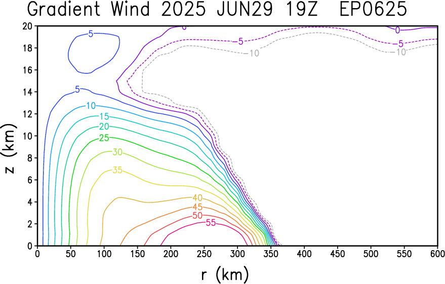
2025JUN30 1410 15.40 -102.43 994 63 57 69 And latest gradient wind analysis from CIRA suggests the inner core is already present:
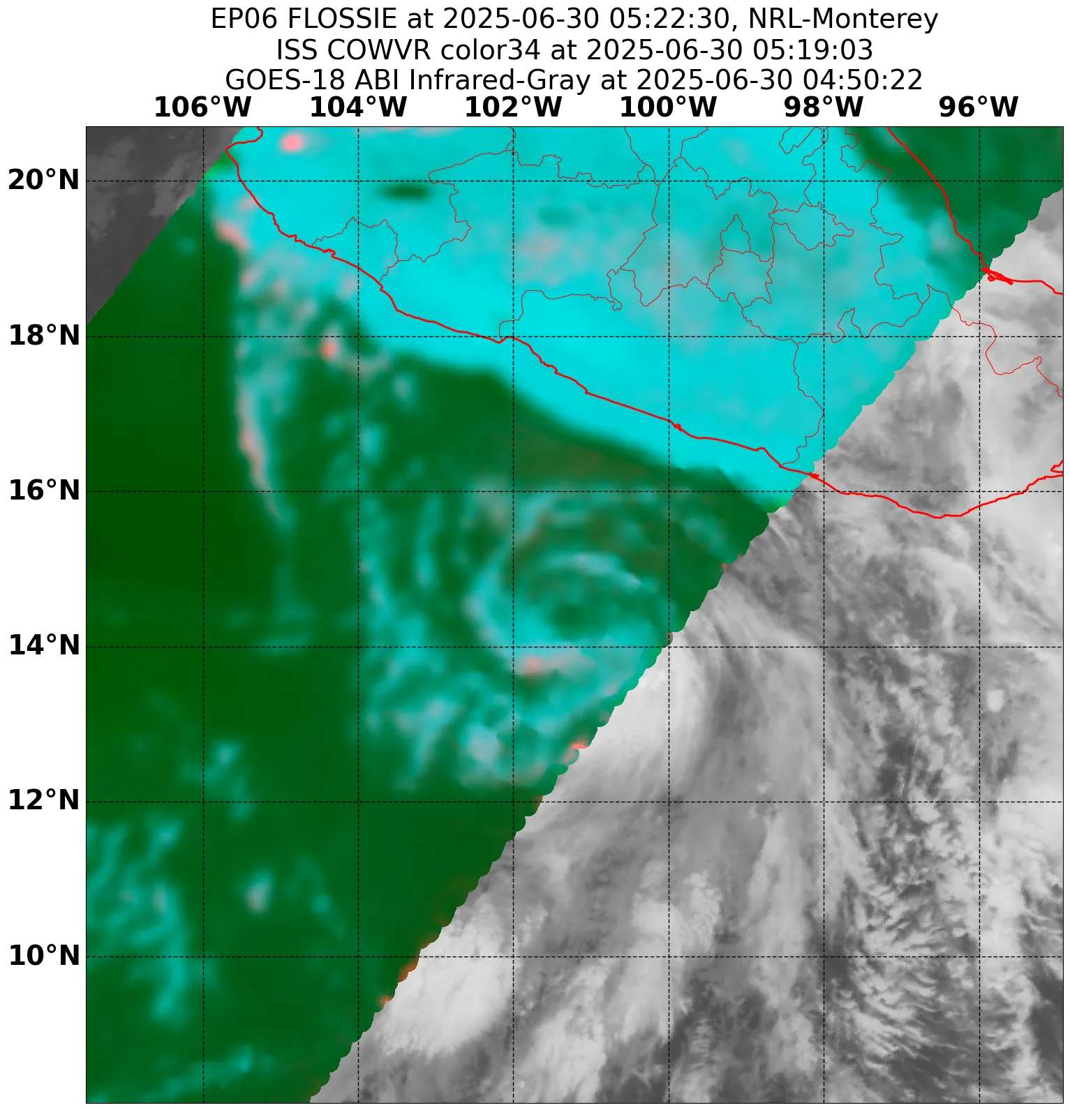
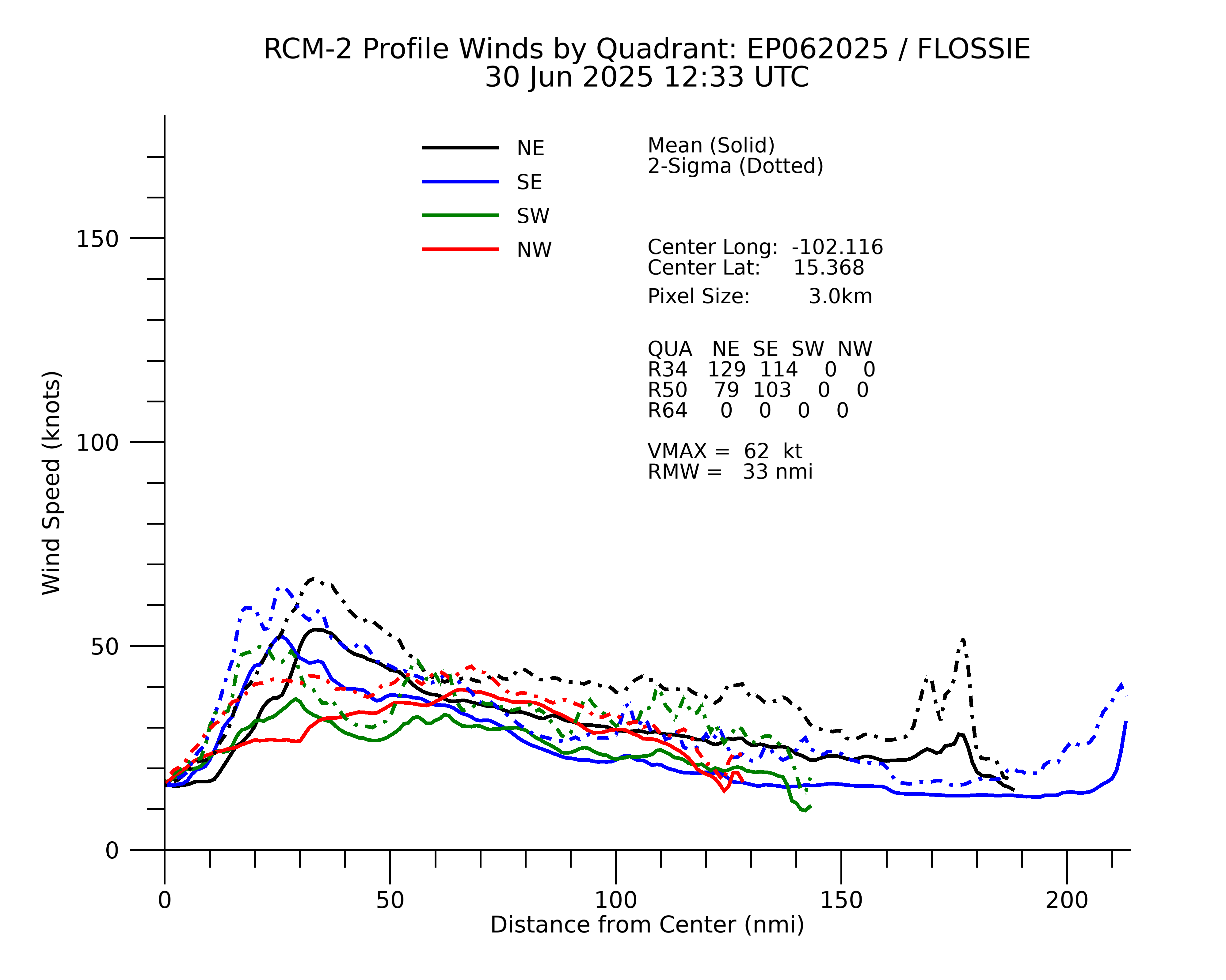
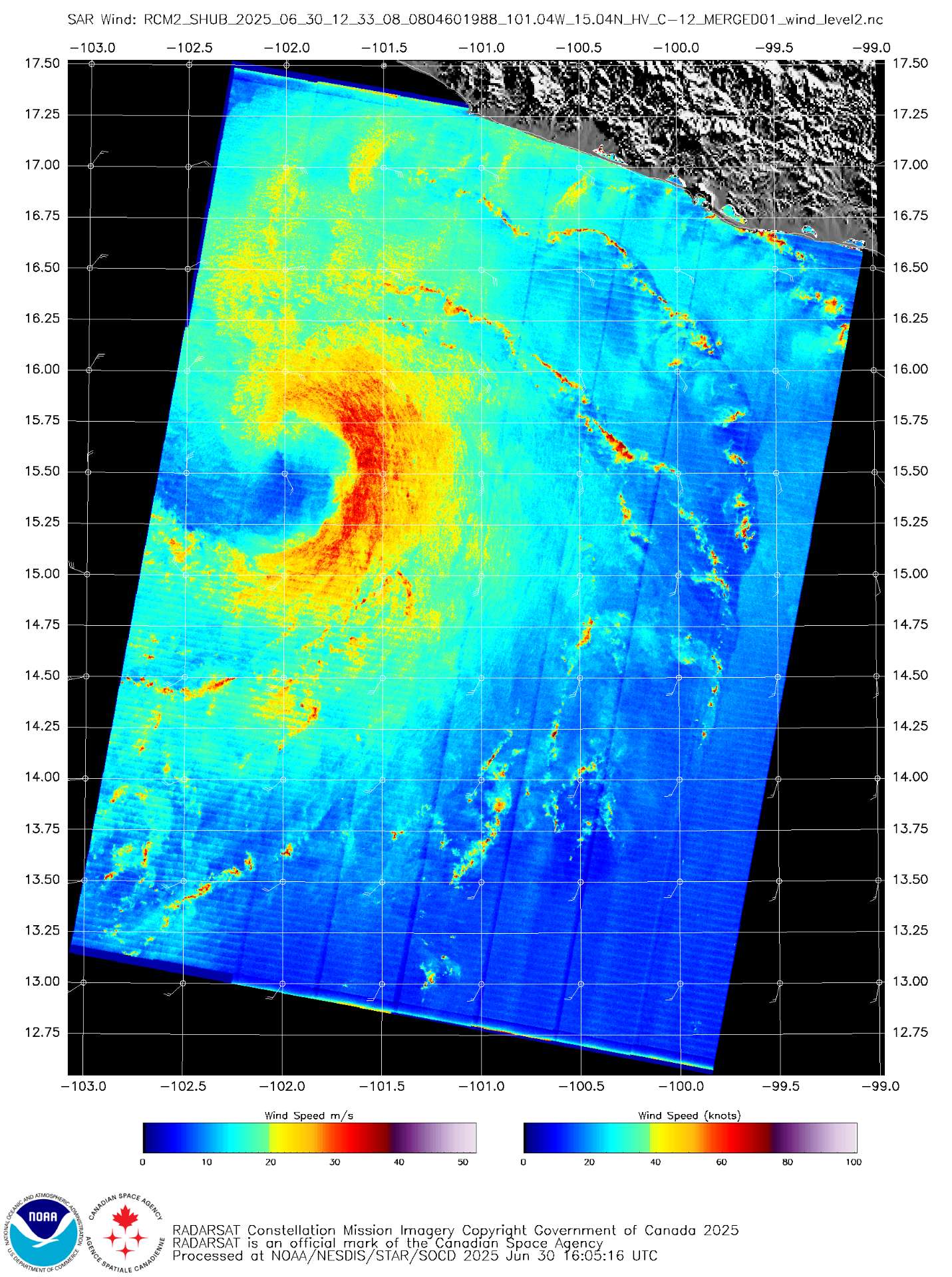
Edit2: SAR winds from 12Z show it near hurricane strength
Edit4
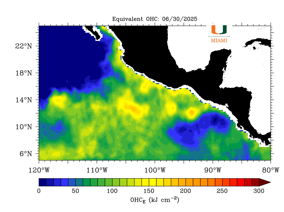
01/ 00Z has passed and it still hasn’t cleared out an eye although it has good banding (NHC has kept its intensity steady); its track has followed a “valley” of lower OHC — I wonder if this led to very uneven convection on either side, and disrupted its structure enough after 30/12Z to prevent the RI from occurring.
Edit5
Late 00Z HAFS models have peak intensity as a low-mid cat.1