Background
A tropical disturbance, 93L, has formed in the Gulf of Mexico per the National Hurricane Center (NHC).
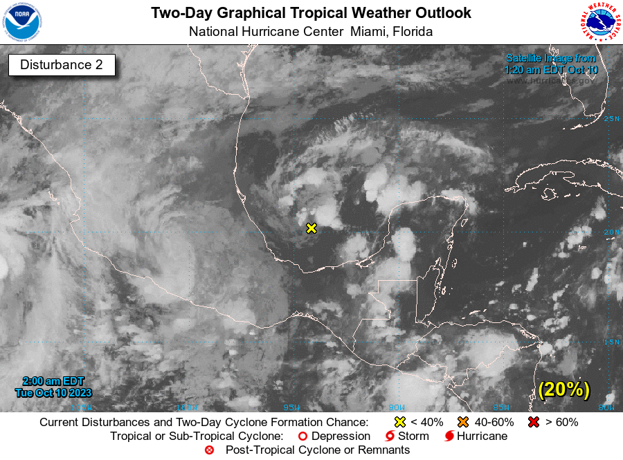
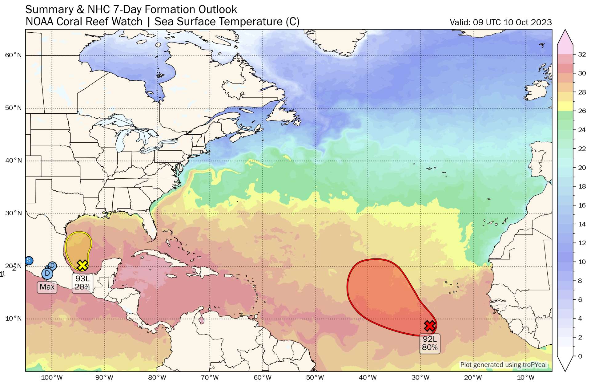
A small low pressure system over the southwestern Gulf of Mexico
continues to produce an area of disorganized cloudiness and
thunderstorms.  Environmental conditions appear only marginally
favorable for some additional development while the system moves
slowly northward during the next day or so.  The low is forecast to
merge with a frontal system over the western Gulf of Mexico by
Wednesday morning.  Regardless of tropical cyclone development, the
system is forecast to produce gale-force winds over portions of
the northern Gulf of Mexico by Wednesday.  Additional information
on this system, including gale warnings, can be found in High Seas
Forecasts issued by the National Weather Service.
* Formation chance through 48 hours...low...20 percent.
* Formation chance through 7 days...low...20 percent.
Will 93L further develop into a tropical storm as it is forecast to sweep northward?
Resolution Criteria
Resolves YES if 93L reaches tropical storm strength, before dissipation or merger with non-tropical fronts, according to the NHC.
Resolves NO if the conditions for YES are not satisfied before dissipation or merger with non-tropical fronts.
Will resolve and adjudicate based on NHC advisories.
I will not bet on this market, but I will put Ṁ200 in as subsidy.
Related Market
 1,000
1,000🏅 Top traders
| # | Trader | Total profit |
|---|---|---|
| 1 | Ṁ236 | |
| 2 | Ṁ32 | |
| 3 | Ṁ6 | |
| 4 | Ṁ2 | |
| 5 | Ṁ0 |
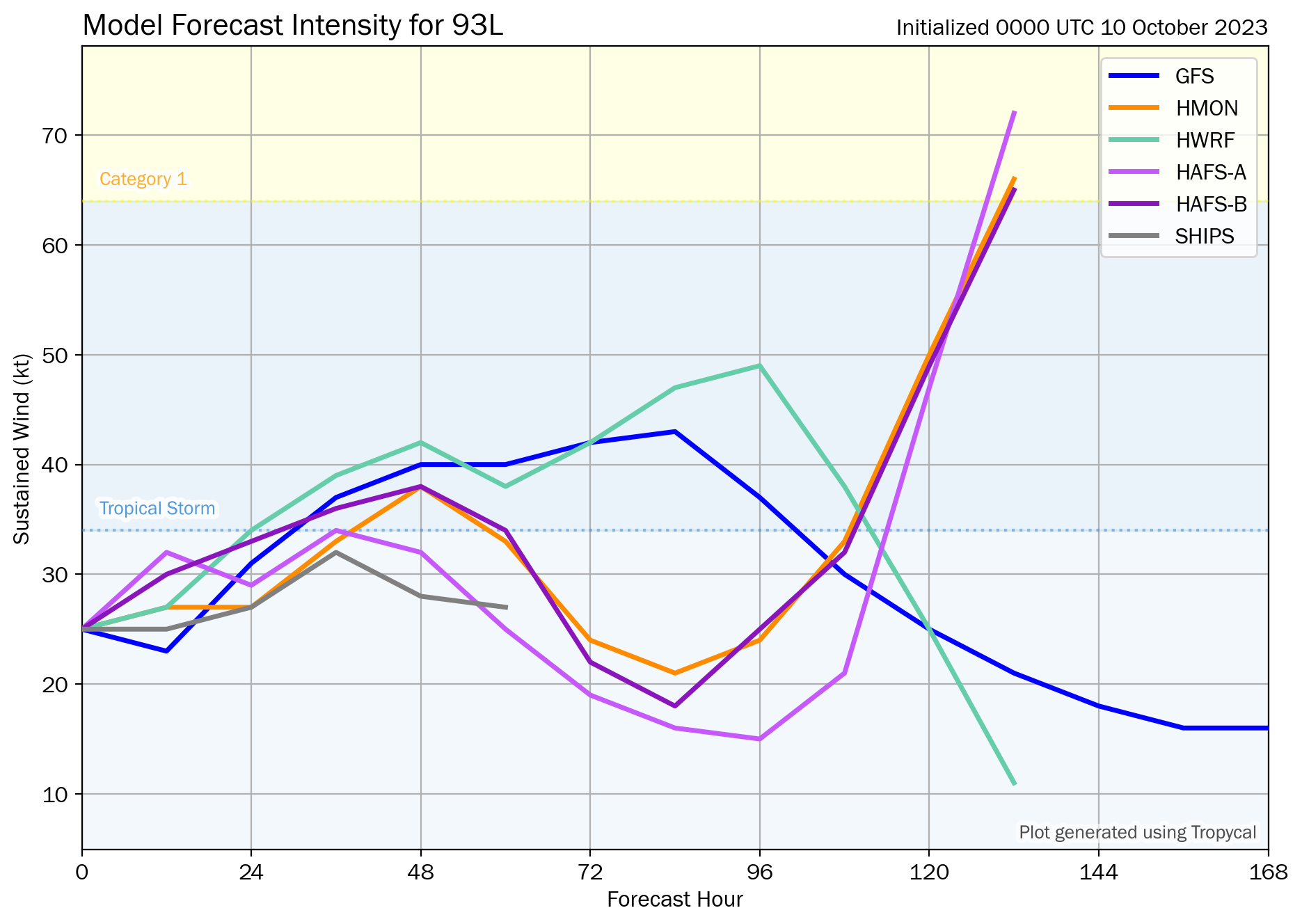
The last NHC outlook text for Invest 93L has been issued on Oct 10, 8pm EDT:
2. Southwestern Gulf of Mexico (AL93):
An area of low pressure located over the southwestern Gulf of Mexico is producing limited and disorganized shower and thunderstorm
activity.  This system is forecast to merge with a developing frontal boundary over the western Gulf of Mexico early Wednesday, and tropical cyclone formation is not expected.  Regardless of
tropical cyclone development, the system is forecast to produce gale-force winds over portions of the northern Gulf of Mexico by
tomorrow, and potentially heavy rainfall along the Gulf Coast by the latter portion of this week. For more information, see products from
your local National Weather Service office, and high seas forecasts issued by the National Weather Service.
* Formation chance through 48 hours...low...near 0 percent.
* Formation chance through 7 days...low...near 0 percent.
The newest outlook on Oct 11, 2am EDT no longer shows or mentions the disturbance.
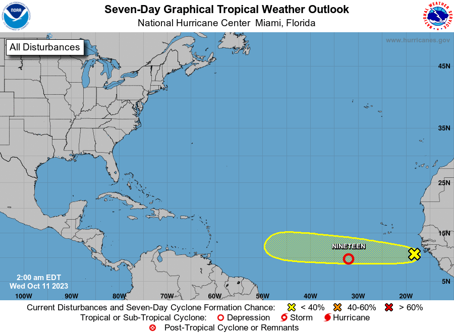
From the NHC Atlantic Tropical Weather Discussion at 0605 UTC, the low has been deemed to have merged with a stationary front:
For the forecast, a stationary front extends from the Straits of Florida to offshore of the NW Yucatan Peninsula to 1003 mb low pressure near 23N94.5W. The front and low pres will lift northward tonight through Wed, reaching along 28N. The low pres is expected to strengthen along the front early Wed over the NW Gulf, and
move eastward across the N central and NE Gulf through Wed evening, then inland across N Florida Wed night. Scattered to numerous strong thunderstorms and strong to gale force winds will accompany this low pressure system and frontal boundary across thenorthern Gulf late tonight through Wed night.
Hence the condition for a resolution of NO in this market has been reached. Please leave a comment below if you have any comment or objection towards this resolution. Otherwise, I will be resolving this market in an hour.
Showers and thunderstorms have increased some, but remain
disorganized, in association with an area of low pressure over the
southwestern Gulf of Mexico. While environmental conditions appear
only marginally favorable, surface pressures have been falling near
the system, and it has a short window to develop further over
the next day or so. However, by Wednesday morning the system is
forecast to merge with a developing frontal system over the western
Gulf of Mexico. An Air Force Reserve Reconnaissance aircraft is
scheduled to investigate the system later today, if necessary.

Regardless of tropical cyclone development, the system is forecast
to produce gale-force winds over portions of the northern Gulf of
Mexico by Wednesday, and potentially heavy rainfall along the Gulf
Coast by the latter portion of this week. For more information, see
products from your local National Weather Service office, and high
seas forecasts issued by the National Weather Service.

* Formation chance through 48 hours...low...30 percent.
* Formation chance through 7 days...low...30 percent.
NHC forecast slightly increases the formation chance to 30%, but the window is narrowing down.