Resolves YES if the NHC designates TS Ophelia as a Hurricane at any point in the next 7 days.
 1,000
1,000🏅 Top traders
| # | Trader | Total profit |
|---|---|---|
| 1 | Ṁ125 | |
| 2 | Ṁ65 | |
| 3 | Ṁ43 | |
| 4 | Ṁ17 | |
| 5 | Ṁ15 |
People are also trading
As per the NWS/NHC (Big weather Gov) this resolves NO. October so far looks pretty uneventful; subtropical jet + ridging across the Caribbean seem likely to stop CONUS threats well into the first half of October. Haven't had a lot of time for Manifold as of late (school+work), but if storms pop off, I'm sure I won't be able to resist.
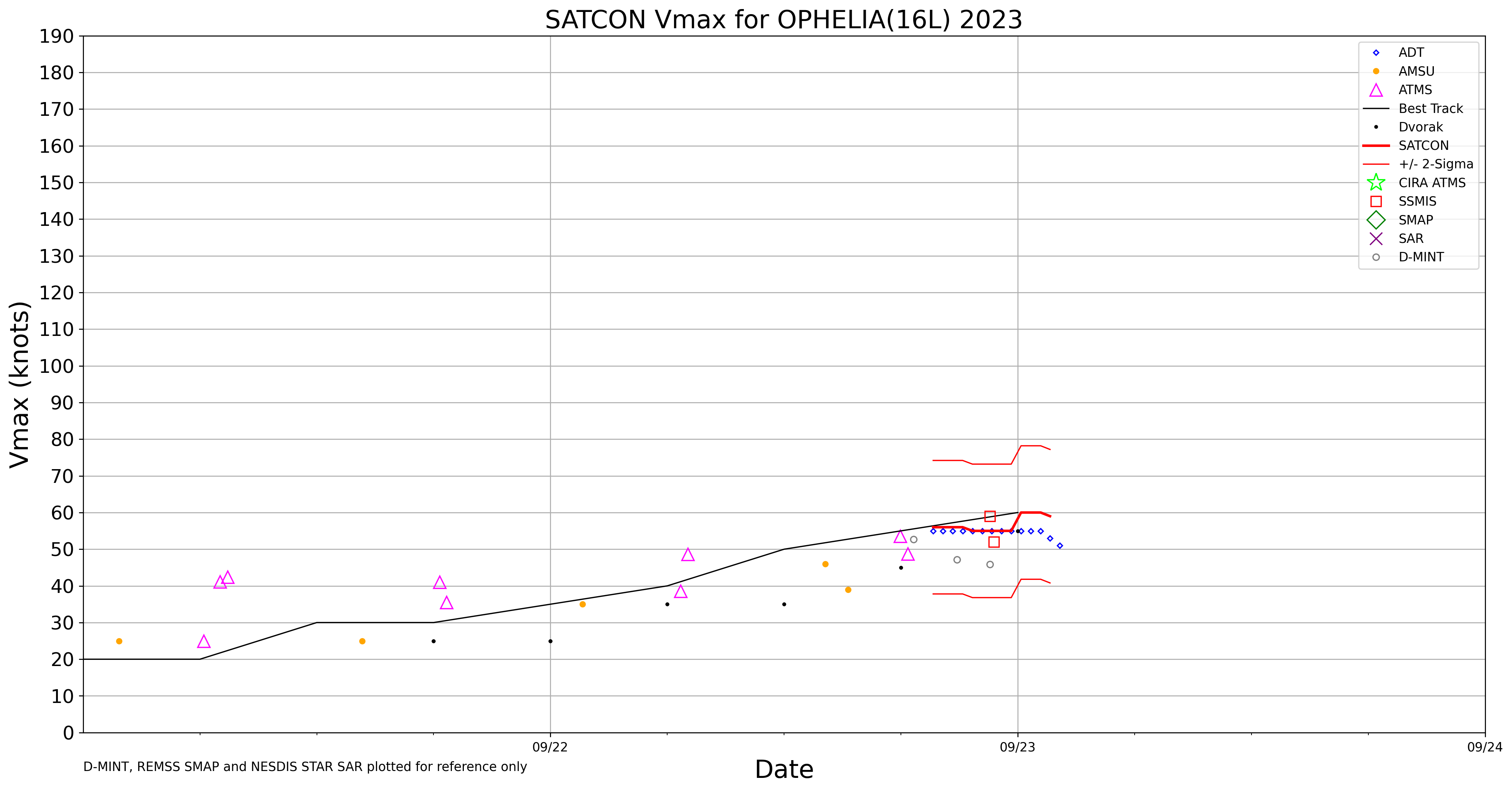
There won't be any revisions to intensity within the next 6 day, so this will eventually resolve NO. But there is a pretty good chance that Ophelia met the Criteria for a Cat I at some point - though probably only briefly.
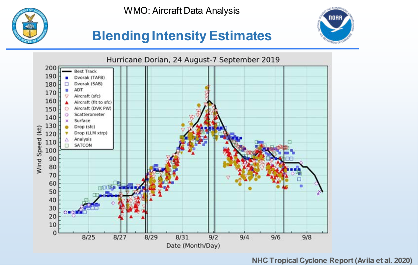
Using the standard surface wind reduction from flight-level
suggest that maximum surface winds are likely between 60-65 kt. The
initial intensity is held at 60 kt based on a combination of the
flight-level winds and velocity data from Doppler radar.@sarius Yeah it feels like this type of close market is more about what predicting what the forecaster will choose to blend the intensities as rather than single data points...
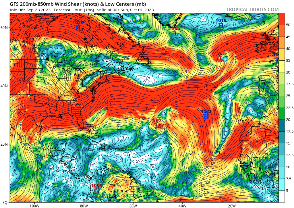
@sarius in other news, this atlantic hurricane season seems to be coming to an early-ish close. More so there are no CONUS threats on the horizon, with the subtropical jet forecast to bring shear (and lots of it). More favorable conditions in the W and ECAR, areas which are way too hard to forecast for me to be confident in anything. I guess the EPAC could pop off too. With SSTs like this I never wanna rule anything out. We'll see what happens, I guess.
@parhizj I mean how attractive is a market: "Will a Hurricane Hunter dropsonde find surface-level hurricane-force winds on any mission into Ophelia?" We could try that ofc (should anything interesting happen in the remainder of the season).
@sarius Rather than dropsondes, for landfall, we could just rely solely on buoy data, METAR and other sources like windalert.com (which has stations in addition to METAR). It is a lot more effort though... Edit: might be moot if there are no more land-falling storms this year...
@parhizj Just made one for Ireland - where Ophelia looks to be a pretty hefty windstorm on Wednesday.
@sarius on approach now for a more northern pass. strongest winds probably in there - with the ongoing convective burst.
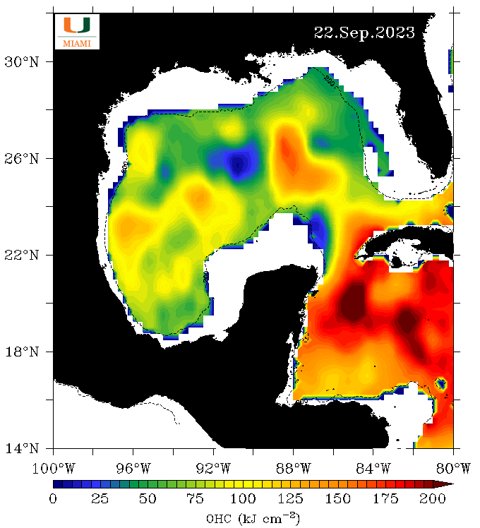
Ophelia's center is only expected to be over the warm waters of the
Gulf Stream for another 6 hours or so before moving inland, so the
window for strengthening is beginning to close
I don’t expect it to strengthen as it looks like it might have started to weaken in the last hour….
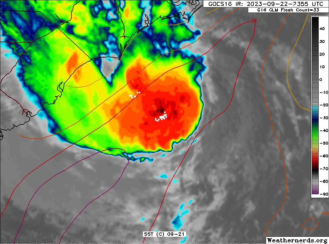
GOES IR shows slightly less cool cloud tops.
Buoy data for last hour shows wind gusts 5-6 lower than the hour prior to that.
Edit: Satcom has it at 59 kt
Can it wrap all the way around? An eye for Ophelia? It's trying for sure.
Oops
oh the suspense.
@Will58c3 "...OPHELIA PRODUCING WINDS JUST BELOW HURRICANE FORCE"
Changed all my bets based on that headline... to me it is sort of hinting that they won't upgrade at the 11PM advisory...
https://www.nhc.noaa.gov/text/refresh/MIATCMAT1+shtml/222057.shtml
NEXT ADVISORY AT 23/0300Z

$$
FORECASTER REINHART
11PM local (EDT) ... I mean
@parhizj They def had some wind data points to justify an upgrade. Maybe they are waiting for better vertical alignment? I am pretty sure this will strengthen more up until landfall - convection and lightning activity ongoing - will it be enough? No clue. I am still feeling some potential for more baroclinic forcing while on final approach, I guess. Very close call.
In any case, if there was less dry air sitting to the east, I'm sure this would be a Cat I rn. Not your typical TC...
@sarius But the system is running out of time and the SST gradient will drop off (at least a slight bit) while on approach.
We only have access to a few of the data points unfortunately and the error is like 10% (of which we are in the margin for):
The ADT/Dvorak estimates I saw had it much lower (55-60) so maybe that is why...
@parhizj we will get more data points luckily with another recon mission scheduled for later tonight. Curious to see what they will find.
Edit: zzzzz time....
@sarius the NHC agrees with the margin between Cat I and Trop Storm being small and Ophelia's time running out. Recon will have the final say, I guess.
Ophelia's center is only expected to be over the warm waters of the
Gulf Stream for another 6 hours or so before moving inland, so the
window for strengthening is beginning to close.  It should be
stressed, however, that there is very little difference if Ophelia
reaches land as a 60-kt tropical storm or a 65-kt hurricane.

Another Hurricane Hunter aircraft is
scheduled to investigate Ophelia in a couple of hours and should
provide a final estimate of the intensity before the storm reaches
land.