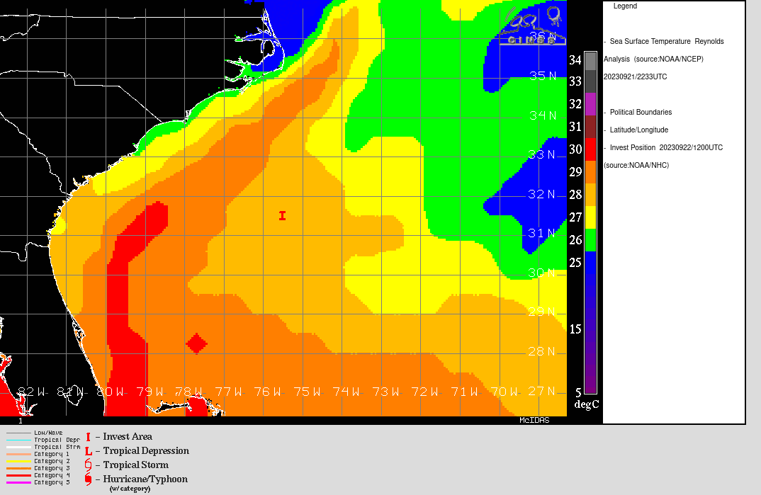
Watching a potential spin-up low off the SE U.S. Coast. Does it have what it takes to become a Tropical Storm and make landfall as one? Resolves per the NHC.
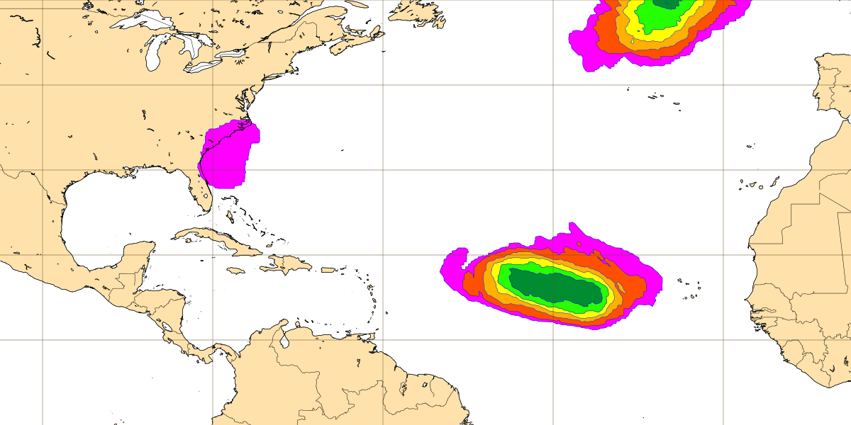
This map shows Tropical storm strike probability (5-10%) on 20230926 00z init on 20230917 00z via the Tropical cyclone activity (Including genesis) forecast product. The strike probability is based on the number of ENS members that predict a tropical storm, and each member has equal weight. The strike probability is the probability that a tropical storm will pass within a 300 km radius from a given location and within a time window of 48 hours.
 1,000
1,000🏅 Top traders
| # | Name | Total profit |
|---|---|---|
| 1 | Ṁ278 | |
| 2 | Ṁ224 | |
| 3 | Ṁ164 | |
| 4 | Ṁ105 | |
| 5 | Ṁ71 |
People are also trading
Tropical Storm Ophelia Tropical Cyclone Update
NWS National Hurricane Center Miami FL AL162023
620 AM EDT Sat Sep 23 2023
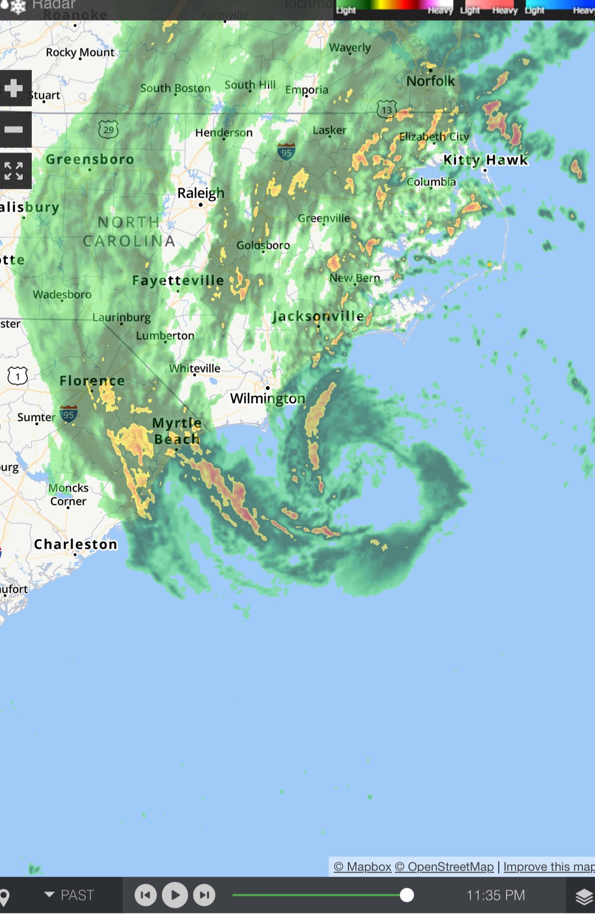
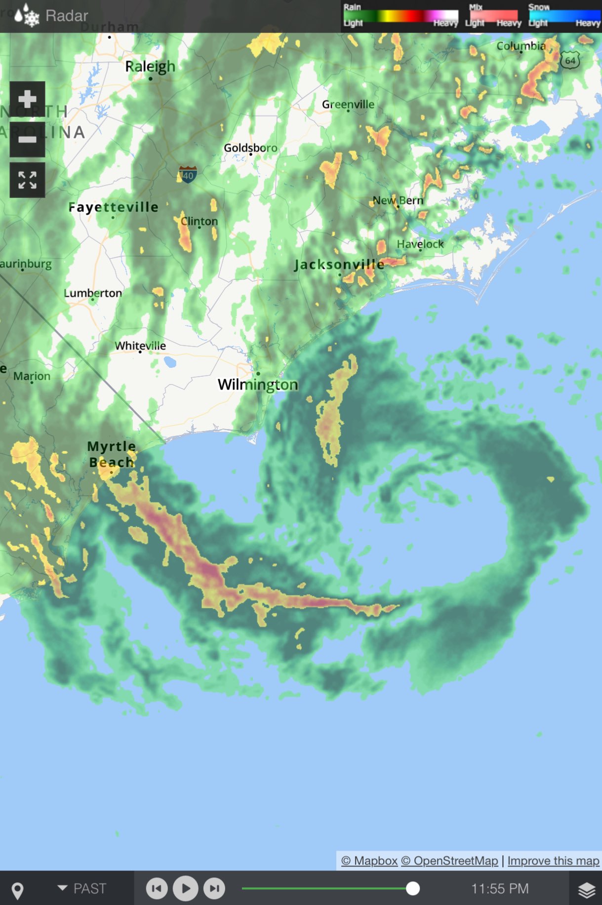
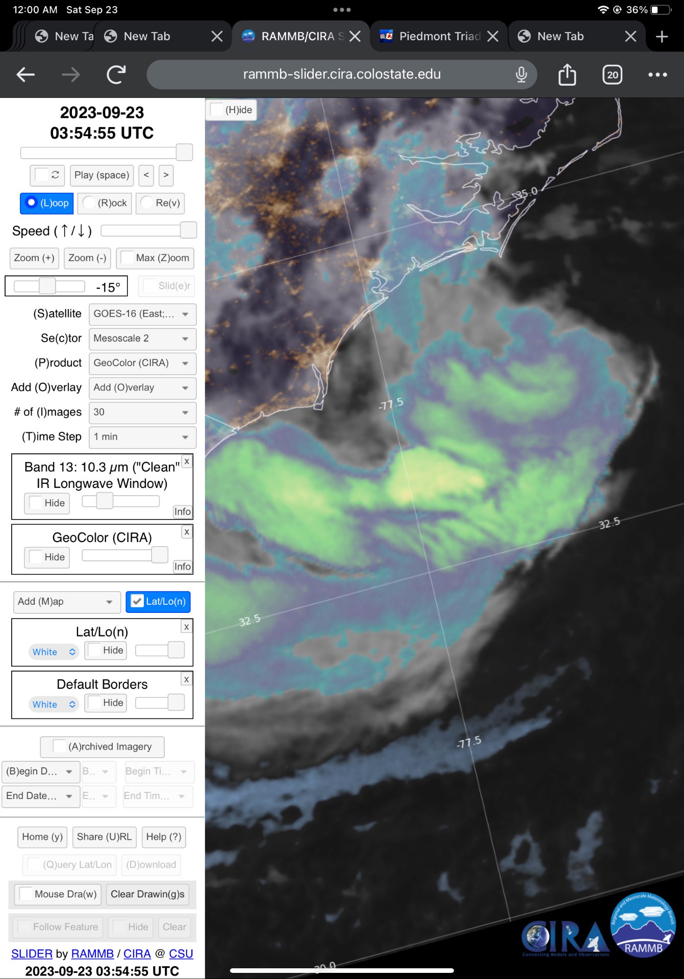
...OPHELIA MAKES LANDFALL IN NORTH CAROLINA...
Doppler Radar images, Air Force Hurricane Hunter data and surface
observations indicate that Ophelia made landfall near Emerald Isle
in North Carolina around 615 am EDT (1015 UTC) with estimated
maximum winds of 70 mph (110 km/h).If the special update wasn't enough, 8AM Intermediate advisory has it as inland and a tropical storm still
https://www.nhc.noaa.gov/text/refresh/MIATCPAT1+shtml/231156.shtml


SHIP report of wind speed of 58kt...
Edit:
No more nice ring...
https://www.nhc.noaa.gov/text/refresh/MIATCPAT1+shtml/DDHHMM.shtml
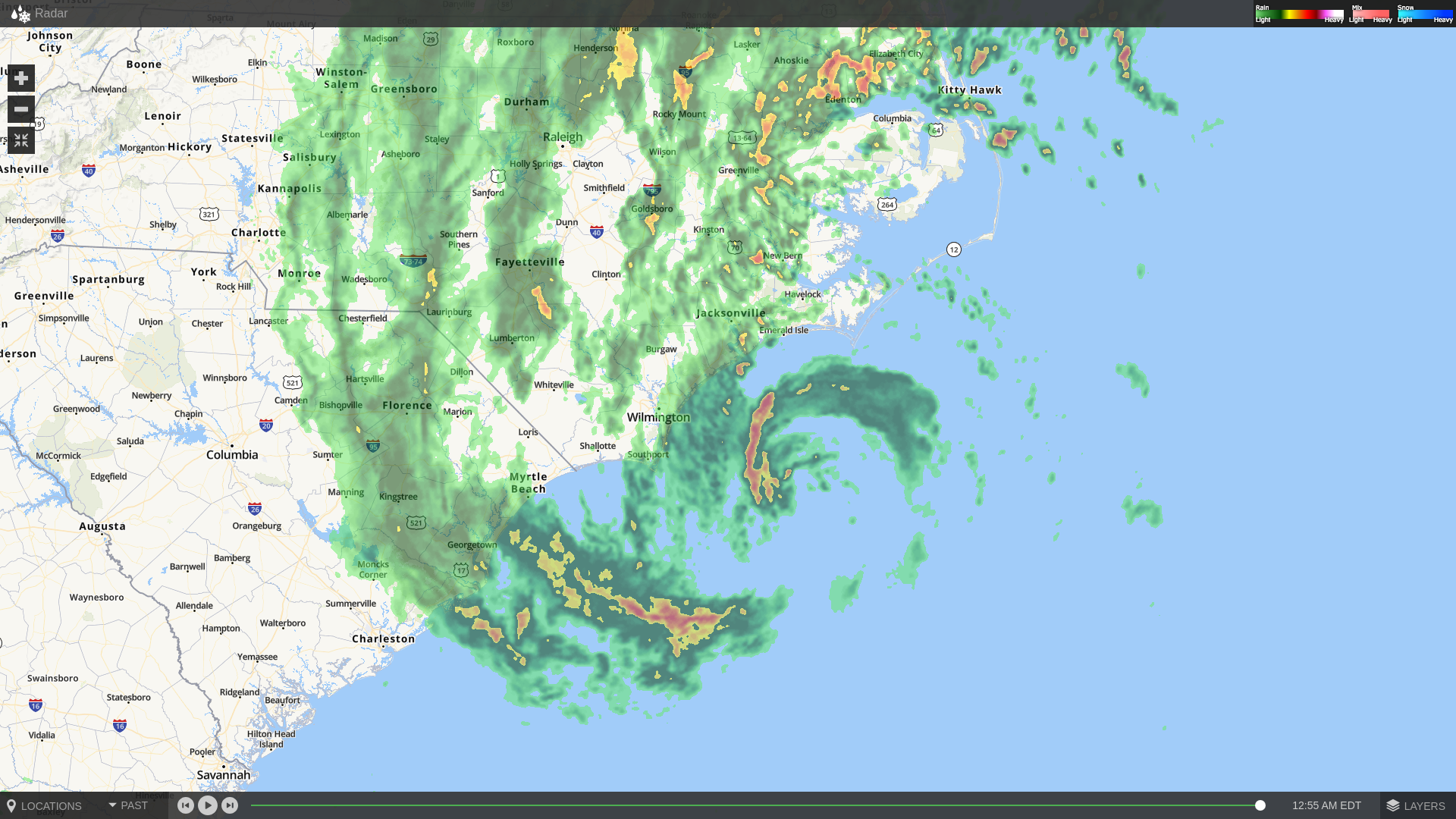
SUMMARY OF 800 PM EDT...0000 UTC...INFORMATION
----------------------------------------------
LOCATION...33.3N 76.6W
ABOUT 90 MI...145 KM S OF CAPE LOOKOUT NORTH CAROLINA
ABOUT 90 MI...145 KM ESE OF CAPE FEAR NORTH CAROLINA
MAXIMUM SUSTAINED WINDS...70 MPH...110 KM/H
PRESENT MOVEMENT...NNW OR 330 DEGREES AT 12 MPH...19 KM/H
MINIMUM CENTRAL PRESSURE...984 MB...29.06 INCHES
From google maps, that center is about 160km north, so using the speed of 19 KM/H = ~ 8.4 hours to landfall on average (+- a couple of hours)
Based on latest advisory looks like landfall at 4 AM (+- 3 hours)?
@sarius It's only 10sec not 1 minute though
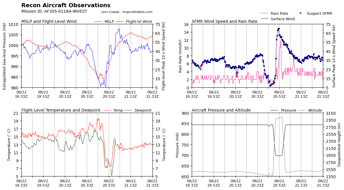
205130 3238N 07643W 6962 02994 9868 +091 +075 310015 025 062 003 00
205200 3237N 07645W 6964 02999 9872 +094 +071 302029 033 068 002 00
205230 3236N 07646W 6982 02984 9878 +095 +078 302030 033 070 005 00
205300 3235N 07648W 6967 03005 9887 +089 +089 306030 031 070 005 00
205330 3234N 07649W 6965 03006 9896 +083 //// 298032 035 063 010 01
205400 3232N 07651W 6977 03002 9907 +083 //// 308042 044 063 010 01
Take the average of the highest 6 readings in the time range: (62 + 68 + 70 + 70 + 63 + 63) / 6 = 66 kt
@sarius What happens if it becomes a hurricane before landfall (last advisory prior to landfall) but landfalls as a tropical storm? Does this still resolve YES?
New NHC 5pm update, upgrades current max winds to 60 kt. Not forecast to strengthen further but can't be ruled out...
https://www.nhc.noaa.gov/text/refresh/MIATCDAT1+shtml/DDHHMM.shtml
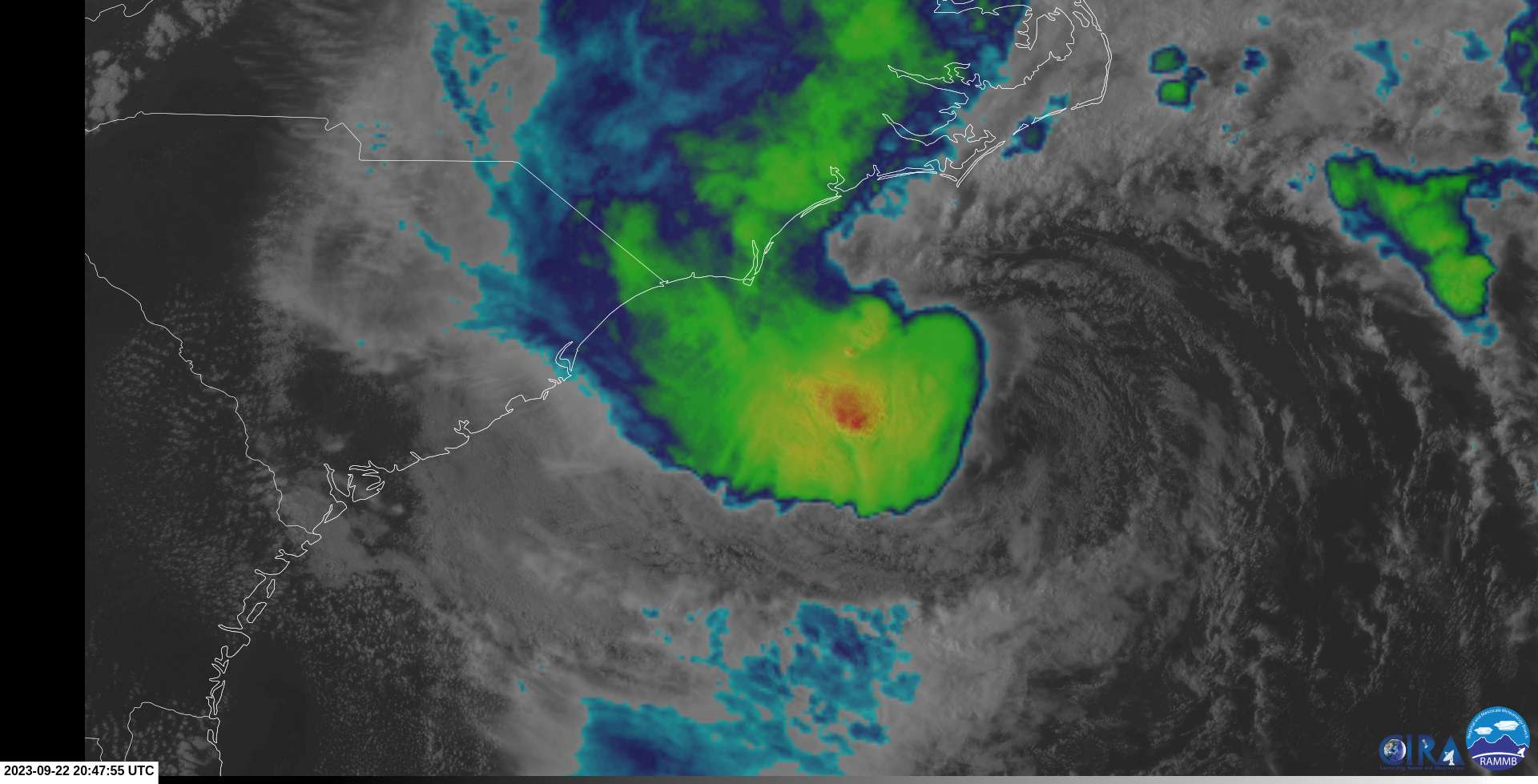
The intensity forecast is more challenging given the unexpected
strengthening trend observed today. Most of the intensity guidance
shows little change in strength before landfall, although the global
models show additional deepening of the low. However, some
additional strengthening cannot be ruled out as Ophelia traverses
the warm waters of the Gulf Stream on its approach to eastern North
Carolina. While this does not seem like the most likely outcome and
is not explicitly forecast, the increased risk warrants the issuance
of a Hurricane Watch for a portion of the North Carolina coast from
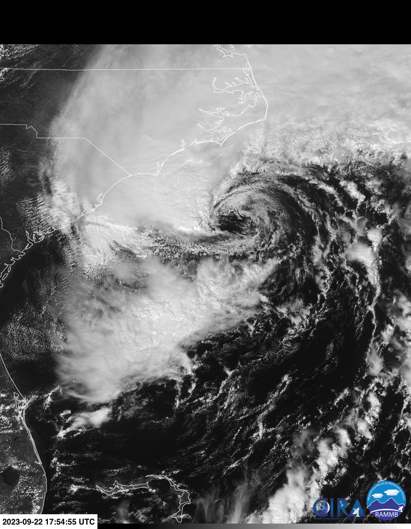
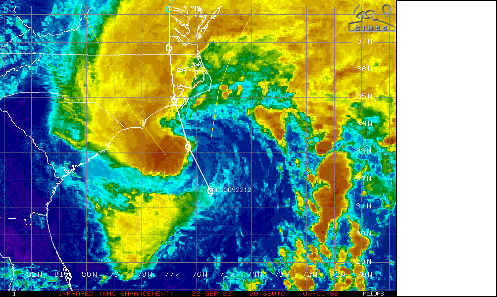
north of Surf City to Ocracoke Inlet.Deep convection lined up with center:
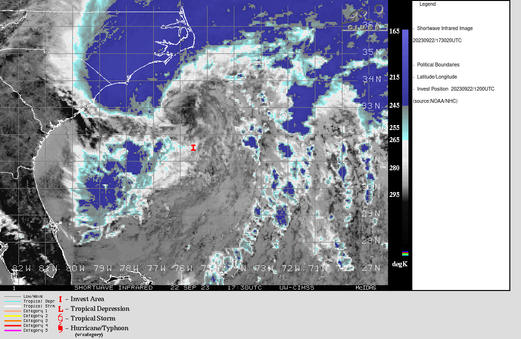
Visible+IR
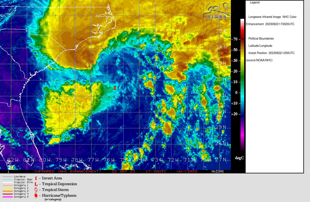
IR:
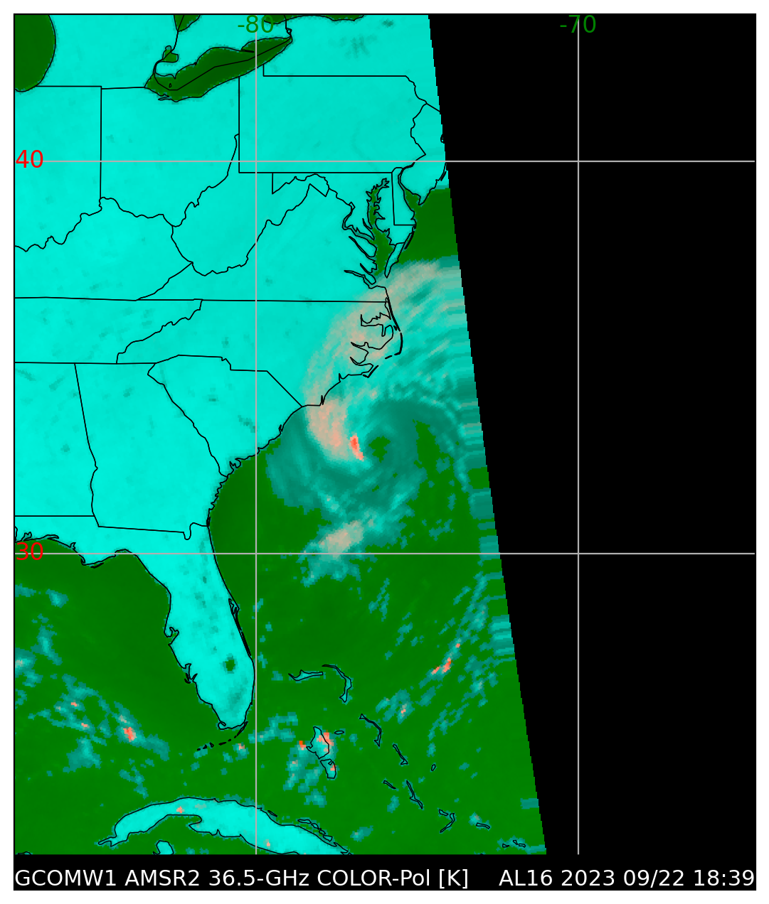
MW:

ATMS
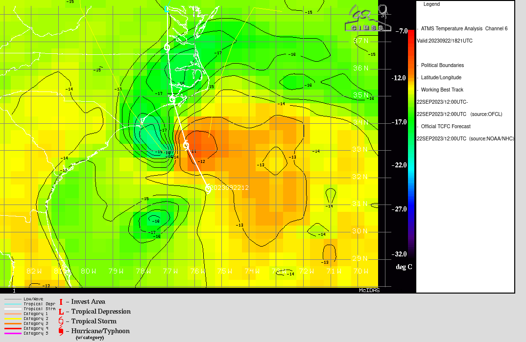
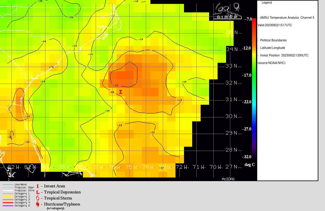
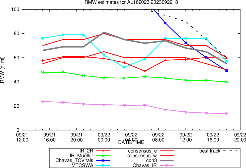
Looks to be more organized now: RMW estimates < 60:
@parhizj If it's a Trop Storm at landfall, this will resolve YES. I might wait a few days if there is a lot of uncertainty (also to see how the other bigger markets resolve), but not until the NHC storm report is released.
@sarius hedging in case this makes a run at Cat I... really quite unlikely but possible.
@sarius Surely a hurricane is a tropical storm just more powerful so gets an enhanced name but still a type of tropical storm. ?
@sarius https://tropic.ssec.wisc.edu/real-time/ai-ri/
1% … for RI 20 to make it a cat 1….
@ChristopherRandles the NHC says Tropical Storm = tropical cyclone in which the maximum sustained surface wind speed (using the U.S. 1-minute average) ranges from 34 kt to 63 kt. Hurricane = tropical cyclone in which the maximum sustained surface wind is 64 kt or more.
@parhizj yeah ik but I don't wanna end up losing 500+ mana on the other hurricane markets while I am not watching. And this hedge means I can buy them down even more in the meantime 😭
@sarius I used my NHC errors model and it says the base rate (1989-2022) for an OFCL intensity error of -10 kt 12 H in advance (given that RI is not forecast) is ~37 %. This is likely an overestimate though as skill has increased every decade since and the RI probabilities above are tiny (if they were higher I might hedge also).