Extended forecast question. 2 week bins.
Resolves to AST timezone (UTC - 4 hours) per NHC advisories.
The last answer is phrased so this question will definitively resolve by December 1, 2024.
Clarification: This will count even if it is only a Subtropical Storm as the spirit of the question is whether we will get a named storm.
🏅 Top traders
| # | Trader | Total profit |
|---|---|---|
| 1 | Ṁ267 | |
| 2 | Ṁ87 | |
| 3 | Ṁ54 | |
| 4 | Ṁ23 | |
| 5 | Ṁ16 |
DISCUSSION AND OUTLOOK
----------------------
Recent satellite-derived wind data indicate that the disturbance
over the northwestern Caribbean Sea has become a tropical storm.
At 100 AM CDT (0600 UTC), the center of Tropical Storm Nadine was
centered near latitude 17.3 North, longitude 86.4 West.  Nadine is
moving toward the west near 8 mph (13 km/h), and this general motion
should continue through tonight.  On the forecast track, Nadine is
expected to move inland along the coast of Belize later today.
https://www.nhc.noaa.gov/text/refresh/MIATCPAT5+shtml/190537.shtml
TS Nadine forms on Oct. 19.
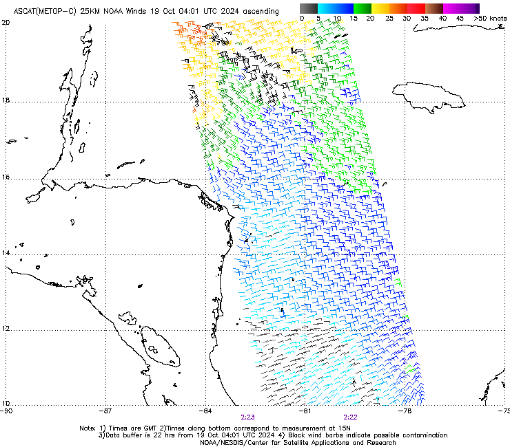
I assume they meant objective ADT? I didn’t see any 34kt barbs in the ASCAT passes.
2024OCT19 042020  2.5 1003.8  35.0  2.5 2.8 3.6  0.7T/6hr  OFF  OFF  OFF  OFF -44.48 -60.15  CRVBND   N/A   -1.1   17.59   86.31  FCST    GOES16 24.2
2024OCT19 045020  2.6 1002.6  37.0  2.6 2.8 2.8  NO LIMIT  OFF  OFF  OFF  OFF -36.15 -61.65  UNIFRM   N/A   -1.1   17.59   86.39  FCST    GOES16 24.3
2024OCT19 052020 2.7 1001.4 39.0 2.7 2.8 3.1 0.7T/6hr OFF OFF OFF OFF -44.94 -63.69 UNIFRM N/A -1.1 17.59 86.47 FCST GOES16 24.3 @SaviorofPlant Considering we had Oscar the same morning, no you didn't -- you got it exactly correct.
If you're referring to the ASCAT pass, see my discord posts as to why I was confused about the ASCAT reference.
WTNT45 KNHC 190239
TCDAT5

Potential Tropical Cyclone Fifteen Discussion Number   2
NWS National Hurricane Center Miami FL       AL152024
1000 PM CDT Fri Oct 18 2024

The satellite presentation of the disturbance has improved this
evening. Curved bands of deep convection have developed closer to
the estimated center position, although it is unclear from recent
passive microwave imagery whether a well-defined surface center
exists yet. The strongest winds are occurring within the convective
bands to the north of the center, where NOAA buoy 42056 has reported
sustained winds of 25-30 kt and gusts to tropical storm force. Based
on these observations and available satellite data, the system will
remain a 30-kt potential tropical cyclone for this advisory. Data
from an ASCAT-C overpass will arrive within the next couple of
hours, which should provide some clarity about the current intensity
of the system and whether it has a well-defined center.

The disturbance appears to be moving westward at about 7 kt to the
south of a high pressure ridge over the eastern United States. The
latest track guidance agrees that the system should continue on a
westward heading through Saturday night and cross the coast of
Belize between 12-24 h from now. The latest NHC track forecast is
very similar to the previous prediction and remains close to the
multi-model consensus aids.

Despite limited time remaining over water, warm SSTs and relatively
low shear in a moist environment should allow the system to
consolidate and strengthen into a tropical storm before it moves
ashore. The strongest winds are forecast to occur within the
northern semicircle, and a Tropical Storm Watch remains in effect
from Belize City northward to Tulum, Mexico. Weakening is expected
once the system moves inland, and it is forecast to dissipate over
southern Mexico by early Sunday.

Key Messages:

1. Potential Tropical Cyclone Fifteen is expected to bring impacts
from heavy rain, coastal flooding, and high surf to portions of
Belize and the Yucatan Peninsula of Mexico this weekend. Localized
areas of flash flooding are possible as the system moves westward
through southern Mexico, northern Guatemala, and northern Belize.

2. Tropical storm conditions are possible along portions of the
coasts of Belize and the Yucatan Peninsula of Mexico within the
Tropical Storm Watch area by early Saturday.


FORECAST POSITIONS AND MAX WINDS

INIT  19/0300Z 17.6N  86.1W   30 KT  35 MPH...POTENTIAL TROP CYCLONE
 12H  19/1200Z 17.5N  87.5W   35 KT  40 MPH...TROPICAL CYCLONE
 24H  20/0000Z 17.3N  90.0W   30 KT  35 MPH...INLAND
 36H  20/1200Z...DISSIPATED

$$
Forecaster Reinhart
From forecast advisory they are predicting a TS by 12Z. This leaves less than 12 hours before landfall for it to become a TS (as indicated by the two advisories).
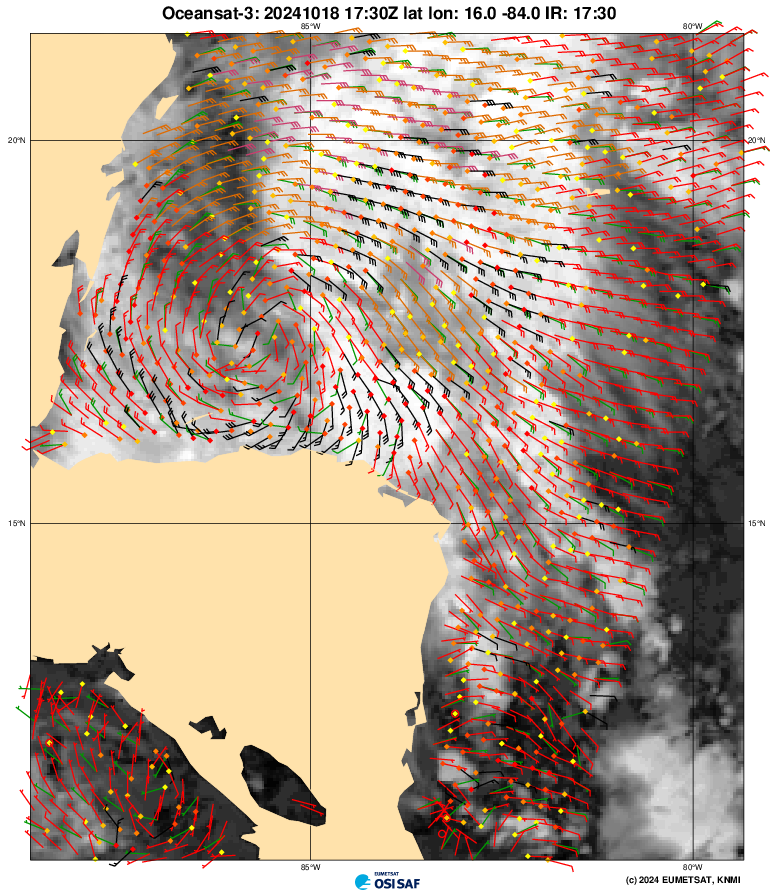
Said ASCAT-C pass in discussion should be available by ~12:30 AM EDT as it usually takes 1-2 hours, but its likely to be a slim partial (especially as the center from the previous ASCAT pass from OCEANSAT3 suggests GFSO/18Z is not far off the mark:
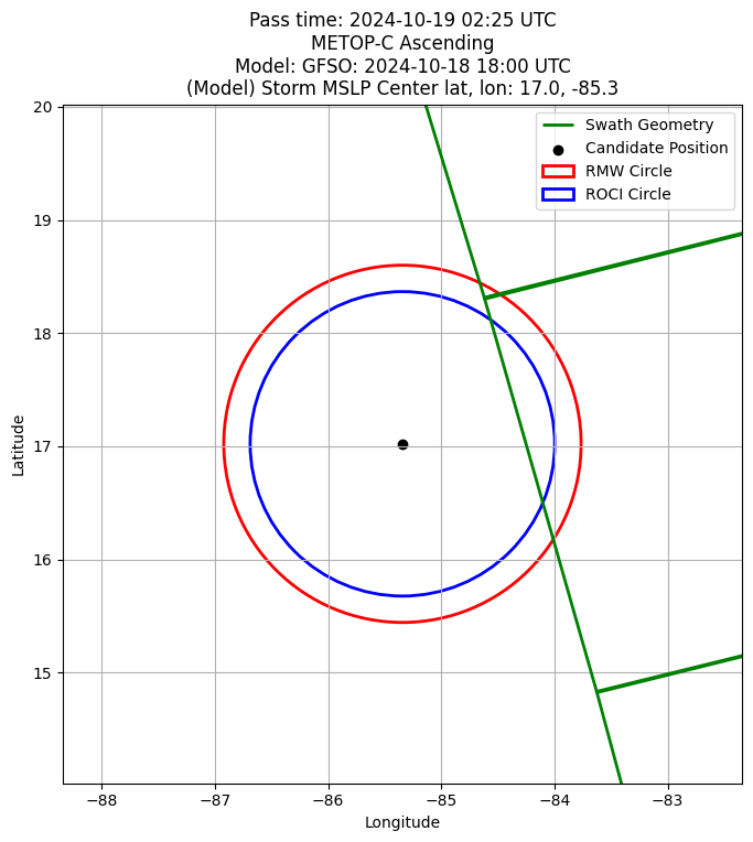
However a ASCAT-B pass should be available shortly after (by ~1 AM EDT).
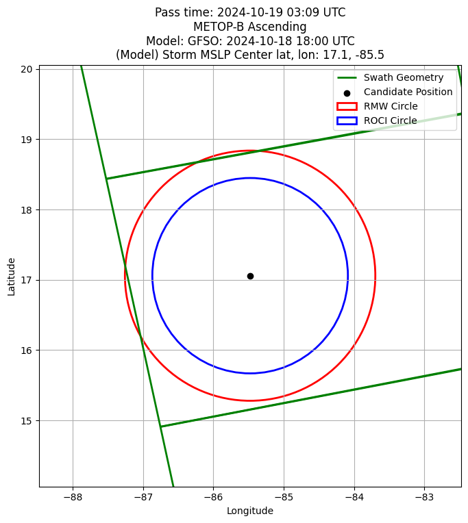
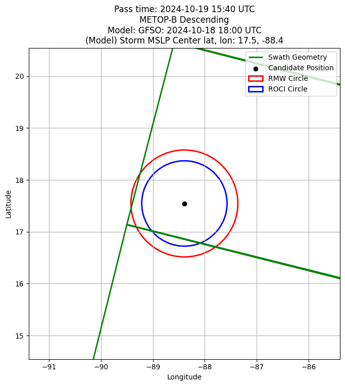
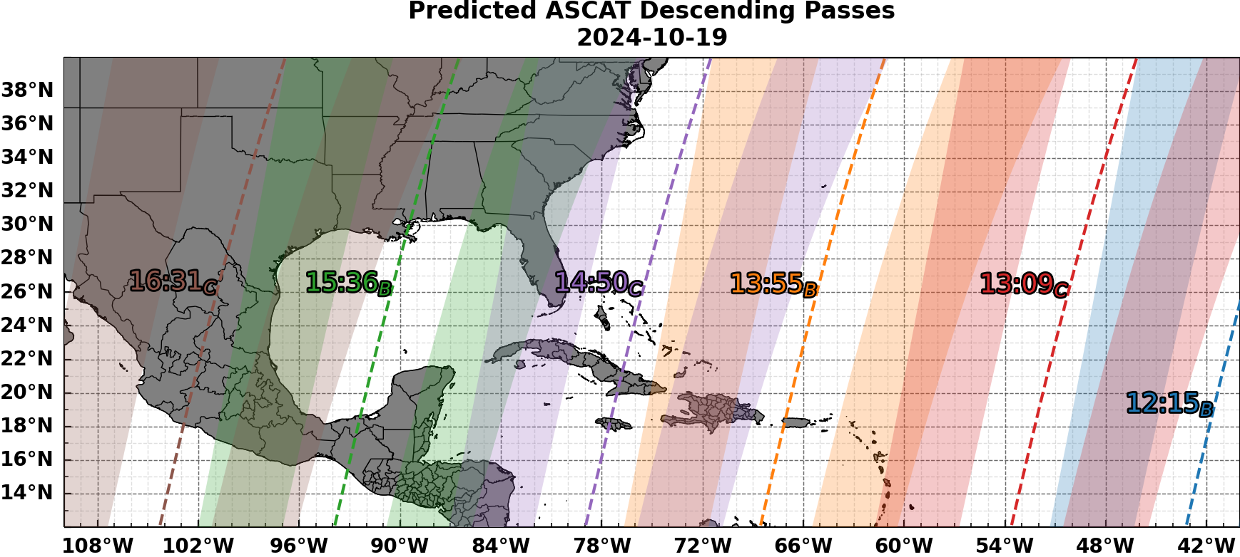
As mentioned before here is the ASCAT pass predicted for tomorrow..
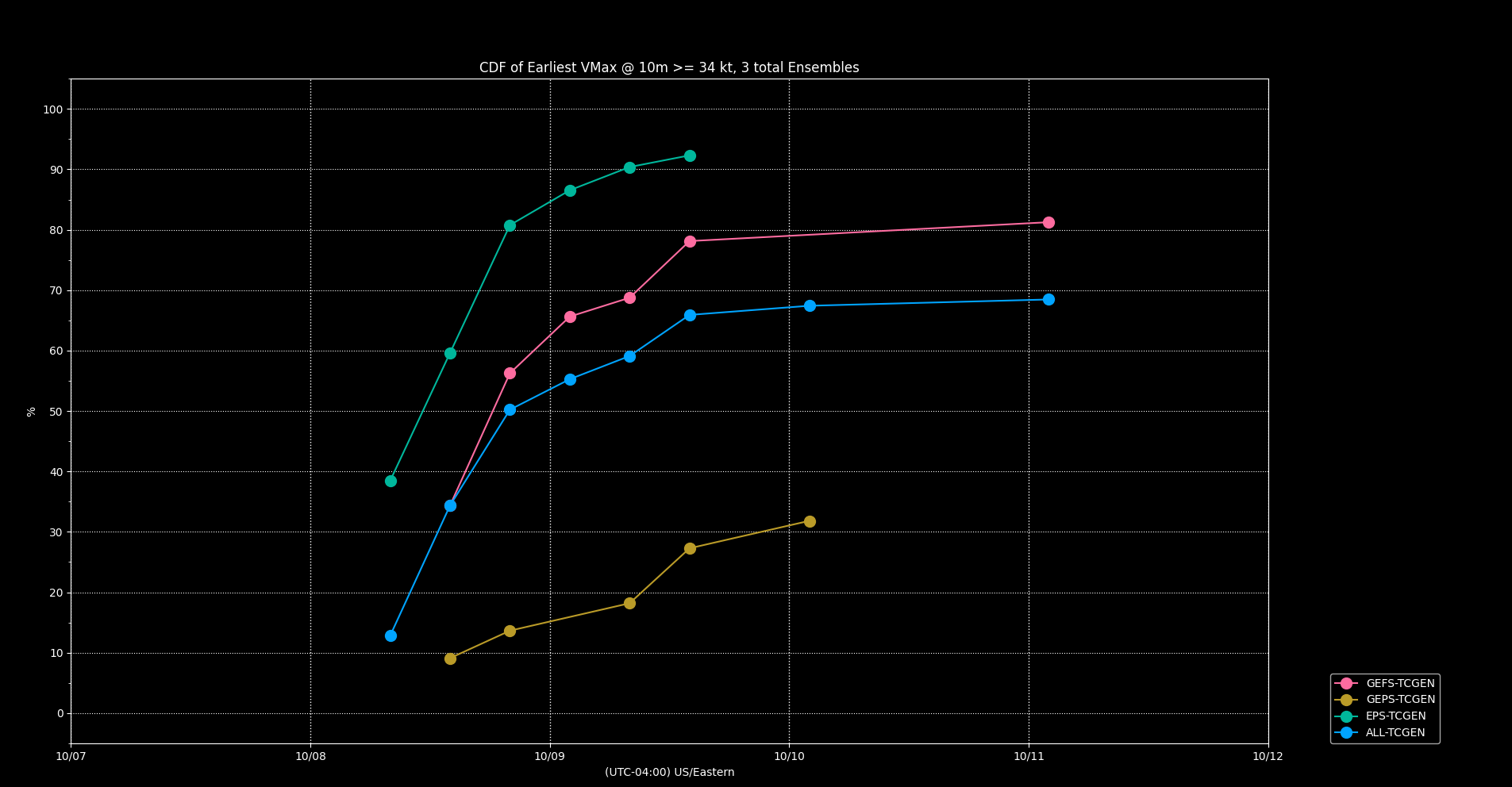
Regarding the NHC landfall timing.. the first advisory put the land fall slightly after 18Z, however the ensembles from the genesis trackers suggest a slightly earlier landfall time. Using the last couple scatterometer passes (HY2D and OCEANSAT3) I estimate the surface center, speed, and use the ensembles to estimate landfall time:
Using ascat pass center estimate for: ~ 17.3, -84.5 @ 16:46Z
And ascat pass center estimate for: ~ 17.4, -85.8 @ 18:08Z
This suggests a speed of about 6 knots (tcvitals is at ~7 knots); (heading of ~278 degrees)
Landfall estimates:
Using simple constant speed estimate from last ascat pass estimated center and distance to coast (135-140 n.miles): ~17Z
Pruning ensemble members by 0.75 deg. tolerance matching last two ascat passes yields 4 tracks: taking mean of (4 total) tracks: ~14Z
Taking all ensembles members mean track (18Z,12Z,12Z GEFS,GEPS,EPS ensembles) yields a landfall of 16Z.
The average of these suggest a landfall of ~ 16Z (at least a couple hours faster than the OFCL track, which considers the axis of the storm...).
Regarding latest objective estimates from last couple hours:
OSPO ADT's last couple of raw-T values are at TS strength:
2024OCT19 015020  2.1 1005.7  31.0  2.1 2.3 2.6  0.2T/hour OFF  OFF  OFF  OFF  -5.96 -52.74  CRVBND   N/A    N/A   17.51   85.63  FCST    GOES16 23.7
2024OCT19 022020  2.2 1005.3  32.0  2.2 2.4 2.8  0.2T/hour OFF  OFF  OFF  OFF   4.95 -55.28  CRVBND   N/A    N/A   17.51   85.69  FCST    GOES16 23.8
D-PRINT is also above 34 kt now:
AL, 15, 202410190100,  30, DPNT,         IP,  , 1760N,  8560W,      , 2,  37, 1,     , 1, MEAS,    ,     ,     ,     ,     ,     ,  ,  ,  ,  ,  ,    ,    , W,  CIMS,    ,  ,    ,       ,   ,     ,     ,     ,    ,       ,    ,     ,     ,     ,     ,     ,     ,     ,     ,     ,  ,  ,  ,  ,  ,  ,  ,  ,  , CIMSS D-PRINT
AL, 15, 202410190200,  30, DPNT,         IP,  , 1760N,  8560W,      , 2,  38, 1,     , 1, MEAS,    ,     ,     ,     ,     ,     ,  ,  ,  ,  ,  ,    ,    , W,  CIMS,    ,  ,    ,       ,   ,     ,     ,     ,    ,       ,    ,     ,     ,     ,     ,     ,     ,     ,     ,     ,  ,  ,  ,  ,  ,  ,  ,  ,  , CIMSS D-PRINT
OSPO MTCSWA still above 34 kt:
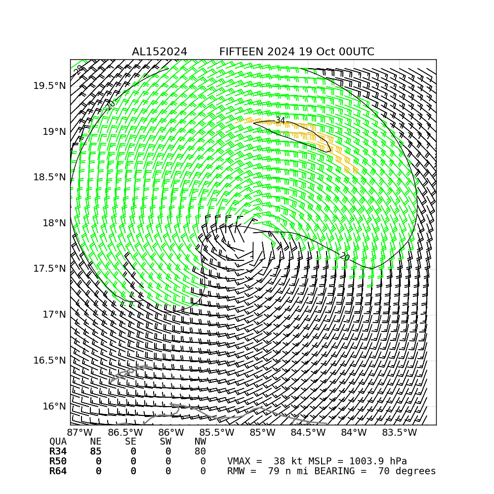
There was a pair of subjective dvorak estimates earlier (from 00Z) putting it's current intensity below these objective estimates: CI between 1.0-2.0 (SAB, TAFB)
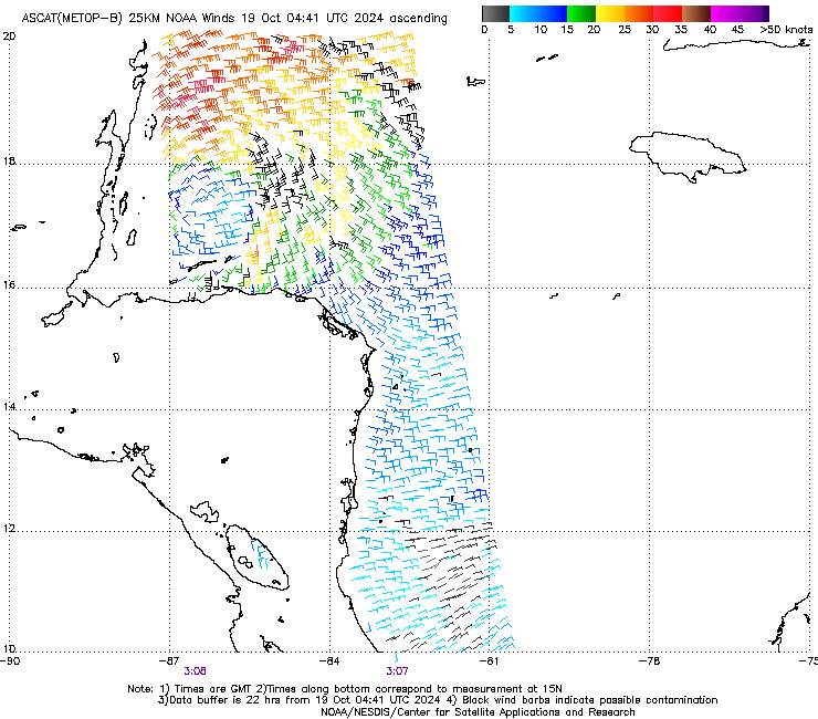
and now METOP-B pass just came out..
Not a great surface center...
Looks like a solid 30kt...
Should be an ASCAT pass tomorrow hours before the 5 pm advisory (but probably should expect a special advisory on this if they do decide to upgrade to a TS).
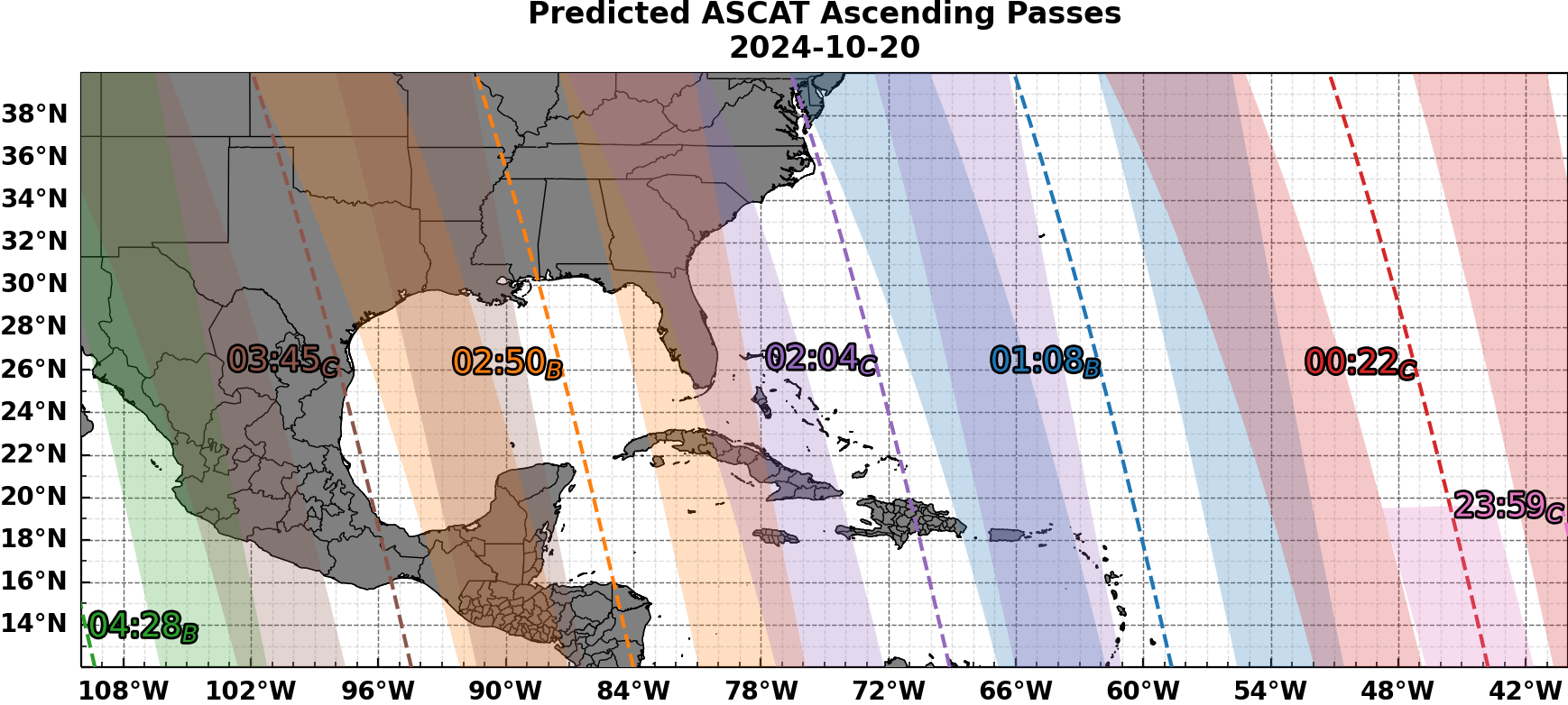
And the next partial becoming available on the 20th…
Based on the official mean track and current RMW (222 km) from tcvitals looks like it’s likely the 34 kt wind speeds will be far from the only nearby buoy https://www.ndbc.noaa.gov/station_page.php?station=42056
There is a single recon flight scheduled for tomorrow that roughly covers when it is forecast to become a TS:
NOUS42 KNHC 181513
REPRPD
WEATHER RECONNAISSANCE FLIGHTS
CARCAH, NATIONAL HURRICANE CENTER, MIAMI, FL.
1115 AM EDT FRI 18 OCTOBER 2024
SUBJECT: TROPICAL CYCLONE PLAN OF THE DAY (TCPOD)
         VALID 19/1100Z TO 20/1100Z OCTOBER 2024
         TCPOD NUMBER.....24-140

I.  ATLANTIC REQUIREMENTS
    1. SUSPECT AREA (NORTHWEST CARIBBEAN - AL95)
       FLIGHT ONE - TEAL 71
       A. 19/1500Z
       B. AFXXX 01IIA INVEST
       C. 19/1200Z
       D. 17.5N 87.5W
       E. 19/1430Z TO 19/1930Z
       F. SFC TO 10,000 FT
       G. FIX
       H. NO WRA ACTIVATION

    2. OUTLOOK FOR SUCCEEDING DAY.....NEGATIVE.
Current raw data T from ADT is vacillating between a TD and a TS:
https://www.ospo.noaa.gov/tropical-data/2024/adt/text/15L-list.txt
OSPO MTCSWA:
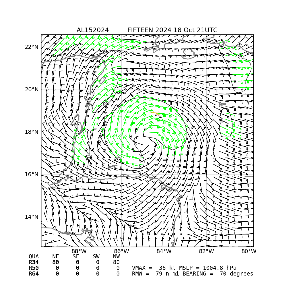
Potential TC 15 for the NW Caribbean (given 70% at the TWO, 3 hours ago)
https://www.nhc.noaa.gov/text/refresh/MIATCDAT5+shtml/182037.shtml?
Potential Tropical Cyclone Fifteen Discussion Number   1
NWS National Hurricane Center Miami FL       AL152024
400 PM CDT Fri Oct 18 2024
...
Conditions are generally favorable for modest intensification, with
light vertical wind shear and warm sea-surface temperatures.
However, the disturbance has less than one day before it moves
inland. Some strengthening is possible before landfall, and the
official forecast indicates that the disturbance will reach low-end
tropical storm status prior to landfall and then weaken before
dissipating on Sunday.
@parhizj That 70% is for formation right? So it might be
50% chance T Storm,
20% unnamed depression,
30% no formation
or even
40% chance T Storm,
30% unnamed depression,
30% no formation
@ChristopherRandles It can't be <50% for a T Storm as they are explicitly forecasting a tropical storm in the discussion...
For reference to:
1. Southwestern Atlantic:
Last-light visible satellite imagery indicates that the area of low
pressure located northeast of the northwestern Bahamas has become
better defined on the northern edge of a region of showers and
thunderstorms. The system is already producing gale-force winds, but
environmental conditions appear only marginally favorable for
additional tropical or subtropical development over the next day or
so while the low moves northeastward to east-northeastward at around
15 mph. Upper-level winds are likely to increase further by
Wednesday night, which should end any chances for further
development. Additional information on this system, including gale
warnings, can be found in High Seas Forecasts issued by the National
Weather Service.
* Formation chance through 48 hours...low...30 percent.
* Formation chance through 7 days...low...30 percent.
By CPS parameters none of the GEFS/GEPS members show it becoming a TS. Otherwise it would show up a a strong TC signal all other things given (EPS I dont have CPS parameter data so I can't filter it out):
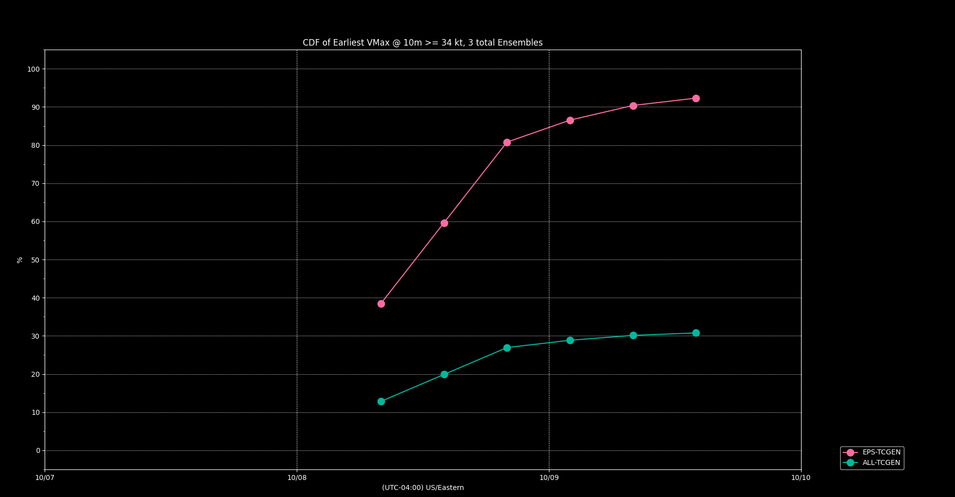
Not filtering by CPS:
