When will Tropical Storm Boris form? (EP)
0
Ṁ1kDec 31
13%
June 7
13%
June 8
13%
June 9
13%
June 10
13%
June 11
13%
June 12
13%
June 13
13%
Resolution source: https://www.nhc.noaa.gov/archive/2026/
Subtropical storm also counts.
Resolves to the UTC time written in the advisory text.
N/A if does not form in 2026.
Will add days to the answers as needed.
This question is managed and resolved by Manifold.
Market context
Get  1,000 to start trading!
1,000Sort by:
Special:
The National Hurricane Center will initiate advisories on Tropical Depression Two-E (formerly EP91), located south of southern Mexico at 9:00 AM CST (1500 UTC).
~
EP91 was given 90%/90% of forming a TC for the 12Z TWO. EP92 was given 70%/70%.
~
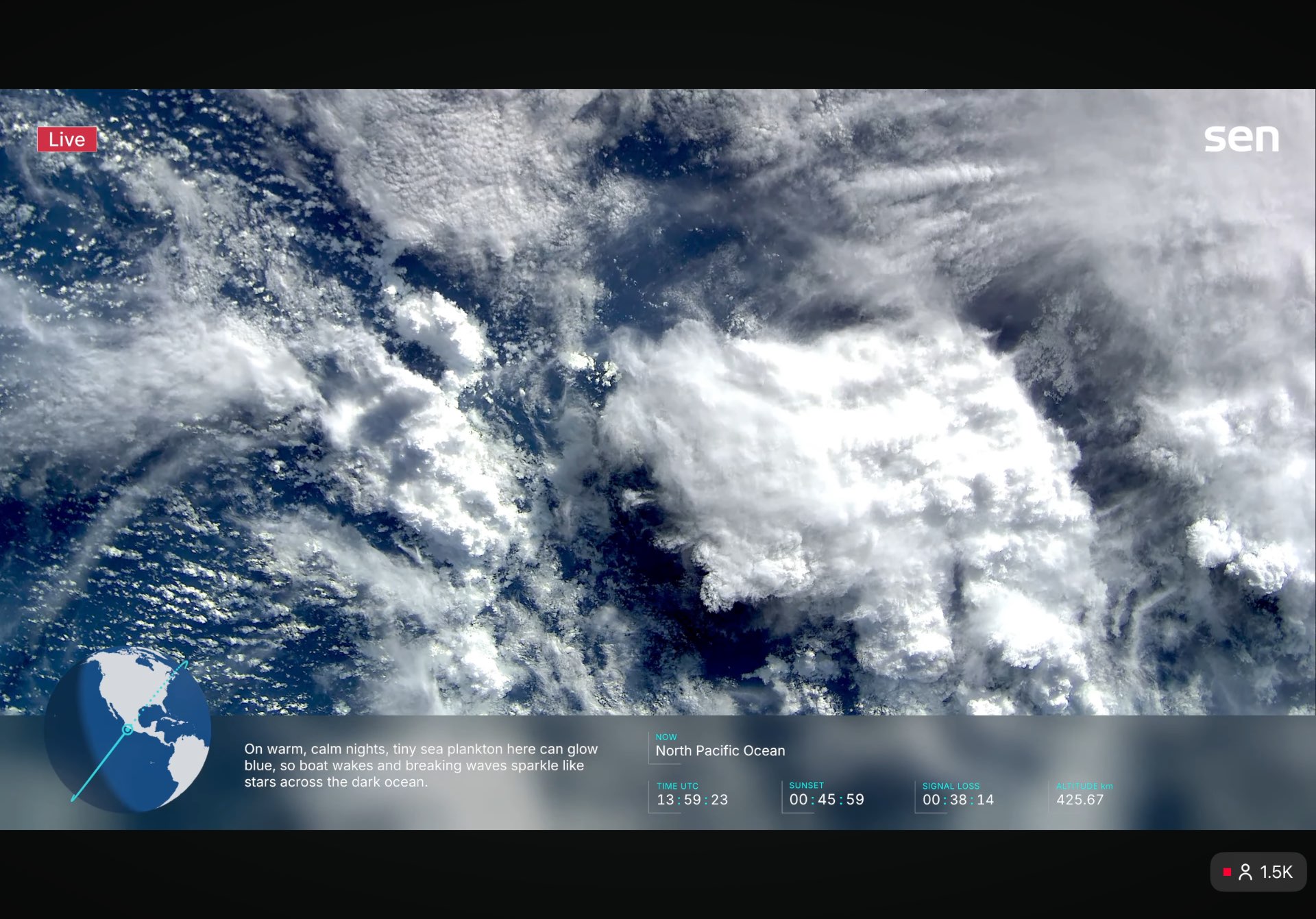
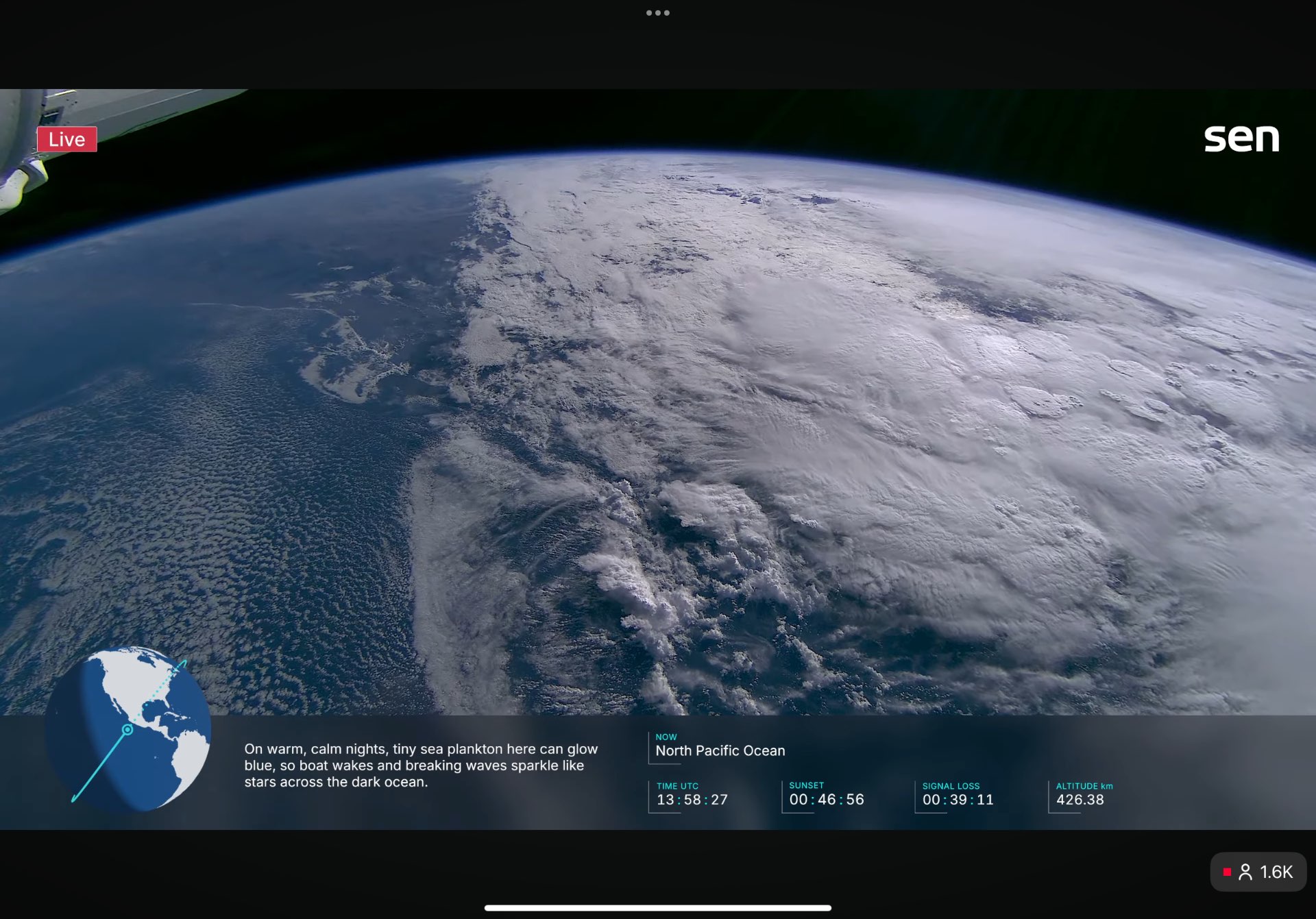
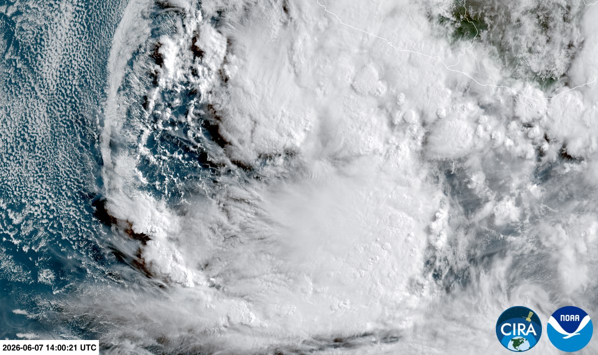
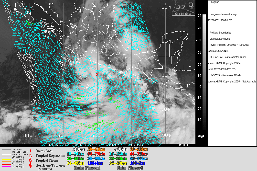
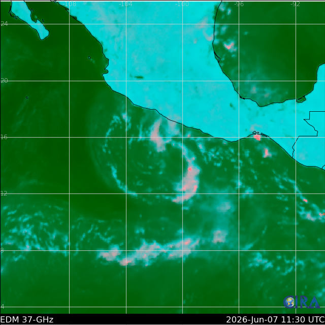
(Eyecandy) Overpass of NW circulation and broader view of EP91 from ISS at 14Z (SEN), and Geocolor (CIRA) from GOES at same time. Oceansat3 scatterometer data from earlier this morning via CIMSS.
Synthetic 37GHz (CIRA)
EP91 forecast to become a TS before landfall
WTPZ42 KNHC 071457
TCDEP2

Tropical Depression Two-E Discussion Number   1
NWS National Hurricane Center Miami FL       EP022026
900 AM CST Sun Jun 07 2026

The area of low pressure to the south of Acapulco, Mexico, has been
gradually becoming better organized with some bands of deep
convection forming. An OSCAT overpass from several hours ago
revealed a fairly well-defined closed circulation, and the Dvorak
satellite classification is T1.5.  Advisories are being initiated
on the second tropical cyclone of the eastern North Pacific season.
The initial intensity estimate is 30 kt.

The depression has been moving slowly northeastward and the initial
motion is a somewhat uncertain 045/5 kt.  The system is on the west
side of a subtropical ridge and is also embedded within a broad
low-level cyclonic gyre.  Within this steering environment, the
cyclone should turn northward and move to the coastline within the
next day or so.  The official forecast is a blend of the corrected
consensus, HCCA, guidance and the Google DeepMind ensemble mean
solution.

The system is over very warm waters with fairly weak vertical wind
shear, although the upper-level outflow is slightly restricted to
the west.  Therefore some strengthening is likely, however the
broad inner core of the cyclone makes rapid intensification
unlikely before landfall.  The official forecast is close to the
model consensus.  Since the forecast calls for the depression to
become a tropical storm in the next 12 hours, a tropical storm
warning has been issued for a portion of the southern coast of
Mexico.

Key Messages:

1. Heavy rainfall associated with Tropical Depression Two-E will
impact portions of southern Mexico. This rainfall is likely to
produce life-threatening flooding and mudslides, especially in areas
of steep terrain.

2. Tropical storm conditions are expected to reach the coast of
southern Mexico within the Tropical Storm Warning area tonight and
continue into Monday.


FORECAST POSITIONS AND MAX WINDS

INIT  07/1500Z 15.5N  99.9W   30 KT  35 MPH
 12H  08/0000Z 15.8N  99.4W   35 KT  40 MPH
 24H  08/1200Z 16.6N  99.1W   40 KT  45 MPH...INLAND
 36H  09/0000Z 17.7N  99.8W   30 KT  35 MPH...INLAND
 48H  09/1200Z...DISSIPATED

$$
Forecaster Pasch