
Recently, Typhoon Bebinca hit Shanghai with 120km/h (75mph) winds. Was very annoying.
There's a tropical storm Pulasan that recently left Guam as of this question creation that some people in Shanghai rumour would hit again, somewhere around next weekend. Will this happen?
Question resolves YES if Shanghai is hit by 40mph (around 65km/h) winds at any time in September local time as shown in https://www.timeanddate.com/weather/china/shanghai/historic after market creation time. I will check all dates from September 18th in the bottom table and see whether there is any 30-minute period with average wind speeds 40mph or above.
 1,000
1,000🏅 Top traders
| # | Trader | Total profit |
|---|---|---|
| 1 | Ṁ419 | |
| 2 | Ṁ216 | |
| 3 | Ṁ67 | |
| 4 | Ṁ62 | |
| 5 | Ṁ52 |
Krathon's current forecast TS wind field looks to be about 500 n.miles away by the end of September.
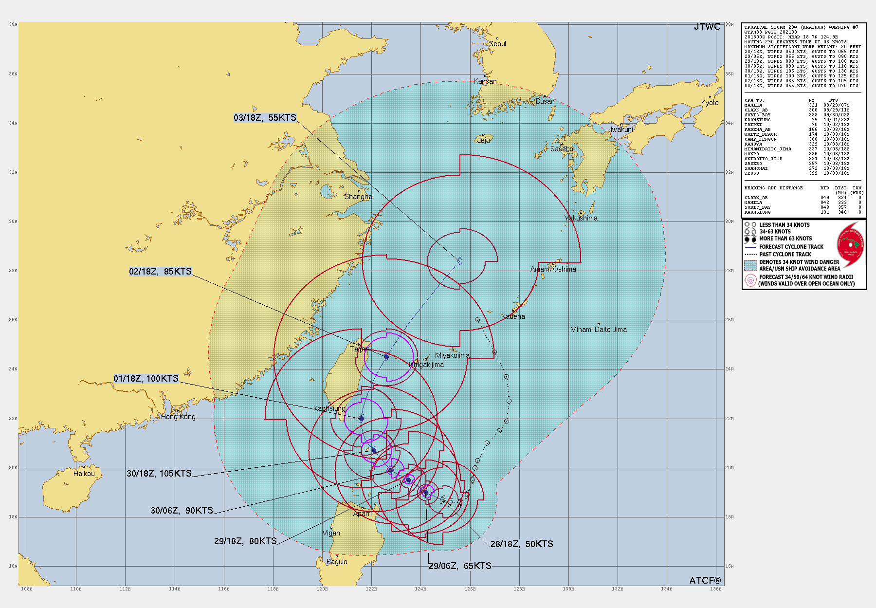
The blob of uncertainty at first glancce looks a bit scary... but my mean track analysis for a super-ensemble through 12Z shows it may not be as bad as it appears ( mean track error is ~40 n .miles (times are UTC):
The farthest (fastest) outlier north for Oct. 1 is identifiable just from the tracks display (below) and is ~380 n.miles away from Shanghai; the JTWC wind field for late Oct. 1 is < 120 n. miles.
Given there are no other storms with genesis tracking through Shanghai in the next couple days, I'm putting the probability at less than 2% now (without assessing the distribution of the wind field sizes in the ensembles and relying on JTWC's estimates).

Ok... JTWC/18Z does show Shanghai within the 34kt warning area before landfall...
JTWC has it landfalling south of Shanghai.
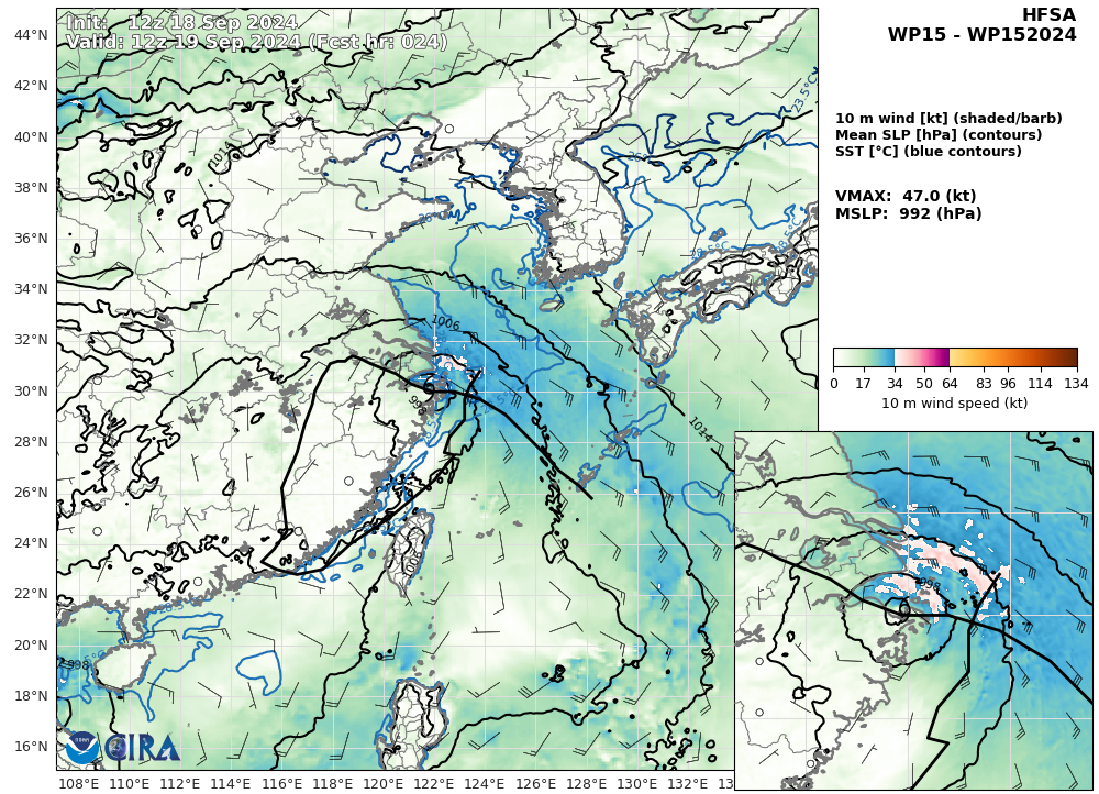
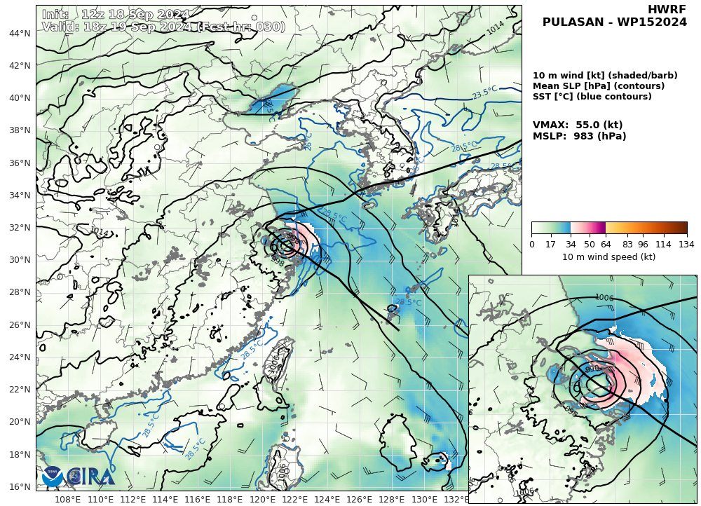
A couple regional models I looked do show TS winds in the NE quadrant as it makes landfall but largely not seemingly reaching that intensity over land (will be some undersampling though as these are 6 hours apart).
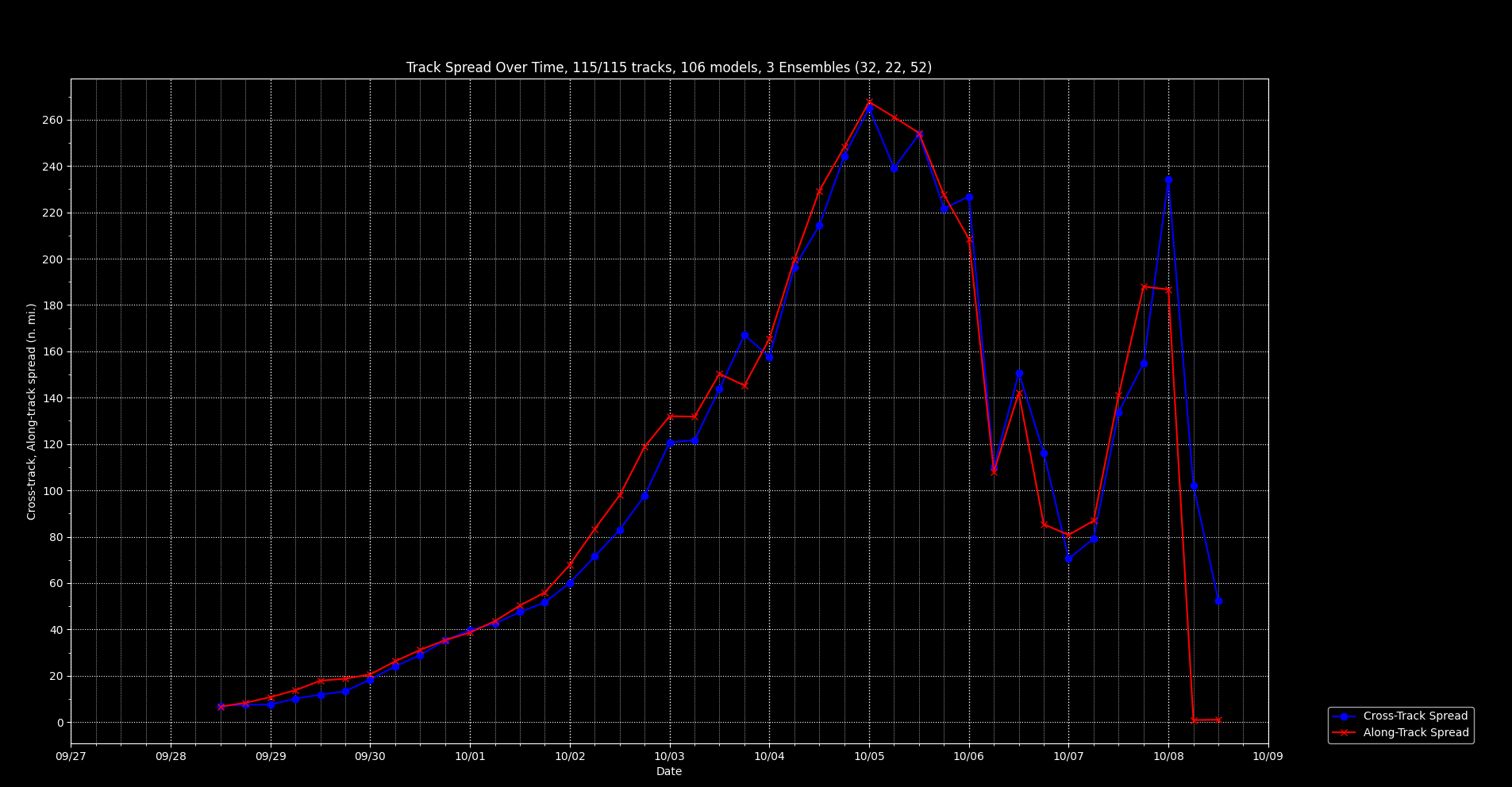
Most of the global ensembles from 12Z showed this track as well. Depending on how big of a box you draw you get different probabilities for this question using the global model data and wind radii. If we only consider a point estimate at ZSSS (the airport is a few miles inland) the probabilities narrow. As a point estimate you might get as small as 1-2% by looking at the superensemble (12-18Z) wind radii for that point (global models); however obviously if you include the entire Shanghai area (pink outline below) the probability would naturally of course increase (36/106 members or about 30%) as the area is larger and it includes the shore. Regardless, both the point probability and the sensitivity to undersampling are factors I unfortunately lack the judgement to determine, and that is without considering the model track and intensity uncertain on underlying that as well (which may very well swamp these considerations). (The calculations of the ensemble member wind radii (interpolated every hour) impacting the points,polygons and such are very experimental analysis that I wrote in the last day or so, so I don't have high confidence in such estimates myself...)
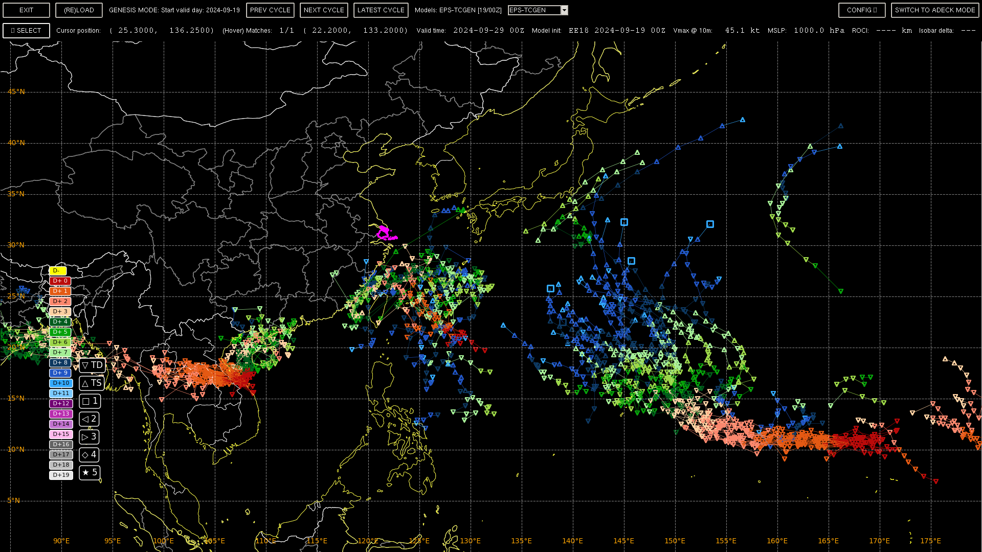
(unofficial) Spaghetti of superensemble for reference (12-18Z) (NCEI genesis tracker + ECM data (no FNMOC ensemble members as it appears to be broken)::

ECMWF EFI/CDF show the chances of such gusts at < 10%, though this data like the rest of the models is a bit stale by now...

I suspect this CDF might be less prone to the timewise undersampling you would expect from using global model data.
Given the location of the sampling source (and the wind recordings of the last storm just days ago) I am placing a small NO bet after considering all this...
Pulasan seems to have shifted slightly north from the model tracks I looked at yesterday and imacted southern Shanghai. Was downgraded to a TD by the JTWC before landfall. I am aware China's CMA had an earlier landfall and higher wind speeds.
Relevant to this market, current wind reports from ZSSS are about 7 m/s. JTWC discussion explains most of the wind is offshore to the north east (similar to the model forecast from yesterday). Given this I'm relying on the 00Z EFI/CDF from ECMWF (and Shanghai city weather forecasts) which put this lower than 20%.
As for the rest of September..
EPS covers most of the remaining time (but past 7 days genesis is not useful). At least JTWC currently has an invest (90W) giving it a low chance of development for the next 24 hours.
It's hard to decipher from the tracks what's going to happen .. Here is an EPS spaghetti of the basin (slightly modified with own tracker)
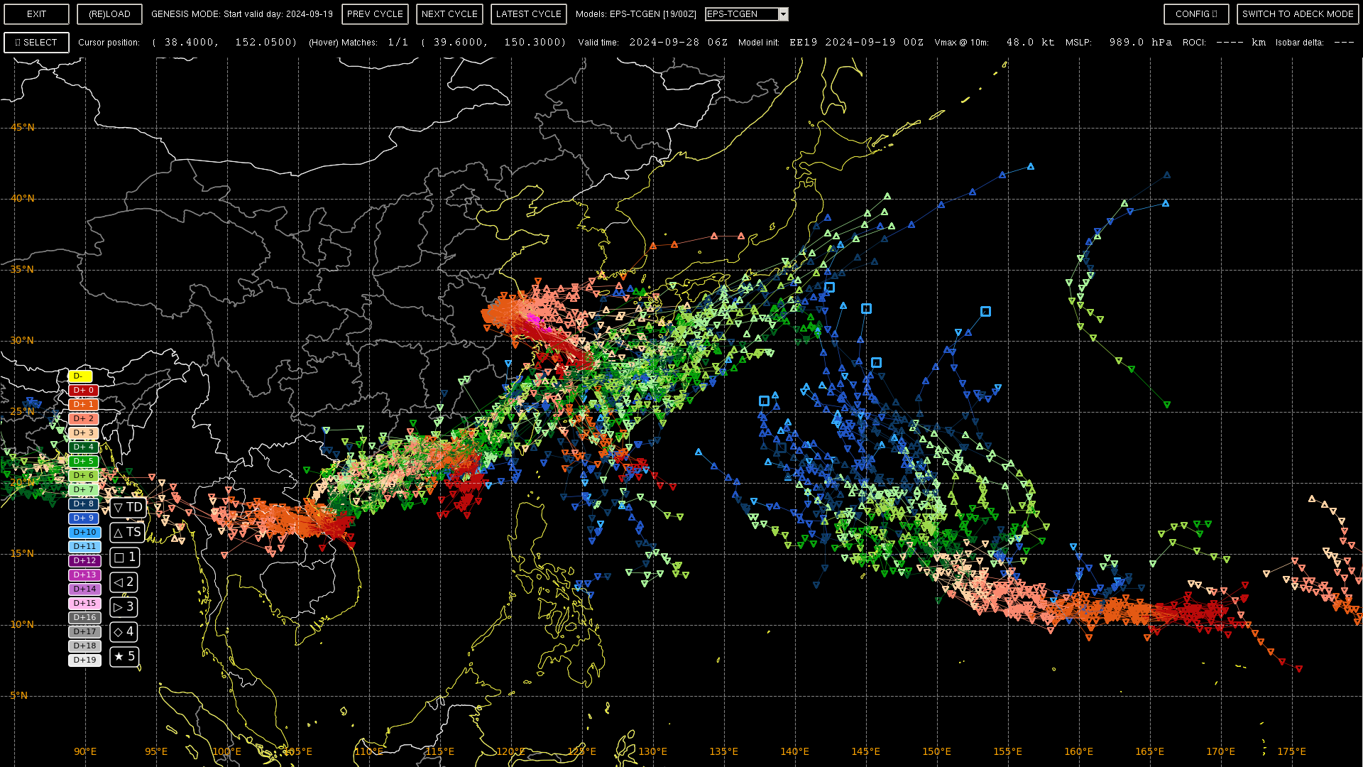
Hiding Pulasan, the tracks to the southwest, and the tracks south of Japan... 90W doesn't look too likely to develop but what there are a few members that do have its genesis track trend towards the NW.
For this market you would probably be better served relying on the climatological mean for the last ~5 days of September. Unfortunately, I have no idea what these chances are (my notebook only covers NA/EP basins), but they should become small given the number of days in the period.
Tokyo RSMC (18Z) has it on land finally.. but have it as a TS ...
.WTPQ31 RJTD 191800
RSMC TROPICAL CYCLONE PROGNOSTIC REASONING
REASONING NO.19 FOR TS 2414 PULASAN (2414)
1.GENERAL COMMENTS
TS PULASAN IS LOCATED ON LAND AT 31.1N, 120.9E. INFORMATION ON THE
CURRENT POSITION IS BASED ON ANIMATED MSI AND SURFACE
OBSERVATIONS. POSITIONAL ACCURACY IS FAIR. CENTRAL PRESSURE IS
998HPA AND MAXIMUM SUSTAINED WINDS ARE 35KNOTS. THE SYSTEM IS IN A
NEUTRAL ENVIRONMENT FOR DEVELOPMENT UNDER THE INFLUENCE OF HIGH
SSTS, WEAK VWS, LOW TCHP, DRY AIR AND LAND. THIS HAS CAUSED THE
SYSTEM TO MAINTAIN ITS INTENSITY OVER THE LAST SIX HOURS.
INFORMATION ON THE CURRENT INTENSITY IS BASED ON DVORAK INTENSITY
ANALYSES AND SURFACE OBSERVATIONS.
2.SYNOPTIC SITUATION
THE SYSTEM IS MOVING WEST-NORTHWESTWARD ALONG THE SOUTHWESTERN
PERIPHERY OF A MID-LEVEL SUB-TROPICAL HIGH. ANIMATED MSI SHOWS CB
CLUSTERS GATHERING AROUND THE CSC. WATER VAPOR IMAGERY SHOWS DRY
AIR IN THE DIRECTION OF THE MOVEMENT. GCOM-W/AMSR2 89 GHZ
MICROWAVE IMAGERY SHOWS THE SYSTEM HAS ACTIVE CONVECTIVE CLOUD
CLUSTERS AROUND THE CSC.
3.TRACK FORECAST
THE SYSTEM WILL GRADUALLY DECELERATE AND MOVE NORTH-NORTHWESTWARD
ALONG THE PERIPHERY OF A MID-LEVEL SUB-TROPICAL HIGH UNTIL FT12.
THE SYSTEM WILL THEN GRADUALLY TURN TO THE EAST-NORTHEAST UNTIL
FT24. THE SYSTEM WILL THEN GRADUALLY ACCELERATE AND MOVE
EAST-NORTHEASTWARD UNDER THE INFLUENCE OF MID-LATITUDE PREVAILING
WESTERLIES UNTIL FT48. THE TRACK FORECAST IS BASED ON GSM
PREDICTIONS, AND REFERENCE TO OTHER NWP MODELS. TRACK FORECAST
CONFIDENCE IS LOW DUE TO SIGNIFICANT DIFFERENCES AMONG NWP MODEL
OUTPUTS.
4.INTENSITY FORECAST
THE SYSTEM WILL MAINTAIN ITS INTENSITY UNTIL FT24 DUE TO THE
INFLUENCE OF INTERACTION WITH HIGH SSTS, LOW TCHP AND LAND. THE
SYSTEM WILL THEN DEVELOP UNTIL FT48 IN A STATE OF EXTRATROPICAL
TRANSITION. THE SYSTEM WILL TRANSFORM INTO AN EXTRATROPICAL
CYCLONE BY FT48. THE INTENSITY FORECAST IS BASED ON A CONSENSUS OF
GUIDANCE DATA INCLUDING GSM.
Changed resolution source:
Question resolves YES if Shanghai is hit by 40mph (around 65km/h, but 40mph takes precedence) at any time in September local time as shown in https://www.timeanddate.com/weather/china/shanghai/historic after market creation time. I will check all dates from September 18th in the bottom table and see whether there is any 30-minute period with average wind speeds above 40mph.
Thanks @parhizj!
Based on the header, the source (customweather.com is the aggregator for the site), for that particular link, the source of the data seems to simply be the TAF data for Shanghai Hongqiao International Airport (ICAO: ZSSS).
Peak wind for the other day, at 16/0309 UTC
202409160309 SPECI ZSSS 160309Z 17022G28MPS 2000 +SHRA BKN013 26/26 Q0986 NOSIG=22 m/s (43 kt, 49 mph, 79 km/h)
Edit: looks like the forecast (misread it as a report) was for the airport was for significantly higher gusts:
202409152125 TAF ZSSS 152125Z 1600/1706 09020G34MPS 2800 SHRA BR BKN008
                      TX30/1606Z TX32/1706Z TN26/1621Z
                      TEMPO 1600/1606 1200 +SHRA BR BKN006 SCT030CB
                       BECMG 1601/1603 12015G28MPS
                      BECMG 1607/1609 13008G18MPS 6000 NSW BKN015=
202409151515 TAF ZSSS 151515Z 1518/1624 03013G20MPS 3000 +SHRA BR BKN008
                      TX30/1606Z TN26/1521Z TN26/1621Z
                      BECMG 1521/1523 05018G28MPS 2500
                      TEMPO 1523/1603 09022G34MPS 1000 BKN006 SCT030CB
                       BECMG 1601/1603 12018G28MPS
BECMG 1607/1609 13009G18MPS 6000 NSW BKN015=Some edits:
Question resolves YES if Shanghai is hit by 65km/h or higher average wind speed (40mph) at any time (not day) in September local time as shown in https://zoom.earth/maps/wind-speed/ (added source) after market creation time.
@bohaska Edit: Disregard what I said about the synoptic hours for ICON... I don't know what Zoom.earth is doing exactly for historical data... I amconfused
For other bettors, I can't say anything at the moment about how zoom.earth interpolates the gridded data to calculate the wind speed (is it done on an area, or point wise?); this may be irrelevant for a storm with a large windfield, but might be more significant for a storm with a small wind field.
@bohaska Ok after some research I believe what is going on is zoom.earth is using the model forecast data for the wind fields in the past. This is not great in general and for this market....
This is somewhat obvious by 2 points: the credit at the bottom citing the source (pointing to it being forecast hours), and that it gives 1 hour updates for the wind field -- the real reanalysis for ICON only assimilates data at 3 hour intervals: https://www.dwd.de/DWD/forschung/nwv/fepub/icon_database_main.pdf ("From 2016-01-20 on the analysis system consists of the 3-hourly cycled Ensemble Variational Data assimilation system (En-Var) providing initial fields for the deterministic ICON forecasts at 13 km resolution, based on the 3-hour short range forecast (first guess) and the observations at the actual analysis time."). The forecast model does produce data at 1 hour intervals for the first 78 hours (edit), which is why I assume the site uses the model data (to give users a guess at what the wind speeds were...
Might help to clarify a few things: resolution source ? If it’s “average” wind speeds you need to define the time period.. (this will be tied to the resolution source). Depending on resolution source, some other details might be needed…
The 120 km/h you mentioned seems to have been an estimate of the storms max wind from the JTWC before landfall …
https://meteostat.net/en/station/58362?t=2024-09-16/2024-09-16
Shows 45 km/h winds… but I don’t know it’s source nor average period