Resolves UTC
 1,000
1,000🏅 Top traders
| # | Trader | Total profit |
|---|---|---|
| 1 | Ṁ420 | |
| 2 | Ṁ29 | |
| 3 | Ṁ24 | |
| 4 | Ṁ4 | |
| 5 | Ṁ3 |
They've made 92E a TD; bit surprised by this. Got plenty of spin in lower levels, and looks good with lots of convection but looks a bit disorganized still from mid shear; the determinsitic models from 00Z weren't all that bullish on it being so organized from what I saw earlier.
Tropical Depression Ten-E Discussion Number   1
NWS National Hurricane Center Miami FL       EP102025
200 PM MST Sun Aug 24 2025

Data from both the ASCAT-B and ASCAT-C scatterometers indicate that
the broad area of low pressure located well offshore of the
southwestern coast of Mexico now has a well-defined circulation.
The deep convection has been forming a rudimentary banding
structure over the western semicircle of the circulation.  Thus,
the system is being designated as Tropical Depression Ten-E at this
time.  The scatterometer observations indicate that the system is
just below tropical storm strength, and the intensity estimate is
in good agreement with a Dvorak estimate from TAFB.
NHC is forecasting a TS by tomorrow morning.
Google 12Z has 100% members reaching TS level by tomorrow night. EPS is at 70%. Rest of the ensembles are below those two in confidence of 34 kt winds.
Tropical Weather Outlook
NWS National Hurricane Center Miami FL
1100 AM PDT Sun Aug 24 2025

For the eastern and central North Pacific east of 180 longitude:

Southwest of Southwestern Mexico (EP92):
Satellite-derived wind data indicate that the low-level circulation
associated with a broad area of low pressure located about 500
mile south of the southern tip of the Baja California Peninsula is
becoming better defined, and tropical depression or tropical storm
advisories on this system will likely be initiated later today.  The
system is expected to move generally west-northwestward at 10 to 15
mph for the next couple of days, remaining well offshore of the
coast of Mexico.
* Formation chance through 48 hours...high...90 percent.
* Formation chance through 7 days...high...90 percent.

$$
Forecaster Pasch
I assume they mean for the 11PM advisory which would fall under the 25th UTC....
Its still got some ways to go ...
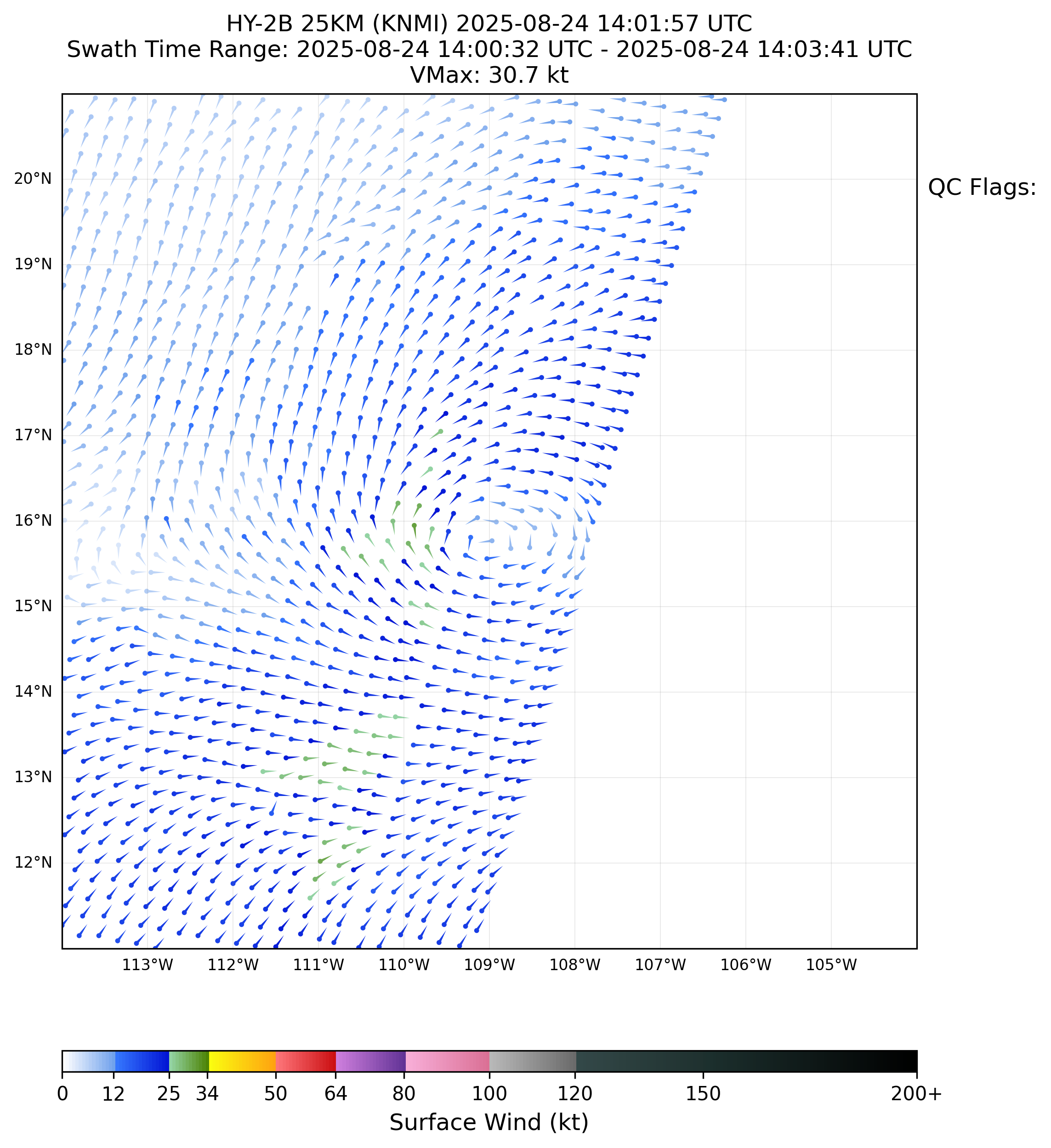
Edit: There was a rain-flagged pass from HY-2B (14Z) with 31 kt peak winds. If its strengthened since then on the surface ....
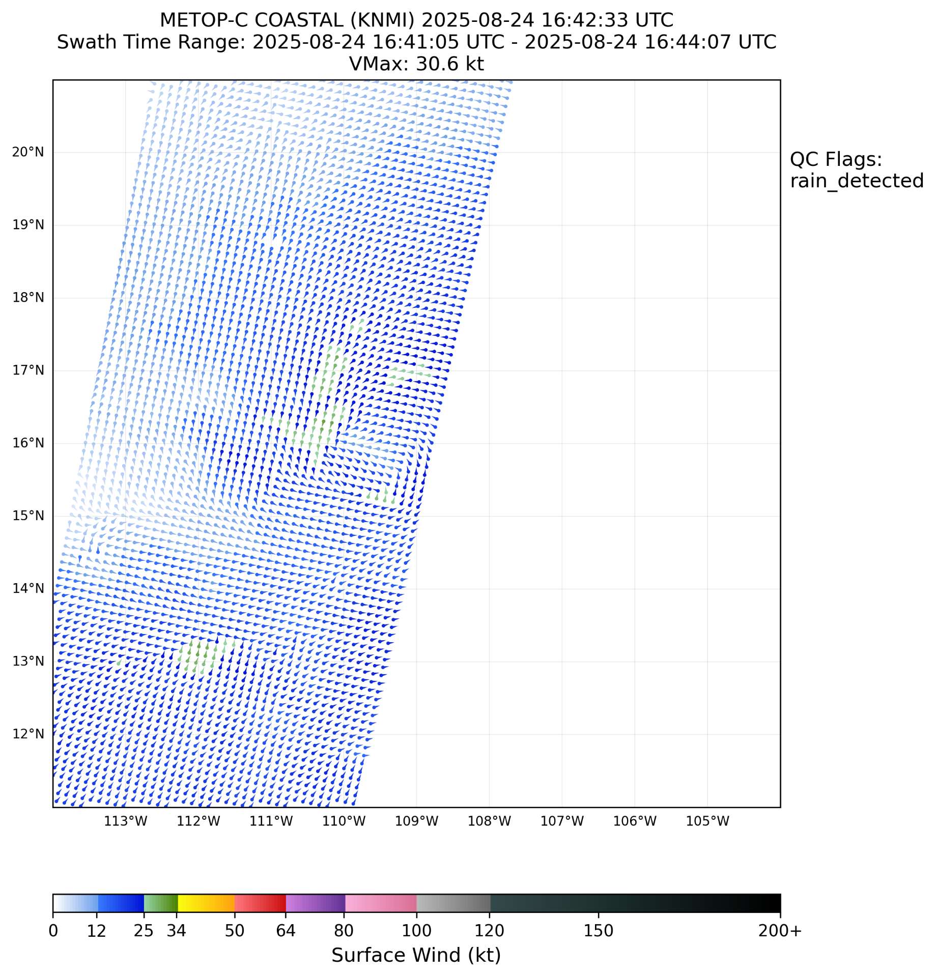
Metop-C that just came in also shows ~ 31 kt around a somewhat rough center.
Upcoming passes before 03Z (it looks like now only the Oceansat-3 will make it before the 03Z advisory):
Satellite: OCEANSAT-3
Pass: Descending
Time: 2025-08-24T19:43:00Z
Swath 3 of 5
Satellite: HAIYANG-2C
Pass: Ascending
Time: 2025-08-25T01:12:00Z
Swath 4 of 5
Satellite: HAIYANG-2B
Pass: Ascending
Time: 2025-08-25T01:31:00Z
Swath 5 of 5
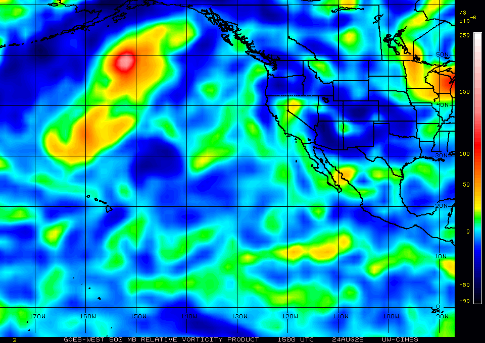
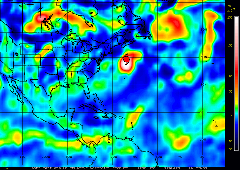
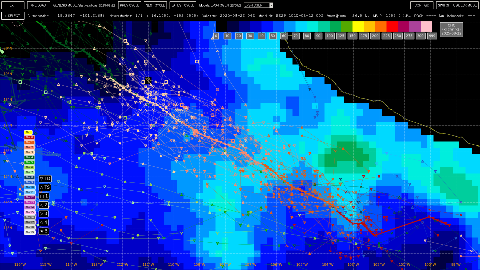
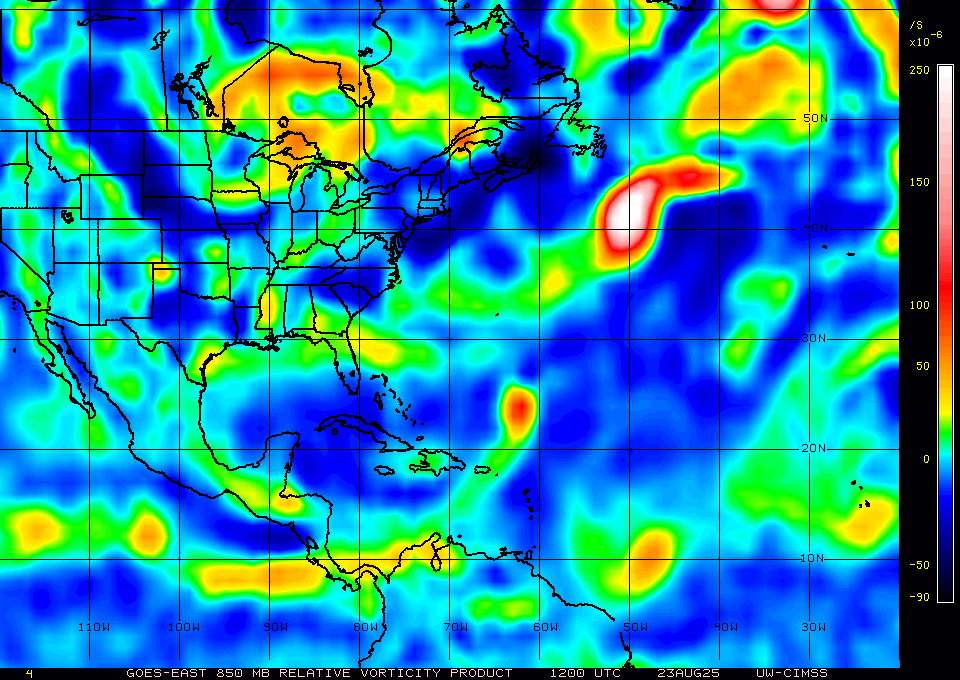
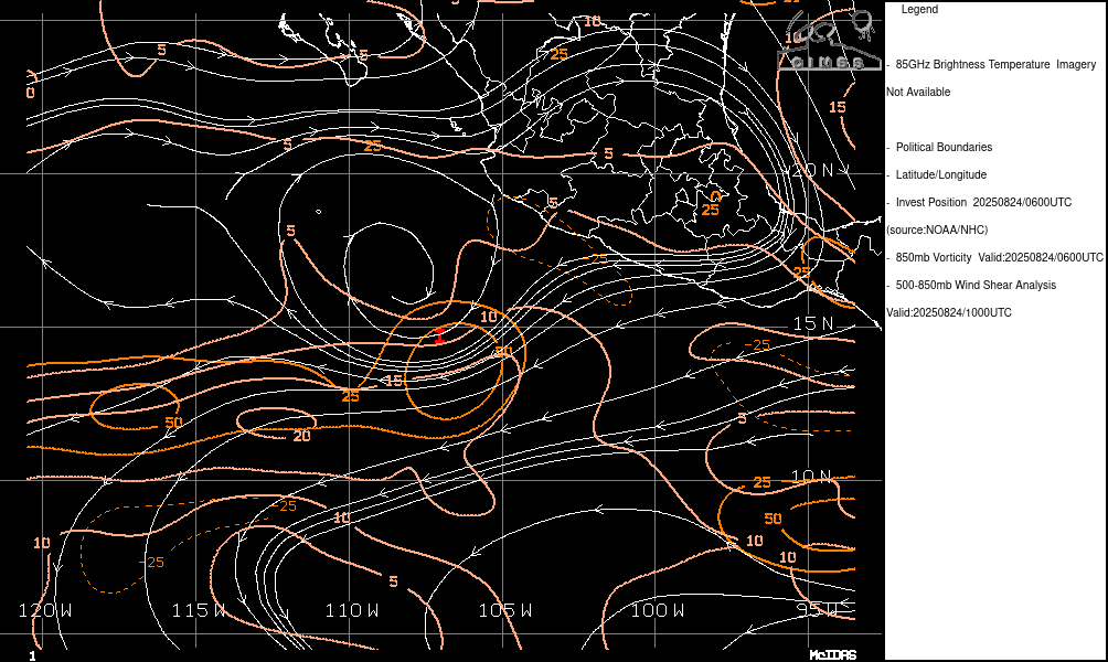
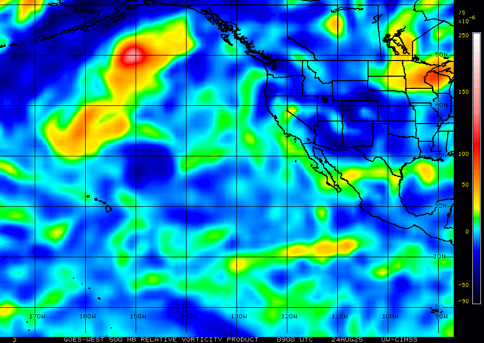
The ensembles seem to disagree on the timing for it to become a TS, and oddly EPS/00Z has the plurality of its members on the 23rd (a TS near 105W, but presently near ~103W); this seems quite unusual for the ~30% of the EPS members given the most recent vorticity analysis from CIMSS...
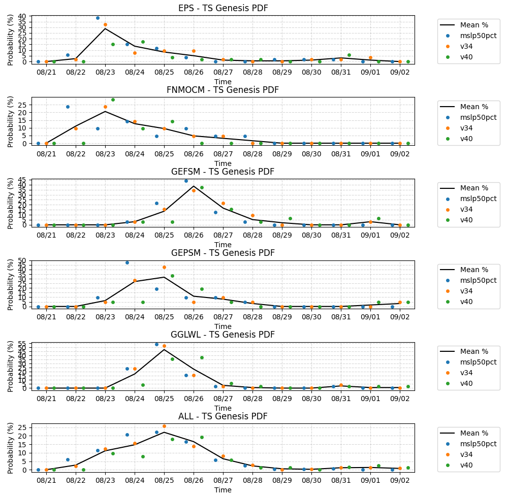
EPS/00Z mean track (of the group near 105W) as solid line
Edit: LLCC apparent from HY2C pass earlier.
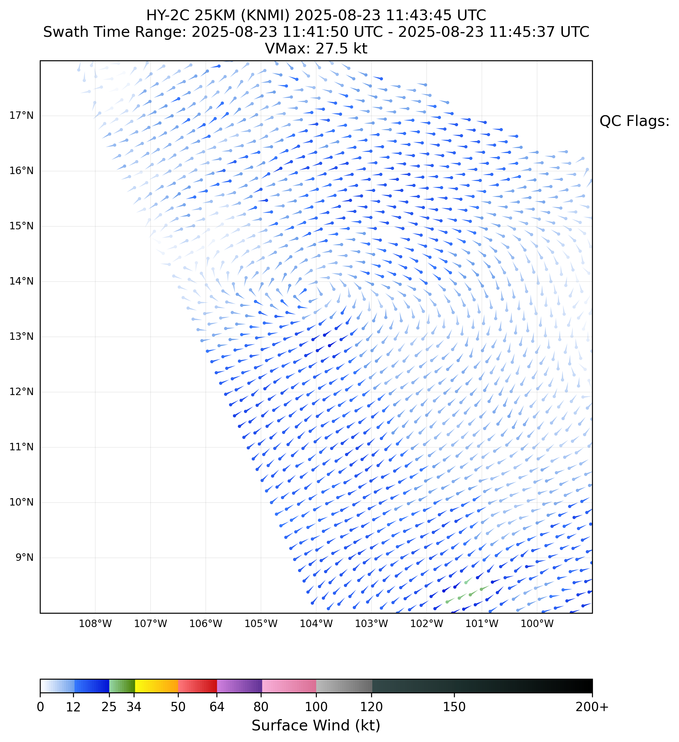
Circulation though looks rather modest from satellite analysis (CIMSS), so it doesn't look likely to become a TS today based on that. Maybe a TD today if convection gets sustained (has not been so far).
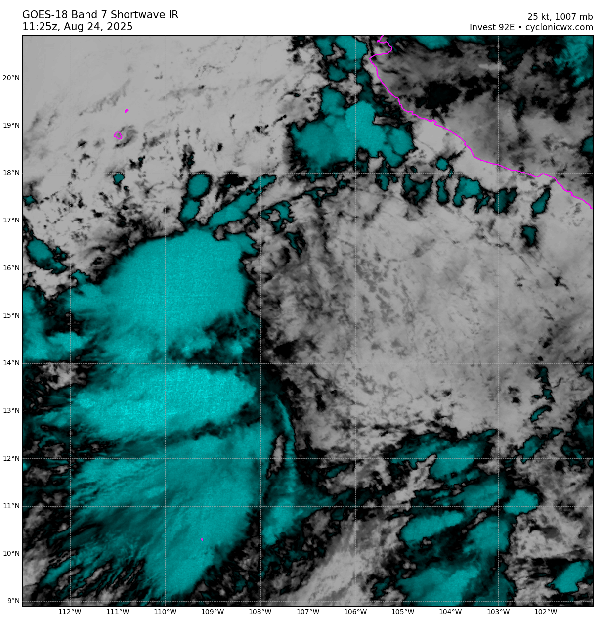
Looks disorganized.
Mid shear is apparent even from shortwave IR. CIMSS and CIRA products show how bad it is now, and I assign the chances of it organizing in 12 hours as ~ nil
Intensity wise some of the ensembles (EPS and Google's model think it will develop TS level winds today ~ 70%, 60% respectively), but accounting for cyclone phase space parameters, GEFS and GEPS give it later development (late 25th / 26th as more likely).