Resolves according to local time zone wherever the storm is. Subtropical storms count for the purpose of this market (although that's pretty irrelevant to the EPAC)
Update 2025-07-31 (PST) (AI summary of creator comment): Resolution will be based on the geographical time zone of the storm's location at formation, regardless of the time zone used in the official advisory.
Update 2025-07-31 (PST) (AI summary of creator comment): Based on the storm's formation coordinates (12.7N 115.1W), the creator has determined the applicable 'local time zone' to be UTC-8. This results in a formation date of July 31.
Update 2025-07-31 (PST) (AI summary of creator comment): For this market, resolution will be based on the timezone used in the official advisory (HST), not the geographical timezone of the storm's formation.
 1,000
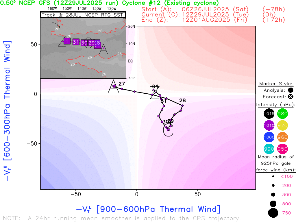
1,000@SaviorofPlant Gil has formed. And as usual, the timezone for the advisory is RANDOM again. Today they chose HST, which puts it back onto the 30th...
BULLETIN
Tropical Storm Gil Advisory Number   1
NWS National Hurricane Center Miami FL       EP072025
1100 PM HST Wed Jul 30 2025

...TROPICAL STORM GIL FORMS WELL TO THE SOUTH-SOUTHWEST OF THE
SOUTHERN BAJA CALIFORNIA PENINSULA...


SUMMARY OF 1100 PM HST...0900 UTC...INFORMATION
-----------------------------------------------
LOCATION...12.7N 115.1W
ABOUT 785 MI...1260 KM SSW OF THE SOUTHERN TIP OF BAJA CALIFORNIA
MAXIMUM SUSTAINED WINDS...45 MPH...75 KM/H
PRESENT MOVEMENT...W OR 275 DEGREES AT 15 MPH...24 KM/H
MINIMUM CENTRAL PRESSURE...1004 MB...29.65 INCHES
This is why I prefer UTC ... I would have expected them to pick PDT but I was completely wrong on that point.
@parhizj the description says "local timezone wherever the storm is" and I think that would be PDT, regardless of advisory timezone? 12.7N 115.1W is directly south of California i think
@SaviorofPlant
Surely it is in international waters.
In international waters, time zone boundaries are meridians 15° apart, except that UTC−12 and UTC+12 are each 7.5° wide and are separated by the 180° meridian ( ...
Except may be a litle more complicated?
https://www.geogarage.com/blog/news-1/post/geogarage-time-zone-api-31

It's on the eastern edge of the blue zone according to this map, which should be UTC-8, where it was July 31 at time of storm formation
@SaviorofPlant Yes boundary seems to be 112.5W so UTC-8
Time of advisory 09:00 UTC per https://www.nhc.noaa.gov/archive/2025/GIL.shtml?
So seems like an hour into 31st July at that location.
That is the way I would read it at the moment, but other views might be possible?
Edit: I can't find the comments about the below in past markets so perhaps I have a false memory of the below or am remembering some internal monologue about the rational of using local timezones for these questions, so maybe we never actually discussed this.
I sort of remember in the past when we talked about this idea of whatever "local timezone" for the storm for these type of questions, you mentioned using the local timezone in the advisory text, as it was important info for the people the storm it MAY/WILL effect -- this is the whole point using local timezones to resolve this type of question, and the source was the advisory text itself.
It sounds like now you want to switch to using a different notion of local timezone, perhaps local sidereal time is what you are talking about now?
In the advisory itself is the MET authoring it is supposed to insert the relevant timezone for the people that the storm will/is effect (determined by watches/hazards in the advisory). Similarly for these types of prediction questions. I discussed with you previously, about how its going to be essentialy random, especially when there are no watches/hazards associated with the advisory. In the past I went back through several advisories and confirmed they do seem to randomly assign PDT/HST etc when there are no watches, which is why I said it makes more sense to resolve to UTC to simplify resolutions. Otherwise you are just gambling on a combination of which timezone the MET places it when there are no watches, or betting which local timezones will have watches.
@parhizj I don't recall this discussion but it looks like I was using set time zones for previous markets, should go back to doing that to avoid this type of confusion. We can go by the advisory timezone for this one since it seems like that was how all bettors interpreted it.
@SaviorofPlant It might have been all in my head as I cant find the actual comments when searching through old markets =\.
As far as this particular market I don't actually care what you resolve to (spirit of the market or legalese), because at least in comments+bets I predicted the actual timing fairly well.
I did spend an annoying amount of time on this issue in the past so its a bit jumbled; I do recall adding timezone stuff to the analysis part of my program so I could answer these types of questions in any timezone because of these market criteria.
As I said, I dislike using local timezones or sidereal timezones for a number of reasons. I think whatever is in the actual advisory text as the UTC time is the simplest and cleanest for making predictions and resolving the markets. Its also clear to anyone using the market for information.
If you dont say advisory text's UTC time then when they splash the new TS on the NHC home page and its 20 minutes before the hour it can affect the resolution, because then people can argue they announced it 20 minutes before the hour, and the whole point of the advisory time is the advisory time is for the actual time of the of the text's written advisory time not when they release it.
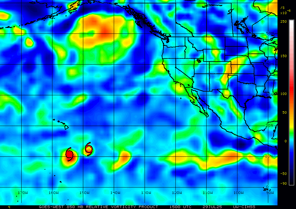
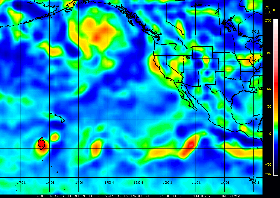
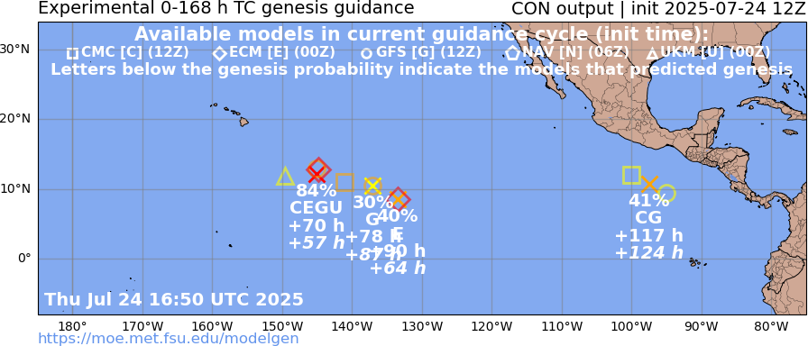
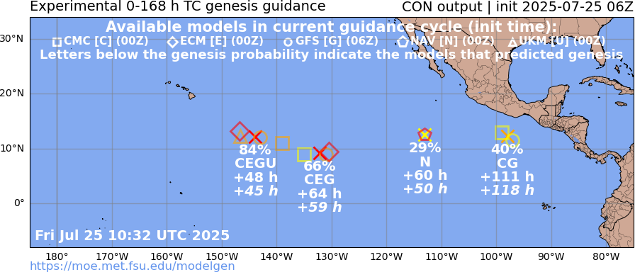
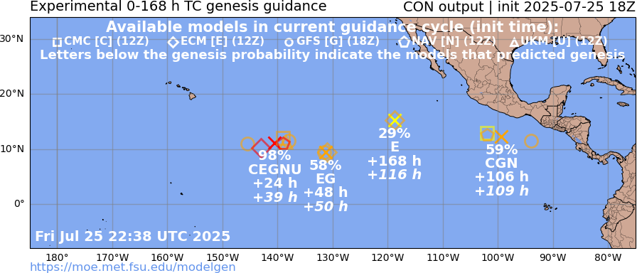
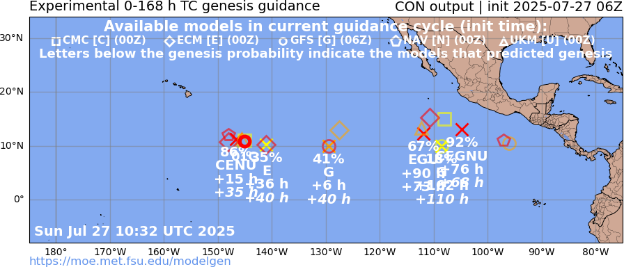
Have invests now for both systems (EP98 for the one nearing CPAC, and EP99 for the one south of Mexico). New NHC outlook is 60/60 and 60/90 respectively.
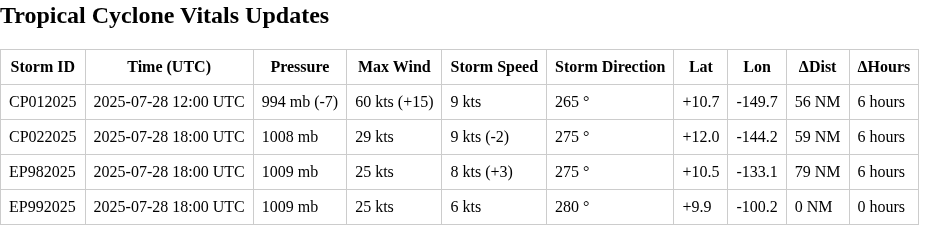
18Z tcvitals:
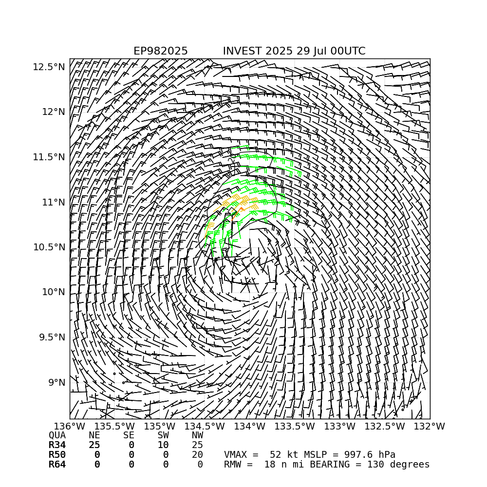
Deep convection has stopped near the center for the last few hours for EP98 while it goes over a small patch of very low OHC:
(Mean track from genesis tracks 00Z and 12Z GFS; rest of 12Z ensembles should be out in the next couple hours)
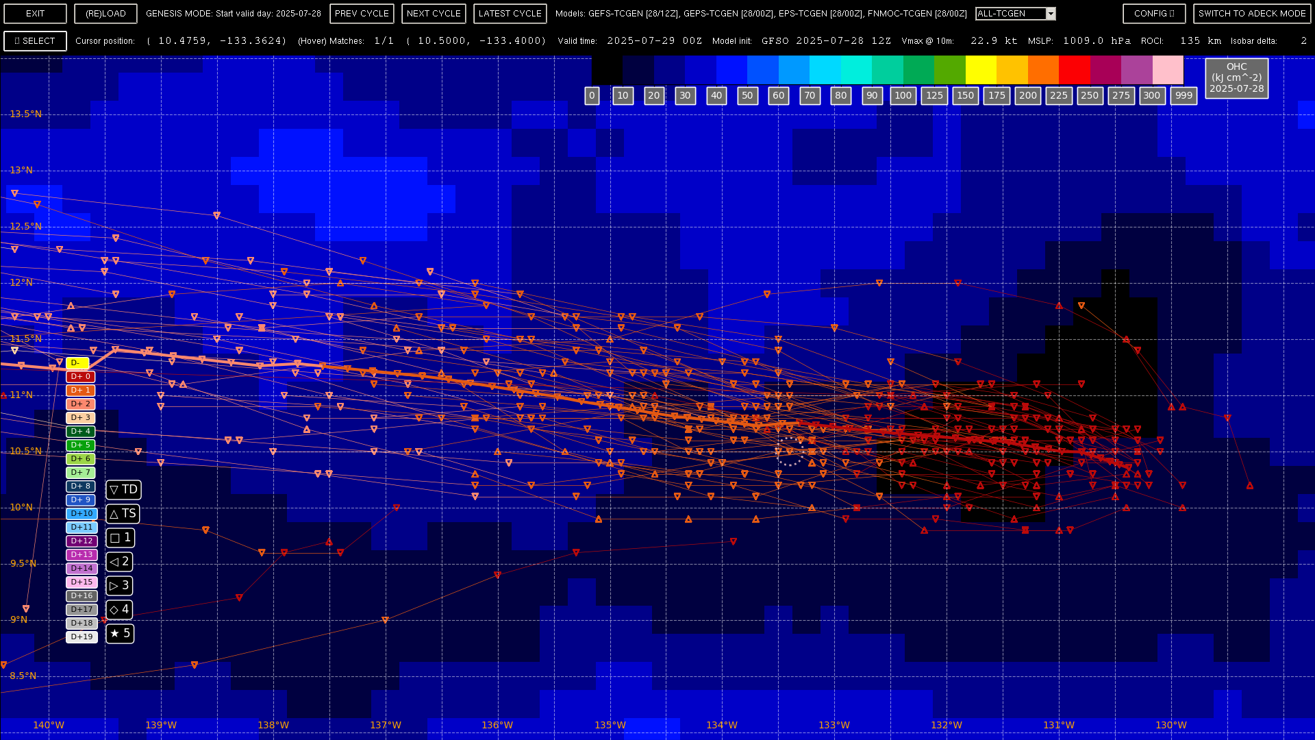
EP98s chances of becoming Gil seem low (maybe 10-20%?) from the (dated) 00Z ensembles in the limited current time frame it has (maybe it will become a TD late tomorrow?), as it looks like it will move into the CP in the next 2 days. It's moving slightly faster than the mean track from the ensembles and appears slightly south from vis. sat and the tcvitals fix, and based on the OHC plot, storm speed fix and tracks, I'd estimate it won't start deep convection again until a bit before 12Z tomorrow (if it doesn't wobble north a bit..).
EP99 looks like it needs a bit more time to cook compared to forecasts from a few days ago, but looking to be better than even odds to become Gil good before August starts.
An earlier ASCAT for 98E showed some 30+ kt winds (vmax=33kt) and its been upgraded as since per the tcvitals. Looks good it might be classified as a TD sometime tomorrow.
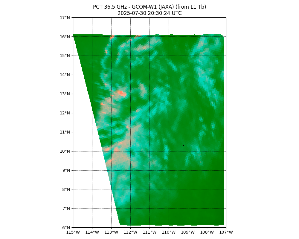
AMSR2 winds from GCOM-W1 bin near the center as 28-38 kt winds, and satellite wind analysis from CIRA show even lower winds near 20kt but oddly OSPO's satellite winds product shows a small cell of much higher winds for the last two cycles (it is usually fairly high but this is unusual):
It shouldn't start deep convection again for another 8 hours or so (maybe around 10Z?) per my earlier estimate, but if the OSPO wind speeds are to be believed than the max surface wind speeds were higher than assumed by the models, which means it could spin-up and develop very quickly (this seems unlikely given all the model and other data though).
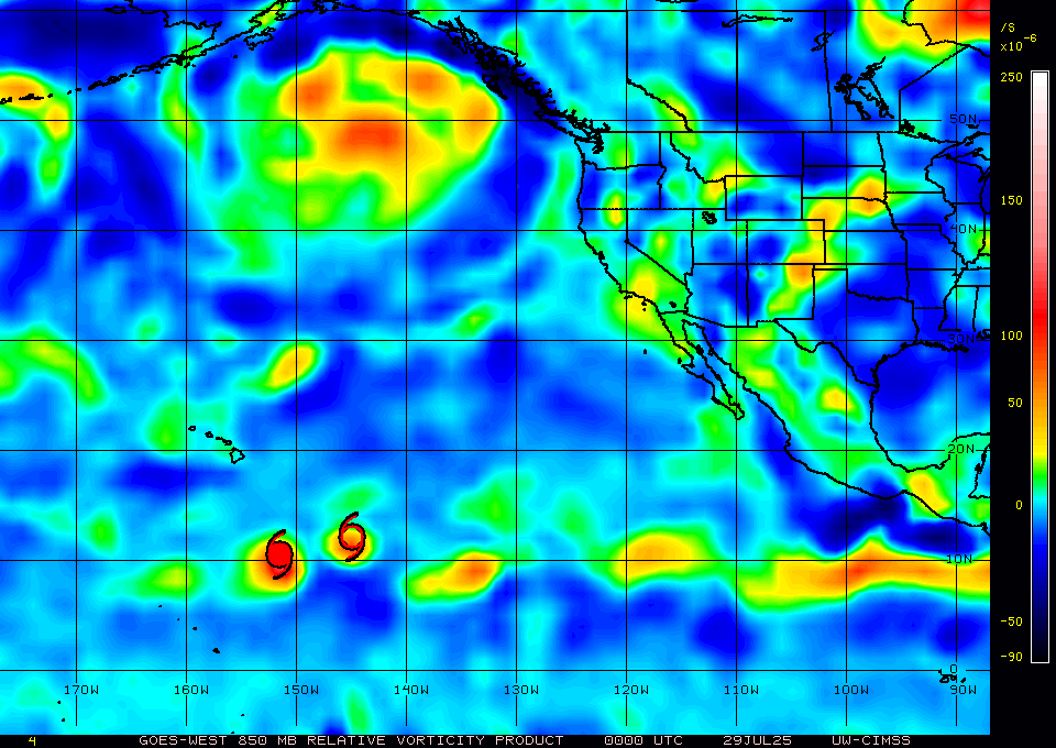
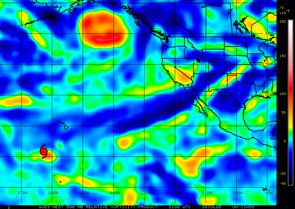
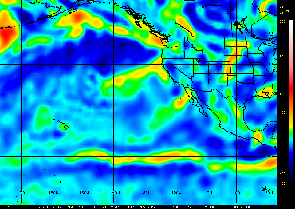
99E looks like it might have TS winds fairly early on, but phase analysis (FSU) of recent models (GFS 18Z/CMC 12Z/etc.) shows it will take some additional time to become more organized, as the broad circulation may take time to tighten up, especially as can be seen from CIMSS RVOR:
98E: very limited pulsing convection and almost no lightning, contrary to my expectations. I guess from looking at satellite imagery and model analysis the deep shear and dry air intruding from the midlevels and upwards are choking off any deep convection from sustaining. Models show the deep shear continuing for another day at least, and by then it will be in the CPAC. The equivalent OHC is minimal now but the environment overall looks worse than I thought it might be yesterday. Yet, I don’t understand why NHC upgraded 98E chances again, when ensembles and det. genesis tracks from 00Z, etc are very bearish. I think it has much less likely chance of even becoming a TD at this point so I am confused by their optimism.
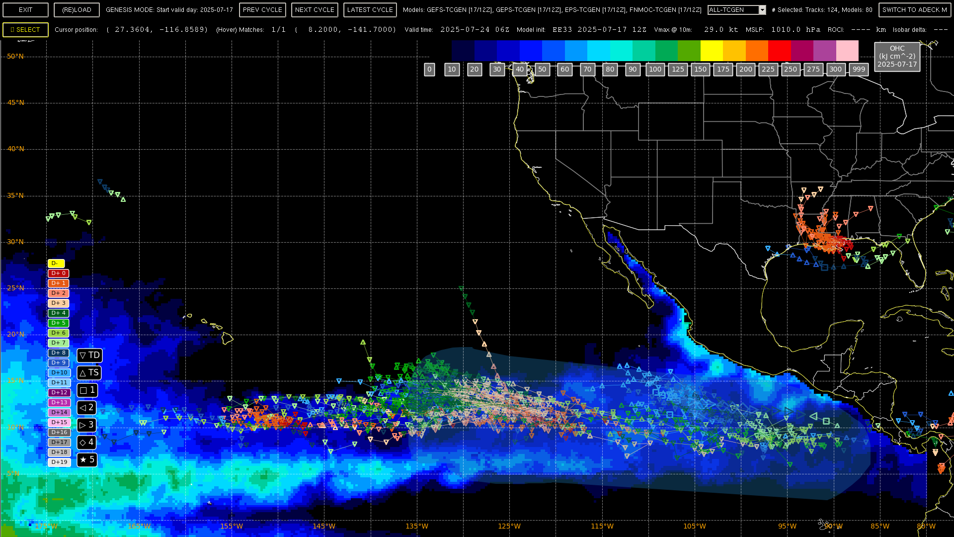
Western East Pacific (EP98):
Showers and thunderstorms have increased in association with a
well-defined area of low pressure located about 1400 miles
east-southeast of the Hawaiian Islands. If the thunderstorms
persist or increase, this system will likely become a tropical
depression or tropical storm while it moves westward into the
Central Pacific basin.
* Formation chance through 48 hours...high...70 percent.
* Formation chance through 7 days...high...70 percent.
12Z GFS phase analysis and other more dated models from FSU shows it remaining shallow.
99E:
Earlier scat. pass show the only surface low near 108W is to the west of the invest center and the strongest of the low to mid level circulation in rvor analysis from CIMSS
so it still looks like Gil won’t happen today as 99E is going to take 1-2 more days.
98E: despite impressive convection for last 5-6 hours I don't think it will make it as a tropical storm by the 03Z advisory in 4 hours (which is the last relevant one for the PDT timezone; there won't be an intermediate advisory at 06Z that affects July 30).
Recent microwave imagery from 20:30Z shows the elongated circulation.
(GPM-CORE's GMI pass was as predicted a miss, so not shown)
Vorticity analysis (CIMSS) 21Z shows the circulation is still elongated.
The 500mb rvor showing it isnt organized yet ...
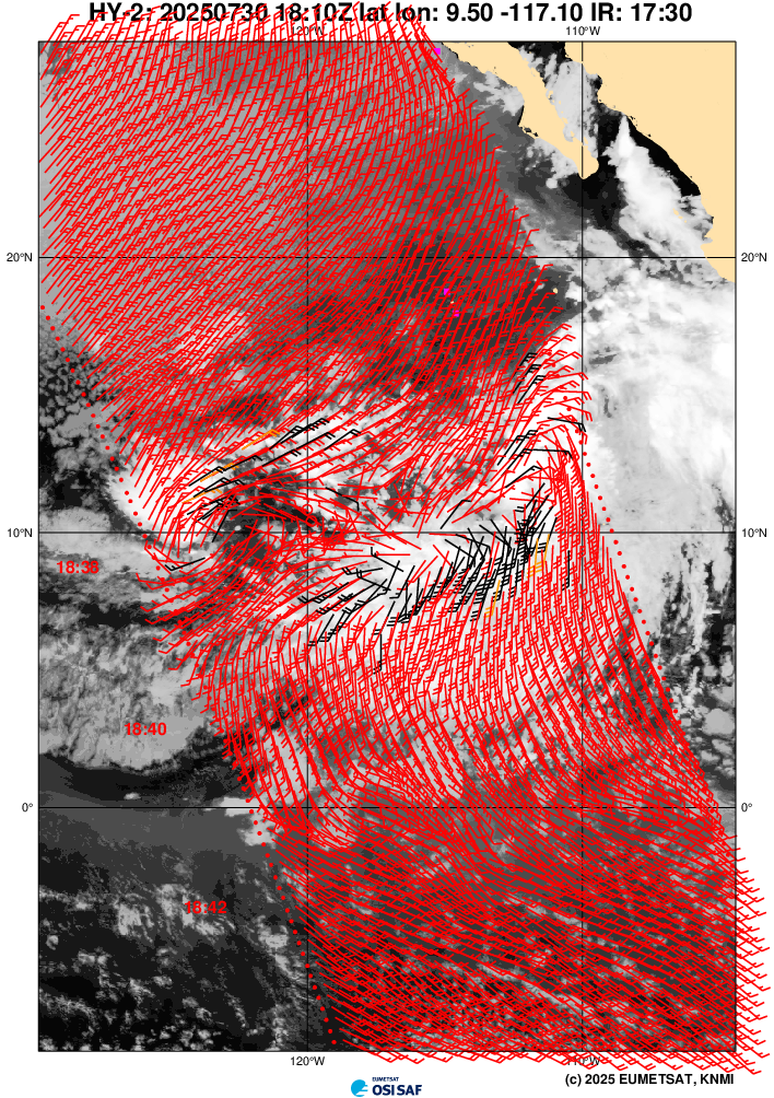
An earlier HY-2C scat. pass (KNMI) doesn't reveal a clear surface low, also only perhaps an elongated circulation; vmax for winds near the 18Z fix are at 31kt though.
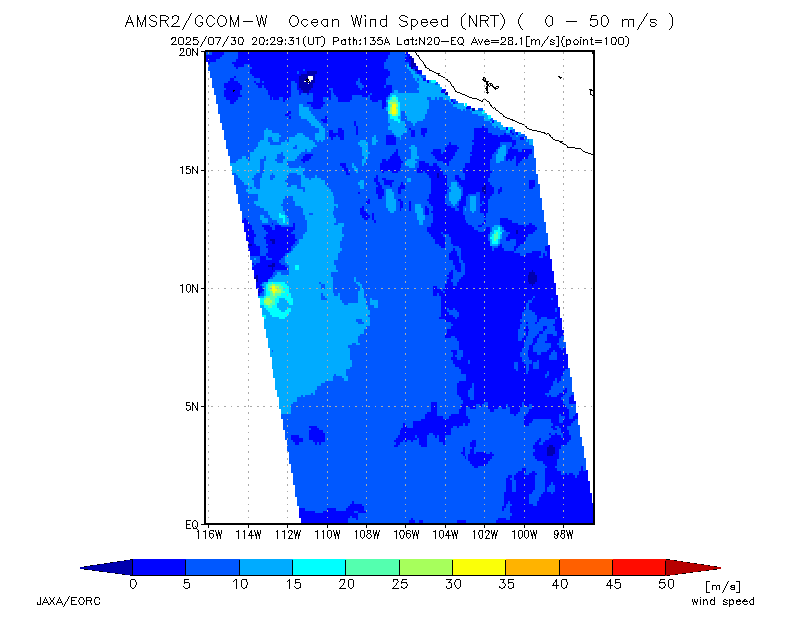
AMSR2 wind diagnostics (JAXA) show similar near the 18Z center fix (some stronger winds to the south, a bit too far from what is the center circulation...)
There is a SAR winds pass scheduled for later (01:32Z); I don't know what the acquisition time will be (perhaps at least 4-5 hours after this) so it seems unlikely to make it or be used for the 03Z advisory (it recently became an operational product, but I don't know whether its being used at the NHC yet).
Based on 12Z ensemble genesis mean paths shouldn't be any further scat. passes before 00Z (the earlier oceansat-3 pass from 18:59Z that isn't available yet, and the HY-2C pass later (around 00:53Z) I estimate should be misses)
Last TAFB subjective dvorak was at 1.5/1.5. Last tcvitals from 18Z was vmax at 25 kt.
Looks like tomorrow will be the day from the 12Z ensemble probabilities.
Edit:
Should be an early ascat pass (METOP-B ascending @ 04:57Z) tomorrow morning avail in time for the 09Z advisory if it strengthens and gets organized by then.
@ChristopherRandles looks like he was last active 5 days ago. I’ll create a market if he doesn’t return by tomorrow.
@ChristopherRandles and other bettors in this market, I've created another market for this question since Plant is away. Note the slightly different resolution criteria (UTC advisory time).
@SaviorofPlant no problem. I will keep my market open if you don’t mind, since chris has already bet and looks like it will resolve anyway in a few days. It will be interesting if they resolve different days due to time zone of the advisory.
Edit: FSU Det. probabilities for 22/12Z:
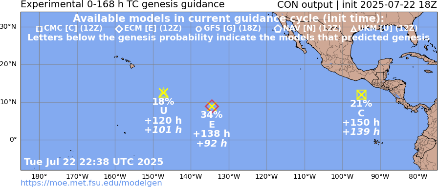
About 3 different genesis events predicted by various det. models in the next 7 days east of 140W (cumulatively this should mean something should develop; but EPS/12Z probabilities indicate its less than even odds for 7 days.
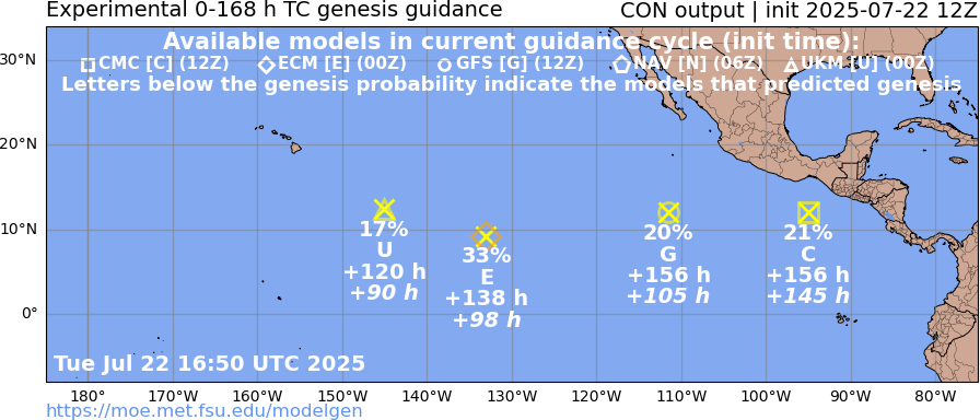
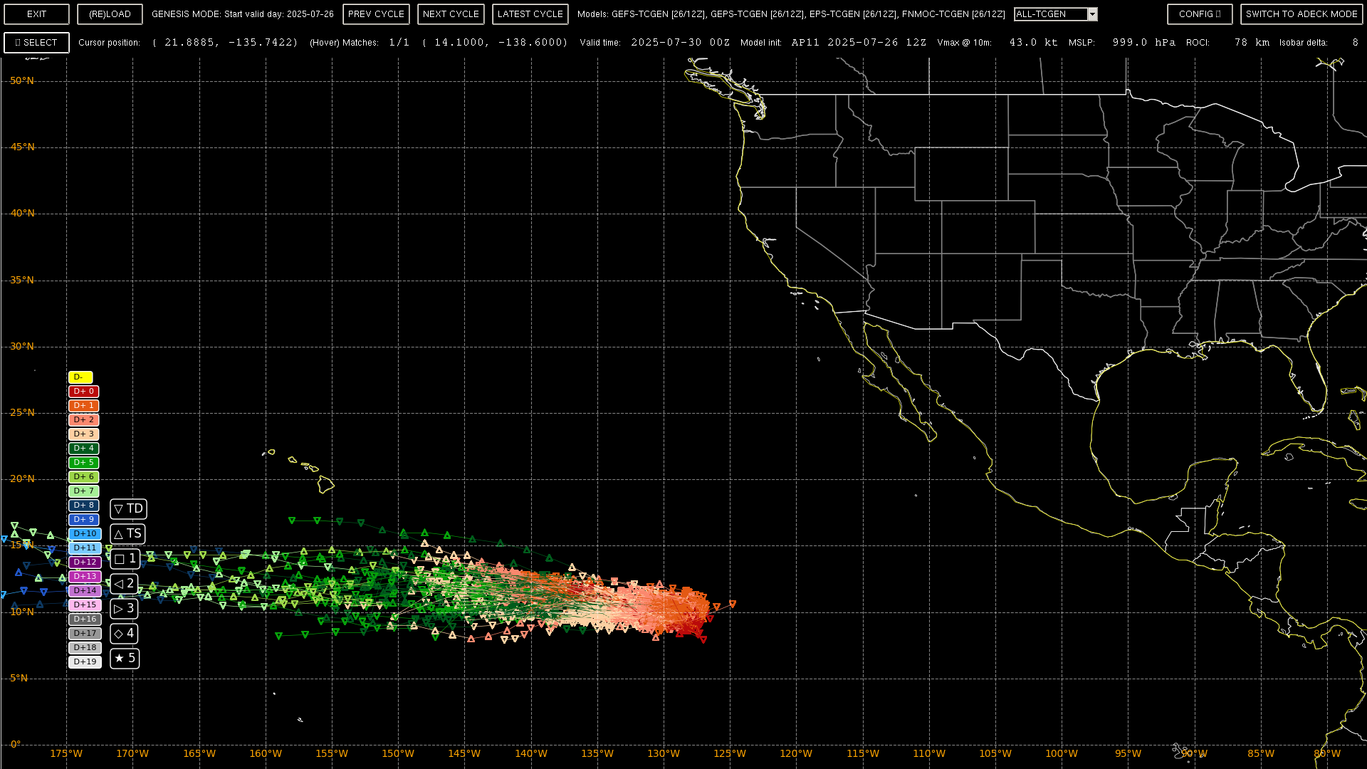
The only one of any minor note seems the genesis event related to the CMC deterministic run near 10N, 90-100W in 6 days (~28th), as for the ensembles only EPS/12Z only shows so far any chances of development for this particular genesis event (its a bit noisy to isolate, so perhaps ~ 40% +- 10% for this to become a named storm in 10 days) (the GEFS/GEPS ensembles don't cover this timing yet -- 5days only for the NCEP genesis tracker product).
The noted genesis event for ECM deterministic near 135W is too close to the central pacific RSMC for this market, and the EPS model doesn't give it good chances of developing before crossing over (looks like a weak TS?)...
Tracks before the 28th in the area removed; mean track for the mentioned genesis event as solid line):
CMC det. still consistently predicting above system's genesis near 100W, with genesis in ~5-6 days. EPS 23/12Z probs in 10 days for that specific system/timing are still roughly the same as yesterday (with most genesis tracks starting from the 28th).
(FSU locations for that TC showing fairly good consistency for CMC)...
Same system near 90-100W still looks decent to CMC, GFS; but oddly no NHC outlook for it though?
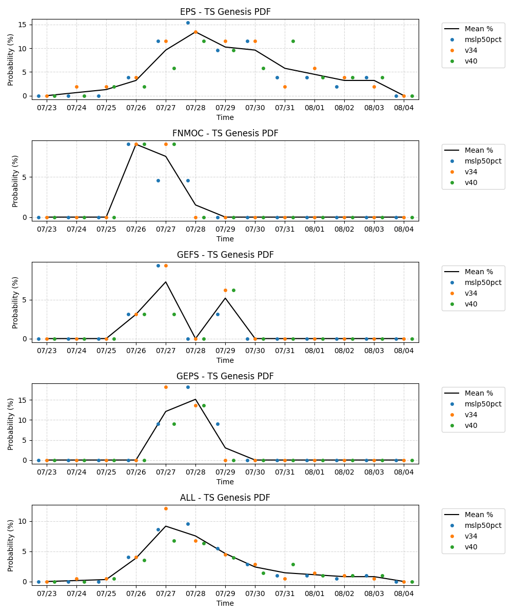
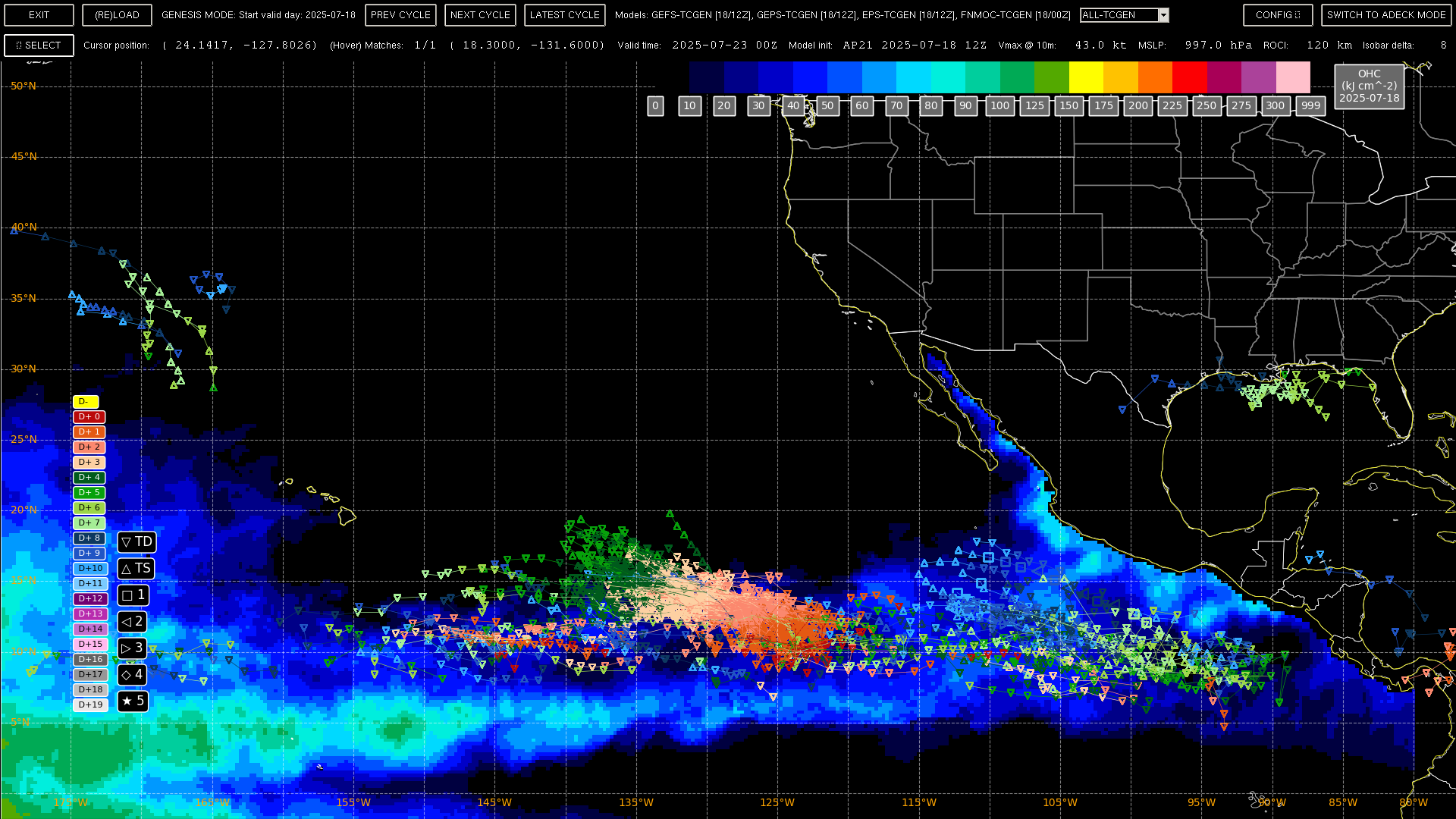
This is what the probs look like for me from the ensembles in EPAC as a whole (including the storms that reach 34 kt BEFORE crossing over into the CPAC), EPS obviously the most bullish as a whole reaching now ~65% chance of a named storm by the end of its 10-day window (other ensembles are only covering 5 days) (TZ is Pacific):
@SaviorofPlant Can you add more days?
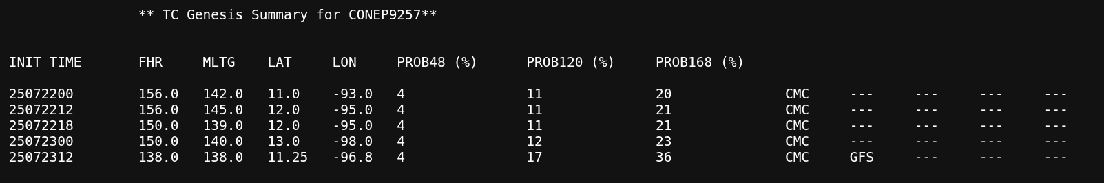
The CMC prediction for the genesis near 100W is now in the TWO at 30% in 7 days.
EPS/00Z ensembles have it higher than that still (closer to 60% in its 10 day window now, with more than 50% in 7 days), but it is the most aggressive by far of the ensembles.
FSU has it still at 40% combining GFS/CMC:
Also, I added a binary market for Iona (central pacific) for traders interested... since it has a good chance to form:
@SaviorofPlant NHC has upgraded the (CMC predicted system) in EPAC to 40% chance:
Central East Pacific:
An area of low pressure is forecast to form offshore of the
southwestern coast of Mexico early next week. Thereafter,
environmental conditions appear conducive for some development and a
tropical depression could form during the middle to latter part of
next week as the system moves generally west-northwestward at 10 to
15 mph.
* Formation chance through 48 hours...low...near 0 percent.
* Formation chance through 7 days...medium...40 percent.
FSU det.:
EPS/12Z probabilities are on par with the FSU estimate actually (although for a named storm...)
,Latest TWO adds a system that is expected to form further west, keeps the other system at 40% for now.
Western East Pacific:
A trough of low pressure centered a little more than 1500 miles
east-southeast of the Hawaiian Islands is producing a large area of
disorganized showers and thunderstorms. Some slow development of
this system is possible as it moves generally westward during the
next several days.
* Formation chance through 48 hours...low...10 percent.
* Formation chance through 7 days...low...20 percent.

South of Southwestern Mexico:
An area of low pressure is forecast to form well offshore of the
southwestern coast of Mexico early next week. Thereafter,
environmental conditions appear conducive for gradual development,
and a tropical depression could form during the middle to latter
part of next week as the system moves west-northwestward or
northwestward at 10 to 15 mph.
* Formation chance through 48 hours...low...near 0 percent.
* Formation chance through 7 days...medium...40 percent.

$$
Forecaster Cangialosi
det. for ECM/12Z NAV/12Z hasn't been updated yet @ FSU...

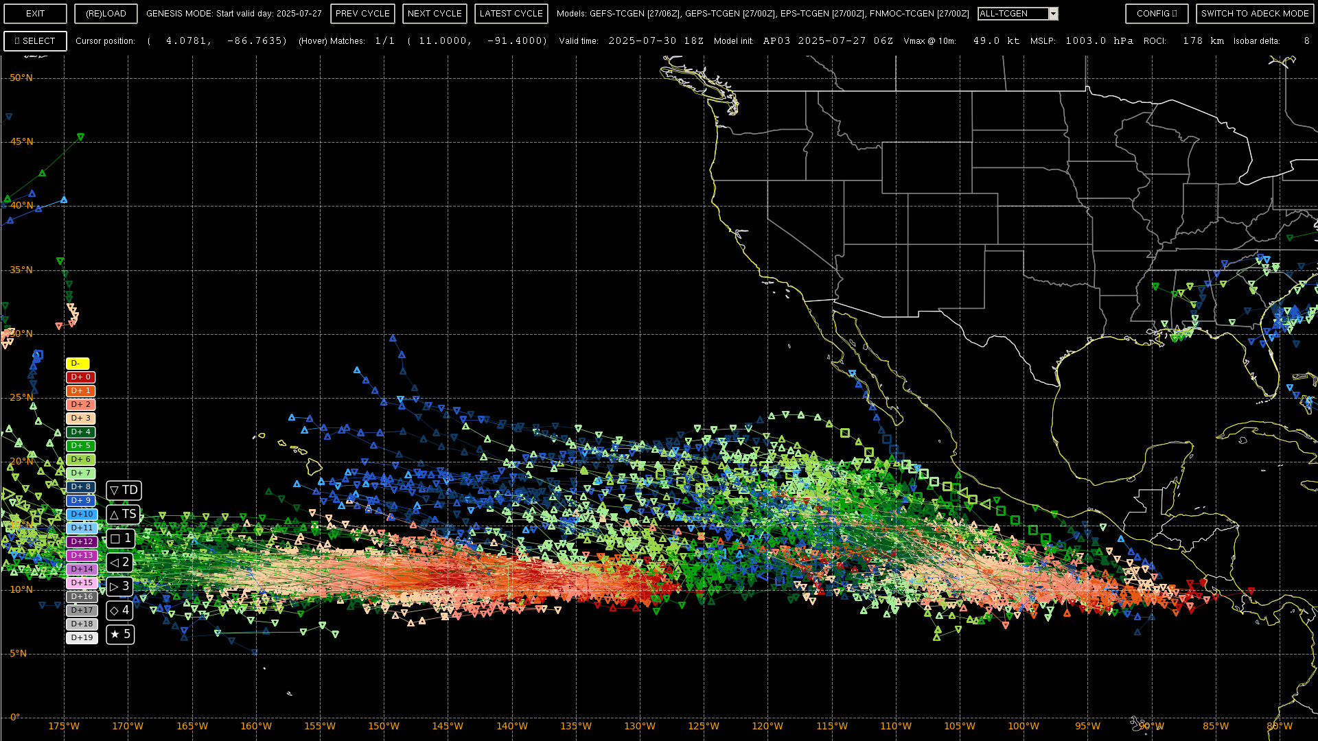
For the still rough signal for this system (somewhere between 90-120W, with a coherent track in 4 days, likely by the 30th), there is still not much coherence on the actual genesis location in the ensembles (haven't narrowed), however GEPS/GEFS 12Z do show high confidence in a TS somewhere (80% and 90% respectively now in the next 5 days). EPS/12Z chances of genesis for this seem to me to be about 50% in 7 days, 67% in 10 days.
12Z ensembles:
~
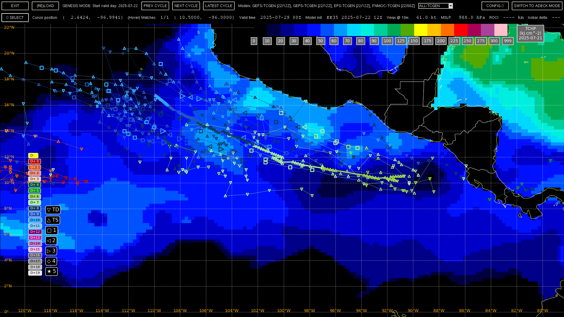
For the other system near 130W, there seems to be two genesis locations in the area (137W and 127W); I've isolated it based on storms forming west of 124 W in the next 5 days, and eliminated those tracks with points west of 140 in the next day to eliminate the CP storm).
EPS/12Z has a good 45% of its members with 34kt winds already today with most of 95% members with MSLP > 1004 though, so its not the best source of probabilities alone but it looks like its chances of reaching a TS are higher than 10% based on MSLP alone, i.e 50% of its members <=1004 MSLP in the next 3 days; similarly for GEFS/12Z in terms of MSLP. GEFS gives it about 30% and GEPS ~ 20% (28th and 29th). Looks like its at has ~ 30% of a TS based on this. For this market though I'd think its probs are quite a bit less than these before it crosses over into the CP (maybe about 15%?).
Isolated 12Z tracks:
The probabilities of the circulation near 130W forming into a named storm before crossing over into the CP seem to have dropped a bit as less than 10% now of members per EPS/00Z forecast a TS in the short timeframe of the next 3 days, and that is based on an over-estimate of its current wind speed by some of its members. An Oceansat-3 pass from earlier shows a LLCC with some rainflagged wind speeds that are near TS strength on outerband but it isn't a TS yet as the mid level circulation isn't there (solid low level circulation with 800mb rvor > 100e-6 per CIMSS); phase analysis (FSU) from GEFS/06Z and IR sat. imagery also shows it not there yet.
The probabilities for a TS forming south of Mexico in the next week have increased a bit
NHC has upgraded its 7-day chances to 50%.
Referencing the 00Z ensembles, roughly 94% of GEPS members now think a TS will form by my estimate in the next 5 days, with GEFS is still around 80%. EPS has increased to near 60% in 7 days (70% in 10 days).
Tracks have gotten considerably tighter compared to yesterday but doesn't appear to be a clear consensus on genesis location as the timing of it becoming a TS is mainly spread over the next 4 days:
FSU det. shows 2 different genesis events (and GFS with a third in ~4 days):
Some weak signal in the ensembles for a TC next week (mostly from GEFS which is ~40% chance for a TS).
Maybe about 20% chance of a TS. No NHC outlook for it.
Only showing up in GFS deterministic on FSU:
Probably not worth adding days for it yet.
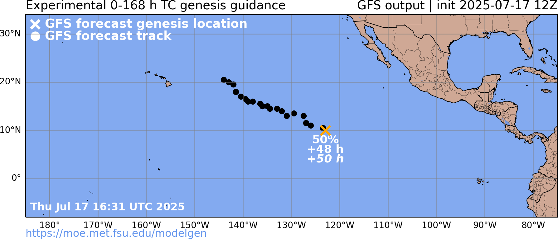
Edit 18/12Z: Including the faint genesis possibility further east, GEFS 18/06Z now puts it at ~ 60% chance of a weak TS somewhere in the next ~3 days (GEPS and EPS are at ~10 and 20% chance of a weak TS, so it could still be GEFS hallucinating). From GFS det. looks like the supposed low will stabilize tomorrow night (the 19th) (until then the low bounces around a bit.). No low on TAFB surface analysis and nothing on CIMSS vorticity analysis/scatterometer data suggests anything significant present otherwise. Some scattered deep convection associated in the area near 120W, 10N for last 12 hours.
@SaviorofPlant NHC has started issuing TWO's for this system (0%/20% for 48h/7days).
GEFS is still the most aggressive, but a TC (by PDT time) is expected to form in the next 2-3 by GEFS probabilities. So likely a TD, a coin toss for a TS at the moment.
EPS/12Z probabilities for a TS are more flattened out over the next 10 days (smoothly increasing) but cumulative probabilities of a TS developing somewhere in the EPAC are about the same as GEFS/12Z in the next 10 days (about a coin toss now):
Still no surface low indicated on 18Z analysis. Not much observable either on recent, partial scatterometer data.
Not a lot apparently going on from (CIRA) vorticity analysis:
GOES IR shows some scattered deep convection but not much signs of organization.
Perhaps some beginnings of banding in CIRA's TPW/LPW (lower levels).