
Resolves EST. Subtropical storms also count
 1,000
1,000🏅 Top traders
| # | Trader | Total profit |
|---|---|---|
| 1 | Ṁ907 | |
| 2 | Ṁ367 |
People are also trading
2. Eastern Tropical Atlantic:
An area of low pressure located several hundred miles southwest of
the Cabo Verde Islands is producing an area of disorganized showers
and thunderstorms.  Environmental conditions appear conducive for
additional development of this system, and a tropical depression
could form by the middle of next week while it moves generally
westward at 15 to 20 mph across the eastern and central tropical
Atlantic.
* Formation chance through 48 hours...low...30 percent.
* Formation chance through 7 days...high...70 percent.
Some (unofficial) estimates of (first) intensity >= 34kt after genesis
GFS/12Z: July 1, 00Z
CMC/12Z: July 1, 06Z
(dated) ECM/00Z: July 2, 06Z
NAV/06Z: ~ (not predicting genesis)
The NHC discussion makes no mention of a TS only a TD.
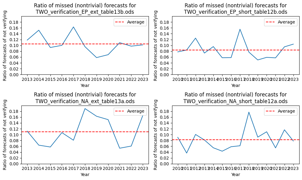
My interpretation of that 50% means it's tricky using their prediction for this market though, since their calibration is good (we can't just simply bet up June 30 to 50%). By my calculations they make the correct genesis predictions > ~90% of the time in such non-trivial cases 48 hours out (non trivial, as in other likelihoods forecast other than 0% or 100%):
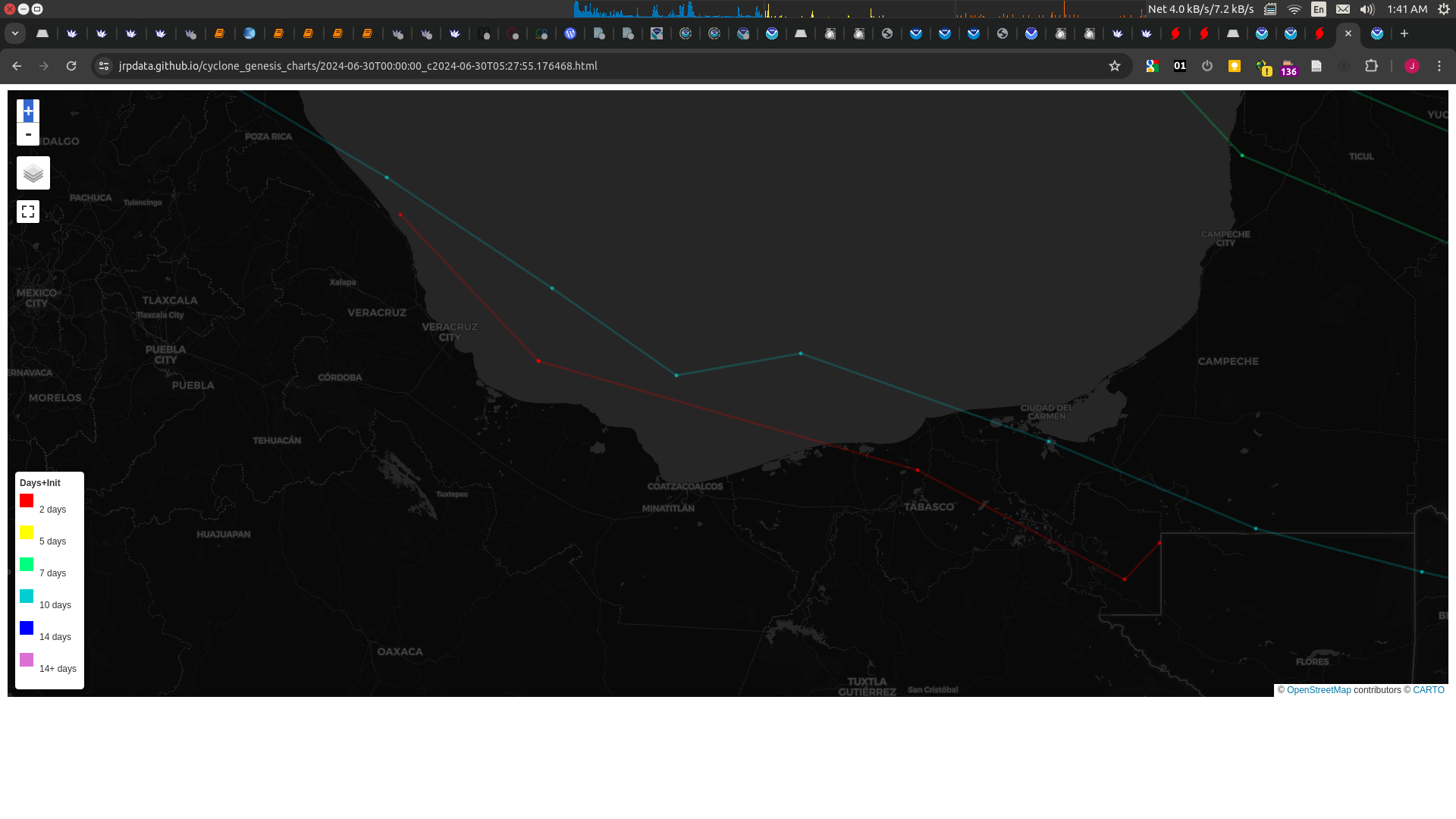
Having said that, GFS/00Z track for AL94 does show it having some TC genesis characteristics (enough for my simple tracker to mis-classify it as a TC despite it being overland right now), and winds reaching 36kt just before dissipating (with a min MSLP of 1005.6 reached 6 hours earlier). The track though (in red) is kind of sketchy:
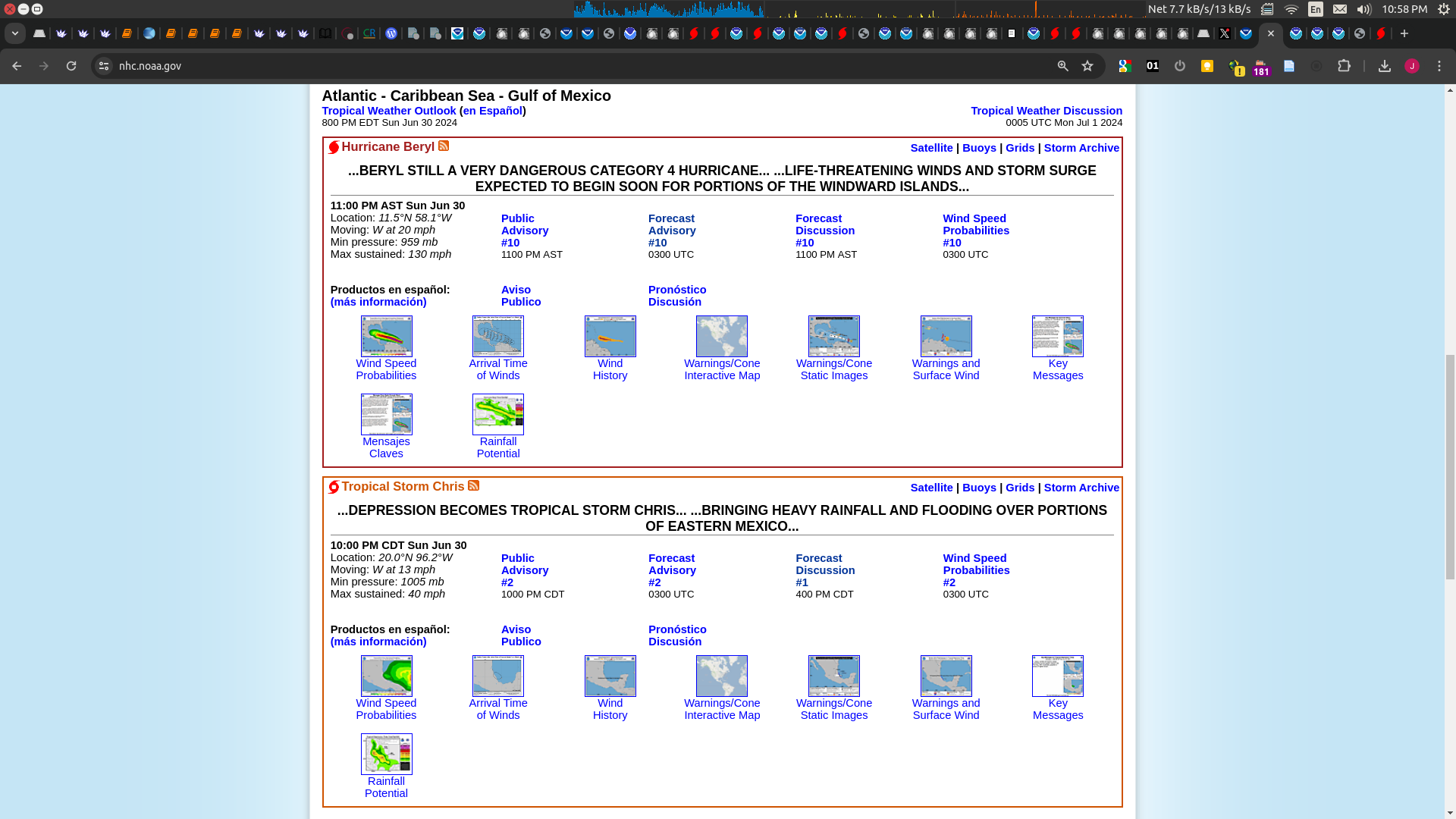
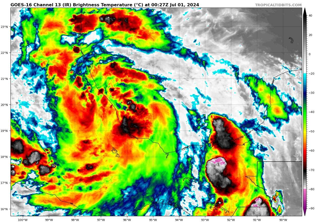
1. Southwestern Gulf of Mexico (AL94):
Satellite derived winds and preliminary aircraft reconnaissance
data indicate that the area of low pressure located over the
southern portion of the Bay of Campeche has become better organized
during the past few hours and a tropical depression could be
forming. The system is moving toward west-northwestward at 10 to 15
mph and is expected to approach the eastern coast of Mexico tonight
and move inland on Monday morning.  Consequently, a Tropical Storm
Watch may be required later today for a portion of the eastern coast
of Mexico. Interests along the Gulf Coast of Mexico should monitor
the progress of this system.  Regardless of development, heavy
rainfall will result in areas of flooding across eastern Mexico
today and into Monday, with mudslides possible in areas of higher
terrain. An Air Force reconnaissance aircraft is currently
investigating the system.
* Formation chance through 48 hours...high...80 percent.
* Formation chance through 7 days...high...80 percent.Now TD3.
Aircraft reconnaissance data and satellite-derived winds
indicate that the low-pressure system that emerged over the
southeastern Bay of Campeche this morning has become sufficiently
organized to be classified as a tropical depression, the third
tropical cyclone of the 2024 Atlantic hurricane season.
Conventional satellite imagery shows developing curved bands in the
northwest and northeast quadrants with a recent deep burst of
convection near the surface center.  Based on the wind data, this
advisory's initial intensity is set at 30 kt.

The surrounding environment appears conducive for some
strengthening before the tropical cyclone moves inland early
Monday.  Subsequently, the official intensity forecast calls for
the system to become a tropical storm before landfall and this
agrees with the global models and the SHIPS statistical guidance.
Afterward, the circulation is very likely to dissipate over the
mountainous terrain of eastern Mexico by Monday night.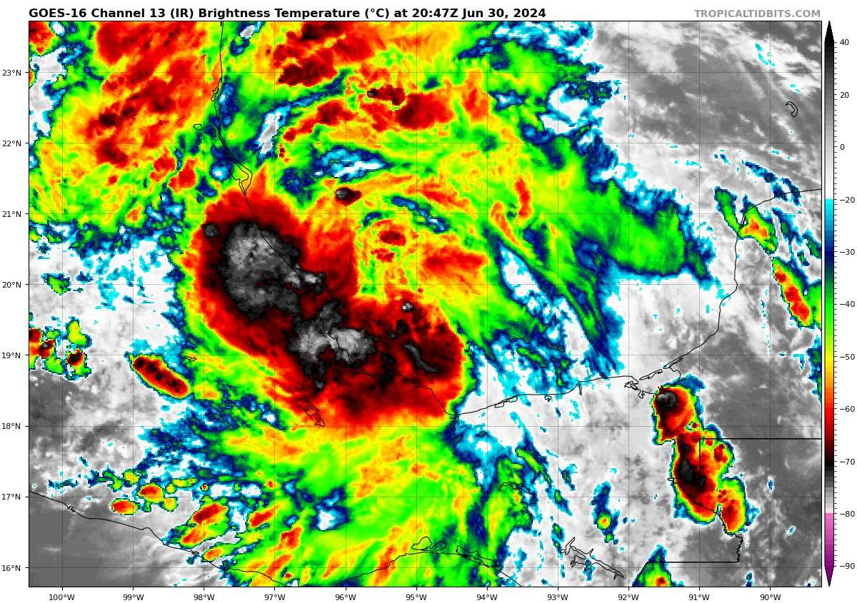
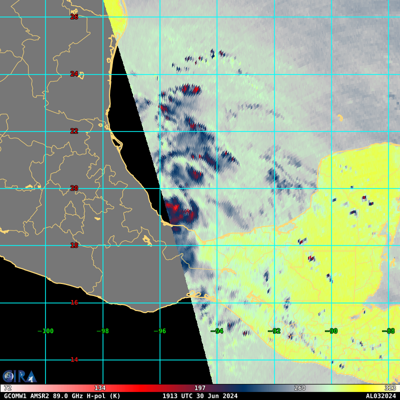
Edit: looks clearer on microwave (CIRA)
(GFS/HAFS hyped it too much). It's a very narrow SHIPS guidance though to make it to TS:
AL032024 reaches TS?
2024-07-01 06Z :  66.0 %
Cutting it in half to 33% make it a TS by 11PM seems generous:
Don't know if it will strengthen to a TS by the 11PM advisory, the subjective dvorak's haven't been favorable from OSPO/TAFB earlier. Objective from CIRA has it at 30kt. Here is the recent recon that does show mostly 30 kt winds and some TS level winds further out (which makes it less marginal)?
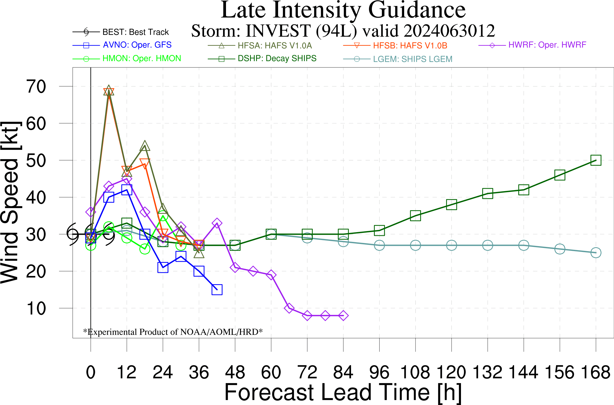
Bit of a head scratcher though about the model guidance ...
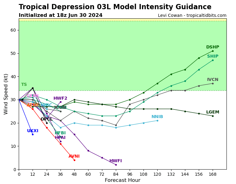
Looking directly at the raw public aid file from 18Z, only a CLIPER type model (DCLR) and HAFSA show it making it to TS... the aid from 12Z earlier though was a lot more optimistic.
Based on some of the objective measures like D-PRINT/D-MINT and the trend from ADT from OSPO looks like 03L will be reasonably classifiable as a TS in going by max wind speed alone in the next 2 hours (if not already) in time for the 11PM advisory. Still some pulsing deep convection near the center making it somewhat marginal on that front whether it will continue to do so or not.
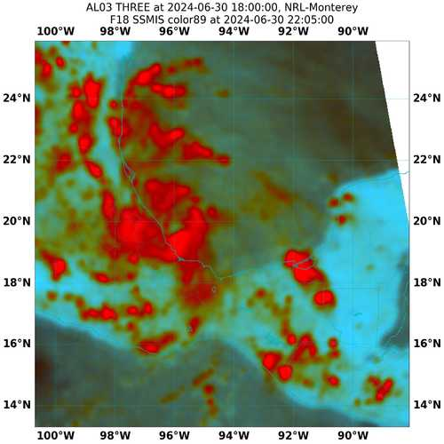
DMINT of multiple SSMIS passes puts intensity of 03L at TS level. DPRINT also puts it in 40kt+ range for last hours. Objective ADT puts it at TS level. Convection looks barely enough on Longwave IR though. Subjectively shortwave IR looks good for it. GFS 18Z phase analysis shows it still tropical then and forecast to remain so.
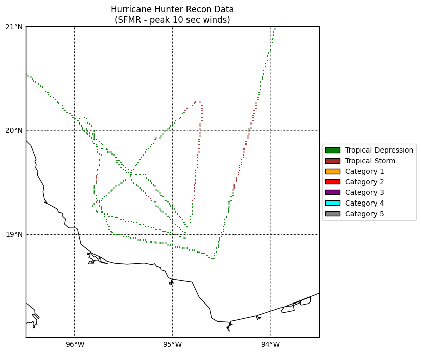
All signs I looked at say it might well be declared a TS in the next couple hours. Don't know why no new fixes on the fdecks on both nhc/ucar mirror. Hurricane recon on route to investigate ....
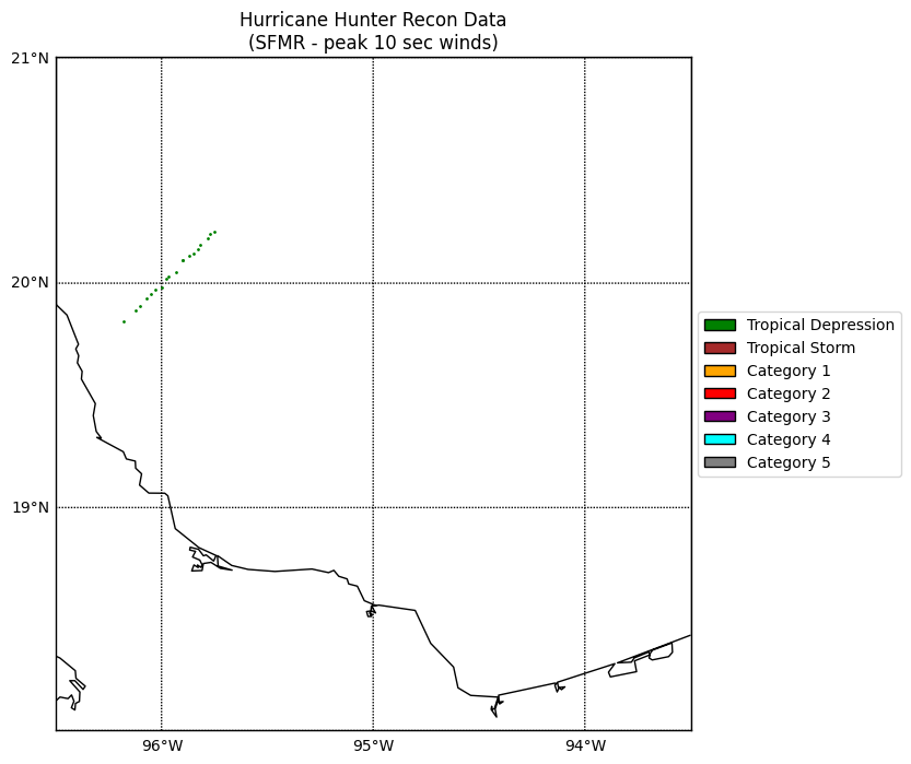
Not enough data from recon yet but only showing TD winds from SFMR so far:
5 mins left to advisory... waiting to last minute?