
Resolves EST
 1,000
1,000🏅 Top traders
| # | Trader | Total profit |
|---|---|---|
| 1 | Ṁ121 | |
| 2 | Ṁ101 | |
| 3 | Ṁ61 | |
| 4 | Ṁ32 |
People are also trading
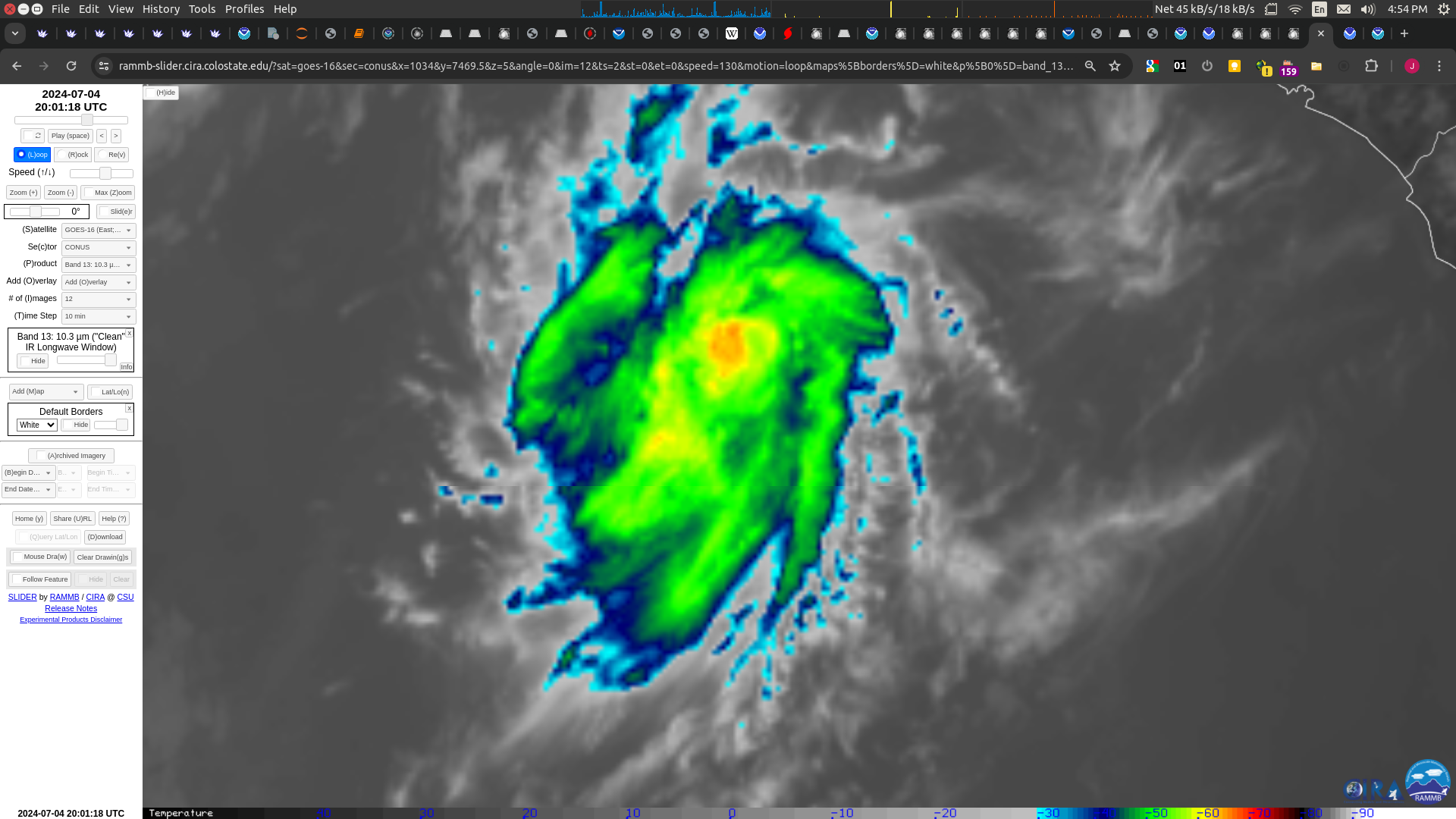
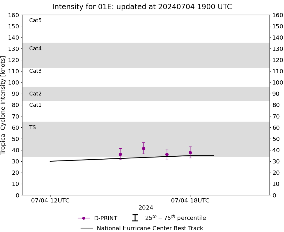
Given the small size of the system, these higher estimates appear believable, and so the initial intensity is raised to 35 kt for this advisory.I don't know if it stays a TS in the final best track when they do the reports some months down the line: looked so marginal given the convection in the last few hours
SAB and TAFB provided T2.0 final-T
numbers, although SAB did report a T2.5 data-T number.
Edit: nevermind they were referring to subjective:
https://www.ssd.noaa.gov/PS/TROP/DATA/2024/bulletins/epac/20240704180001E.html
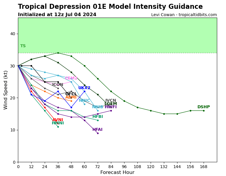
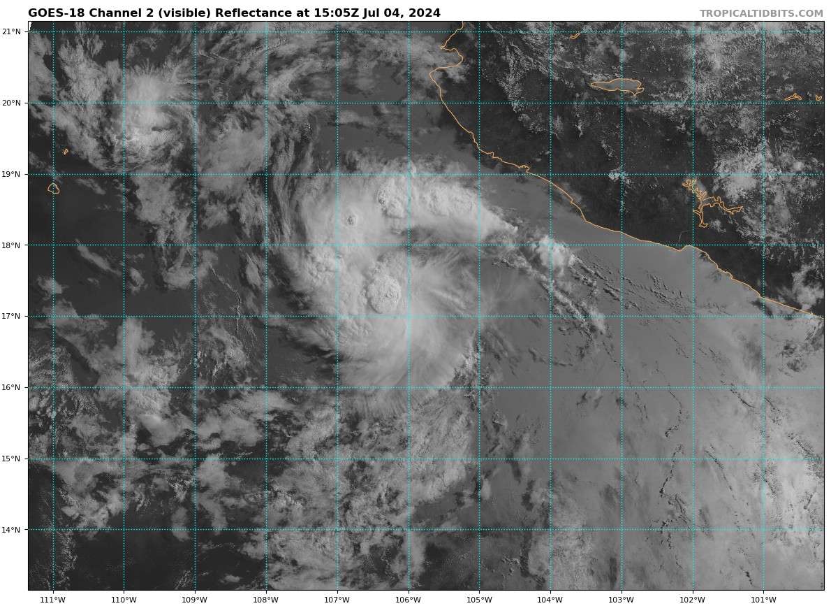
They've fed it as a TS into the computer models. Mixed bag from satellite analysis though:
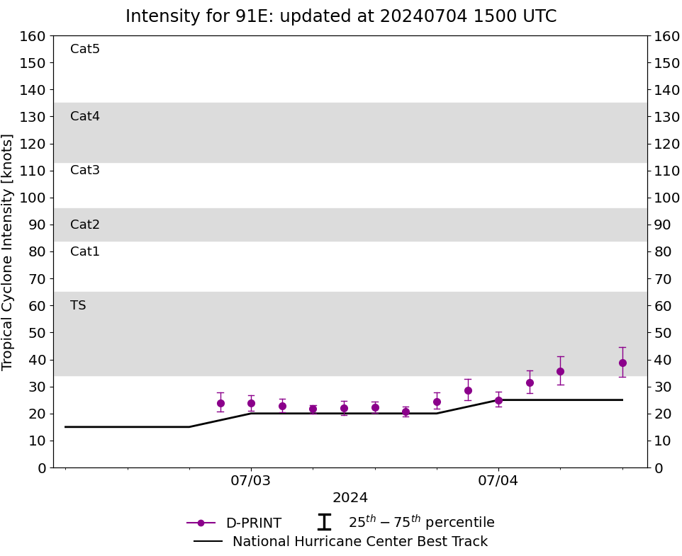
D-PRINT still has it as a TS:
ADT objective from OSPO,CIMSS puts it at a TD still though (CI = 2.2,2.1)
Deep convection appears to have stopped in last hour two so with such variable strength maybe it will remain a TD despite this...
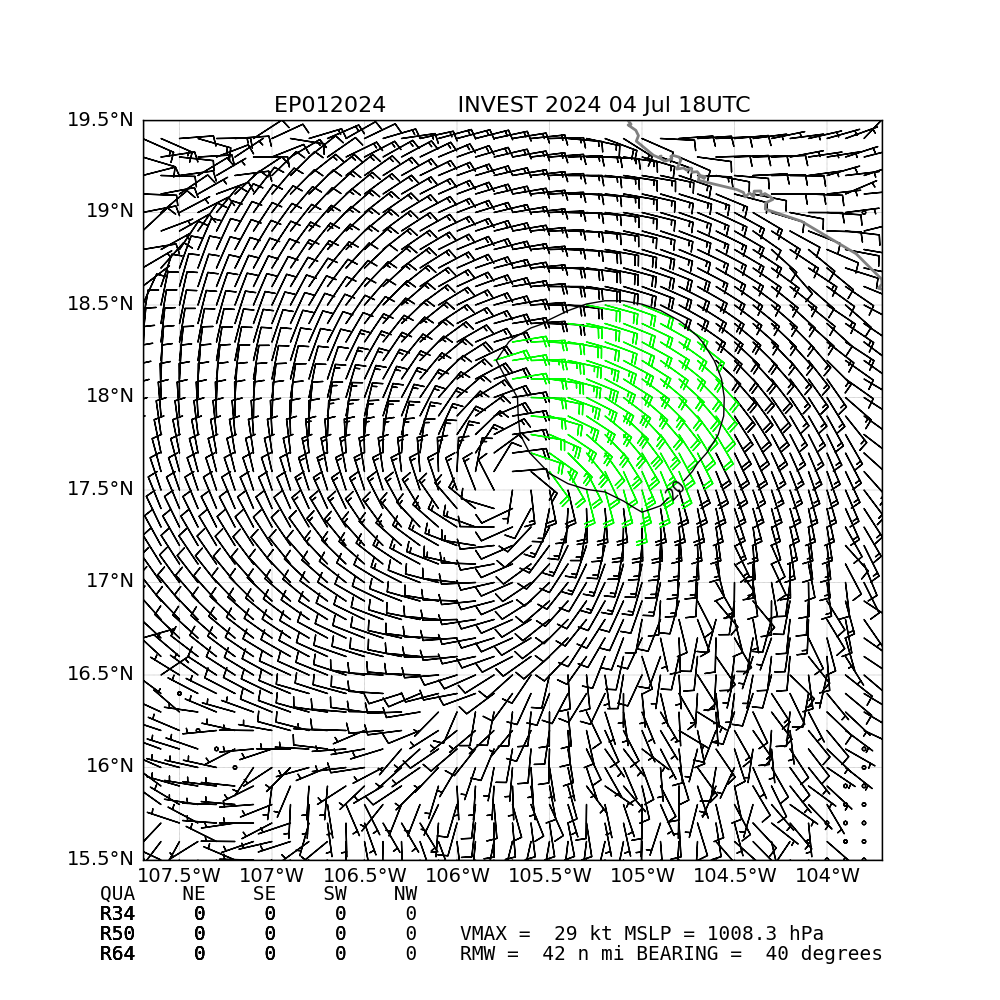
SATCON MSW puts it at 32kt just on the border:
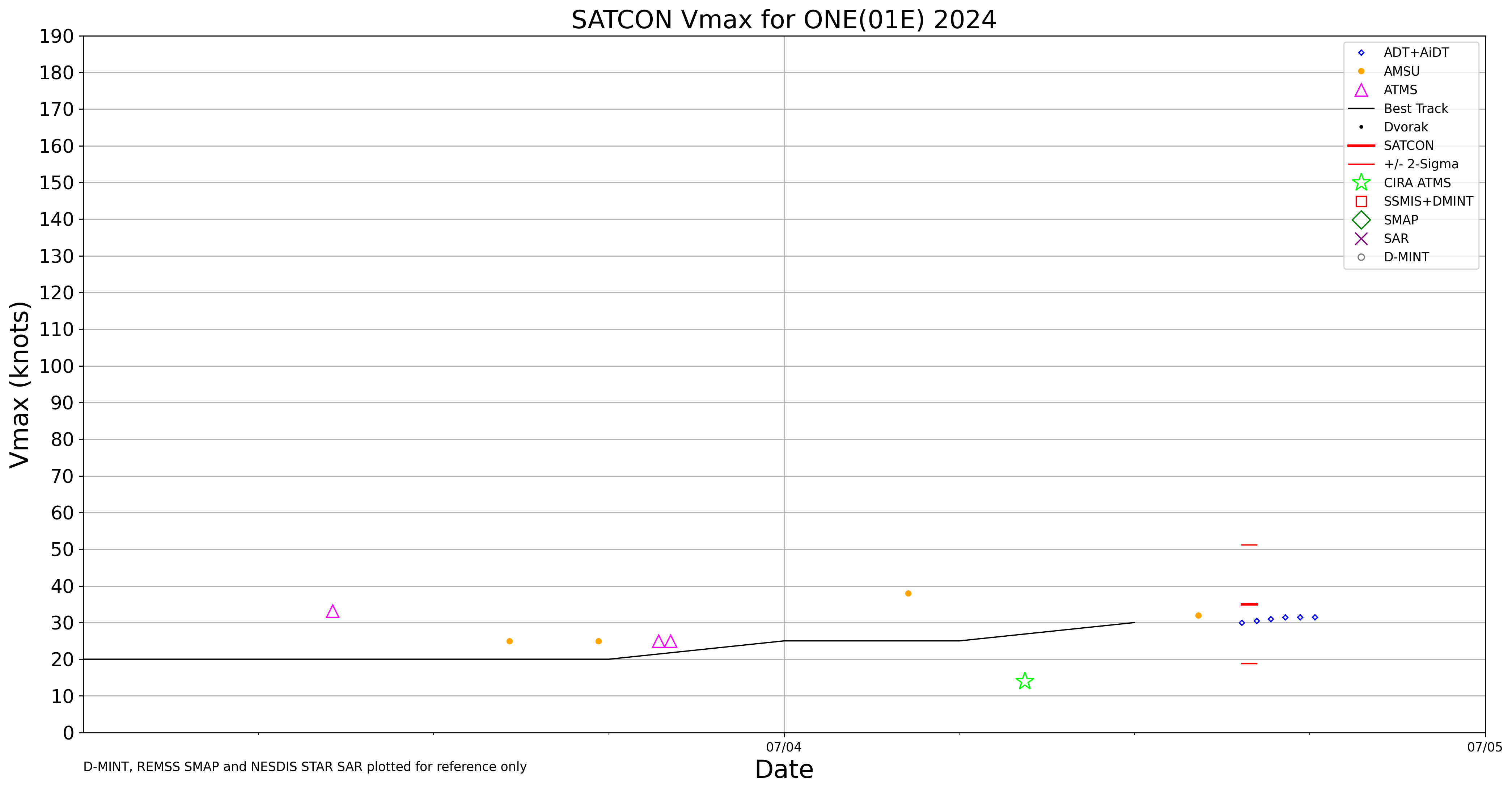
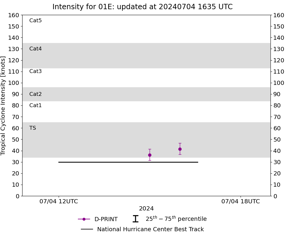
But NHC has 60%. Seems strange?
Looking at phase analysis from the 12Z models its right on the margins (mostly not a TC at least at 12Z) deep warm core/symmetric (CMC shows it barely then as a TC) but the trend is negative.
Did see some momentary banding from the spin that is present and some pulsating convection (over my guess for the center of storm) in the last hour or two:
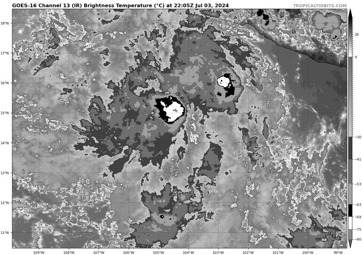
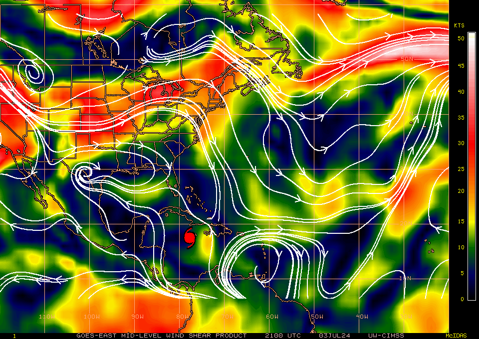
Some small neutral-unfavorable mid-level shear not helping it though?
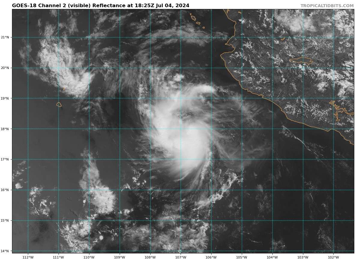
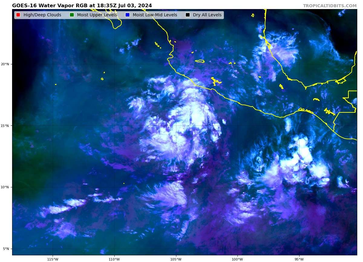
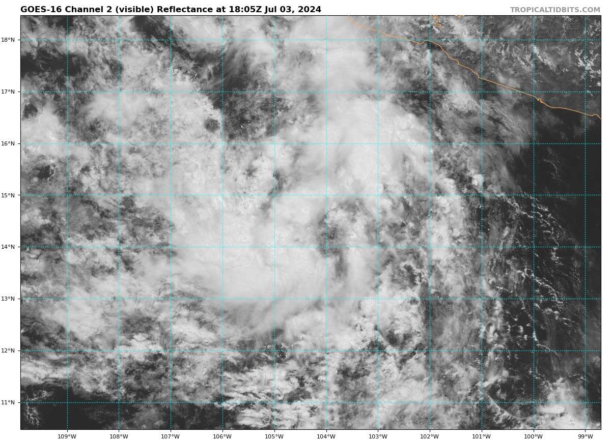
The vis looked momentarily like it might have a decent chance of developing earlier:
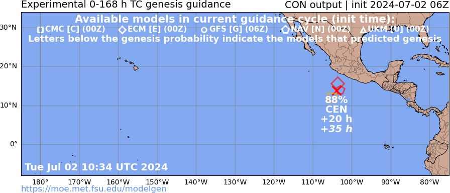
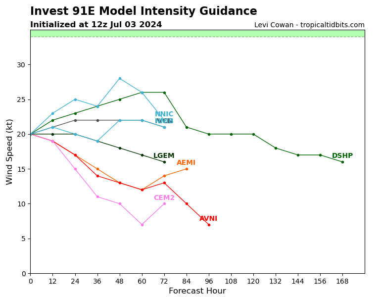
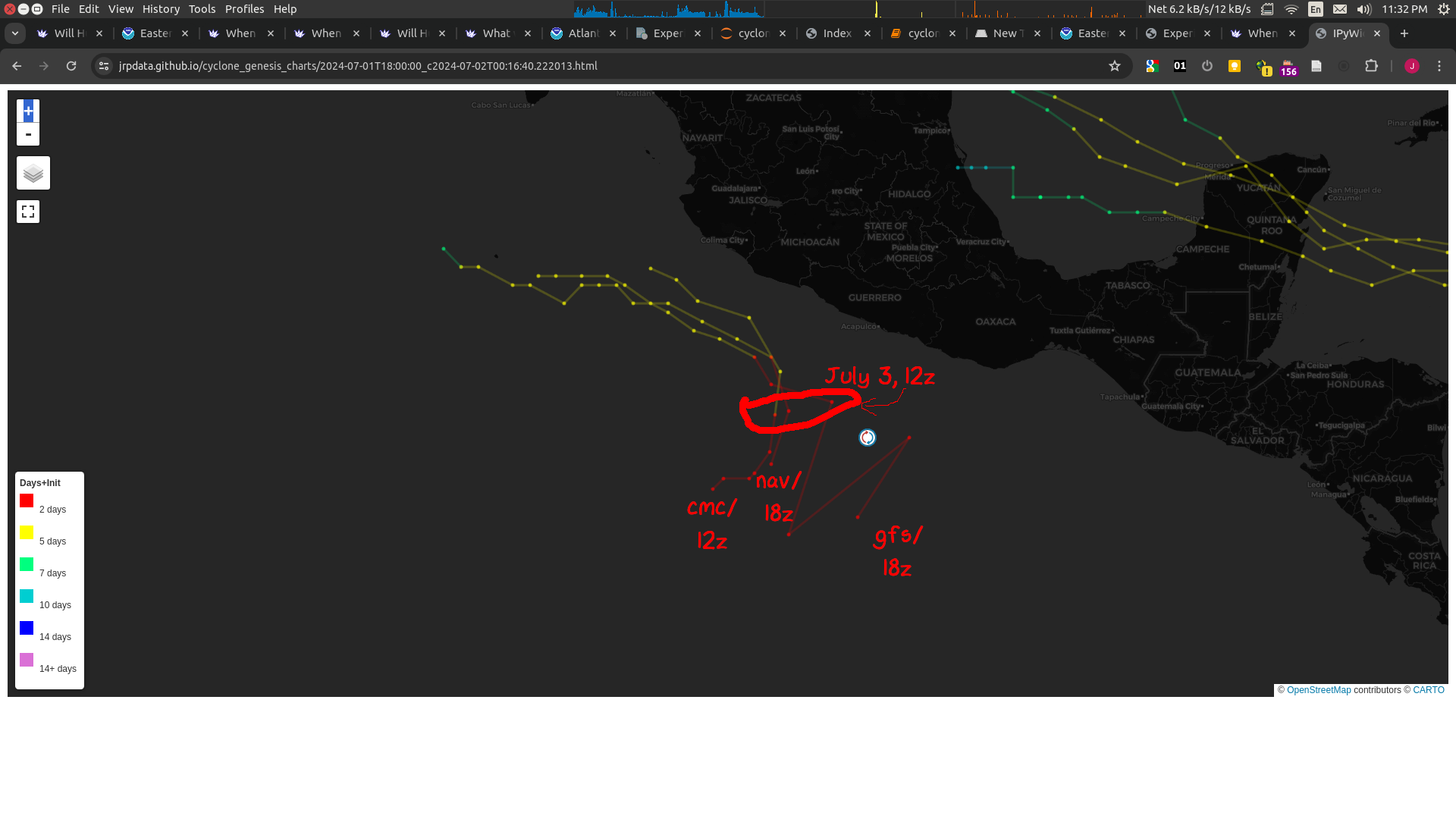
GFS/NAV (18Z) and CMC (12Z) now all show it becoming TS by July 3rd (06Z or 12Z).:
(From left to right on genesis, is CMC, NAV, GFS)
(Edit) annotated:
(According to some quick calculations referencing https://www.nhc.noaa.gov/data/hurdat/hurdat2-nepac-1949-2023-042624.txt)
The latest named storm formed during the regular season (>=May 15) of recorded TS from the start of the satellite era (>=1979) is July 2, 2016.
Given Other is at 80%+, it looks like we will be breaking another record in ~5 days.