
Resolves EST
 1,000
1,000🏅 Top traders
| # | Trader | Total profit |
|---|---|---|
| 1 | Ṁ654 | |
| 2 | Ṁ504 | |
| 3 | Ṁ219 | |
| 4 | Ṁ215 | |
| 5 | Ṁ40 |
People are also trading
I would bet they pull the naming and vitals from the COM directory or some similar mirror:
https://ftp.nhc.noaa.gov/atcf/com/?C=M;O=D
I read on a educational/training type powerpoint (last year?) that it was not absolutely definitive that the NHC forecaster couldn't change their mind on the advisory in between feeding the computer models and the advisory time. (I was going to switch my bet to 85% on June 28 on seeing the latest fixes/IR before the TAFB fix and then the subsequent .com updates)
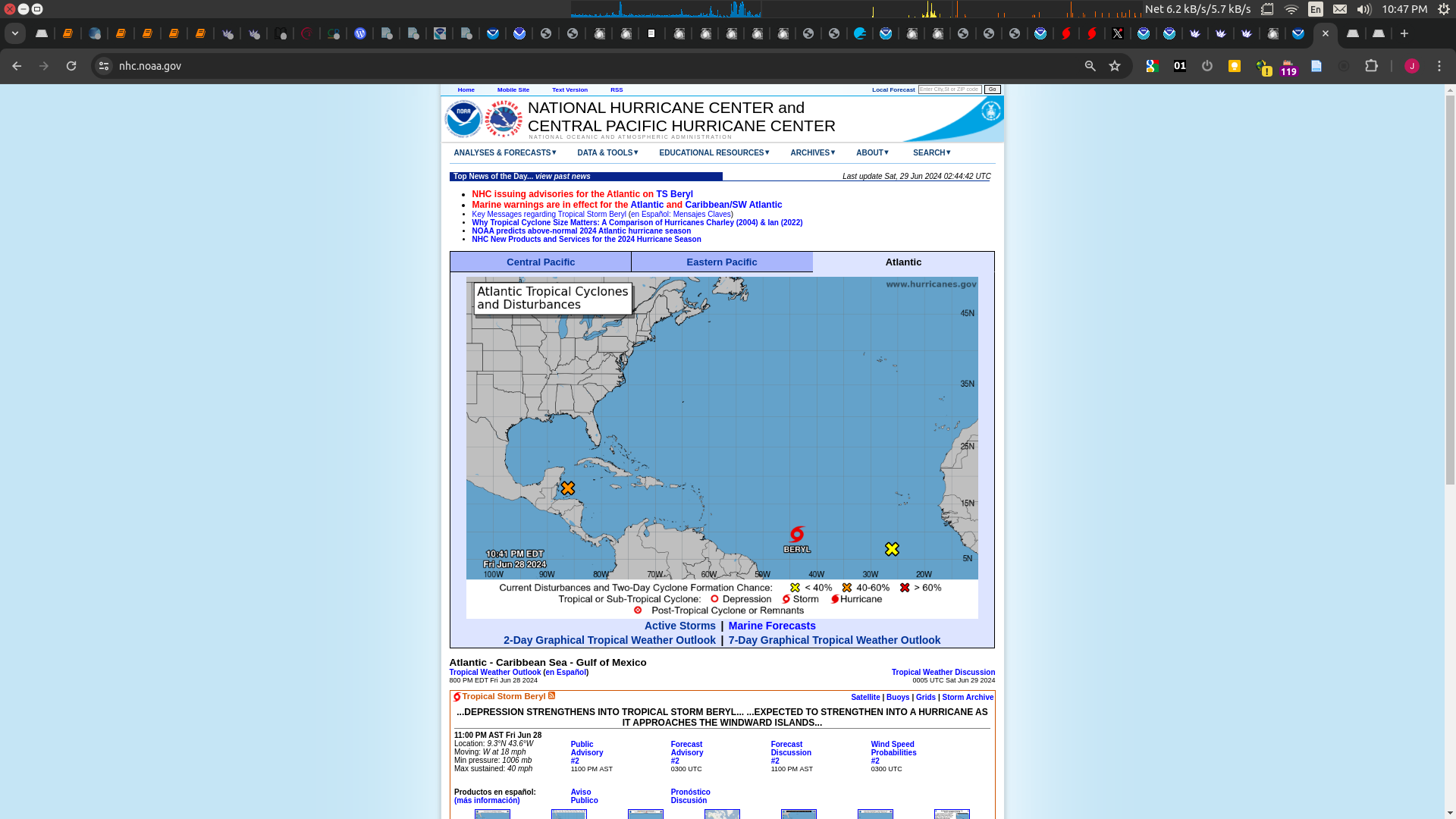
AL, 02, 202406290000, 10, DVTS, CI, , 920N, 4390W, , 2, 35, 2, 1005, 2, DVRK, , , , , , , , , , , , , , L, TAFB, NR, VI, 3, 2525 /////, , , GOES16, CSC, T, TAFB 00Z at TS strength. Along with other fixes it looks like it will likely be rated a TS at 11PM.
Latest model input data has it as a TS as well (CARQ):
AL, 02, 2024062900, 01, CARQ, 0, 92N, 427W, 35, 1006, TS, 34, NEQ, 40, 0, 0, 40, 1011, 150, 40, 0, 0, L, 0, X, 275, 16, BERYL, M, 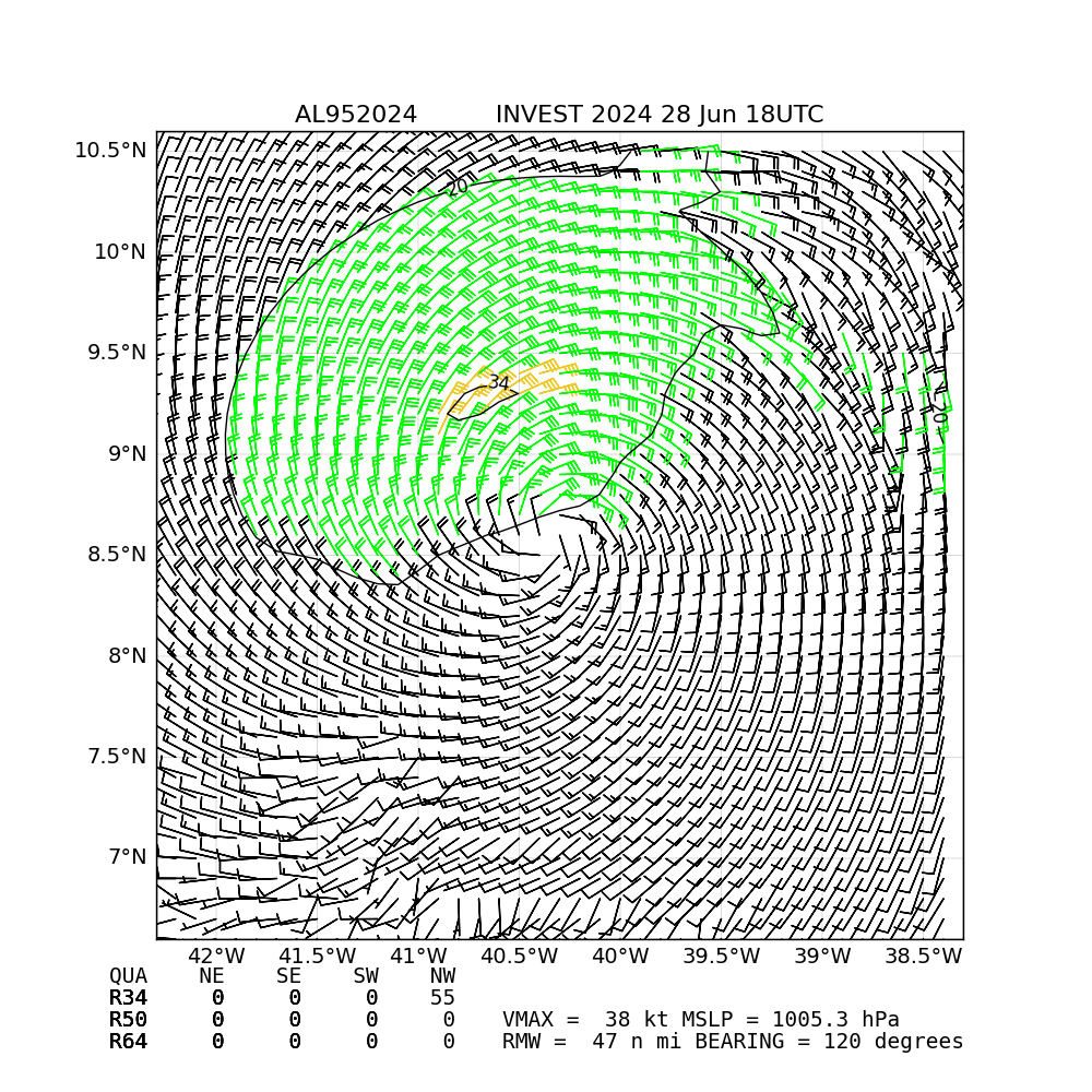
12H 29/0600Z 9.4N 44.5W 35 KTBut we don't get forecast for 6 hours
well perhaps this:
Accordingly, the official forecast calls for strengthening and shows
the depression becoming a tropical storm tonight or early Saturday
and then a hurricane before it reaches the Windward Islands.
(from the discussion)
Might be time for third Atlantic named storm of 2024 market. Can we have multichoice any number market, 'On or after date' style so old ones can be resolved?
TWO 8am on AL95:
2. Central Tropical Atlantic (AL95):
A low pressure system located about 1500 miles east-southeast of the
Windward Islands is gradually becoming better defined.  Showers and
thunderstorms are also showing signs of organization, and a tropical
depression or tropical storm will likely form later today or on
Saturday. This system is expected to move westward at 15 to 20 mph
and approach the Lesser Antilles by the end of the weekend.
Interests there should monitor the progress of this system.  For
more information, including gale warnings, see High Seas Forecasts
issued by the National Weather Service.
* Formation chance through 48 hours...high...90 percent.
* Formation chance through 7 days...high...90 percent.2PM TWO. Edit (forgot TC advisories on different time step then outlooks): Looks like they'll wait to 5PM/11PM to classify it? (Comments don't seem bullish as a TS today though.)
Central Tropical Atlantic (AL95):
A low pressure system located about 1400 miles east-southeast of the
Windward Islands is becoming better defined and the associated
showers and thunderstorms are increasing in organization. If these
trends continue, a tropical depression will likely form later today.
This system is expected to move westward at 15 to 20 mph and
approach the Windward Islands by the end of the weekend, and
Hurricane or Tropical Storm Watches could be required for portions
of that region tonight or early Saturday. For more information,
including gale warnings, see High Seas Forecasts issued by the
National Weather Service.
* Formation chance through 48 hours...high...near 100 percent.
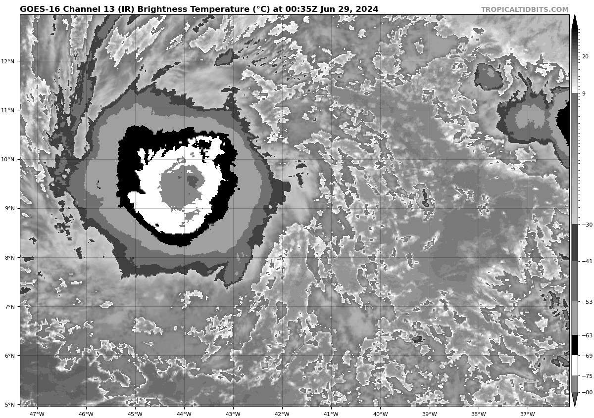
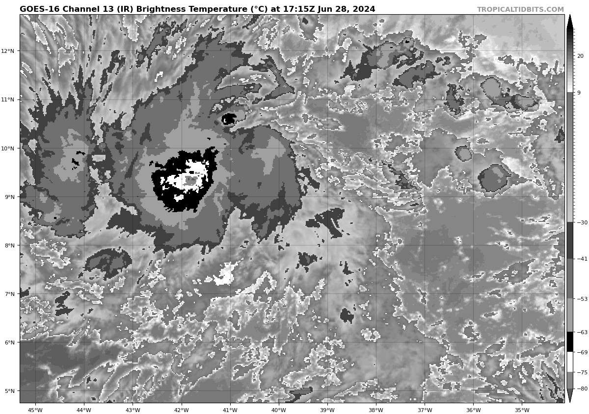
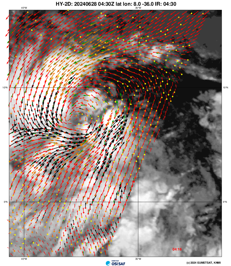
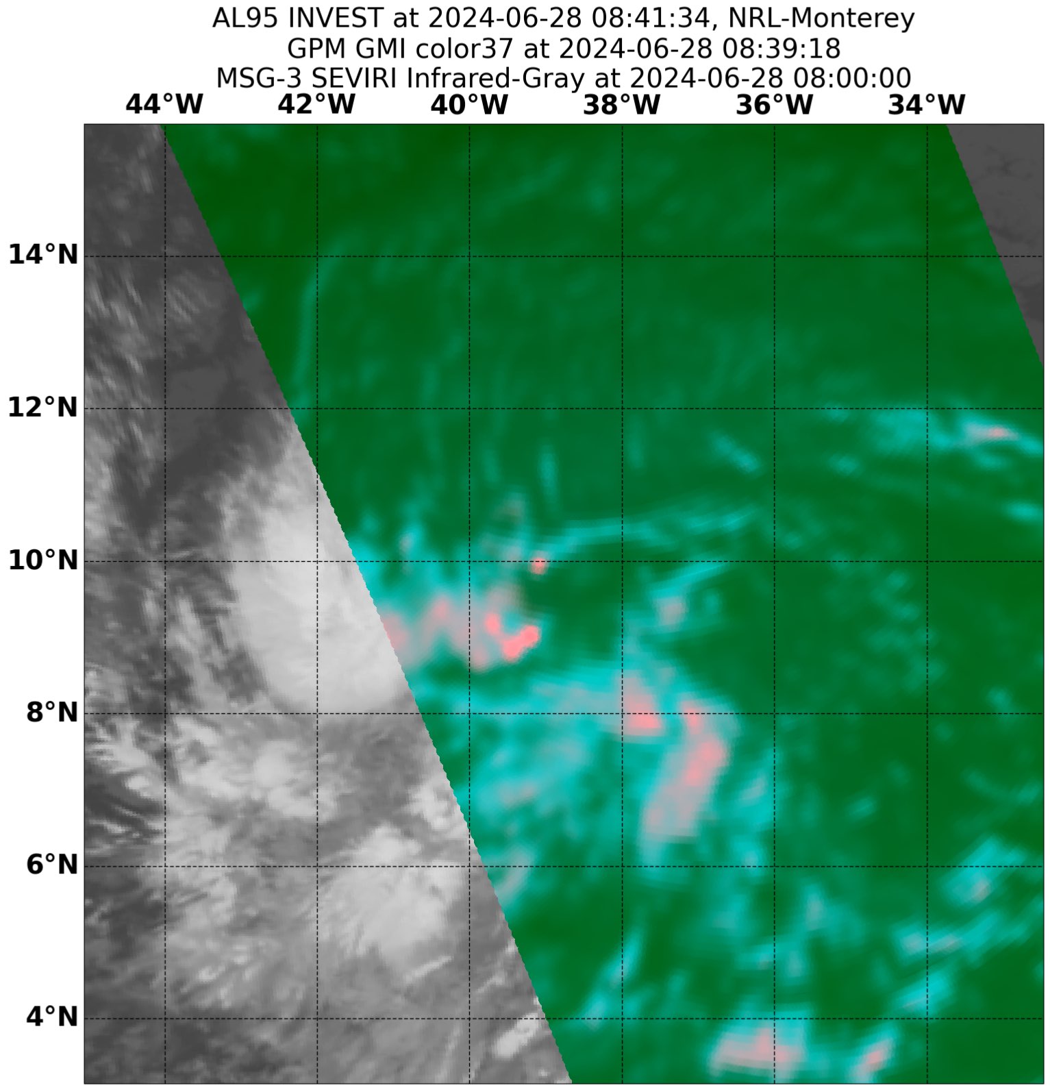
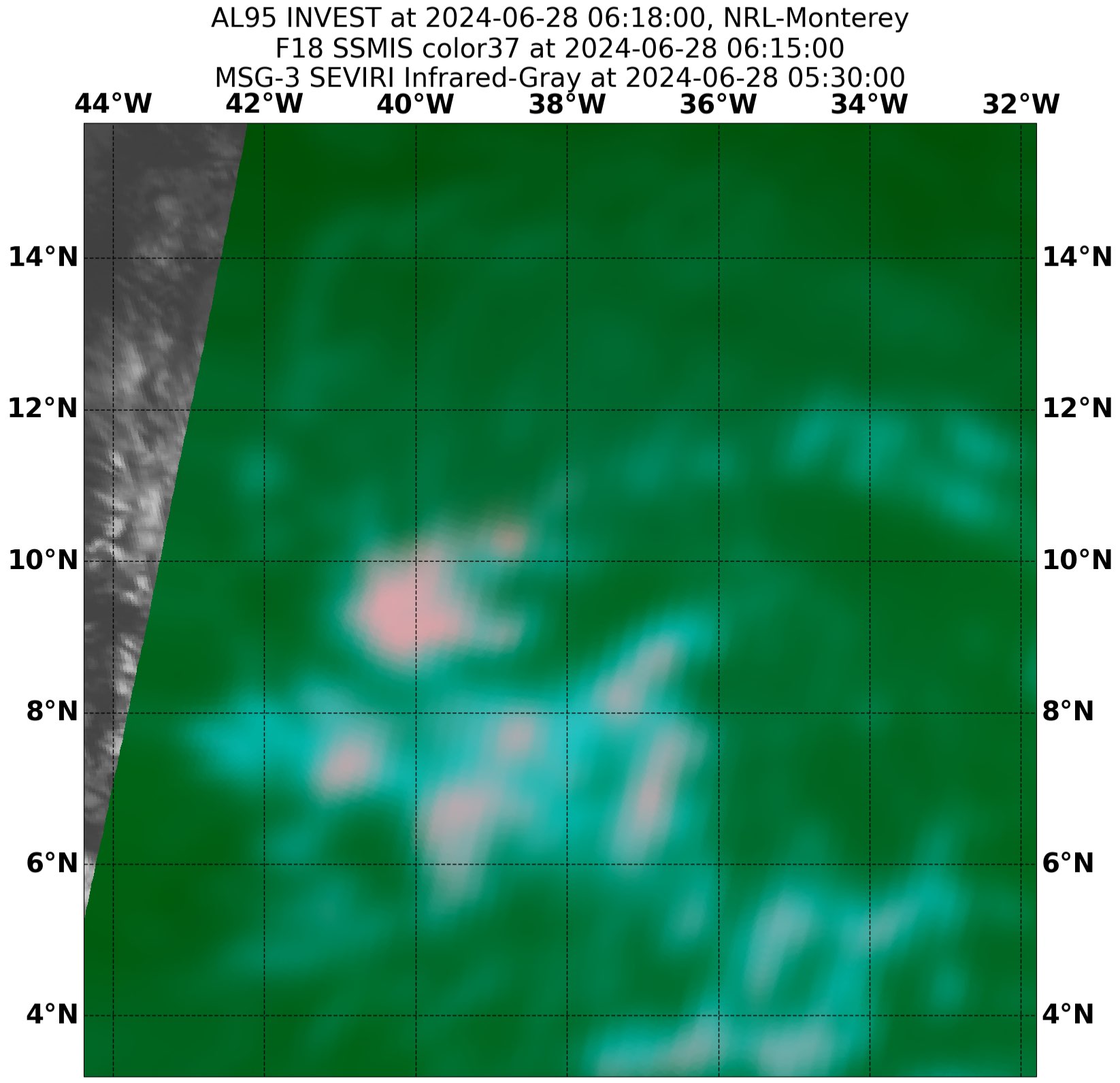
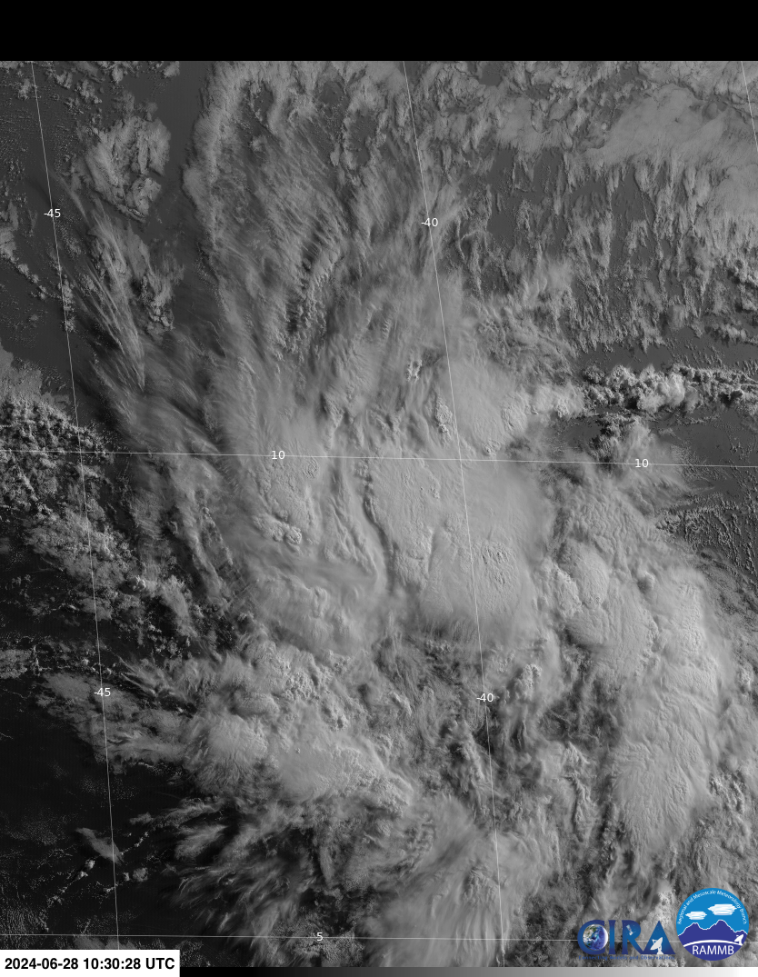
* Formation chance through 7 days...high...near 100 percent.New deep convection in the last couple of hours:
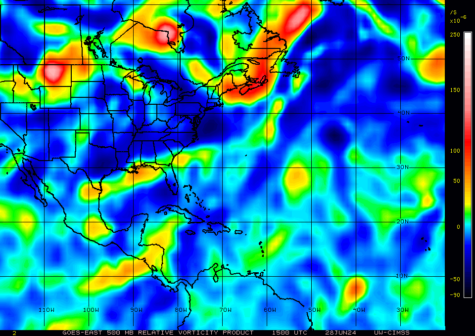
More spin (more relative vorticity from low to (now) mid troposphere):
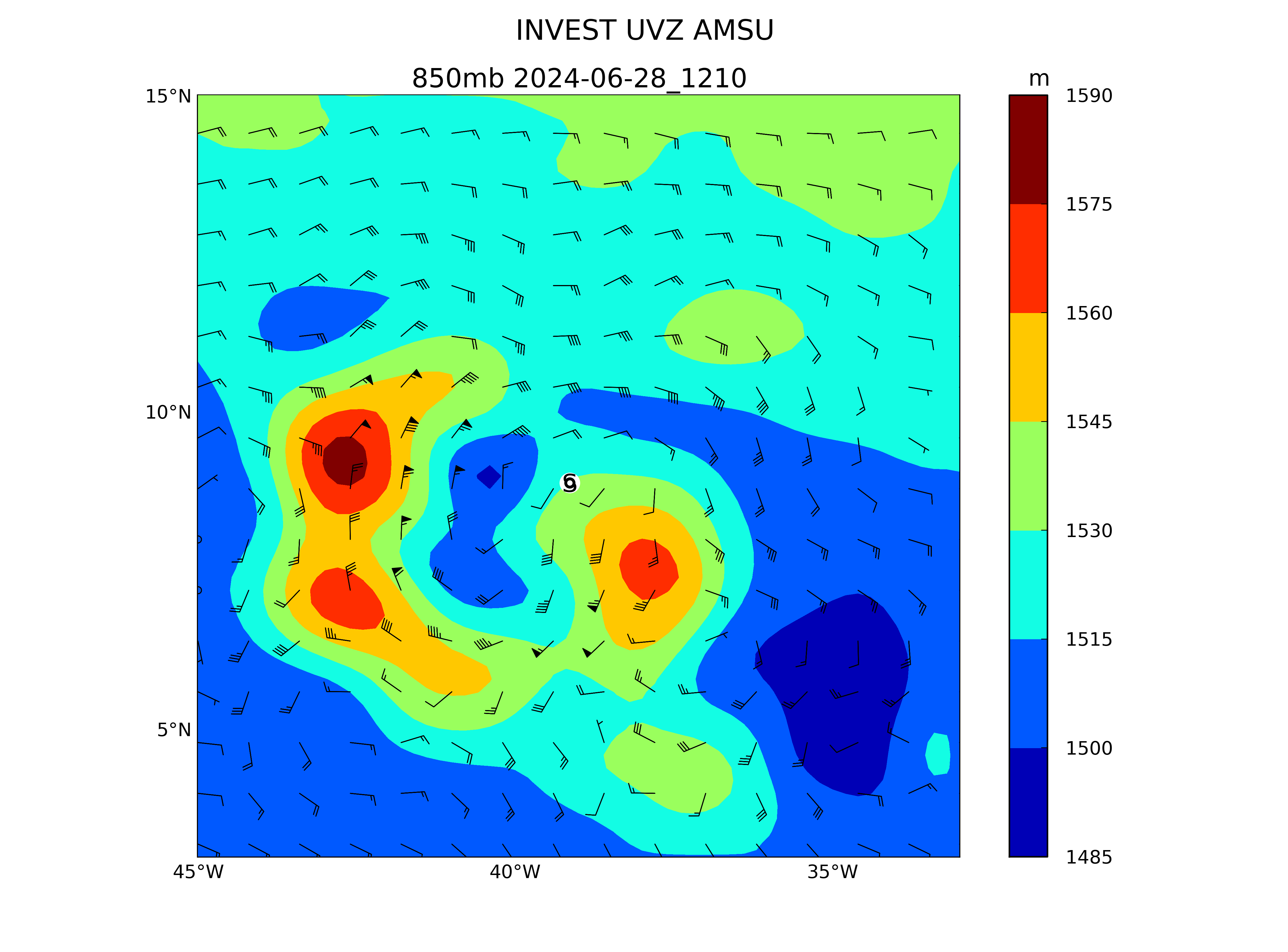
850mb (OSPO analysis) showed up to 80 kt winds at that level at 12Z:
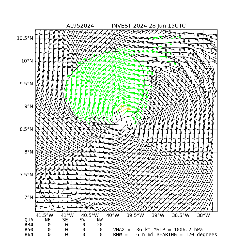
Latest Surface winds (satellite) analysis continues to have a few TS level winds close to the center:
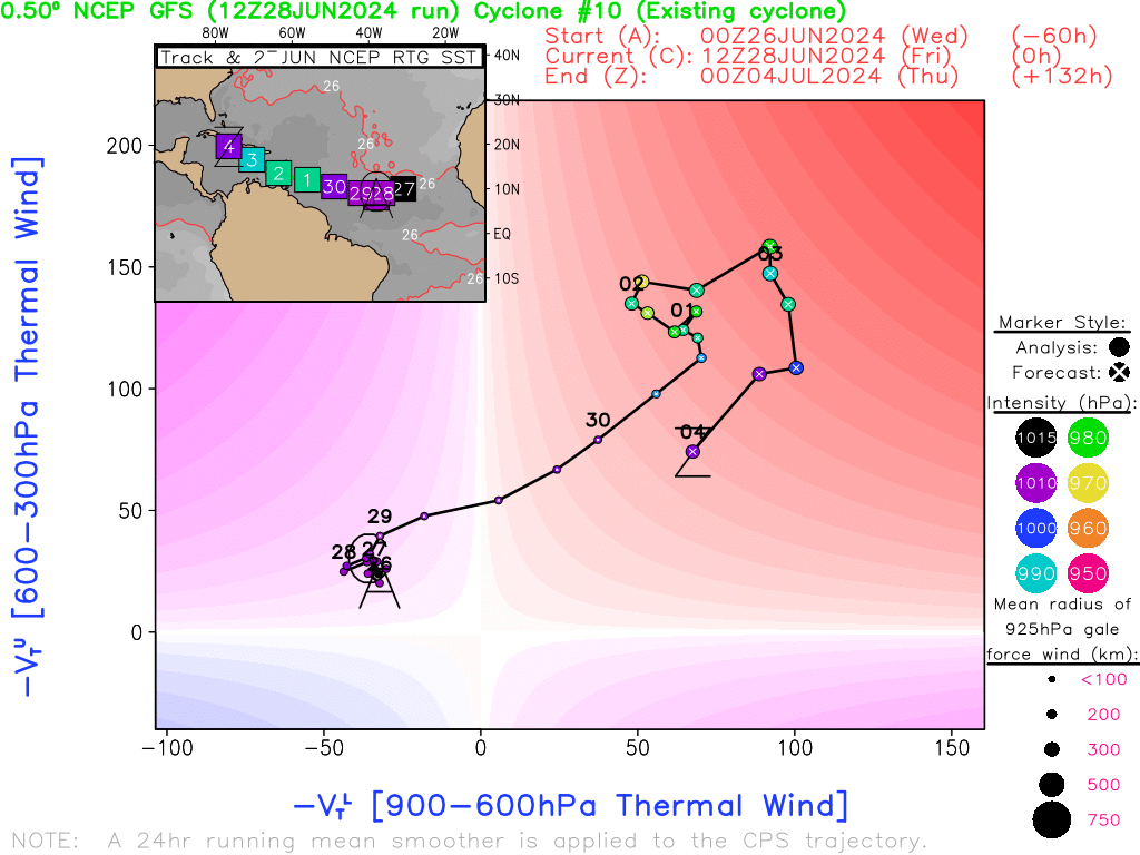
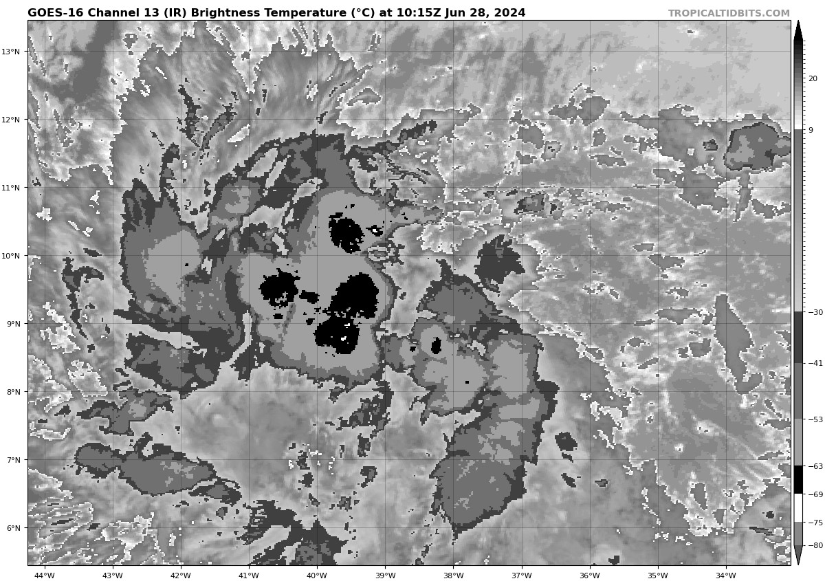
The lack of convection at 12Z matches GFS phase analysis showing no warm core at 12Z (will have to wait until 18Z run analysis to see whether it thinks the recent convection is indicative of a warm core for the remaining slim chance of 6/28 becoming a TS at 8PM):
Dvorak:
Fixes from TAFB have rated it at TD intensity (2.0/2.0) for the last 3 synoptic intervals (00, 06, 12Z)
SAB has started publishing its first fix (as 1.0/1.0) for 12Z
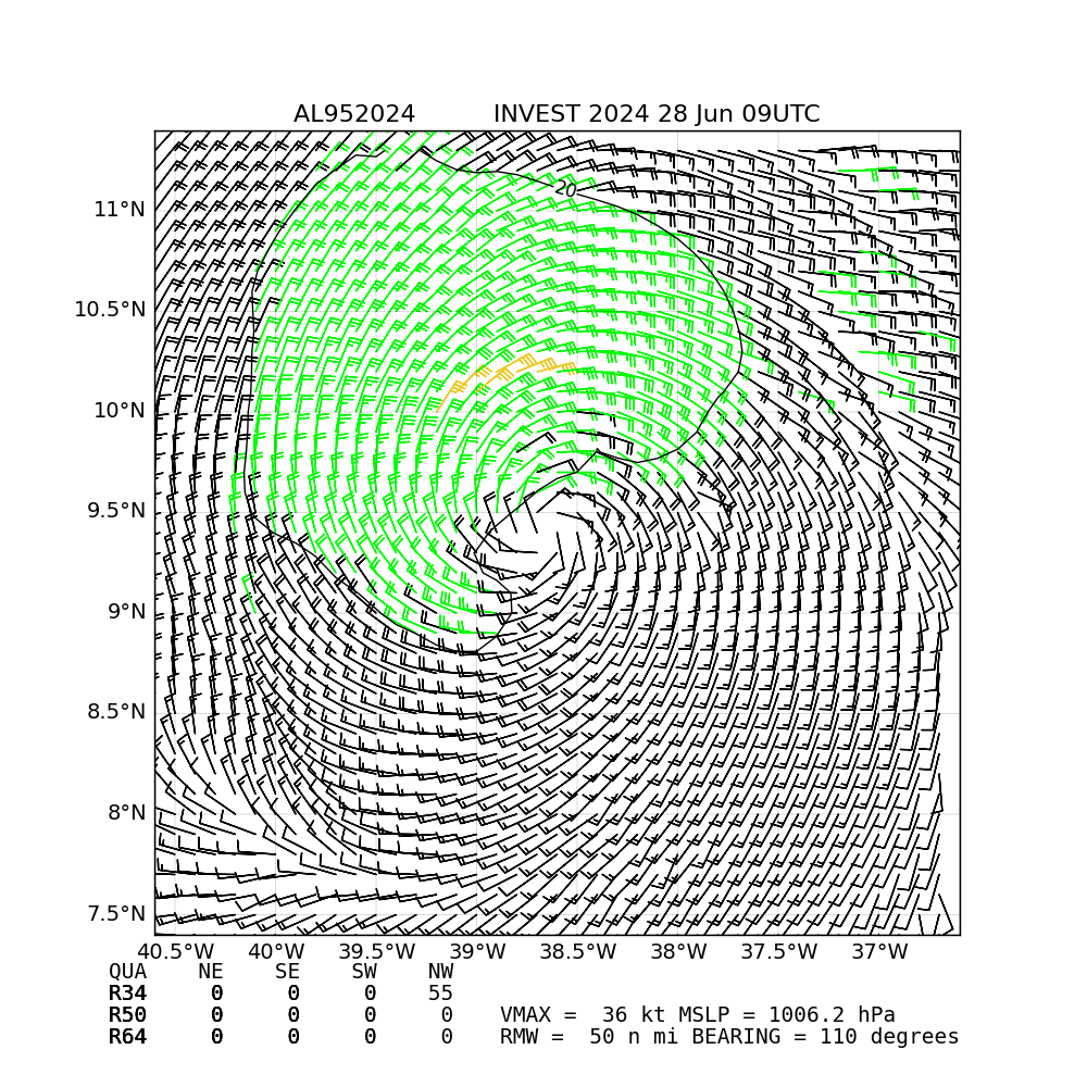
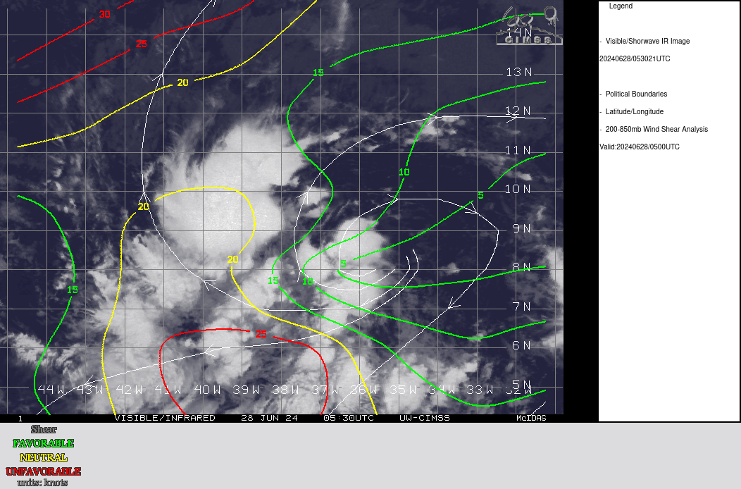
NHC TWO has increased genesis probabilities to 70%/90% (48h/7days).
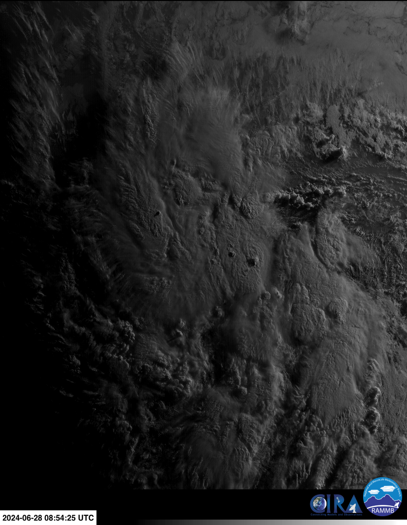
Increasing bet on (late) June 28 after reviewing model guidance, seeing TAFB subjective dvorak CI of 2.0 (TD), and 5 straight hours of deep convection on IR. 28/00Z fix:
AL, 95, 202406280000, 10, DVTS, CI, , 990N, 3730W, , 2, 30, 2, 1009, 2, DVRK, , , , , , , , , , , , , , L, TAFB, NR, VI, 3, 2020 /////, , , GOES16, CSC, T, The regional models (as well as CMC 12Z) show AL95 having max winds at TS strength by 29/00Z (in time for 8 PM advisory), with the question remaining of whether it will look organized enough to categorize it as a TS by tomorrow night.
comparison of simulated IR (GFS, HAFS A/B) to actual for 06Z models (only 2-3 steps):
https://raw.githubusercontent.com/JRPdata/wastebook/main/simulated_ir_comparison_AL95_2024-06-27.gif
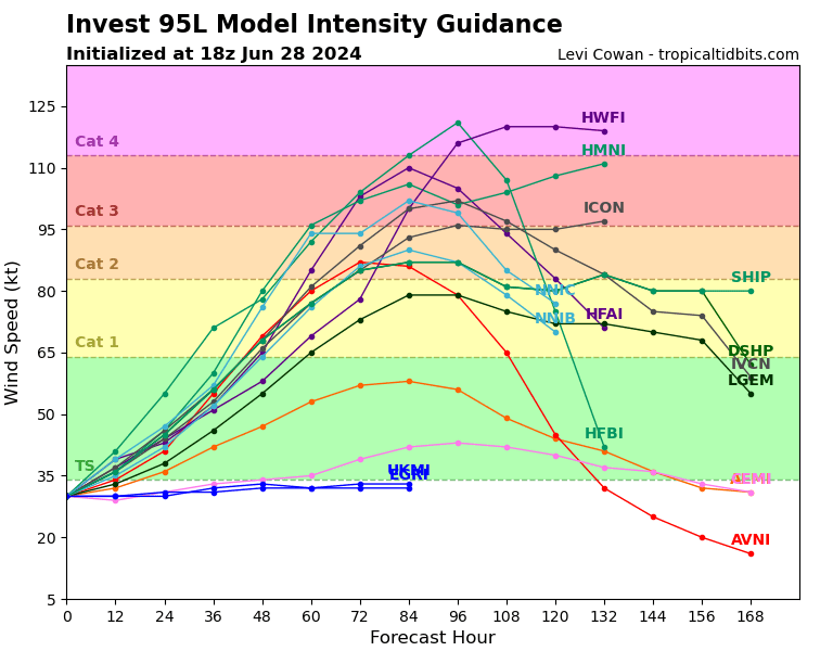
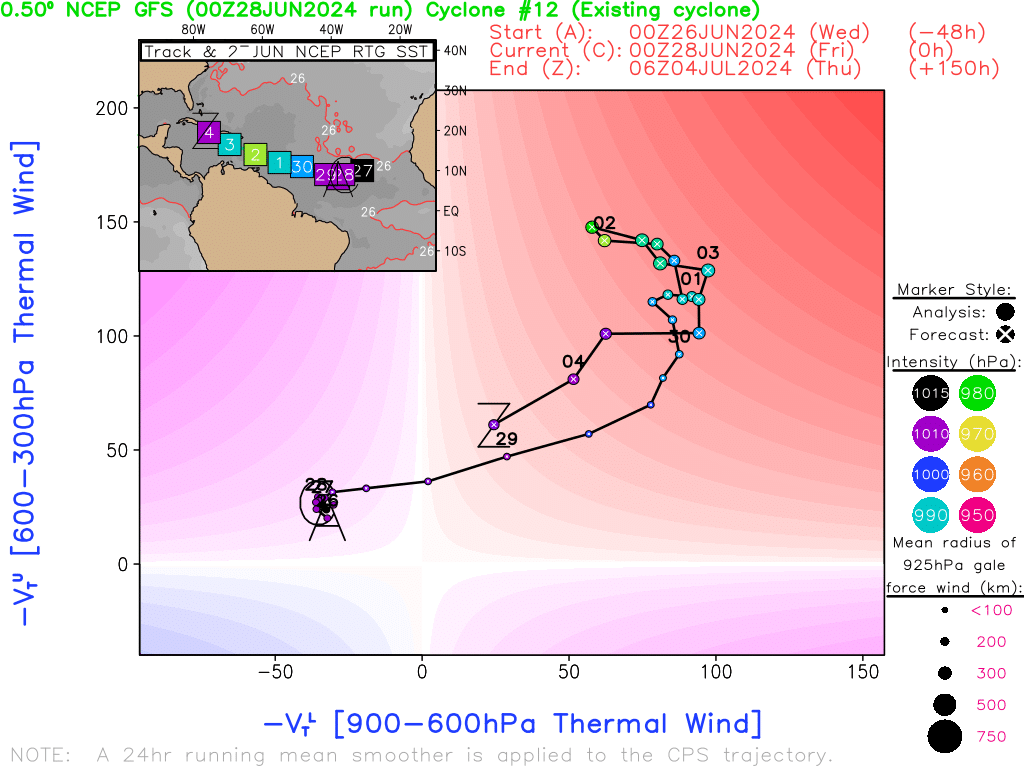
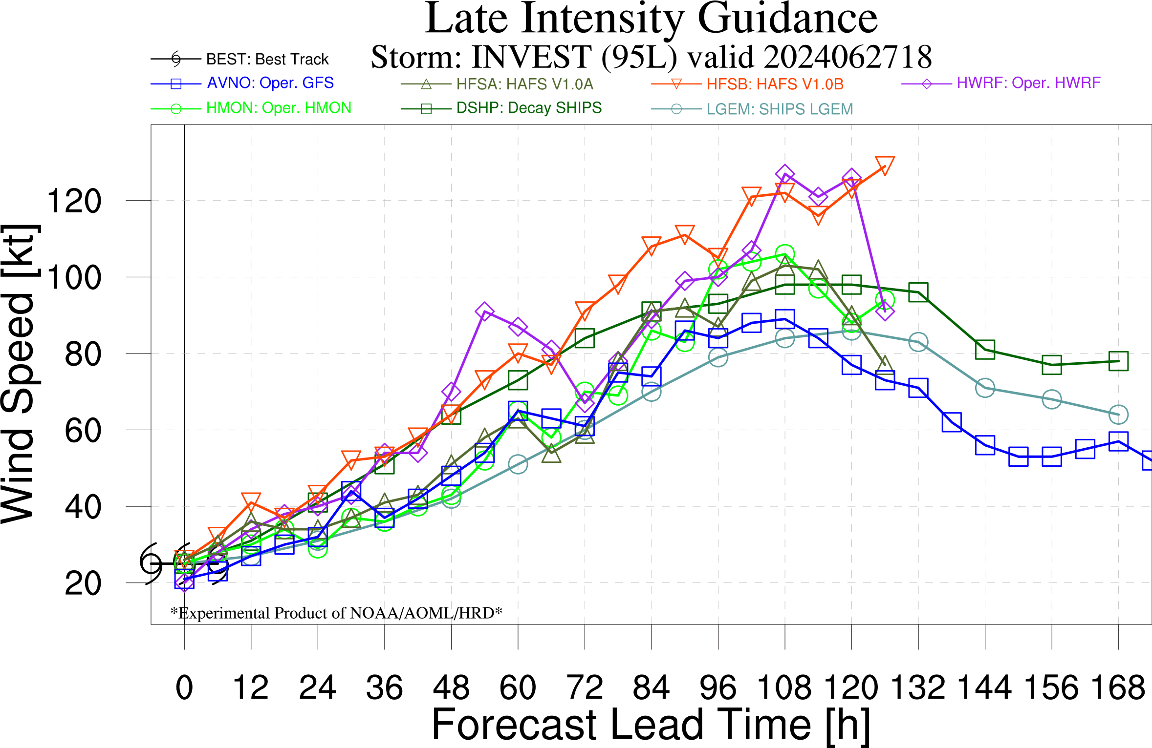
4 models all taking it to hurricane ?
https://www.tropicaltidbits.com/storminfo/95L_intensity_latest.png
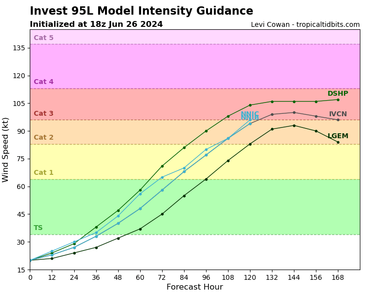
DSHP and LGEM are just statistical models though... but yes the three global models from 12Z all show it nearing or exceeding hurricane strength:
ECM:
Max 10m Wind Speed Valid Time: 2024-07-05T12:00:00
AL Basin, Latitude (deg:): 17.2, Longitude (deg): -82.8, MSLP (hPa): 961.7, ~ROCI (km): 359
850 RV MAX (*10^-5 1/s): 182.51, 250-850 hPa Thickness (m): 9688.48, 925 hPa WS MAX (m/s): 50.93
10m WS MAX (knots) in ~ROCI: 115.9, Isobar delta (hPa) (MSLP for OCI - minimum): 46
CMC:
Max 10m Wind Speed Valid Time: 2024-07-02T06:00:00
AL Basin, Latitude (deg:): 13.5, Longitude (deg): -63.3, MSLP (hPa): 990.9, ~ROCI (km): 237
850 RV MAX (*10^-5 1/s): 182.24, 250-850 hPa Thickness (m): 9650.97, 925 hPa WS MAX (m/s): 46.05
10m WS MAX (knots) in ~ROCI: 63.0, Isobar delta (hPa) (MSLP for OCI - minimum): 19
GFS:
Max 10m Wind Speed Valid Time: 2024-07-02T06:00:00
AL Basin, Latitude (deg:): 12.8, Longitude (deg): -65.5, MSLP (hPa): 988.4, ~ROCI (km): 171
850 RV MAX (*10^-5 1/s): 221.30, 250-850 hPa Thickness (m): 9625.21, 925 hPa WS MAX (m/s): 50.69
10m WS MAX (knots) in ~ROCI: 70.6, Isobar delta (hPa) (MSLP for OCI - minimum): 22