Operational. Closes early
 1,000
1,000🏅 Top traders
| # | Trader | Total profit |
|---|---|---|
| 1 | Ṁ544 | |
| 2 | Ṁ264 | |
| 3 | Ṁ248 | |
| 4 | Ṁ22 | |
| 5 | Ṁ5 |
@Calibrate If John reaches Category 4 or Category 5, I will ask a mod to change the resolution, but not going to reopen it for more betting before then as I usually have these markets close early anyway
@SaviorofPlant Cat.3 at landfall
000
WTPZ65 KNHC 240322
TCUEP5

Hurricane John Tropical Cyclone Update
NWS National Hurricane Center Miami FL       EP102024
920 PM CST Mon Sep 23 2024

...MAJOR HURRICANE JOHN MAKES LANDFALL IN MEXICO...

Satellite data indicates that Hurricane John has made landfall
along the southern coast of Mexico just to the south-southwest of
Marquelia, Mexico in the state of Guerrero at around 915 PM CST
(0315 UTC). The maximum sustained winds at landfall are estimated
to be 120 mph (195 km/h), and the minimum central pressure is
estimated at 959 mb (28.32 inches). This makes John a category 3
hurricane on the Saffir-Simpson Hurricane Wind Scale.


SUMMARY OF 920 PM CST...0320 UTC...INFORMATION
---------------------------------------------------
LOCATION...16.6N 98.9W
ABOUT 25 MI...40 KM NW OF PUNTA MALDONADO MEXICO
ABOUT 130 MI...205 KM WNW OF PUERTO ESCONDIDO MEXICO
MAXIMUM SUSTAINED WINDS...120 MPH...195 KM/H
PRESENT MOVEMENT...N OR 350 DEGREES AT 8 MPH...13 KM/H
MINIMUM CENTRAL PRESSURE...959 MB...28.32 INCHES

$$
Forecaster PapinOfficialy a major hurricane now..
HURRICANE JOHN FORECAST/ADVISORY NUMBER   7
NWS NATIONAL HURRICANE CENTER MIAMI FL       EP102024
0300 UTC TUE SEP 24 2024

HURRICANE CENTER LOCATED NEAR 16.3N  98.8W AT 24/0300Z
POSITION ACCURATE WITHIN  20 NM

PRESENT MOVEMENT TOWARD THE NORTH OR 350 DEGREES AT   7 KT

ESTIMATED MINIMUM CENTRAL PRESSURE  959 MB
EYE DIAMETER   5 NM
MAX SUSTAINED WINDS 105 KT WITH GUSTS TO 120 KT.
64 KT....... 10NE  10SE   0SW  10NW.
50 KT....... 20NE  20SE  15SW  20NW.
34 KT....... 40NE  40SE  30SW  40NW.
12 FT SEAS.. 10NE  90SE  60SW  10NW.
WINDS AND SEAS VARY GREATLY IN EACH QUADRANT.  RADII IN NAUTICAL
MILES ARE THE LARGEST RADII EXPECTED ANYWHERE IN THAT QUADRANT.

REPEAT...CENTER LOCATED NEAR 16.3N  98.8W AT 24/0300Z
AT 24/0000Z CENTER WAS LOCATED NEAR 15.9N  98.6W

FORECAST VALID 24/1200Z 17.0N  98.9W...INLAND
MAX WIND  55 KT...GUSTS  65 KT.
50 KT...  0NE  10SE  10SW  10NW.
34 KT... 20NE  40SE  50SW  30NW.
Hurricane John Discussion Number   7
NWS National Hurricane Center Miami FL       EP102024
900 PM CST Mon Sep 23 2024

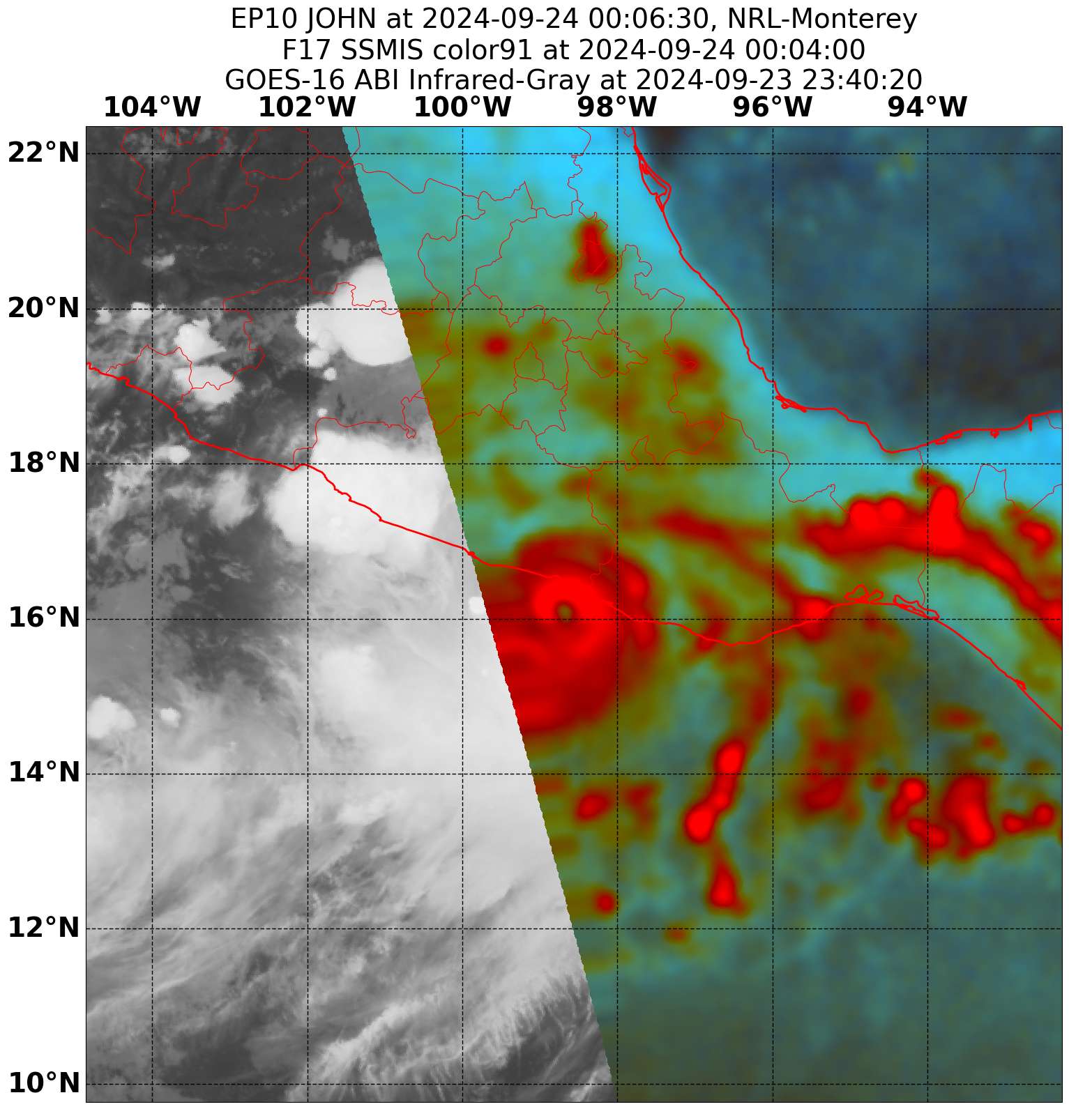
John has continued to strengthen this evening with a small tight
inner core, which was well depicted in SSMIS microwave images around
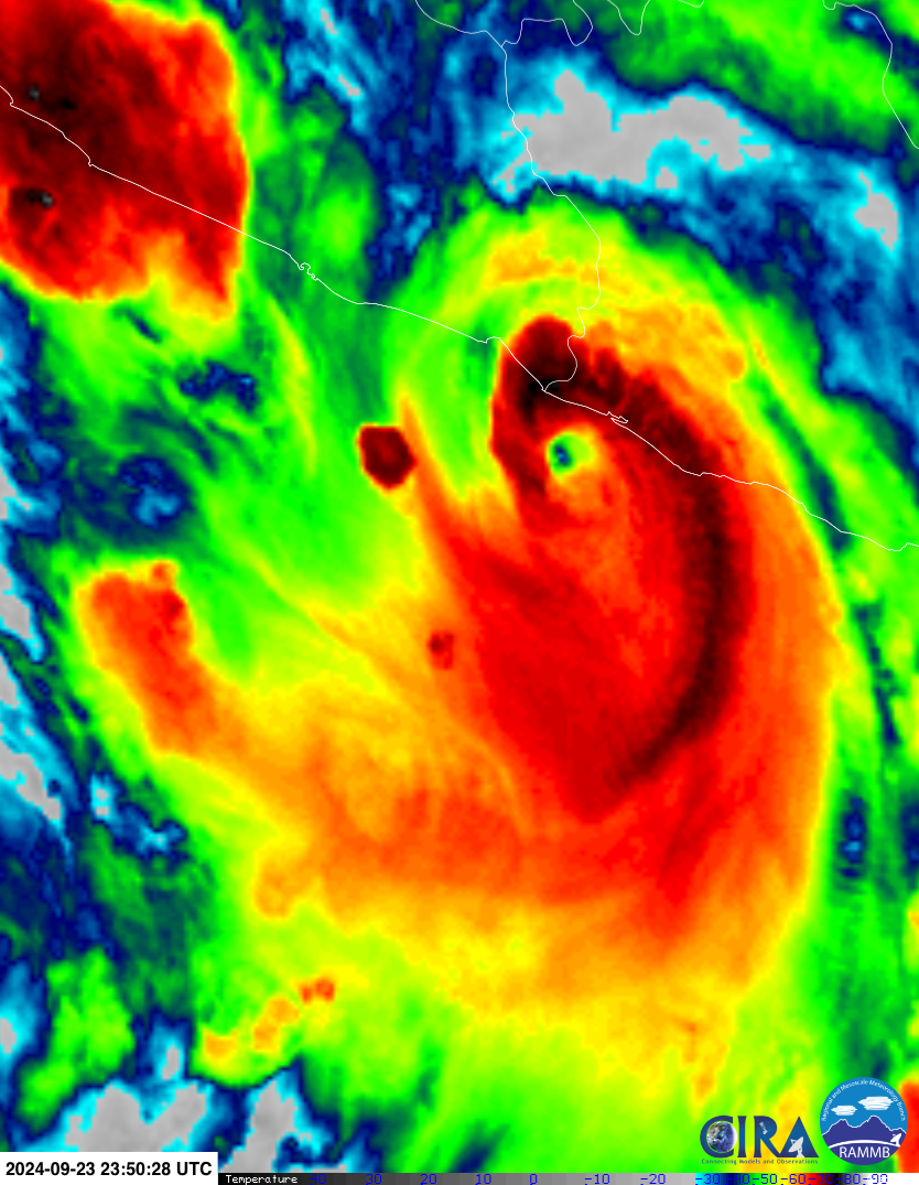
00z. Infrared imagery depicts an eye with cold cloud tops near -80 C
wrapping around the core. Subjective intensity estimates have
continued to increase this evening with data-T values of T5.5 from
both SAB and TAFB, with final-T values constrained due to the rapid
intensification. Given the most recent satellite depiction and using
the data-T values, the intensity for this advisory is increased to
105 kt. John is now a major category 3 hurricane.

The hurricane could still strengthen some more over the next couple
of hours before it makes landfall along the coast of southern
Mexico. After John moves inland, rapid weakening is forecast over
the higher terrain with the small inner core quickly deteriorating.
The rate of weakening could occur faster than what is currently
forecast and the 24 h forecast point is held for continuity inland
as it is possible the system could dissipate sooner.

John continues to move northward around 7 kt.  This current motion
should continue as John nears the coast, making landfall in the next
couple of hours and will continue to move inland on Tuesday. The
cyclone is forecast to slow its forward motion as it moves inland
and dissipates.
@SaviorofPlant Don't know if it will make it into the advisory in an hour but it is in the best track data now as a cat. 3:
Doing some calculations for ADT...
2024SEP24 015020 5.2 958.7 94.8 5.2 6.3 6.5 1.3T/6hr OFF OFF OFF OFF -18.21 -71.97 EYE 10 IR 87.2 16.31 98.85 ARCHER GOES16 33.2 If it can only increase by 1.3T / 6 hours thats ~0.22 T per hour... so about ~0.42T in 2 hours or 0.65 T in 3 hours... If they don't reference the raw data T numbers this leads to a maximum constrained final-T of about 5.4 in 1 hour, 5.6 in 2 hours and 5.8 in 3 hours (rounding up) if the suggested track and landfall time holds up and it doesn't weaken significantly.
6.0 is a cat. 4, so it doesn't seem the final-T will reach that number (unless you round up under the 3 hours scenario) by landfall if the timing/track forecast in the discussion is correct. It's also possible they just reference the raw data-T numbers and ignore the final-T for the landfall advisory on it's strength. It's also possible it weakens in the next couple hours instead of maintaining or strengthening...
https://ftp.nhc.noaa.gov/atcf/com/tcvitals
NHC 10E JOHN 20240924 0000 159N 0986W 355 036 0962 1004 0185 51 019 0074 0074 0056 0074 D 0037 0037 0028 0037 36 167N 984W 0019 0019 -999 0019 51 m/s = 99 kt
@Calibrate MW data was constraining ADT estimates but the raw numbers have it higher and it should start moving up again..
2024SEP24 002020  5.0  964.5  90.0  5.0 5.0 5.8  MW ON     OFF  OFF  OFF  OFF -34.53 -68.30  EYE      7 IR  87.2   16.06   98.71  ARCHER  GOES16 32.9
2024SEP24 005020  5.0  962.5  90.0  5.0 5.0 6.1  MW ON     OFF  OFF  OFF  OFF -32.84 -71.13  EYE      8 IR  87.2   16.12   98.76  ARCHER  GOES16 33.0
2024SEP24 012020 5.0 962.5 90.0 5.0 5.5 6.4 MW AdjEnd OFF OFF OFF OFF -29.67 -72.33 EYE 10 IR 87.2 16.20 98.78 ARCHER GOES16 33.0 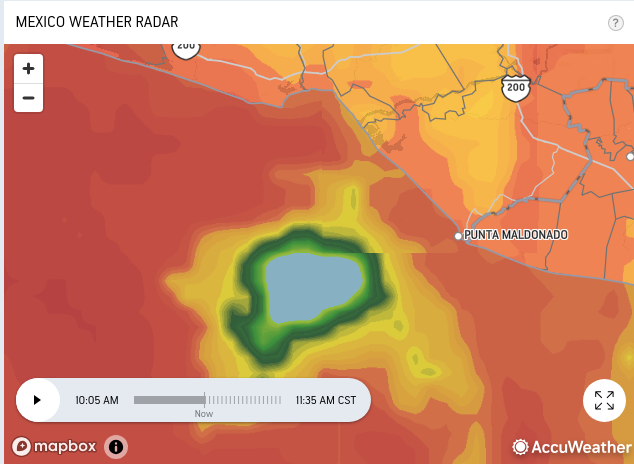
https://www.nhc.noaa.gov/text/refresh/MIATCDEP5+shtml/232049.shtml
cat 2 right now… Doesn’t seem it will stay that way
The latest NHC forecast is near
the high end of the intensity guidance and continues to show John
strengthening to a 105-kt hurricane.  It is possible that John could
peak even higher than shown below between the 12 h forecast point
and when it reaches the coast.Already mid cat. 1
Hurricane John Tropical Cyclone Update
NWS National Hurricane Center Miami FL       EP102024
1145 AM CST Mon Sep 23 2024

Satellite imagery indicates that John continues to rapidly
strengthen with estimated maximum sustained winds of 85 mph (140
km/h).  A special advisory will be issued by 1200 PM CST (1800 UTC)
to reflect this intensity change and update the track and intensity
forecast. The special advisory will be issued in lieu of the 1200
PM CST (1800 UTC) intermediate advisory.


SUMMARY OF 1145 AM CST...1745 UTC...INFORMATION
----------------------------------------------
LOCATION...15.1N 98.4W
ABOUT 85 MI...135 KM S OF PUNTA MALDONADO MEXICO
ABOUT 100 MI...160 KM WSW OF PUERTO ESCONDIDO MEXICO
MAXIMUM SUSTAINED WINDS...85 MPH...140 KM/H
PRESENT MOVEMENT...N OR 5 DEGREES AT 3 MPH...6 KM/H
MINIMUM CENTRAL PRESSURE...980 MB...28.94 INCHES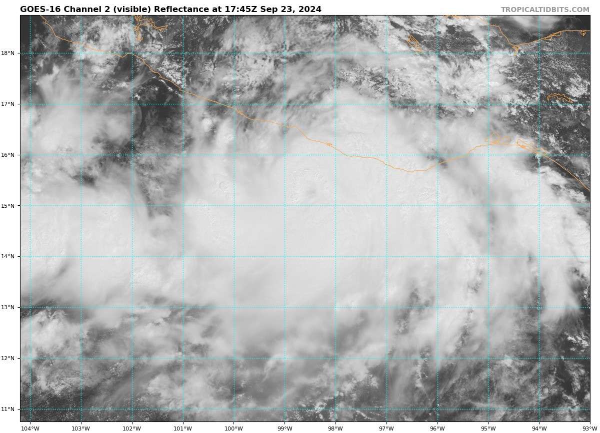
@SaviorofPlant I thought I was being cautious only putting 350 NO early on for Cat. 3... now 12 hours later, it seems most likely...
@parhizj Models missed this completely. Seems to be a consistent issue in this area, the exact same thing happened with Otis last year
@SaviorofPlant I remember doing some yard work all day and then coming back to finding OTIS RI'd to cat. 5... It still seems very unlikely it will RI to cat 5 though but that's based on old model data...
@parhizj There's just not enough time before landfall in this case, it would quite possibly do it with an extra 24 hours over water
NHC forecasting a Category 2: https://www.nhc.noaa.gov/text/refresh/MIATCDEP5+shtml/231447.shtml?
@SaviorofPlant Technicality (knowing what you meant), but can you rename the Strong TS category (it just says 50-50 kt)
@SaviorofPlant Maybe wanna do one on AL97 (Can always rename it Helene later)? I don't think it's too premature given how some of the models are blowing up ...