Background
Invest 90E is a tropical disturbance that had formed off the south of Gulf of Tehuantepec, Mexico, in the Eastern Pacific, and is poised to strengthen and threaten central western Mexico, just shortly after the landfall of Lidia on October 10. Lidia landed at near peak strength as a Category 4 hurricane, following a rapid intensification before landfall.
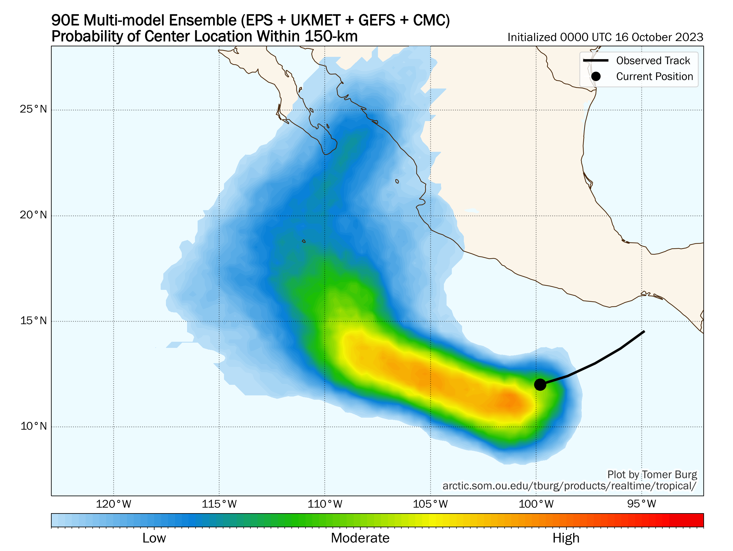
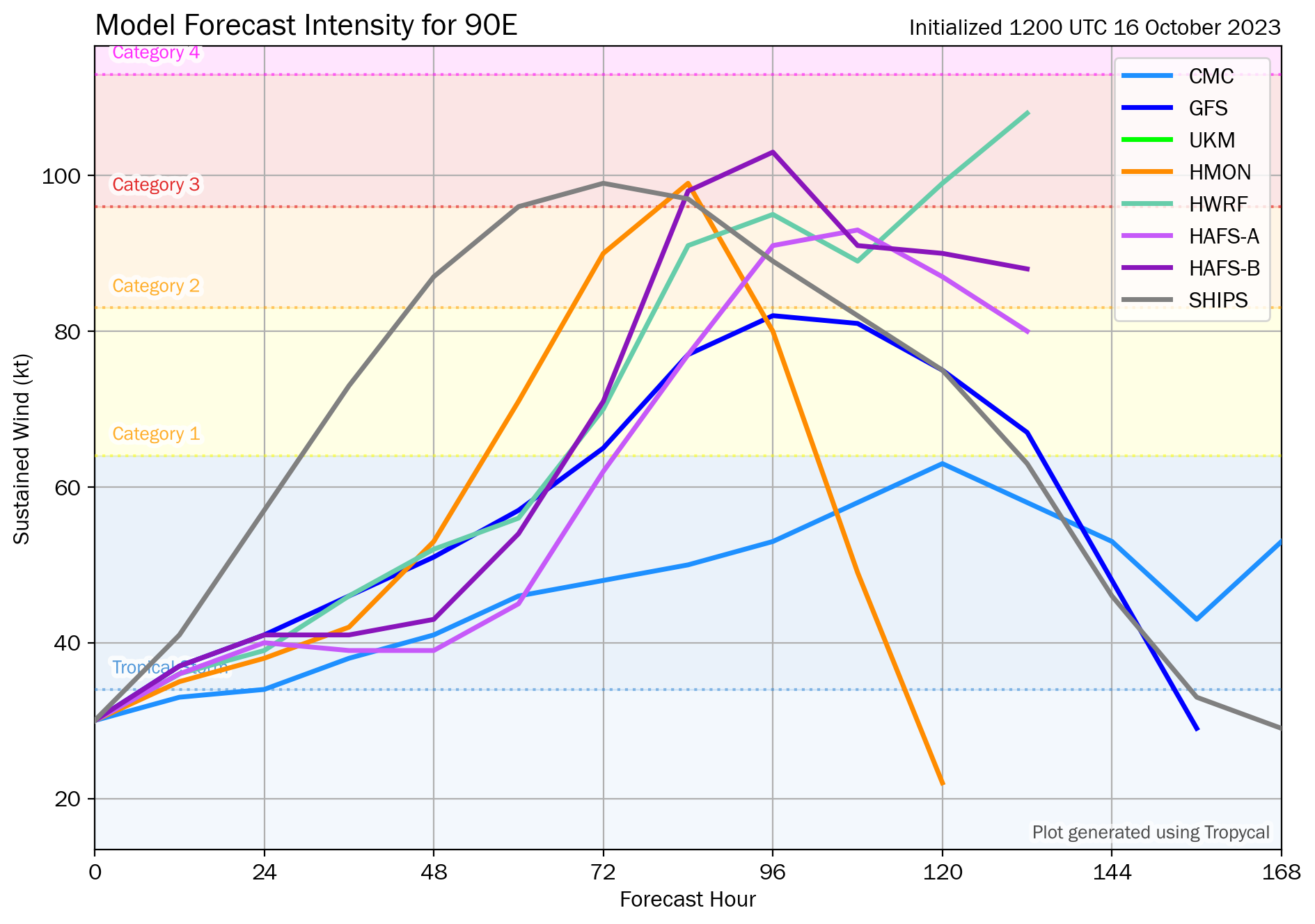
90E is also forecast to increase in strength in the coming days, with some models predicting a Category 2 to 3 storm at landfall. As of October 18, 0300 UTC, 90E has strengthened into a tropical storm and has been given the name Norma.
Will Norma / 90E therefore make landfall in Mexico, as a tropical storm or a stronger cyclone, just a week or so after Lidia has pounded the region with heavy rain and wind?
Resolution Criteria
Resolves YES if Norma / 90E strengthens to or above tropical storm (Spanish: tormenta tropical) strength, and is deemed to have landed in any part of mainland Mexico by the Servicio Meteorológico Nacional (SMN) of Mexico, excluding all outlying islands, while still at or above Tropical Storm strength. SMN's tropical storm warning page can be found here.
Resolves NO if no such information can be found from the SMN of Mexico before the dissipation, degeneration below tropical storm strength, or extratropical transition of Norma / 90E.
Will resolve based on SMN data, with supplemented data from NHC if necessary. I will not bet on this market.
 1,000
1,000🏅 Top traders
| # | Trader | Total profit |
|---|---|---|
| 1 | Ṁ92 | |
| 2 | Ṁ57 | |
| 3 | Ṁ8 | |
| 4 | Ṁ8 | |
| 5 | Ṁ3 |
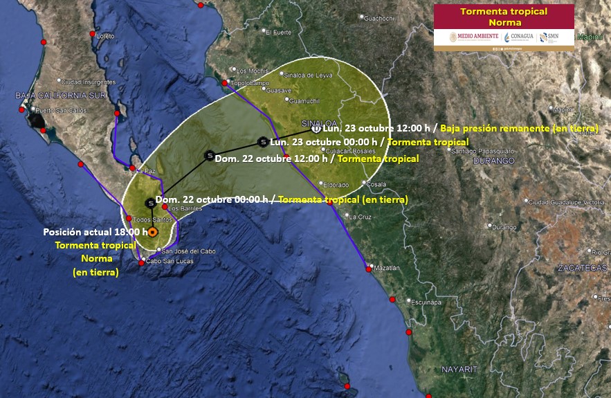
Landfall per SMN:
https://smn.conagua.gob.mx/en/pronosticos/avisos/aviso-de-ciclon-tropical-en-el-oceano-pacifico
Google translation:
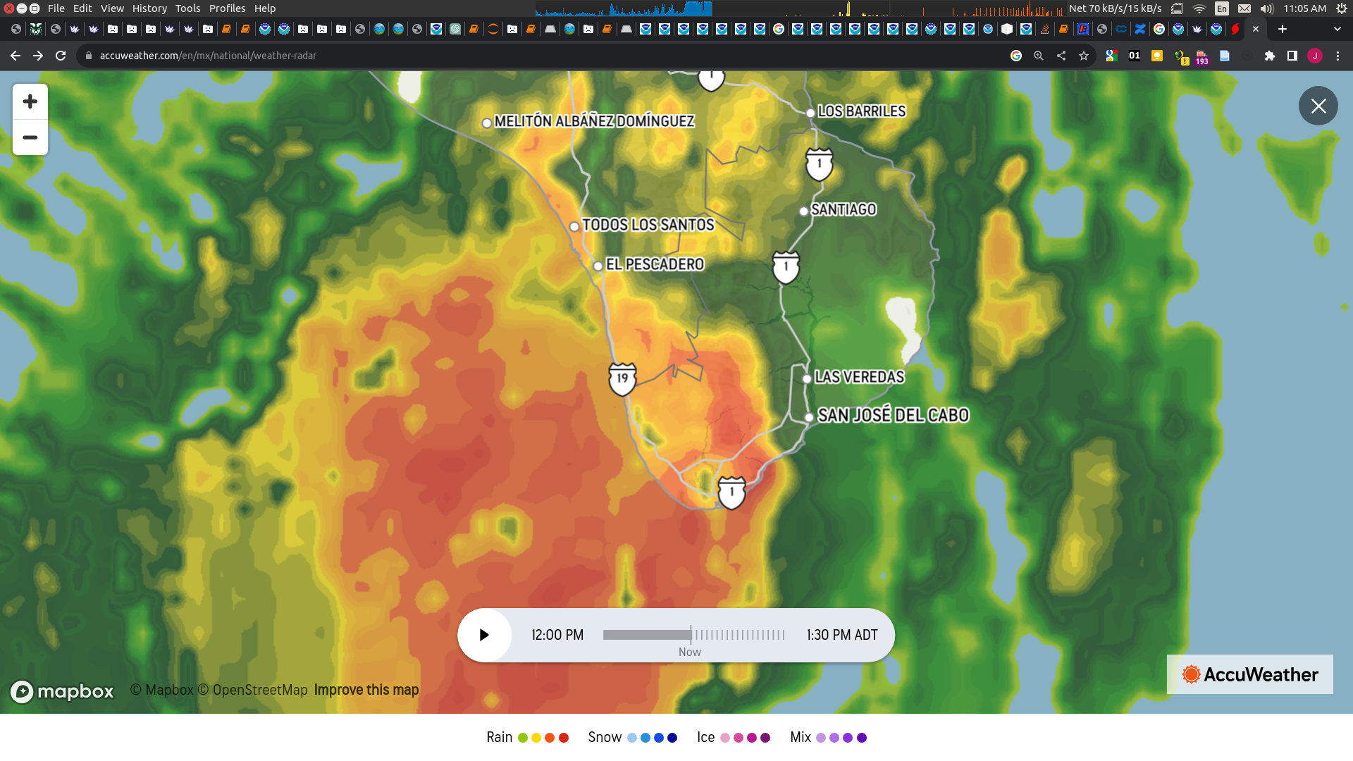
Current situation:
Hurricane Norma was downgraded to category 1 on the Saffir-Simpson scale. It is located on land in the town of Todos Santos, in the municipality of La Paz, BCS. Its most dangerous quadrant is affecting the municipalities of Los Cabos and La Paz, BCS. Because it moves slowly, the damage is expected to be greater.

Latest NHC forecast and discussion says the center will cross over Baja California Sur:
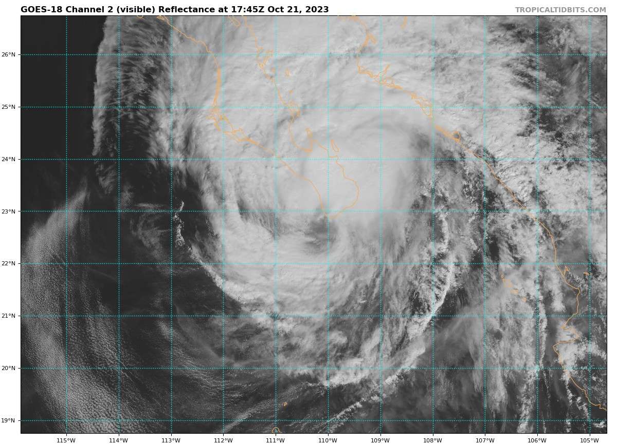
Scatterometer data and aircraft fixes show that Norma has moved
slightly left-of-track today, and its initial motion is 330/7 kt.
The hurricane is expected to turn toward the north-northwest and
north during the next day or so while it moves between a mid- to
upper-level trough to its northwest and a mid-level ridge to its
east. This will bring the center of Norma over the southern tip of
Baja California Sur within the hurricane warning on Saturday. The
track models have again trended westward this cycle, and the updated
NHC forecast is nudged in that direction during the next 24-36 h. Rregardless of whether it landfalls over Baja first, latest advisory does show it as a TS at landfall in Mexico (Eldorado):
FORECAST VALID 23/1200Z 24.7N 107.4W...INLAND
MAX WIND  40 KT...GUSTS  50 KT.
34 KT... 20NE  30SE  40SW   0NW.

latest advisory show the center barely missing ( its interpolated track, plus with cross track error, it’s not going to be so accurate to say whether there is landfall in Baja) but it’s too close to say that for sure. Further along the track (landfalling maybe as a TS), it’s heading right towards Culiacán.
It will be close if it does cross over Baja (not sure if they will even issue a notice of landfall in that case when it is that close). Regardless, despite NHC official having it inland below TS strength, it does have it at 50kt beforehand, so I think it is likely it will make landfall as a TS or stronger in Baja or a little bit later.
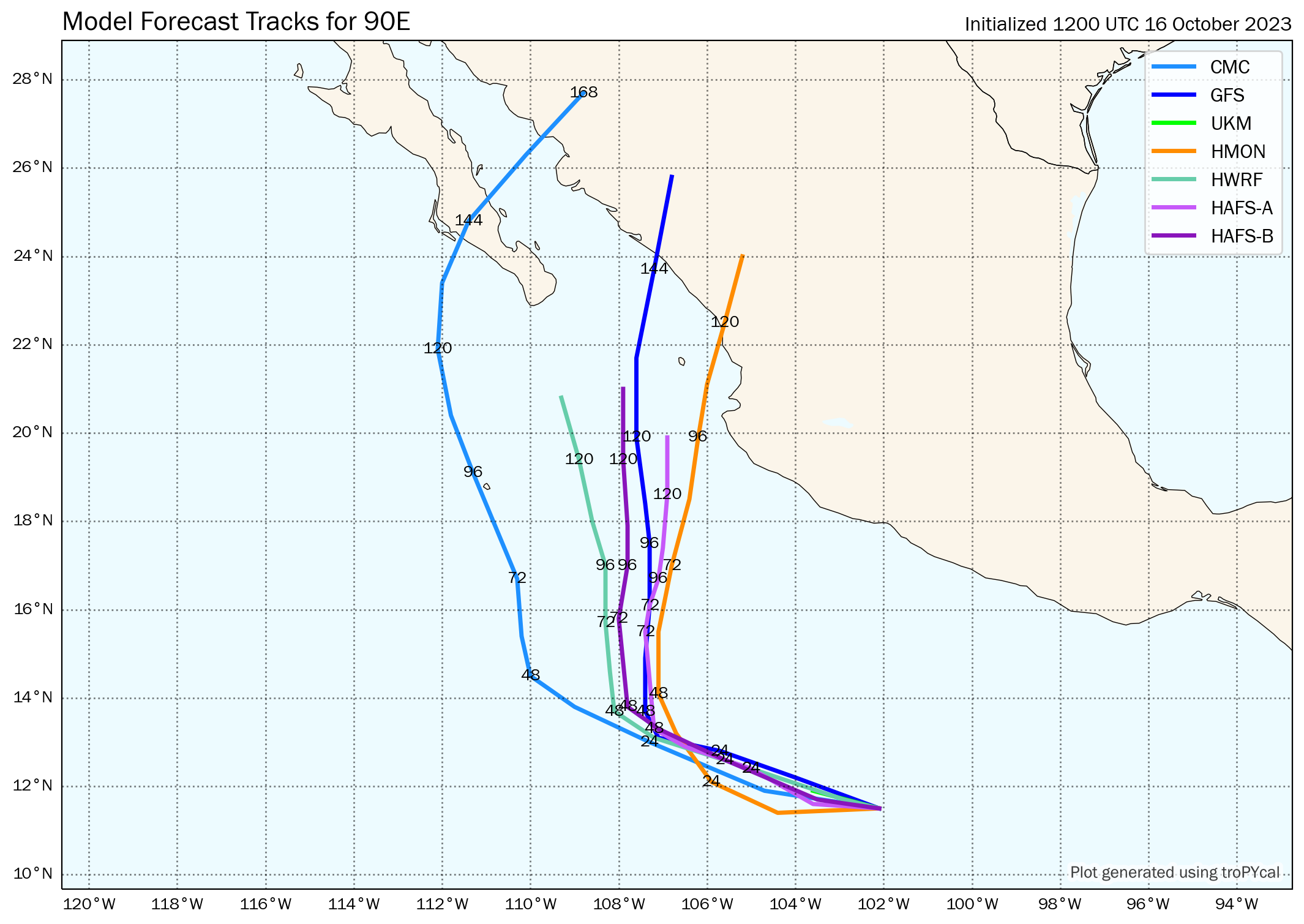
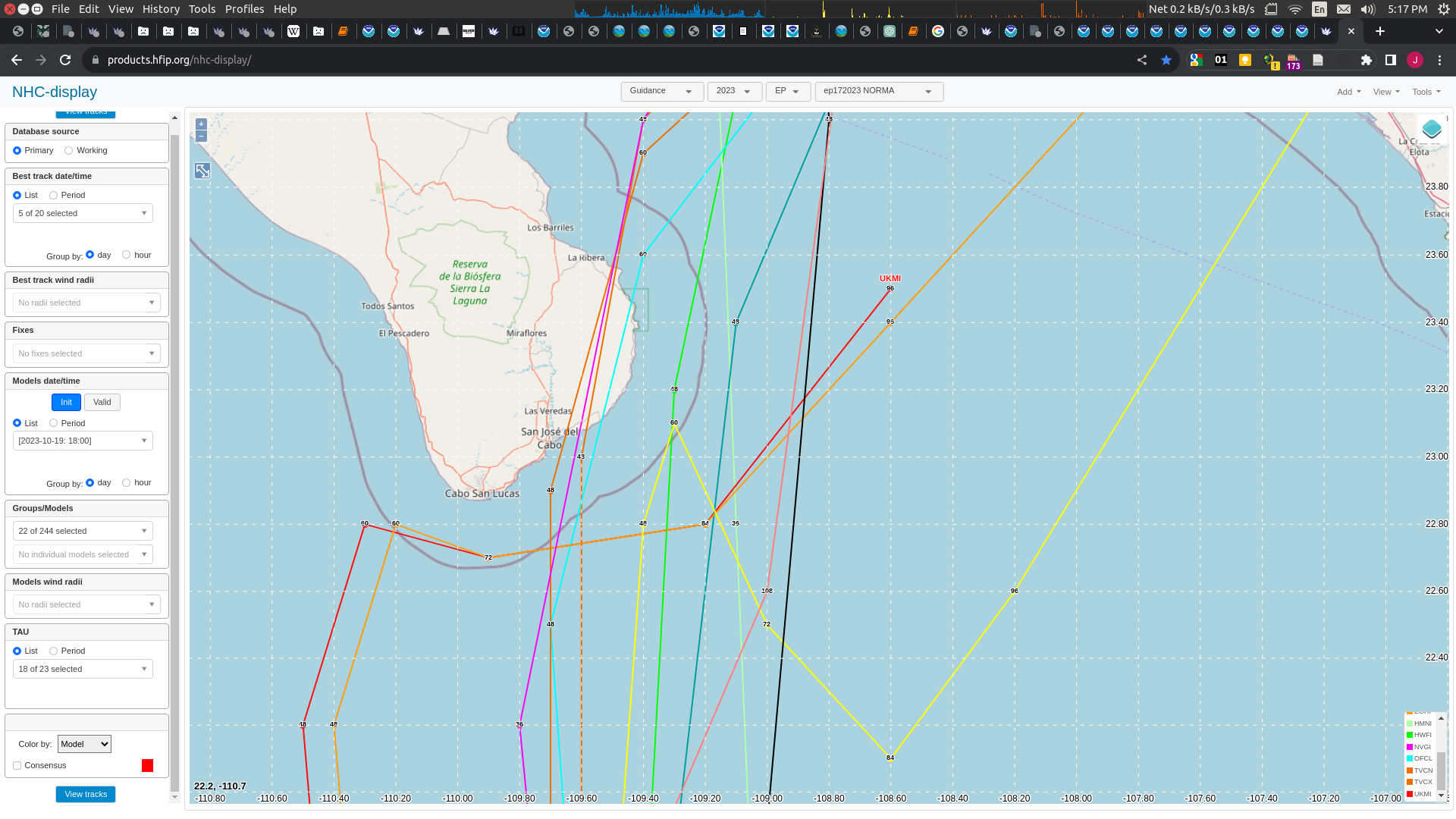
Lot of uncertainty in track of Norma in latest advisory. I think if it is misses Baja, it might not make landfall as a HU or a TS
The eye of Norma has deviated right of track during the past 6-12 h,
and the longer-term motion is nearly due north (360/6 kt). The
track forecast remains challenging. Even in the near term, there is
significant spread among the various models, likely related to
differences in the steering flow based on the vertical depth of the
cyclone. Given recent trends, the NHC forecast has been adjusted to
the right of the previous one through 60 h, bringing it just east of
the multi-model consensus aids and favoring the stronger GFS and
regional hurricane models. Thereafter, it remains unclear whether
Norma will turn northeastward and approach the west coast of
mainland Mexico, or stall and meander to the south of the Baja
California peninsula. The official forecast continues to show Norma
moving toward mainland Mexico beyond 60 h, albeit slower than some
of the stronger model guidance (GFS, HAFS) with a deeper vortex.
Once again, confidence is low and future track and/or speed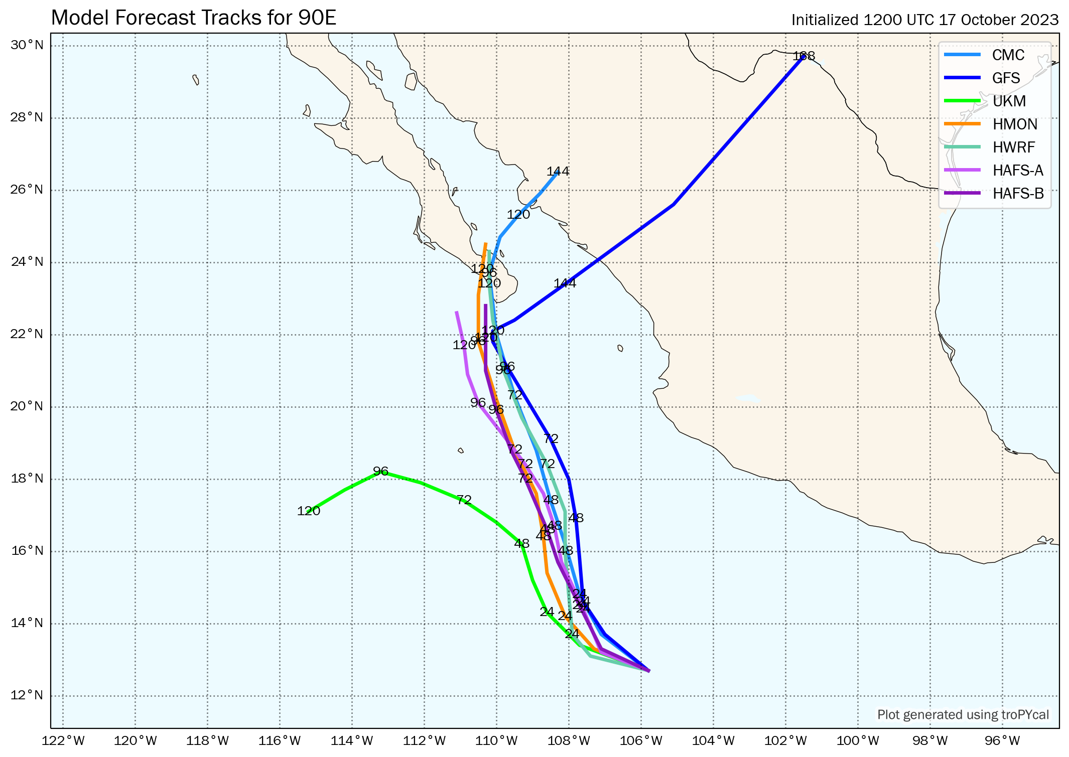
adjustments could be required.12Z: Most models show Mexico landfall except for UKM, which along with CMC also predict TS-level storm only.

@SarkanyVar Are you considering Baja California to be part of Mexico's mainland? When I looked it up I got some mixed answers (some maps show Baja as part of the mainland but some writings suggested it wasn't part of the mainland).
@parhizj Good question. When I wrote the criteria, I specified mainland to contrast against the outlying islands. As Baja California is linked to the rest of Mexico by land, I would consider it to be part of mainland Mexico (akin to the concept of the contiguous US).
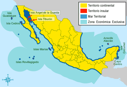
This figure from National Institute of Statistics and Geography (INEGI) of Mexico would be a good reference. Yellow area would be the mainland territories (territorio continental) of Mexico.