
Background
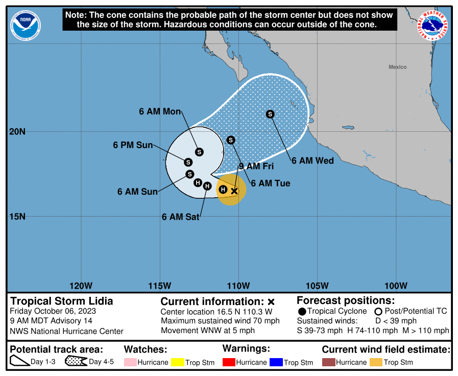
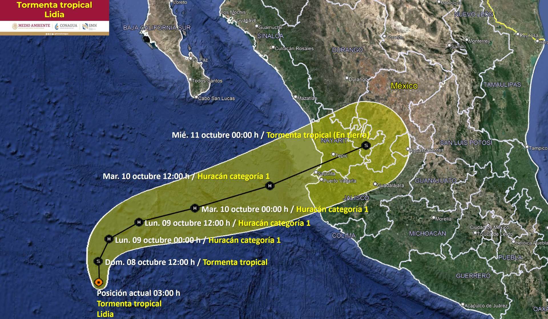
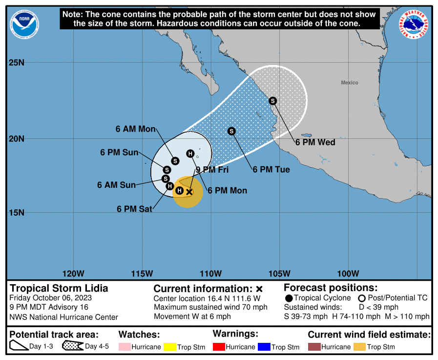
Tropical Storm Lidia is a tropical cyclone that had formed in the Eastern Pacific off the western coast of Mexico. It is forecast to become a hurricane shortly according to NHC advisories. The most recent forecast predicts that Lidia will turn west, then make a U-turn to the east towards the Mexican coast.
Tropical Storm Lidia Discussion Number 14
NWS National Hurricane Center Miami FL EP152023
900 AM MDT Fri Oct 06 2023
...
Although Lidia is tilted, its center is still obscured by the cirrus canopy produced by its deep convection. Consequently, there is more uncertainty than normal with the tropical storm's center location.
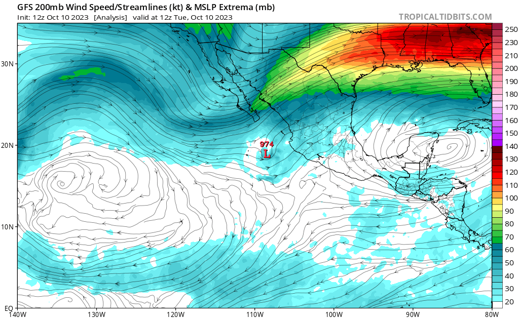
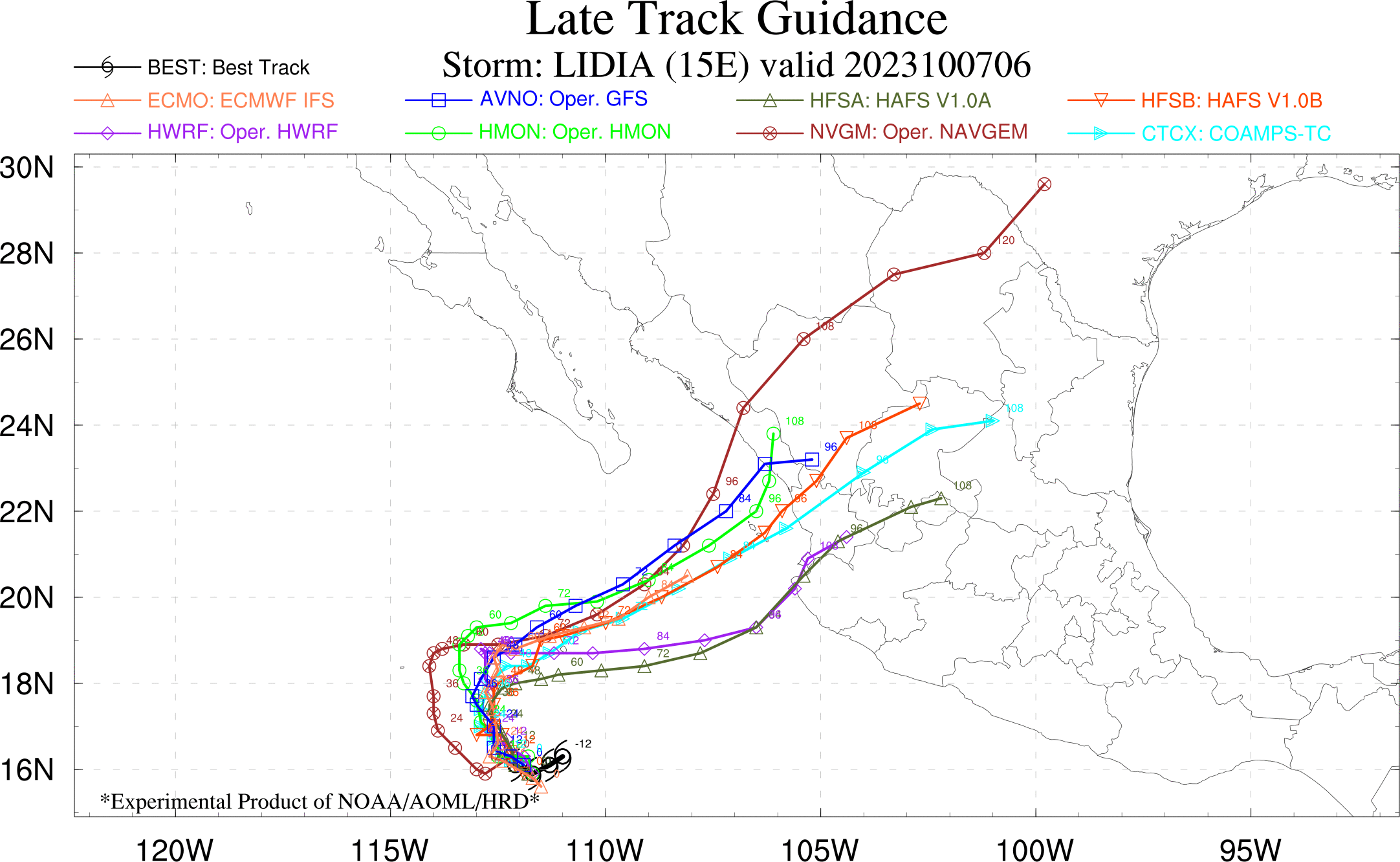
This is probably the largest source of uncertainty associated with Lidia's track for the next 2 to 3 days. Lidia should move slowly west-northwestward for the next day or so, and then gradually begin to turn northward after that. After about 72 h, Lidia should begin to accelerate northeastward, steered by a shortwave trough approaching from the northwest. While the dynamical models agree quite well on this general forecast, there is quite a bit of disagreement on how fast Lidia will accelerate around day 4 and 5. The NHC official track forecast has been nudged eastward, and lies roughly halfway between the TVCN and HCCA consensus models.Will Lidia proceed to make landfall in any part of Mexico, following the last tropical cyclone landfall by Hilary in August?
Resolution Criteria
Resolves YES if Lidia is deemed to have landed in any part of mainland Mexico by the Servicio Meteorológico Nacional (SMN) of Mexico, excluding all outlying islands. SMN's tropical storm warning page can be found here.
Resolves NO if no such information can be found from the SMN of Mexico before the dissipation, degeneration below tropical storm strength, or extratropical transition of Lidia.
Will resolve based on SMN data, with supplemented data from NHC if necessary.
I will not bet on this market, but I will put Ṁ200 in as subsidy.
 1,000
1,000🏅 Top traders
| # | Trader | Total profit |
|---|---|---|
| 1 | Ṁ180 | |
| 2 | Ṁ101 | |
| 3 | Ṁ71 | |
| 4 | Ṁ41 | |
| 5 | Ṁ30 |
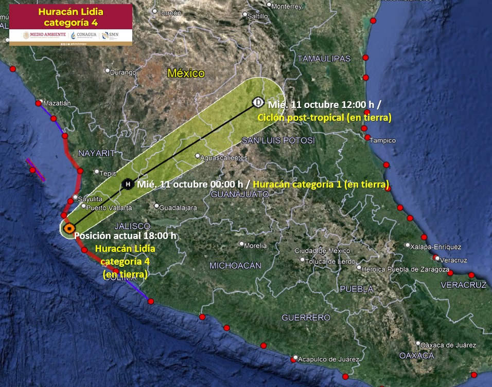
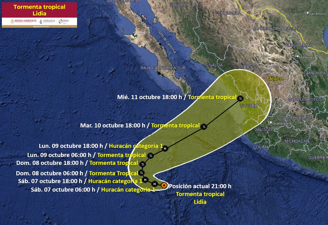
According to both NHC and SMN, Lidia has made landfall as a Category 4 (!) Hurricane in Jalisco near Las Penitas, shortly before 6 p.m. MT in west-central Mexico. This means the condition for YES on this market has been reached. I will leave this market open for another hour for the raising of any possible comments or concerns, and then I will resolve this as YES.
https://www.nhc.noaa.gov/text/refresh/MIATCPEP5+shtml/102356.shtml
Landfall as cat 4
SUMMARY OF 600 PM MDT...0000 UTC...INFORMATION
----------------------------------------------
LOCATION...20.1N 105.5W
ABOUT 15 MI...25 KM SSE OF CABO CORRIENTES MEXICO
ABOUT 35 MI...55 KM SSW OF PUERTO VALLARTA MEXICO
MAXIMUM SUSTAINED WINDS...140 MPH...220 KM/H
PRESENT MOVEMENT...ENE OR 70 DEGREES AT 16 MPH...26 KM/H
MINIMUM CENTRAL PRESSURE...942 MB...27.82 INCHES
Should resolve YES now per SMN: “
Situación Actual:
El centro del huracán Lidia de categoría 4 ingresó a tierra aproximadamente a las 17:50 horas (hora del centro de México) en la localidad de Las Peñitas, en el municipio de Tomatlán, Jal. Su circulación origina lluvias puntuales extraordinarias en Nayarit, Jalisco y Colima; lluvias puntuales torrenciales en Baja California Sur, Sinaloa, Michoacán y Guerrero, además de viento con rachas fuertes y oleaje elevado en costas de dichas regiones.
“
Google translate:
Current situation:
The center of Category 4 Hurricane Lidia made landfall at approximately 5:50 p.m. (Central Mexico Time) in the town of Las Peñitas, in the municipality of Tomatlán, Jal. Its circulation causes extraordinary occasional rains in Nayarit, Jalisco and Colima; occasional torrential rains in Baja California Sur, Sinaloa, Michoacán and Guerrero, in addition to wind with strong gusts and high waves on the coasts of these regions.
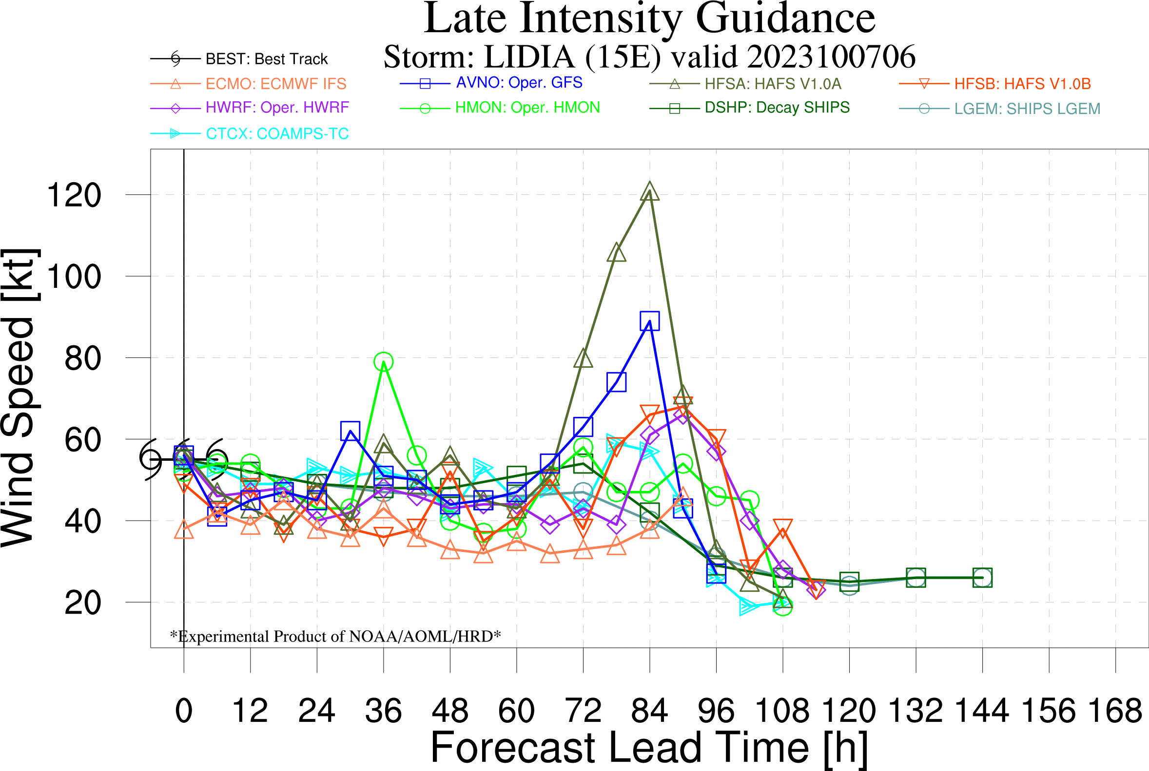
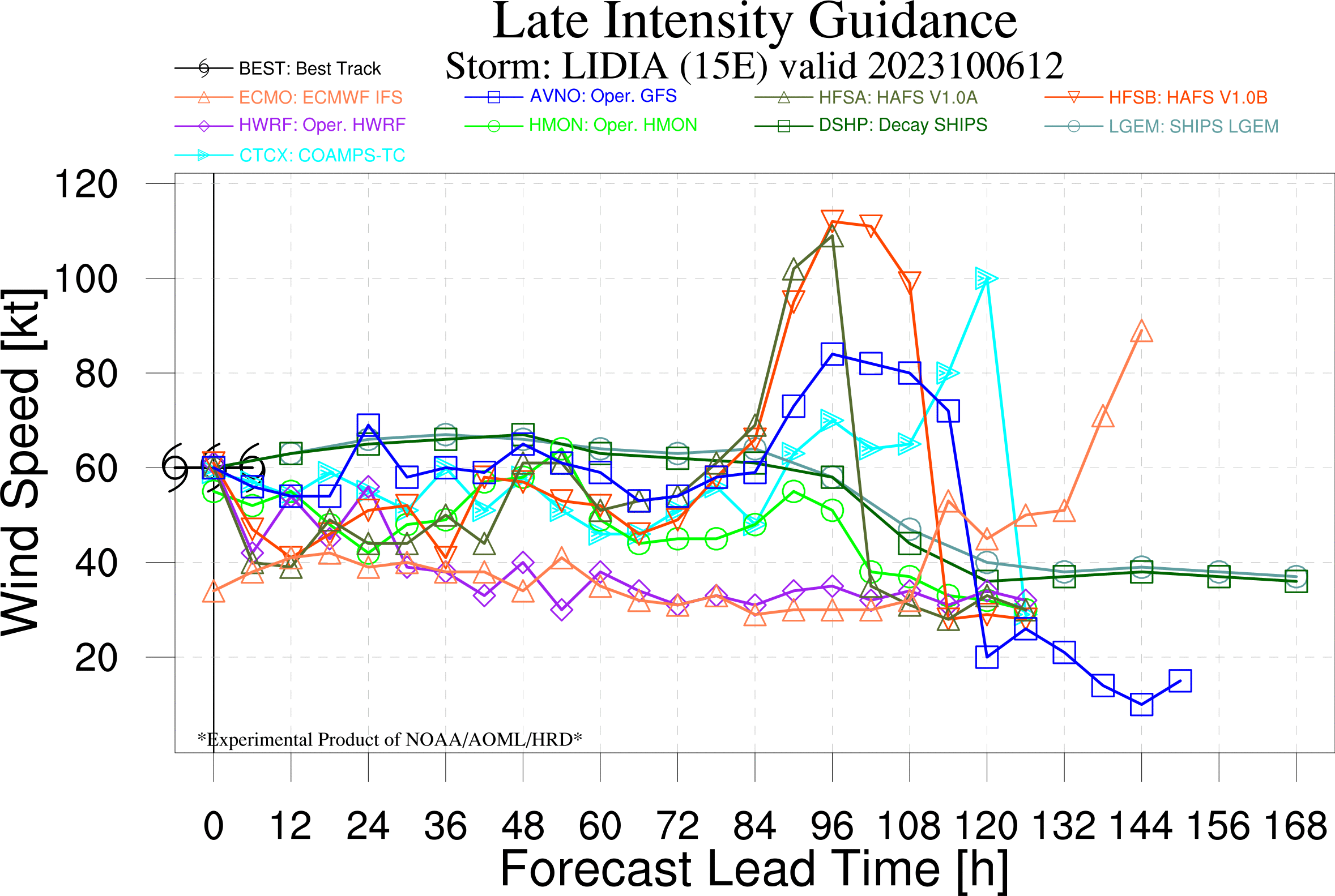
Quite a spread in intensity data points (~65-90kt):
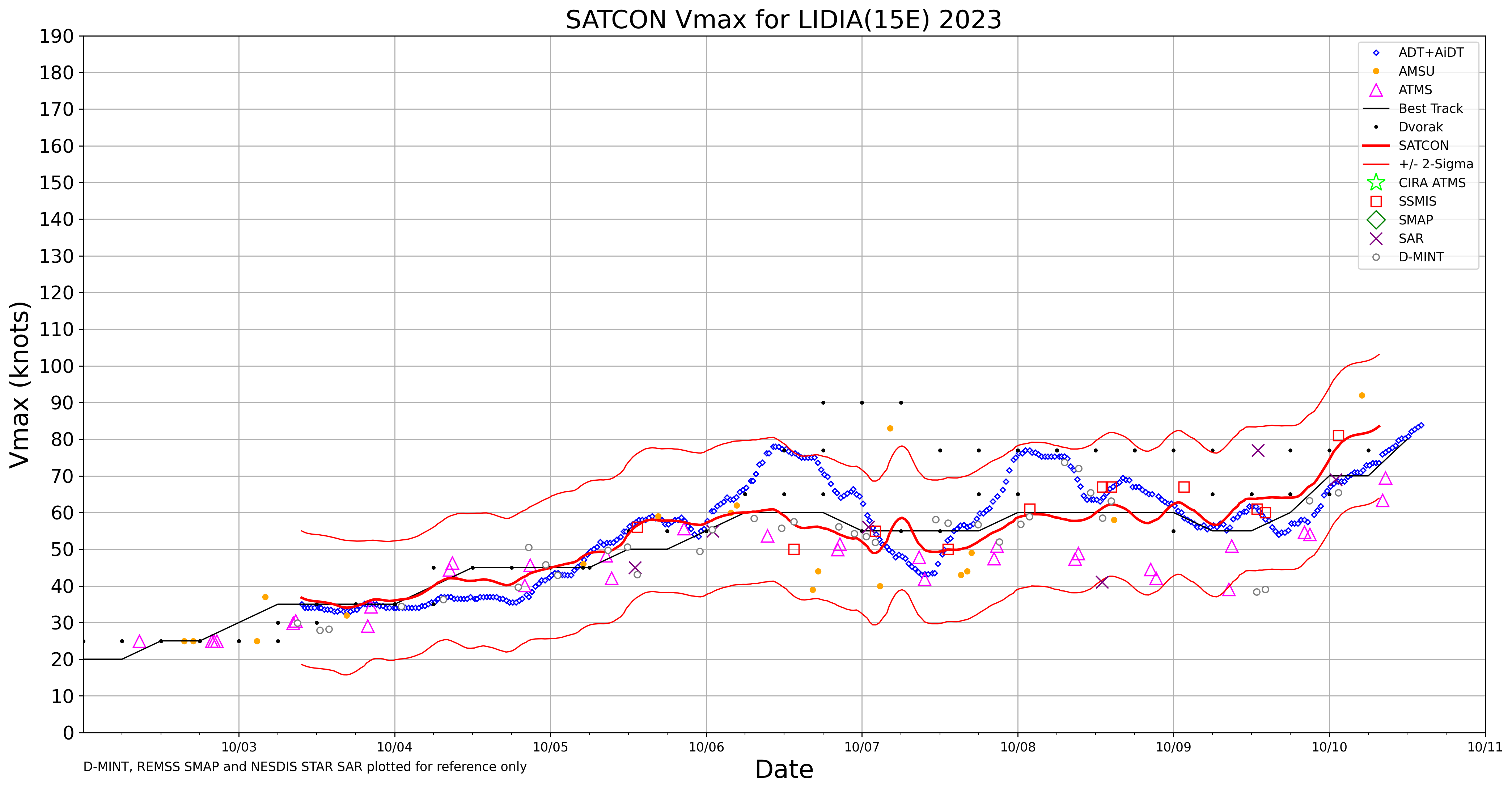
The Air Force Hurricane Hunters are in route
to investigate Lidia this afternoon, and will provide a better
estimate of the hurricane's intensity.
NHC is towards SATCON's middle value at about 85 kt but from the discussion there should be a better estimate tonight.
Now a major hurricane ( cat 3) https://www.nhc.noaa.gov/text/refresh/MIATCPEP5+shtml/101757.shtml
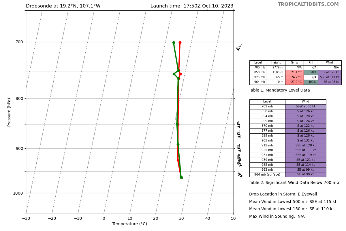
Hurricane hunters doing a run, with dropsonde at 98 kt.
Near cat. 4 in update:
https://www.nhc.noaa.gov/text/refresh/MIATCUEP5+shtml/101943.shtml
Data from an Air Force Reserve Hurricane Hunter aircraft indicate
that Lidia has strengthened rapidly and has maximum winds near 125
mph (200 km/h). The minimum pressure is estimated to be 950 mb
(28.05 in.). An updated intensity forecast to reflect this change
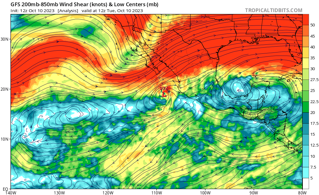
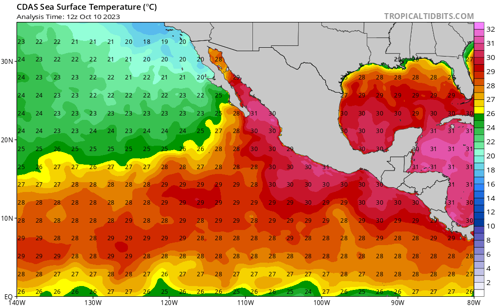
will be issued within the next hour.holy... that jet interaction... baroclinic enhancement and thus RI right up until landfall seems to almost be a new normal for big storms around the Gulf at this point. And that is as per the usual reinforced by above average SSTs... well at least HAFS seems to be running pretty accurately for these storms.
000
WTPZ45 KNHC 100246
TCDEP5

Hurricane Lidia Discussion Number  28
NWS National Hurricane Center Miami FL       EP152023
900 PM MDT Mon Oct 09 2023

Lidia has become better organized this evening, with an increase in
deep convection and banding near the center.  An 0122 UTC SSMIS
microwave overpass revealed a well-defined mid-level center that
could be slight tilted from the low-level center.  The upper-level
outflow has also become a little better established over the western
portion of the system.  Subjective Dvorak data T-numbers from TAFB
and SAB are both T4.0 (65 kt), and the objective estimates are
close to that value as well.  Based on the increase in organization
and recent subjective and objective estimates, the initial
intensity is raised to 65 kt, making Lidia a hurricane.
Hurricane Lidia according to NHC and SMN.
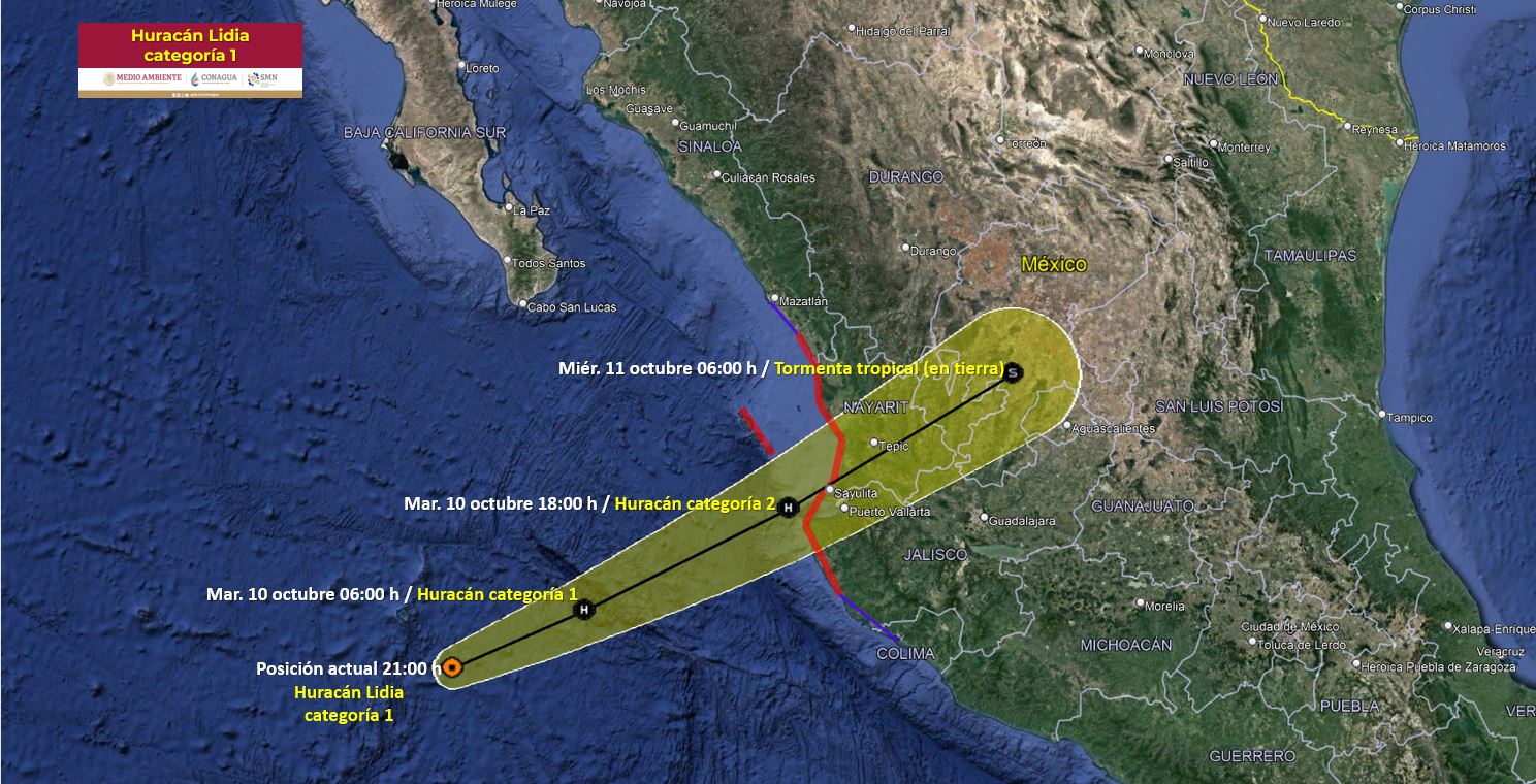
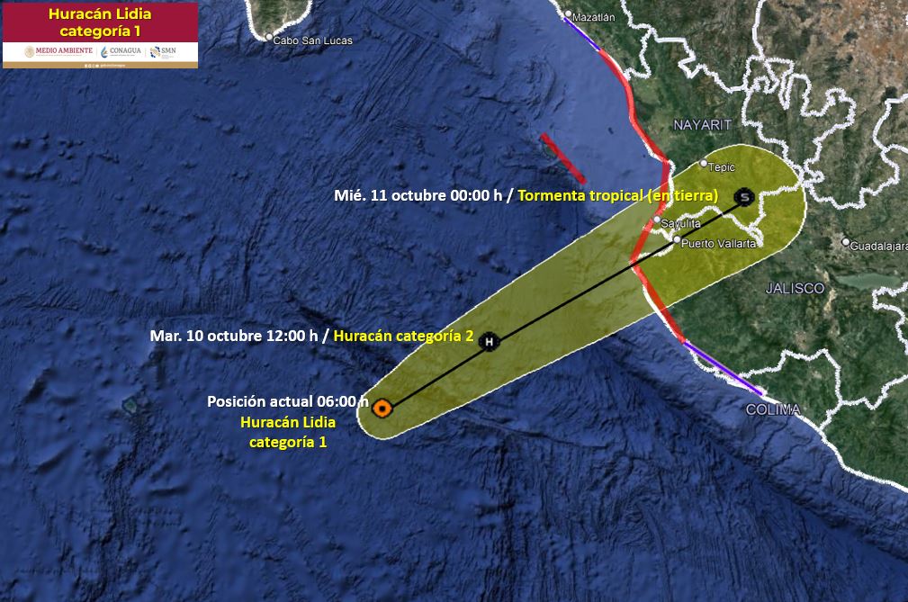
Models are in much more agreement for late 06Z than yesterday considering track and timing
OFCL puts it just as a cat.1 hurricane just before/at landfall
96H 11/1200Z 21.6N 105.4W 65 KT 75 MPH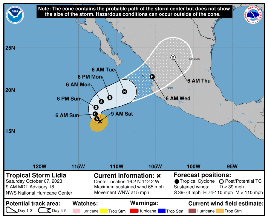
Based on this single point in my analysis for OFCL errors (96 hours out), there is < 5% chance it will be < 35kt strength. Since it is only a single data point, this time however I am only placing about 10% credence (for deferral) on this 96% probability since previous forecasts were uncertain.
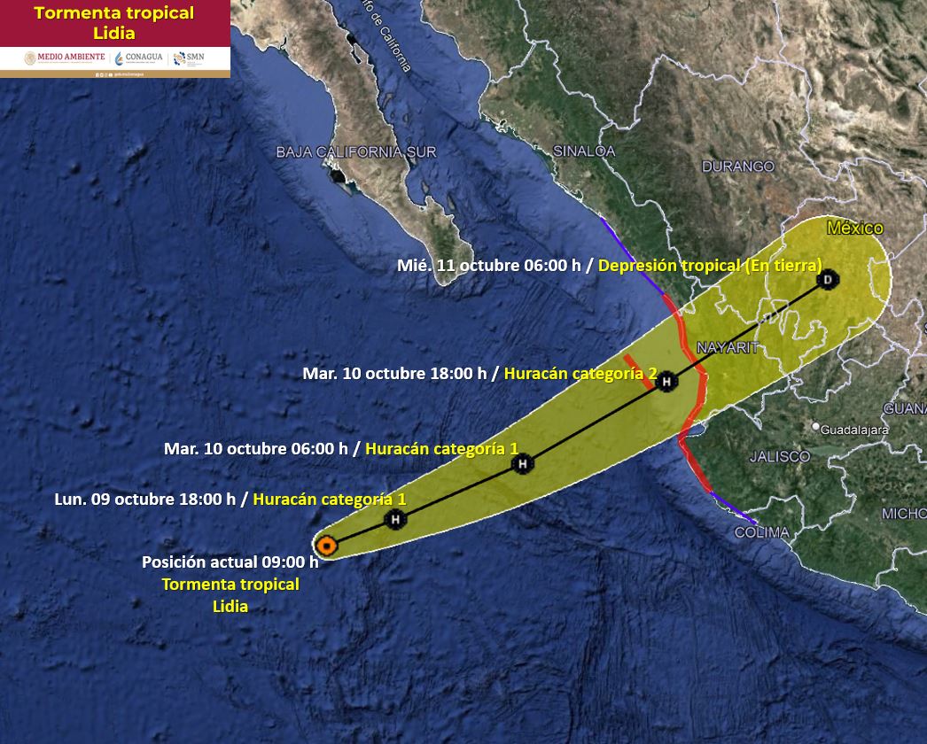
Not a lot on timing (along-track) agreement as mentioned by NHC, as some of the models - HMON/HWRF show it meandering and moving very slowly weakening between a TD and TS (not even making landfall in 5 days) while some models show intensifying to a hurricane. There is also another low to the SE that shows chances of TC genesis in 2 days time that may affect its forecast.
Looks like it will be at least a TS (4/7 models) before landfall.