Background
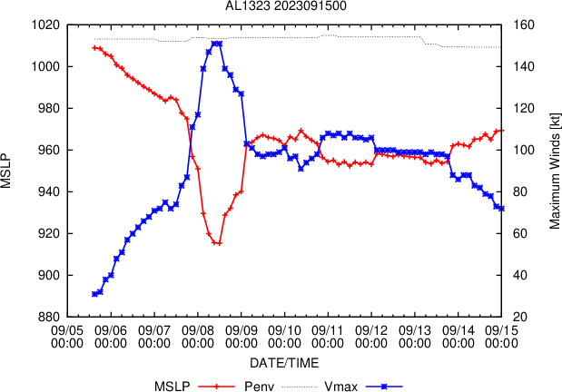
Hurricane Lee is a classic Cape Verde hurricane that formed off West Africa, in a process that often produces some of the strongest North Atlantic hurricanes. Moving over unusally warm oceans and enjoying favourable atmospheric conditions, it quickly strengthened into a Category 1 hurricane Wednesday afternoon and is expected to continue intensifying, as it moves towards the Lesser Antilles.
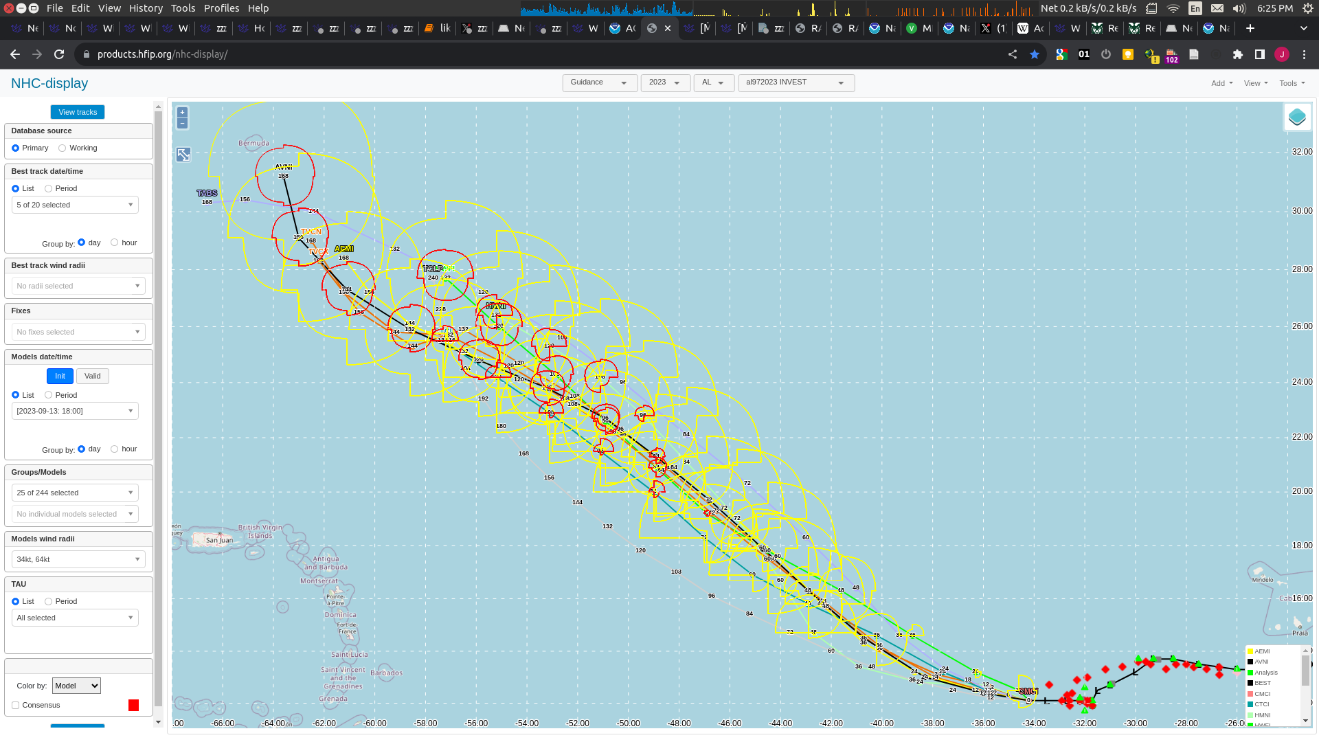
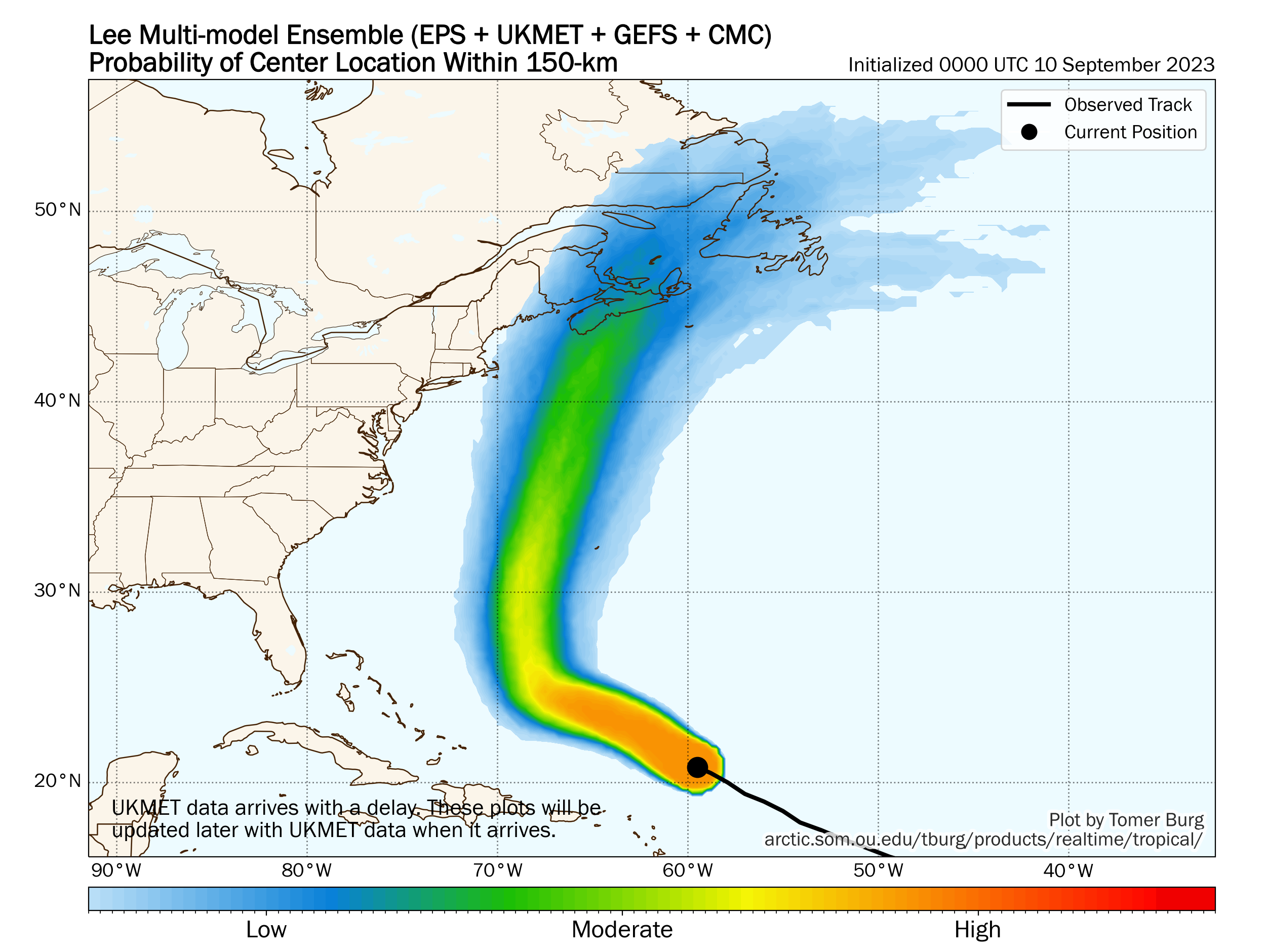
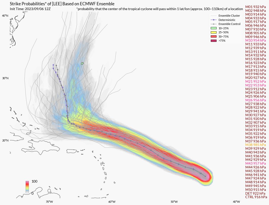
According to long-term forecasts as of September 6, it is not expected to make landfall for the next week, and a low pressure trough moving off the East Coast of the US would steer the hurricane north before it reaches the Bahamas and US coasts. Current ECWMF ensemble predictions suggest a 10-25% chance for the hurricane to pass within 1 latitude or longitude of Bermuda, forecasted to be around September 14-15.
Resolution Criteria
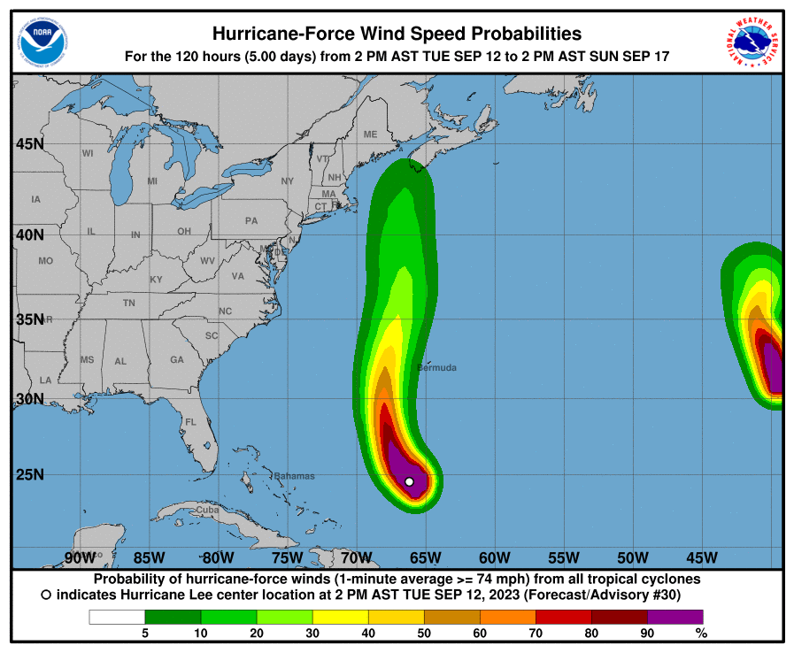
Resolves YES if Hurricane Lee brings hurricane-level winds (>64 knots, >74 mph) to any part of Bermuda while maintaining tropical characteristics.
Resolves NO if Hurricane Lee dissipates or becomes extratropical before the fulfilment of the condition for YES.
Will resolve based on Bermuda Weather Service and/or the National Hurricane Center data.
Here is a similar market with a lower wind speed requirement:
I will not bet on this market, but I will put Ṁ200 in as subsidy.
 1,000
1,000🏅 Top traders
| # | Name | Total profit |
|---|---|---|
| 1 | Ṁ254 | |
| 2 | Ṁ161 | |
| 3 | Ṁ57 | |
| 4 | Ṁ49 | |
| 5 | Ṁ36 |
Per NHC, the extratropical transition of Lee has been completed.
If there is no disagreement, I will be resolving this market as NO at 9 am EST.
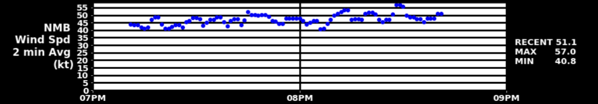
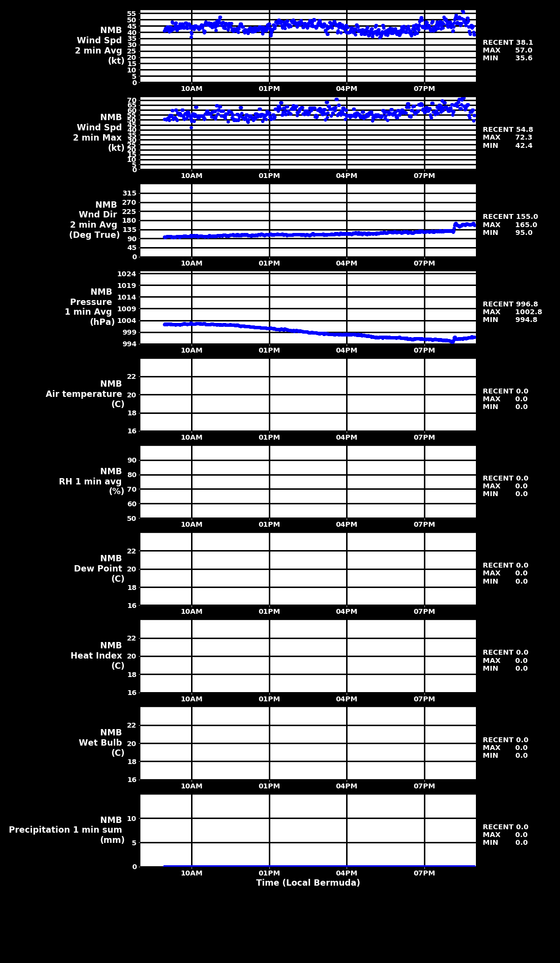
According to the Bermuda Weather Service, wind is subsiding all across Bermuda, with wind speeds down to 30-40kt across different weather stations. While Tropical Storm Warning is still in effect, the gusty conditions will ease overnight as Lee moves north.
The market is very likely to be resolved NO barring improbable events, but per the criteria, the market can only be resolved if Lee dissipates or becomes extratropical, and thus we would need to wait for a bit until that happens.
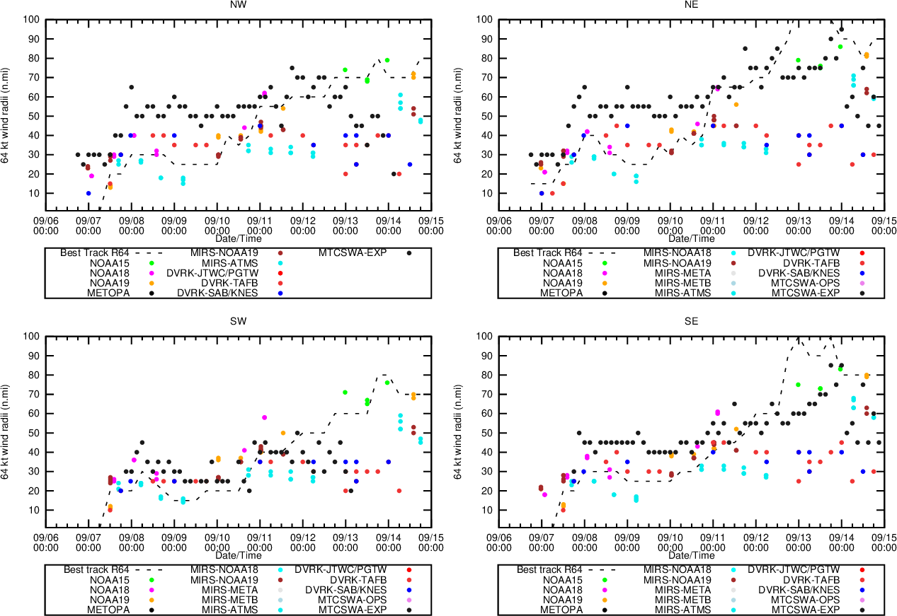
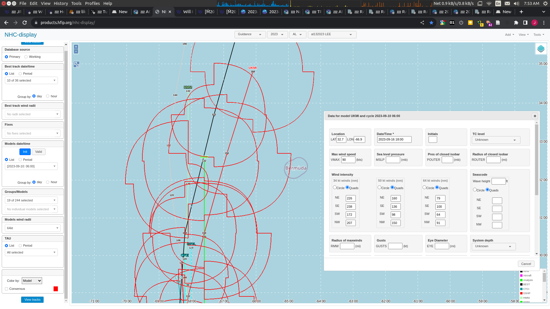
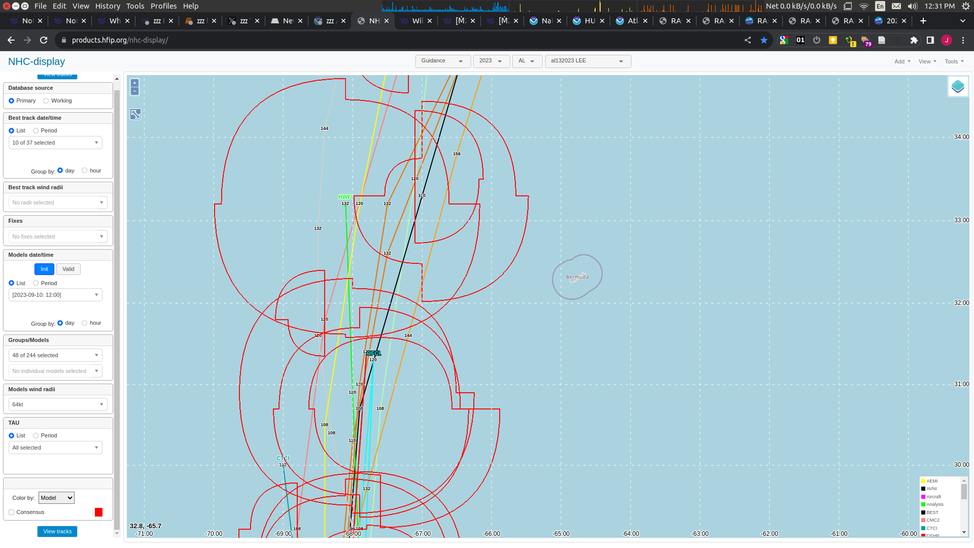
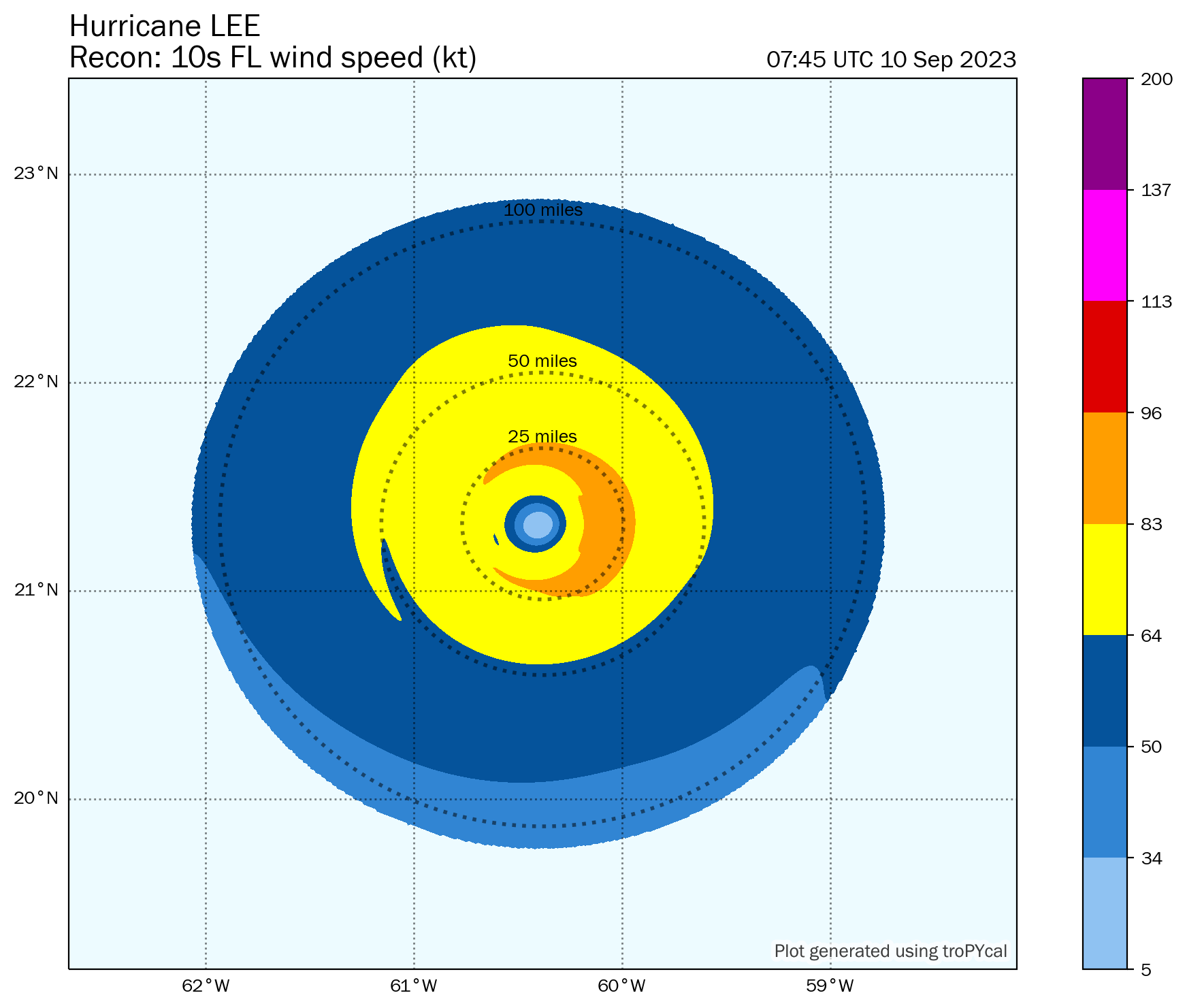
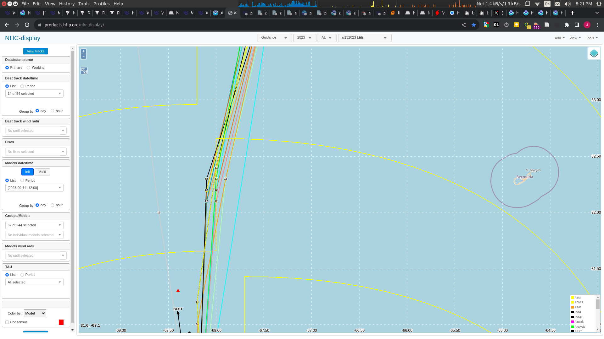
(Experimental from CSU) 64kt wind radii for SE from last best track is now about 80 n.miles (highest was 100 n.miles)
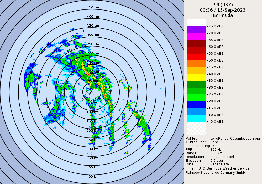
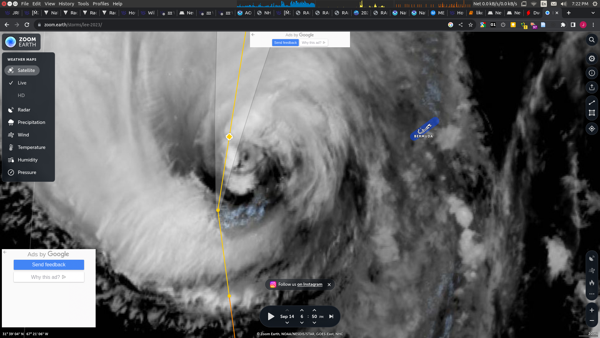
You can now see Lee on radar and the center appears be about 200km +-50 km (110 n.miles +- 27 n. miles) west of the western edge of Bermuda.
Trend is weakening (experimental from CSU):
Given that the storm appears to be no longer moving east on radar, trending to weaken, I think it's unlikely for it to hit 64kt at the museum, and as I am going to sleep and will probably have no more profitable opportunities to update I am going to bet NO.
@SarkanyVar Based on the satellite images I see... there is going to be a drop for multiple hours I think....and you can already see it starting.
Yep...
https://tropic.ssec.wisc.edu/real-time/adt/movies/odthtml5_13L.html
Takes a while for the automated positioning to show up (blue is forecast, red is auto positioning)

Looks to be about 20-30nm east of 12h forecast guidance (actually where OFCL interpolated line is)
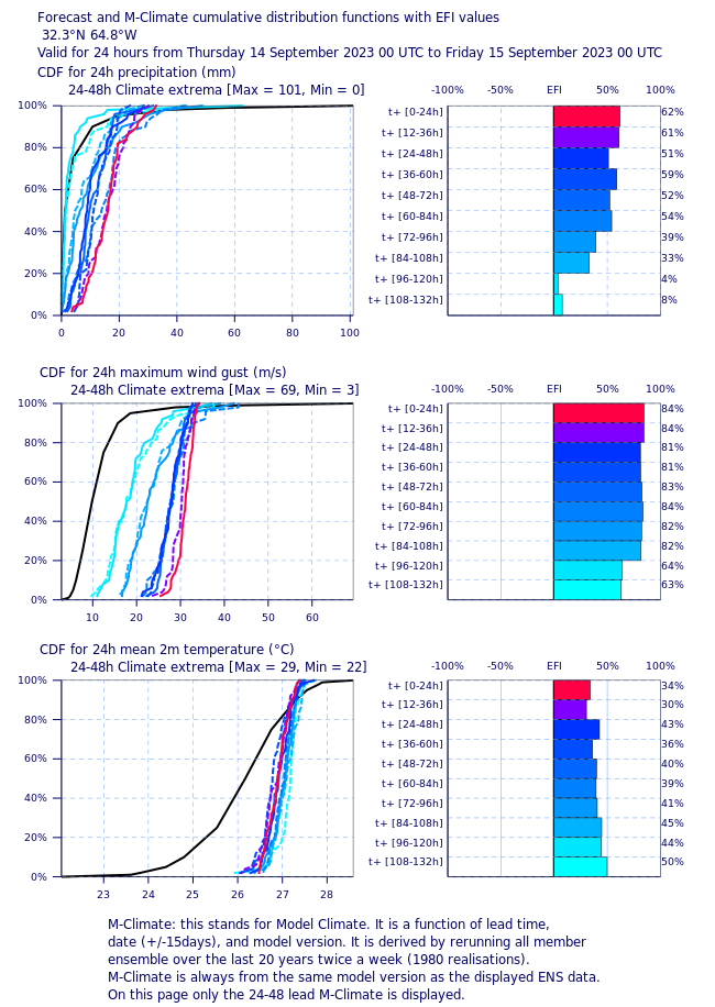
Hmm.... looking at ECMWF EFI point forecast for wind it doesn't say but the above is for 10m altitude wind gusts in the rough area of Bermuda.
33 m/s is the threshold for cat 1, so from the above it would seem that 30% is overpriced since the 99% percentile it looks like it barely includes 33 m/s for wind gusts at 10 m... This however doesn't account for the wind at 35m though, forecast track&intensity errors, etc.
I'm inclined to adjust the forecast upwards (linearly) since the forecast predicts stronger winds tonight than this morning, but I don't know about this intuition... I'll pay attention to the radar and keep looking looking at real time data (experimental):
https://rammb-data.cira.colostate.edu/tc_realtime/storm_experimental.asp?storm_identifier=al132023

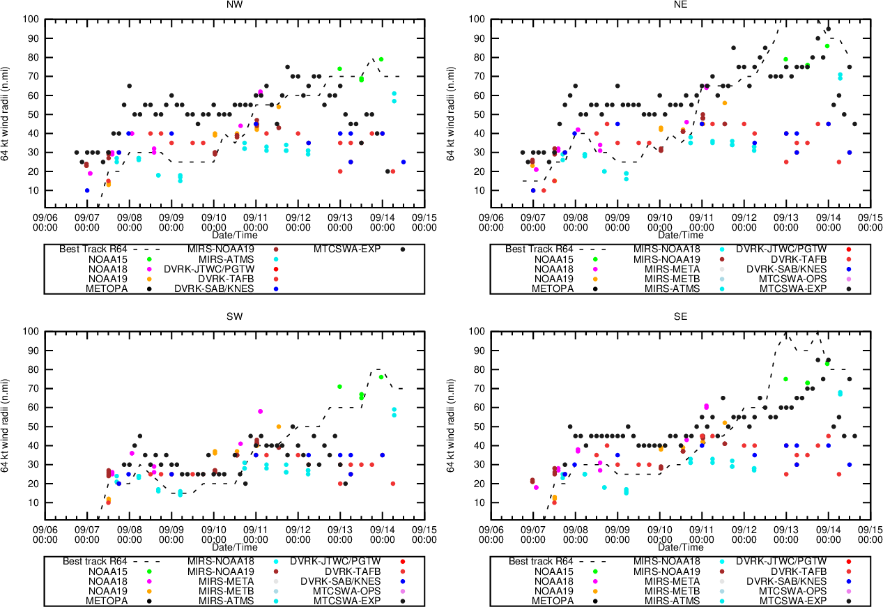
... shows trend of max winds weakening today so far, and 64 kt radii also (mostly) decreasing:
Watching the SRI..
http://weather.bm/tools/graphics.asp?name=250KM%20SRI&user=
When you see the rain bands from the radar cover 50km in the animation (~the radar loop is about 25min) that's an estimate of 64kt... anyone else doing this?
@parhizj It might also be a factor that the NMB is situated on the western side of Bermuda, so it's also closer to the hurricane and more likely to be swept by the rain bands than other parts of Bermuda.
I tried predicting the speed using the rainbands but I suppose it is much windier at a few kilometers altitude than at 35m; there also may be a lot more tilt to those bands (vertically) so it is probably not a good idea after all difficult to estimate the true velocity this way.
2PM advisory:
https://www.nhc.noaa.gov/text/refresh/MIATCDAT3+shtml/141441.shtml
An Air Force Reserve reconnaissance
aircraft that has been investigating Lee this morning has measured
peak 700-mb flight-level winds of 96 kt, and the NOAA P-3 aircraft
has found peak 8000 ft flight-level winds of 100 kt.  However, peak
SFMR winds from both aircraft have been around 70 kt. Using a blend
of the flight-level and SFMR data, the initial wind speed has been
lowered to 80 kt, but this could be a little generous.
Southwesterly vertical wind shear is expected to increase over Lee
during the next 24 to 36 hours, and this is likely to lead to
gradual weakening during that time.@SarkanyVar Do the winds have to be sustained or are gusts enough?
Because: Hurricane-force wind gusts - probably happening at some point later today. Sustained hurricane-force winds - eh nah... I mean, there is some 70 odd miles between the hurricane-fore wind field and Lee's (forecast) closest point of approach.
@SarkanyVar I didn’t know about this elevated museum station (re. https://www.nhc.noaa.gov/text/refresh/MIATCPAT3+shtml/141156.shtml) as I mentioned in the tropical storm market. If the NHC has an advisory mentioning only that station reporting hurricane sustained winds, will that be sufficient to resolve YES, or will you want something more normal like a report from the airport? I’ve sold my shares in this market since I haven’t foreseen this situation.
@parhizj Thank you very much for raising this to my attention. As I have stated in the description, that the resolution criteria are applicable for 'any part of Bermuda', I think it would be reasonable to accept sustained winds from the museum station as it is indeed part of Bermuda, even though it might occupy a higher elevation.
Besides, the spot seems to be simply about 30m from sea level (Referencing this and this), and the highest point in Bermuda is just at an altitude of 79m - not exactly Hong Kong level. So I would consider the data from the NMB to be sufficient.