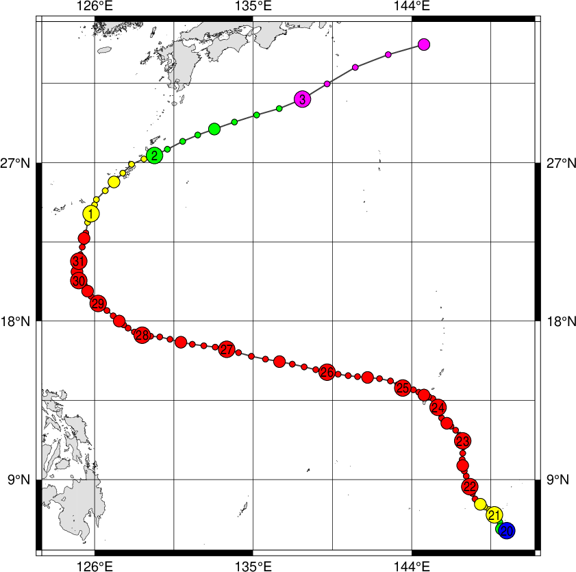
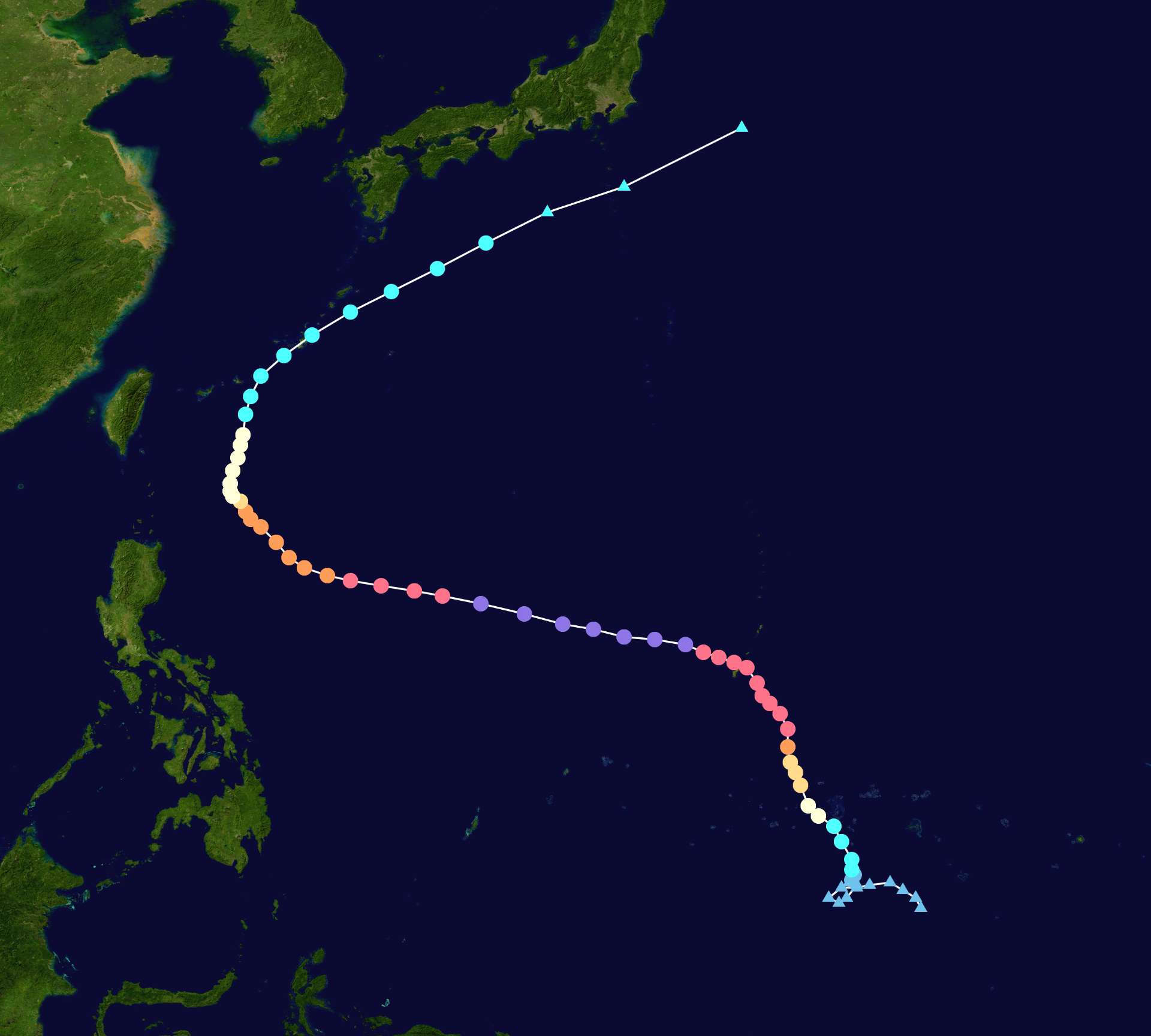
In late May 2023, a potent typhoon spun toward the Mariana Islands in the North Pacific Ocean. The storm, named Typhoon Mawar, was one of the strongest in decades to lash the U.S. territory of Guam, according to news reports.
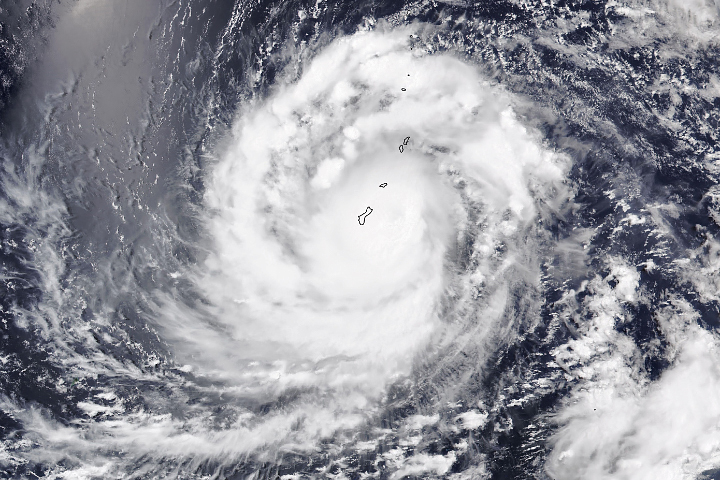
The Visible Infrared Imaging Radiometer Suite (VIIRS) on the NOAA-20 satellite acquired this image at 1:50 p.m. local time (03:50 Universal Time) on May 24, 2023, as Mawar approached Guam. At the time, the storm carried sustained winds of about 140 miles (225 kilometers) per hour—equivalent to a category 4 storm on the Saffir-Simpson wind scale.
The image shows the typhoon’s cloud bands completely covering the islands, which were already being lashed with powerful winds and heavy rain. (The bright area in the top-left of the image is sunglint—an optical phenomenon unrelated to the storm.)
The typhoon maintained its category 4 strength as the storm’s center traversed the Rota Channel, between the islands of Guam and Rota, at about 9 p.m. local time on May 24. The eye’s southern wall passed over much of Guam, according to the U.S. National Weather Service, and delivered the most extreme winds to the northern-third of the island.
On May 25, the typhoon moved west-northwest and away from the islands. The full extent of storm damage in Guam remained unclear, but early reports indicated widespread power outages, downed trees, and coastal flooding. U.S. officials declared an emergency in the region on May 22, authorizing disaster relief efforts.
https://earthobservatory.nasa.gov/images/151388/typhoon-mawar
 1,000
1,000🏅 Top traders
| # | Trader | Total profit |
|---|---|---|
| 1 | Ṁ17 | |
| 2 | Ṁ14 | |
| 3 | Ṁ11 |


-