Resolves YES if Nigel is ever designated a Category 3 hurricane or stronger by the NHC.
 1,000
1,000🏅 Top traders
| # | Trader | Total profit |
|---|---|---|
| 1 | Ṁ516 | |
| 2 | Ṁ161 | |
| 3 | Ṁ61 | |
| 4 | Ṁ17 | |
| 5 | Ṁ15 |
People are also trading
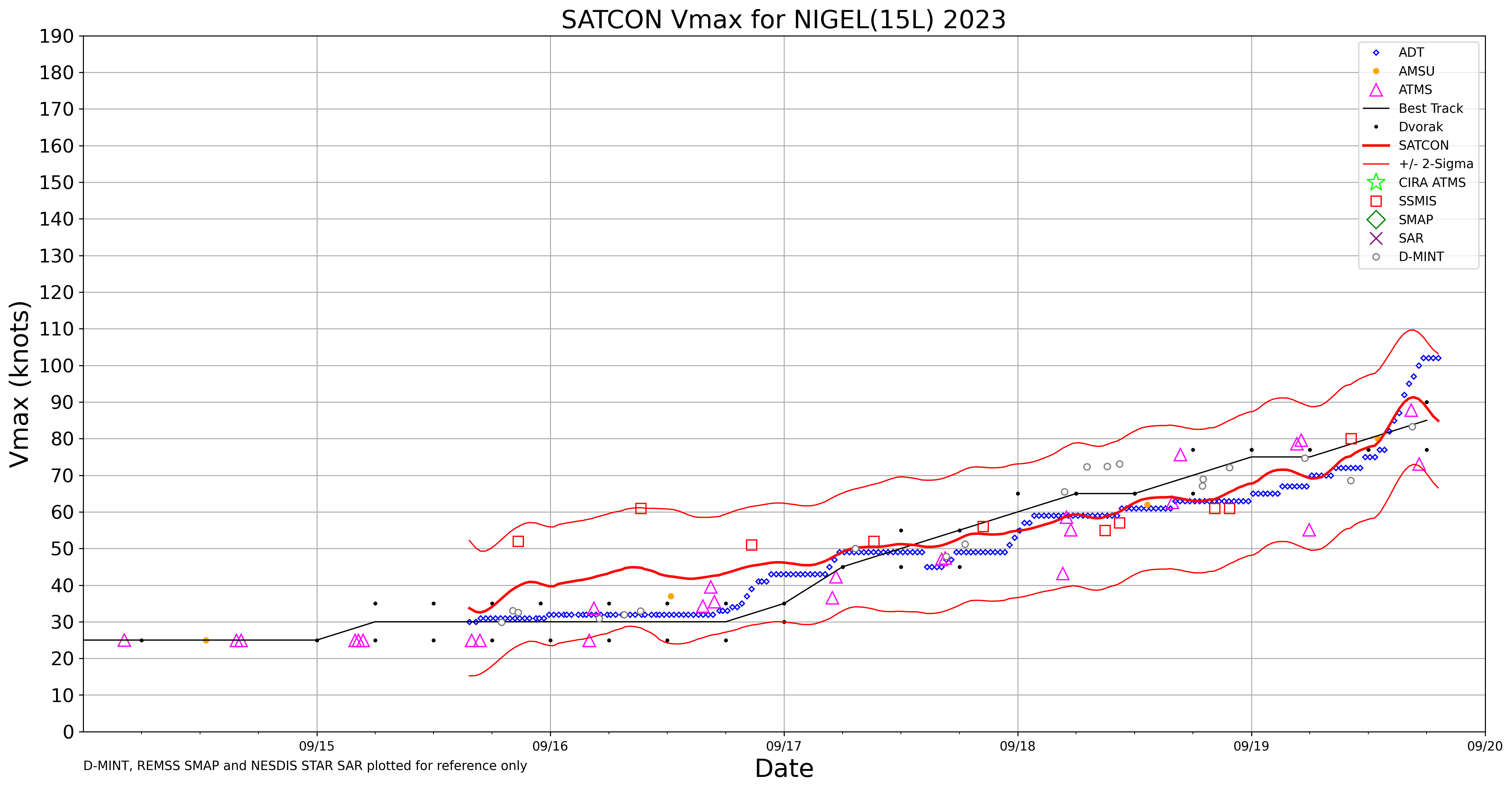
Latest NHC discussion at 0500 AST:Nigel has about 18-24 hours before it is expected to move over cooler sea surface temperatures and into significantly stronger vertical wind shear. As a result, the latest NHC intensity forecast shows Nigel remaining steady to slightly weakening in the short term, followed by steady weakening through the remainder of the forecast period. Although weakening is forecast, Nigel is expected to be a strong extratropical cyclone in about 48 hours.
And compared to the last two advisories, max forecast sustained wind speed had been revised down from 95kt to 90kt, then 85kt (current speed).
https://www.nhc.noaa.gov/text/refresh/MIATCPAT5+shtml/200838.shtml
New advisory still at 85 kt and not expected to strengthen further:
Maximum sustained winds are near 100 mph (155 km/h) with higher
gusts. Nigel has likely reached its peak intensity, with gradual
weakening expected later today, followed by faster rate of weakening
on Friday. Nigel is forecast to become a post-tropical cyclone by
Friday.
From recon FLW
185830 3112N 05413W 6961 02951 9733 +160 +119 188067 074 074 000 00
185900 3112N 05410W 6959 02963 9762 +144 +127 186089 094 076 000 00
185930 3112N 05408W 6956 02985 9791 +132 +137 184096 097 076 000 01
190000 3112N 05405W 6947 03010 9817 +124 +136 190100 102 072 007 01
190030 3112N 05403W 6966 03004 9837 +121 +126 193101 103 071 005 01
190100 3112N 05401W 6955 03029 9858 +117 +120 191095 099 068 000 01
190130 3112N 05358W 6956 03040 9878 +114 +096 189093 096 063 002 00
190200 3112N 05356W 6962 03044 9894 +111 +091 188093 095 061 000 00
Using 30s avg FLW speeds and 90% norm for 700mb (3000m)
0.9*(100+101)/2 ~= 90 kt
Using SFMR averaged over 1 minute:
(74 + 76 + 76 + 72 + 71 + 68) / 6 = 73 kt
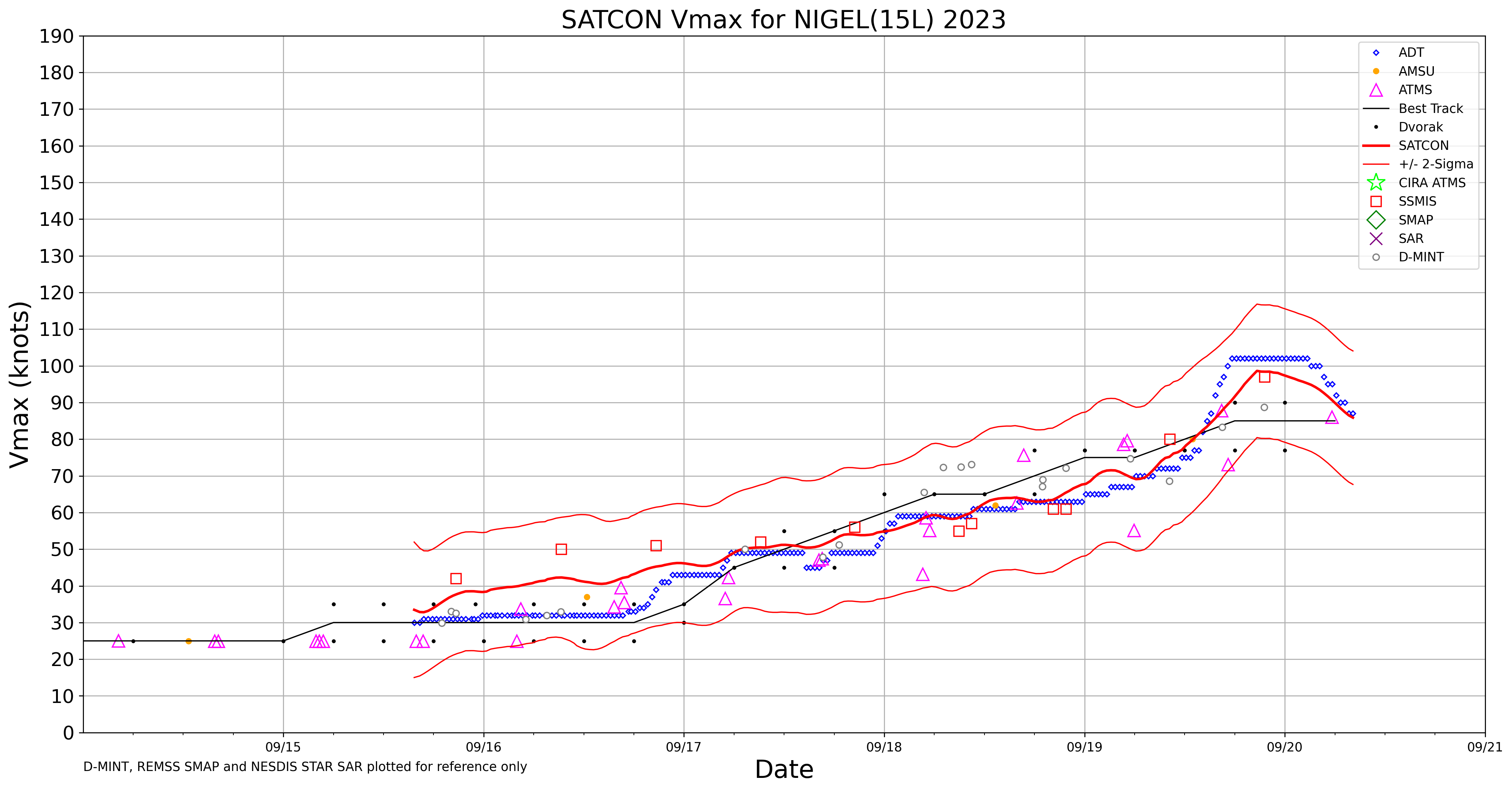
Extrapolated MSLP puts it at 969 mb, and using that as an estimate for intensity gives 90 knots matching the Dvorak data point below
191600 3113N 05427W 6953 02937 9692 +177 +098 171026 028 030 000 00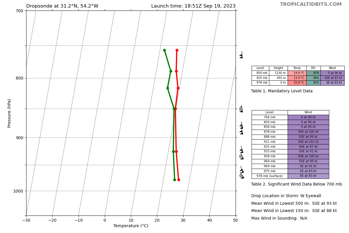
Dropsonde average of MBL and WL150 also puts it at 90 kt
Wisconsin analysis (best track from satellite data) puts it at 85 kt now.
Given the limited info I have it at 85-90 and now the NHC forecast has come out at 85 kt.
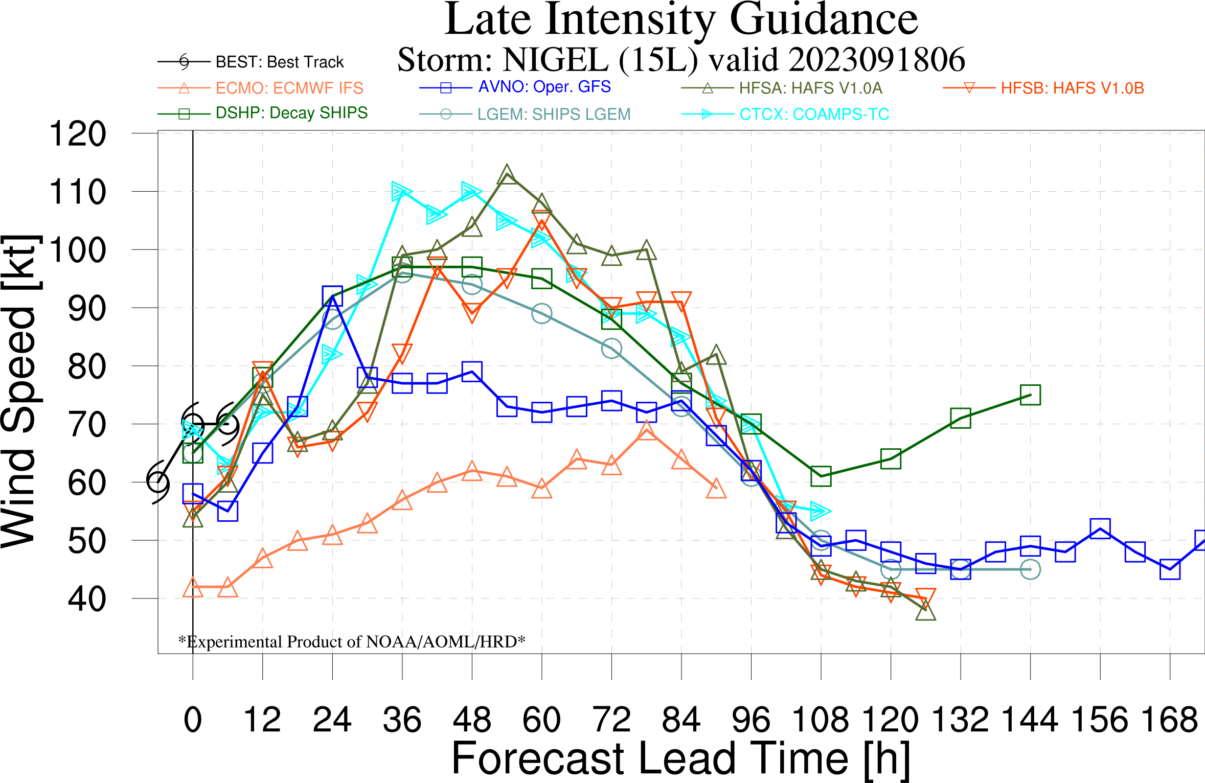
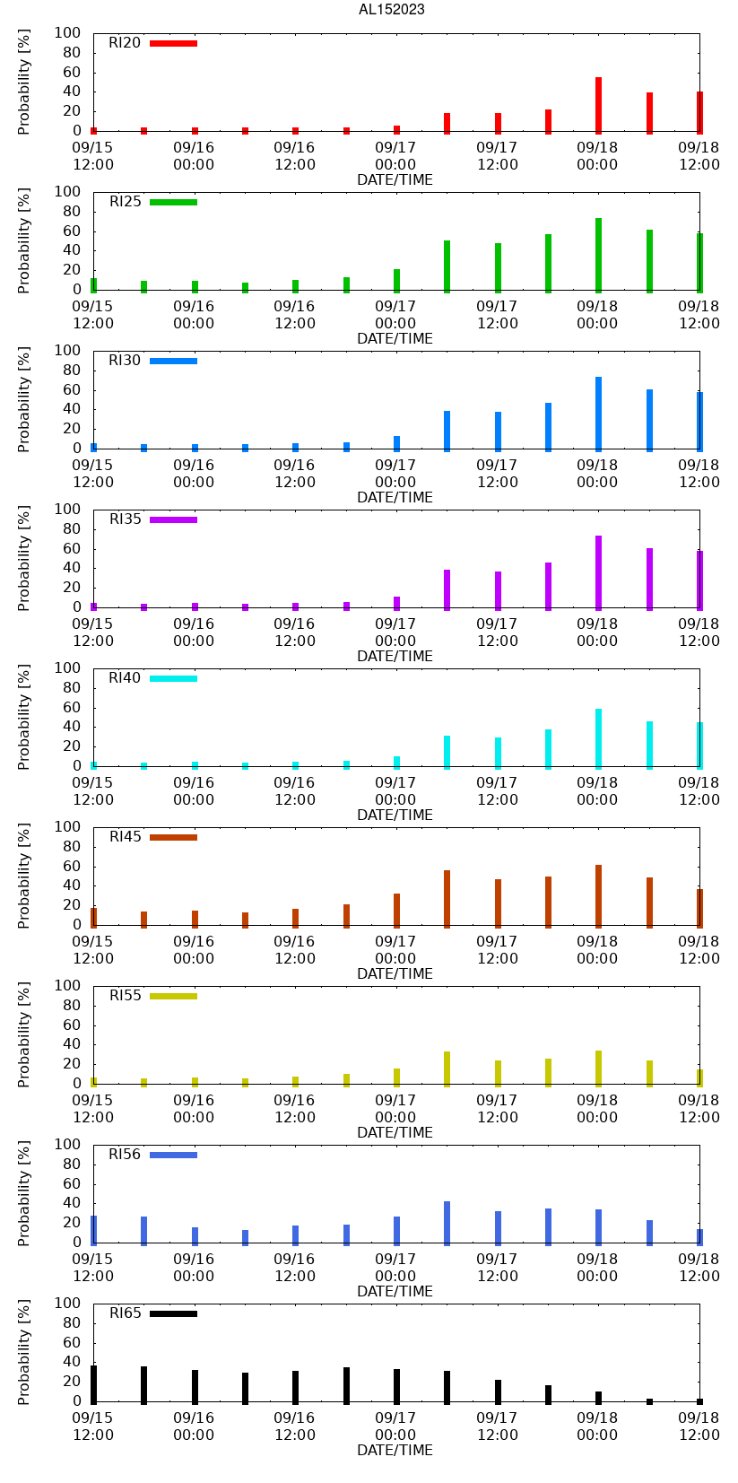
Latest NHC Upgrades to 95 kt, 12 hours out… increasing the probability to 51% based on only error in OFCL). None of the models in late guidance show it increasing beyond 95 in 12 hours (HMON does later on 30h out), although the most recent best intensity is above 6/8 models.
https://www.nhc.noaa.gov/outreach/presentations/nhc2013_aircraftData.pdf
If you are interested in the below you can just read the above and get some insight into the (somewhat subjective) nature of figuring out these intensities (described above and below in the recent discussion). (tropicaltidbits.com has the raw files for the hurricane hunter missions so you can examine and do similar calculations as mentioned below)
" The satellite structure of Nigel has improved this afternoon. Satellite images indicate a solid ring of deep convection surrounds the large, 45 to 50-n-mi wide eye of the hurricane. The NOAA Hurricane Hunters have conducted research missions into Nigel today and provided helpful data to better assess the hurricane's structure and intensity. The aircraft recorded peak 700-mb flight-level winds of around 100 kt, which reduces to a surface intensity of 90 kt using a standard reduction factor. However, peak SFMR winds from both planes were around 75 kt, and dropsonde data indicate only modest pressure falls to around 974 mb. Based on a blend of these data, the initial intensity is set at 85 kt for this advisory."
Late guidance from 06H shows Category 3 is unlikely
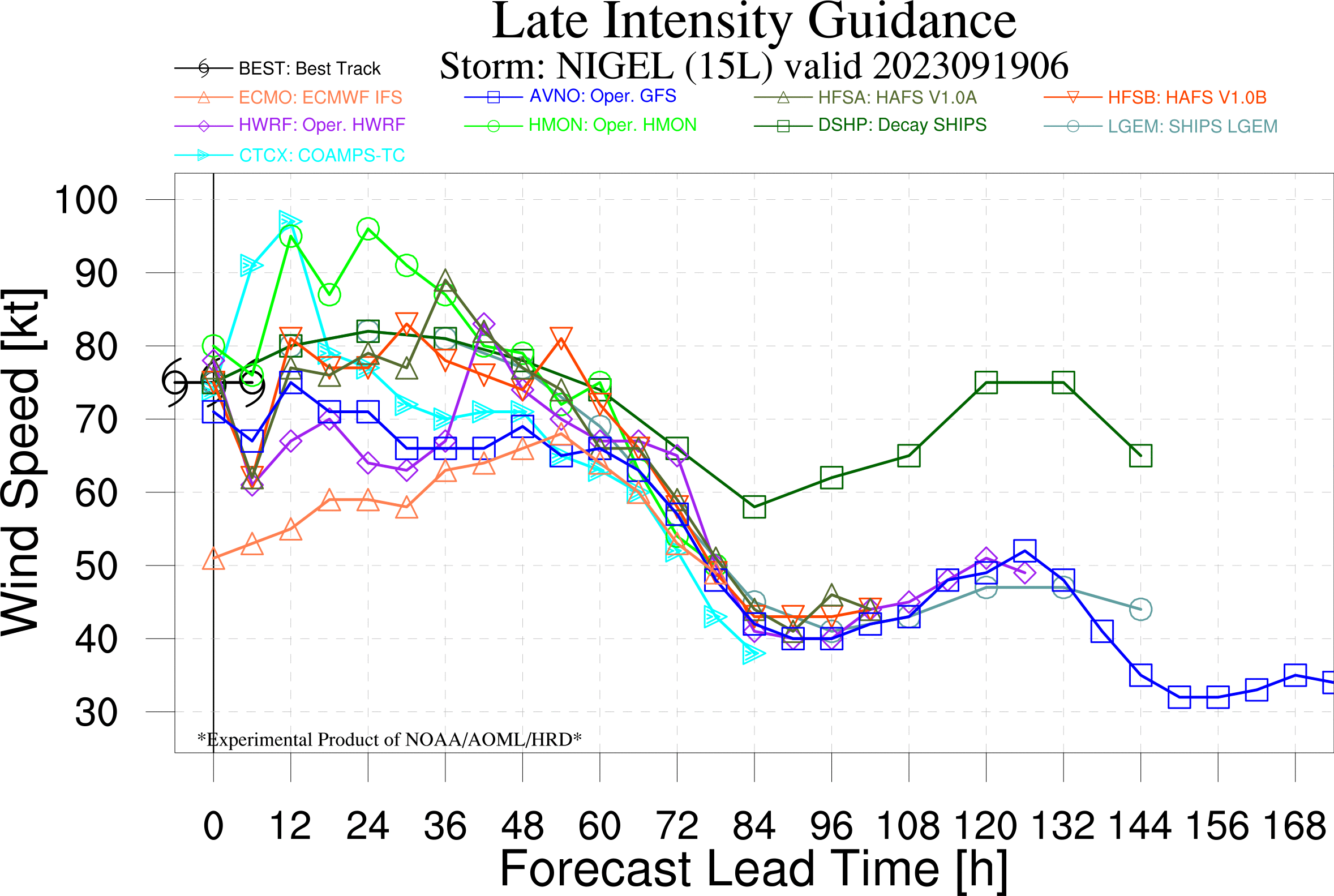
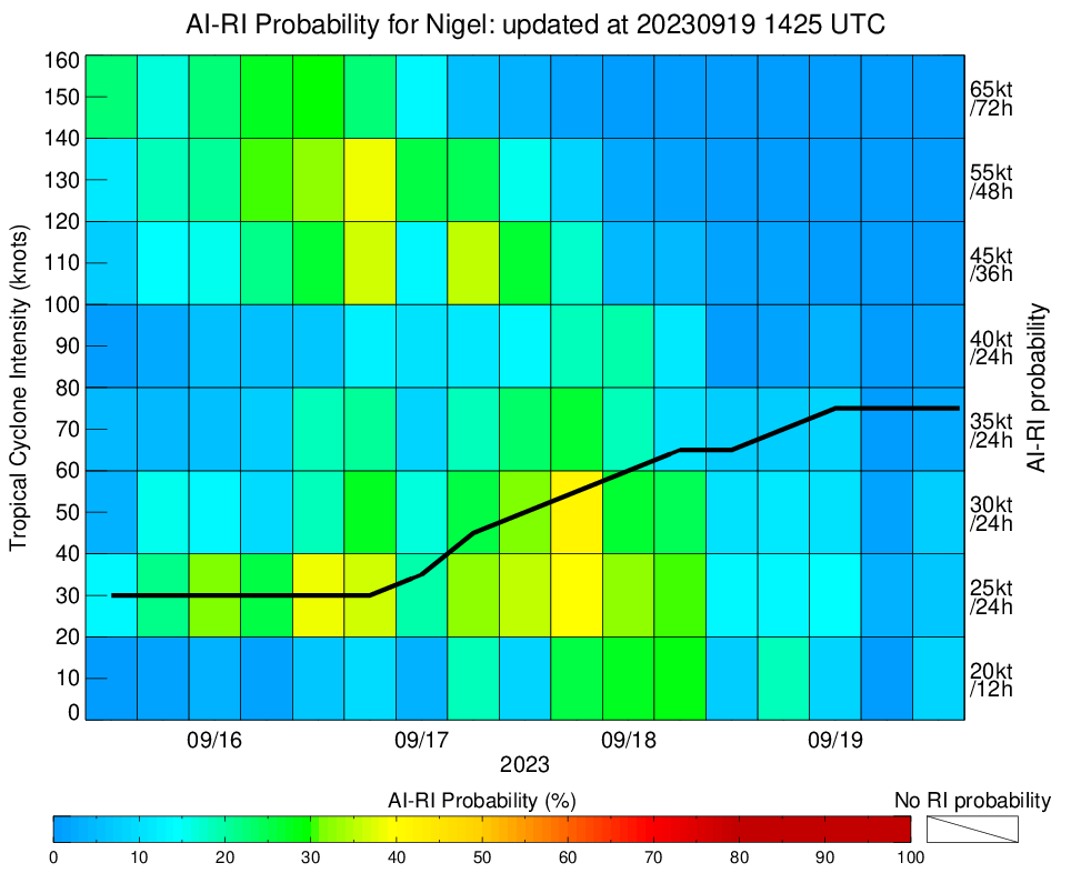
RI not favorable either (<10%) according to Wisconsins AI model
Using only the 5AM OFCL forecast advisory and my error model on OFCL forecasts, there is only a 17% chance of it becoming a category 3 in 24 hours.
The next complete OFCL forecast is coming out in the next half hour.
Edit: OFCL has it at 80kt which increases the probability to 25%, but since none of the model guidance or RI seem would plausibily support this high % for a ~20kt RI, I think it is reasonable to weight this less until the next complete forecast, unless the Wisconsin RI forecast changes dramatically in the next 6 hours.
Only conflicting points of data:
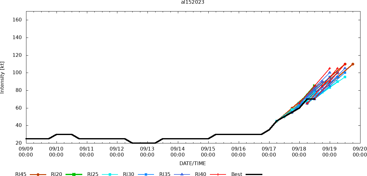
Latest OFCL has it at 105kt in 36h
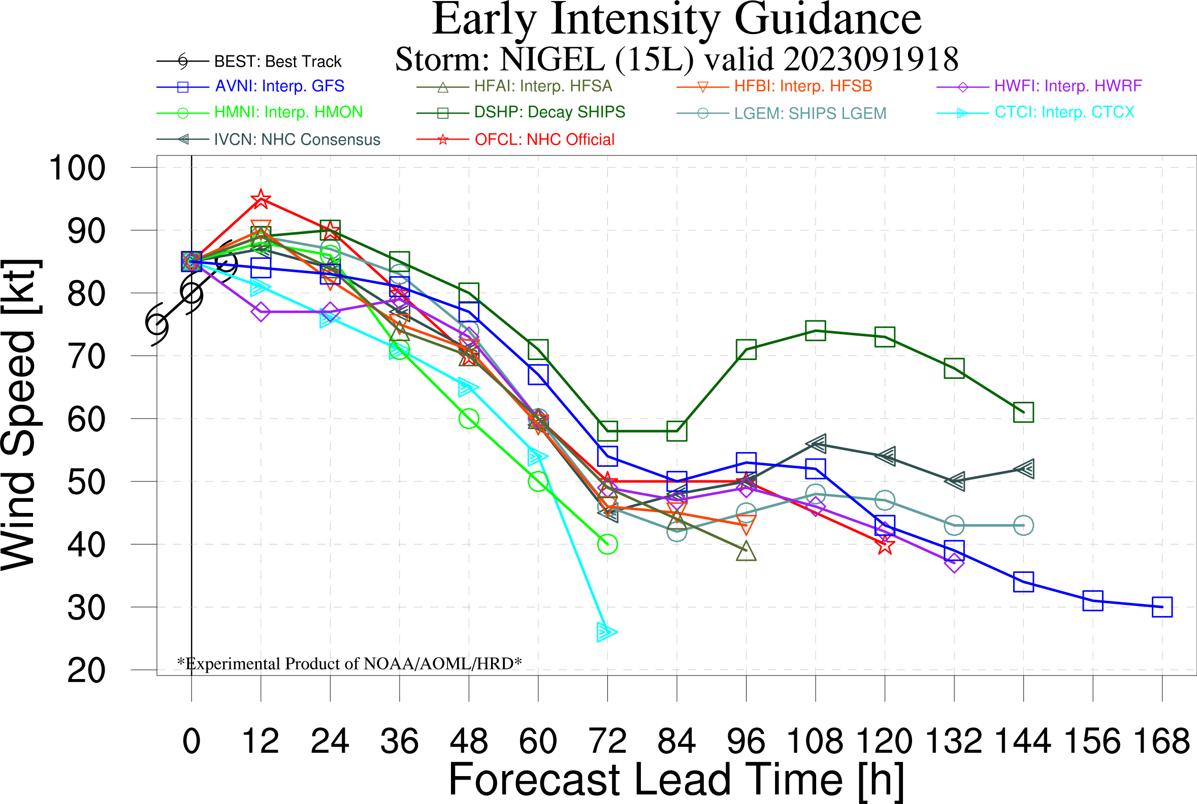
Late guidance for the best regional models (hafs and coamp) on intensity show it reaching cat 3 in 48h
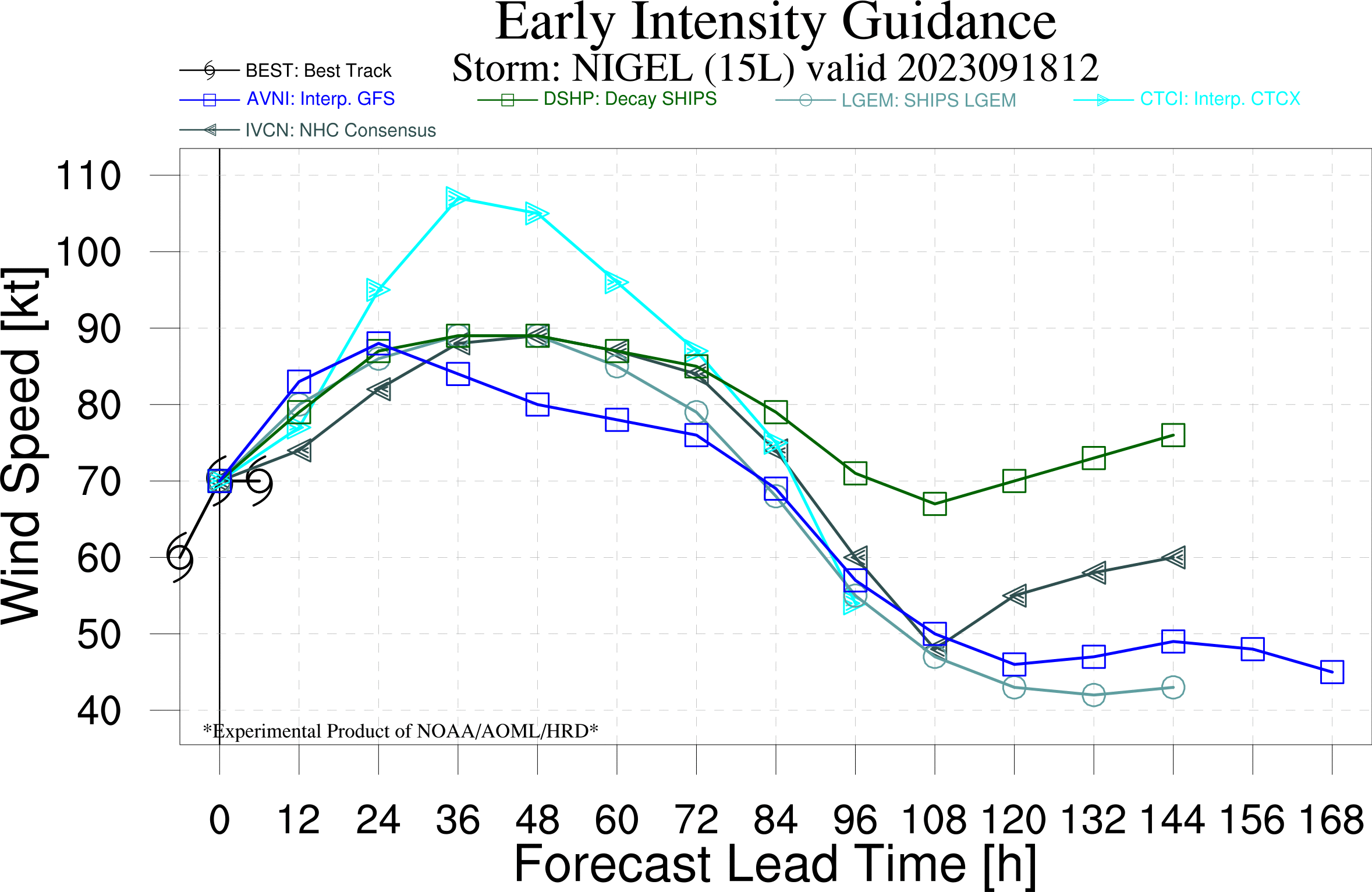
Early guidance from 12h Shows coamps with downgraded max intensity but still cat 3, and the consensus model still having Nigel not reach cat 3.
The latest RI probabilities have also dropped all of a sudden according to Wisconsins index
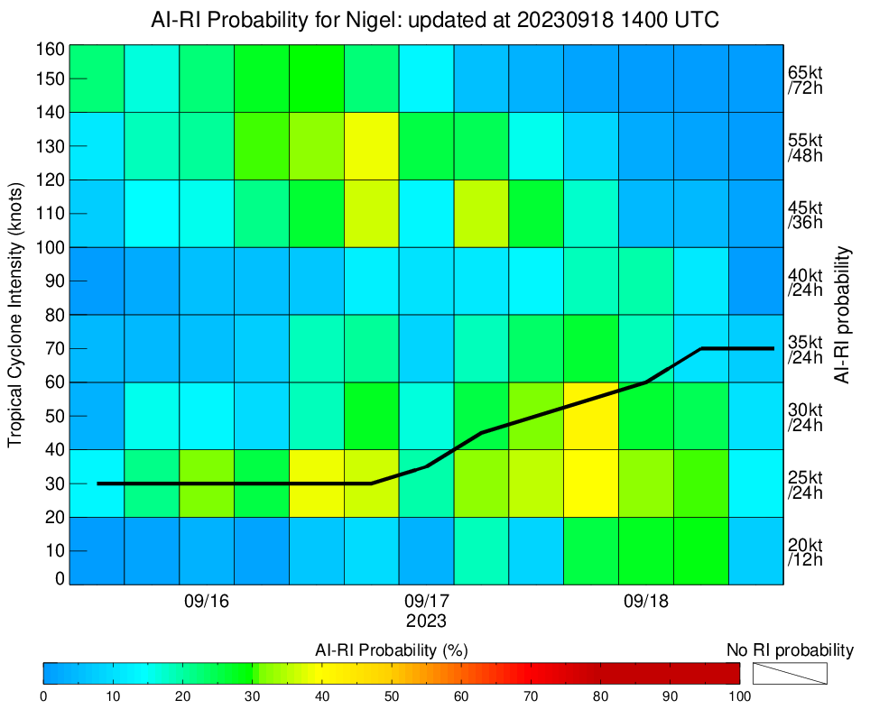
with Colorados CIRA (experimental) forecast for RI still show it likely reaching cat3
@parhizj Next NHC complete advisory should come in next half hour — will be interesting to see if they still forecast RI
@parhizj Still predicting RI while relying on SHIPS probabilities
https://www.nhc.noaa.gov/text/refresh/MIATCDAT5+shtml/181443.shtml
But only up to 100 kt now so it will be close…
@parhizj I have done my own conditional analysis of assigning % to NHC forecasts where RI is forecast using ideas drawn from that rapid intensification paper I mentioned during Idalia and my own (up to 2022 data), but a little bit more complicated. Using this model I get 54% probability. Something to keep in mind is that this includes forecasts going back to 1989 and forecasting skill has improved every decade since, so 54% should most likely be taken as a lower bound. It is not possible under this conditional analysis to exclude older decades because the sample size goes way down (for instance there are only 67 storms forecast with 24h RI in the dataset for the Atlantic. So, 59% market probability sounds reasonable
Notebook is here if anyone is curious (comments from last 3 cells are the most useful instructions on how I think the data should be used):
https://github.com/JRPdata/nhc_errors/blob/main/nhc_errors.ipynb