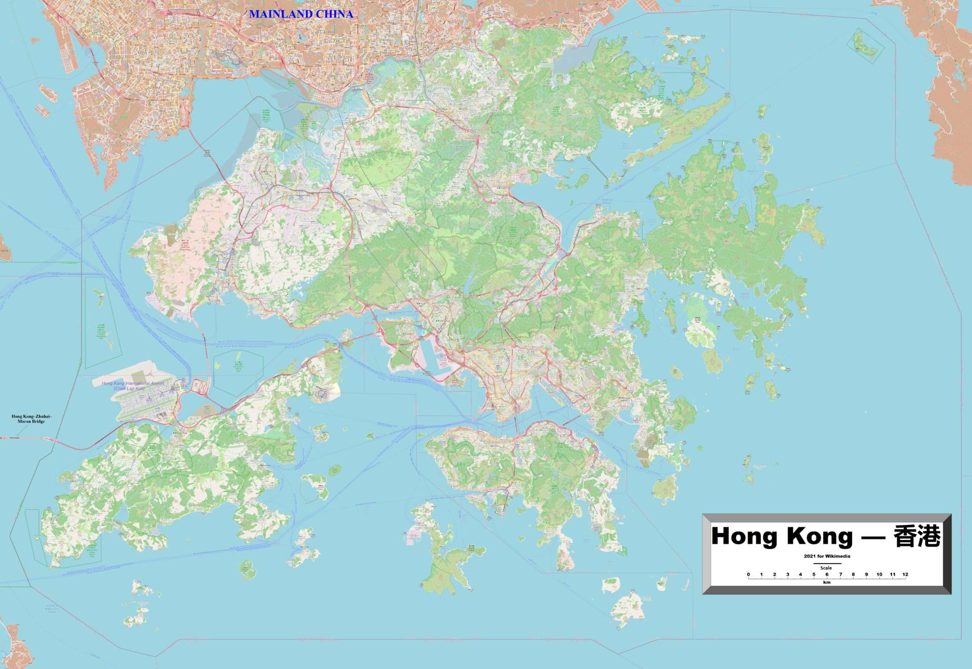
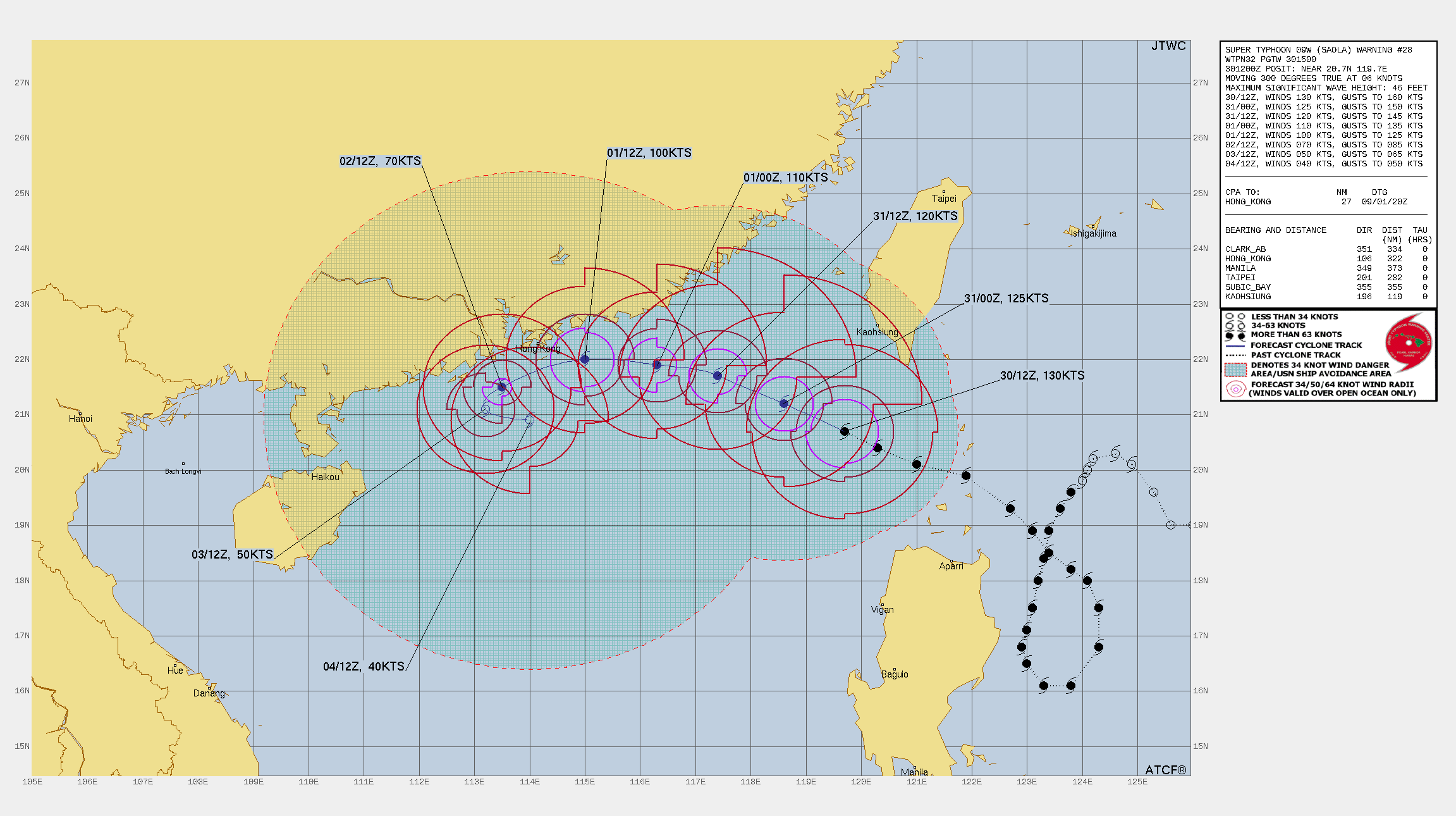
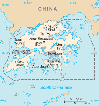
Resolves YES if Saola's low-pressure center comes within 1 nautical mile of any part of Hong Kong while still at minimum Cat II (or in HKO terms a severe typhoon with wind speeds of 85–104 knst) rength. Will resolve based on info from the JTWC and/or the Hong Kong Observatory (HKO) and if necessary my own measurements.
 1,000
1,000🏅 Top traders
| # | Trader | Total profit |
|---|---|---|
| 1 | Ṁ463 | |
| 2 | Ṁ135 | |
| 3 | Ṁ118 | |
| 4 | Ṁ49 | |
| 5 | Ṁ7 |
Thanks @parhizj @SarkanyVar and @capybara for interacting and providing some very high-quality inputs and updates! I wish more markets were like this one.
After some more track review I will be resolving this as YES. I believe that the eye came within 1nm of Hong Kong's maritime (and land) borders. If you disagree and give reasons I will happily make you whole because I did not invest enough time into this to be fully certain and am also not an expert on any of this. I base the following on JTWC data, nicely visualized at http://arctic.som.ou.edu/tburg/products/realtime/tropical/?storm=WP092023
Assuming an initial position of 22°06'00.0"N 114°24'00.0"E and using the JTWC's best track estimate as of 20230901 18z at 22°00'00.0"N 113°24'00.0"E this gives us a W-SW track and at 22°05'11.3"N 114°15'50.0"E brings Saola's center within 4.20nm of Nam Kok Tsui (coincidentally HK's southernmost point).
Given that the eye at this time was estimated by the JTWC to be 8nm in diameter, this moves it roughly 0.2nm into Po Toi. WIth HK's maritime border extending south for another 1.07nm, this gives us a total of 2.27nm room for the storm to have tracked even further south. This lines up with the Japanese satellite data.
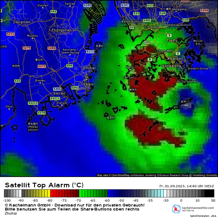
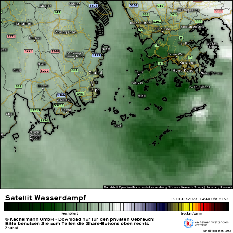
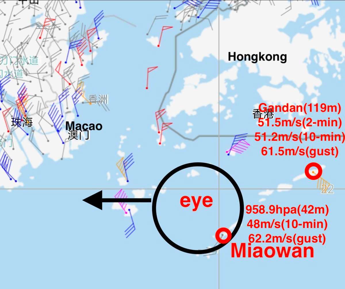
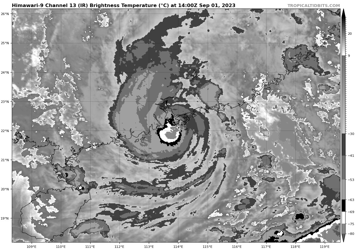
Water vapor and IR satellite footage, as well as the eyewall's impact on HK do not make me believe it not track more than 2.27m further south. This is consistent with data from the weather station on Waglan Island which at the time of the center passing roughly 2.7nm away from it recorded north eastern eyewall winds of 85,85knts and pressure of 979.1mB.
Okay, so it seems the storm seemingly meets the intensity requirement. Wind data gives us a few measurements at HK at >154kmh - which is enough to maintain Cat. II status.
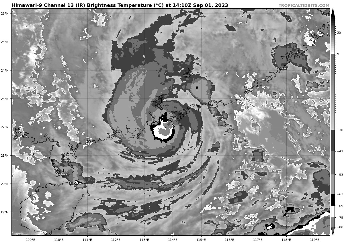
Unfortunately at the time of these measurements I also lose track of the high - the most high-res water vapor view I could find has me confident the eye is somewhere south/over Dapai.
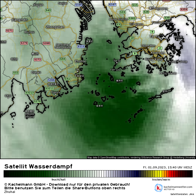
I'll wait for the official sources to chime in. The weather station on Cheung Chau bottoms out at 983mB, which with an around 8nm eye could put it within the YES range. Maybe a Soko Islands pass could be just close enough. Not very confident in that, though. I will consider maritimes borders if the 1nm brings it into HK water. Well that is if we/others are able to find the eye/low-pressure center conclusively.
I do think the auto-positioning loses the center at around 21.98 114.24 and then goes off the rails sending it into the Bay. So more likely than not this is a NO. Saw this on twitter ( I have about 90% confidence the LLC is in there) - lines up with the wind patterns and the pressure levels (though, I am not familiar with the potential differences in the WP so my intuition may be off). It also matches the HKO track. Though, JMA has it further north.
@sarius I think with the choice of time resolution/sampling (meaning how many samples you average over and the frequencies of the sampling (10 minute vs hourly)) and different sources of data (radar vs satellite) might cause it resolve either way maybe… this is the tricky thing about these storms.. just like the Hilary question with landfall.
For this question since it is a small target area and specific requirements (1 n mile) I assumed you would use what ever sources had higher time frequency tracks or try to generate your own (6 hours apart would seem too much), but I won’t complain at all about the methodology you choose since I expected this would be challenging to answer/resolve from the get go.
In the future I think these types of questions involving tracks / intensity would benefit from a strict methodology/sources beforehand for resolution, at least then we could make a prediction based on estimates of the sampling times of the sources and it would save you time and effort for resolution.
@parhizj For the next HK typhoon I'll just use "Distance from the Observatory" tbh... You are right, though, this was pretty hard to track - especially because it took me forever to find the satellite data scaled to a high-res enough HK map. Let's hope that I (or any of y'all) won't have to run yet another storm market all that soon - I think a 10+ day break would be reasonable....
Question is closed. Now to figure out where this one falls. I think @parhizj has some pretty compelling evidence so far. Maybe the eye did track more north than anticipated. Might take me a while to get to a definitive point. The Chinese data is sometimes way too inaccesible.
@sarius As I was watching HKO's radar I copied all the images locally for reference later. In case you might find it useful: https://github.com/JRPdata/wastebook/blob/main/saola-hk-radar.zip I don't think it is as useful as the satellite images though. Good luck!
Edit: See also my comment on the speed at the time in question (it's buried among all these comments): https://manifold.markets/sarius/will-the-eye-of-typhoon-saola-come#ziiz5U1l6cPImiPrv7rZ

Edit sorry had a typo into Google maps ignore previous
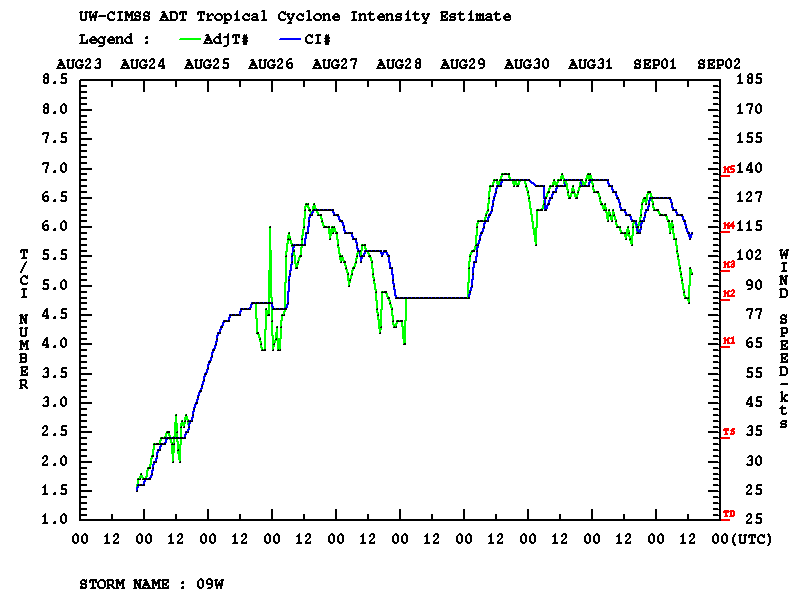
https://tropic.ssec.wisc.edu/real-time/adt/09W-list.txt
About 2.5 n miles from Shek Kwu Chau
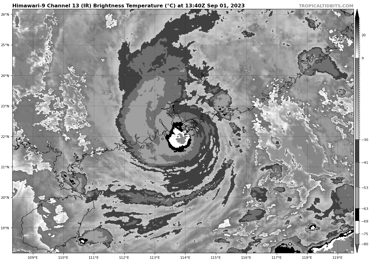
2023SEP01 140000 5.8 942.8 109.8 4.9 5.1 3.9 0.7T/6hr ON OFF OFF OFF -42.44 -47.57 UNIFRM N/A 7.9 22.15 -114.01 ARCHER HIM-9 39.6 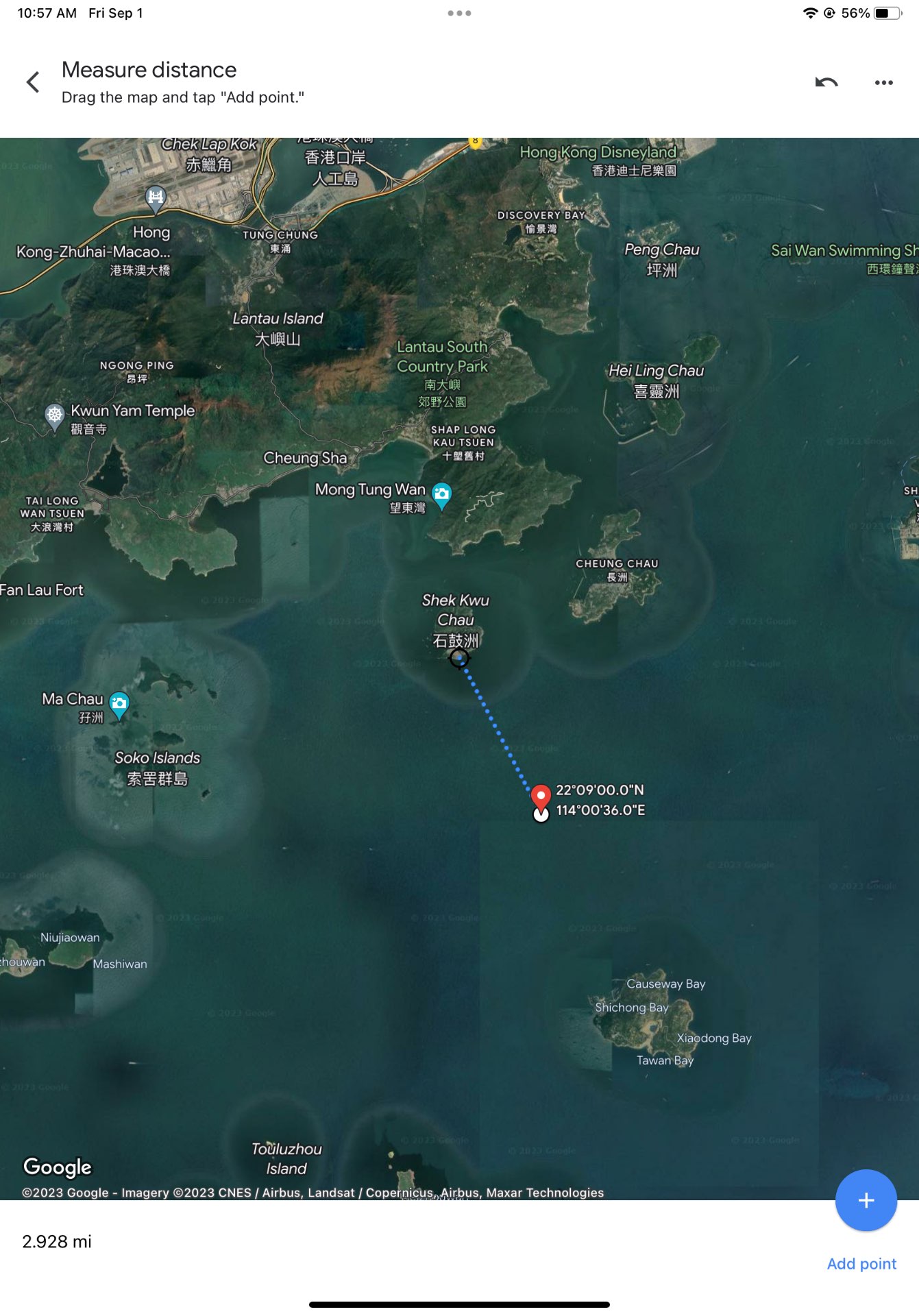
if we were going by this and previous data point for the speed from this source… I’d say it should resolve yes but that is probably not enough for @sarius
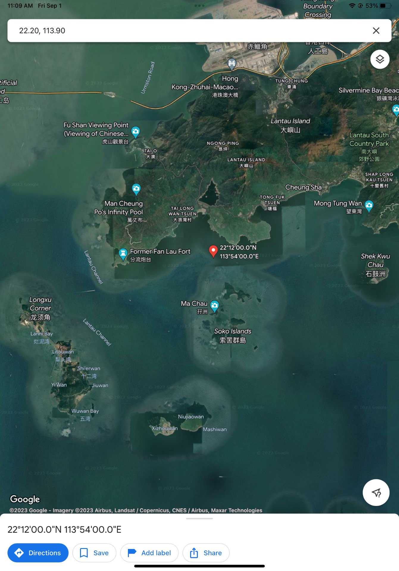
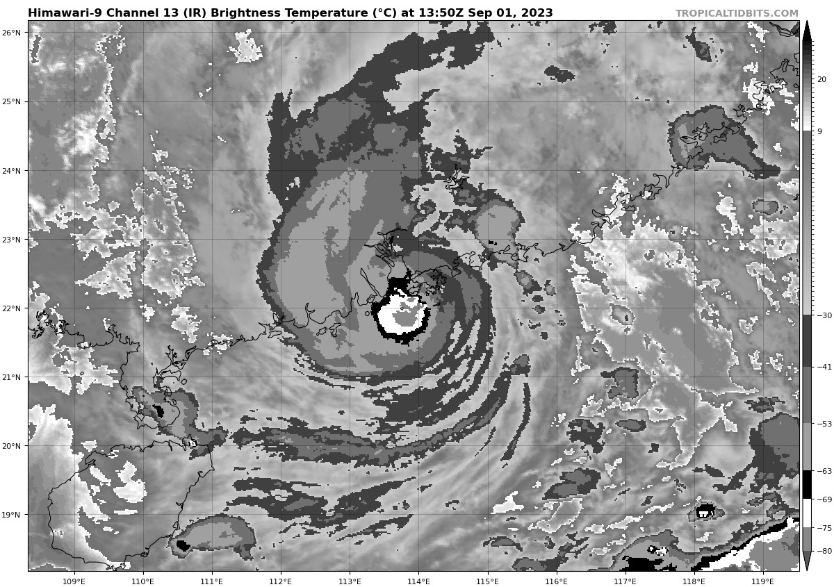
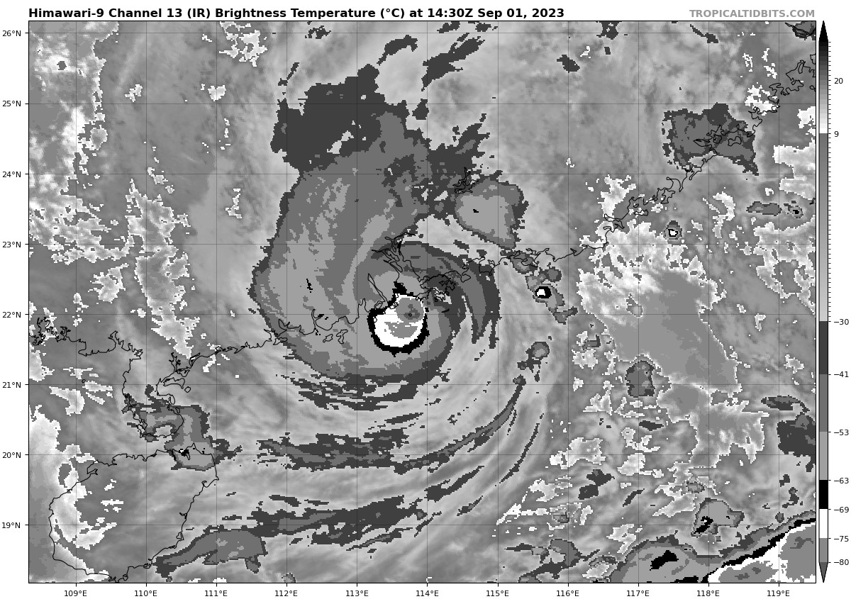
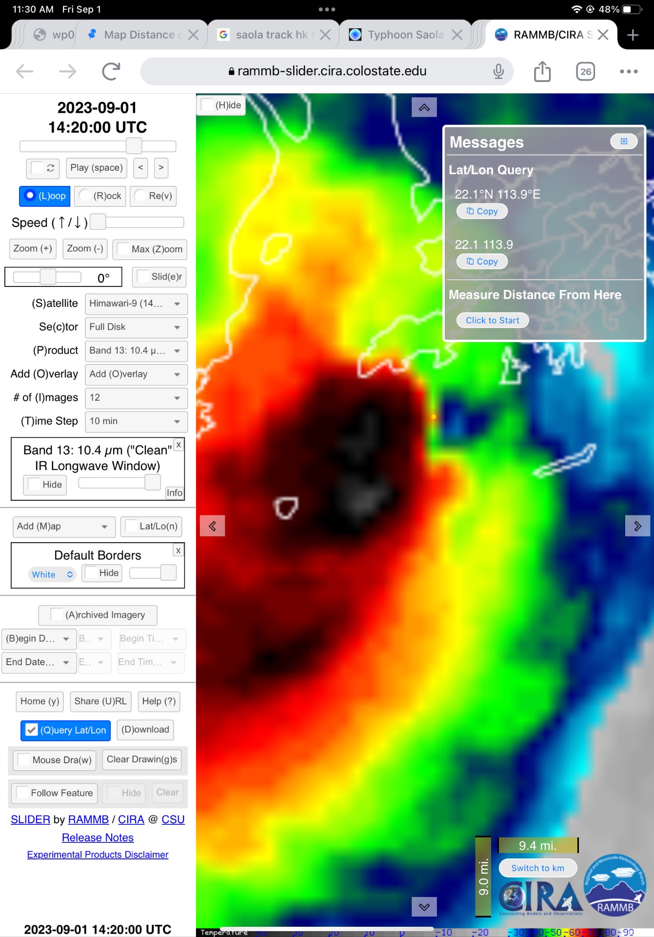
2023SEP01 142000 0.0 0.0 0.0 0.0 0.0 0.0 N/A N/A N/A OFF 99.50 99.50 LAND N/A N/A 22.20 -113.90 ARCHER HIM-9 39.8 @parhizj Less than a mile for this fix from that source, but it is not included in the resolution desc
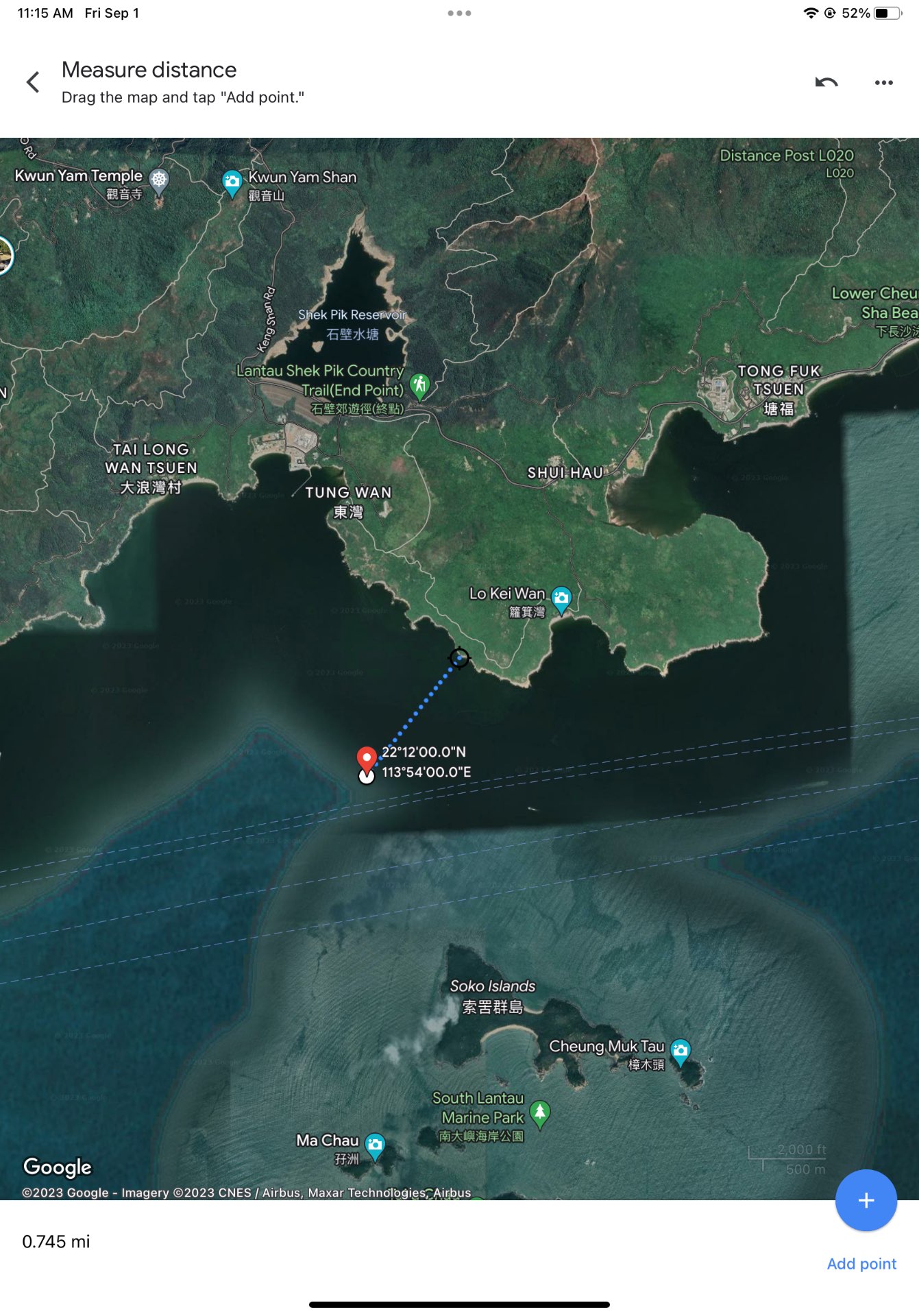
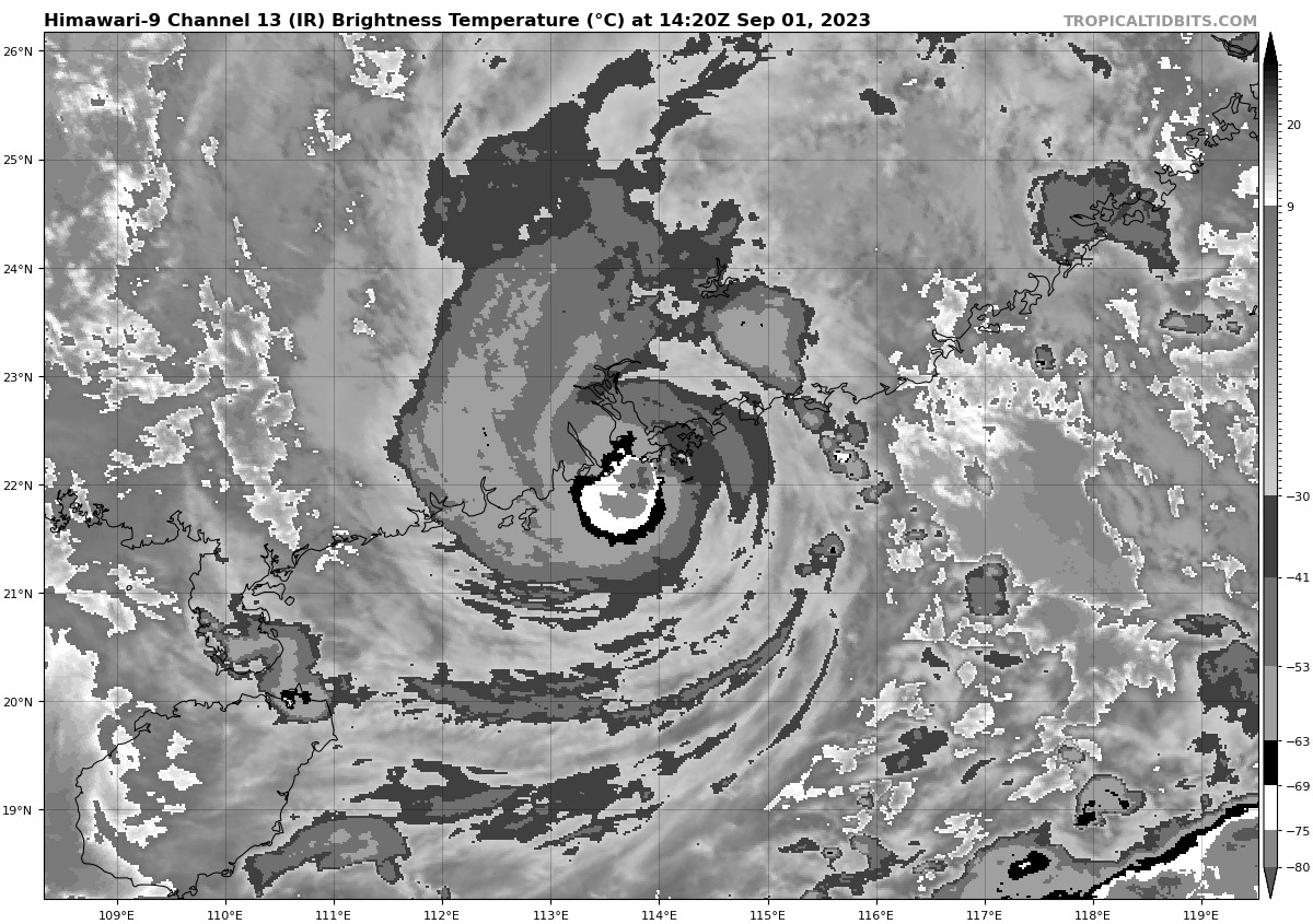
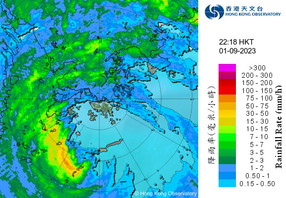
the 14:20 utc image that supposedly shows it close/on land

don’t know enough to fix it need an expert…. Need a better tool also since that doesn’t show islands
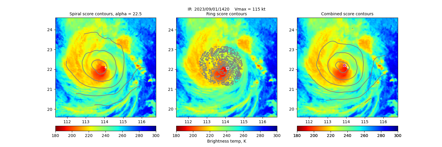
the archer position page has a breakdown including its own certainties / scoring and description of that, but the certainty measures don’t make sense to me for the center of rotation, as the 50% certainty has a larger area than the 90% certainty when you would expect it the other way around ..
https://tropic.ssec.wisc.edu/real-time/adt/ARCHER/ARCHERinfo_09W.html
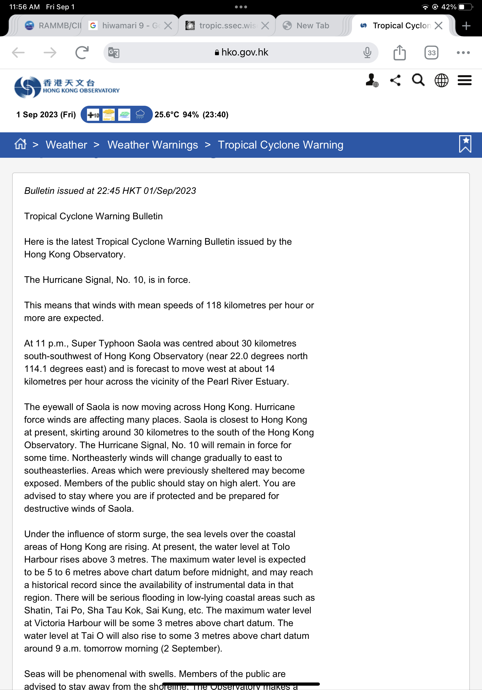
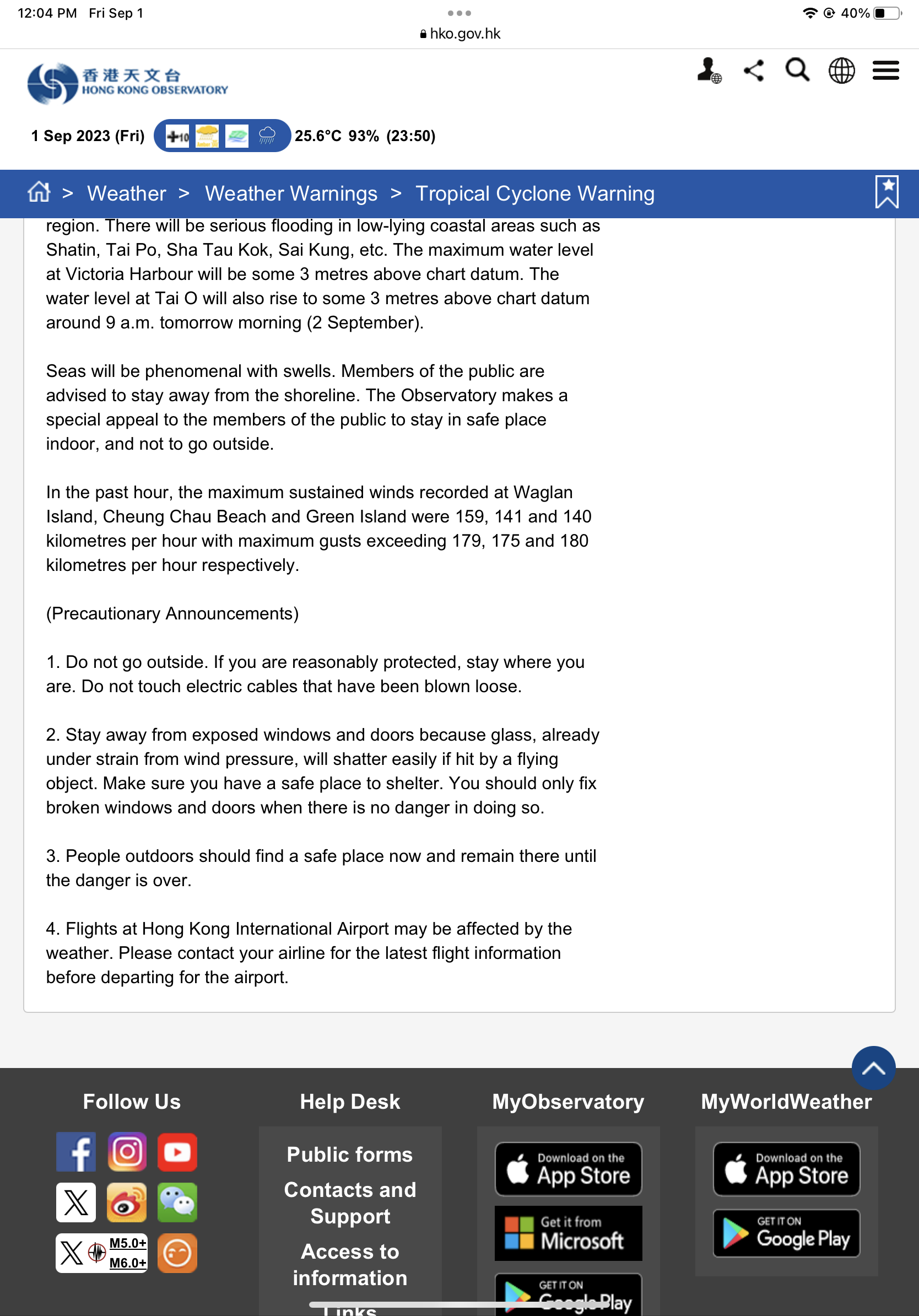
@parhizj Ok for reference to the 14:20 utc positioning(22:20 Hong Kong time) for the above, according to this HKO bulletin it satisfies the speed requirement as it was still a super typhoon at the time (bulletin was issued 22:45 and mentions in last hour which covers the positioning of the above archer positioning record). The hko does have a completely different position though since this is mixing and matching the requirements
not sure where to put the eye any more from radar
The center is unclear/widened when it looks like it has undergone replacement
And the strength by adjusted ADT is back up also