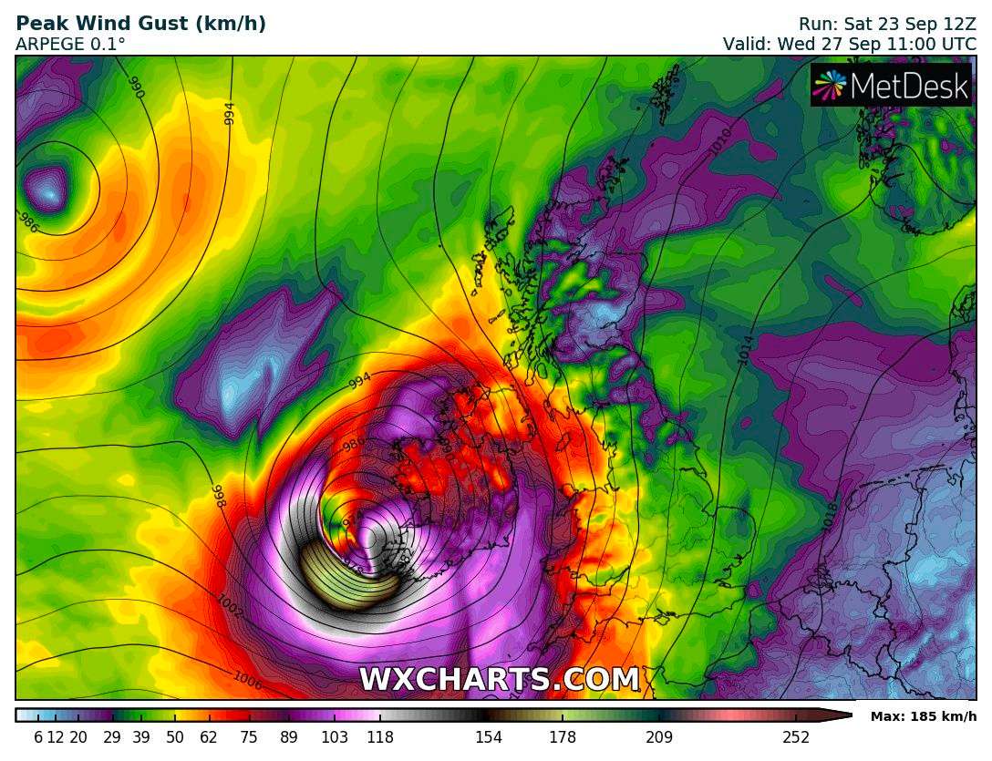
Opheilia -> Windstorm -> (maybe) Ireland... Gusts must be recorded at any of the following observation points. Resolves via Met Éireann.
🏅 Top traders
| # | Trader | Total profit |
|---|---|---|
| 1 | Ṁ57 | |
| 2 | Ṁ36 | |
| 3 | Ṁ18 | |
| 4 | Ṁ3 | |
| 5 | Ṁ2 |
People are also trading
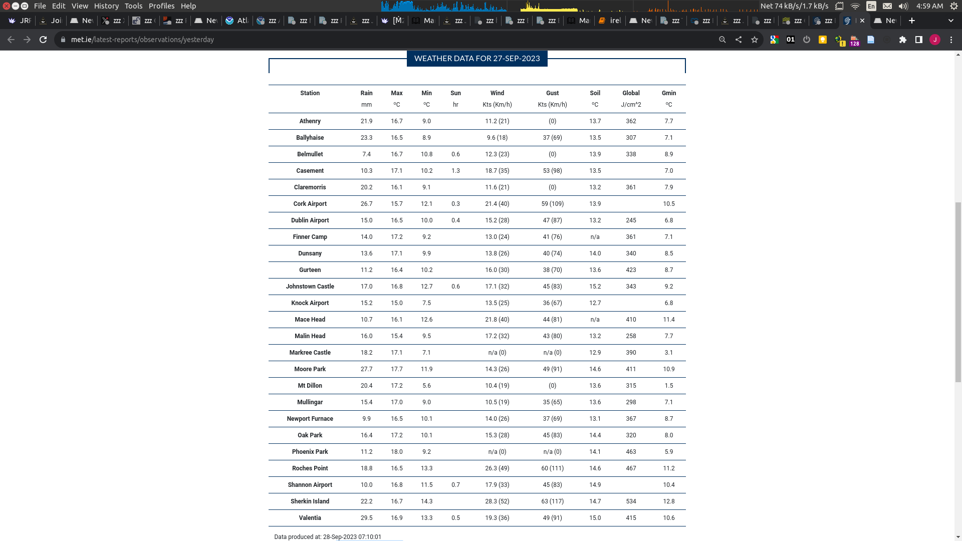
Yep, this didn't happen. Max gusts between 111-117 km/h. Thanks @parhizj for going above and beyond!
I found today that the Met Office Weather DataHub service is free and allows 1GB of data. I downloaded the UKV model data for max wind gusts (10m) for the 12 hours period of interest of tomorrow (referencing windy.com) and updated my notebook to get the max for points nearest the stations (note not all stations may be included, such as Dublin and Knock since the page I reference didn't have specific data). Most of the distances (lat/long) are not too far from this high res model (~1 nm) but these small distances create large vertical distances for the point estimates...So, I also note the model surface altitude difference. This is for reference and lets me know the range in differences, which is between about -85 (Mullingar) to +8 meters (Sherkin Island). So for Sherkin Island I am more confident that the model of 43m/s is perhaps a (slight?) overestimate (meanwhile the other points are likely underestimates)
The following is from the 0900 UTC run (In my notebook you can see the max values for all the stations):
--------------
Station with highest max value
Weather Station: Sherkin Island
  Valid Time: 2023-09-27 10:00:00
  Max Wind Gust Value (10m): 43.0 m/s
  Distance from model (nautical miles): 0.6
  Station altitude (official): 21 m
  Terrain height (model): 29.4 m
  Model height differential: 50.4 m

Number of stations exceeding threshold of 41.67 m/s: 1
I couldn't find a good method that lets me easily adjust gusts by altitude (there is wind profiles for mean wind speeds) and I don't know if the modelling error for individual points (compared to observations) would be more or less orders of magnitude different than the error resulting from adjusting by altitude since I have read that wind speeds vary the greatest closest to ground. At the least I try to borrow the power profile concept for mean wind speeds to discover which stations are the most sensitive to this mismatch of altitude (normally p=0.1 to 0.6 is typical for mean wind speeds, but for gusts this is meaningless other than to perhaps show which stations error could be the greatest) ( note this has no methodological basis whatsoever that I've found for wind gusts ):
p=0.4, Ballyhaise Adjusted gust: 42.2 m/s
p=0.4, Carlow Oakpark Adjusted gust: 45.3 m/s
p=0.4, Dunsany Adjusted gust: 42.5 m/s
p=0.4, Gurteen Adjusted gust: 43.6 m/s
p=0.4, Johnstown Castle Adjusted gust: 44.2 m/s
p=0.4, Mullingar Adjusted gust: 45.8 m/s
p=0.5, Ballyhaise Adjusted gust: 47.5 m/s
p=0.5, Carlow Oakpark Adjusted gust: 49.4 m/s
p=0.5, Dunsany Adjusted gust: 48.2 m/s
p=0.5, Gurteen Adjusted gust: 48.4 m/s
p=0.5, Johnstown Castle Adjusted gust: 47.9 m/s
p=0.5, Mullingar Adjusted gust: 52.6 m/s
p=0.6, Ballyhaise Adjusted gust: 53.5 m/s
p=0.6, Carlow Oakpark Adjusted gust: 53.9 m/s
p=0.6, Claremorris Adjusted gust: 45.1 m/s
p=0.6, Dunsany Adjusted gust: 54.6 m/s
p=0.6, Gurteen Adjusted gust: 53.7 m/s
p=0.6, Johnstown Castle Adjusted gust: 51.9 m/s
p=0.6, Mullingar Adjusted gust: 60.5 m/s
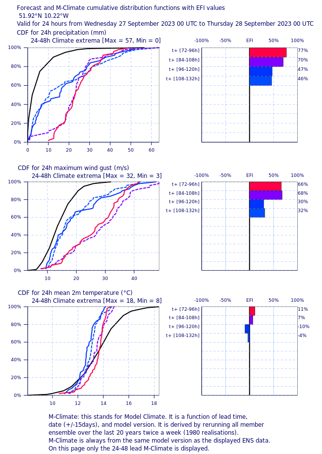
Given that the UKV does show a wind gust above 41.67 m/s for Sherkin Island, I can't say it is low probability despite the EFI/CDF for that point forecast showing it at < 5%.
From UKV 08 UTC (looking at next 12 hours) doesn't look like the requirement for 160 km/h will be met today. Observations from last two hours show that the previous forecast from 09 UTC yesterday was too high (Sherkin Island: 111 km/h).
--------------
Station with highest max value
Weather Station: Valentia
  Valid Time: 2023-09-26 15:00:00
  Max Wind Gust Value (10m): 36.0 m/s
  Distance from model (nautical miles): 0.4
  Station altitude (official): 25 m
  Terrain height (model): 28.4 m
  Model height differential: 53.4 m

Number of stations exceeding threshold of 41.67 m/s: 0Clicking at all the dots in the map up (until 20:00), highest seems to be Sherkin Island at 117 km/h at 16:00.
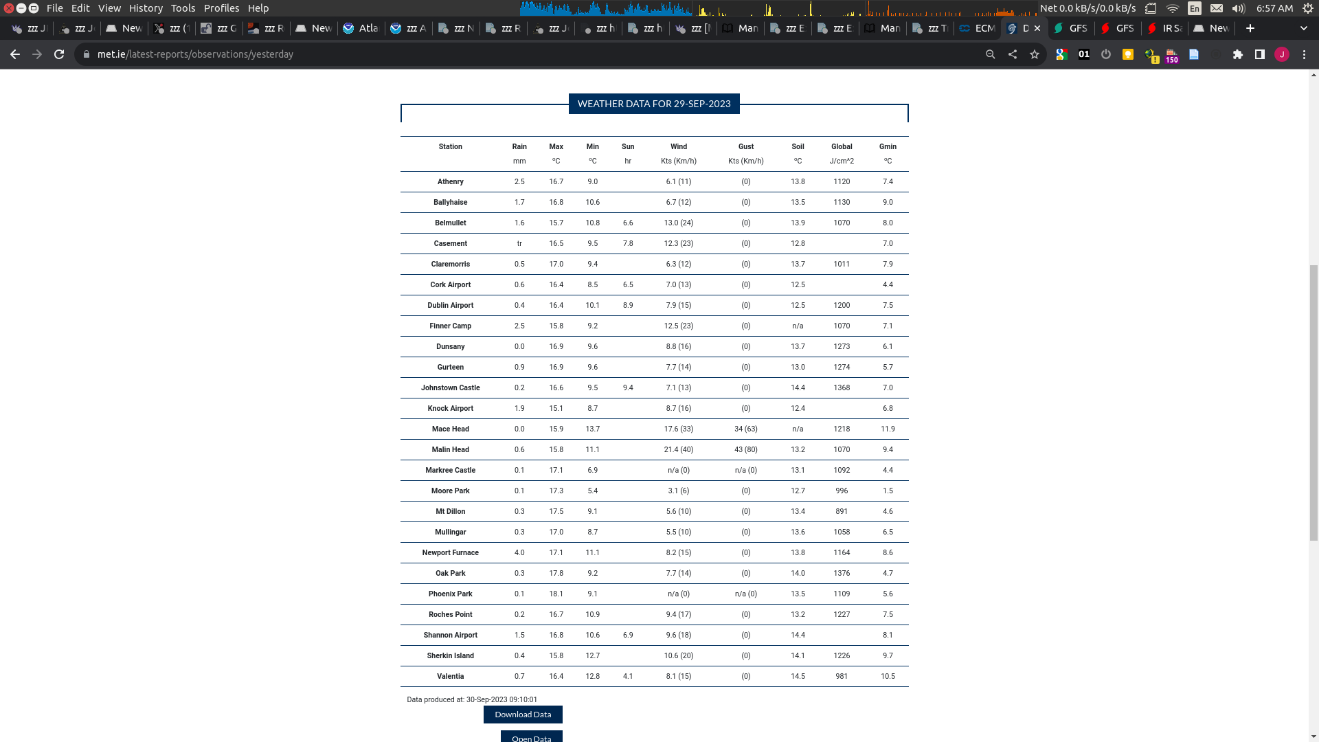
The data for "yesterday" produced tomorrow should be quicker and easier to confirm this:
https://www.met.ie/latest-reports/observations/yesterday
Don't see any other storms in GFS for rest of September like the one today.
Might need to wait till tomorrow for all of 29 to fill in
1 day left…
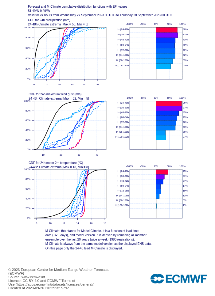
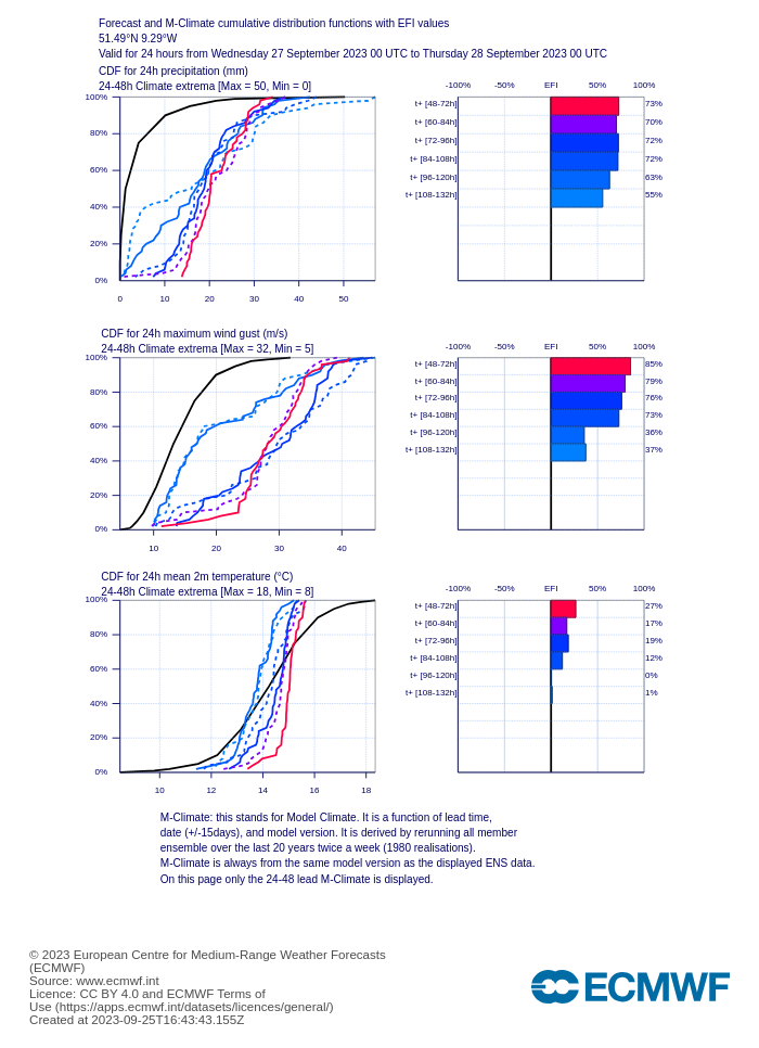
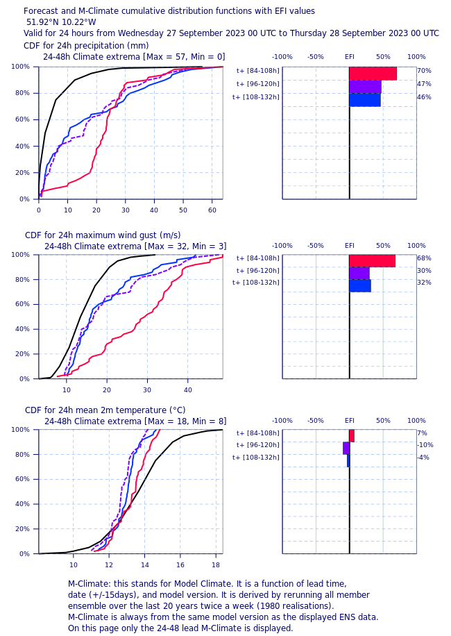
Created a notebook to gather wind gusts for NW Europe, and EFI/CDF for the observatories at the description URL (so I can look at all of them quickly).
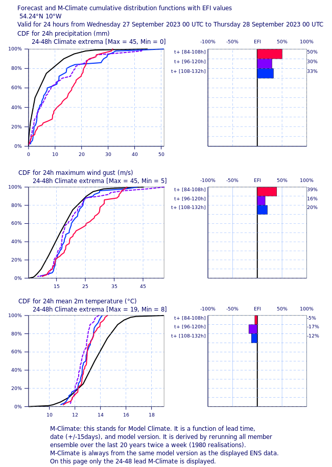
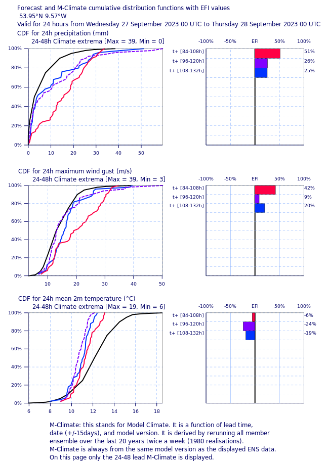
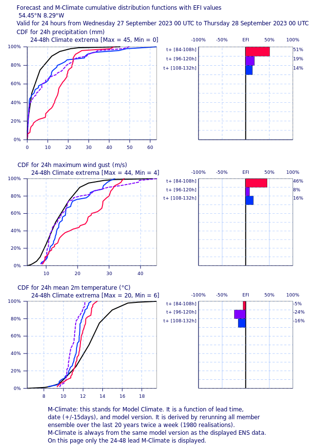
Sherkin Island is the only one showing a non-zero probability on Wednesday (red line), with about ~5%):
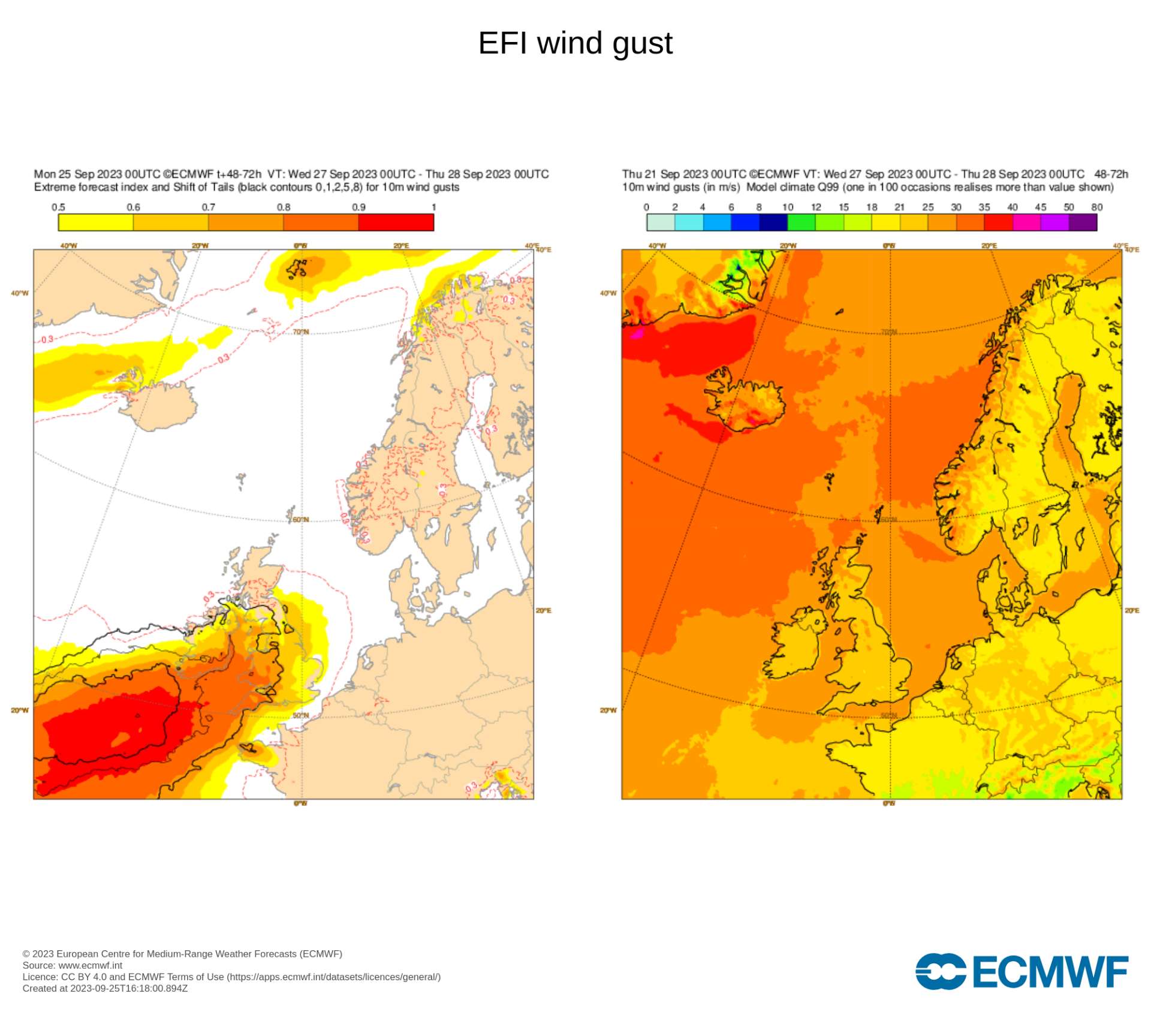
This matches that the SoT for wind gusts are greatest in Southern Ireland), but the 99 percentile for wind gusts only goes up to 30-35kt range (only 1% exceeding that range)
The notebook takes a while to run since it has to do several API requests (https://github.com/JRPdata/wastebook/blob/main/ireland_weather_stations.ipynb)
150km= 81 kt = 41.67 m/s = 93.21 mph
Dublin Airport in Ireland. Latitude: 53.4264 Longitude: -6.2499.
On one hand ECMWF isn’t great at intensity forecasts for TCs… on the other hand it’s a low effort product to use their point forecast EFI/CDF….

Met office UK forecasts only max 19m/s for Wednesday
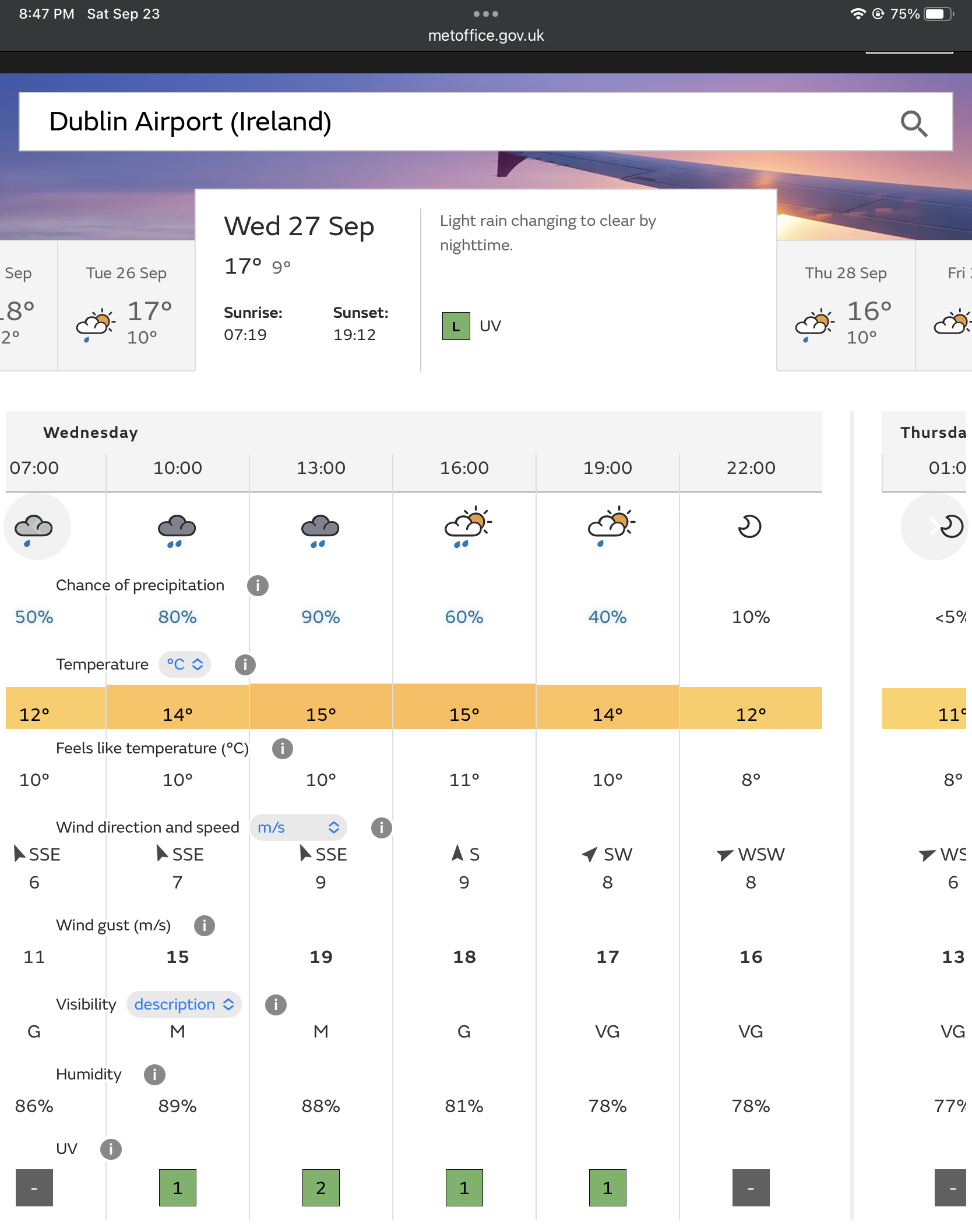
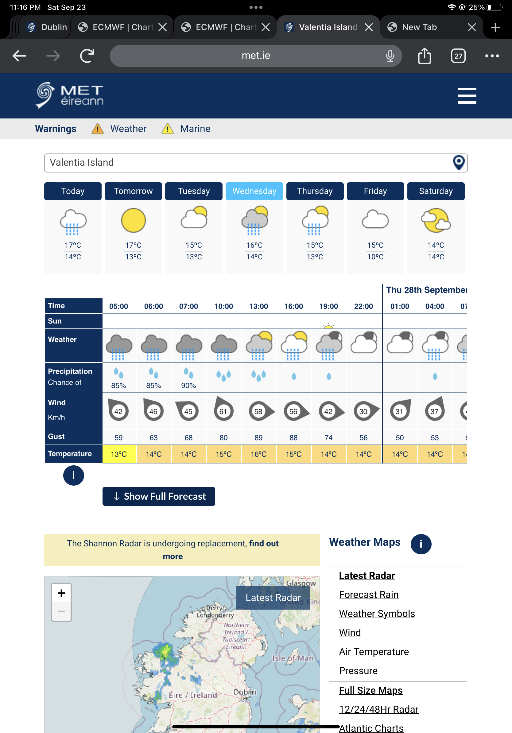
Met Éireann With 74 km/s
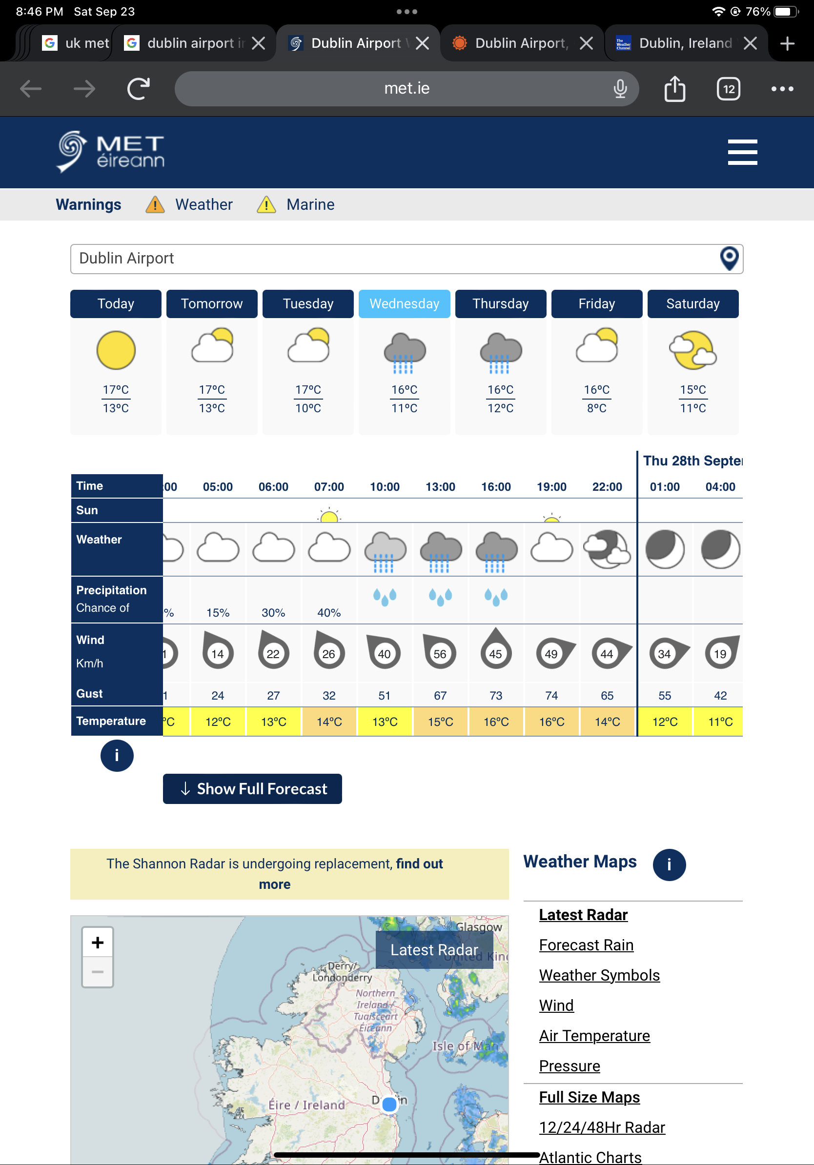
Weather.com wind gusts over 50 mph

@parhizj Sherkin Island and Valentia + Roche's Point, Shannon Airport and Mace Head's would be my main candidates. Irelands wind records for reference: Highest gusts in September: 181 km/h in Donegal (Malin Head) on 09-16-1961 from Debbie.
@sarius Just picked the major airport as a good starting point… (plenty of forecasts for it and usually they have good weather history so the forecasts should be better?)
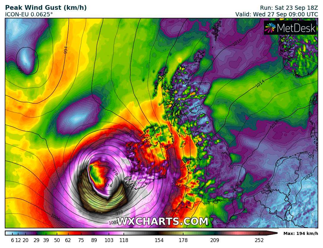
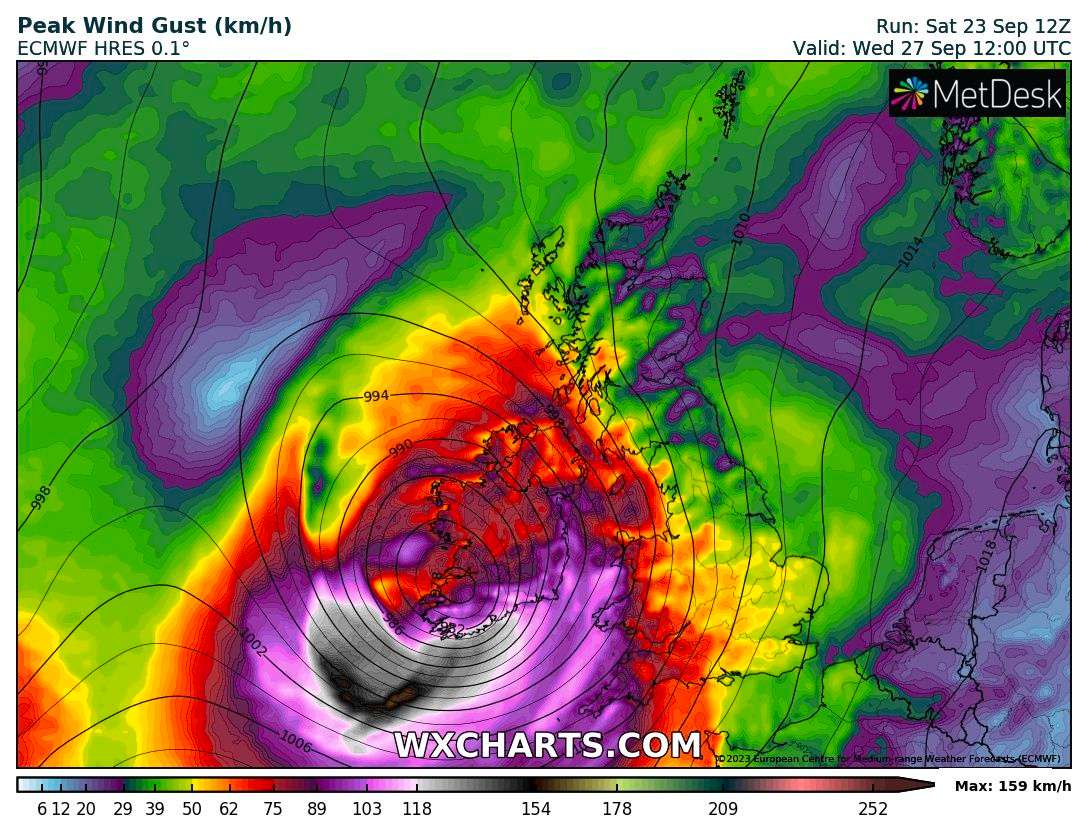
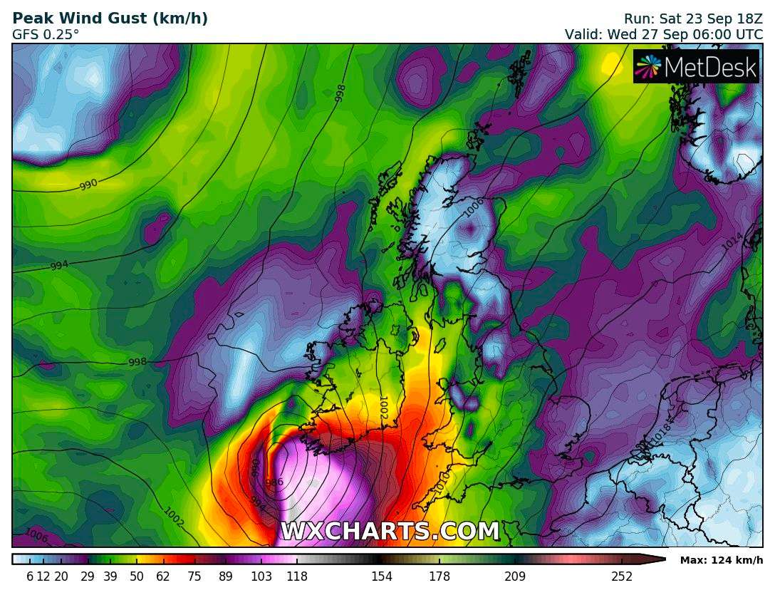
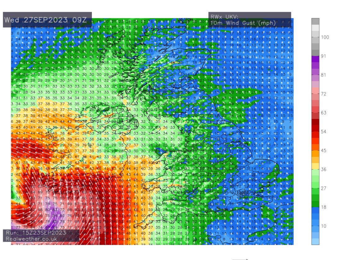
@sarius https://wxcharts.com/ is a bit fidgety with putting down points (and not super high-res) but for the western tip most models have gusts >100 km/h but <130 km/h. So far this doesn't seem likely. Time for me to start reading up on windstorms in the British Isles, I guess...
@sarius To find better candidates…correlate those records with this (experimental) EFI wind gust chart
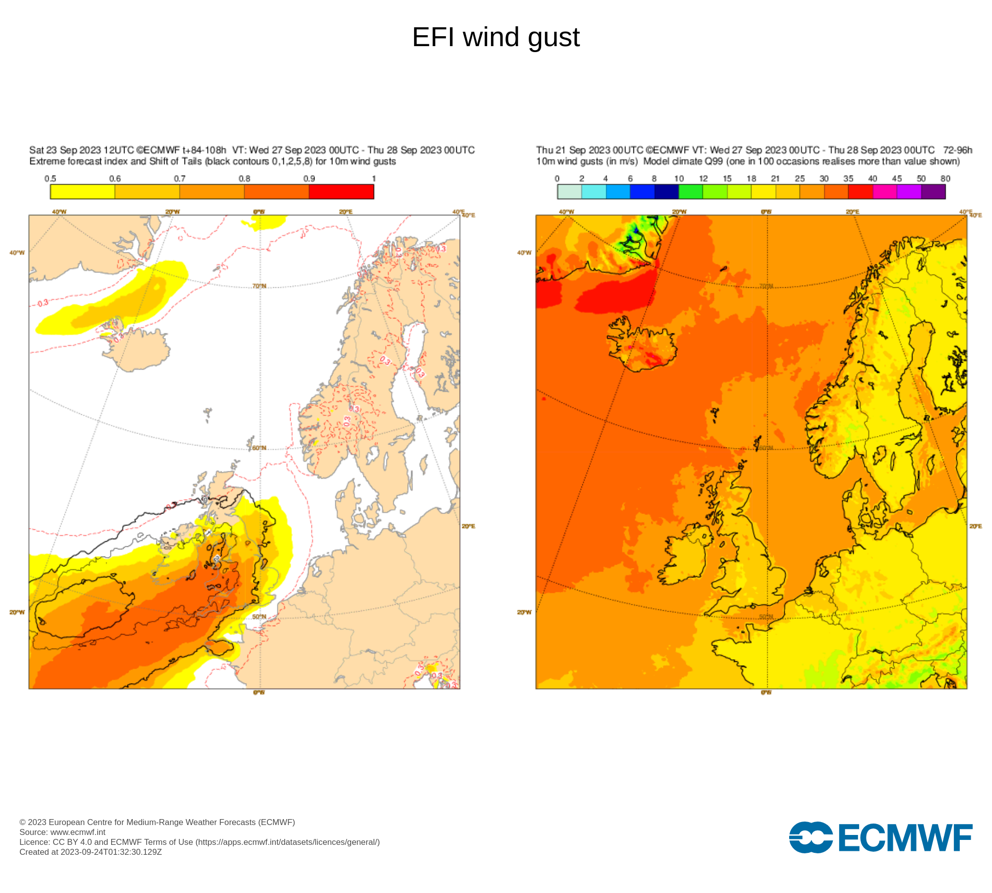
marking best candidates by highest SoT
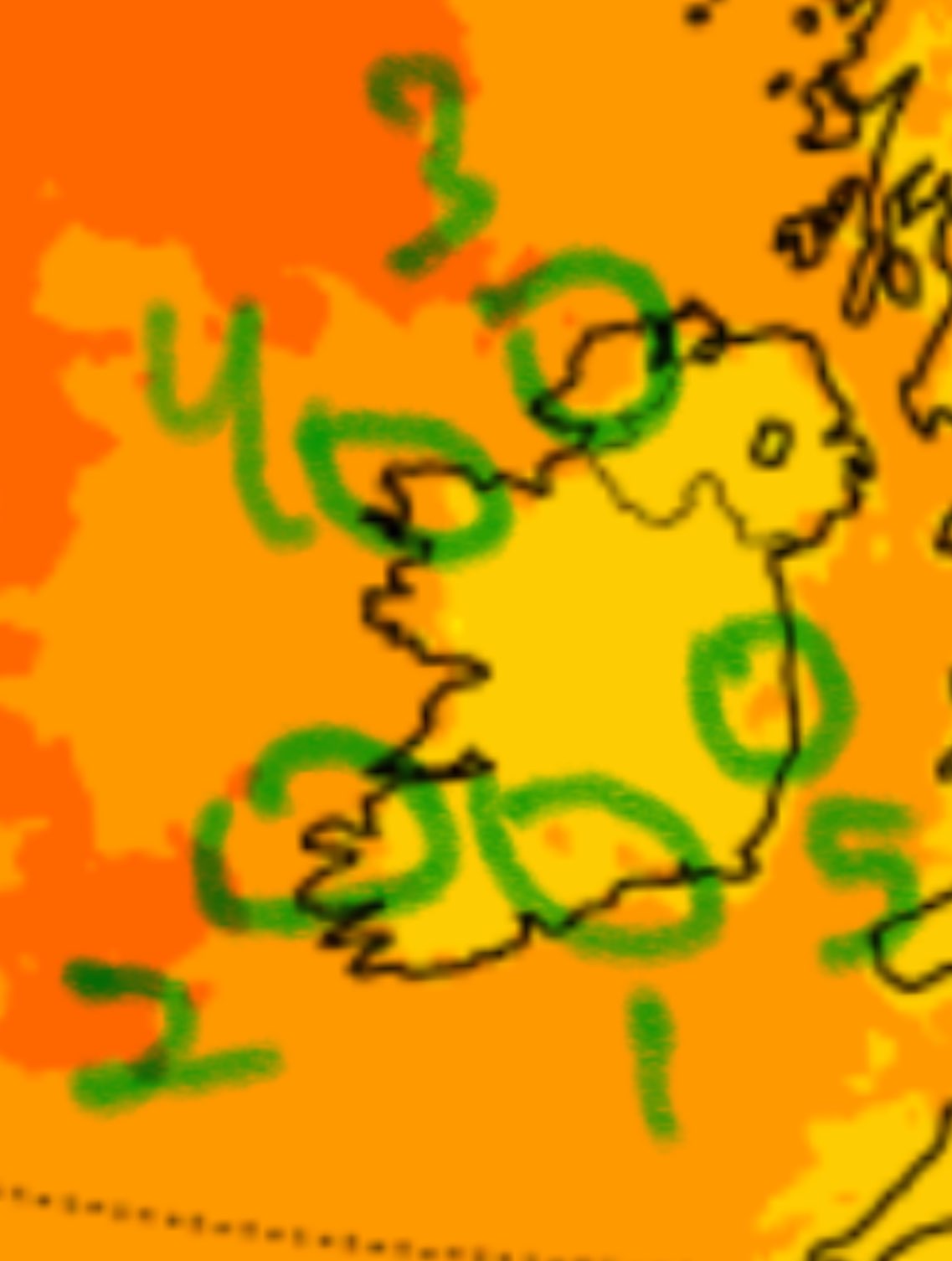
since the question is constrained to those stations…
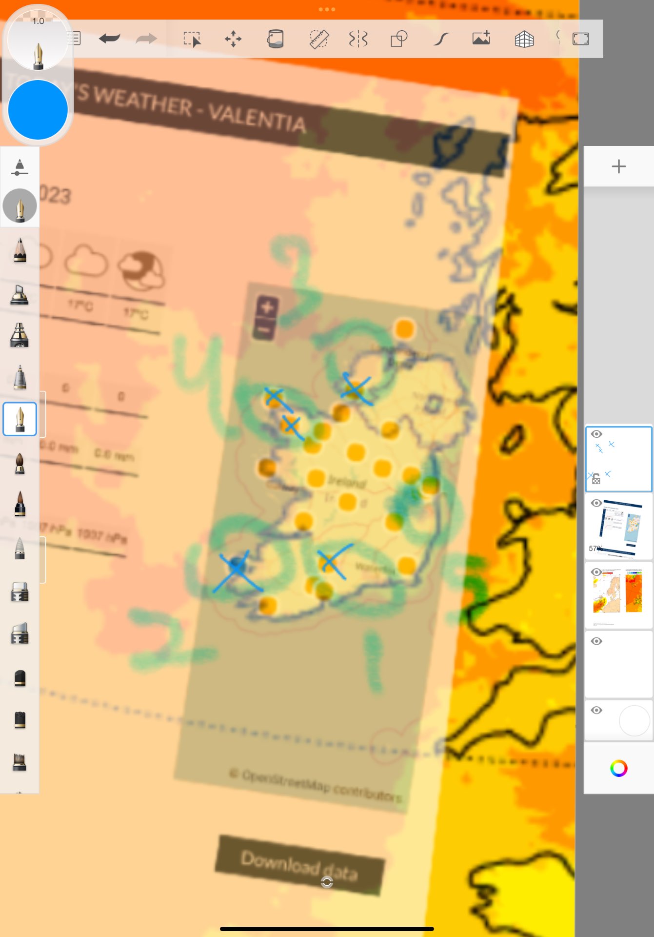
that leaves those x marked five as I think the most promising:
BELMULLET
NEWPORT FURNACE http://burrishoole.marine.ie/FurnaceWeather.aspx
FINNER
VALENTIA
MOORE PARK
Belmullet: 54.2250, -9.9908
Newport: 53.9229, -9.5732
Finner: 54.4621, -8.3653
Valentia: 51.9397, -10.2444
Moore Park: 52.1639, -8.2639

some of the cords I got from random places, but here is a better source:
Based on the above maybe about
10% for Valentia
5% for Belmullet
Those are the highest from this so far.
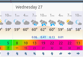
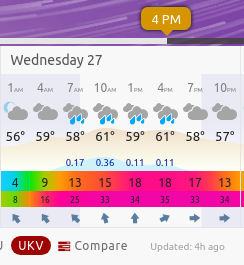
Valentia forecast
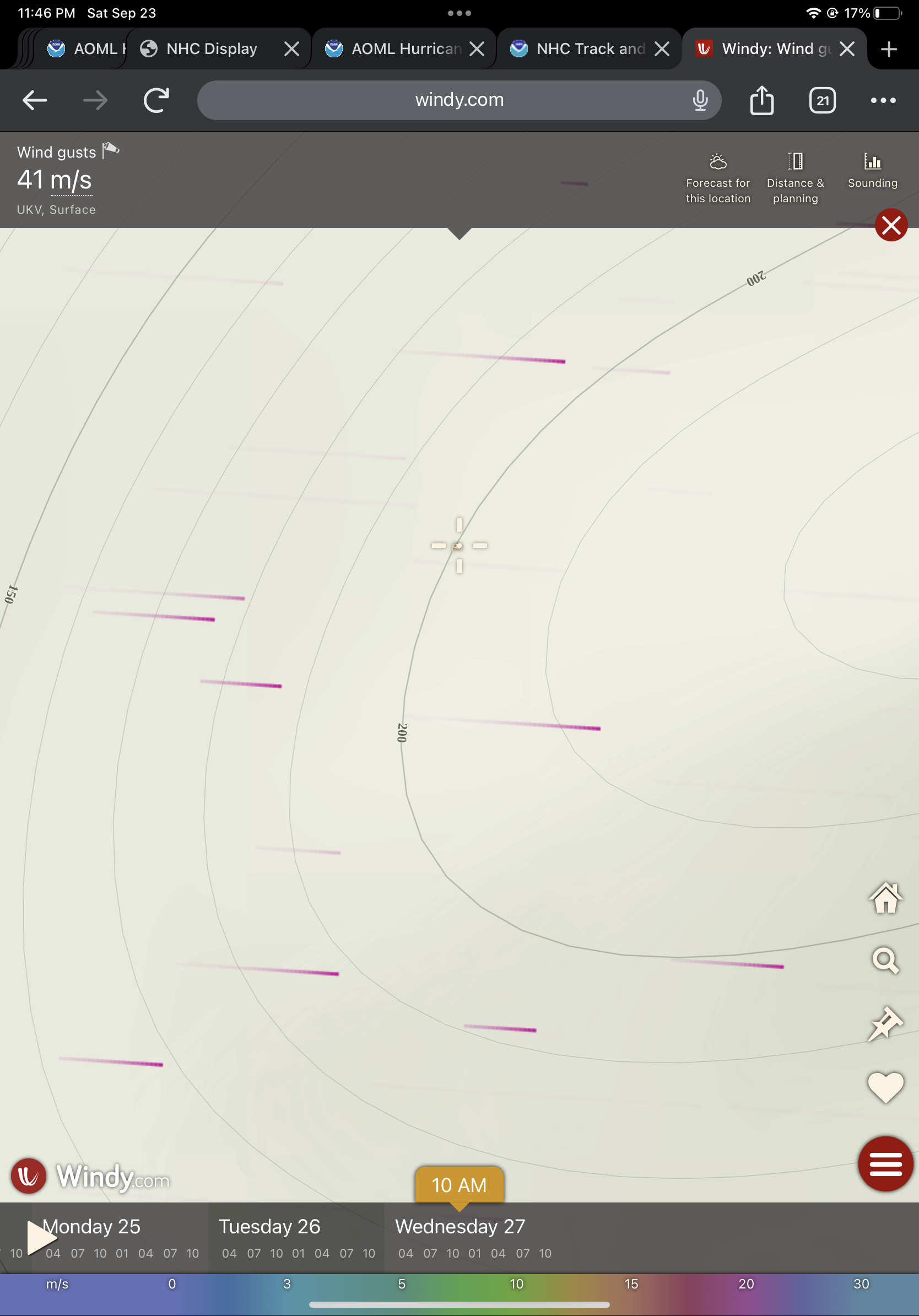
Difficult to fiddle with windy graphically …
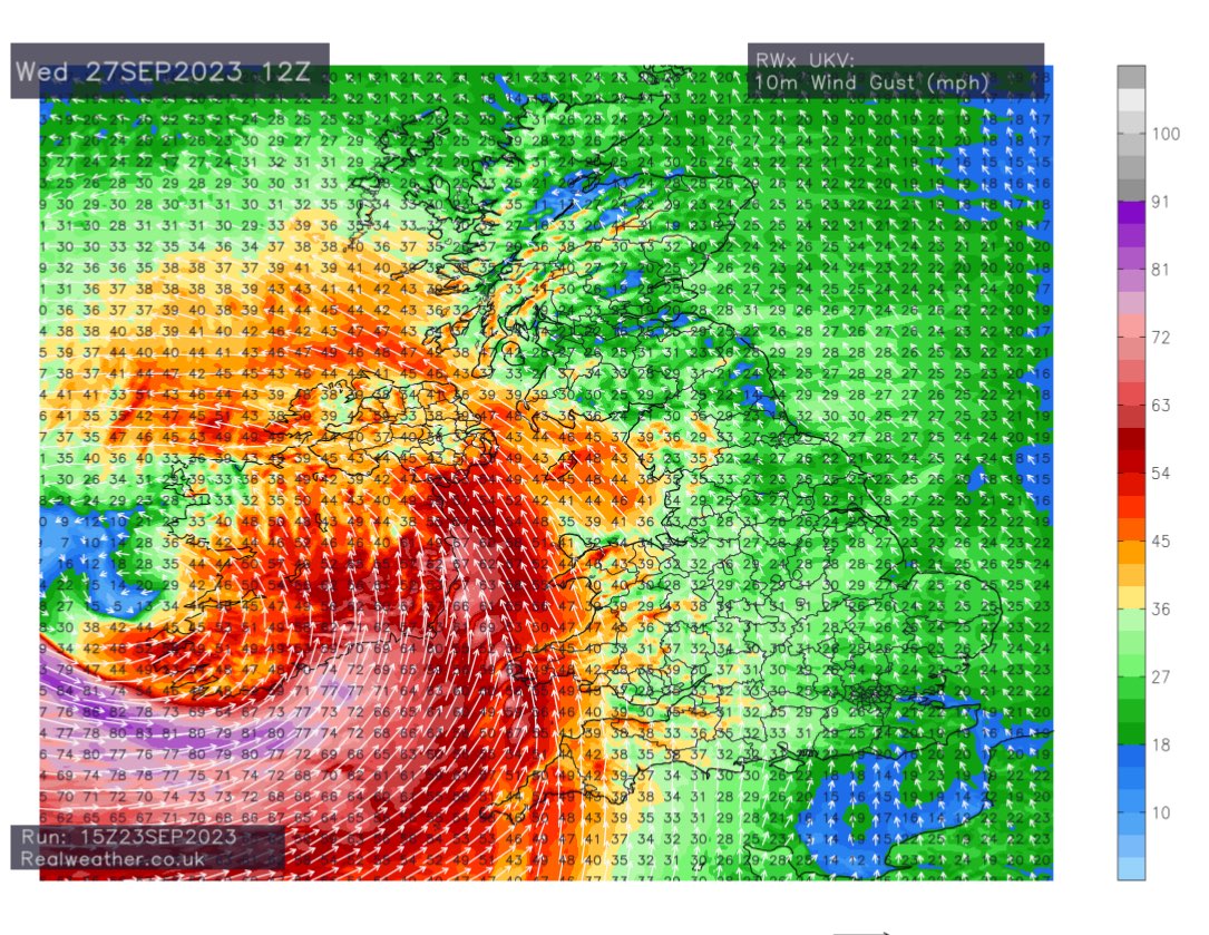
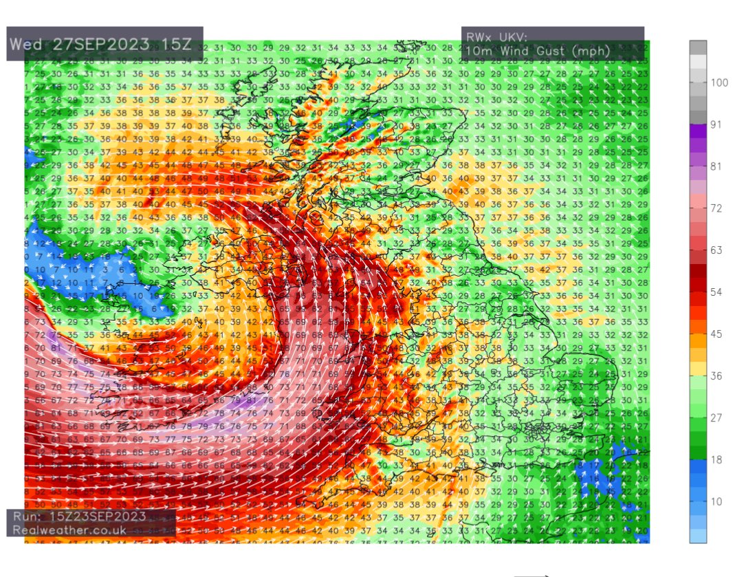
At Valentia, UKV (highest res model) gives a gust of 41m/s at 10am Wednesday
10m (not surface) UKV for Wednesday (in mph so looking only at grey colors of which there are none at this chart resolution) looks like south Ireland is the best candidate (fitting with the choice of Valentia from the ECMWF model)
@sarius ICON is a consensus of DSHP, LGEM, HWFI, HMNI
since their is no Invest or ready made plots of the most relevant members (HWFI HMNI) it’s hard to figure out what is going on…. Its possible the statistical members are also doing something bizarre… also don’t know how well validated forecasts are for those regional American models for Europe..
