Resolves UTC
 1,000
1,000Based on the below I'm keeping to the ensemble probabilities (with lower confidence) filtered by CPS params/1k contour for FNMOC/GEFS/GEPS, as the det. models are in disagreement about what scenario that will play out; this results in a fairly flat distribution as GEPS/GEFS anticipate later development).
~~~
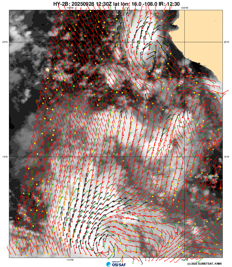
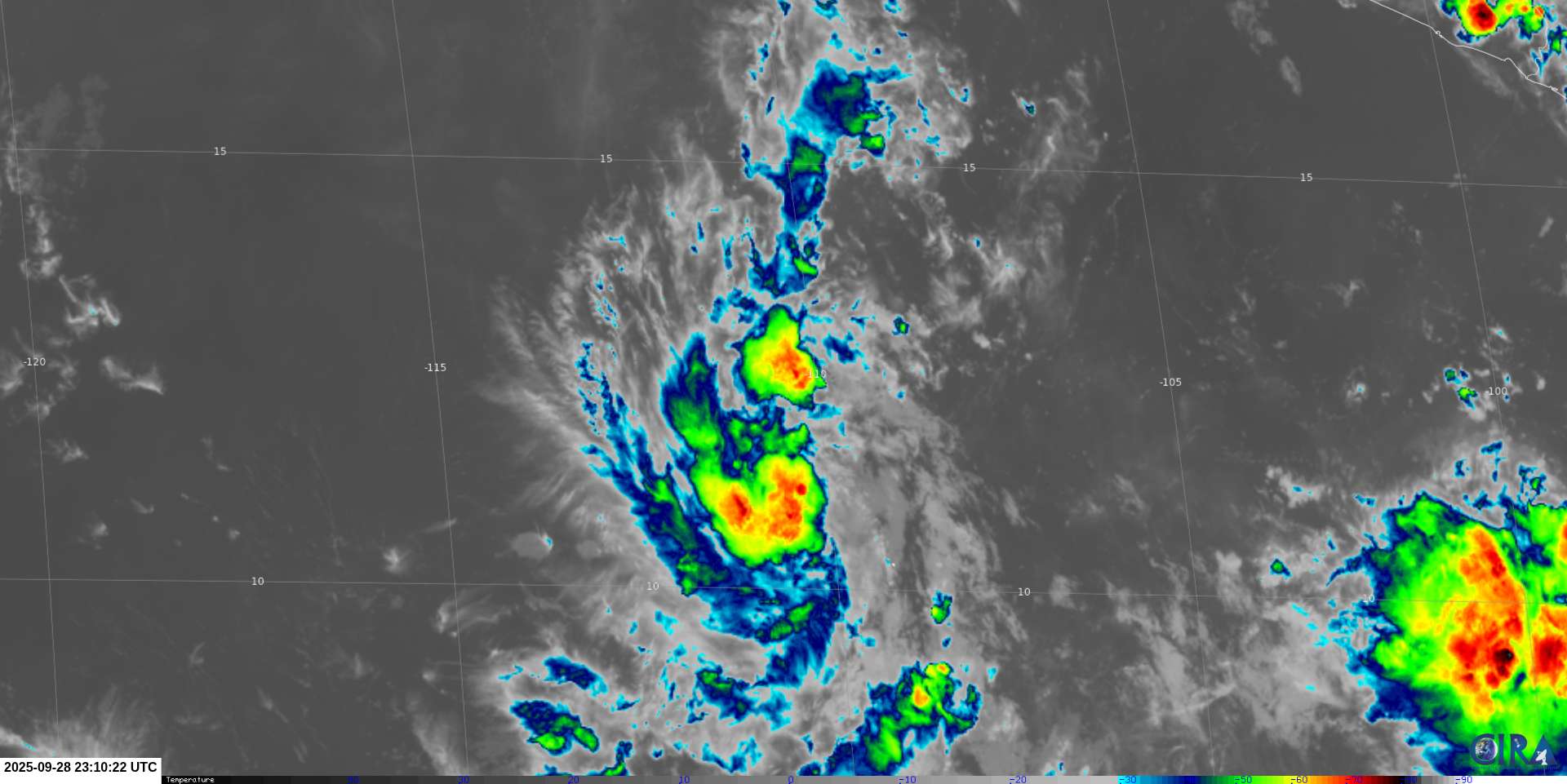
I spent some time looking at satellite imagery after examining the 12Z det. models (GFS,CMC,EMC, and 12/18Z GFS) and recent CIMSS vorticity analysis.
The two level circulations (above) (up to 700 mb) are a feature in the GFS solutions where they later combine and delay development (whether ending up more organized/stronger depends on the run).
I'll call the primary circulation the southern one (and the northern one secondary) since that is the most organized... (and the one the latest NHC TWO is up to 80% now in 7 days).
The northern circulation:
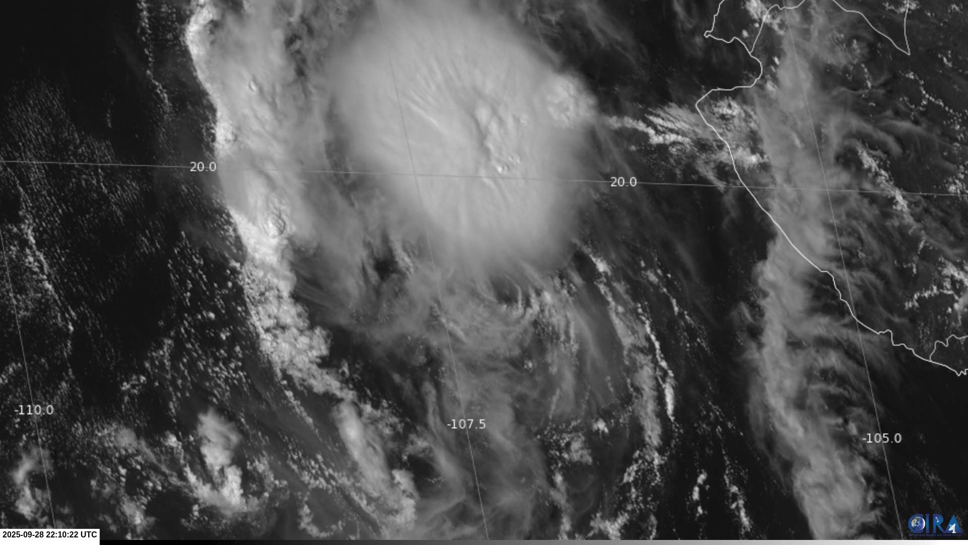
The southern, primary circulation which looks fairly healthy on IR (less so organized on VIS):
For CMC/12Z its a bit more complicated how they merge but it involves the primary circulation stretching and moving northwards, merging with the remnants of the secondary circulation and not quite ever getting well organized (per 500 mb vorticity charts from tropical tidbits).
ECMWF doesn't show the northern circulation dipping down (just weakening?), and so it expects faster, more tidy organization of the primary circulation (although ending up a weaker system with a drier environment: i.e. less convection from the secondary circulation somewhat helping it out strengthen if it does develop compared to GFS/12Z).
~
Of the 12Z ensembles GEPS/GEFS/FNMOC by examining the conditional probabilities for tracks with points reaching TS level and the CPS params/1K 300-500mb contour show that there is roughly ~ a 10% chance that its structure/apperance might end up a problem in classifying it.
EPS and Google are very bullish though on relatively early development.
~
Of note also is the ensembles and det. models also show another one or two additional chances for development in ~ the next 10 days, with possible similar timing to the delayed development of the above primary circulation, so even if this disturbance doesn't develop, there should be 1-2 more chances for genesis in 10 days (depending on wind shear). NHC is currently given the more likely of these two already 20% in 7 days, and it should be noted Google/12Z and GFS heavily favor the development of this later system into a strong storm.
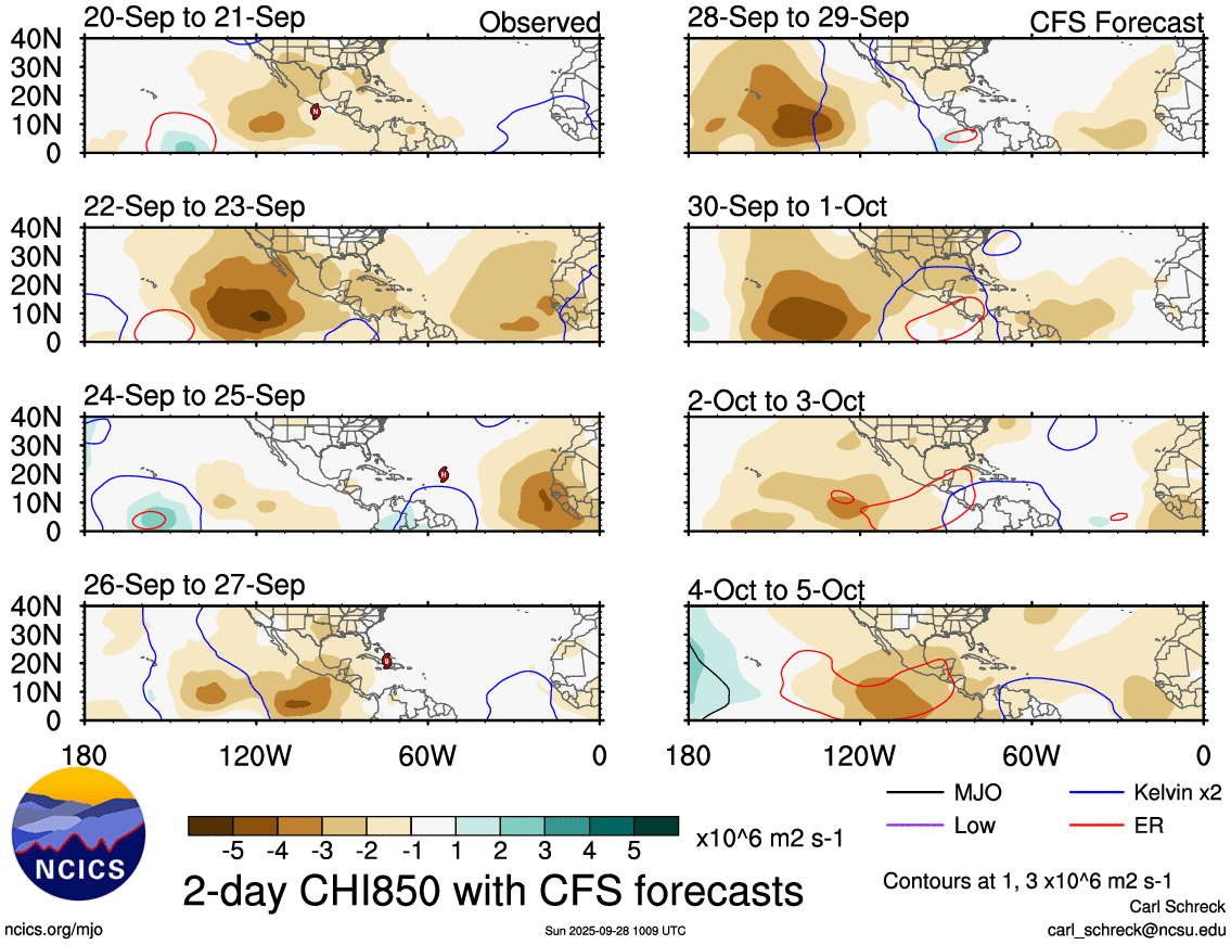
A kelvin wave in the CFS forecast to continue heading east, which appears to cause enough instability the end of next week to increase the chances for such a system (or possibly even a third) to develop.