
Resolves based on operational intensity, not post-season adjustments
🏅 Top traders
| # | Trader | Total profit |
|---|---|---|
| 1 | Ṁ1,014 | |
| 2 | Ṁ163 |
Remnants of Gordon have spun up again a bit in the last 12 hours or so (~100 vorticity per CIMSS); they opened an Invest again for it.
NHC TWO for Gordon's remnants are at 20%/20% still.
Only looks to me about 10-15% chance of development into a named storm again in the next 48h from looking at the stale ensembles from 00Z-06Z.
Tropical Weather Outlook
NWS National Hurricane Center Miami FL
200 PM EDT Sat Sep 21 2024

For the North Atlantic...Caribbean Sea and the Gulf of Mexico:

1. Central Subtropical Atlantic (Remnants of Gordon):
Strong upper-level winds continue to keep showers displaced well
to the east of an area of low pressure (the remnants of Gordon)
located over one thousand miles southwest of the Azores.
Development of this system is not expected while it moves slowly
northwestward over the central subtropical Atlantic during the next
couple of days.
* Formation chance through 48 hours...low...near 0 percent.
* Formation chance through 7 days...low...near 0 percent.@SaviorofPlant I believe it is safe to resolve this now. It's gone from the TWO and there is no longer an Invest for it.
Edit nope, im just sleep deprived :/
Final advisory.
Perhaps could regenerate?
1100 AM AST Tue Sep 17 2024
...GORDON DEGENERATES TO A TROUGH OF LOW PRESSURE...
...THIS IS THE FINAL NHC ADVISORY...
@ChristopherRandles As far as I know, then it will be Helene if there is something that forms in the area from its remnants... Edit: not sure about this, may depend on how much Gordon remnants retain what ever tropical characteristics remain
@ChristopherRandles can't find any thing certain about that (it may depend how much character Gordon retains?) .... From the discussion ..
While the
structure is unlikely to improve in the short term, there are
indications in the global models that the remnants of Gordon could
redevelop later this week once the system moves into a more moist
environment and gains some distance from the nearby frontal low. NHC
will continue to monitor the remnants of Gordon for signs of
organization and the possibility of redevelopment later this week.
Information on the potential for regeneration will be contained in
the Tropical Weather
Outlook.
@SaviorofPlant are we going to wait another week? EPS members showed it taking up to the 22nd or 23rd if I recall to get cat1 strength
I never thought it likely would survive past tomorrow anyway, but I've sold off everything else YES in the other bins in case other bettors want it and the market stays open or the NHC restarts advisories (in which case they are now super cheap)
@parhizj
Disorganized showers and thunderstorms over the central tropical
Atlantic are associated with the remnants of Gordon. This
disturbance is forecast to interact with a non-tropical low to its
north while moving north-northeastward at 5 to 10 mph during the
next couple of days. Environmental conditions could become more
conducive for development later this week, and a tropical depression
or storm could re-form in a few days while the system moves slowly
northward over the central subtropical Atlantic.
Use of the word "re-form" makes me think the storm will retain the name Gordon. Hurricane models (plus the GFS) unanimously show the system achieving at least Cat 1 strength. Outlier is the Euro, which forms a TS and then kills it.
@SaviorofPlant I tried researching for an official statement about this and failed to find it. I did find a bunch of examples of the opposite (where remnants were renamed).
@parhizj Link the examples, we can compare the language with storms like Lee 2017 / Paulette 2020 that weren't renamed
@SaviorofPlant Nevermind I did finally find an example:
https://en.wikipedia.org/wiki/Hurricane_Ivan
"On September 22, the National Weather Service, "after considerable and sometimes animated in-house discussion [regarding] the demise of Ivan,"[8] determined that the low was in fact a result of the remnants of Ivan and thus named it accordingly."
@parhizj I'd put it at like 80% that it keeps the name, given that forecasts are using terms like "re-form" and referring to the system as the remnants of Gordon, and genesis is not that far out. Could be wrong though
Looks likely from ensembles something will become a TD at least in the area... ECM/GEFS differ on when it will become a TS in the short term (not sure about the long EPS forecast for a week from now who knows if it will be frontal then as the trackers don't have this info). Most likely genesis time into a TC is the 19th. Most likely scenario seems to be a TD / marginal TS at the moment...
@parhizj Models have entirely dropped the hurricane projections from a couple days ago, looks like a TS at best now
@SaviorofPlant As a point estimate I currently only give it a 15% of regenerating into a TS at the moment... of course I only give that area in general as high as 20% for a TS... but these values might be off since not all TC characteristics are considered... I interpret that 50% from the TWO as it might become a TD or possibly a SD given how far north it is and the model phase data... (~70/30 conditionally it having either some TD or SD characteristics). But as I have a large prior being fairly confident of Gordon being dead today, I can't even keep to the 15% for a TS... As for 50kt.. much less...
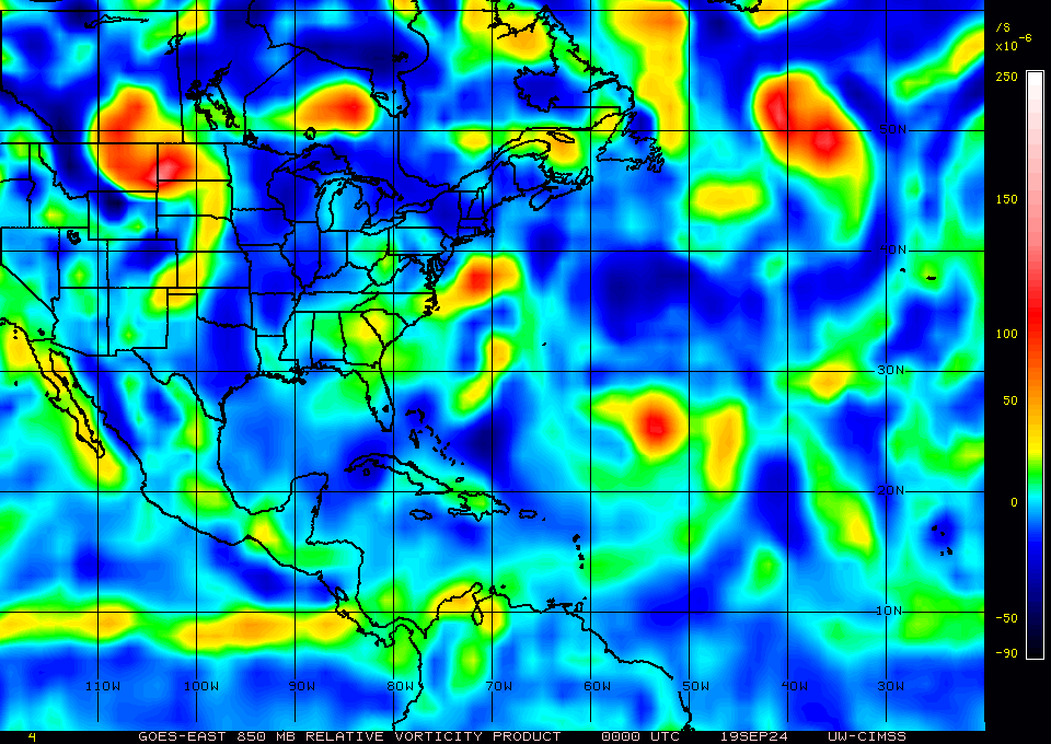
It was always going to look awful today, but 25 vorticity is pretty pitiful ...
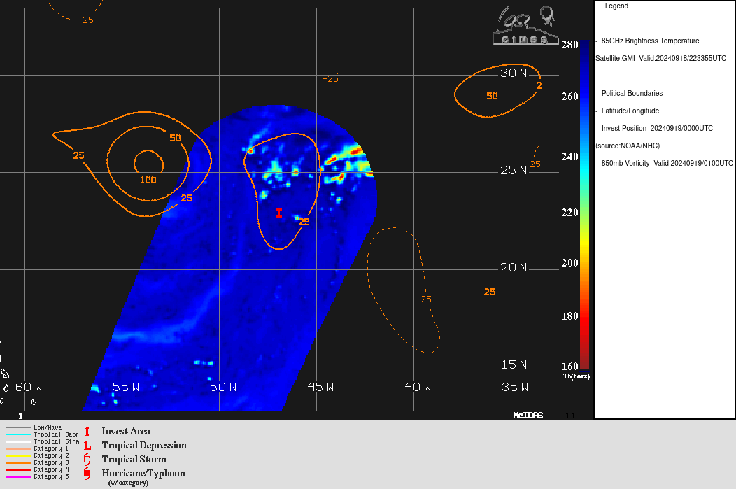
Edit: basin wide is a better look at how bad it is (just an elongated blobby remnant at the moment)
https://www.nhc.noaa.gov/text/refresh/MIATCDAT2+shtml/170845.shtml
As a result, there is a large spread in the
intensity guidance, leading to below average confidence in the NHC
intensity forecast.  The NHC intensity forecast is similar to the
previous one, and remains near the low end of the intensity guidance
through the forecast period.
Gordon is back on GOES-E Mesoscale 1 as of a couple hours ago, but deep convection as gone poof again after diurnal max ...
Continued shear, a dry mid-level atmosphere, and a subsident
upper-level environment are likely to cause Gordon to weaken to a
tropical depression later today.  In fact, all of the global models
show the wind field weakening and broadening during the next couple
of days, and it's entirely possible that Gordon could degenerate
into a remnant low at any time if deep convection wanes.  If
Gordon survives the next few days, the environment could become a
little more conducive for strengthening toward the end of the
forecast period.
Above From latest NHC discussion…
Lots of folks don’t like death markets on Manifold.. this market is now basically a death market for Gordon…. lot of uncertainty still remains on whether it will survive, recuperate and become stronger than ever…
Latest advisory keeps Gordon a TD.
Relevant latest discussion:
Tropical Depression Gordon Discussion Number  19
NWS National Hurricane Center Miami FL       AL072024
1100 PM AST Sun Sep 15 2024

Gordon is barely hanging on as a tropical cyclone tonight.
As a doctor would say ... the next 48 hours is critical...
Gordon is struggling mightily against very dry mid-level air, and
this environment is unlikely to change much over the next few days.
In fact, it would not be surprising to see Gordon become a remnant
low at any time if convection does not soon return in a more
prominent way near the center. After 48 h, the environment is
forecast to begin moistening some while vertical wind shear is
expected to be fairly low, providing an opportunity for Gordon to
re-intensify, presuming there is enough of a system left to take
advantage of the improving environmental conditions.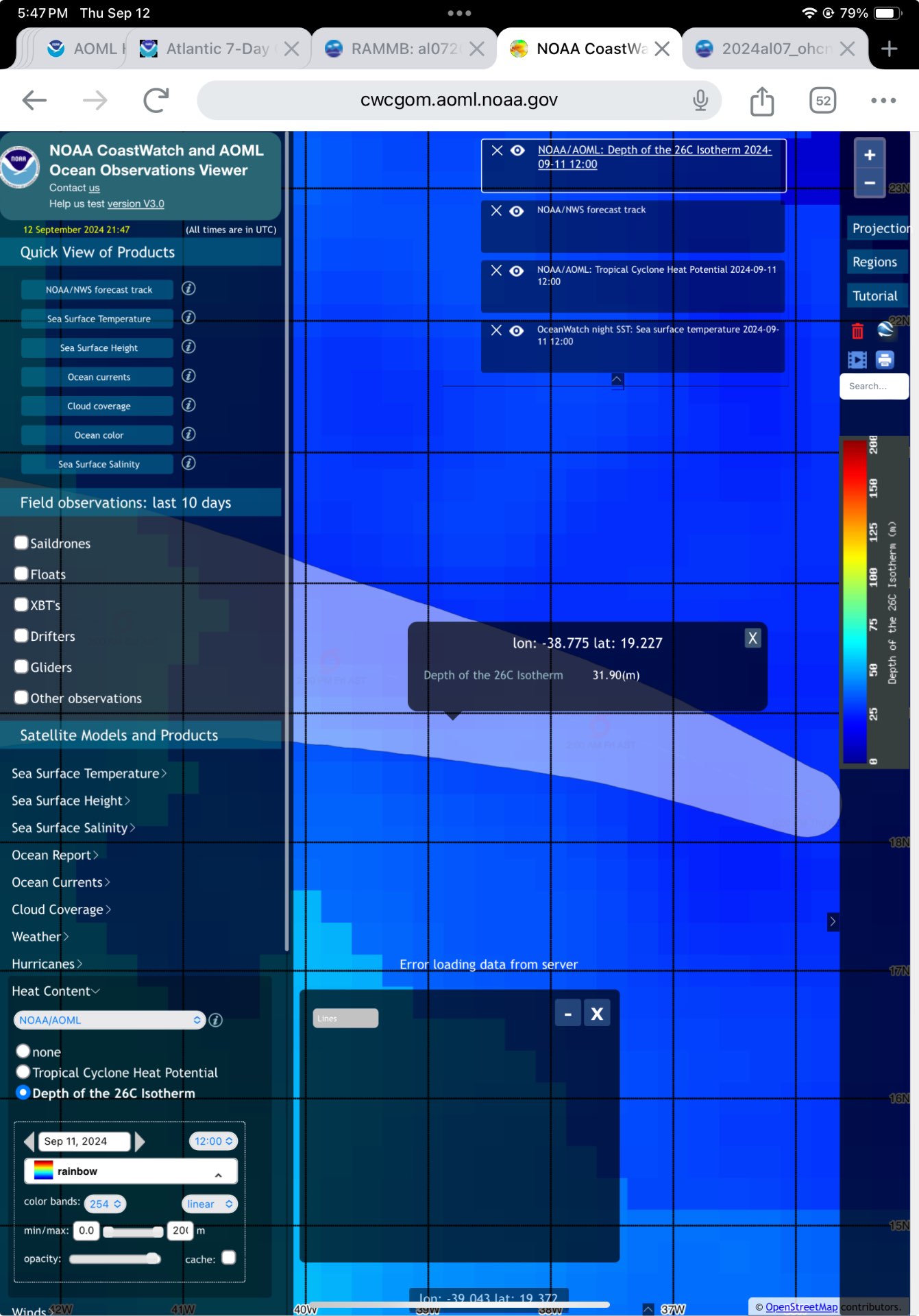
Considering the 11 pm advisory …
26 deg iso therm Only about 30 m or so deep
OHC and THCP marginal
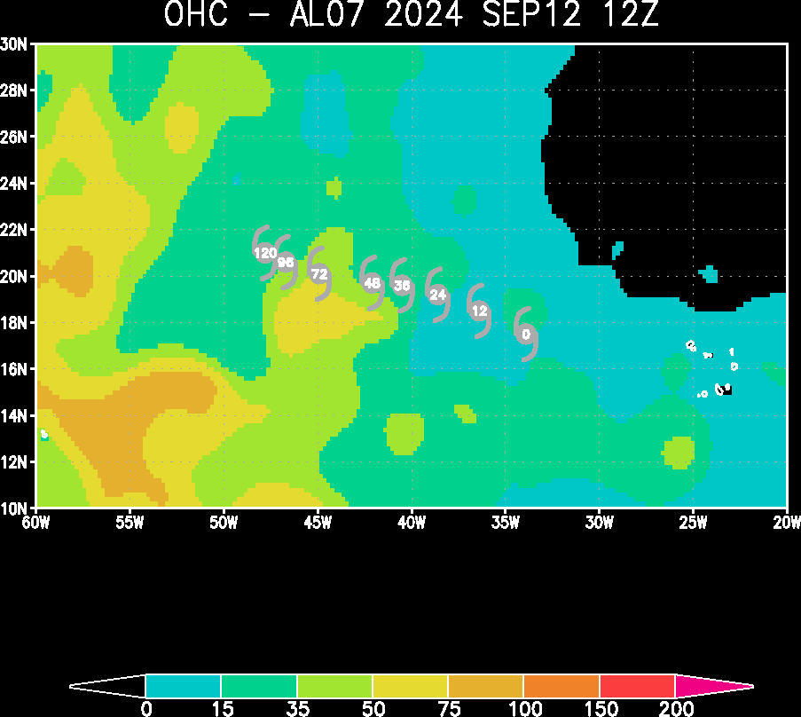

The 5 pm discussion
While environmental conditions are somewhat favorable for gradual
strengthening, with low-moderate vertical wind shear and
marginally warm SSTs, intensity guidance is even lower than the
last cycle.  Slight strengthening seems most probable within the
marginal environment, and the forecast continues to show a 45-kt
peak in 5 days.
Yet, I can’t expect it to maintain the status quo or even weaken for the next 12 hours given the dry air and marginal heat content…