
Debby is forecasted to emerge off the coast of Georgia, re-intensify, and then make landfall again.
 1,000
1,000🏅 Top traders
| # | Trader | Total profit |
|---|---|---|
| 1 | Ṁ241 | |
| 2 | Ṁ171 | |
| 3 | Ṁ108 | |
| 4 | Ṁ70 | |
| 5 | Ṁ64 |
https://www.nhc.noaa.gov/archive/2024/al04/al042024.public_a.023.shtml
Second landfall reported in 06Z advisory as 50 mph (~45 kt, per best track)...
They did have it at 50kt earlier (6 hours prior), so it was close.. Preliminary best track:
AL, 04, 2024080800,   , BEST,   0, 327N,  794W,  50,  994, TS,  50, NEQ,    0,  120,    0,    0, 1010,  250, 100,  60,   0,   L,   0,    ,   0,   0,      DEBBY, M, 12, NEQ,  270,  240,    0,    0, genesis-num, 011,
AL, 04, 2024080806, , BEST, 0, 329N, 796W, 45, 994, TS, 34, NEQ, 150, 160, 0, 0, 1008, 300, 100, 55, 0, L, 0, , 0, 0, DEBBY, M, 0, , 0, 0, 0, 0, genesis-num, 011, Latest 11AM OFCL advisory puts it closer to the coast than 12 hours ago (following closer to HMON).... Relevant discussion:
Although the center of Debby is forecast to be over water later
today, the lack of an inner core should allow only slow
re-strengthening for the next day or so. Since the system is not
expected to move far enough offshore to interact significantly with
the Gulf Stream, this should limit the amount of oceanic heat
content available to the storm. The official intensity forecast
is near or slightly above the latest statistical/dynamical DSHIPS
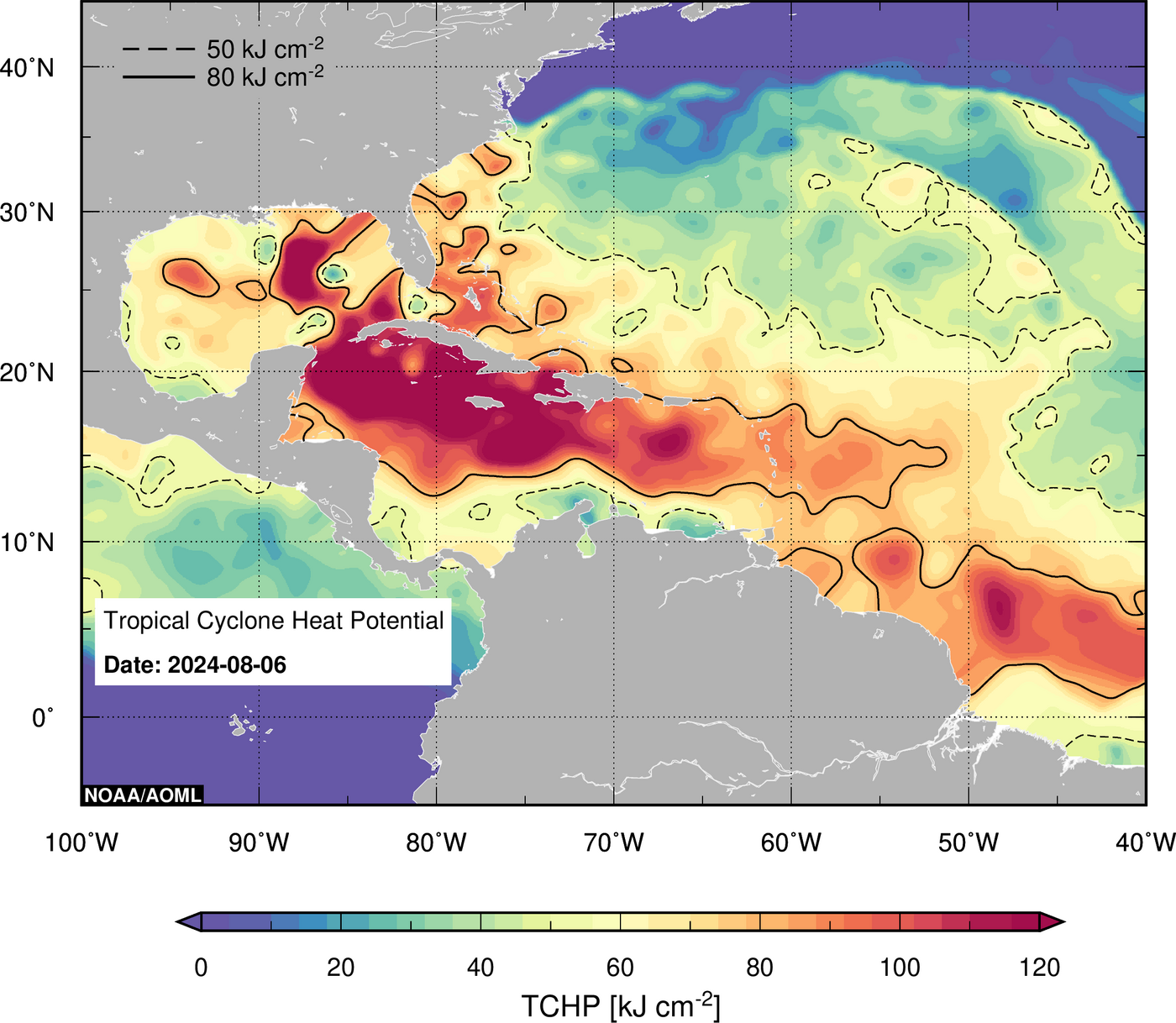
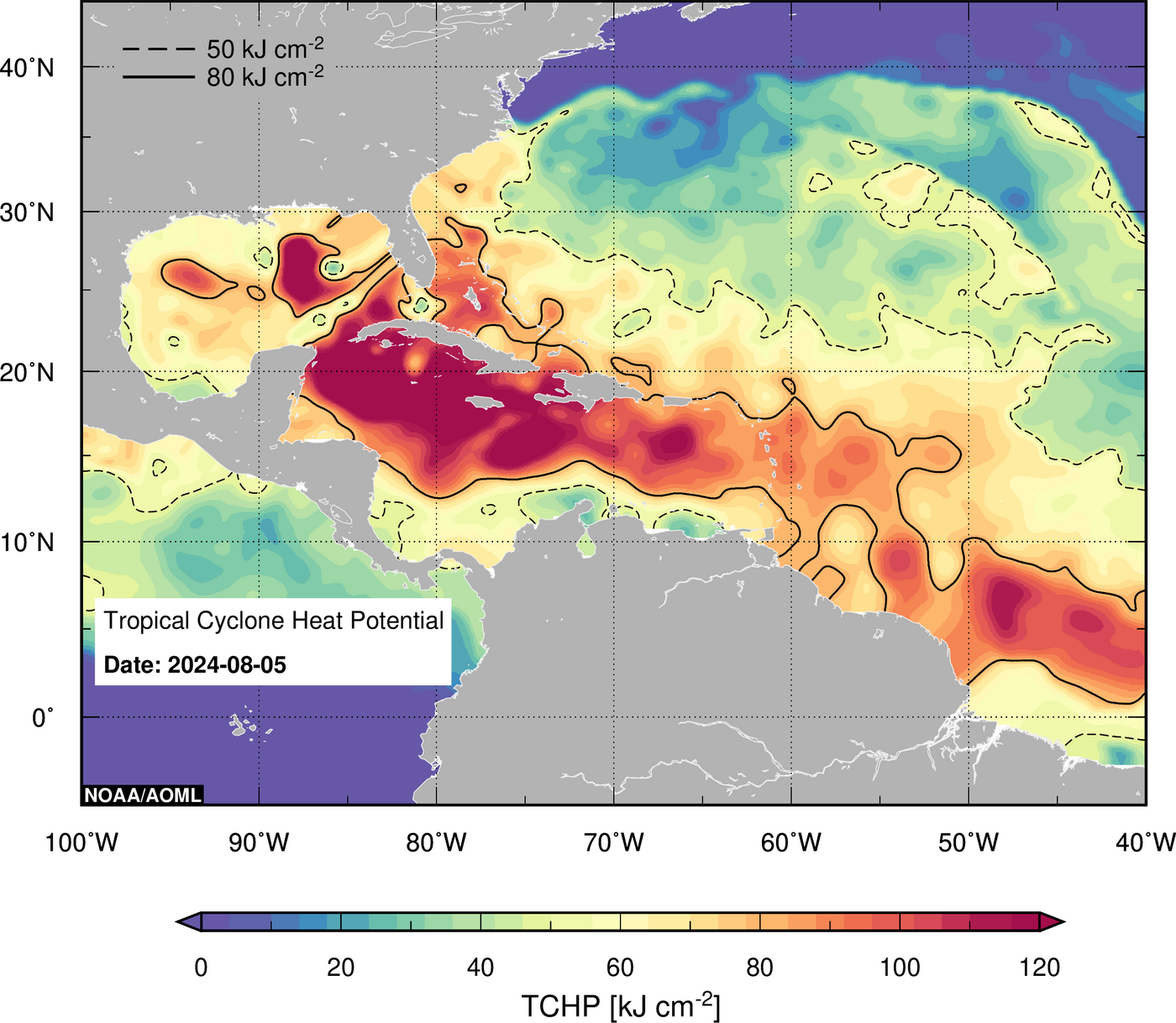
and LGEM guidance.TCHP (from PHOD/AOML) looks to be about ~60 from the track and small amount of water its going over...:
Given OFCL has the best intensity error records 48 hours out I'm going to assume now its about 50/50 for the proportion of the probability that it is a TS:
Which I place a probability of it being a TS between 64% and 71% (based on advisory error alone), with am middle of 68%. So that gives it 34% for the two bins. 14% and 19% for a TD and Cat 1 respectively... (not conditioning on track or anything such as that, just advisory error)....
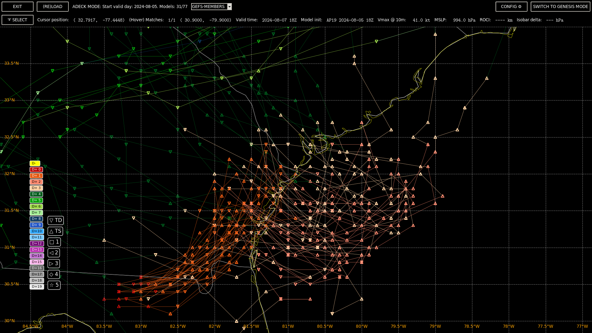
Didn't have time to look at much other guidance other than there is a good amount of spread (trackwise) still in GEFS... (though seems very unlikely it won't make a second landfall)
https://www.nhc.noaa.gov/text/refresh/MIATCMAT4+shtml/052047.shtml
Latest advisory is out... 50kt at 08/12Z (about an hour or two before landfall I guess)... Based on that OFCL has been the most accurate I assign TS at landfall to be 75% (using advisory error alone); splitting it up into the two bins I have no model for so I can only use my best guess. Slightly larger chance of cat.1 than TD despite not much real model support aside from NAVGEM (Edit 12Z (not 18Z as I Said before)),ECM 12Z ... Relevant discussion on track... :
Although there is still
low confidence in the specifics of the track forecast, there is high
confidence that Debby will be meandering near the southeastern U.S.
coast for the next few days.
The ECMWF/NAVGEM track does meander quite a while and ECM12Z further east (of most of the GEFS 18Z members) allowing it be an outlier.... Until it moves onto the water for a while, it'll be difficult to predict...
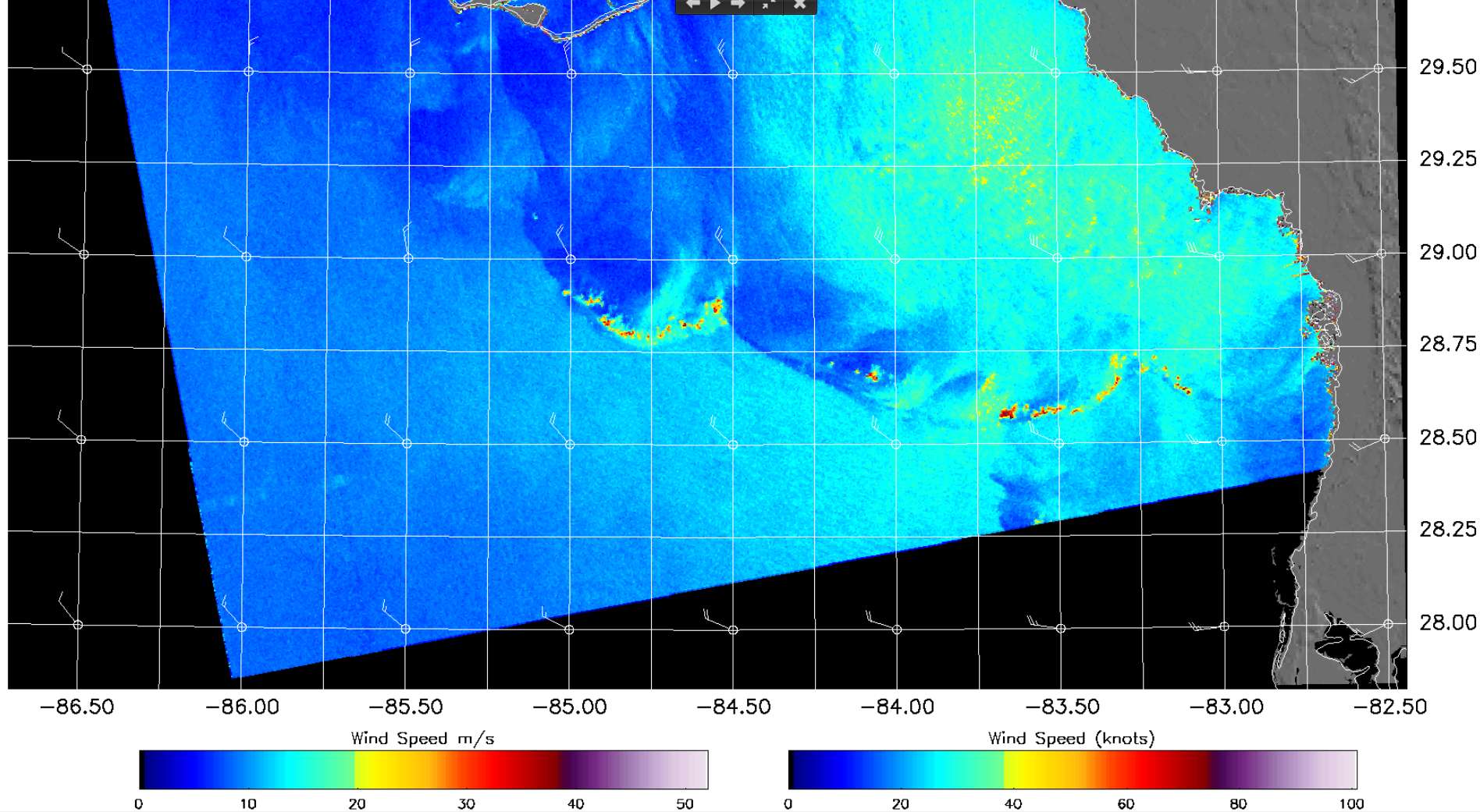
Edit: (from NOAA/STAR NESDIS) The discussion doesnt mention it but I wonder if the SAR winds does also seem to support 40kt from the far to the SW? (roughly about 220km, and ROCI from tcvitals is ~300 km, so its within the storm range roughly?)
Mix of public data:
Latest tcvitals have it at 41 kt moving NE at 8mph.
@SaviorofPlant That was an interesting catch...
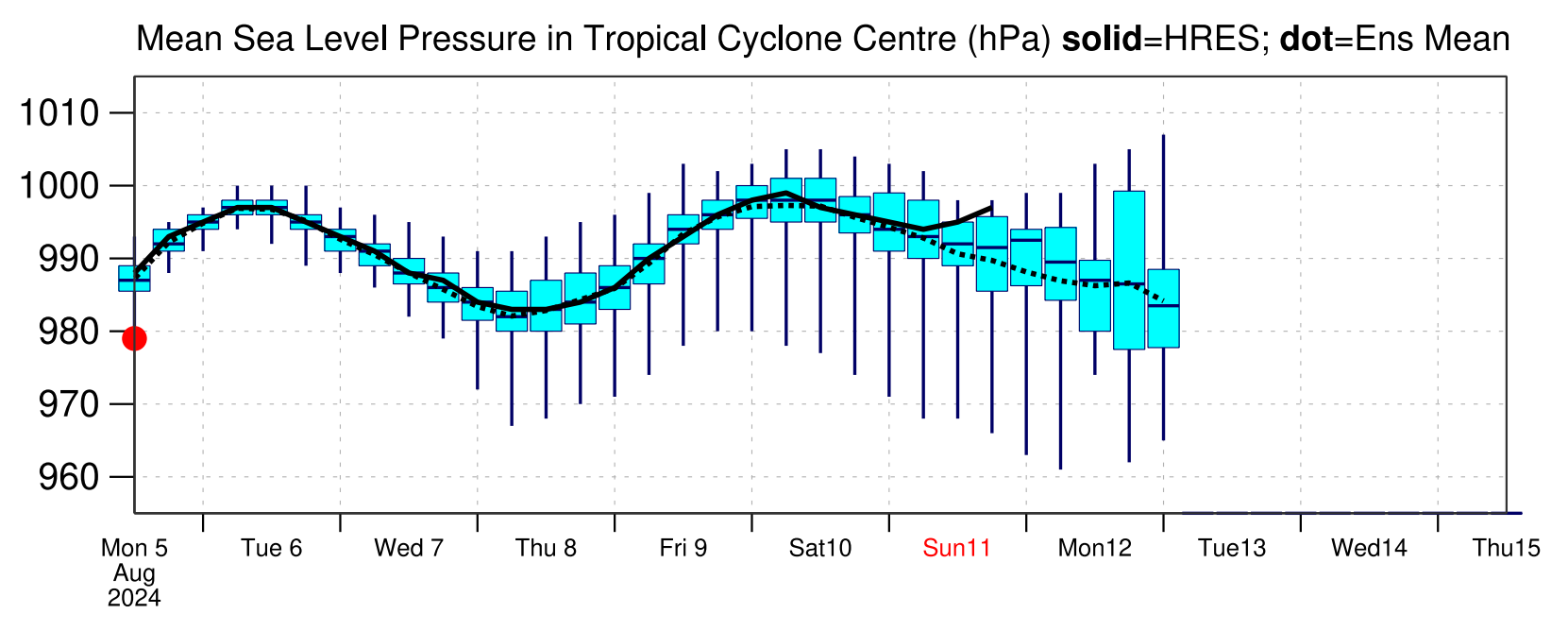
Yeah, ECM 12Z deterministic (which is a bit dated now that I've finally gotten to looking at it, since it's init position was before landfall) shows it dropping to 983 mb (landfall after 05/12Z); I get a peak closed isobar delta of 24 (outer most closed isobar - inner most closed isobar pressure), so then a POUTER of > 1007 before landfall; a ROCI of 431 to 539km for the 12 hours before the storm makes landfall, suggesting an average size TC at the time (right now its a bit smaller than that). Looks to be on open water for only 48 hours ... What about ECM Ensemble? From the ECMWF website (pdf crop), 18Z MSLP 1-sigma covers ~ (980, 987) mb for the ensemble (so the 983 deterministic is roughly in the middle)
NAVGEM also has been very bullish predicting it temporarily increasing to cat.2 even for a short time for the last couple cycles.
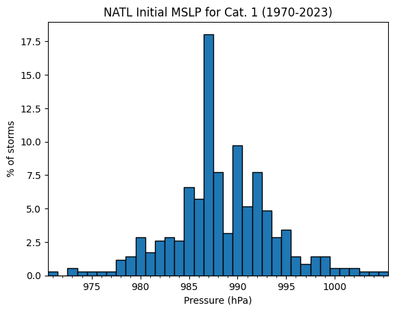
The ECM/12Z model MSLP of 983mb puts it in the 12th percentile for initial classifications of NATL cat.1 storms, 1970-2023.
TCHP (PHOD/AOML) is only ~50-80 (for today) for the area ECM wants to move as far east as 78 W
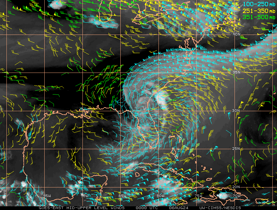
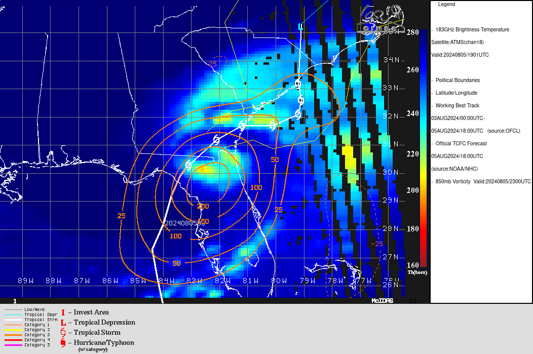
Obs 00Z (images from CIMSS):
good cyclonic outflow above the storm, and a good large anticyclonic flow far outside the storm:
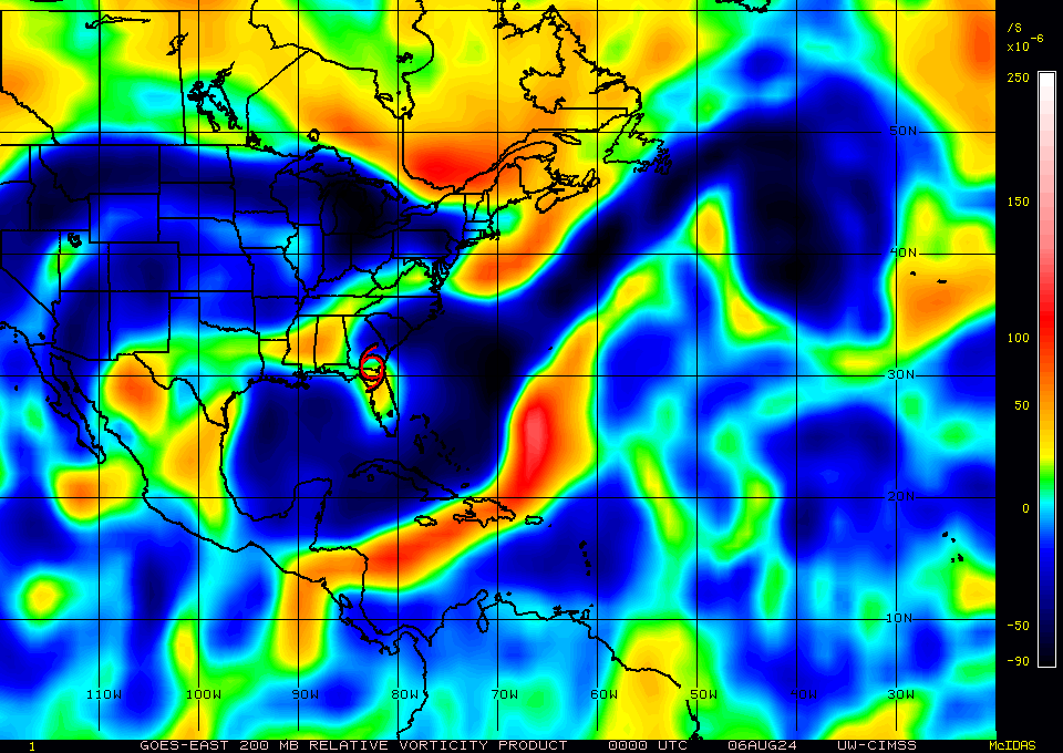
Rel. vorticity at 850mb:
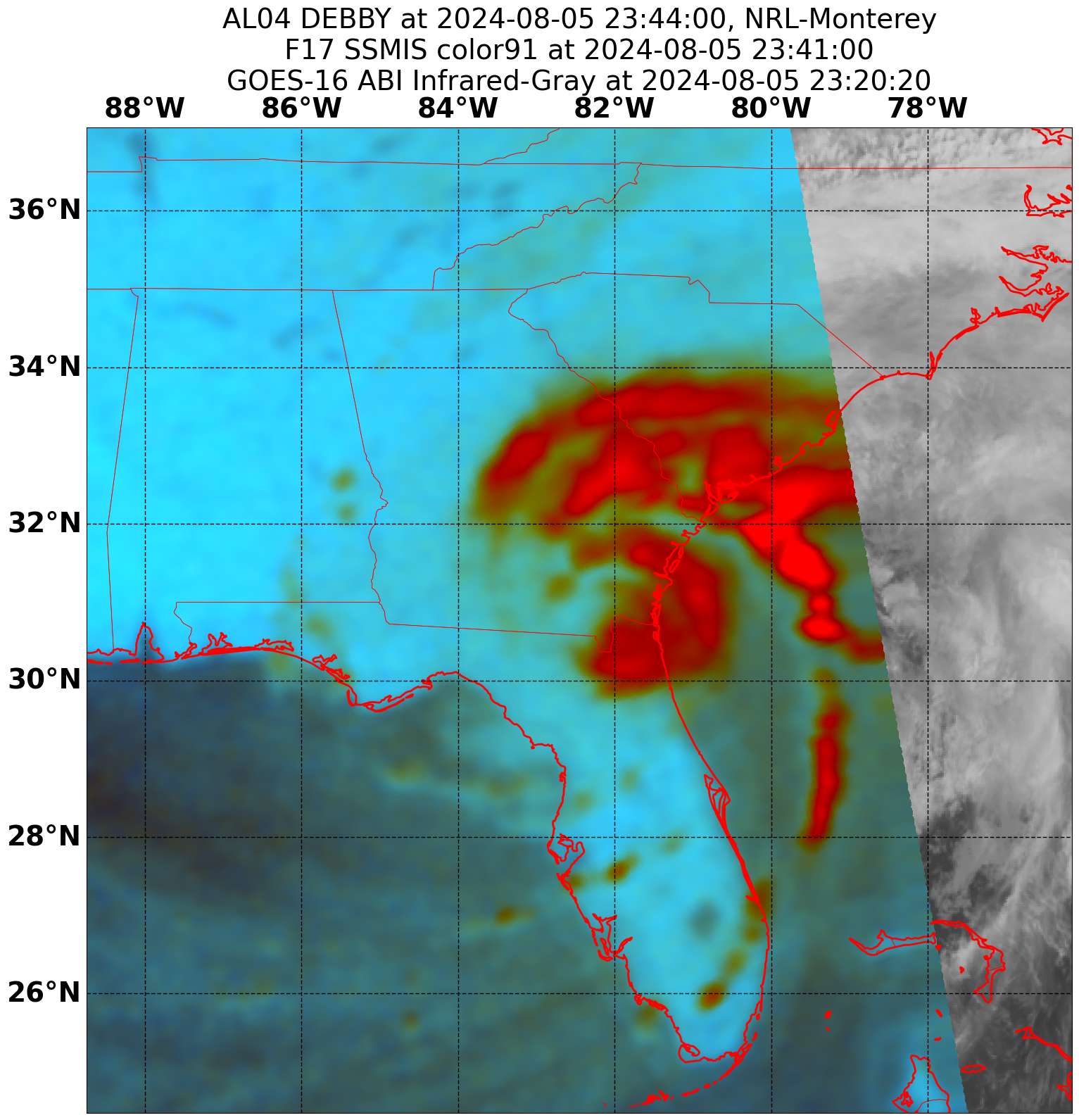
NRL imagery showing plenty of rain at 23Z:
Plots from my viewer from nhc public guidance (ATCF) (mostly 00Z):
Global models: (not sure why I included NNIC it shouldnt be in this list)
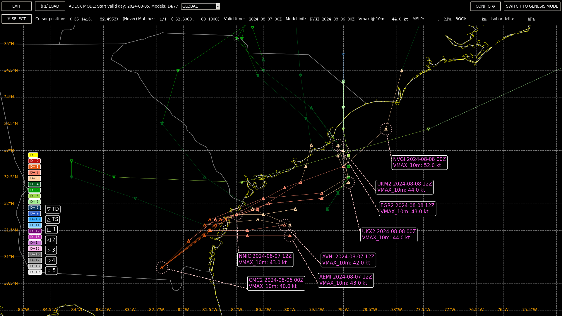
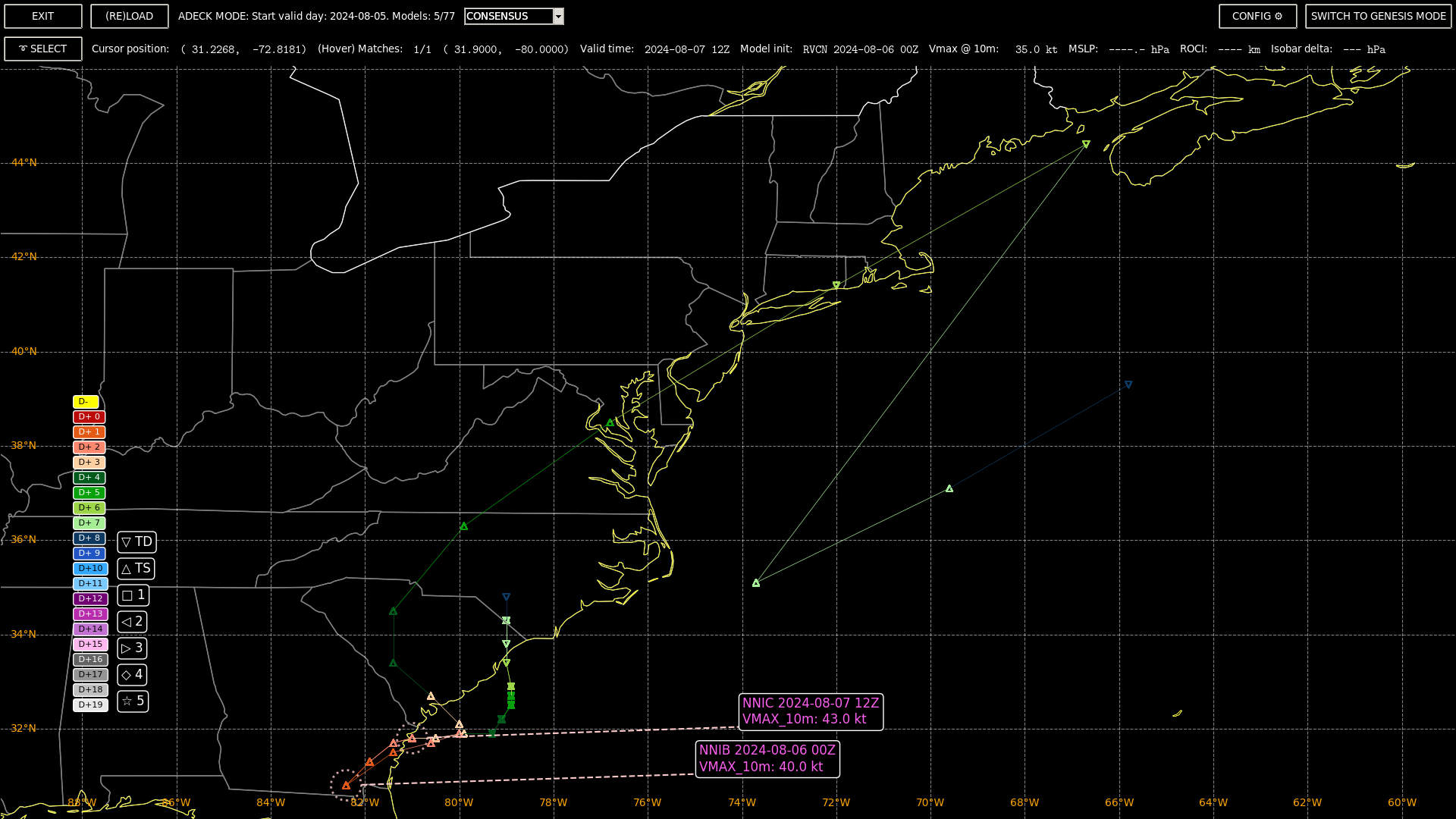
Consensus:
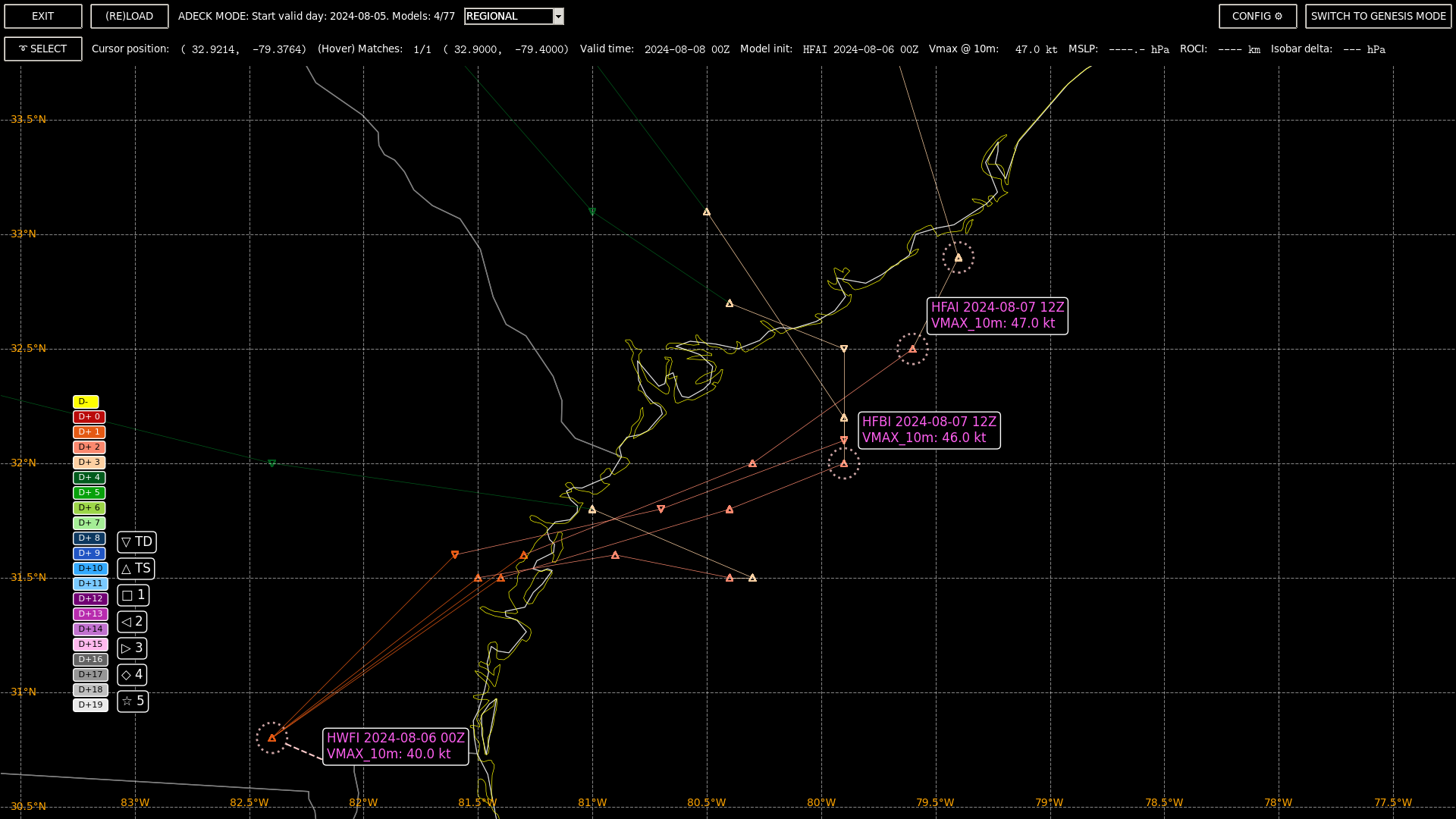
Regional :
GEFS 18Z:
Regional model Validation (early/interpolated models) from CIRA:
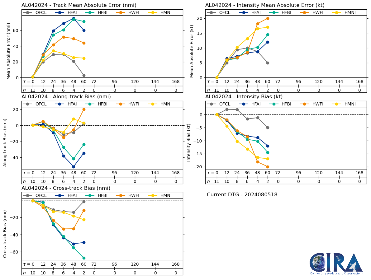
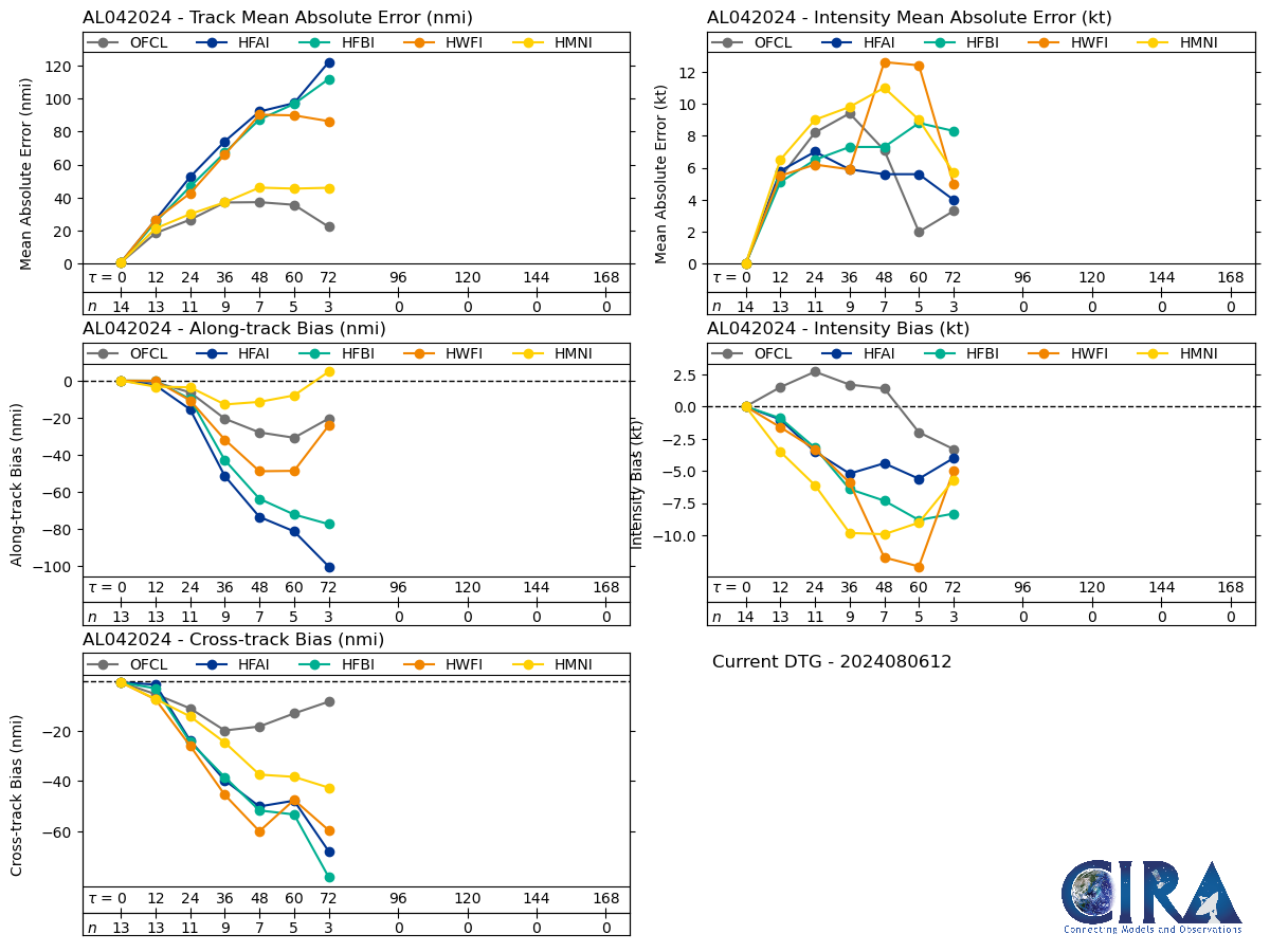
HMON/HMNI still looking decent for track performance... OFCL dominating far out though